Antique Texas Maps

1
to
2
22
8
26
19
6
4
3
3
3
3
2
2
2
2
2
1
1
1
1
1
1
1
1
1
1
Sort By
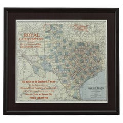
1908 "Map of Texas" by The Kenyon Company
Located in Colorado Springs, CO
Presented is an antique map of the state of Texas, printed as a pocket map in 1908 by The Kenyon
Category

Early 1900s American Antique Texas Maps

Materials

Paper

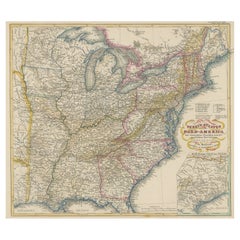
Antique Map of the Eastern United States with Inset Map of Texas
Located in Langweer, NL
. Inset map of the "southern principal part of Texas." Shows states, major cities, railroads, topography
Category

Mid-19th Century Antique Texas Maps

Materials

Paper

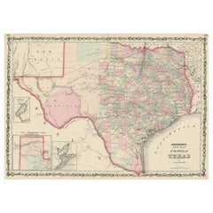
Large Antique Map of the State of Texas, 1861
Located in Langweer, NL
Antique map titled 'Johnson's New Map of the State of Texas' Large map of Texas, shows railroads
Category

Mid-19th Century Antique Texas Maps

Materials

Paper

Large Antique Map of the State of Texas, 1861
Free Shipping
H 18.04 in W 26.58 in D 0.02 in
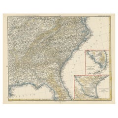
Antique Map of the Region of Georgia with Inset Maps of Florida and Texas
Located in Langweer, NL
southern part of Texas. This map was part of a set of six individual sheets with maps of the United States
Category

Late 19th Century Antique Texas Maps

Materials

Paper

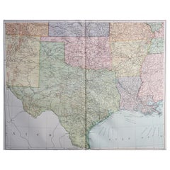
Large Original Vintage Map of Texas and Adjacent States, circa 1920
Located in St Annes, Lancashire
Great map of Texas and adjacent States Original color. Good condition Published by
Category

1920s English Antique Texas Maps

Materials

Paper

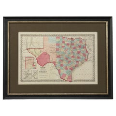
1859 "Colton's New Map of the State of Texas..." by Johnson & Browning
Located in Colorado Springs, CO
Presented is "Colton's New Map of the State of Texas Compiled from De Cordova's Large Map
Category

1850s American Antique Texas Maps

Materials

Paper

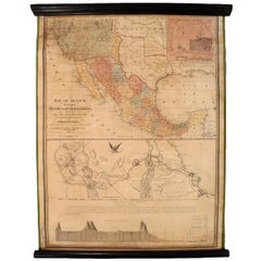
1847 Antique Map of Mexico, Texas and California by Samuel Augustus Mitchell
By Samuel Augustus Mitchell 1
Located in Colorado Springs, CO
right. The map is considered to be an adaptation of Mitchell's earlier 1846 A New Map of Texas, Oregon
Category

1840s American Antique Texas Maps

Materials

Paper

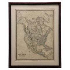
1864 Map of North America, Antique Hand-Colored Map, by Adolphe Hippolyte Dufour
Located in Colorado Springs, CO
Offered is a map of North America entitled Amerique du Nord from 1864. This rare, separately
Category

1860s French Antique Texas Maps

Materials

Paper

Framed 1838 North America & Recent Discoveries Map
Located in Stamford, CT
. This map shows Texas as a Republic without its panhandle. Framed in brown carved wood frame.
Category

1830s American American Classical Antique Texas Maps

Materials

Glass, Wood, Paper

1830 Mexico and United States Framed Map
Located in Stamford, CT
Map of North America published circa 1830. Map shows United States into Canada. Mexico extending
Category

1830s American American Classical Antique Texas Maps

Materials

Glass, Wood, Paper

1865 "Johnson's California, Utah, Nevada, Colorado, New Mexico, Arizona" Map
Located in Colorado Springs, CO
, New Mexico, and Arizona” map. First published in 1864, this map was issued as pages 66 and 67 in the
Category

Mid-19th Century Antique Texas Maps

Materials

Paper

Antique Map of Tennessee, Kentucky, Virginia, Alabama, Georgia and Surroundings
Located in Langweer, NL
southern part of Texas. This map was part of a set of six individual sheets with maps of the United States
Category

Mid-19th Century Antique Texas Maps

Materials

Paper

Louisiana: A Framed 19th Century Map by O. W. Gray
By Gray and Co
Located in Alamo, CA
. It is a highly detailed map of Louisiana and adjacent portions of Mississippi to the east and Texas
Category

Mid-19th Century American Other Antique Texas Maps

Materials

Paper

America "Amérique Septentrionale": A 19th Century French Map by Delamarche
By Maison Delamarche 1
Located in Alamo, CA
This framed mid 19th century map of North America entitled "Amérique Septentrionale" by Felix
Category

Mid-19th Century American Other Antique Texas Maps

Materials

Paper

"The United States from the Latest Authorities" Antique Wall Map, 1835
Located in Colorado Springs, CO
This is a 1835 map of “The United States from the Latest Authorities” by Ezra Strong. A hand
Category

1830s American Antique Texas Maps

Materials

Paper

1847 Ornamental Map of the United States & Mexico by H. Phelps
Located in Colorado Springs, CO
map proclaims the Manifest Destiny, with the recent acquisition of Upper California and Texas at the
Category

1840s American Antique Texas Maps

Materials

Paper

1899 Poole Brothers Antique Railroad Map of the Illinois Central Railroad
Located in Colorado Springs, CO
lead to the creation of the Louisville, New Orleans, and Texas Railway. This map was first produced by
Category

1890s American Antique Texas Maps

Materials

Paper

1859 "Map of the United States of America..." by J. H. Colton
By J.H. Colton
Located in Colorado Springs, CO
across Texas appears on the map, as well as the Comanche Trail south into the Mexican State of Coahuila
Category

1850s American Antique Texas Maps

Materials

Paper

1863 "Lloyd's New Map of the United States, the Canadas, and New Brunswick"
Located in Colorado Springs, CO
, "Indian Territory," and Texas. The southern continuation of Florida is shown in an inset map along the
Category

1860s American Antique Texas Maps

Materials

Linen, Wood, Paper

Antique Map of the Eastern United States with Only the Northern Part of Florida
Located in Langweer, NL
. Inset map of the "southern principal part of Texas." Shows states, major cities, railroads, topography
Category

Mid-19th Century Antique Texas Maps

Materials

Paper

1889 "The Pacific States and Territories"
Located in Colorado Springs, CO
Texas to the east. The map provides a fascinating look at the western states of the United States, just
Category

1880s American Antique Texas Maps

Materials

Paper

1889 "The Pacific States and Territories"
H 16.25 in W 14.25 in D 1 in
1879 "United States of America, Western Part" by O. J. Stuart
Located in Colorado Springs, CO
This colorful original map, titled “United States of America, Western Part,” was issued in Volume
Category

1870s American Antique Texas Maps

Materials

Paper

Texas, Eastern Part. USA. Century Atlas state antique vintage map
Located in Melbourne, Victoria
'The Century Atlas. Texas, Eastern Part.' Original antique map, 1903. Central fold as issued. Map
Category

Early 20th Century Victorian Antique Texas Maps

Materials

Lithograph

19th Century Embroidered Silk Panel Map Of The World
Located in Forney, TX
-crafted in Continental Europe in the 19th century, depicting map of the world, double hemisphere, having a
Category

19th Century European Victorian Antique Texas Maps

Materials

Silk, Thread

Louisiana: A Framed 19th Century Map by O.W. Gray
Located in Alamo, CA
. It is a highly detailed map of Louisiana and adjacent portions of Mississippi to the east and Texas
Category

1870s Antique Texas Maps

Materials

Engraving

one of the earliest large-scale English maps of North America
By John Senex
Located in London, GB
one of the earliest large-scale English maps of North America SENEX, John. North America Corrected
Category

1710s Naturalistic Antique Texas Maps

Materials

Watercolor, Engraving

North America: A Framed Hand-colored 19th Century German Map by Adolph Stieler
By Adolf Stieler
Located in Alamo, CA
This framed early 19th century map of North America entitled "Nord-Amerika" is plate No. LIV (No
Category

1830s Antique Texas Maps

Materials

Engraving

United States, 1844
Located in Houston, TX
Republic of Texas lower left. Original antique map on paper displayed on a white mat with a gold border
Category

1840s Antique Texas Maps

Materials

Ink, Watercolor, Handmade Paper

United States, 1844
United States, 1844
H 24 in W 30 in D 0.1 in
Personal Memoirs of P. H. Sheridan, First Edition, Two-Volume Set, 1888
Located in Colorado Springs, CO
is highly illustrated, with 27 maps and 17 plates. The book is presented beautifully rebound in
Category

1880s American Antique Texas Maps

Materials

Leather, Paper

A huge pair of 21 inches Cruchley Library Globes
By G.F. Cruchley
Located in ZWIJNDRECHT, NL
divisions in Australia, New Zealand, Californa, Texas, &c. London. Sold by Gould and Porter opticians 181
Category

1850s British Victorian Antique Texas Maps

Materials

Other

Demosthenis Selectae Orationes by Richard Mounteney 1791 7th Edition
Located in Dallas, TX
418 pages with illustrated pull out map of ancient Greece. In Latin. Previous owners label: ‘WM
Category

18th Century English Classical Greek Antique Texas Maps

Materials

Leather, Paper

Get Updated with New Arrivals
Save "Antique Texas Maps", and we’ll notify you when there are new listings in this category.

Antique Texas Maps For Sale on 1stDibs

There is a range of antique texas maps for sale on 1stDibs. Each of these unique antique texas maps was constructed with extraordinary care, often using paper. Antique texas maps have long been popular, with older editions for sale from the 19th Century and newer versions made as recently as the 20th Century. Antique texas maps made by Victorian designers — are very popular at 1stDibs. Samuel Augustus Mitchell, Charles Desilver and J.H. Colton each produced beautiful antique texas maps that are worth considering.

How Much are Antique Texas Maps?

The average selling price for at 1stDibs is $1,550, while they’re typically $45 on the low end and $22,000 highest priced.

Read More

Pamela Shamshiri Shares the Secrets behind Her First-Ever Book and Its Effortlessly Cool Interiors

The sought-after designer worked with the team at Hoffman Creative to produce a monograph that beautifully showcases some of Studio Shamshiri's most inspiring projects.

Moroccan Artworks and Objects Take Center Stage in an Extraordinary Villa in Tangier

Italian writer and collector Umberto Pasti opens the doors to his remarkable cave of wonders in North Africa.

Montecito Has Drawn Royalty and Celebrities, and These Homes Are Proof of Its Allure

Hollywood A-listers, ex-pat aristocrats and art collectors and style setters of all stripes appreciate the allure of the coastal California hamlet — much on our minds after recent winter floods.

Whaam! Blam! Pow! — a New Book on Pop Art Packs a Punch

Publishing house Assouline and writer Julie Belcove have teamed up to trace the history of the genre, from Roy Lichtenstein, Andy Warhol and Yayoi Kusama to Mickalene Thomas and Jeff Koons.

The Sparkling Legacy of Tiffany & Co. Explained, One Jewel at a Time

A gorgeous new book celebrates — and memorializes — the iconic jeweler’s rich heritage.

What Makes a Gem-Encrusted Chess Set Worth $4 Million?

The world’s most opulent chess set, weighing in at 513 carats, is literally fit for a king and queen.

Tauba Auerbach’s Geometric Pop-Up Book Is Mighty Rare, Thanks to a Hurricane

This sculptural art book has an epic backstory of its own.

Step inside the Storied Mansions of Palm Beach’s Most Effervescent Architect

From Spanish-style courtyards to fanciful fountains, these acclaimed structures abound in surprising and elegant details.