Items Similar to Three Varieties of Leucoium , Hortus Eystettensis, ( after ) Besler

Want more images or videos?
Request additional images or videos from the seller
1 of 5
(After) Basilius BeslerThree Varieties of Leucoium , Hortus Eystettensis, ( after ) Besler1713
1713
$1,500
£1,137.38
€1,313.36
CA$2,104.59
A$2,344.83
CHF 1,236.67
MX$28,427.25
NOK 15,732.23
SEK 14,655.56
DKK 9,809.60
About the Item
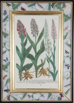
Three Varieties of Leucoium (I. Leucoium purpureum variegatum flore pleno. II Leucoium pleno flor album purpureis maculis signatum. III. Leucoium pleno flor album sanguine maculis signatum), from B. Besler, Hortus Eystettensis possibly (after) Basil Besler (German, 1561–1628) published 1713 with contemporary hand coloring.
- Creator:(After) Basilius Besler (1561 - 1629, German)
- Creation Year:1713
- Dimensions:Height: 21.5 in (54.61 cm)Width: 17 in (43.18 cm)
- Medium:
- Period:Early 17th Century
- Condition:
- Gallery Location:Paonia, CO
- Reference Number:1stDibs: LU78032590223
About the Seller
4.9
Vetted Professional Seller
Every seller passes strict standards for authenticity and reliability
Established in 1978
1stDibs seller since 2017
126 sales on 1stDibs
Typical response time: 2 hours
- ShippingRetrieving quote...Shipping from: Paonia, CO
- Return Policy
Authenticity Guarantee
In the unlikely event there’s an issue with an item’s authenticity, contact us within 1 year for a full refund. DetailsMoney-Back Guarantee
If your item is not as described, is damaged in transit, or does not arrive, contact us within 7 days for a full refund. Details24-Hour Cancellation
You have a 24-hour grace period in which to reconsider your purchase, with no questions asked.Vetted Professional Sellers
Our world-class sellers must adhere to strict standards for service and quality, maintaining the integrity of our listings.Price-Match Guarantee
If you find that a seller listed the same item for a lower price elsewhere, we’ll match it.Trusted Global Delivery
Our best-in-class carrier network provides specialized shipping options worldwide, including custom delivery.More From This Seller
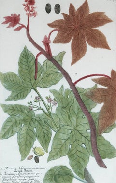
View AllRicinus Africanus Maximus N. 867 J.W. Weinman original engraving 1737
By Johann Wilhelm Weinmann
Located in Paonia, CO
Mezzotint Engraving with Some Hand Coloring image size 15.25 x 10 from Johan Wilhelm Weinmann’s ( 1683-1741 ) Phytanthoza Iconographia, a comprehensive scientific eight volume set w...
Category
1730s Landscape Prints
Materials
Engraving
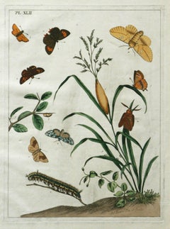
The Aurelian, A Natural History of English Moths and Butterflies Plate XLII
By Moses Harris
Located in Paonia, CO
Moses Harris ( British 1731-1785 )
The Aurelian, A Natural History of English Moths and Butterflies
Plate XLII 1778 edition
hand colored edition
17.88 x 11.00
good condition
Pla...
Category
1770s More Prints
Materials
Engraving
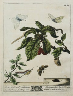
The Aurelian, A Natural History English Moths Butterflies Moses Harris pl. IX
By Moses Harris
Located in Paonia, CO
Moses Harris ( British 1731-1785)
The Aurelian, A Natural History of English Moths and Butterflies – Plate IX
Hand-Colored Engraving
17.88 x 11.00
very good condition
Plate IX fro...
Category
1770s Animal Prints
Materials
Engraving
Ananus Sclvestris ( Pineapple ) N. 110 mezzotint engraving with hand coloring
By Johann Wilhelm Weinmann
Located in Paonia, CO
Johann Wilhelm Weinmann
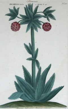
Ananus Sclvestris ( Pineapple ) N. 110
mezzotint engraving with hand coloring
paper size 15.50 x 9.50
image size 13 x 8.25
Ananus Sclvestris ( Pineapple ) N....
Category
1730s Still-life Prints
Materials
Mezzotint
The Aurelian, A Natural History of English Moths Butterflies Plate XXXVIII
By Moses Harris
Located in Paonia, CO
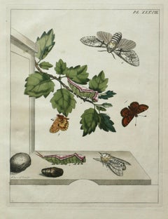
Moses Harris ( British 1731-1785 )
Plate XXXVIII ,The Aurelian, A Natural History of English Moths and Butterflies
Hand colored engraving 1778 edition
17.88 x 11.00
Very good condi...
Category
1770s More Prints
Materials
Engraving
The Aurelian, A Natural History English Moths Butterflies Plate XXVII 1778 ed.
By Moses Harris
Located in Paonia, CO
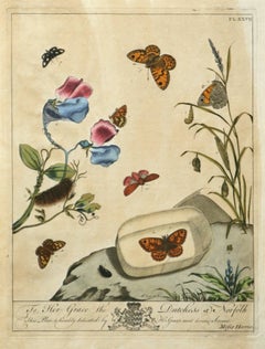
Moses Harris ( British 1731-1785 )
The Aurelian, A Natural History of English Moths and Butterflies
Hand colored engraving – Plate XXVII
1778 edition
Plate XXVII is from The A...
Category
1770s More Prints
Materials
Engraving
You May Also Like
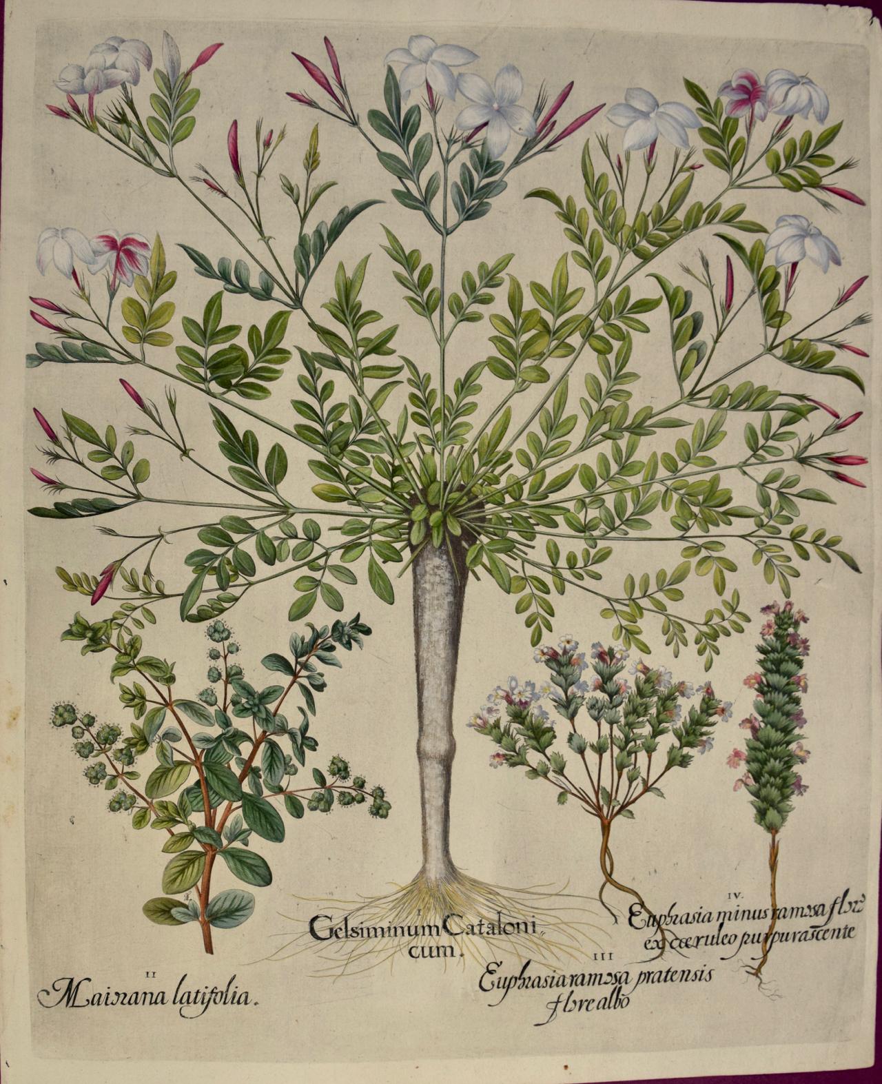
Flowering Jasmine and Laurel Plants: A Besler Hand-colored Botanical Engraving
Located in Alamo, CA
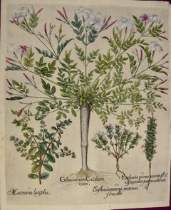
This is a hand-colored copper-plate engraving entitled "Gelsiminum Catalonicum, Mairana Latifollia, Euphasiaramosa Pratensis Flore Albo, Euphasia Minus Ramosa Flore Excereruleo Purpurascente", depicting flowering Jasmine, Mountain Laurel...
Category
1710s Academic Still-life Prints
Materials
Engraving
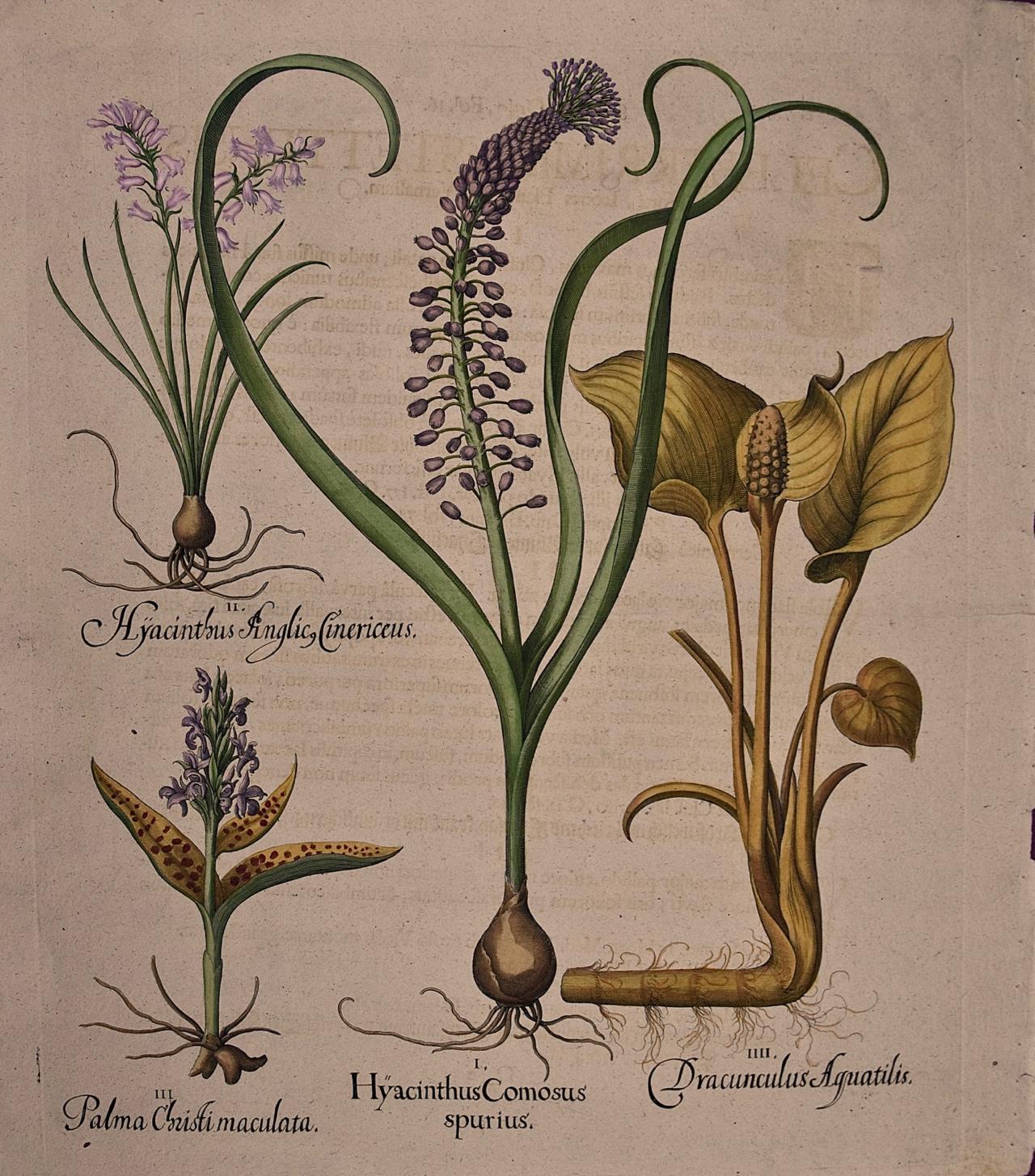
Flowering Hyacinth & Calla Plants: A Besler Hand-colored Botanical Engraving
Located in Alamo, CA
This is a hand-colored copper plate engraving depicting flowering "Hyacinthus Comosus Spurius" (Hyacinth), "Hyacinthus Anglicus" (Blue Hyacinth), "Palma ...
Category
Early 18th Century Academic Still-life Prints
Materials
Engraving

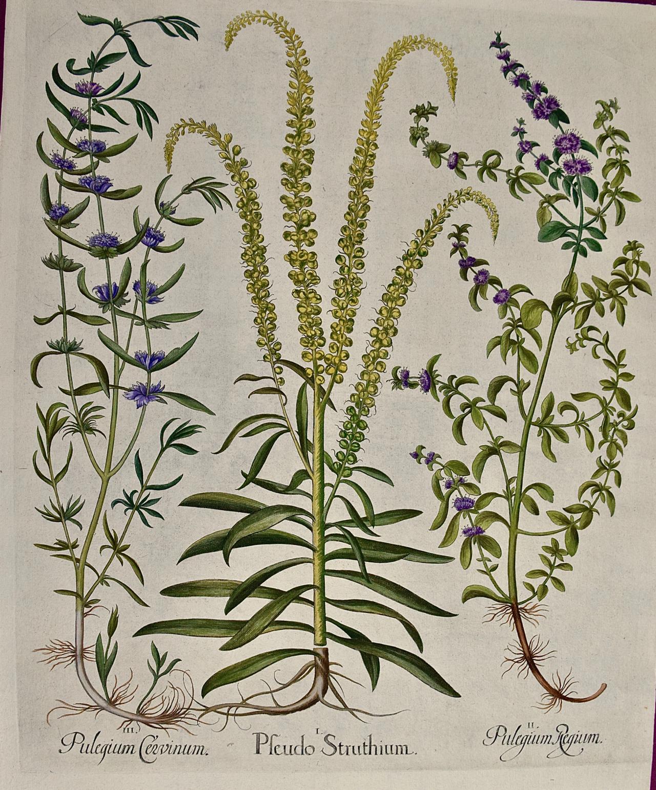
Flowering Peppermint Plants: A 17th C. Besler Hand-colored Botanical Engraving
Located in Alamo, CA
This is a hand-colored copper plate engraving entitled "Pulegium Cervinum, Pseudo Pulegium Struthium, Pulegium Regium", depicting flowering Peppermint, Weld and Pennyroyal plants respectively from Basilius Besler's landmark work, Hortus Eystettensis (Garden at Eichstatt), first published in 1613 in Eichstatt, Germany near Nuremberg and later in 1640 and 1713.
This beautiful colorful engraving is printed on thin laid chain-linked paper. There are subtle creases in the right upper corner, very common with Besler's relating to the drying of the paper during its production. The right margin is thinner than the others. The print is otherwise in excellent condition with striking hand-coloring.
Basilius Besler (1561–1629) was an apothecary and botanist. He was curator of the Willibaldsburg Castle garden of Johann Konrad von Gemmingen, prince bishop...
Category
1640s Academic Still-life Prints
Materials
Engraving

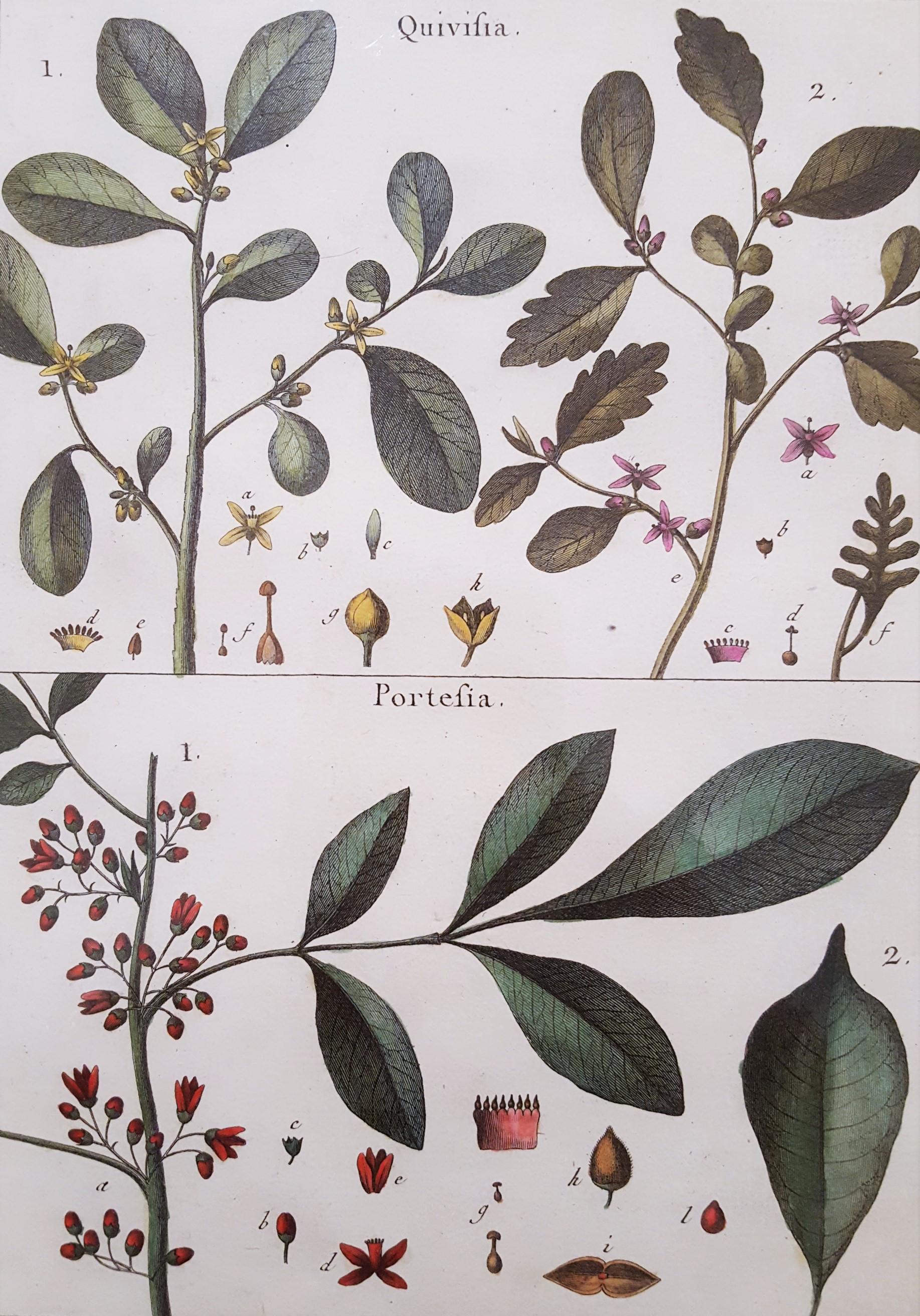
Quivisia; Portesia /// Antique Botanical Botany Plants Science Engraving Buffon
By Georges-Louis Leclerc, Comte de Buffon
Located in Saint Augustine, FL
Artist: Georges-Louis Leclerc, Comte de Buffon (French, 1707-1788)
Title: "Quivisia; Portesia" (Octandreie, Monogynie, Plate 302)
Portfolio: Histoire Naturelle
Year: 1749-1789
Medium: Original Hand-Colored Engraving on laid paper
Limited edition: Unknown
Printer: Imprimerie Nationale, Paris, France
Publisher: Georges-Louis Leclerc, Comte de Buffon, Paris, France
Framing: Not framed, but beautifully double matted with hand decorated archival French matting...
Category
2010s Naturalistic Still-life Prints
Materials
Watercolor, Engraving, Laid Paper, Intaglio

Johann Weinmann: c18th Botanical Engravings in Decalcomania Frames
Located in Richmond, GB
A wonderful selection of hand-coloured mezzotint engravings from: ""Phytanthoza Iconographia"", c1739, presented in hand- made parcel-gilt, ebonised and decalcomania frames.
Joha...
Category
18th Century More Prints
Materials
Watercolor, Mezzotint
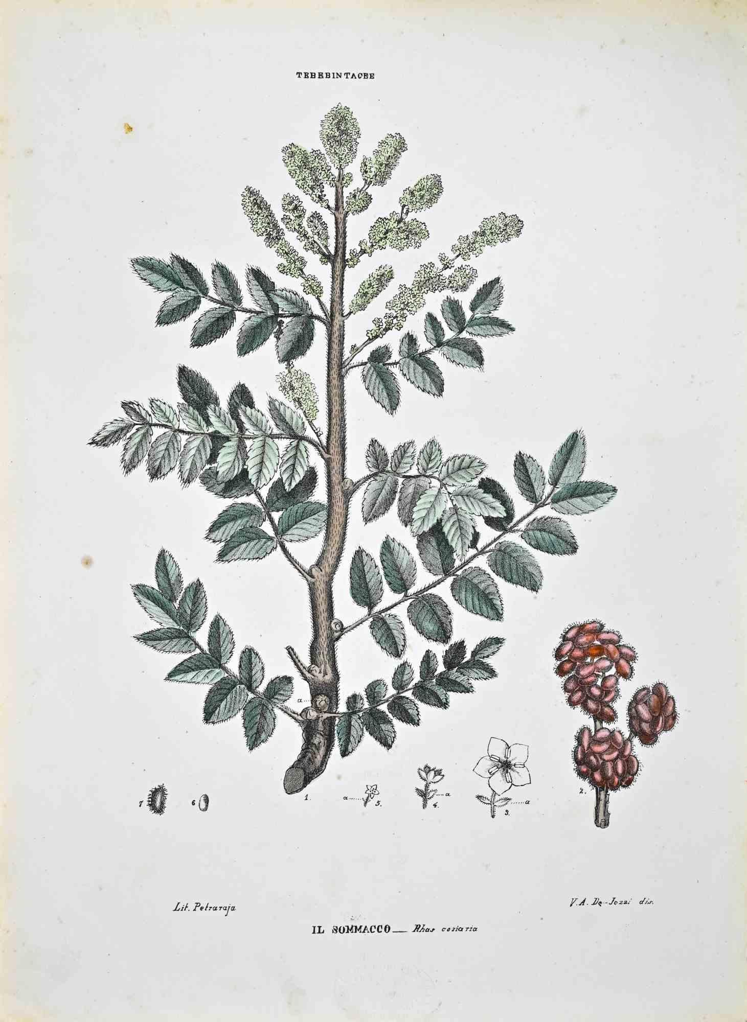
The Thebebintaceae - Lithograph by Vincenzo Tenore - 1870s
Located in Roma, IT
Lithograph hand watercolored.
Plate from "Atlante di Botanica popolare ossia Illustrazione di Piante Notevoli di ogni famiglia" (Atlas of popular botany or illustration of notable p...
Category
1870s Modern Figurative Prints
Materials
Lithograph

More Ways To Browse
17th Century German Engravings
Man And Woman Bust Sculpture
Marble Relief Portrait
Michael Bowles Art
Nude Athlete
Pair Of 19th Century Oil Portraits
Renee French
Schuster Modern
The Cottage Girl
2 Matching Painting
Black Forest Horse
H Collins
Mid Century Paintings Male Nudes
Pair 19th Century Oil Portrait Paintings
Palm Botanical Prints
Surf Sculpture
Warhol Jackie
West German Bowl