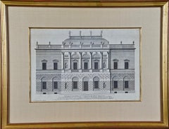
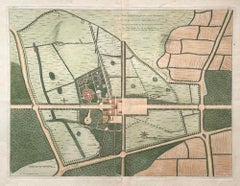
18th C. Architectural Engraving from "Vitruvius Britannicus" by Colen Campbell


Want more images or videos?
Request additional images or videos from the seller
1 of 11
Colen Campbell18th C. Architectural Engraving from "Vitruvius Britannicus" by Colen Campbell1715
1715
$975List Price
About the Item
- Creator:Colen Campbell (1676 - 1729, British)
- Creation Year:1715
- Dimensions:Height: 17.25 in (43.82 cm)Width: 22.25 in (56.52 cm)Depth: 0.75 in (1.91 cm)
- Medium:
- Period:1710-1719
- Condition:
- Gallery Location:Alamo, CA
- Reference Number:Seller: #39441stDibs: LU117325250062
Colen Campbell
Colen Campbell (15 June 1676 – 13 September 1729) was a pioneering Scottish architect and architectural writer who played an important part in the development of the Georgian style. For most of his career, he resided in Italy and England. As well as his architectural designs, he is known for "Vitruvius Britannicus", three volumes of high-quality engravings showing the great houses of the time.
About the Seller
5.0
Platinum Seller
Premium sellers with a 4.7+ rating and 24-hour response times
Established in 2011
1stDibs seller since 2019
285 sales on 1stDibs
Typical response time: 1 hour
Authenticity Guarantee
In the unlikely event there’s an issue with an item’s authenticity, contact us within 1 year for a full refund. DetailsMoney-Back Guarantee
If your item is not as described, is damaged in transit, or does not arrive, contact us within 7 days for a full refund. Details24-Hour Cancellation
You have a 24-hour grace period in which to reconsider your purchase, with no questions asked.Vetted Professional Sellers
Our world-class sellers must adhere to strict standards for service and quality, maintaining the integrity of our listings.Price-Match Guarantee
If you find that a seller listed the same item for a lower price elsewhere, we’ll match it.Trusted Global Delivery
Our best-in-class carrier network provides specialized shipping options worldwide, including custom delivery.More From This Seller
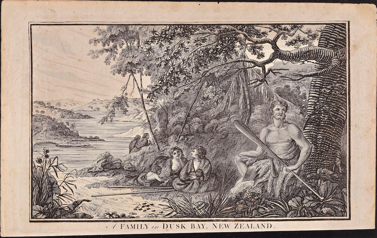
View AllFamily in Dusky Bay, New Zealand: Original 18th C. Engraving from Captain Cook
By William Hodges
Located in Alamo, CA
"A Family in Dusk Bay, New Zealand" is an original 18th century engraving from a drawing by William Hodges (1744-1797), who was the artist who accompanies Captain Cook on his second ...
Category
1780s Landscape Prints
Materials
Engraving

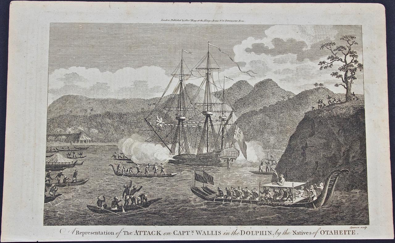
Attack on Captain Wallis When He Discovered Tahiti: Original 18th C. Engraving
Located in Alamo, CA
"A Representation of the Attack on Captain Wallis in the Dolphin by the Natives of Otaheite (Tahiti)" is an engraving created by the artist Sparrow based on an engraving in John Hawk...
Category
1780s Landscape Prints
Materials
Engraving
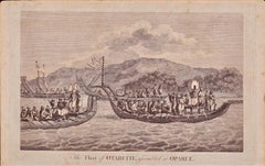
The Fleet of Tahiti displayed for Captain Cook: An Original 18th C. Engraving
By William Hodges
Located in Alamo, CA
"The Fleet of Otaheite, Assembled at Oparee" is an original 18th century engraving from a drawing by William Hodges (1744-1797), who was the artist who accompanies Captain Cook on hi...
Category
1780s Landscape Prints
Materials
Engraving
Persia, Armenia & Adjacent Regions: A Hand-colored 17th Century Map by De Wit
By Frederick de Wit
Located in Alamo, CA
This colorful and detailed 17th century copperplate map by Frederick De Wit was published in Amsterdam between 1666 and 1690. It depicts the Caspian Se...
Category
Late 17th Century Old Masters More Prints
Materials
Engraving

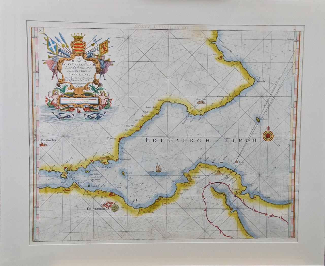
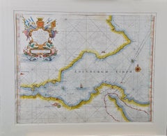
Edinburgh, Scotland: An Original 17th C. Hand-Colored Engraved Sea Chart
By Captain Greenvile Collins
Located in Alamo, CA
This hand-colored sea chart is entitled "Edinburgh Firth" from "Great Britain's Coasting Pilot. Being a New and Exact Survey of the Sea-Coast of England" by Captain Greenville Collin...
Category
Late 17th Century Landscape Prints
Materials
Engraving
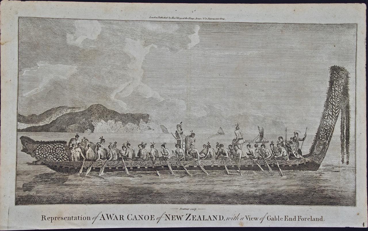
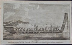
New Zealand War Canoe: Original 18th C. Engraving from Captain Cook's 1st Voyage
Located in Alamo, CA
"War Canoe of New Zealand, with a View of the Gable End Foreland" is an engraving created by Thomas Prattent, from a drawing by Sydney Parkinson, who was the artist on Captain James ...
Category
1780s Landscape Prints
Materials
Engraving
You May Also Like
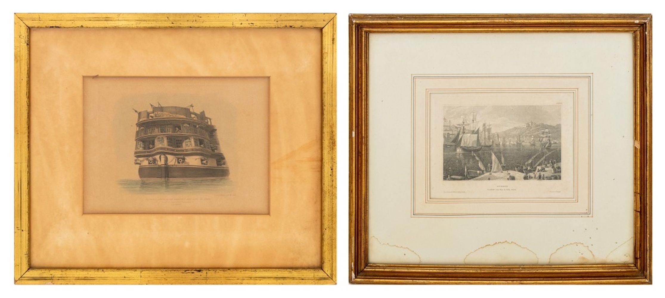
E.W. Cooke, Etc. European Maritime Etchings, 2
Located in Astoria, NY
Two European Maritime Engravings, comprising: E.W. Cooke (English, 1811-1880), "The (Circular) Stern of His Majesty's Ship Asia, 84 Guns", marked lower right and titled lower center ...
Category
19th Century Other Art Style Landscape Prints
Materials
Paper, Engraving
Plan of the Park, Garden and Plantations of Goodwood, 18th century engraving
By Colen Campbell
Located in Melbourne, Victoria
Plan of the Park, Garden and Plantations of Goodwood in Sussex the Seat of his Grace the Duke of Richmond and Lenox &c
Copper-line engraving with later hand-colouring by Hendrik Hul...
Category
18th Century English School Landscape Prints
Materials
Engraving
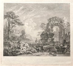
Les Bergers Romains, landscape with Roman ruins, 18th century engraving
Located in Melbourne, Victoria
Les Bergers Romains
Copper-line engraving by Jean Jacques Leveau (1729-1786) after Pierre Mettay (1728-1759). C1755.
Proof, before lettering. Laid, watermarked paper.
A landscap...
Category
18th Century French School Landscape Prints
Materials
Engraving
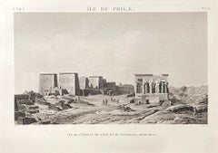
Island of Philae, Egypt. Early 19th century engraving, 1820
Located in Melbourne, Victoria
'Ile de Philae : Vue de l'edifice de l'est et de plusieurs monuments'
(Island of Philae : View of the east building and other monuments)
Elephant folio engraving, by Baltard after...
Category
Early 19th Century Other Art Style Landscape Prints
Materials
Engraving
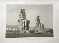
Colossi of Memnon, Thebes, Egypt. Early 19th century engraving, 1820
Located in Melbourne, Victoria
'Vue des Deux Colosses. Thebes, Memnonium'
Elephant folio engraving, by Baltard after Dutetre, from 'Description de l'Egypte', published after Napoleon's expedition to colonize Egyp...
Category
Early 19th Century Other Art Style Landscape Prints
Materials
Engraving
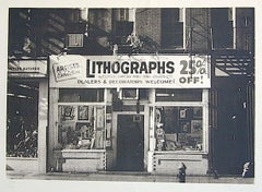
LITHOGRAPHS Greenwich Village NYC, Signed Mezzotint, Art Gallery, Photorealism
By John Baeder
Located in Union City, NJ
LITHOGRAPHS Greenwich Village NYC by the American photorealist artist John Baeder is a limited edition mezzotint printed using hand printmaking techniques on archival, cream colored ...
Category
1970s Photorealist Landscape Prints
Materials
Mezzotint
Recently Viewed
View AllMore Ways To Browse
Vitruvius Britannicus
Garters Gold
Sir Christopher Wren
Palladio Prints
Georgian Library Steps
Nando Kallweit
Pumpkin Box
Rhino Gold
Vivian Brown
Apostles Painting
Black Greek Statue
Hare Sculpture Bronze
Peacock Photography
Portrait Of Nobleman
Shona Sculptures
19th Century Male Oil Paintings
Antigua Art
Ballerina Bronze Sculpture