Items Similar to A View of Kauai, Hawaii Discovered by Captain Cook: Original 18th C. Engraving
Want more images or videos?
Request additional images or videos from the seller
1 of 5
John WebberA View of Kauai, Hawaii Discovered by Captain Cook: Original 18th C. Engraving1785
1785
$225
£171.34
€195.66
CA$316.15
A$346.88
CHF 182.72
MX$4,126.50
NOK 2,340.62
SEK 2,137.30
DKK 1,461.74
About the Item
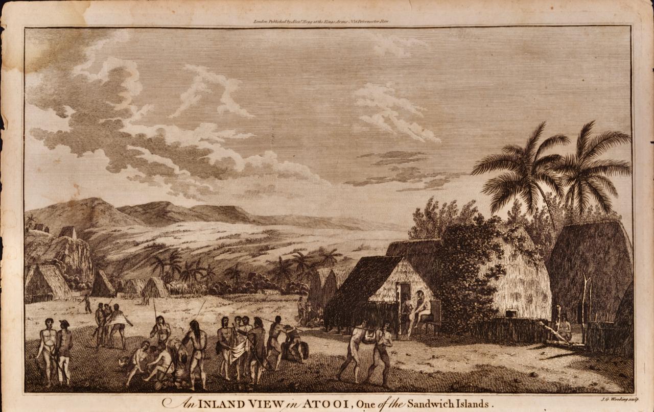
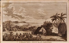
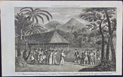
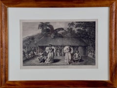
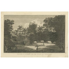
"View of A Morai or Burial Place of Atooi, One of the Sandwich Islands (Kauai, Hawaii)" is an original 18th century engraving from a drawing by John Webber (1751-1793), who was the artist who accompanied Captain Cook on his third voyage of discovery, 1776-1780. The engraving appeared in Alexander Hogg's publication "A New, Authentic, and Complete Collection of Voyages Round the World" published in London in 1785.
This engraving depicts Captain Cook's visit to the village of Waimea on the island of Kauai, Hawaii. Hawaii was discovered by Captain James Cook. He first saw present day Oahu on January 18th, 1778, but sailed past it. He and the crew of his ships the H.M.S. Resolution and Discovery made their 1st landing on Kauai at the village of Waimea. He named the islands the Sandwich Islands after John Montague, the Earl of Sandwich, head of the British Admiralty at the time and a patron of Cook's. The name was in use until 1819 when King Kamehameha I unified the islands into a single kingdom called Hawaii.
The scene depicts a Morai, a sacred Hawaiian place of burial and worship, located on the island of Kauai in the village of Waimea. A panoramic view of the island's interior is seen in the distance. The scene was witnessed by John Webber, the artist who accompanied Cook on his 3rd voyage of discovery. He made the drawing that was used for this 18th century engraving.
The engraving is printed on laid chain-linked paper. The sheet measures 9.75" in height 15.25" in width. There is a small area of staining in the upper left corner, some small spots in the margins and minimally in the upper portion of the image, and small chips of the lower edge of the sheet and one along the right edge. The image is beautifully inked.
Alexander Hogg was an 18th and early 19th century publisher of illustrated books of architectural and historical prints, as well as maps. His publishing house was located in London at the Kings Arms on Paternoster Row.
- Creator:John Webber (1751 - 1793, British)
- Creation Year:1785
- Dimensions:Height: 9.75 in (24.77 cm)Width: 15.25 in (38.74 cm)
- Medium:
- Period:1780-1789
- Framing:Framing Options Available
- Condition:
- Gallery Location:Alamo, CA
- Reference Number:Seller: # 8091stDibs: LU1173216439352
John Webber
John Webber (1751-1793) was recommended to the Admiralty for appointment as artist for the Captain Cook's 3rd voyage by the Swedish botanist Daniel Carlsson Solander (1733-1782) who had accompanied Cook on his first voyage. Just 24 years old when he joined the Captain Cook’s ship the Resolution at Plymouth one week prior to departure, Webber's skill in both portraiture and landscape resulted in a visual record of Cook's third voyage that is unsurpassed in the annals of 18th century exploration.
About the Seller
5.0
Platinum Seller
Premium sellers with a 4.7+ rating and 24-hour response times
Established in 2011
1stDibs seller since 2019
298 sales on 1stDibs
Typical response time: 1 hour
- ShippingRetrieving quote...Shipping from: Alamo, CA
- Return Policy
More From This Seller
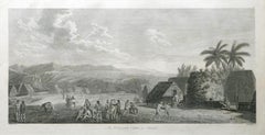
View AllA View of Kauai, Hawaii as Seen by Captain Cook: An Original 18th C. Engraving
By John Webber
Located in Alamo, CA
"An Inland View in Atooi, One of the Sandwich Islands (Kauai, Hawaii)" is an original 18th century engraving from a drawing by John Webber (1751-1793), who was the artist who accompa...
Category
1780s Landscape Prints
Materials
Engraving
Surrender of Tahiti to Captain Wallis: An Original 18th C. Engraving
By John Webber
Located in Alamo, CA
"A Representation of the Surrender of the Island of Otaheite to Capt.n Wallis, by the Supposed Queen of Oberea" is an original 18th century engraving created by Sparrow, from a drawi...
Category
1780s Landscape Prints
Materials
Engraving
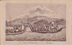
The Fleet of Tahiti displayed for Captain Cook: An Original 18th C. Engraving
By William Hodges
Located in Alamo, CA
"The Fleet of Otaheite, Assembled at Oparee" is an original 18th century engraving from a drawing by William Hodges (1744-1797), who was the artist who accompanies Captain Cook on hi...
Category
1780s Landscape Prints
Materials
Engraving
Kamtschatka, Russia: Engraving by J. Webber from Capt. Cook's 3rd Voyage Journal
By John Webber
Located in Alamo, CA
"A View of the Town and Harbour of St Peter and St Paul, in Kamtschatka" is an engraving created by Charles Grignion, from a drawing by John Webber (1752-1793), who was the artist on...
Category
1780s Landscape Prints
Materials
Engraving
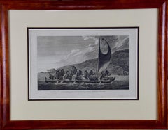
Sandwich Islands Canoe (Hawaii): Framed 18th C. Engraving Captain Cook's Journal
By John Webber
Located in Alamo, CA
"A Canoe of the Sandwich Islands, the Rowers Masked" is an engraving created by Charles Grignion, from a drawing by John Webber (1752-1793), who was the artist on Captain James Cook's 3rd and final voyage of discovery. It is Plate 65 in the atlas of "A Voyage to the Pacific Ocean Undertaken by the Command of His Majesty, for Making Discoveries in the Northern Hemisphere", the official British Admiralty sanctioned journal published upon completion of the voyage in London in 1784 by Strahan & Cadell.
This famous image of ten Hawaiian rowers transporting a priest who is carrying a feather-covered image of Kukailimoku, the Hawaiian god of war. The priests and paddlers are all wearing gourd masks in their double-hulled canoe with an upright lateen woven sail. Each hull was shaped from a single large Koa log harvested from island rainforests, where they were carved before being transported to the coast.
This engraving is presented in a Koa wood frame and a white mat. There are occasional faint spots, but the print is otherwise in very good condition. Koa is the same wood as was used to make the canoe. Koa wood is legendary in Hawaii. Not only is this amazing wood native to Hawaii, but it is known for the deep rich colors and varied grain pattern. Koa has an honored heritage in Hawaii and is highly revered and sacred. The word “koa” means “warrior” in Hawaiian. The warriors of King Kamehameha the Great, created canoes and weapons from a wood plentiful on the Big Island of Hawaii. This wood became synonymous with the warriors themselves, and it became known as koa. The frame measures 20.75" high, 26.75" wide and 0.88" deep.
There are three other engravings listed from the official journal of Captain Cook's 3rd voyage available that are presented in identical Koa wood frames and mat (LU117324682022, LU117324684052, LU117324684062). They would make a wonderful grouping for a display of 2, 3 or 4 prints. A discount is available for a grouping depending on the number of items included.
Hawaii was discovered by Captain Cook (1728-1779) during this voyage. Hawaii was originally called The Sandwich Islands in honor of The Earl of Sandwich...
Category
1780s Landscape Prints
Materials
Engraving
"A Dance in Otaheite" (Tahiti), Engraving from Captain Cook's 3rd Voyage
By John Webber
Located in Alamo, CA
"A Dance in Otaheite" (Tahiti) is an engraving created by William Sharp (1749-1824), from a drawing by John Webber (1752-1793), who was the artist on Captain James Cook's 3rd and final voyage of discovery. It is a plate in the atlas of "A Voyage to the Pacific Ocean Undertaken by the Command of His Majesty, for Making Discoveries in the Northern Hemisphere", the official British Admirality sanctioned journal published upon completion of the voyage in London in 1784 by Strahan & Cadell.
Two women and two men wearing ceremonial costumes, performing a dance outdoors standing on a mat. Three men are playing the drums in the background, in front of a thatched roof building. An audience of men are sitting on both sides of the stage. By the time Webber arrived in Tahiti, 'south sea' imagery had become familiar. Webber gave concentrated attention to dance. He had the opportunity to distinguish the Tahitian dance from the more formalized dancing of Tonga. Whereas they seem to have called to mind the more formal dances of antiquity, the Tahitian dancing aroused memories of peasant and folk dancing.
This engraving is professionally framed in Koa wood. Koa wood is legendary in Hawaii. Not only is this amazing wood native to Hawaii, but it is known for the deep rich colors and varied grain pattern. Koa has an honored heritage in Hawaii and is highly revered and sacred. The word “koa” means “warrior” in Hawaiian. The warriors of King Kamehameha the Great, created canoes and weapons from a wood plentiful on the Big Island of Hawaii. This wood became synonymous with the warriors themselves, and it became known as koa.
The print is in excellent condition.
There are three other engravings listed from the official journal of Captain Cook's 3rd voyage available that are presented in identical Koa wood frames and double mats (LU117324682432, LU117324684052, LU117324684062). They would make a wonderful grouping for a display of 2, 3 or 4 prints. A discount is available for a grouping depending on the number of items included.
Hawaii was discovered by Captain Cook during this voyage. Hawaii was originally called The Sandwich Islands in honor of The Earl of Sandwich...
Category
1780s Realist Landscape Prints
Materials
Engraving
You May Also Like
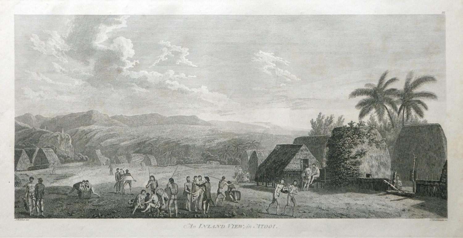
An Inland View; in Atooi ( Hawaii ) 1784 Captain Cook engraving by John Webber
By John Webber
Located in Paonia, CO
An Inland View in Atooi ( Hawaii ) is from the 1784 First Edition Atlas Accompanying Capt. James Cook and King; Third and Final Voyage of Captain James Cook. This engraving depicts ...
Category
1780s Realist Landscape Prints
Materials
Engraving
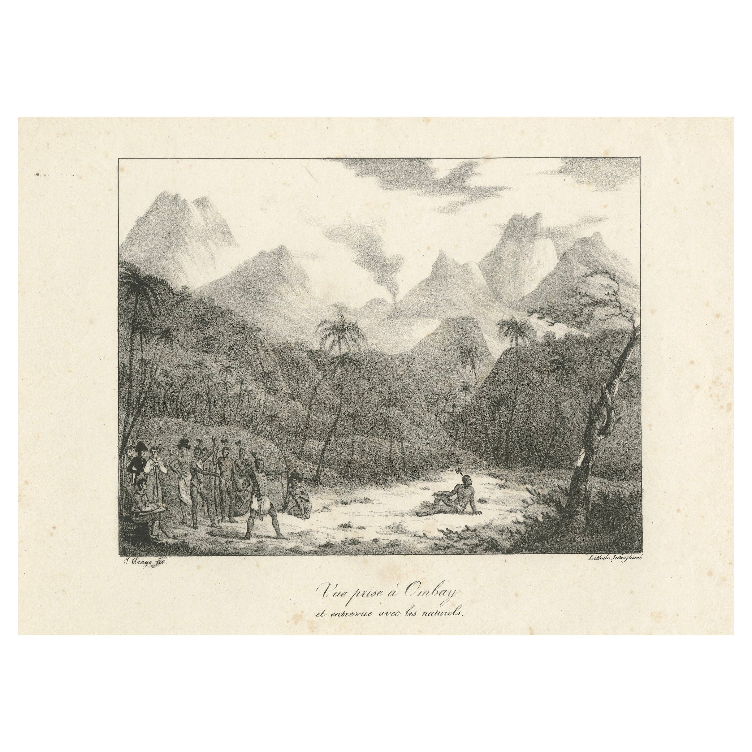
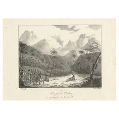
First Contact in Owhyhee: Webber's 1785 Engraving of Hawaii
Located in Langweer, NL
First Contact in Owhyhee: Webber's 1785 Engraving of Hawaii
Description: This captivating print, titled "Vue prise à Owhyhee et entrevue avec les naturels," offers a glimpse into a ...
Category
Antique 1780s Prints
Materials
Paper
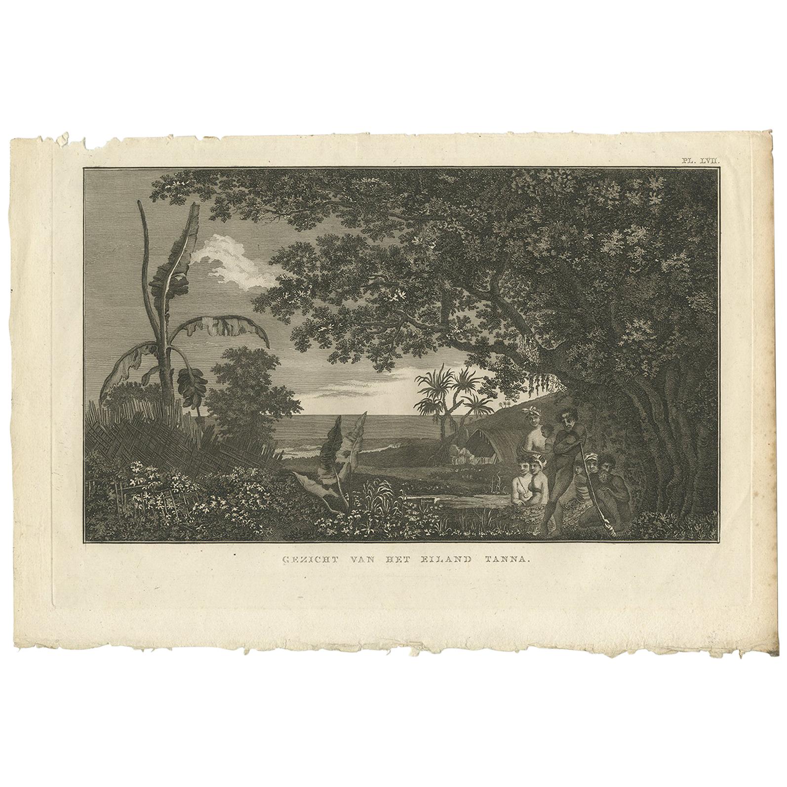
View of Tanna Island: A Glimpse into Vanuatu from Cook's Voyages, 1803
Located in Langweer, NL
Antique print titled 'Gezicht van het Eiland Tanna'. This print depicts a view of Tanna Island, Vanuatu. Originates from 'Reizen rondom de Waereld' by J. Cook. Translated by J.D. Pas...
Category
Antique Early 19th Century Dutch Prints
Materials
Paper

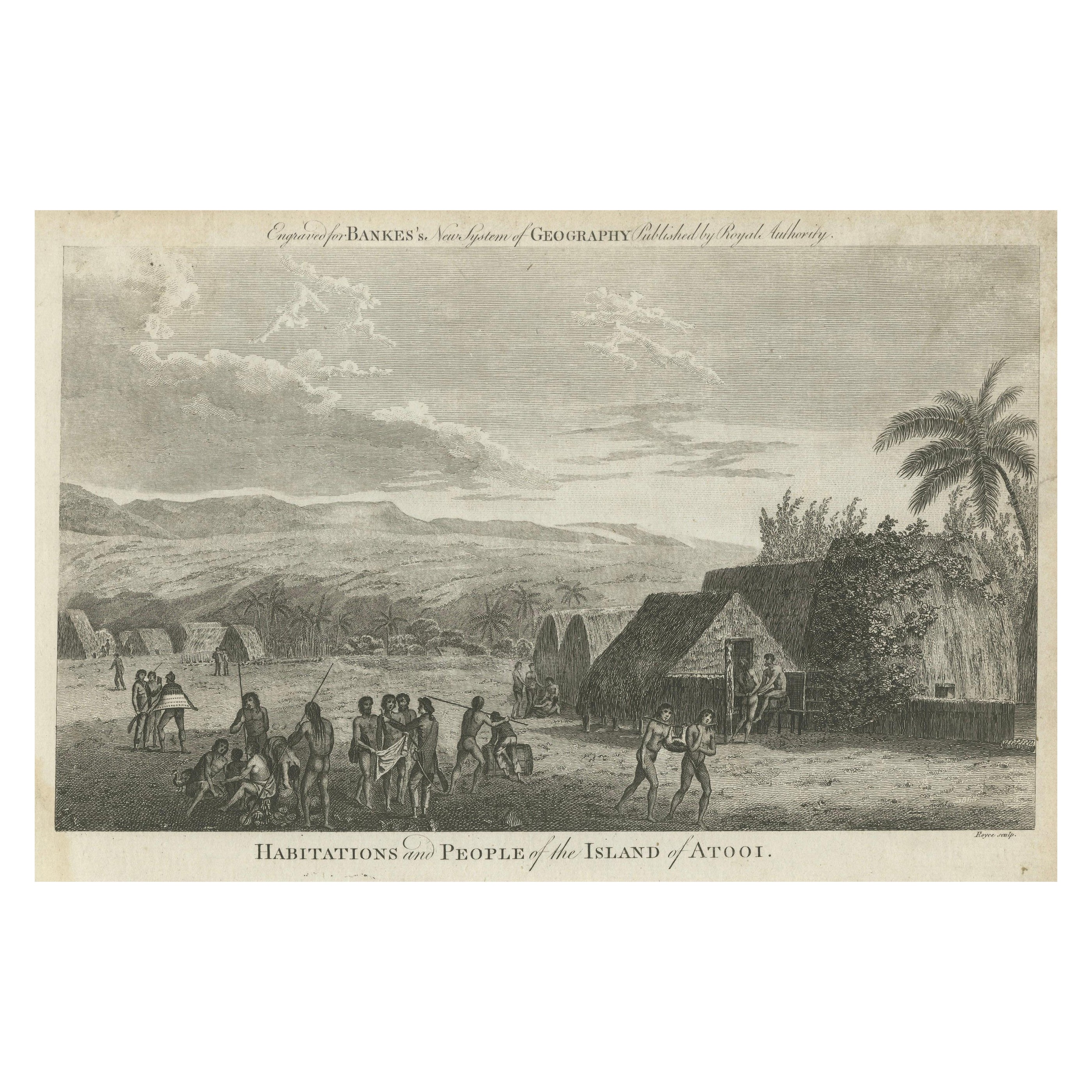
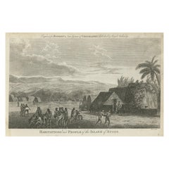
Daily Life in Atooi: An 18th-Century View of Kauai and Its People, circa 1785
Located in Langweer, NL
This antique engraving with the caption "Habitations and People of the Island of Atooi," which is an old name for Kauai, part of the Hawaiian Islands. The engraving is captioned to have been engraved for "Bankes's New System of Geography Published by Royal Authority."
The scene is rich with cultural and ethnographic details. It shows several indigenous Hawaiian people engaged in various activities in front of thatched houses...
Category
Antique 1780s British Prints
Materials
Paper
$229 Sale Price
20% Off
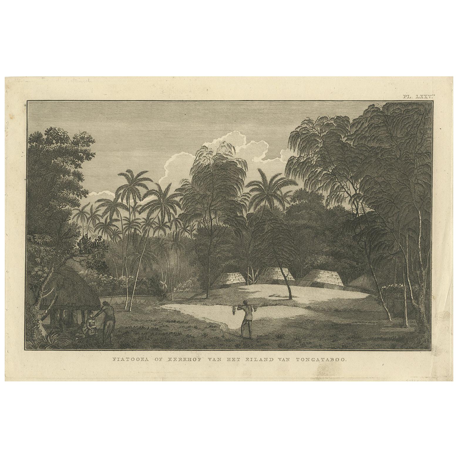
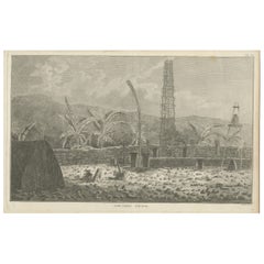
Antique Print of the Cemetery on the Island Tongatapu by Cook, circa 1801
Located in Langweer, NL
Antique print titled 'Fiatooka of Kerkhof van het Eiland van Tongataboo'. This print depicts a cemetery on the Island of Tongatapu. Originates from 'Reizen rondom de Waereld' by J. C...
Category
Antique Early 19th Century Prints
Materials
Paper
Antique Print of a Sacred Cemetery on Kauai, Hawaii
Located in Langweer, NL
Antique print titled 'Cimetiere d'Atooi'. View of a sacred cemetery on Kauai, Hawaii (Atooi). This print originates from 'Cartes et figures du troisième voyage de Cook' published 1785.
Category
Antique Late 18th Century Prints
Materials
Paper
$208 Sale Price
40% Off
More Ways To Browse
Captain Cook
Hawaiian Antique
Sandwich Islands
Antique Hawaiian Prints
Earl Stetson Crawford On Sale
Ed Ruscha History Kids
Edward Sokol Art
Edward Sokol
Emery Clark
Flordali I
Flordali Ii
Gary Barsumian
Georges Spiro
Hal Mcintosh
Harold Altman Child
Harold Hitchcock On Sale
Helen West Heller. American. On Sale
Highlands Ski