Items Similar to 'Coupe Gordon Bennett 1909' original lithograph by Marguerite "Gamy" Montaut

Want more images or videos?
Request additional images or videos from the seller
1 of 9
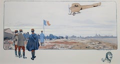
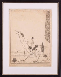
Marguerite Montaut'Coupe Gordon Bennett 1909' original lithograph by Marguerite "Gamy" Montaut1909
1909
$6,500
£4,937.81
€5,687.57
CA$9,298.91
A$10,198.43
CHF 5,259.76
MX$121,828.90
NOK 66,709.73
SEK 62,581.30
DKK 42,490.34
About the Item
"Coupe Gordon Bennett 1909 — Curtiss le Gagnant" is an original Lithograph with Pochoir created by Marguerite Montaut (GAMY). Gamy presents the viewer with a technical illustration of an early model airplane in profile flying above an expansive landscape with small figures. Such images were popular among technology enthusiasts during the turn of the century and Gamy and her husband Ernest Montaut worked to fill the demand. This particular example shows the American aviator Glenn Curtiss, flying a Curtiss no. 2, as he took first prize in the 1909 Gordon Bennett competition in Reims, France. Signed 'Gamy' in the stone, lower right. Publisher inscription 'Copyright 09 Mabileau et Co Paris' in the stone, lower left. Overall good condition; minor scattered foxing and surface accretions on artwork.
Artwork Size: 11 1/2" x 29"
Frame Size: 24 5/8" x 41 3/8"
Framed to conservation standards using archival materials: 100 percent rag silk-lined matting with 1/4 inch bevel, UV clear glass, and housed in a gold reverse ogee moulding.
Artist Bio:
Gamy is the name used by the prolific printmaker Marguerite Montaut, specializing in images of aviation & racing. She was a turn-of-the-century artist, wife of Ernest Montaut, and is credited with inventing many artistic techniques, including speed lines and the deliberate distortion of perspective by bending and foreshortening the image in order to create the illusion of movement and speed. Many of these techniques have stood the test of time and are still used today by artists that draw and paint transportation subjects.
She produced her own works and a with her husband, also a printmaker, under the combined name of Gamy-Montaut. Ernest Montaut (1879-1909) and his wife, Marguerite (who Gamy is possibly a pseudonym for), were the first artists to capture the Heroic Age of aviation and motor racing. The Gamy-Montaut prints were produced by the pochoir process, in which the outlines for each image were drawn onto lithographic stones, printed and hand-coloured.
Marguerite Montaut, Ernest's wife, joined him in his work producing not only racing prints but also developing a fine series of aviation prints commemorating such events as the first flights on the early European mail routes. While Marguerite Montaut's works were occasionally signed "M. Montaut", she also used the name "Gamy", an anagram for Magy.
The Gamy-Montaut prints document various historical events in the early history of motorized transportation, including Power Boat Racing, Motorcycle and Motor Car Racing, Motor Car Touring, Zeppelins and Airplanes. Having observed the rapidly growing interest in cars and racing during the early years of motor cars, Ernest Montaut produced his first motoring prints in the mid-1890s, and by 1897, his drawings were pictorial records of the many races in France. Montaut's work was extremely well received in the Paris of his day and was shown in the fashionable shops of the Rue de l'Opera and Rue de la Paix, as well as in the better galleries. The Gamy-Montaut prints were all produced by the pochoir process in which the outlines for each image were drawn onto lithographic stones and printed. Using these uncoloured prints as a template, elaborate stencils were cut for each colour. Water-colour was then brushed onto the image through the stencil. The colouring process was quite complex, with each print taking several days to produce. It was also quite labour intensive, and the studio of Gamy-Montaut therefore employed a group of trained artists, including Nevil and Campion, to assist in the colouring. Besides his wife, other artists known to have worked for or with Montaut include Roowy, Nevil, Campion, Aldelmo, Brie, Dufourt and Jobbe du Val and we are sure that there are others!
- Creator:Marguerite Montaut (French)
- Creation Year:1909
- Dimensions:Height: 26.63 in (67.65 cm)Width: 41.38 in (105.11 cm)
- Medium:
- Movement & Style:
- Period:
- Framing:Frame IncludedFraming Options Available
- Condition:Overall good condition; minor scattered foxing and surface accretions on artwork; housed in a new frame.
- Gallery Location:Milwaukee, WI
- Reference Number:Seller: 12054g1stDibs: LU60536207992
About the Seller
4.9
Gold Seller
Premium sellers maintaining a 4.3+ rating and 24-hour response times
Established in 1966
1stDibs seller since 2017
451 sales on 1stDibs
Typical response time: 2 hours
- ShippingRetrieving quote...Shipping from: Milwaukee, WI
- Return Policy
Authenticity Guarantee
In the unlikely event there’s an issue with an item’s authenticity, contact us within 1 year for a full refund. DetailsMoney-Back Guarantee
If your item is not as described, is damaged in transit, or does not arrive, contact us within 7 days for a full refund. Details24-Hour Cancellation
You have a 24-hour grace period in which to reconsider your purchase, with no questions asked.Vetted Professional Sellers
Our world-class sellers must adhere to strict standards for service and quality, maintaining the integrity of our listings.Price-Match Guarantee
If you find that a seller listed the same item for a lower price elsewhere, we’ll match it.Trusted Global Delivery
Our best-in-class carrier network provides specialized shipping options worldwide, including custom delivery.More From This Seller
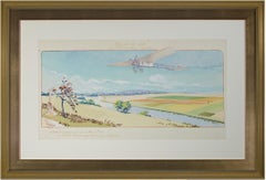
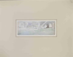
View All"Circuit De L'Est" Original Aeronautical Lithograph Poster by Marguerite Montaut
By Marguerite Montaut
Located in Milwaukee, WI
"Circuit De L'Est" is an original lithograph poster by Marguerite Montaut (GAMY). This artwork features an early biplane flying over farm fields. It is also passing over a river that...
Category
1910s Modern Landscape Prints
Materials
Lithograph, Ink
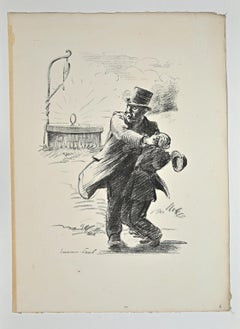
"En Auto, " Original Color Lithograph, Signed
Located in Milwaukee, WI
"En Auto" is an original color lithograph by Singils. The artist signed the piece in stone and wrote the title in the lower left. The edition number, also written lower left, is 46/5...
Category
Early 1900s Victorian Figurative Prints
Materials
Lithograph
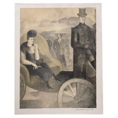
"French Air Show with Remarque of Head of Pilot, " Lithograph & Stencil by GAMY
By Marguerite Montaut
Located in Milwaukee, WI
"French Air Show with Remarque of Head of Pilot" is an original lithograph and stencil print by Marguerite Montaut (GAMY). It depicts an early airplane flying above a crowd of specta...
Category
1910s American Realist Landscape Prints
Materials
Lithograph, Stencil, Ink
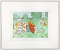
"La Chatelaine, from 'L'Estampe Moderne, '" Lithograph by Charles Doudelet
By Charles Doudelet
Located in Milwaukee, WI
"La Chatelaine" is a color lithograph by Charles Doudelet. The artist's name is printed lower right. This piece, featuring a wealthy woman on a white horse surrounded by dogs, was published in the Art Nouveau publication L'Estampe Moderne.
15 3/4" x 12" art
19 1/4" x 23" frame
Belgian painter, sculptor, illustrator and stage designer. He studied music at the Koninklijk Muziekconservatorium and sculpture at the Gewerbeschule, Ghent (after 1877). He visited Paris in 1887 and Italy in 1890, with a grant from the city of Ghent. He was deeply impressed by the masters of the Quattrocento, and was encouraged to take up painting after meeting Constantin Meunier...
Category
1890s Art Nouveau Figurative Prints
Materials
Lithograph
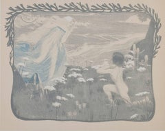
"H. L'Illusion (L'Estampe Moderne I), " Color Lithograph
By Henri Bellery-Desfontaines
Located in Milwaukee, WI
"H. L'Illusion (L'Estampe Moderne I)" is an original color lithograph by Henri Bellery-Desfontaines. This piece depicts a nude child before a dream-like woman in a blue translucent robe. This piece was published in the French Art Nouveau publication L'Estampe Moderne. Signed in plate.
15 3/4" x 12" art
Henri Bellery-Desfontaines , born with Paris in 1867 and dead the October 6th 1909, is a French Noveau artist Jack-of-All- Trades, who produced tables, illustrations, posters, lithographies, drawings of carpet, pieces of furniture and banknotes, and even dabbled with decoration & architecture.
In the 1900s, Paris was the perfect place for a group of young artists influenced by artistic currents like neogothic style or symbolism. Most of them started as painters and they switched later to decorative arts, attracted by the idea of an ever-present art, a lifeless art, a total art. Henri Bellery-Desfontaines was a member of this group and he started as as painter in Pierre-Victor Galland’s atelier. He entrusted him the decorative motifs which would frame Panthéon de Paris' drawings: Maillot, Bonnat, Humbert and specially Jean-Paul Laurens, who proposed him to join his atelier in l’École des Beaux-Arts de Paris. With him, he decorated l'Hôtel de Ville de Paris or Le Salon Lobau, Henri Bellery-Desfontaines is thought to have Luc-Olivier Merson (1846-1920) as a teacher.
During his years as a student, he started to illustrate magazines and books of tales and in 1895, Bellery-Desfontaines opted rapidly for illustration, probably due to financial problems, and he participated in magazines such as L’Image, L’Estampe Moderne or L’Almanach des Bibliophiles. This year, the Salon des Artistes Français hosted one of his design of tapestry.
From 1900 on, he gradually evolved toward an ambitious decorative artist, making tapestries and furniture for rich leaders and patrons. Bellery-Desfontaines was an important artist of his epoch, and he took part in numerous events like Bal de...
Category
1890s Art Nouveau Figurative Prints
Materials
Lithograph
20th century color lithograph figurative landscape print sepia sketch signed
By Claude Weisbuch
Located in Milwaukee, WI
"Nicolas Poussin, Homage" is an original color lithograph by Claude Weisbuch. The artist signed the piece in the lower right and wrote the edition numb...
Category
1970s Old Masters Figurative Prints
Materials
Lithograph
You May Also Like
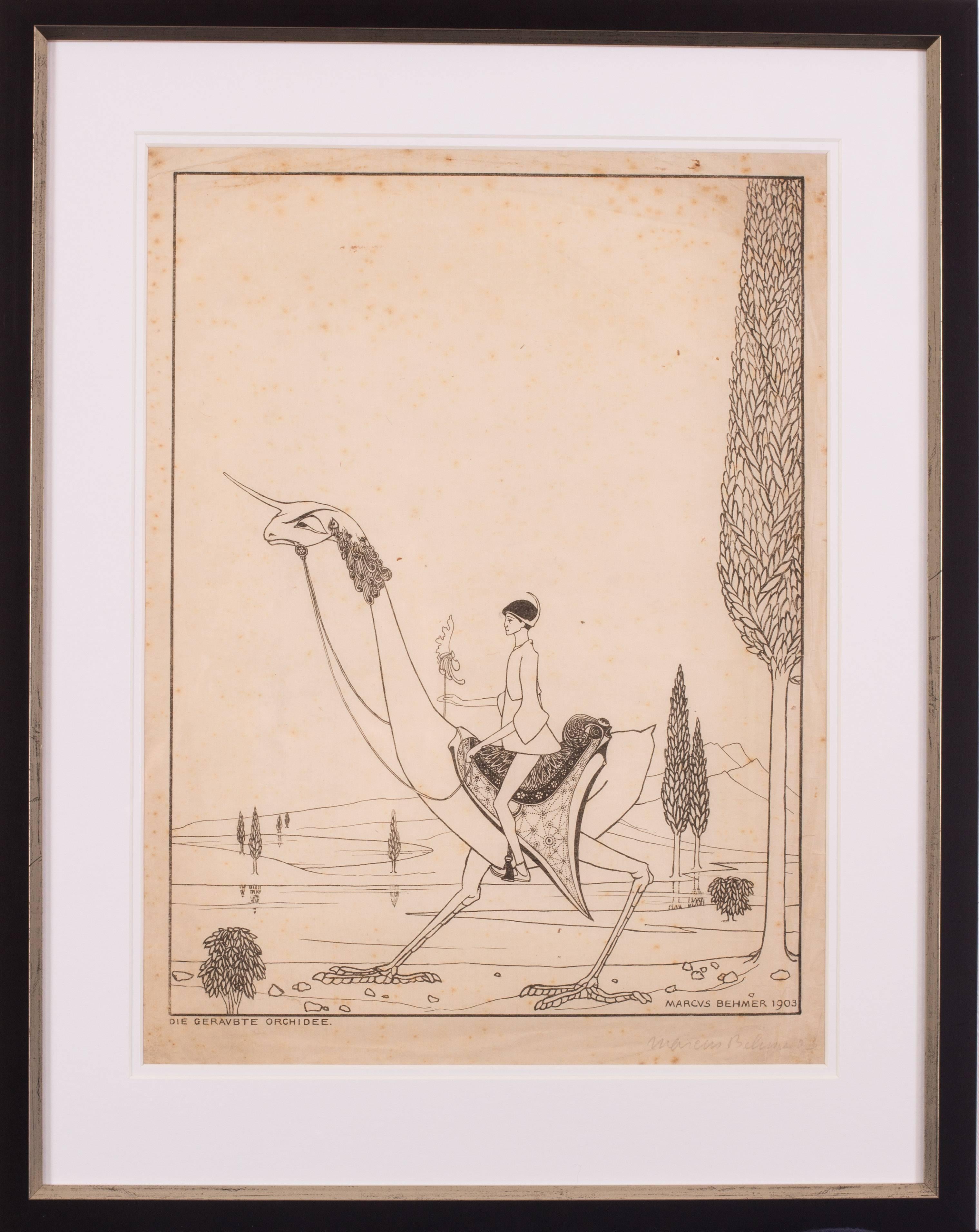
Original early 20th Century German signed lithograph by Marcus Behmer
By Marcus Behmer
Located in Petworth, West Sussex
Marcus Behmer (German, 1879 – 1958)
Die Geravbte orchidee (The robbed orchid), 1903
Signed ‘Marcus Behmer’ (lower right in pencil)
Lithograph on paper
16.1/8 x 12in. (40.8 x 30.5cm.)
It is apparent Behmer is influenced by the work of Aubrey Beardsley, though this work is no less beautiful in its execution. Little is known regarding his connections to Oscar Wilde though he is obviously an admirer and has many similarities with his private life and incarceration in prison. These works were a personal gift to Baron Detlev von Hadeln, the aristocrat and prominent art historian of the age.
Behmer is known to be, since 1903, a member in the first ever homosexual organization in Berlin and was thus probably a part of Adolf Brand’s circle, and may have contributed to Brand’s publication Der Eigene. Until now, few know that Behmer was sentenced in April 1937 by a court in Konstanz to imprisonment for two years, being arrested in Freiburg and at other locations in southern Germany for being a homosexual. At times he was given the opportunity to work as an artist in prison. The works produced in this period are mostly calligraphic designed tablets with Greek text (prayers and Bible quotes...
Category
Early 20th Century Art Nouveau More Prints
Materials
Lithograph
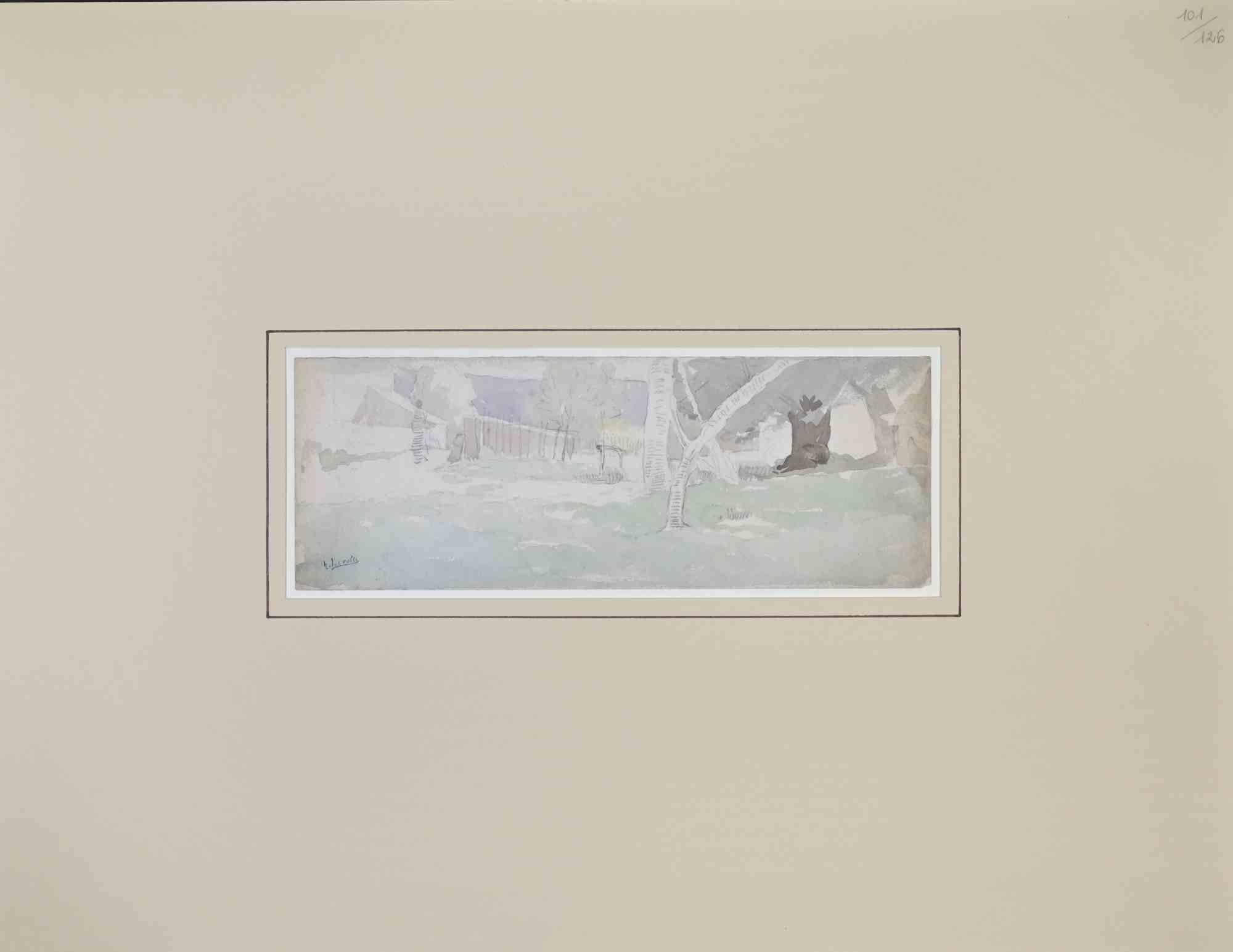
Landscape - Drawing by Henri Lerolle - Early 20th Century
Located in Roma, IT
Landscape is an artwork realized by Henri Lerolle in the Mid-20th Century.
Watercolor.
Good condition.
hand-signed.
Category
Early 20th Century Modern Figurative Drawings and Watercolors
Materials
Watercolor
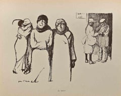
Hommage des Artistes à Picquart - Lithograph by Hermann Paul -1899
Located in Roma, IT
Hommage des artistes à Picquart is a Lithograph realized by Hermann Paul.
Hand signed on the lower left corner. Passpartout included cm 49x32.5
Good condition.
René Georges Herman...
Category
1890s Modern Figurative Prints
Materials
Paper, Lithograph
$361 Sale Price
20% Off
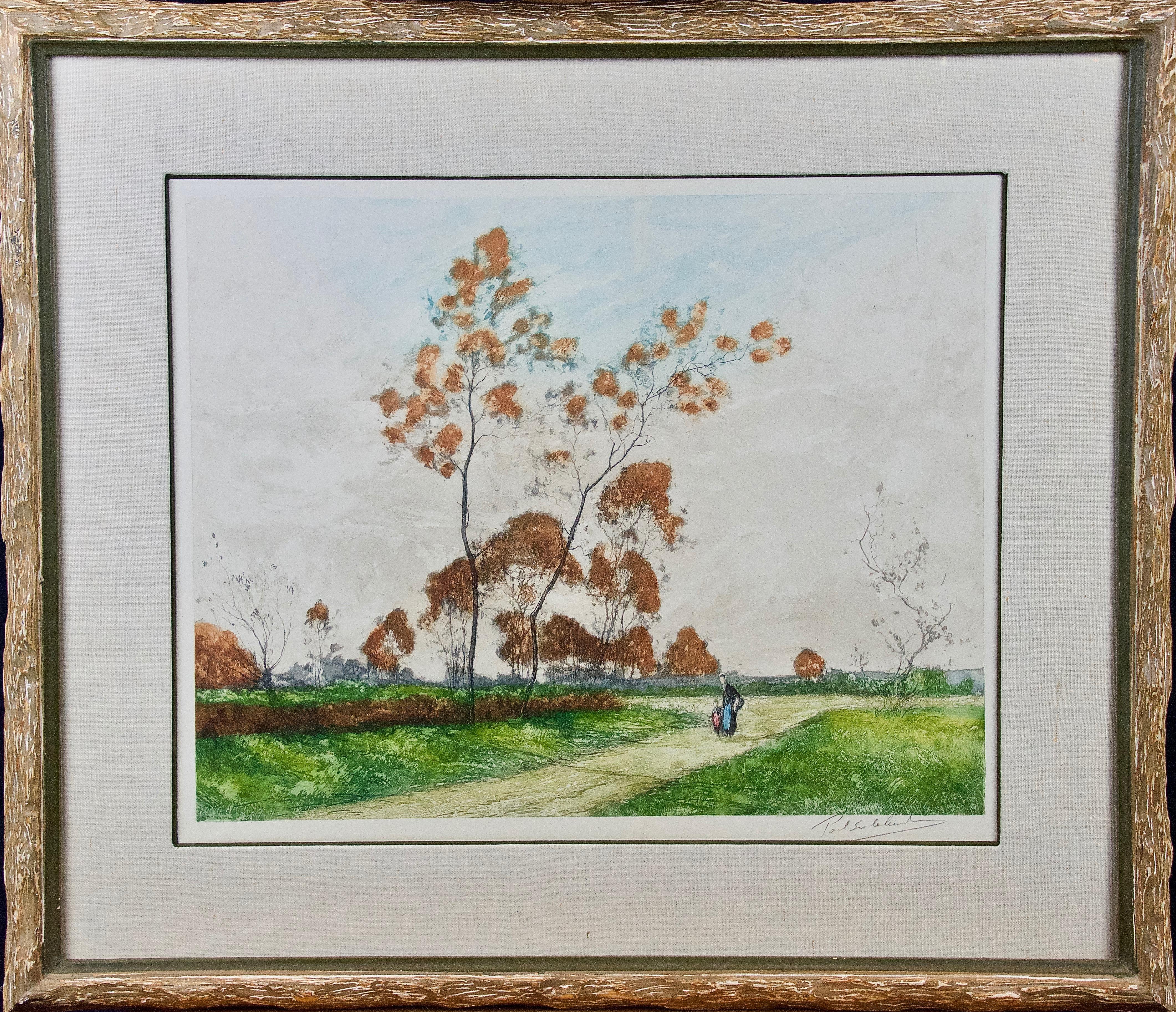
A Signed Etching of a Pastoral Scene in Picardy, France by Paul Emile Lecomte
By Paul Emile Lecomte
Located in Alamo, CA
A beautiful aquatint etching of a serene pastoral scene in the Picardy region of northern France by Paul Emile Lecomte (1877-1950). A mother and child are seen walking down a path in...
Category
Early 20th Century Impressionist Landscape Prints
Materials
Aquatint

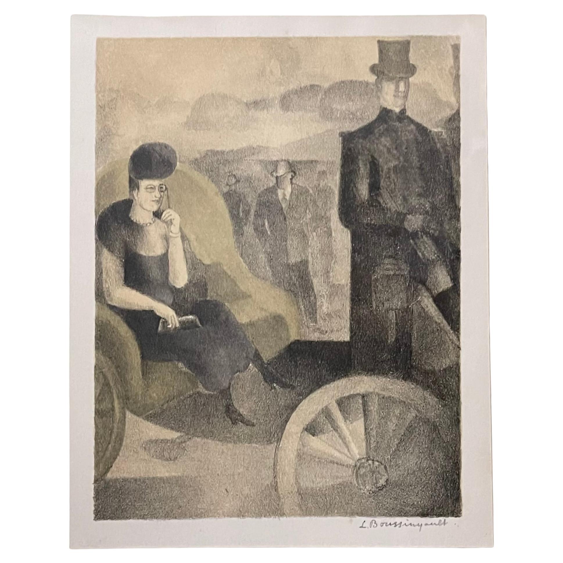
20th Century French Signed Belle Epoque Lithograph
By Jean-Louis Boussingault
Located in Roma, IT
Beautiful lithograph by the great Parisian Art Nouveau artist.
It depicts with rare effectiveness the unmatched atmosphere of the Belle Époque with a snobbish noblewoman sitting in h...
Category
Early 20th Century French Belle Époque Prints
Materials
Glass, Wood, Paper
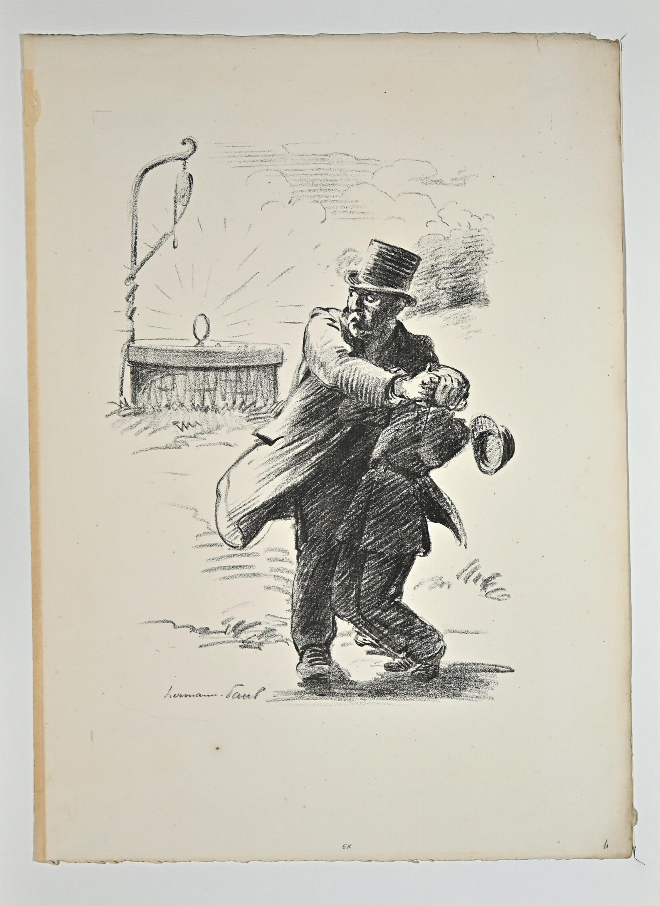
Le Départ - Lithograph by Hermann Paul - Early 20th Century
Located in Roma, IT
Le Départ is an Original Lithograph realized by Hermann Paul from the series "La Grande Guerre Par Les Artistes"
Good condition on a yellowed cardboard.
Signed and titled on the lo...
Category
Early 20th Century Modern Figurative Prints
Materials
Lithograph