Items Similar to 1947 original map "Le Cognac Bois ordinaires & Bois communs" by Larmat


Want more images or videos?
Request additional images or videos from the seller
1 of 8
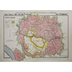
Louis Larmat1947 original map "Le Cognac Bois ordinaires & Bois communs" by Larmat1947
1947
$1,187.78
£885.41
€1,000
CA$1,655.59
A$1,799.35
CHF 950.88
MX$21,768.21
NOK 11,842.59
SEK 11,186.06
DKK 7,615.45
About the Item
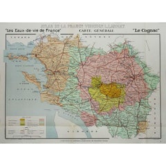
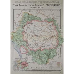
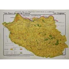
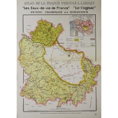
The 1947 original map Atlas de la France Vinicole - Les Eaux-de-vie de France - Le Cognac Bois Ordinaires & Bois Communs dits à Terroir, created by Louis Larmat and printed by Dorel in Paris, offers a detailed depiction of one of the most peripheral Cognac-producing areas in France. This map is part of Larmat’s extensive Atlas de la France Vinicole series, which meticulously charts the various wine and spirit regions of France with both aesthetic artistry and geographical precision. In particular, this map focuses on the Bois Ordinaires and Bois Communs, regions often considered the outermost Cognac crus, characterized by their maritime influence and distinct terroir.
Louis Larmat is widely recognized as a master of cartographic artistry, whose work is deeply respected for its ability to blend artistic beauty with scientific and geographical accuracy. His Atlas de la France Vinicole series is among the most celebrated vinicultural maps of the 20th century, designed to document the terroirs of France's wine and spirit-producing regions. The 1947 map of Bois Ordinaires and Bois Communs highlights this often-overlooked but important part of Cognac production, demonstrating Larmat’s commitment to providing a comprehensive view of all the regions that contribute to the spirit's rich diversity.
Bois Ordinaires and Bois Communs are the furthest Cognac crus from the central regions like Grande Champagne and Petite Champagne, which are known for producing the most refined and long-aging Cognacs. These outer zones, bordering the Atlantic coastline and scattered across the islands of Ré and Oléron, are unique in their terroir due to the strong maritime influences. The Cognacs from these regions tend to be quicker to age and more rustic in flavor, with a briny or saline character imparted by the proximity to the ocean. Larmat’s map captures the geographical extent of these crus, illustrating how the proximity to the sea and coastal climate play a pivotal role in shaping the Cognac produced here.
The map is beautifully detailed, with careful attention given to the topography and natural features of the Bois Ordinaires and Bois Communs areas. The boundaries of these regions are clearly delineated, showing their placement on the westernmost edges of the Cognac appellation, including portions that extend to the Atlantic islands. Larmat’s map provides an invaluable resource for understanding the specific environmental and climatic conditions of these regions, which differentiate them from the more centrally located Cognac crus. The diverse soil types in these areas, particularly the sandy, chalky, and clay-rich soils, are shown on the map, highlighting their importance in the maturation and flavor profile of the Cognac eaux-de-vie.
What sets this map apart, like others in Larmat’s series, is the use of hand-colored detailing that brings the regions to life. The artistic flourishes not only make the map visually appealing but also enhance its readability. The boundaries of the Bois Ordinaires and Bois Communs areas are emphasized through vibrant color schemes that differentiate them from surrounding regions. This technique allows the viewer to appreciate both the geographical layout and the aesthetic beauty of the map, making it a valuable piece for collectors, historians, and those passionate about French viniculture.
Larmat includes comprehensive annotations on this map, explaining the unique characteristics of the eaux-de-vie produced in the Bois Ordinaires and Bois Communs regions. Cognac from these areas is often described as lighter and less complex than those from the more prestigious crus, with a faster maturation process. Due to the coastal environment, the Cognacs from Bois Ordinaires and Bois Communs frequently exhibit distinctive saline or briny notes, which give them a unique profile that is particularly valued in certain blends. These Cognacs may also have more pronounced fruity and floral aromas, as well as earthy tones, which Larmat carefully details in his notes. The quicker aging process makes them suitable for blending, adding body and depth to more delicate eaux-de-vie.
Larmat’s map also highlights the economic and cultural significance of the Bois Ordinaires and Bois Communs regions, noting how the production of Cognac here is intertwined with the livelihoods of local communities. The map identifies key towns, rivers, and ports that have historically played a role in the distribution and export of Cognac, particularly via maritime routes. The importance of these regions in supplying more robust and quickly maturing eaux-de-vie for blending purposes is underscored in Larmat’s annotations, which provide a rich context for understanding their place within the larger Cognac production area.
The artistic elements of the map are complemented by elegant typography and decorative borders that enhance its overall aesthetic. The title, Le Cognac Bois Ordinaires & Bois Communs dits à Terroir, is presented prominently, ensuring that the map’s subject is immediately identifiable. The borders are often adorned with decorative motifs that relate to Cognac production, such as barrels and grapevines, symbolizing the craftsmanship and tradition associated with the region. These embellishments reflect the deep cultural significance of Cognac production in France and reinforce the map’s role as both a functional cartographic tool and a work of art.
In the context of post-war France in 1947, when this map was produced, there was a renewed emphasis on promoting the country’s agricultural products and re-establishing its dominance in global markets. Cognac, as one of France’s most prestigious exports, was central to these efforts. Larmat’s maps of the Cognac regions played a key role in this promotional effort, showcasing the uniqueness of each terroir and the diversity of the eaux-de-vie they produced. The map of Bois Ordinaires and Bois Communs reflects this broader initiative, emphasizing the distinct qualities of Cognac from these outer regions while celebrating their contribution to the rich tapestry of French viniculture.
Today, Larmat’s 1947 map of Bois Ordinaires and Bois Communs is a treasured collectible, valued not only for its cartographic precision but also for its artistic beauty. The map is highly sought after by collectors of vinicultural memorabilia, cartography enthusiasts, and those with a deep appreciation for the history of Cognac. Its combination of practical information and aesthetic appeal ensures that it remains a valuable piece, whether displayed as a decorative item or studied for its geographical insights. For those interested in the diversity of Cognac production, the map offers a fascinating look at how even the most remote regions contribute to the overall character of this iconic French spirit.
Larmat’s Atlas de la France Vinicole series, and in particular the map of Bois Ordinaires and Bois Communs, remain significant for both their educational value and their celebration of French cultural heritage. The map stands as a testament to the importance of terroir in Cognac production, offering a lasting tribute to the craftsmanship and expertise that have made Cognac one of France’s most revered spirits. Through this map, Larmat has captured not only the geographical essence of Bois Ordinaires and Bois Communs but also their place in the broader narrative of Cognac, ensuring their role in France’s vinicultural legacy is remembered and appreciated.
Original Poster
Alcohol - Map - Charente - France
Dorel - Paris
- Creator:Louis Larmat
- Creation Year:1947
- Dimensions:Height: 17.72 in (45 cm)Width: 24.81 in (63 cm)
- Medium:
- Period:
- Condition:Good condition, original folds.
- Gallery Location:PARIS, FR
- Reference Number:1stDibs: LU1792215285642
About the Seller
5.0
Gold Seller
Premium sellers maintaining a 4.3+ rating and 24-hour response times
Established in 2021
1stDibs seller since 2022
183 sales on 1stDibs
Typical response time: 2 hours
- ShippingRetrieving quote...Shipping from: PARIS, France
- Return Policy
Authenticity Guarantee
In the unlikely event there’s an issue with an item’s authenticity, contact us within 1 year for a full refund. DetailsMoney-Back Guarantee
If your item is not as described, is damaged in transit, or does not arrive, contact us within 7 days for a full refund. Details24-Hour Cancellation
You have a 24-hour grace period in which to reconsider your purchase, with no questions asked.Vetted Professional Sellers
Our world-class sellers must adhere to strict standards for service and quality, maintaining the integrity of our listings.Price-Match Guarantee
If you find that a seller listed the same item for a lower price elsewhere, we’ll match it.Trusted Global Delivery
Our best-in-class carrier network provides specialized shipping options worldwide, including custom delivery.More From This Seller
View All1947 original map "Les eaux-de-vie de France - Le Cognac fins bois" by Larmat
Located in PARIS, FR
The 1947 original map Atlas de la France Vinicole - Les Eaux-de-vie de France - Le Cognac Fins Bois, created by Louis Larmat and printed by Dorel in Paris, is an exquisite piece that...
Category
1940s Prints and Multiples
Materials
Lithograph, Paper
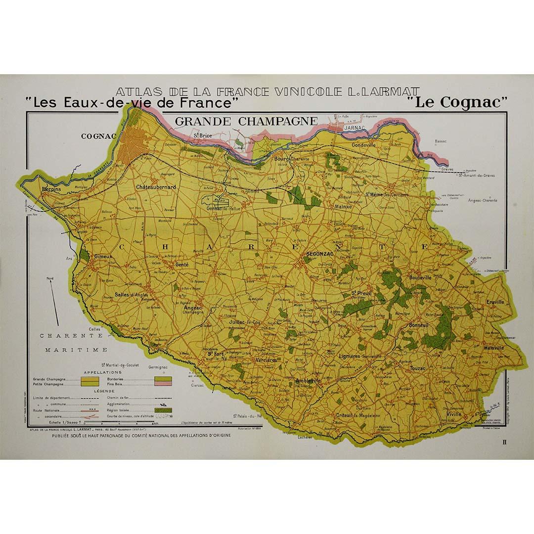
1947 original map "Les eaux-de-vie de France - Le Cognac" by Larmat
Located in PARIS, FR
The 1947 original map Atlas de la France vinicole - Les eaux-de-vie de France - Le Cognac, created by Louis Larmat and printed by Dorel in Paris, is a fascinating and detailed cartog...
Category
1940s Prints and Multiples
Materials
Lithograph, Paper
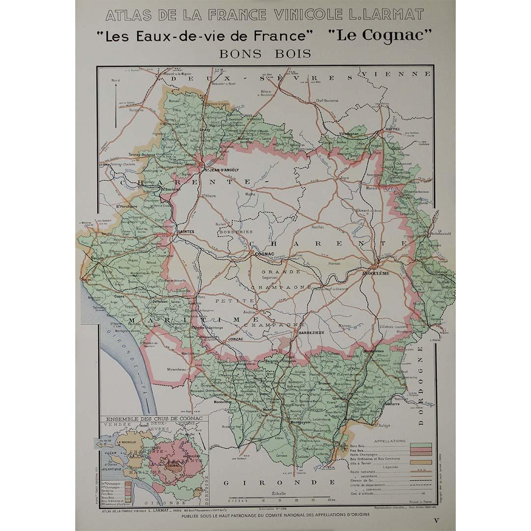
1947 original map "Les eaux-de-vie de France - Le Cognac Bons Bois" by Larmat
Located in PARIS, FR
The 1947 original map Atlas de la France Vinicole - Les Eaux-de-vie de France - Le Cognac Bons Bois, created by Louis Larmat and printed by Dorel in Paris, is a beautifully crafted c...
Category
1940s Prints and Multiples
Materials
Lithograph, Paper
1947 original map "Les eaux-de-vie de France - Le Cognac" by Larmat
Located in PARIS, FR
The 1947 original map Atlas de la France vinicole - Les eaux-de-vie de France - Le Cognac, created by Louis Larmat and printed by Dorel in Paris, is a fascinating and detailed cartog...
Category
1940s Prints and Multiples
Materials
Lithograph, Paper
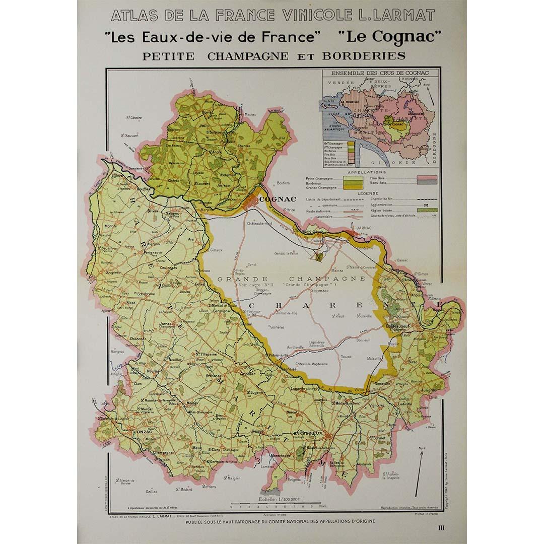
1947 original map "Les eaux-de-vie de France - Le Cognac petite Champagne"
Located in PARIS, FR
The 1947 original map Atlas de la France Vinicole - Les eaux-de-vie de France - Le Cognac Petite Champagne et Borderies, created by Louis Larmat and printed by Dorel in Paris, is a d...
Category
1940s Prints and Multiples
Materials
Lithograph, Paper
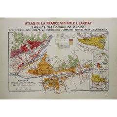
1946 original map "Les vins des côteaux de la Loire - Bourgueil" by Larmat
Located in PARIS, FR
The 1946 original map Atlas de la France Vinicole - Les Vins des Côteaux de la Loire: Bourgueil, St Nicolas-de-Bourgueil, Chinon, Montlouis, Jasnières, created by Louis Larmat and pr...
Category
1940s Prints and Multiples
Materials
Lithograph, Paper
You May Also Like
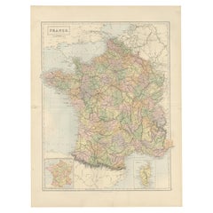
Antique Map of France by Johnston (1909)
Located in Langweer, NL
Antique map titled 'France'. Original antique map of France. With inset maps of France in provinces, part of the Riviera and Corsica. This map or...
Category
Early 20th Century Maps
Materials
Paper

$237 Sale Price
20% Off
Decorative Antique Map of France in Departments – Collectible Print, 1884
Located in Langweer, NL
Antique Map of France in Departments – Black’s Atlas, 1884
This finely engraved and hand-colored map of France was published in the New and Revised Edition of Black’s General Atlas ...
Category
Antique 1880s Scottish Maps
Materials
Paper
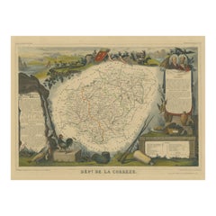
Hand Colored Antique Map of the Department of Correze, France, 1852
By Victor Levasseur
Located in Langweer, NL
Antique map titled 'Dépt. de la Corrèze'. Map of the French department of Correze, France. This area of France is known for its production of Straw Wine, a sweet red or white wine. T...
Category
Antique Mid-19th Century French Maps
Materials
Paper
$323 Sale Price
20% Off
Antique Map of France by A & C. Black, 1870
Located in Langweer, NL
Antique map titled 'France'. Original antique map of France with inset map of France as divided into provinces, before the revolution of 1789 and map of Corsica...
Category
Antique Late 19th Century Maps
Materials
Paper

$261 Sale Price
20% Off
Large 19th Century Map of France
Located in Pease pottage, West Sussex
Large 19th Century Map of France.
Remarkable condition, with a pleasing age worn patina.
Recently framed.
France Circa 1874.
Category
Antique Late 19th Century French Maps
Materials
Linen, Paper

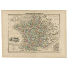
Antique Map of the Departments of France by Migeon, 1880
By J. Migeon
Located in Langweer, NL
Antique map titled 'France par Départements'. Old map of France with a decorative vignette of Strasbourg and an inset map of Corsica. This map originate...
Category
Antique 19th Century Maps
Materials
Paper
$114 Sale Price
20% Off
More Ways To Browse
The Vintage Map
Vintage French Map
Alcohol Poster
Vintage Alcohol Posters
Map Stand
Louis Cognac
Used Cognac Barrels
Egon Schiele And Max Jaffe
Erotic 1920
Harriet Tubman
Helen Frankenthaler Lincoln Center Posters
Hercules Print
Homage To Andy Warhol
I Have Been To Hell And Back
Iris Lithograph
Japanese Art Print Flower
Jewish Woodcut
Jules Perahim