Items Similar to 1937 original poster illustrated map of the Exposition Internationale

Want more images or videos?
Request additional images or videos from the seller
1 of 8
Unknown1937 original poster illustrated map of the Exposition Internationale1937
1937
$952.38
£707.28
€800
CA$1,309.16
A$1,459.37
CHF 768.12
MX$17,691.62
NOK 9,779.57
SEK 9,092.64
DKK 6,090.45
About the Item
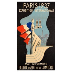
This 1937 original poster presents a detailed illustrated map of the Exposition Internationale des Arts et Techniques dans la Vie Moderne, held in Paris. The International Exposition, which took place from May to November 1937, was a monumental event showcasing the latest advancements in architecture, science, and industry while highlighting the artistic and cultural contributions of various nations.
Designed in a vivid and precise cartographic style, the map captures the layout of the exhibition grounds along the Seine, extending from the Trocadéro and Palais de Chaillot to the Grand Palais and beyond. Each pavilion and section is clearly marked, guiding visitors through areas dedicated to foreign nations, industry, transportation, scientific innovations, and artistic movements.
The Exposition Internationale de 1937 is famous for the dramatic architectural rivalry between the German and Soviet pavilions, which stood directly opposite each other, symbolizing the rising tensions of the era. The fair also introduced modernist design principles, with contributions from Le Corbusier, Robert Mallet-Stevens, and Auguste Perret, shaping the future of urbanism and industrial aesthetics.
This historic map is an invaluable collector’s piece, offering a fascinating glimpse into the grandeur of 1930s world fairs, the evolution of Parisian architecture, and the technological ambitions of the interwar period.
Tourism - Map - France
Exhibition of arts and techniques applied to modern life
- Creation Year:1937
- Dimensions:Height: 15.36 in (39 cm)Width: 29.93 in (76 cm)
- Medium:
- Period:
- Condition:Good condition, traces of folds, on linen.
- Gallery Location:PARIS, FR
- Reference Number:1stDibs: LU1792215821352
About the Seller
5.0
Platinum Seller
Premium sellers with a 4.7+ rating and 24-hour response times
Established in 2021
1stDibs seller since 2022
169 sales on 1stDibs
Typical response time: <1 hour
- ShippingRetrieving quote...Shipping from: PARIS, France
- Return Policy
Authenticity Guarantee
In the unlikely event there’s an issue with an item’s authenticity, contact us within 1 year for a full refund. DetailsMoney-Back Guarantee
If your item is not as described, is damaged in transit, or does not arrive, contact us within 7 days for a full refund. Details24-Hour Cancellation
You have a 24-hour grace period in which to reconsider your purchase, with no questions asked.Vetted Professional Sellers
Our world-class sellers must adhere to strict standards for service and quality, maintaining the integrity of our listings.Price-Match Guarantee
If you find that a seller listed the same item for a lower price elsewhere, we’ll match it.Trusted Global Delivery
Our best-in-class carrier network provides specialized shipping options worldwide, including custom delivery.More From This Seller
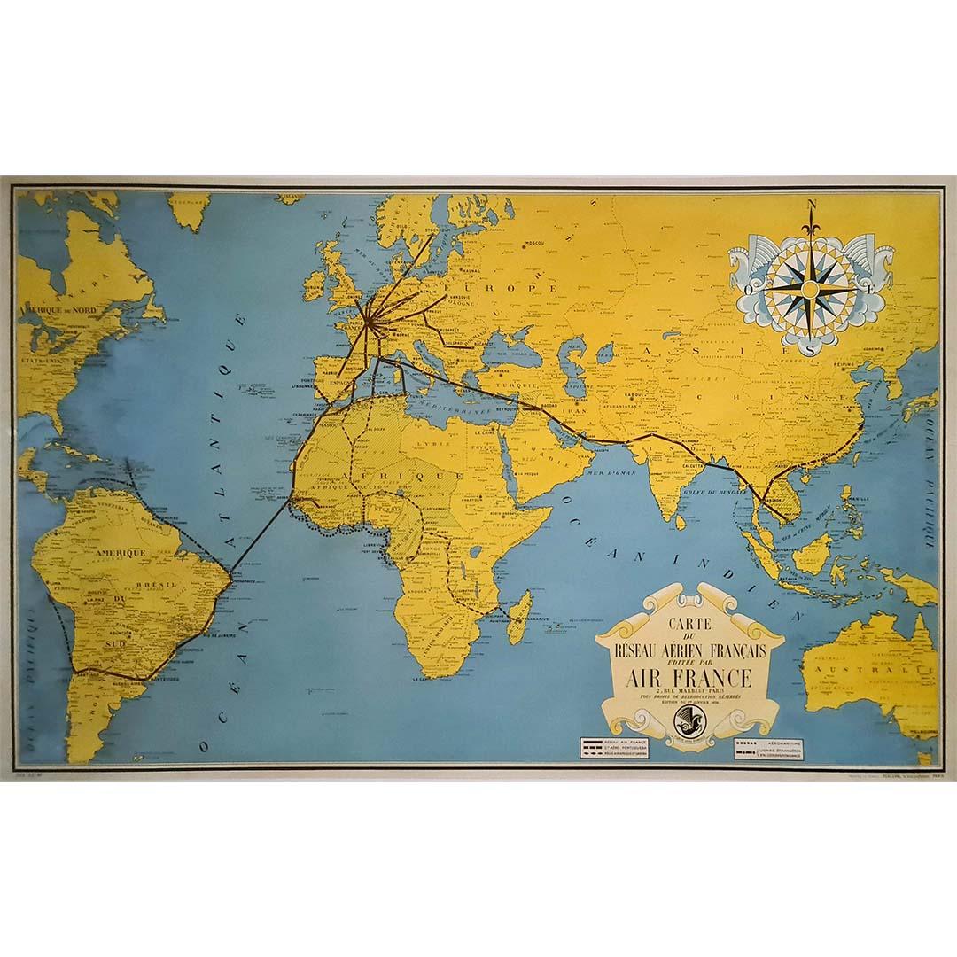
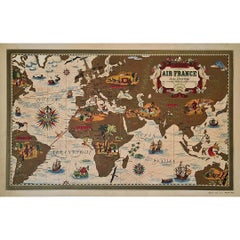
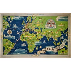
View All1938 original map titled "Carte du réseau aérien français" Air France
Located in PARIS, FR
The 1938 original map titled "Carte du réseau aérien français" by A. Collinet offers a captivating snapshot of Air France's global aviation network durin...
Category
1930s Prints and Multiples
Materials
Linen, Paper, Lithograph

1939 original map for Air France titled "Nova et Vetera" by Lucien Boucher
By Lucien Boucher
Located in PARIS, FR
In 1939, Lucien Boucher, a renowned French artist and illustrator, created a captivating map for Air France titled "Nova et Vetera", which translates to "New and Old" in Latin. This original lithographic poster is a remarkable fusion of vintage cartographic art and modern aviation, crafted as a promotional piece for the airline. It beautifully symbolizes the connection between the historic routes of exploration and the new ones made possible by air travel.
Boucher was celebrated for his unique ability to combine the romanticism of classic maps with the sleek, modern spirit of 20th-century flight. Among his series of illustrated maps for Air France, "Nova et Vetera" stands out with its nostalgic allure and references to history.
The map exudes the charm of the age of exploration, echoing the style of 16th- and 17th-century cartographers. Rendered in rich, earthy tones, it depicts brown continents framed by pale blue oceans, evoking the feel of antique navigational...
Category
1930s Prints and Multiples
Materials
Lithograph, Paper, Linen
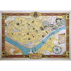
1950 original map by Garcia Fuentes Manuel - Sevilla Perspectiva General
Located in PARIS, FR
The 1950 original map by Garcia Fuentes Manuel, titled "Sevilla Perspectiva General," offers a comprehensive and detailed overview of Seville as it stood...
Category
1950s Prints and Multiples
Materials
Paper, Lithograph, Linen
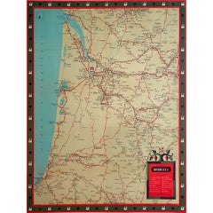
Circa 1950 original illustrated map for "Carte France autour de Bordeaux"
Located in PARIS, FR
The circa 1950 original illustrated map for "Carte France autour de Bordeaux" is an excellent representation of mid-20th century cartography, focusing on the area surrounding Bordeau...
Category
1950s Prints and Multiples
Materials
Paper, Linen
1931 ink poster for the Exposition Coloniale Internationale in Paris
Located in PARIS, FR
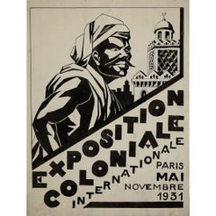
This original 1931 ink poster project was created as a concept for the Exposition Coloniale Internationale, held in Paris from May to November 1931. The striking black-and-white composition features a bold, angular depiction of a man in traditional North African attire, set against an architectural backdrop reminiscent of Islamic and colonial influences. The typography, arranged in a dynamic diagonal layout, gives the piece a sense of power and movement.
As a preliminary design, this ink project was likely part of a larger effort to develop the visual identity of the Exposition Coloniale, which was one of the most significant international exhibitions of its time. The exposition, hosted in Bois de Vincennes, aimed to showcase the cultural, economic, and artistic achievements of France’s colonial empire, with pavilions representing territories such as North Africa, Indochina, and West Africa.
The artwork's bold contrasts, dramatic perspective, and modernist style reflect the Art Deco and early 20th-century graphic design trends, emphasizing strong geometric forms and high-impact visuals. As a hand-drawn project, it provides a fascinating glimpse into the creative process behind exhibition advertising, where artists experimented with layouts, typography, and imagery before finalizing a printed poster.
Today, this ink poster project is a historical artifact, offering insight into both colonial-era propaganda and vintage graphic...
Category
1930s Prints and Multiples
Materials
Ink, Paper
1937 Original planisphere by Lucien boucher - World map
By Lucien Boucher
Located in PARIS, FR
Original poster
Airline Company - Map - Tourism
West - Northern - Orient - Midi
In 1937, Lucien Boucher, a renowned French illustrator, unveiled his masterpiece, the "Planisphère ...
Category
1930s Prints and Multiples
Materials
Linen, Lithograph, Paper
You May Also Like
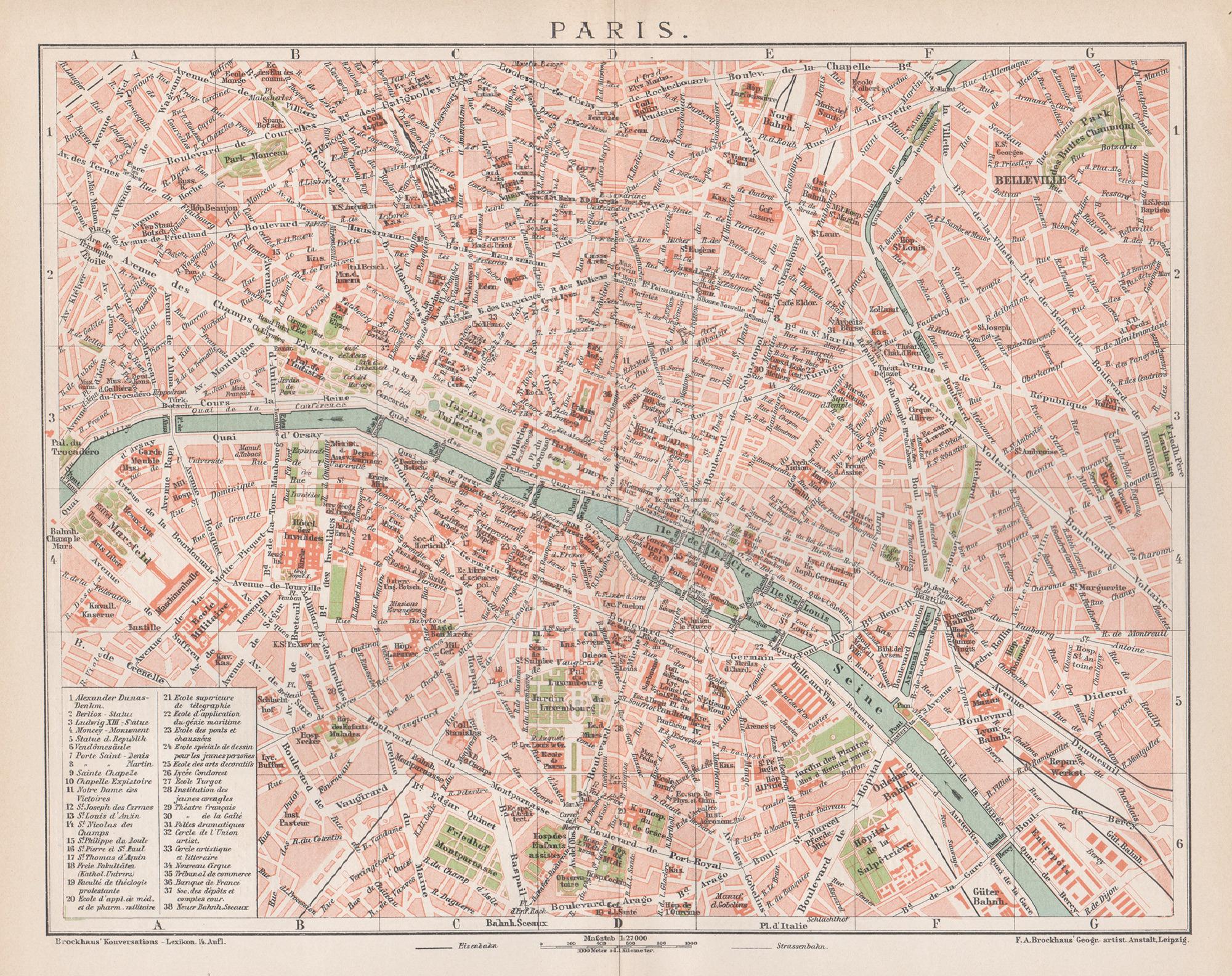
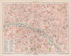
Paris, France. Antique Map City Plan Chromolithograph, circa 1895
Located in Melbourne, Victoria
'Paris'
Colour lithograph. 1895.
250mm by 305mm (sheet).
Late 19th century German lithograph plan of Paris, France.
Central vertical fold. Printed street index on the reverse o...
Category
Late 19th Century Victorian More Prints
Materials
Lithograph
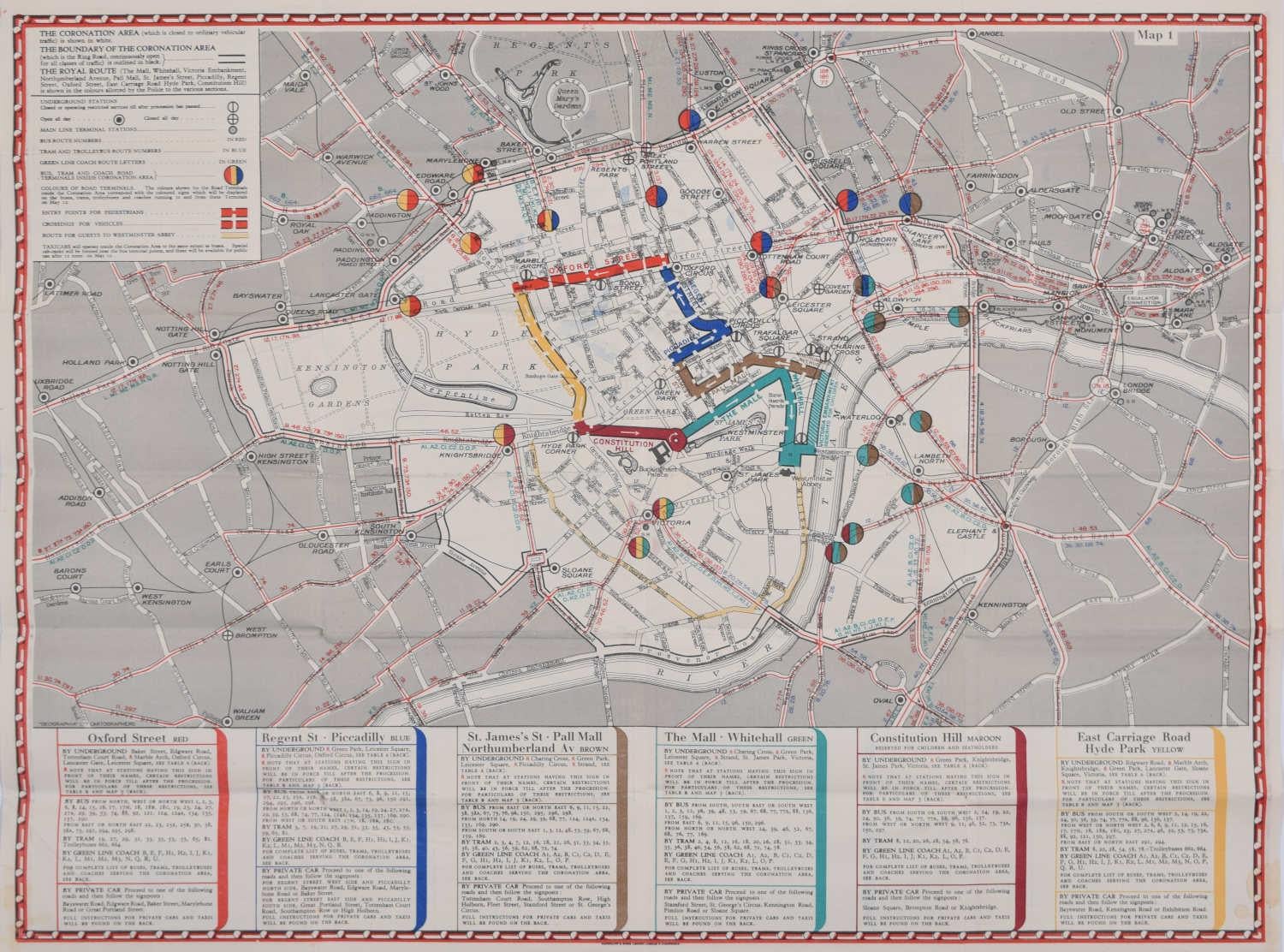
1937 Coronation Map for London Transport
Located in London, GB
To see more, scroll down to "More from this Seller" and below it click on "See all from this Seller."
Coronation Arrangements – Map of London (1...
Category
1950s Landscape Prints
Materials
Lithograph
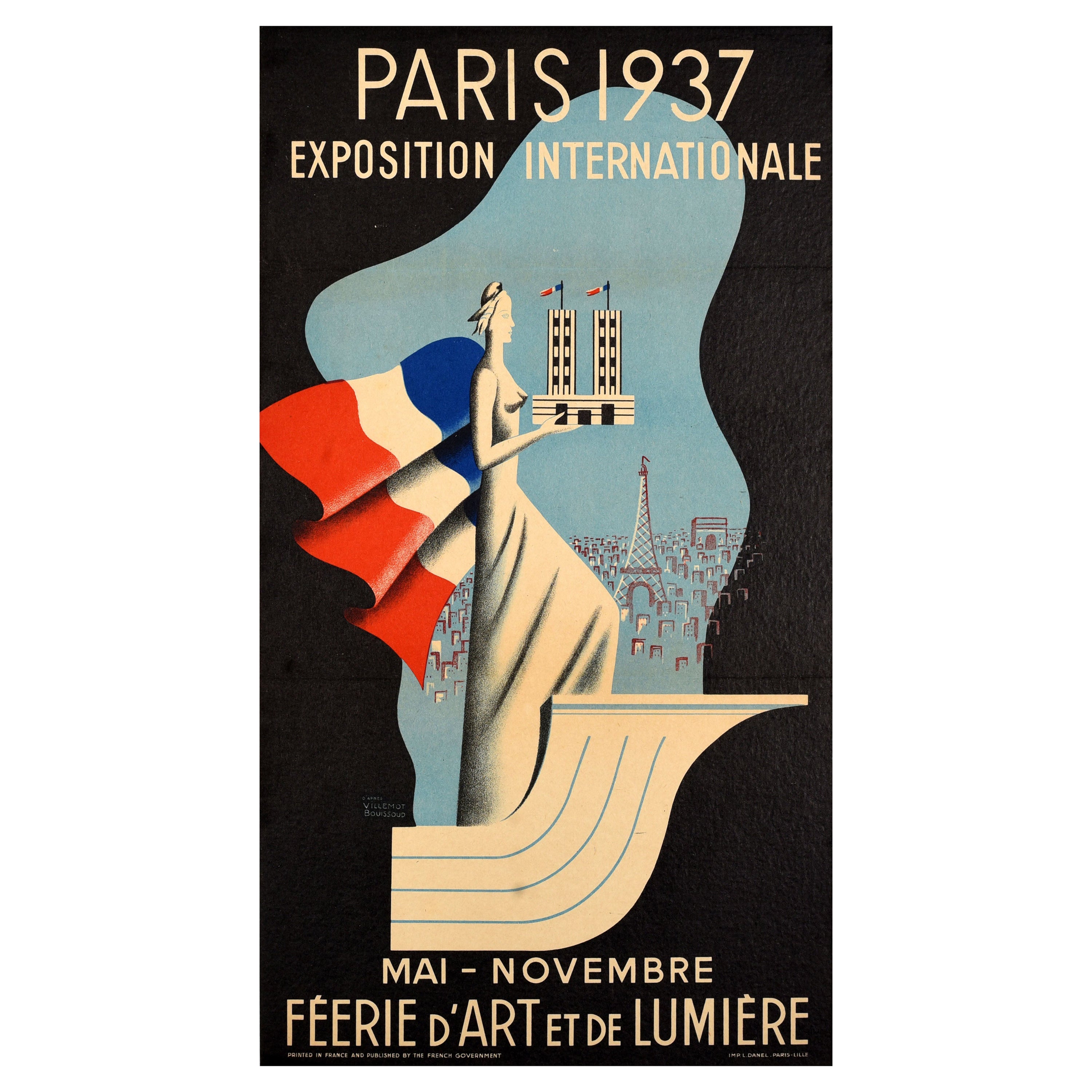
Original Vintage Travel Poster Paris 1937 World Fair Villemot Bouissoud Art Deco
By Bernard Villemot
Located in London, GB
Original vintage travel advertising poster for the World's Fair in Paris May-November 1937 enchanting art and light - Paris 1937 Exposition Internationale Feerie d'art et de lumiere ...
Category
Vintage 1930s French Art Deco Posters
Materials
Paper
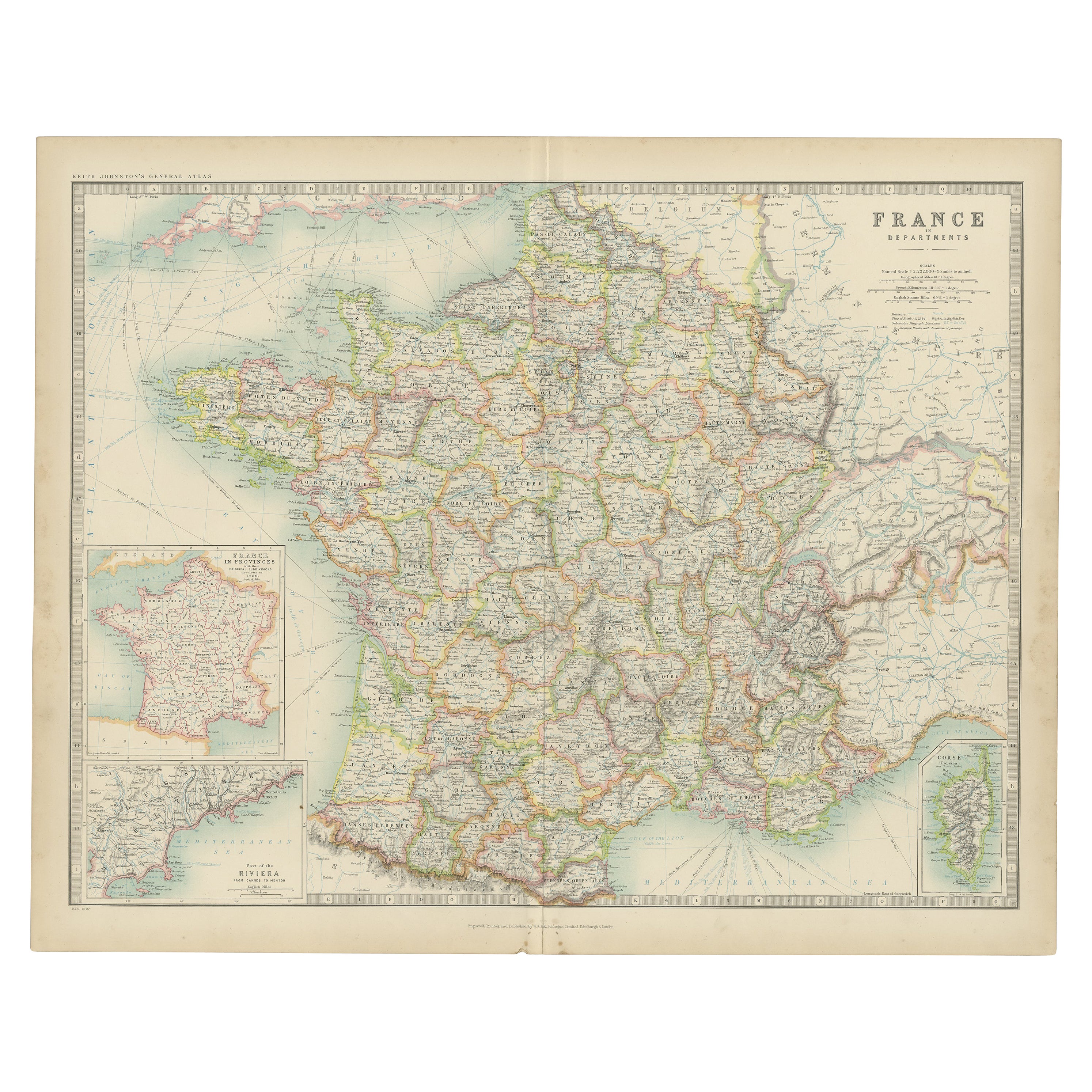
Antique Map of France by Johnston (1909)
Located in Langweer, NL
Antique map titled 'France'. Original antique map of France. With inset maps of France in provinces, part of the Riviera and Corsica. This map or...
Category
Early 20th Century Maps
Materials
Paper

$238 Sale Price
20% Off
Vintage "View of the Center of Paris Taken from the Air" Lithograph Map
Located in San Diego, CA
A very stylish "View of the Center of Paris Taken from the Air" lithograph map published by the Paris Ministry of Tourism, circa early 1950s. The piece measures 27" x 43" and shows...
Category
20th Century French Mid-Century Modern Prints
Materials
Paper

$680 Sale Price
20% Off
Paris 1937 -- Exposition Internationale
By Eugene Beaudoin and Marcel Lods
Located in London, GB
Original French poster for the Exposition International in Paris, 1937.
This award-winning Art Deco design was created by Eugene Beaudoin (1898-1983) and Marcel Lods...
Category
Vintage 1930s French Art Deco Posters
More Ways To Browse
Worlds Fair Posters
Paris 1937 Poster
1939 Worlds Fair Poster
Le Corbusier Poster
Vintage Architecture Posters
Illustrated Map
Vintage Foreign Posters
International Vintage Poster Fair
Paris 1937 Exposition
Soviet Posters 1930
Soviet Map
Skiing Lithographs
Arab Man
British Hunting Prints
Palestine Wall Art
Vintage Agricultural Poster
Vintage Glamour Posters
Vintage Lake Poster