Matthäus Merian the Elder Collectibles and Curiosities
German, 1593-1650
Matthäus Merian is one of the most respected Swiss/German artists and engravers of the 17th century. In addition to creating a large number of illustrations and maps, he passed his knowledge and skill to his children, who followed in the family tradition. His son Matthäus Merian, the Younger was an accomplished engraver. His daughter Maria Sybella Merian in addition to becoming a prominent artist, became one of the greatest woman scientists of the 18th century as an entomologist. Her engravings of insects in their natural habitats are as sought after by collectors as are her father's illustrations.to
1
1
1
1
1
1
1
1
1
3
104
101
74
71
Creator: Matthäus Merian the Elder
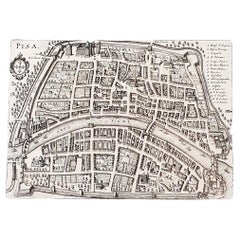
Italian Parchment Map of the City of Pisa Dated, 1640
By Matthäus Merian the Elder
Located in Florence, Tuscany
An antique map of the Tuscan city of Pisa engraved for The 'Itinerarium Italiæ Nov-antiquæ' by Matthäus Merian the Elder and printed in 1640....
Category
1640s Italian Antique Matthäus Merian the Elder Collectibles and Curiosities
Materials
Paper
Related Items
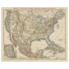
Antique Map of the United States with inset map of the region of Mexico City
Located in Langweer, NL
Antique map titled 'Verein-Staaten von Nord-America, Mexico, Yucatan u.a.'. Very detailed map of the United States of America showing the Caribbean. With an inset map of the surround...
Category
Mid-19th Century Antique Matthäus Merian the Elder Collectibles and Curiosities
Materials
Paper
$826 Sale Price
20% Off
H 14.69 in W 17.92 in D 0.02 in
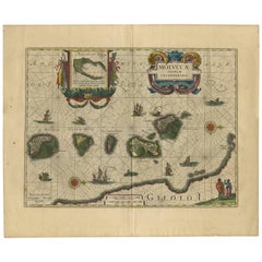
Antique Map of the Spice Islands 'Moluccas', Indonesia by W. Blaeu, circa 1640
By Willem Blaeu
Located in Langweer, NL
Antique map titled 'Moluccae Insulae Celeberrimae'. Highly decorative antique map of the Spice Islands (Moluccas) published by W. Blaeu (circa 1640). This map features a large inset ...
Category
Mid-17th Century Antique Matthäus Merian the Elder Collectibles and Curiosities
Materials
Paper
$1,676
H 19.69 in W 23.04 in D 0.02 in
1640 Map of North Africa Nova Barbariae Descriptio or The Barbarian Coast
Located in Langweer, NL
1640 Antique Map of North Africa 'Nova Barbariae Descriptio' by Johannes Janssonius
This antique map titled Nova Barbariae Descriptio*, published by Johannes Janssonius around 1640,...
Category
1640s Antique Matthäus Merian the Elder Collectibles and Curiosities
Materials
Paper
$461 Sale Price
20% Off
H 20.08 in W 23.43 in D 0 in
Antique Map of the City of Jerusalem by N. Visscher, 1702
Located in Langweer, NL
Antique map titled 'Die Heylige en Wytvermaerde stadt Jerusalem Eerst Genaemt Salem, Genesis 14 vers 18'. This map originates from 'Biblia. Ouden ende Nieuwen Testaments (..)'. Publi...
Category
Early 18th Century Antique Matthäus Merian the Elder Collectibles and Curiosities
Materials
Paper
$3,314 Sale Price
20% Off
H 20.87 in W 26.97 in D 0.75 in
Antique Map of the Region of Le Mans 'France' by Blaeu, circa 1640
By Willem Blaeu
Located in Langweer, NL
Antique Map: Cenomanorum Galliae regionis typus vulgo le Mans – Blaeu, circa 1640
This beautifully engraved and hand-colored map depicts the historical province of Maine in northw...
Category
Mid-17th Century Antique Matthäus Merian the Elder Collectibles and Curiosities
Materials
Paper
$480 Sale Price
20% Off
H 20.08 in W 23.23 in D 0.02 in
Antique Map Of Brabantia Ducantus By Bleau Circa 1640
Located in Brussels, Brussels
map of theBrabantia Ducantus (Belgium) circa 1640 by Bléau. Bléau was well known for antique atlas that he draw during the 17 century
beautiful map, double page folded in the middle,...
Category
17th Century French Renaissance Antique Matthäus Merian the Elder Collectibles and Curiosities
Materials
Paper
Antique Map of Artois in the North of France by Famous Mapmaker Blaeu, c.1640
Located in Langweer, NL
Antique map titled 'Artesia Comitatus Artois'. Map of Artois or Artesia, France. Artois is former province located in the northwestern part of France, boarding Belgium (Flanders) on ...
Category
17th Century Antique Matthäus Merian the Elder Collectibles and Curiosities
Materials
Paper
$461 Sale Price
20% Off
H 19.69 in W 23.43 in D 0 in
Antique Map of the Region of Bourbonnais by Janssonius, circa 1640
Located in Langweer, NL
Antique map titled 'Bourbonois - Borbonium Ducatus'. Old map of the former region of Bourbonnais, France. It includes the cities of Bourbon, Moulins, Charenton, Brulles, Varennes and...
Category
Mid-17th Century Antique Matthäus Merian the Elder Collectibles and Curiosities
Materials
Paper
$480 Sale Price
20% Off
H 19.49 in W 23.04 in D 0.02 in
Original Antique Map of the Northern Part of Scotland, circa 1640
Located in Langweer, NL
The antique map, titled 'Scotiae pars septentrionalis,' depicts the northern part of Scotland. Crafted by Hondius around 1640, this map is a historical treasure showcasing the geogra...
Category
Mid-17th Century Antique Matthäus Merian the Elder Collectibles and Curiosities
Materials
Paper
$845 Sale Price
20% Off
H 19.49 in W 23.94 in D 0.02 in
Rare and Early Map of the Seventeen Provinces, Published in circa 1640
Located in Langweer, NL
Antique map titled 'Carte Generale des Dixsept Provinces des Pais Bas'. Rare and Early map of the Seventeen Provinces. The Seventeen Provinces were the Imperial states of the Habsbur...
Category
Mid-17th Century Antique Matthäus Merian the Elder Collectibles and Curiosities
Materials
Paper
$2,113 Sale Price
20% Off
H 23.08 in W 16.93 in D 0.02 in
Vintage Map of the Frisian City of Harlingen, 1930
Located in Langweer, NL
Vintage map titled 'Harlingen'. Original map of the city of Harlingen, Friesland, the Netherlands. Published circa 1930.
Condition: Good, passe-partout/matting included. General a...
Category
20th Century Matthäus Merian the Elder Collectibles and Curiosities
Materials
Paper
Decorative Map of the Spice Islands in the Mollucas, Indonesia, ca.1640
Located in Langweer, NL
Antique map titled 'Moluccae Insulae Celeberrimae'.
Decorative map of the Spice Islands. Inset of the Island of Bachian (Batjan) in an elaborate frame as well as a Moluccan couple in the lower right corner in Europeanized native dress.
Artists and Engravers: Willem Janszoon Blaeu (1571-1638) was a prominent Dutch geographer and publisher. Born the son of a herring merchant, Blaeu chose not fish but mathematics and astronomy for his focus. He studied with the famous Danish astronomer Tycho...
Category
1640s Antique Matthäus Merian the Elder Collectibles and Curiosities
Materials
Paper
$816 Sale Price
28% Off
H 18.51 in W 22.25 in D 0 in
Previously Available Items
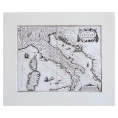
17th Century Geographical Map of Italy
By Matthäus Merian the Elder
Located in Florence, Tuscany
This beautifully detailed geographical map of Italy was printed in 1640. It was made by the expert Swiss engraver Matthaus Merian the Elder (1593-1650). Its high quality uniform inki...
Category
Mid-17th Century Italian Antique Matthäus Merian the Elder Collectibles and Curiosities
Materials
Parchment Paper
Italian Parchment Map of the City of Lucca Dated 1640
By Matthäus Merian the Elder
Located in Florence, Tuscany
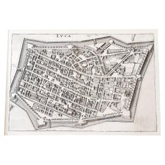
An antique map of the Tuscan city of Lucca engraved for The 'Itinerarium Italiæ Nov-antiquæ' by Matthäus Merian the Elder and printed in 1640...
Category
1640s Italian Antique Matthäus Merian the Elder Collectibles and Curiosities
Materials
Paper, Parchment Paper
Matthäus Merian The Elder collectibles and curiosities for sale on 1stDibs.
Matthäus Merian the Elder collectibles and curiosities are available for sale on 1stDibs. These distinctive items are frequently made of paper and are designed with extraordinary care. If you’re looking for additional options, many customers also consider collectibles and curiosities by Vincenzo Coronelli, Tommaso Barbi, and Creazioni Sacchetti. Prices for Matthäus Merian the Elder collectibles and curiosities can differ depending upon size, time period and other attributes — on 1stDibs, these items begin at $1,098 and can go as high as $1,098, while a piece like these, on average, fetch $1,098.
