Richard Blome Maps
to
1
1
1
1
1
1
1
1
1
1
1
104
63
28
24
Creator: Richard Blome
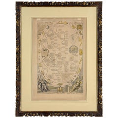
Cosmgraphy and Astrology, 1686 by Richard Blome from the First Edition
By Richard Blome
Located in BUNGAY, SUFFOLK
Cosmography & Astrology
Large oval engraved plate with inscriptions outlining the various parts of cosmography and astronomy; below, two emblematic figures with scientific instruments either side. Lettered with title, dedication, and various inscriptions. To his Excellency Roger Palmer, Earle of Castelmain and Baron of Limerick in Ireland, Embassador Extraordinary from his majesty King James II to his Holyness Pope Innocent 11th anno dom 1686. This plate is humbly DD by Richard Blome. On paper and retaining its original coloring.
Sheet width 26 ½ cm., 10 ½ in., height 41 ½ cm., 16 ½ in.,
In a part-gilded Sansovino frame...
Category
1680s English Charles II Antique Richard Blome Maps
Materials
Paper
Related Items
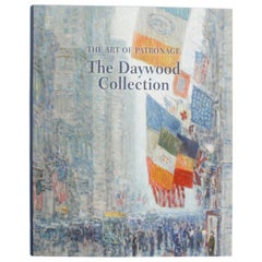
The Art of Patronage, The Daywood Collection, First Edition
Located in valatie, NY
The Art of Patronage, The Daywood Collection. Charleston: Huntington Museum of Art, 2017. First Edition hardcover with dust jacket. 122 pp. A catalogue of works from The Daywood Collection at the Huntington Museum of Art. The collection includes oils by: Childe Hassam, landscape and figurative oils...
Category
21st Century and Contemporary American Richard Blome Maps
Materials
Paper
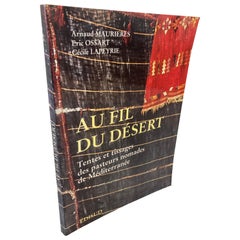
Over the Desert Au Fil du Désert Textiles from the Nomadic Desert Book
Located in North Hollywood, CA
Over the Desert - Tents And Weaving Of Nomadic Pastors.
Au fil du de´sert: Tentes et tissages des pasteurs nomades de Me´diterrane´e
(French Edition)
(French language) Paperback...
Category
1990s Moroccan Modern Richard Blome Maps
Materials
Paper
Pair of Monumental Sculpted Panels from the Eighteenth Century
Located in Madrid, ES
PAIR OF MONUMENTAL CARVED PANELS FROM THE 18TH CENTURY
IMPORTANT SPANISH BAROQUE 18TH CENTURY WOODEN PANELS ATTRIBUTED TO: Luis Bonifás y...
Category
18th Century Antique Richard Blome Maps
Materials
Fruitwood
$10,486 Sale Price
20% Off
H 72.84 in W 6.3 in D 36.23 in
Lateral Thinking: Art Of The 1990s, by Toby Kamps, First Edition
Located in valatie, NY
Lateral Thinking: Art Of The 1990s by Toby Kamps. Museum of Contemporary Art, San Diego, 2002. Kamps is the curator of the Museum of Contemporary Art, San Diego. First edition softcover. Lateral Thinking assesses the artistic achievements of the 1990s, concentrating on works by 40 contemporary artists from North, South, and Central America, Cuba, Africa, China and Europe. These include: Matthew Barney, Vanessa Beecroft...
Category
Early 2000s American Richard Blome Maps
Materials
Paper
Antique Wood Sign From Pratt Institute
Located in New York, NY
Great antique sign originally from the world renown design, art school Pratt Institute in NYC. The sign is constructed of solid wood, having a black ba...
Category
Early 20th Century American Art Deco Richard Blome Maps
Materials
Wood, Paint
Panneaux Decoratifs et Tentures Murales from 18th and Early 19th Century (Book)
Located in North Yorkshire, GB
This is a complete folio with 34 loose plates in colour and black and white showing elegant 18th century decorative wall panels, wall hangings and arabesques. An excellent design res...
Category
18th Century Antique Richard Blome Maps
Materials
Paper
$2,500
H 18.25 in W 12.75 in D 0.66 in
Antique Map of the Region Near the Gulf of Zula, 1870
Located in Langweer, NL
Antique map titled 'Map of the Country between Annesley Bay and the Plain of Salt'. Lithographed map of the region near the Gulf of Zula, also known as Annesley Bay, Baia di Arafali ...
Category
Mid-19th Century Antique Richard Blome Maps
Materials
Paper
$111 Sale Price
20% Off
H 11.42 in W 8.27 in D 0.02 in
Set of 24 Engravings by Richard Blome Framed in Pair of Regency Screens
By Richard Blome
Located in Charleston, SC
Regal set of twenty-four steel engravings of English Hunt Scenes by Richard Blome (1635-1705) framed in a pair of three panel mahogany Regency Screens, 17th century. The etchings are from "BLOME, Richard (1635-1705): The Gentlemans Recreation. ... An Encyclopedia of the Arts and Sciences ... [and] Horsemanship, Hawking, Hunting, Fowling, Fishing and Agriculture. With a Short Treatise of Cock-Fighting. London: S. Roycroft for R. Blome, 1686". Twenty-three of the twenty-four hunt engravings...
Category
Late 17th Century English Charles II Antique Richard Blome Maps
Materials
Upholstery, Mahogany, Paper
$32,500 / set
H 66 in W 80 in D 1.25 in
A Musical Gathering: Engraving from Richard Blome’s The Gentleman’s Recreation
Located in Langweer, NL
This print is an illustration from Richard Blome’s The Gentleman's Recreation, published in 1686, showing a group of people engaged in making music, with one person playing an organ....
Category
1680s Antique Richard Blome Maps
Materials
Paper
$298 Sale Price
20% Off
H 12.72 in W 8.47 in D 0 in
Antique Map of South East Asia, Australia and the Indian Ocean, 1726
By F. Valentijn
Located in Langweer, NL
Antique map titled 'Tabula Indiae Orientalis'.
Beautiful detailed map of Australia, Southeast Asia and the Indian Ocean. The map features a fine depiction of the outlines of the western two-thirds of Australia, based on the discoveries of explorers working for the Dutch East India Company (the VOC). These include Willem Jansz's discoveries in the Gulf of Carpentaria in 1606; the encounters of Dirk...
Category
Mid-18th Century Dutch Antique Richard Blome Maps
Materials
Paper
$6,711 Sale Price
20% Off
H 20.67 in W 27.17 in D 0.02 in
Antique Map of the Bahia Todos Santos 'Brazil' by Tirion, circa 1750
Located in Langweer, NL
Antique map titled 'Kaart Van De Aller-Heiligen Baay Waar aan de Hoofdstad legt van Brazil.', Detailed map of the Bahia Todos Santos in Brazil, with a lar...
Category
Mid-18th Century Antique Richard Blome Maps
Materials
Paper
$419 Sale Price
20% Off
H 16.54 in W 20.48 in D 0.02 in
Original Antique Map of The World by Dower, circa 1835
Located in St Annes, Lancashire
Nice map of the World
Drawn and engraved by J.Dower
Published by Orr & Smith. C.1835
Unframed.
Free shipping
Category
1830s English Antique Richard Blome Maps
Materials
Paper
Richard Blome maps for sale on 1stDibs.
Richard Blome maps are available for sale on 1stDibs. These distinctive items are frequently made of paper and are designed with extraordinary care. There are many options to choose from in our collection of Richard Blome maps, although beige editions of this piece are particularly popular. If you’re looking for additional options, many customers also consider maps by and John Ogilby. Prices for Richard Blome maps can differ depending upon size, time period and other attributes — on 1stDibs, these items begin at $3,852 and can go as high as $3,852, while a piece like these, on average, fetch $3,852.


