Tony Sarg Maps
to
2
2
2
2
2
2
2
2
2
2
2
1
104
63
28
24
Creator: Tony Sarg
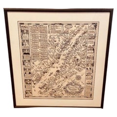
Tony Sarg Map of Nantucket Town, 1937
By Tony Sarg
Located in Nantucket, MA
Tony Sarg Map of Residential Main Street, Nantucket, 1937, a black and white printed map of our historic downtown area, with images of each building, street names and whimsical figur...
Category
1930s American Other Vintage Tony Sarg Maps
Materials
Paper
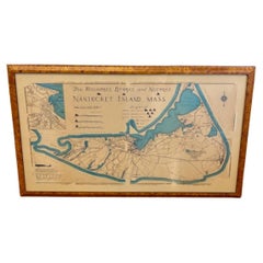
Nantucket High-Ways, By-Ways and Not-Ways Decorative Map by Tony Sarg, ca 1930
By Tony Sarg
Located in Nantucket, MA
Vintage Nantucket High-Ways, By-Ways and Not-Ways Decorative Map by Tony Sarg, (Nantucket: 1880 - 1942) circa 1930, a decorative tourist map of Nantucket Island with details of roadw...
Category
1930s American Other Vintage Tony Sarg Maps
Materials
Paper
Related Items
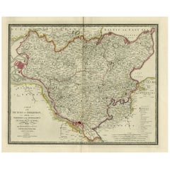
Old Map of Holstein with the Imperial Towns Hamburg & Lubeck, Germany, 1854
Located in Langweer, NL
Antique map titled 'Map of the Duchy of Holstein with the territories of the Imperial Towns Hamburg & Lubeck (..)
Based on a map by Fischer.' Map of the Duchy of Holstein. From Jam...
Category
1850s Antique Tony Sarg Maps
Materials
Paper
$929 Sale Price
20% Off
H 22.13 in W 27.96 in D 0 in
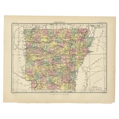
Antique Map of Arkansas
Located in Langweer, NL
Antique map titled 'Arkansas'. Original antique map of Arkansas, United States. This print originates from 'Encyclopaedia Britannica', Ninth Edition. P...
Category
Late 19th Century Antique Tony Sarg Maps
Materials
Paper
Paris 1937 -- Exposition Internationale
By Eugene Beaudoin and Marcel Lods
Located in London, GB
Original French poster for the Exposition International in Paris, 1937.
This award-winning Art Deco design was created by Eugene Beaudoin (1898-1983) and Marcel Lods...
Category
1930s French Art Deco Vintage Tony Sarg Maps
Antique Map of China and Korea incl Formosa and Hainan, by Janssonius, ca.1650
Located in Langweer, NL
Antique map titled 'Imperii Sinarum Nova Descriptio'. Beautiful map of China and Korea, much detail troughout the map. Including the Islands of Formosa (Taiwan) and Hainan. The Great...
Category
17th Century Antique Tony Sarg Maps
Materials
Paper
$2,827 Sale Price
20% Off
H 20.48 in W 24.02 in D 0 in
1907 Chart of Nantucket Harbor by George Eldridge
Located in Norwell, MA
Chart of Nantucket Harbor from 1907 by cartographer George W. Eldridge. The chart shows the channel passing by the jetty into the harbor, by Brant Point to Steamboat Wharf. Also show...
Category
Early 1900s North American Antique Tony Sarg Maps
Materials
Paper
Greece and Ottoman Balkans Map – Homann Engraving ca. 1720
Located in Langweer, NL
Greece and the Danube Basin Map c.1720 – Antique Engraving of the Balkans
This remarkable early 18th-century map presents a sweeping view of southeastern Europe, centering on the co...
Category
18th Century European Antique Tony Sarg Maps
Materials
Paper
Antique Map of Principality of Monaco
By Antonio Vallardi Editore
Located in Alessandria, Piemonte
ST/619 - "Old Geographical Atlas of Italy - Topographic map of ex-Principality of Monaco" -
ediz Vallardi - Milano -
A somewhat special edition ---
Category
Late 19th Century Italian Other Antique Tony Sarg Maps
Materials
Paper
Ship's Model Nantucket
Located in Norwell, MA
Museum quality model of the Lightship Nantucket, outfitted with countless milled brass fittings. Carved hardwood hull, painted brass masts etc... Also showing well executed cabin wor...
Category
1830s North American Antique Tony Sarg Maps
Materials
Wood
Highly Decorative Map of The Eastern Mediterranean and The Middle East, ca.1700
Located in Langweer, NL
Antique map titled 'Byzondere Kaart van de Landen Daar de Apostelen Het Evangelium Gepredikt Hebben (..).'
Highly decorative map of the eastern Mediterranean...
Category
Early 1700s Antique Tony Sarg Maps
Materials
Paper
$910 Sale Price
20% Off
H 16.74 in W 19.89 in D 0 in
Antique Decorative Coloured Map Marocco, Algeria and Tunis, 1882
Located in Langweer, NL
The maps is from the 1882 atlas by Blackie & Son and offers a detailed view of the North African regions as understood in the late 19th century.
**Map of Morocco, Algeria, and Tun...
Category
1880s Antique Tony Sarg Maps
Materials
Paper
$239 Sale Price
20% Off
H 14.97 in W 22.45 in D 0 in
Antique Map of Persia, Georgia and Kazakhstan, ca.1780
Located in Langweer, NL
Antique map titled 'Carte de la Perse, de la Georgie, et de la Tartarie Independante'.
Map of Persia, Georgia and Kazakhstan. This map shows current days Georgia, Iran, Irak, Kaz...
Category
1780s Antique Tony Sarg Maps
Materials
Paper
$498 Sale Price
20% Off
H 9.85 in W 14.97 in D 0 in
Half Model of the Lightship Nantucket
Located in Norwell, MA
Museum quality half model of the Lightship Nantucket. This fine model has a carved hull, countless milled brass fittings, built up cabins, etc. Details inc...
Category
2010s North American Tony Sarg Maps
Materials
Wood
Previously Available Items
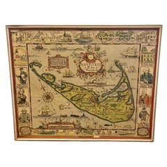
Tony Sarg Hand Colored Whimsical Map of Nantucket, circa 1926
By Tony Sarg
Located in Nantucket, MA
Antique Tony Sarg Hand Colored Whimsical Map of Nantucket, circa 1926, a decorative colored folk art tourist map of Nantucket Island by Tony Sarg (Nantucket: 1880 - 1942) depicting g...
Category
1920s American Folk Art Vintage Tony Sarg Maps
Materials
Paint
Tony Sarg maps for sale on 1stDibs.
Tony Sarg maps are available for sale on 1stDibs. These distinctive items are frequently made of paper and are designed with extraordinary care. Many of the original maps by Tony Sarg were created in the folk art style in united states during the 20th century. Prices for Tony Sarg maps can differ depending upon size, time period and other attributes — on 1stDibs, these items begin at $1,750 and can go as high as $1,800, while a piece like these, on average, fetch $1,775.
