Bartele Gallery Furniture
to
13,105
16,770
16,769
1
1
6,143
9,358
1,268
1
699
112
5
141
9
59
56
2
4
16,741
18
15
9
3
1,791
566
544
292
260
16,770
16,770
16,770
104
95
79
74
58
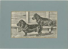
Dachshund Dog Illustration – Antique 1915 Print from Dogs of All Nations
Located in Langweer, NL
Title: Dachshunds – Antique Dog Illustration, 1915
This charming early 20th-century print depicts two Dachshunds, one standing alert in the foreground and the other resting on a woo...
Category
Early 20th Century American Prints
Materials
Paper
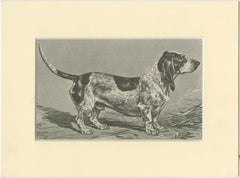
Blue Basset of Gascogne – Antique Dog Illustration, 1915
Located in Langweer, NL
Blue Basset of Gascogne – Antique Dog Illustration, 1915
This fine early 20th-century illustration depicts the Blue Basset of Gascogne, a rare and distinctive breed from southwest F...
Category
Early 20th Century American Prints
Materials
Paper
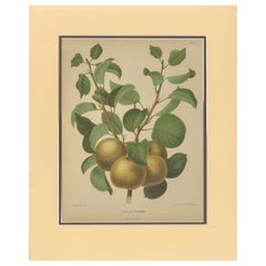
Golden Pear Cluster – Botanical Print, Dutch, ca. 1870 Chromolitho
Located in Langweer, NL
Golden Pear Cluster – “Peer var. Eyewood” Botanical Print, Dutch, ca. 1870 Chromolitho
Elegant antique chromolithograph depicting the Eyewood pear (*Peer var. Eyewood*), a richly co...
Category
Antique Mid-19th Century Dutch Prints
Materials
Paper
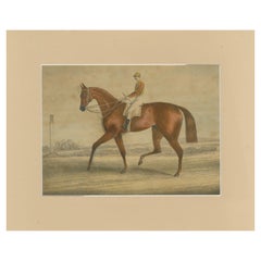
Racehorse with Jockey – 19th-Century Hand-Colored Lithograph, British School
Located in Langweer, NL
Racehorse with Jockey – 19th-Century Hand-Colored Lithograph, British School
Charming 19th-century hand-colored lithograph of a racehorse with jockey, depicted in profile during tra...
Category
Antique Mid-19th Century English Prints
Materials
Paper
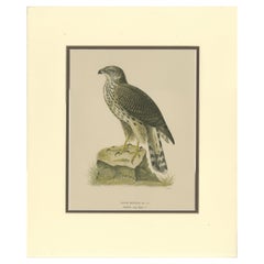
Northern Goshawk – Astur gentilis – Original 1917 Lithograph in Matting Board
Located in Langweer, NL
Northern Goshawk – Astur gentilis – Original 1917 Lithograph from "Skandinaviens Fåglar"
Original antique bird print of the Northern Goshawk (Astur gentilis), identified in Swedish ...
Category
Early 20th Century Swedish Prints
Materials
Paper
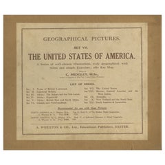
Geographical Pictures of the USA – Set VII by A. Wheaton & Co., ca. 1929
Located in Langweer, NL
Geographical Pictures of the USA – Set VII by A. Wheaton & Co., ca. 1929
A complete set of educational pictorial cards titled Geographical Pictures – Set VII: The United States of A...
Category
Early 20th Century English Prints
Materials
Paper
18th-Century German Engraving – Allegory of War, Poem & Naval View
Located in Langweer, NL
A rare and intriguing 18th-century German engraving combining a finely detailed allegorical scene of naval warfare with a poetic handwritten reflection on military life, ambition, an...
Category
Antique Early 18th Century German Prints
Materials
Paper
Large Decorative Colonial-Era Map of South India – Peninsula of India, 1800
Located in Langweer, NL
Antique Map of South India – “A Map of the Peninsula of India,” London 1800
This large and detailed antique map titled *A Map of the Peninsula of India* was published in London in 1...
Category
Antique Early 19th Century English Maps
Materials
Linen, Paper
Antique Map of Algeria, Tunisia & Tripolitania – Andriveau-Goujon, Paris 1865
Located in Langweer, NL
Antique Map of Algeria, Tunisia & Tripolitania – Andriveau-Goujon, Paris 1865
This finely detailed and beautifully colored map was engraved and published in Paris in 1865 by the ren...
Category
Antique Mid-19th Century French Maps
Materials
Paper
Egypt & Red Sea Antique Map – Detailed 1865 Chart of Nubia and Nile Regions
Located in Langweer, NL
Antique Map of Egypt, Nubia & Red Sea Coast – Andriveau-Goujon, Paris 1865
This delicately colored antique map, titled *Partie du Cours du Nil comprenant l'Égypte, la Nubie, l'Abyss...
Category
Antique Mid-19th Century French Maps
Materials
Paper
Antique Map of China, Japan & Korea – Eastern Asia by Andriveau-Goujon, 1860
Located in Langweer, NL
Antique Map of China, Japan & Korea – Eastern Asia by Andriveau-Goujon, 1860
This beautifully hand-colored antique map, titled “Carte de la Chine, de la Corée et du Japon,” was publ...
Category
Antique Mid-19th Century French Maps
Materials
Paper
Antique Map of India, Persia & Afghanistan – Detailed Continental Engraving 1864
Located in Langweer, NL
Antique Map of India, Persia & Afghanistan – Andriveau-Goujon, Paris 1864
This detailed 19th-century map titled “Asie Méridionale comprenant la Presqu'île de l'Inde, la Perse, l'Afg...
Category
Antique Mid-19th Century French Maps
Materials
Paper
Antique Asia Map – Large 19th-Century Engraving with Political Boundaries, 1865
Located in Langweer, NL
Antique Map of Asia – Andriveau-Goujon, Paris 1865
This large and finely engraved antique map titled “Asie” was published in Paris in 1865 by the prominent French cartographer E. An...
Category
Antique Mid-19th Century French Maps
Materials
Paper
Large Antique Set Ottoman Empire Maps – Europe & Asia in Striking Detail, 1868
Located in Langweer, NL
Antique Maps of the Ottoman Empire – Europe and Asia by Andriveau-Goujon, circa 1865
This finely engraved and hand-colored two-sheet map of the Ottoman Empire was published in Paris...
Category
Antique Mid-19th Century French Maps
Materials
Paper
Antique Map of Eastern Europe – Russia, Ottoman Empire & Greece, 1868
Located in Langweer, NL
Antique Map of Eastern Europe – Russia, Ottoman Empire and Greece by Andriveau-Goujon, 1868
This detailed antique map titled “Carte de l’Europe Orientale, la Russie d’Europe, l’Empi...
Category
Antique Mid-19th Century French Maps
Materials
Paper
Antique Map of Scandinavia and the Baltic – Andriveau-Goujon, circa 1860s
Located in Langweer, NL
Antique Map of Scandinavia and the Baltic – Andriveau-Goujon, circa 1860s
This impressive antique map presents Northern Europe, focusing on the Scandinavian Peninsula, the Baltic re...
Category
Antique Mid-19th Century French Maps
Materials
Paper
Germany & Central Europe – Antique 1865 Map by Andriveau-Goujon, Paris
Located in Langweer, NL
Antique Map of Germany and Central Europe – “Allemagne et Europe Centrale” by Andriveau-Goujon, 1865
This large, finely engraved map titled “Allemagne et Europe Centrale” was publis...
Category
Antique Mid-19th Century French Maps
Materials
Paper
Spain & Portugal Map – Antique 1867 Engraving by Andriveau-Goujon, Paris
Located in Langweer, NL
Antique Map of Spain and Portugal – “Espagne et Portugal” by Andriveau-Goujon, 1867
This finely detailed antique map titled “Espagne et Portugal” was published in Paris in 1867 by t...
Category
Antique Mid-19th Century French Maps
Materials
Paper
Antique Map of Italy – Pre-Unification Italy by Andriveau-Goujon, Paris 1861
Located in Langweer, NL
Antique Map of Italy – Pre-Unification Italy by Andriveau-Goujon, Paris 1861
This antique map of Italy, titled simply “Italie,” was published in Paris in 1861 by E. Andriveau-Goujon...
Category
Antique Mid-19th Century French Maps
Materials
Paper
Antique Map of France – Divided into 89 Departments by Andriveau-Goujon, 1861
Located in Langweer, NL
Antique Map of France – Divided into 89 Departments by Andriveau-Goujon, 1861
This finely engraved and beautifully hand-colored map titled “France divisée en 89 Départements” was pu...
Category
Antique Mid-19th Century French Maps
Materials
Paper
Antique Map of Europe – Political Divisions by Andriveau-Goujon, Paris 1861
Located in Langweer, NL
Antique Map of Europe – Political Divisions by Andriveau-Goujon, Paris 1861
This beautifully engraved and hand-colored antique map of Europe was published in 1861 by the Parisian ca...
Category
Antique Mid-19th Century French Maps
Materials
Paper
World Wind Currents Map – “Courants de l’Atmosphère” by Andriveau-Goujon, 1861
Located in Langweer, NL
World Wind Currents Map – “Courants de l’Atmosphère” by Andriveau-Goujon, 1861
This striking and educational antique chart titled “Courants de l’Atmosphère d’après le Lt. F. Maury” ...
Category
Antique Mid-19th Century French Maps
Materials
Paper
Roman Gaul & Northern Italy – Antique Map of La Gaule by Andriveau-Goujon, 1861
Located in Langweer, NL
Roman Gaul & Northern Italy – Antique Map of La Gaule by Andriveau-Goujon, 1861
This antique map titled "Carte Comparée de La Gaule" was published in Paris in 1861 by J. Andriveau-G...
Category
Antique Mid-19th Century French Maps
Materials
Paper
Antique Celestial Star Map – Northern & Southern Hemispheres, 1860
Located in Langweer, NL
Antique Celestial Star Map – Northern & Southern Hemispheres, Andriveau-Goujon 1860
This elegant antique celestial chart, published in Paris in 1860 by the noted French cartographer...
Category
Antique Mid-19th Century French Maps
Materials
Paper
New Zealand Botanical Hand-Colored Lithograph Set with Miro & Kawakawa, 1890
Located in Langweer, NL
New Zealand Botanical Study – Hand-Colored Lithograph Set with Miro & Kawakawa, 1890
This charming trio of hand-colored lithographs comes from the rare 1890 New Zealand publication ...
Category
Antique Late 19th Century New Zealand Prints
Materials
Paper
New Zealand Native Plants & Fruits – Set of Three Botanical Lithographs, 1890
Located in Langweer, NL
New Zealand Native Plants & Fruits – Set of Three Botanical Lithographs, 1890
This striking set of three hand-colored lithographs from the rare 1890 publication New Zealand Berries ...
Category
Antique Late 19th Century New Zealand Prints
Materials
Paper
New Zealand Native Berry Plants – Set of Three Hand-Colored Lithographs, 1890
Located in Langweer, NL
New Zealand Native Berry Plants – Set of Three Hand-Colored Lithographs, 1890
This beautifully composed set of three botanical prints presents detailed hand-colored lithographs of n...
Category
Antique Late 19th Century New Zealand Prints
Materials
Paper
New Zealand Botanical Fruit Studies – Set of Three Lithographs, 1890
Located in Langweer, NL
New Zealand Botanical Fruit Studies – Set of Three Lithographs, 1890
A captivating trio of hand-colored lithographs from the rare 1890 publication New Zealand Berries, this set show...
Category
Antique Late 19th Century New Zealand Prints
Materials
Paper
Konstantinopel – Panoramic View of Istanbul by François Halma, 1705
Located in Langweer, NL
Konstantinopel – Panoramic View of Istanbul by François Halma, 1705
This engaging hand-colored engraving of “Konstantinopel” offers a sweeping panoramic view of 18th-century Istanbu...
Category
Antique Early 18th Century Dutch Maps
Materials
Paper
Byzantium Nunc Constantinopolis – Braun & Hogenberg View of Istanbul, 1572
Located in Langweer, NL
Byzantium Nunc Constantinopolis – Braun & Hogenberg View of Istanbul, Cologne, 1572
This iconic 16th-century bird’s-eye view titled “Byzantium Nunc Constantinopolis” presents the ci...
Category
Antique 16th Century German Maps
Materials
Paper
Constantinople – Panoramic Engraving by Matthäus Merian the Elder, 1635
Located in Langweer, NL
Constantinople – Panoramic Engraving by Matthäus Merian the Elder, Frankfurt, 1635
This finely detailed copperplate engraving presents a sweeping bird’s-eye view of Constantinople (...
Category
Antique Early 17th Century German Maps
Materials
Paper
Constantinople – Panoramic Hand-Colored Engraving, Augsburg, circa 1720
Located in Langweer, NL
Constantinople – Panoramic Hand-Colored Engraving, Augsburg, circa 1720
This panoramic hand-colored engraving presents a sweeping bird’s-eye view of Constantinople (modern-day Istan...
Category
Antique Early 18th Century German Maps
Materials
Paper
Constantinople (Istanbul) – City View by Werner and Gläser, Augsburg ca.1730
Located in Langweer, NL
Constantinople (Istanbul) – Panoramic City View by Werner and Gläser, Augsburg c.1730
This striking hand-colored copper engraving offers a grand panoramic view of Constantinople (mo...
Category
Antique Early 18th Century German Maps
Materials
Paper
Yeoman of the Guard in Ceremonial Uniform – William Miller, London, ca.1805
Located in Langweer, NL
Yeoman of the Guard in Ceremonial Uniform – William Miller, London, c.1805
This elegant hand-colored print, published by William Miller around 1805, presents a full-length depiction...
Category
Antique Early 19th Century English Prints
Materials
Paper
View of Delft Canal to The Hague – Hand-Colored Optical Print, Paris, c.1760
Located in Langweer, NL
View of Delft Canal to The Hague – Hand-Colored Optical Print, Paris, c.1760
This charming hand-colored optical print titled “Vue du Canal de Delft à la Haye Ville de Hollande” depi...
Category
Antique Late 18th Century French Prints
Materials
Paper
Savage of the Admiralty Isles – Hand-Colored Ethnographic Engraving, c.1785
Located in Langweer, NL
Savage of the Admiralty Isles – Hand-Colored Ethnographic Engraving, c.1785
This striking hand-colored engraving, titled "A Savage of the Admiralty Isles in the South Sea," presents...
Category
Antique Late 18th Century English Prints
Materials
Paper
Nagai Tartars – Traditional Dress of Women of Distinction, c.1810 Engraving
Located in Langweer, NL
Nagai Tartars – Traditional Dress of Women of Distinction, c.1810
This delicately hand-colored copper engraving titled Nagai Tartars portrays three women of the Nogai Tatar ethnic g...
Category
Antique Late 18th Century Dutch Prints
Materials
Paper
Dutch Colonial Views of Batavia – Diestpoort and Castle with Laboratory, c.1780
Located in Langweer, NL
Dutch Colonial Views of Batavia – Diestpoort and the Castle with Laboratory, c.1780
This hand-colored copper engraving features two finely rendered views of Batavia (now Jakarta), t...
Category
Antique Late 18th Century Dutch Prints
Materials
Paper
A Dance at Ulietea – Society Islands Scene from Cook’s Voyages, c.1784
Located in Langweer, NL
A Dance at Ulietea – Society Islands Scene from Cook’s Voyages, c.1784
This finely hand-colored copper engraving titled A Dance at Ulietea, one of the Society Islands in the South S...
Category
Antique Late 18th Century English Prints
Materials
Paper
Oriental Carnival Costume Scene – “Faschingsfreuden” by Edward Cucuel, c. 1900
Located in Langweer, NL
Carnival Costume Scene – “Faschingsfreuden” by Edward Cucuel, c. 1900
This lively and colorful chromolithograph titled Faschingsfreuden (Carnival Pleasures) captures a humorous and ...
Category
Antique Early 1900s German Prints
Materials
Paper
Phoenician Trade Routes – Antique Map of Europe and the Mediterranean, 1748
Located in Langweer, NL
Phoenician Trade Routes – Antique Map of Europe and the Mediterranean, 1748
This antique German map titled Vorstellung von Europa zur Erläuterung der Schifffahrt der Phönicier auf d...
Category
Antique Mid-18th Century Maps
Materials
Paper
Orientalist Lithograph of Reclining Woman with Parrots – Ulrika, c.1840, Berlin
Located in Langweer, NL
Orientalist Lithograph of Reclining Woman with Parrots – “Ulrika”, c.1840, Berlin
This striking hand-colored lithograph titled “Ulrika” presents a vivid and sensual orientalist scen...
Category
Antique Mid-19th Century German Prints
Materials
Paper
Ground Plan of Shwemawdaw Pagoda – Great Temple at Pegu, circa 1800
Located in Langweer, NL
Architectural Plan of the Shwemawdaw Pagoda – Ground Plan of the Great Temple at Pegu, circa 1800
This rare and finely executed Dutch engraving titled “Grondteekening van den Sjoema...
Category
Antique Early 19th Century Dutch Prints
Materials
Paper
Shwemawdaw Pagoda in Pegu – Antique Engraving of the Great Temple of Burma, 1800
Located in Langweer, NL
Shwemawdaw Pagoda in Pegu – Antique Engraving of the Great Temple of Burma, circa 1800
This majestic antique Dutch engraving titled “De Sjoemadoe, of de Groote Tempel, te Pegu” (“Th...
Category
Antique Early 19th Century Dutch Prints
Materials
Paper
Burmese Monk in His Religious Robe – Antique Costume Print, circa 1800
Located in Langweer, NL
Burmese Monk in His Religious Robe – Antique Costume Print, circa 1800
This finely executed Dutch engraving, titled “Een Birmansch Priester in Zijn Orde-Gewaad” (“A Burmese Priest i...
Category
Antique Early 19th Century Dutch Prints
Materials
Paper
Burmese Official, Wife & Secretary in Ceremonial Dress – Antique Print, c.1800
Located in Langweer, NL
Burmese State Official, His Wife, and a Secretary in Ceremonial Dress – Antique Costume Print, circa 1800
This finely executed Dutch engraving titled “Staats-Dienaar en Zijn Vrouw –...
Category
Antique Early 19th Century English Prints
Materials
Paper
Antique Map of the Burmese Empire and Upper Indochina – by Dalrymple, c.1800
Located in Langweer, NL
Map of the Burmese Empire and Upper Indochina – Dutch Edition after Dalrymple, circa 1800
This antique map titled “Eene Schets van het Birmansche Ryk, volgens een Kaart van Indie bo...
Category
Antique Early 19th Century English Prints
Materials
Paper
Mounted Warrior of the Kassai Region – Antique Costume Print, circa 1800
Located in Langweer, NL
Mounted Warrior of the Kassai Region – Antique Costume Print, circa 1800
This dramatic antique engraving titled “Een Cassaische Ruiter” (“A Kassai Horseman”) presents a dynamic imag...
Category
Antique Early 19th Century Dutch Prints
Materials
Paper
Royal Burmese Official & His Wife in State Attire – Antique Costume Print, c1800
Located in Langweer, NL
Royal Burmese Official and His Wife in State Attire – Antique Costume Print, circa 1800
This fine early 19th-century Dutch engraving titled “Een Woendsji, of de Eerste Koninklijk-Bi...
Category
Antique Early 19th Century Dutch Prints
Materials
Paper
Burmese Minister & Wife in Ceremonial Dress – Antique Costume Print, c.1800
Located in Langweer, NL
Second Minister of State and His Wife in Ceremonial Dress – Antique Burmese Costume Print, circa 1800
This elegant antique Dutch engraving titled “De Tweede Staatsraad en Zijne Vrou...
Category
Antique Early 19th Century Dutch Prints
Materials
Paper
Tattooed Burmese Farmer and His Wife – Antique Costume Print, circa 1800
Located in Langweer, NL
Tattooed Burmese Farmer and His Wife – Antique Costume Print, circa 1800
This detailed early 19th-century Dutch engraving titled “Een Birmansche Boer en Boerin” (“A Burmese Farmer a...
Category
Antique Early 19th Century Dutch Prints
Materials
Paper
Seated Buddha at Gaya – Antique Dutch Print of a Statue in Bengal, ca. 1800
Located in Langweer, NL
Seated Buddha at Gaya – Antique Dutch Print of a Statue in Bengal, ca. 1800
This early 19th-century Dutch engraving titled "Afbeelding van Boodh, te Gaija in Bengalen te zien" (Tran...
Category
Antique Early 19th Century Dutch Prints
Materials
Paper
Burmese Script Chart – Rare Dutch Comparative Alphabet Print, circa 1800
Located in Langweer, NL
Burmese Alphabet – Antique Comparative Chart in Dutch, “Het Birmansche Alphabet genaamd Kagye-Kagué”, c.1800
This elegant and rare antique linguistic chart presents the Burmese alph...
Category
Antique Early 19th Century Dutch Prints
Materials
Paper
Antique Map of Rhodesia & British Central Africa – Published by Philip, 1895
Located in Langweer, NL
Antique Map of Rhodesia & British Central Africa – Published by George Philip & Son, 1895
This detailed antique map titled "Rhodesia & British Central Africa" was published in 1895 ...
Category
Antique Late 17th Century English Maps
Materials
Paper
Large Antique Map of Franche-Comté – Divided into Three Historic Bailliages 1681
Located in Langweer, NL
Antique Map of Franche-Comté – “La Franche Comté divisée en Trois Grands Bailliages” by Jaillot, 1681
This richly detailed antique map, titled “La Franche Comté divisée en Trois Gra...
Category
Antique Late 17th Century French Maps
Materials
Paper
Antique Map of India & Southeast Asia – Chevalier Engraving, Malte-Brun, 1853
Located in Langweer, NL
Antique Map of India and Southeast Asia – Chevalier Engraving from Malte-Brun’s Atlas, 1853
This beautifully engraved map titled “Inde, comprenant les Empires de la Chine, de l’Indo...
Category
Antique Mid-19th Century English Maps
Materials
Paper
Large Antique Map of India – Post Roads and Dak Stations by James Wyld, c.1855
Located in Langweer, NL
Antique Map of India – Post Roads and Dak Stations by James Wyld, c.1855
This impressive antique map titled "India Shewing the Post Roads and Dak Stations" was engraved and publishe...
Category
Antique Mid-19th Century English Maps
Materials
Paper
Antique Map of Assam and Bhutan – Hand-Colored Lithograph by Vandermaelen, 1827
Located in Langweer, NL
Antique Map of Assam and Bhutan – Hand-Colored Lithograph by Vandermaelen, 1827
This original antique map titled “Assam et Boutan” (No. 84) is a finely detailed lithograph from the ...
Category
Antique Early 19th Century Belgian Maps
Materials
Paper
Antique Map of Kalmykia – Vandermaelen Lithograph of Central Asia, 1827
Located in Langweer, NL
Antique Map of Kalmykia – Vandermaelen Lithograph of Central Asia, 1827
This rare antique map titled “Partie de la Kalmoukie” (No. 56) is an original 1827 lithograph by Belgian cart...
Category
Antique Early 19th Century Belgian Maps
Materials
Paper
Antique Map of Turkestan – Vandermaelen Lithograph of Central Asia, 1827
Located in Langweer, NL
Antique Map of Turkestan – Vandermaelen Lithograph of Central Asia, 1827
This finely detailed antique map titled “Turkestan” (No. 34) is an original lithograph from the groundbreaki...
Category
Antique Early 19th Century Belgian Maps
Materials
Paper
