Bartele Gallery Furniture
to
13,105
16,770
16,769
1
1
6,143
9,358
1,268
1
699
112
5
141
9
59
56
2
4
16,741
18
15
9
3
1,791
566
544
292
260
16,770
16,770
16,770
104
95
79
74
58
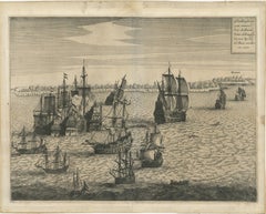
Capture of Spanish Ships by Dutch Fleet Near Cuba, 1628, Led by Pieter Ita
Located in Langweer, NL
Title: The Capture of Two Spanish Admiral Ships by the Fleet of the Dutch West India Company under Admiral Pieter Adriaensz Ita, 1628
Description: This mid-17th century engraving, c...
Category
Antique 1650s Prints
Materials
Paper
$534 Sale Price
20% Off
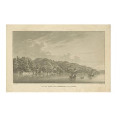
Vue du Kiosk des Conférences de Bebek: Picturesque View of Constantinople, 1817
Located in Langweer, NL
Work from Charles Pertusier's Atlas des promenades pittoresques dans Constantinople et sur les rives du Bosphore, published in 1817.
This significant work provides picturesque view...
Category
Antique 1810s French Prints
Materials
Paper
$276 Sale Price
20% Off
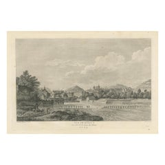
Engraved View of Geneva from the Rhône River, Published in 1780
Located in Langweer, NL
Title: View of Geneva from the Rhône River (Vue de Genève, Du côté de la chute du Rhône)
Description: This finely detailed engraving depicts a panoramic view of Geneva as seen from ...
Category
Antique 1780s Prints
Materials
Paper
$353 Sale Price
20% Off
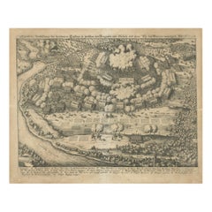
Battle of Wimpfen, 1622: Engraving by Matthäus Merian (ca. 1645)
Located in Langweer, NL
Title: Battle of Wimpfen, 1622: Engraving by Matthäus Merian (ca. 1645)
Description: This antique copper engraving, created by the renowned Swiss-German engraver Matthäus Merian aro...
Category
Antique 1640s Maps
Materials
Paper
$324 Sale Price
20% Off
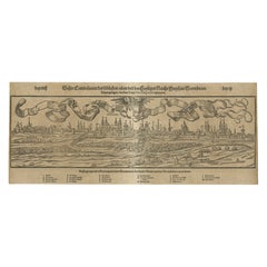
16th-Century Panoramic View of Worms: A Woodcut from Sebastian Münster's
Located in Langweer, NL
This is a woodcut city view of Worms, published in Sebastian Münster's *Cosmographia* around 1578. The image depicts a bird's-eye view of the city of Worms, located in Rheinland-Pfal...
Category
Antique 16th Century Maps
Materials
Paper
$210 Sale Price
20% Off
Capture of Limburg by Spanish Forces under Duke of Parma, 1578 - Engraving
Located in Langweer, NL
This engraving illustrates the capture of Limburg by Spanish forces under the command of Alexander Farnese, Duke of Parma, in 1578 during the Eighty Years' War. The scene vividly dep...
Category
Antique 16th Century Prints
Materials
Paper
$276 Sale Price
20% Off
Capture of Tournai by Parma's Forces, 1581: Siege and Conquest of the City
Located in Langweer, NL
This detailed engraving depicts the capture of Tournai by the forces of the Duke of Parma in 1581. The scene shows the siege and conquest of the city with meticulous illustrations of...
Category
Antique 16th Century Prints
Materials
Paper
$276 Sale Price
20% Off
Siege of Antwerp: Duke of Parma’s Strategic Ship Bridge over the Scheldt, 1585
Located in Langweer, NL
This engraving, titled *Pons Antverpianus Scaldi impositus*, represents the famous ship bridge constructed by the Duke of Parma over the Scheldt River during the Siege of Antwerp in ...
Category
Antique 16th Century Prints
Materials
Paper
$276 Sale Price
20% Off
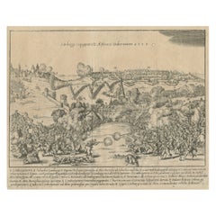
Battle of Kauwenstein Dijk, 1585: Siege of Antwerp Engraving with Latin Legend
Located in Langweer, NL
The 'Battle for the Kauwenstein Dijk', engraved and titled Pugna in Aggerere Covenstio Anno 1585, depicts a significant battle during the Siege of Antwerp on 26 May 1585.
The engraving illustrates the fierce combat around the Kauwenstein embankment, where the Spanish forces under the Duke of Parma attempted to cut off supplies to the city of Antwerp, leading to intense fighting.
The scene vividly portrays soldiers engaged in close combat, naval forces in the background, and smoke rising from the battlefield as cannon fire and musket shots fill the air. The embankment, partially breached, is a focal point, showing the chaotic nature of the battle as forces from both sides converge.
At the top, the title is inscribed in Latin, and a detailed legend (A-O) at the bottom provides further explanations about various parts of the battle, referencing key locations, troops, and actions. The detailed precision of the engraving reflects the high level of craftsmanship typical of 16th-century military engravings...
Category
Antique 16th Century Prints
Materials
Paper
$276 Sale Price
20% Off
Duke of Parma’s 1585 Ship Bridge Plan: Siege of Antwerp Engineering Print
Located in Langweer, NL
This is an original engraved print from 1585, depicting the construction plans for the ship bridge built by the Duke of Parma during the Siege of Antwerp in the Eighty Years' War.
...
Category
Antique 16th Century Prints
Materials
Paper
$267 Sale Price
20% Off
Comparison of Human and Primate Skulls, Lithograph by C.C. Last, 1836
Located in Langweer, NL
This lithograph, titled *Schedels* (Skulls), is another detailed work by Carel Christiaan Antony Last from Heinrich Rudolf Schinz's *Volledige Natuurlijke Historie der Zoogdieren* (1...
Category
Antique 1830s Prints
Materials
Paper
$343 Sale Price
20% Off
Sloth, Galago, and Lemur Species, Lithographs by C. Last, 1836, Natural History
Located in Langweer, NL
This combined image depicts two lithographs of various small primates, drawn by Carel Christiaan Antony Last for Heinrich Rudolf Schinz's *Volledige Natuurlijke Historie der Zoogdier...
Category
Antique 1830s Prints
Materials
Paper
$572 Sale Price / set
20% Off
The Flying Lemur (Colugo) Lithograph by C.C. Last, 1836
Located in Langweer, NL
This lithograph, titled *De Vliegende Maki* (The Flying Lemur), is a striking depiction of the colugo or flying lemur, drawn by Carel Christiaan Antony Last for Heinrich Rudolf Schin...
Category
Antique 1830s Prints
Materials
Paper
$248 Sale Price
20% Off
Golden-crested, Lion Tamarin & Lemur Species, Lithographs by C.C. Last, 1836
Located in Langweer, NL
These two lithographs depict various species of tamarins and lemurs, drawn by Carel Christiaan Antony Last for Heinrich Rudolf Schinz's *Volledige Natuurlijke Historie der Zoogdieren...
Category
Antique 1830s Prints
Materials
Paper
$572 Sale Price / set
20% Off
Saimiri, Night Monkey, Mico & Silky Monkey, Lithographs by C.C. Last, 1836
Located in Langweer, NL
This image showcases two lithographs of primates, drawn by Carel Christiaan Antony Last for Heinrich Rudolf Schinz's *Volledige Natuurlijke Historie der Zoogdieren* (1836). These det...
Category
Antique 1830s Prints
Materials
Paper
$572 Sale Price / set
20% Off
Oeakari, Sodenaap, Cacajao & Capuchin Monkeys, Lithographs by C.C. Last, 1836
Located in Langweer, NL
These two lithographs feature various species of monkeys, carefully depicted by Carel Christiaan Antony Last for Heinrich Rudolf Schinz's *Volledige Natuurlijke Historie der Zoogdier...
Category
Antique 1830s Prints
Materials
Paper
$572 Sale Price / set
20% Off
Forest Devil, Miriki & Long-bearded Howler Monkeys, Lithographs by C. Last, 1836
Located in Langweer, NL
This image features two lithographs depicting different species of primates, originally drawn by Carel Christiaan Antony Last for Heinrich Rudolf Schinz's *Volledige Natuurlijke Hist...
Category
Antique 1830s Prints
Materials
Paper
$572 Sale Price / set
20% Off
Macaque, Mandrill & Dikbuik Monkeys, Lithographs by C.C. Last, 1836
Located in Langweer, NL
This image presents two lithographs depicting different species of primates, drawn by Carel Christiaan Antony Last and printed by S. de Visser en Zoon in The Hague in 1836. These det...
Category
Antique 1830s Prints
Materials
Paper
$572 Sale Price / set
20% Off
Spring Monkeys and Other Species, Lithographs by Last, 1836, Zoological Studies
Located in Langweer, NL
These two lithographs depict various species of monkeys, presented in a naturalistic and detailed manner, created by Carel Christiaan Antony Last for Heinrich Rudolf Schinz's *Volled...
Category
Antique 1830s Prints
Materials
Paper
$572 Sale Price / set
20% Off
Orangutan, Chimpanzee, Siamang & Gibbons, Lithographs by C.Last, 1836, Primates
Located in Langweer, NL
These two lithographs present primates in naturalistic settings, with careful attention to their anatomy and behavior. They are part of a series drawn by Carel Christiaan Antony Last...
Category
Antique 1830s Prints
Materials
Paper
$572 Sale Price / set
20% Off
Negro and Bushmen Portraits, Lithographs by C. Last, 1836, Ethnographic Studies
Located in Langweer, NL
These two lithographs depict individuals of African descent, specifically focusing on the physical characteristics of people of the *Negro* race and the *Bosjesmannen* (Bushmen), as ...
Category
Antique 1830s Prints
Materials
Paper
$572 Sale Price / set
20% Off
Inhabitants of Van Diemen's Land, Lithographs by C.C. Last, 1836, Tasmania
Located in Langweer, NL
These two lithographs are part of the series depicting the native peoples of Van Diemen’s Land, now known as Tasmania, drawn by Carel Christiaan Antony Last for the natural history b...
Category
Antique 1830s Prints
Materials
Paper
$477 Sale Price / set
33% Off
Noru Gal Derri & Australian Aborigines, Lithographs by Last, 1836, Nieuw-Holland
Located in Langweer, NL
These two lithographs are part of a series depicting Aboriginal people from Australia, originally drawn by the artist Nicolas-Martin Petit during the expeditions of French explorer N...
Category
Antique 1830s Prints
Materials
Paper
$572 Sale Price / set
20% Off
1808 Engraving of Antelope Bubalis by S.C. Miger: Detailed Zoological Study
Located in Langweer, NL
This print, titled *Antilope Bubalis - Le Bubale*, was created in Paris in 1808 by the artist and engraver S.C. Miger.
It depicts the African antelope species commonly known as the...
Category
Antique Early 1800s Prints
Materials
Paper
$181 Sale Price
20% Off
Early 19th-Century Engraving of Lemur Catta by S.C. Miger and N. Maréchal, Paris
Located in Langweer, NL
This engraving titled *Lemur Catta - Le Maki Mococo* depicts the ring-tailed lemur, native to Madagascar.
It was drawn by the artist Nicolas Maréchal and...
Category
Antique Early 1800s Prints
Materials
Paper
$181 Sale Price
20% Off
Engraving of Egyptian Goose by Nicolas Maréchal and S.C. Miger, 1808
Located in Langweer, NL
This engraving, titled *Anas Aegyptiaca - L’Oie d’Égypte* (Egyptian Goose), depicts the Egyptian goose, scientifically known as *Alopochen aegyptiaca*.
The artist is Nicolas Maréch...
Category
Antique Early 1800s Prints
Materials
Paper
$181 Sale Price
20% Off
Antique Print of an Eleuth or Oirat man, the westernmost group of the Mongols
Located in Langweer, NL
Antique costume print titled 'Eleuthe (Asie)'. Original antique print of an Eleuth or Elyut man. This print originates from 'Moeurs, usages et costumes de tous les peuples du monde' ...
Category
Antique Mid-19th Century Prints
Materials
Paper
The de Bry Engraving of Maritime Marvels of Dutch Seafarers at Cochin, 1601
Located in Langweer, NL
Engraving by Theodore De Bry from 'Pars Quarta Indiae Orientalis...,' 1601, with descriptive latin text below the image.
This antique engraving of ov...
Category
Antique Early 17th Century Prints
Materials
Paper
$468 Sale Price
20% Off
Antique Map of Cities of the Province of Che-Kyang in China, 1738
Located in Langweer, NL
Antique print China titled 'Cities of the Province of Che-Kyang'. Old map depicting four walled cities of the Chinese Qing dynasty province of Che-Kiang (modern day CHEKIANG): Hang C...
Category
Antique 18th Century Maps
Materials
Paper
$334 Sale Price
20% Off
The Whale Harvest of St. Mary's Island - Copper Engraving by de Bry, 1601
Located in Langweer, NL
Original Antique engraving by Theodore De Bry from 'Pars Quarta Indiae Orientalis...,' 1601, with descriptive latin text below the image.
This 1601 e...
Category
Antique Early 17th Century Prints
Materials
Paper
$379 Sale Price
40% Off
Original Copper Engraving of Various Celebrated Animals in India by De Bry, 1601
Located in Langweer, NL
Title: "Exotic Bestiary: A 1601 de Bry Engraving of India’s Majestic Fauna"
This captivating 1601 copper engraving by Theodore de Bry from his "Indiae...
Category
Antique Early 17th Century Prints
Materials
Paper
$620 Sale Price
20% Off
Map of French Colonies in the Americas: St. Martin, French Guiana and St. Pierre
Located in Langweer, NL
This is an intricately detailed map from 1852 titled *Colonies Françaises en Amérique*, depicting several key French colonies in the Americas.
The map focuses on regions such as Fr...
Category
Antique 1850s Maps
Materials
Paper
$181 Sale Price
20% Off
French Colonies in the Caribbean: Maps of Martinique and Guadeloupe (1852)
Located in Langweer, NL
This pair of maps, published in 1852, provides a detailed representation of the French Caribbean colonies, specifically Martinique and Guadeloupe. They were part of the *Atlas Univer...
Category
Antique 1850s Maps
Materials
Paper
$315 Sale Price / set
20% Off
18th Century Original Dutch Map of Martinique in The West Indies by Isaak Tirion
Located in Langweer, NL
This is an 18th-century Dutch map of Martinique, titled *Het Westindisch Eiland Martinique*. The map was produced by Isaak Tirion, a renowned Dutch cartographer and publisher known for his precise and beautifully crafted maps. The cartouche in the lower left corner, adorned with decorative elements, adds to the aesthetic appeal of the map.
### Key Features:
- Martinique: The map offers detailed topographical information of the island, including mountains, rivers, and settlements.
- Geographical Details: Locations such as Fort Royal, Bay de St. Pierre, and Point de Cloche are marked, showcasing significant features of the island.
- Cartouche: The ornate cartouche, featuring tropical plants, reflects the importance of the island's agricultural production during the colonial period, particularly its sugar plantations.
This map captures Martinique during its time as a French colony and provides valuable insight into the island’s layout and strategic significance in the Caribbean. The attention to coastal detail highlights the importance of Martinique as a hub of maritime activity.
The map’s combination of aesthetic elegance and cartographic precision makes it a remarkable piece for collectors and those interested in Caribbean colonial...
Category
Antique 1760s Maps
Materials
Paper
$420 Sale Price
20% Off
1821 Thomson Map of Guadeloupe, Marie-Galante and Antigua in the West Indies
Located in Langweer, NL
This map, published in 1821 by John Thomson, showcases Guadeloupe, Marie-Galante, and Antigua from the *West India Islands* collection. Part of Thomson's *New General Atlas*, it prov...
Category
Antique 1820s Maps
Materials
Paper
$553 Sale Price
20% Off
1825 Buchon Map of Puerto Rico & Virgin Islands with Detailed Colonial History
Located in Langweer, NL
This map of Puerto Rico and the Virgin Islands, published by Jean Alexandre Buchon in 1825, offers a unique look at the Caribbean during a time of E...
Category
Antique 1820s Maps
Materials
Paper
$439 Sale Price
20% Off
Hand-Colored Map of West India Islands: St. Christopher's, St. Lucia and Nevis
Located in Langweer, NL
This map, titled "West India Islands," was published by John Thomson & Co. in 1821 as part of *Thomson's New General Atlas.* The map offers detailed depictions of three key islands i...
Category
Antique 1820s Maps
Materials
Paper
$553 Sale Price
20% Off
Very Large Double Page Detailed Map of Italy and Surrounding Regions, 1794
Located in Langweer, NL
This is a large (two seperate sheets) and detailed map of Italy, including the southern parts of Germany, Dalmatia, the adjacent countries, and the Illyric Islands. The map is titled...
Category
Antique 1790s Maps
Materials
Paper
$1,900 Sale Price / set
20% Off
Large 1695 Hand-Colored Engraved Map of Gascony (Gascogna), France
Located in Langweer, NL
This map, created by Giacomo Cantelli da Vignola in 1695, represents the "General Government of Guyenne and Gascony" in southwest France. Cantelli da Vignola was a renowned Italian c...
Category
Antique 1690s Maps
Materials
Paper
$2,149 Sale Price
20% Off
1882 Heliogravure of Middelburg Fair by Maxime Lalanne in The Netherlands
Located in Langweer, NL
This antique print, titled *La Kermesse à Middelbourg*, depicts a bustling fairground in Middelburg, the Netherlands. It was created in 1882 as part of the publication *La Hollande à...
Category
Antique 1880s Prints
Materials
Paper
$85 Sale Price
20% Off
Amsterdam: Mid-19th Century Hand-Colored Steel Engraving by Bourgin, Paris
Located in Langweer, NL
This hand-colored engraving depicts a maritime scene in Amsterdam, capital of The Netherlands. The view shows the bustling waterfront, with sailboats navigating through choppy waters...
Category
Antique 1850s Prints
Materials
Paper
$152 Sale Price
20% Off
1720 Etching of St. Christopher's Cathedral in Roermond by Jacobus Harrewijn
Located in Langweer, NL
This antique print, titled *L'Eglise Cathedrale de S. Christophre à Ruremonde*, is an etching and engraving created by Jacobus Harrewijn around 1720.
It offers a detailed view of S...
Category
Antique 1720s Prints
Materials
Paper
$124 Sale Price
20% Off
1875 Engraving of the Historic City Hall in Veere in Zeeland by E. Thérond
Located in Langweer, NL
This is an 1875 wood engraving of the *Stadhuis te Veere* (City Hall of Veere), published in *De Aarde en haar Volken* by Uitgeverij Kruseman & Tjeenk Willink, Haarlem. The illustrat...
Category
Antique 1870s Prints
Materials
Paper
$181 Sale Price
20% Off
Spectacular 1770 Bird's-Eye View of Dunkirk Harbor by Basset, with 66 Landmarks
Located in Langweer, NL
This engraving, titled *Vue de Dunkerque du coté de la Mer*, is a spectacular bird's-eye view of Dunkirk from the sea, published by Basset around 1770.
It provides a detailed panor...
Category
Antique 1770s Maps
Materials
Paper
$468 Sale Price
20% Off
Antique Map of Africa by Bordiga Fratelli 'circa 1818'
Located in Langweer, NL
Antique map titled 'Carta dell Africa'. Large and quite scarce Italian map of Africa, reflecting the then-current knowledge of the continent's geography, with large areas left comple...
Category
Antique Early 19th Century Maps
Materials
Paper
$1,719 Sale Price
20% Off
Print of a Religious Fresco or Decorative Pilaster by Ottoviani, 'circa 1775'
Located in Langweer, NL
Antique print of a religious fresco or decorative pilaster. This print originates from 'Logge di Rafaele nel Vaticano'. Plates from this work are ...
Category
Antique Late 18th Century Prints
Materials
Paper
$1,462 Sale Price
30% Off
Vintage Poster of Japan Air Lines Depicting Singapore River and Raffles, ca.1960
Located in Langweer, NL
Japan Air Lines / Singapore. 1960s. Color photo-offset poster depicting Singapore River and Raffles Place. 39 x 24 ½”. Linen backed. Excellent condition.
Category
Mid-20th Century Posters
Materials
Paper
$1,800 Sale Price
20% Off
Large Wall Map of Europe by George Philip & Son, circa 1920
Located in Langweer, NL
Antique map titled 'Philips' New Commercial Map of Europe'. Very large wall map of Europe including the North African coast and Turkey. Decorative bord...
Category
Early 20th Century Maps
Materials
Linen, Paper
$2,089 Sale Price
30% Off
Large Old Hand-Colored Print of Northern Cardinals from Northern America, 1869
Located in Langweer, NL
Antique bird print titled 'Cardinalis Igneus'.
Old bird print depicting Northern Cardinals. This print originates from 'The new and heretofore unfi...
Category
Antique 1860s Prints
Materials
Paper
$1,098 Sale Price
20% Off
Antique Map of New England and Part of Canada by Vaugondy 'circa 1755'
Located in Langweer, NL
Antique map titled 'Partie de l'Amérique septent qui comprend la nouvelle France ou le Canada'. Decorative and highly detailed map of New England an...
Category
Antique Mid-18th Century Maps
Materials
Paper
$1,567 Sale Price
24% Off
Spectacular Antique Bird Print of an Adult and Young Temminck's Auk, 1869
Located in Langweer, NL
Antique bird print titled 'Brachyramphus Temminckii'.
Old bird print depicting an adult and young Temminck's Auk. This print originates from 'The new and heretofore unfigured speci...
Category
Antique 19th Century Prints
Materials
Paper
Antique Hand-Colored Print of North American White-Headed Woodpecker Birds, 1869
Located in Langweer, NL
Antique bird print titled 'Xenopicus Albolarvatus'.
Old bird print depicting two White-Headed Woodpeckers. This print originates from 'The new and heretofore unfigured species of t...
Category
Antique 1860s Prints
Materials
Paper
Original Antique Bird Print Depicting Latham's Guillemot, 1868
Located in Langweer, NL
Antique bird print titled 'Sagmatorrhina Lathami'.
Old bird print depicting Latham's Guillemot. This print originates from 'The new and heretofore unfigured species of the birds of North America', published 1866-1869.
This spectacular large folio lithograph is from Daniel Giraud Elliot's The New and Heretofore Unfigured Species of the Birds of North America. The work was published in New York for the author between 1866 and 1869. Each lithograph features original hand-coloring. The plates were predmoninantly executed by Bowen of Philadelphia after originals by Elliot and celebrated natural history artist, Joseph Wolf. It is believed only 200 copies of this work were ever printed.
The work generally depicted life-size renderings of birds that were not previously illustrated by Alexander Wilson...
Category
Antique 1860s Prints
Materials
Paper
$2,053 Sale Price
20% Off
Original Rare Old Bird Print Depicting Cassin's Snow Goose 'Anser Albatus', 1869
Located in Langweer, NL
Antique bird print titled 'Anser Albatus'. Old bird print depicting Cassin's Snow Goose. This print originates from 'The new and heretofore unfigured specie...
Category
Antique 19th Century Prints
Materials
Paper
Antique Costume Print of Traditional Attire of Pomerania: Weitzacker in 1870
Located in Langweer, NL
Antique print titled 'Pommern - Weitzacker'. This original antique print shows the costumes of Germany; Pomerania; Weitzacker.
Albert Kretschmer (27 February 1825 – 11 July 1891) w...
Category
Antique Late 19th Century Prints
Materials
Paper
$210 Sale Price
20% Off
Finely Detailed Map Covering Northern Italy, Austria, Slovenia & Croatia, c.1690
Located in Langweer, NL
Antique map titled 'Exactissima Tabula, qua tam Danubii Fluvii Pars Superior'.
Very finely detailed map covering the region of northern Italy, Austria, Slovenia and Croatia. The co...
Category
Antique 1690s Maps
Materials
Paper
$1,766 Sale Price
20% Off
Set of 4 Antique Prints Illustrating the Political Climate in Switzerland '1800'
Located in Langweer, NL
Set of four rare antique prints originating from a satirical series titled 'Das Jahr MDCCC in Bildern und Versen' by Balthasar Anton Dunker. The prints illustrate the satirical repre...
Category
Antique Early 19th Century Prints
Materials
Paper
$1,910 Sale Price / set
20% Off
Large Photographic Plates of Saba, Sint Eustatius, Sint Martin Caribbean, 1910
Located in Langweer, NL
These three original antique prints provide captivating glimpses into the Dutch West Indies, once a part of an educational series designed for school children. Numbered 151 to 153, t...
Category
Early 20th Century Prints
Materials
Paper
$1,575 Sale Price / set
20% Off
Historical Large Map of Kyoto, Japan (1905) - Published by Kobayashi
Located in Langweer, NL
Old map of Kyoto, Japan. Published by Kobayashi, 1905.
This is an old map of Kyoto, Japan, published by Kobayashi in 1905. The map showcases a detailed layout of Kyoto during the ea...
Category
Early 20th Century Maps
Materials
Paper
$1,671 Sale Price
20% Off
Antique Map of the World in 12 Globe Gores by Scherer, 'circa 1702'
Located in Langweer, NL
Antique map titled 'Typus Totius Orbis Terraquei Geographice Delineatus, Et Ad Usum Globo Materiali Superinducendus'. Beautiful example of Scherer's map of the World, configured in 12 globe gores. California is shown as an island. Fascinating Northwest Passage...
Category
Antique Early 18th Century Maps
Materials
Paper
$1,790 Sale Price
25% Off
