Bartele Gallery Collectibles and Curiosities
to
4,753
5,619
5,618
1
3,039
2,220
359
1
208
10
73
4
3
3
2
5,610
8
6
2
2
268
91
79
38
28
5,619
5,619
5,619
104
59
20
14
14
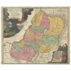
Hand-Colored Map of the Holy Land Divided Among the Twelve Tribes, c.1720
Located in Langweer, NL
Hand-Colored Map of the Holy Land Divided Among the Twelve Tribes, c.1720
This striking antique map, titled "Iudaea seu Palaestina ob Sacratissima Redemtoris Vestigia Hodie Dicta Te...
Category
Antique Early 18th Century European Maps
Materials
Paper
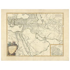
Antique Map of Alexander the Great's Empire & Campaigns, de Vaugondy, 1753
Located in Langweer, NL
Antique Map of Alexander the Great's Empire & Campaigns, de Vaugondy, 1753
This rare and elegantly engraved map, titled "Antiquor Imperiorum Tabula, in qua Prae Caeteris, Macedonicu...
Category
Antique Mid-18th Century European Maps
Materials
Paper
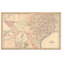
Large Antique Map of Texas with Panhandle & Bay Inset Maps, Colton, 1873
Located in Langweer, NL
Large Antique Map of Texas with Panhandle & Bay Inset Maps, Colton, 1873
This richly detailed and visually striking antique map of Texas was published in 1873 by G.W. & C.B. Colton,...
Category
Antique 1870s Maps
Materials
Paper
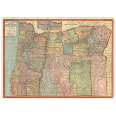
Colorful 1915 Road Map of Oregon with Portland Inset & Index – Geographical Pub.
Located in Langweer, NL
Colorful 1915 Road Map of Oregon with Portland Inset & Index – Geographical Pub.
Description:
This vibrant and information-rich folding map of Oregon, titled "Premier Series Oregon"...
Category
Vintage 1910s Maps
Materials
Paper
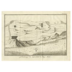
Topographic Map of Mount Sinai Summit – Antique Engraving by Pococke, 1776
Located in Langweer, NL
Topographic Map of Mount Sinai Summit – Antique Engraving by Pococke, 1776
This antique engraving offers a rare and detailed view of the summit plateau of Mount Sinai, titled "Grond...
Category
Antique Late 18th Century Dutch Maps
Materials
Paper
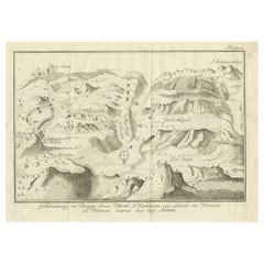
Mount Sinai & St. Catherine's – Antique Map of the Sinai Monasteries, 1776
Located in Langweer, NL
Mount Sinai & St. Catherine's – Antique Map of the Sinai Monasteries, 1776
Description:
This finely engraved antique map depicts the mountainous region of the Sinai Peninsula, focus...
Category
Antique Late 18th Century Dutch Maps
Materials
Paper
Cairo, Babylon & Heliopolis – Antique Map of Ancient Memphis Region, 1776
Located in Langweer, NL
Cairo, Babylon & Heliopolis – Antique Map of Ancient Memphis Region, 1776
This antique map is an 18th-century Dutch engraving showing the region around ancient Memphis, Egypt, inclu...
Category
Antique Late 18th Century Dutch Maps
Materials
Paper
Bordeaux City View – Braun & Hogenberg Original Woodcut, ca. 1575
Located in Langweer, NL
Bordeaux City View – Braun & Hogenberg Original Woodcut, ca. 1575
Description:
This detailed and highly decorative bird’s-eye view of Bordeaux, titled Bovrdeavx, originates from the...
Category
Antique 16th Century German Maps
Materials
Paper
United States, Canada & Mexico – 1857 North America Map
Located in Langweer, NL
North America Map – United States, Canada, Mexico 1857
This impressive antique print shows “Nord-America” meaning “North America,” published in 1857 by Justus Perthes in Gotha as pa...
Category
Antique Mid-19th Century German Maps
Materials
Paper
Iran and Turan Map – Persia, Afghanistan, Baluchistan, Turkestan 1858
Located in Langweer, NL
Iran and Turan Map – Persia, Afghanistan, Baluchistan, Turkestan 1858
This impressive antique print shows “Iran und Turan (Persien, Afghanistan, Beludschistan, Turkestan),” meaning ...
Category
Antique Mid-19th Century German Maps
Materials
Paper
Historic 1857 Map of North-East Africa & Arabia – Fine Engraving
Located in Langweer, NL
North-East Africa and Arabia Map 1857
This detailed antique print shows “Mittel- und Nord-Afrika (östl. Theil) und Arabien” meaning “Central and North Africa (eastern part) and Arab...
Category
Antique Mid-19th Century German Maps
Materials
Paper
Southern Africa & Madagascar Antique Map – Beautiful 1857 Edition
Located in Langweer, NL
Southern Africa and Madagascar Map 1857
This detailed antique print shows “Süd-Africa mit Madagascar” meaning “Southern Africa with Madagascar,” published in 1857 by Justus Perthes ...
Category
Antique Mid-19th Century German Maps
Materials
Paper
Australia, New Zealand, and Neighbouring Islands Map 1858
Located in Langweer, NL
Australia and Neighbouring Islands Map 1858
This attractive antique print shows “Festland von Australien und benachbarte Inseln” meaning “Mainland Australia and neighbouring islands...
Category
Antique Mid-19th Century German Maps
Materials
Paper
European Turkey Map – Detailed Balkan Ottoman Provinces 1858
Located in Langweer, NL
European Turkey and Greece Map – Balkans and Ionian Islands 1857
This detailed antique print shows “Die Europäische Türkei, Griechenland und die Ionischen Inseln” meaning “European ...
Category
Antique Mid-19th Century German Maps
Materials
Paper
European Turkey and Greece Map – Balkans and Ionian Islands 1857
Located in Langweer, NL
European Turkey and Greece Map – Balkans and Ionian Islands 1857
This detailed antique print shows “Die Europäische Türkei, Griechenland und die Ionischen Inseln” meaning “European ...
Category
Antique Mid-19th Century German Maps
Materials
Paper
Greece Map – Kingdom of Greece and Ionian Islands 1847
Located in Langweer, NL
Greece Map – Kingdom of Greece and Ionian Islands 1847
This elegant antique print shows the Kingdom of Greece titled “Königreich Griechenland und die Ionischen Inseln” meaning “King...
Category
Antique Mid-19th Century German Maps
Materials
Paper
Mediterranean, Black Sea & Ottoman Empire Map 1853
Located in Langweer, NL
Mediterranean, Black Sea & Ottoman Empire Map 1853
This impressive antique print shows the Mediterranean and Black Sea regions with a focus on the Ottoman Empire, titled “Das Mittel...
Category
Antique Mid-19th Century German Maps
Materials
Paper
Ireland Map – Provincial and County Divisions 1851
Located in Langweer, NL
Ireland Map – Provincial and County Divisions 1851
This fine antique print shows Ireland titled simply “Ireland,” published in 1851 by Justus Perthes in Gotha as part of Adolf Stiel...
Category
Antique Mid-19th Century German Maps
Materials
Paper
Scotland Map – Highlands, Islands, and Northern England 1858
Located in Langweer, NL
Scotland Map – Highlands, Islands, and Northern England 1858
This attractive antique print shows Scotland and its surroundings titled “Schotland mit der nördlichen Spitze von Englan...
Category
Antique Mid-19th Century German Maps
Materials
Paper
Europe Map – Political Divisions and Borders, Published in 1858
Located in Langweer, NL
Europe Map – Political Divisions and Borders 1858
This fine antique print shows Europe with its political divisions titled “Europa zur Übersicht der politischen Verhältnisse” meanin...
Category
Antique Mid-19th Century German Maps
Materials
Paper
Europe Map – Rivers, Watersheds and Elevation, Published in 1857
Located in Langweer, NL
Europe Map – Rivers, Watersheds and Elevation 1857
This beautiful antique print shows Europe with its river systems and watershed regions, titled “Europa zur Übersicht der Flussgebi...
Category
Antique Mid-19th Century German Maps
Materials
Paper
Mountain Elevation Profiles – Alps, Pyrenees, Andes & World Heights 1857
Located in Langweer, NL
Mountain Elevation Profiles – Alps, Pyrenees, Andes & World Heights 1857
This intriguing antique print shows comparative elevation profiles titled “Die bekannteren Höhen über der Me...
Category
Antique Mid-19th Century German Maps
Materials
Paper
Arctic Polar Map – North Pole and Russian Empire Regions 1857
Located in Langweer, NL
Arctic Polar Map – North Pole and Russian Empire Regions 1857
This remarkable antique print shows the Arctic titled “Polar-Karte enthaltend die Länder und Meere am Nord-Pol” meaning...
Category
Antique Mid-19th Century German Maps
Materials
Paper
World Map – Mercator Projection with Global Sea Routes, Published in 1857
Located in Langweer, NL
World Map – Mercator Projection with Global Sea Routes 1857
This attractive antique print shows a world map titled “Planiglob in Mercators Projection zur Übersicht der Erdfläche und...
Category
Antique Mid-19th Century German Maps
Materials
Paper
Planiglob of the Antipodes – Unique Global Projection Map 1857
Located in Langweer, NL
Planiglob of the Antipodes – Unique Global Projection Map 1857
This rare and fascinating antique print shows a “Planiglob der Antipoden” or Planiglob of the Antipodes, depicting the...
Category
Antique Mid-19th Century German Maps
Materials
Paper
Western & Eastern Hemisphere Maps – World Double Hemisphere Engravings 1857
Located in Langweer, NL
Western & Eastern Hemisphere Maps – World Double Hemisphere Engravings 1857
These beautiful antique prints show two complementary hemispheric maps titled “Westliche Halbkugel” (West...
Category
Antique Mid-19th Century German Maps
Materials
Paper
Northern Hemisphere Star Map – Constellations & Astronomical Chart, c.1858
Located in Langweer, NL
Northern Hemisphere Star Map – Constellations & Astronomical Chart c.1858
This attractive antique print shows the northern starry sky titled “Der nördliche gestirnte Himmel”, meanin...
Category
Antique Mid-19th Century German Maps
Materials
Paper
Solar System Map – Planetary Orbits and Data Chart, Published in 1857
Located in Langweer, NL
Solar System Map – Planetary Orbits and Data Chart 1857
This antique print shows a detailed diagram of the solar system titled “Planeten-System der Sonne” meaning “Planetary System ...
Category
Antique Mid-19th Century German Maps
Materials
Paper
Visible Side of the Moon Map – Detailed Lunar Crater Chart, Published in 1858
Located in Langweer, NL
Visible Side of the Moon Map – Detailed Lunar Crater Chart 1858
This fascinating antique print shows the visible side of the moon with incredible precision and detail. It depicts th...
Category
Antique Mid-19th Century German Maps
Materials
Paper
Antique Map of Granada Spain – Hand-Coloured Tassin Engraving 1651
Located in Langweer, NL
Antique Map of Granada Spain – Hand-Coloured Tassin Engraving 1651
This beautiful hand-coloured engraved map depicts the historic Kingdom of Granada in southern Spain, created by th...
Category
Antique Mid-17th Century French Maps
Materials
Paper
Antique Map of Andalusia Spain – Hand-Coloured Tassin Engraving 1651
Located in Langweer, NL
Antique Map of Andalusia Spain – Hand-Coloured Tassin Engraving 1651
This fine hand-coloured engraved map shows the historic kingdom of Andalusia in southern Spain, created by Nicol...
Category
Antique Mid-17th Century French Maps
Materials
Paper
Map of Virgin Islands and Lesser Antilles by Rigobert Bonne, c. 1780
Located in Langweer, NL
Map of Virgin Islands and Lesser Antilles by Rigobert Bonne, c. 1780
This fine antique map is titled 'Supplément pour les Isles Antilles, extrait des cartes angloises' and was engraved by Rigobert Bonne, Ingénieur-Hydrographe de la Marine, around 1780. It depicts:
Upper half:
* The Virgin Islands (*Les Isles Vierges*), including:
* St. Thomas
* St. John
* Tortola
* Virgin Gorda
* Jost Van Dyke
* Surrounding smaller islands and passages.
* Parts of Puerto Rico visible left.
Lower half:
Nine inset maps of individual Caribbean islands with coastal details:
1. I. de la Barboude (Barbuda)
2. I. St. Christophe (St. Kitts)
3. I. Antigoa (Antigua)
4. I. de la Dominique (Dominica)
5. I. de Sainte Lucie (St. Lucia)
6. I. de la Barbade (Barbados)
7. I. de St. Vincent
8. I. de la Grenade (Grenada)
9. I. de Tabago (Tobago)
Features:
* Coastal names, bays, capes, and harbours noted.
* Fine clear engraving typical of Bonne’s atlases for maritime use.
* Scale bar with French lieues marines.
Engraver: Rigobert Bonne
Date: circa 1780
Published in: Atlas Encyclopédique
Condition:
Good dark impression on laid paper with wide margins. Some slight toning along centre fold and faint edge wear consistent with age. Original platemark visible.
Framing suggestions:
Display with other Bonne Caribbean or West Indies maps in a travel, history, or colonial themed wall. Ideal floated in a black or walnut wood frame with archival matting to preserve the crisp engraving.
Keywords:
Rigobert Bonne Caribbean maps...
Category
Antique 1780s French Maps
Materials
Paper
1758 Map of Saint Kitts – St. Christophe, Antique French Engraving
Located in Langweer, NL
Map of Saint Kitts (St. Christophe), circa 1758
This is an antique French map titled *Carte de l'Isle St. Christophe*, engraved by Jacques-Nicolas Bellin and published around 1758 f...
Category
Antique Mid-18th Century French Maps
Materials
Paper
Map of Guyane (French Guiana) with Cayenne, circa 1826
Located in Langweer, NL
Map of Guyane (French Guiana) with Cayenne, circa 1826
This is an antique French map titled “Guyane” from *Petit Atlas National (Colonies françaises)* published by Blaisot around 18...
Category
Antique Early 19th Century French Maps
Materials
Paper
Martinique Map by Rigobert Bonne – French Antique Map, c.1768
Located in Langweer, NL
Map of Martinique by Rigobert Bonne, circa 1768
This is a detailed antique map of Martinique titled “Isle de la Martinique,” engraved by Rigobert Bonne around 1768 for the Atlas Encyclopédique. Bonne, a renowned French hydrographer and successor to Bellin, is celebrated for his scientifically precise and elegantly engraved maps.
The map shows Martinique with its mountainous interior, rivers, and settlements labelled, including Fort Royal, Fort St. Pierre, Le Marin, and Le Prêcheur. Coastal features, bays, and capes are marked, along with anchorages important for maritime navigation in the 18th century. The depiction includes relief shown pictorially, characteristic of Bonne’s cartographic style, enhancing both geographic understanding and aesthetic appeal.
This copperplate engraving retains original hand colouring outlining the coastlines in delicate blue and brown tones, typical for the period. It served as a key reference for scholars, navigators, and colonial administrators during France’s colonial presence in the Caribbean.
Condition:
Good condition overall. A strong impression with bright, original hand-colour outlines. General age toning, faint offsetting, and a vertical fold as issued in the atlas. Margins ample all around for framing.
Framing suggestions:
This historic Caribbean map...
Category
Antique 1760s French Maps
Materials
Paper
Map of Martinique, Guadeloupe, Marie-Galante, Désirade & Saintes by Bonne, 1788
Located in Langweer, NL
Map of Martinique, Guadeloupe, Marie-Galante, Désirade & Saintes by Bonne, 1788
This fine antique map, titled *Isle de la Martinique, Isles de la Guadeloupe, de Marie Galante, de la...
Category
Antique Late 18th Century French Maps
Materials
Paper
1758 Bellin Map of Guadeloupe and Marie-Galante – Caribbean Islands
Located in Langweer, NL
Thank you for noting the correct date on the map. Here is your **updated plain text catalog listing**:
---
**Title (under 80 characters):**
1758 Bellin Map of Guadeloupe and Marie-Galante – Caribbean Islands
**Description:**
Original antique map titled *Carte de l’Isle de la Guadeloupe* by Jacques Nicolas Bellin, engraved for the *Histoire Générale des Voyages*, published in Paris in 1758.
This finely engraved copperplate map depicts the French Caribbean island of Guadeloupe, showing its distinctive butterfly-shaped division into Basse-Terre and Grande-Terre. The surrounding smaller islands include Marie-Galante (bottom right) and Les Saintes. The map details numerous place names, parishes, rivers, bays, mountains, and anchorages. A decorative rococo title cartouche graces the upper right corner, complemented by a scale bar cartouche in the upper left.
Jacques Nicolas Bellin (1703-1772) served as Hydrographer to the King and was one of the most prominent French cartographers of the 18th century, producing maps noted for their accuracy, elegance, and clarity. This map was created for the influential *Histoire Générale des Voyages* by Abbé Prévost.
Condition report:
Excellent condition. Strong and clean impression on fine laid paper with wide margins. Original hand coloring in outline and wash, highlighting coastlines and cartouches. Minor age toning at edges; verso blank.
Framing suggestion:
Frame with a classic gold or dark wood moulding and a neutral cream archival mat to emphasize the fine engraving and delicate color washes. Museum glass is recommended to preserve this 18th-century Caribbean map...
Category
Antique Mid-18th Century French Maps
Materials
Paper
Map of Iran, Arabia, Asia Minor & Caucasus by Perthes, 1858
Located in Langweer, NL
Map of Iran, Arabia, Asia Minor & Caucasus by Perthes, 1858
This is a detailed engraved map titled Vorder-Asien oder Iran, Turan, Arabien, Kleinasien und die Kaukasus Länder, publis...
Category
Antique Mid-19th Century German Maps
Materials
Paper
Plan of Cincinnati Map, USA c.1870 – Hand-Colored Street Plan with Wards
Located in Langweer, NL
Plan of Cincinnati Map, USA c.1870 – Hand-Colored Street Plan with Wards
This is a finely engraved and hand-colored street plan titled Plan of Cincinnati and Vicinity, published in ...
Category
Antique Mid-19th Century American Maps
Materials
Paper
Brazil Coastline Map – Broenner Carte du Bresil, 1772 Captaincies
Located in Langweer, NL
Carte du Bresil Map, Broenner Krefeld 1772 – Brazil Coastline Captaincies
This is an engraved map titled Carte du Bresil Prem. Partie, published in Krefeld (Germany) by J.J. Broenne...
Category
Antique Late 18th Century French Maps
Materials
Paper
Johnson’s Illinois Map, USA c.1864 – Hand-Colored with Chicago Courthouse View
Located in Langweer, NL
Johnson’s Illinois Map, USA c.1864 – Hand-Colored with Chicago Courthouse View
This is a finely engraved and hand-colored map titled Johnson’s Illinois, published by Johnson and War...
Category
Antique Mid-19th Century American Maps
Materials
Paper
Johnson’s New Brunswick Nova Scotia Newfoundland Map, USA c.1864
Located in Langweer, NL
Johnson’s New Brunswick Nova Scotia Newfoundland Map, USA c.1864
This is a finely engraved and hand-colored map titled Johnson’s New Brunswick, Nova Scotia, Newfoundland, and Prince...
Category
Antique Mid-19th Century American Maps
Materials
Paper
Plan of Baltimore City Map, USA c.1870 – Hand-Colored Street Plan
Located in Langweer, NL
Plan of Baltimore City Map, USA c.1870 – Hand-Colored Street Plan
This is a finely engraved and hand-colored street plan titled Plan of Baltimore, published in the United States cir...
Category
Antique Mid-19th Century American Maps
Materials
Paper
Central America Map – Johnson, Hand-Colored with Insets, c.1864
Located in Langweer, NL
Johnson’s Central America Map, USA c.1864 – Hand-Colored with Insets
This is a finely engraved and hand-colored map titled Johnson’s Central America, published by Johnson and Ward i...
Category
Antique Mid-19th Century American Maps
Materials
Paper
Washington Oregon Idaho Map – Johnson, Hand-Colored, c.1864
Located in Langweer, NL
Johnson’s Washington Oregon Idaho Map, USA c.1864 – Hand-Colored
This is a finely engraved and hand-colored map titled Johnson’s Washington, Oregon, and Idaho, published by Johnson ...
Category
Antique Mid-19th Century American Maps
Materials
Paper
Minnesota and Dakota Map – Johnson, Hand-Colored, USA c.1864
Located in Langweer, NL
Johnson’s Minnesota and Dakota Map, USA c.1864 – Hand-Colored Territorial Map
Description:
This is a finely engraved and hand-colored map titled Johnson’s Minnesota and Dakota, pub...
Category
Antique Mid-19th Century American Maps
Materials
Paper
Maine County Map – Johnson, Hand-Colored, USA c.1864
Located in Langweer, NL
Johnson’s Maine Map, USA Published c.1864 – Hand-Colored County Map
This is a finely engraved and hand-colored map titled Johnson’s Maine, published by Johnson and Ward in New York ...
Category
Antique Mid-19th Century American Maps
Materials
Paper
Delaware and Maryland Map – Johnson, Hand-Colored with Insets, 1864
Located in Langweer, NL
Johnson’s Delaware and Maryland Map, USA c.1864 – Hand-Colored with Insets
This is a finely engraved and hand-colored map titled Johnson’s Delaware and Maryland, published by Johnso...
Category
Antique Mid-19th Century American Maps
Materials
Paper
Arkansas Map by Colton, USA Published c.1864 – Hand-Colored County Map
Located in Langweer, NL
Arkansas Map by Colton, USA Published c.1864 – Hand-Colored County Map
This is a finely engraved and hand-colored map titled Arkansas, published by G.W. & C.B. Colton & Co. in New Y...
Category
Antique Mid-19th Century American Maps
Materials
Paper
Hindostan or British India Map – Johnson, Hand-Colored USA c.1864
Located in Langweer, NL
Johnson’s Hindostan or British India Map, USA c.1864 – Hand-Colored
This is a finely engraved and hand-colored map titled Johnson’s Hindostan or British India, published by Johnson ...
Category
Antique Mid-19th Century American Maps
Materials
Paper
Johnson’s Mexico Map with Tehuantepec Inset, USA c.1864 – Hand-Colored
Located in Langweer, NL
Johnson’s Mexico Map with Tehuantepec Inset, USA c.1864 – Hand-Colored
This is a finely engraved and hand-colored map titled Johnson’s Mexico, published by Johnson and Ward in New Y...
Category
Antique Mid-19th Century American Maps
Materials
Paper
Johnson’s China Map with Canton Inset, USA Published c.1864 – Hand-Colored
Located in Langweer, NL
Johnson’s China Map with Canton Inset, USA Published c.1864 – Hand-Colored
This is a finely engraved and hand-colored map titled Johnson’s China, publis...
Category
Antique Mid-19th Century American Maps
Materials
Paper
Johnson’s Australia Map, USA Published c.1864 – Decorative Hand-Colored Map
Located in Langweer, NL
Johnson’s Australia Map, USA Published c.1864 – Decorative Hand-Colored Map
This is a finely engraved and hand-colored map titled Johnson’s Australia published by Johnson and Ward i...
Category
Antique Mid-19th Century American Maps
Materials
Paper
Attack Plan of Douay Fortress, France, 1710 Siege – Brussels c.1720 Map
Located in Langweer, NL
Attack Plan of Douay Fortress, France, 1710 Siege – Brussels c.1720 Map
This engraved military map shows the detailed plan of attacks on the fortress city of Douay (Douai) in northe...
Category
Antique Early 18th Century French Maps
Materials
Paper
Detailed 1720s Map – Siege of Douay and Lines of Circumvallation, France
Located in Langweer, NL
Detailed 1720s Map – Siege of Douay and Lines of Circumvallation, France
This engraved map shows the detailed fortifications and surrounding region of Douay (Douai) in northern Fran...
Category
Antique Early 18th Century French Maps
Materials
Paper
Detailed 1729 Battle Map – Allied Army Camp at Denain France, 1712 Siege
Located in Langweer, NL
Map of Allied Camp at Denain, France, 1712 Attack – Published 1729
This engraved map depicts the army camp of the Allied forces at Denain, attacked by the French on July 24, 1712 du...
Category
Antique Early 18th Century Dutch Maps
Materials
Paper
Plan of Pondicherry Fortifications and Attacks, France, c.1750
Located in Langweer, NL
Plan of Pondicherry Fortifications and Attacks, France, c.1750
This finely engraved map depicts the fortified city of Pondicherry, titled "Plan de Pondichéry et de ses attaques." It...
Category
Antique Mid-18th Century French Maps
Materials
Paper
1874 Map of Western United States – Detailed Atlas by Keith Johnston
Located in Langweer, NL
1874 Map of Western United States by Keith Johnston – Detailed Atlas
This is an original antique map titled “United States of North America (Western States)” by Alexander Keith John...
Category
Antique 1870s Scottish Maps
Materials
Paper
Batavia Market Scenes & Government House – Antique Prints VOC Period, c.1780
Located in Langweer, NL
Batavia Views – Government House and Market Scenes, circa 1780
This is an original late 18th-century engraving featuring two detailed views of Batavia (now Jakarta, Indonesia) under...
Category
Antique Late 18th Century Dutch Maps
Materials
Paper
1728 Map of Batavia Castle & City, Java – Van der Aa after 1669
Located in Langweer, NL
1728 Map of Batavia Castle & City, Java – Van der Aa after 1669
This is an original antique copperplate engraving titled “Plan de la Ville et du Château de Batavia en l’Isle de Iava...
Category
Antique Early 18th Century Dutch Maps
Materials
Paper
