Bartele Gallery Collectibles and Curiosities
to
4,740
5,652
5,651
1
3,040
2,254
357
1
207
10
73
4
3
3
2
5,643
8
6
2
2
353
120
82
73
40
5,652
5,652
5,652
104
59
20
14
14
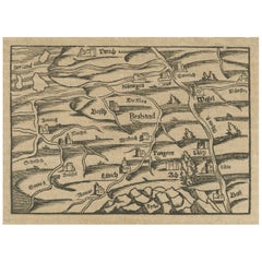
Rare 16th Century Woodcut Map of Brabant and the Rhine Valley, circa 1549
Located in Langweer, NL
Title: Rare 16th Century Woodcut Map of Brabant and the Rhine Valley, circa 1550
Description:
This rare and highly decorative early woodcut map depicts the region of Brabant and the...
Category
Antique 16th Century German Maps
Materials
Paper
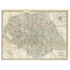
Paris and Surroundings – Antique Map by Gall and Inglis, Published 1843
Located in Langweer, NL
Antique Map of Paris and Environs by Gall and Inglis, 1843
This finely detailed map titled "Gall & Inglis’ Plan of Paris and Environs" was published in 1843 and provides a fascinati...
Category
Antique Mid-19th Century English Maps
Materials
Paper
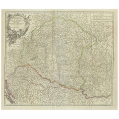
Antique Map of the Kingdom of Hungary and Transylvania, circa 1780
Located in Langweer, NL
Antique Map of the Kingdom of Hungary and Surrounding Regions by S. Robert, circa 1780
This beautifully engraved map titled Royaume de Hongrie, Principauté de Transilvanie, Esclavon...
Category
Antique Late 18th Century French Maps
Materials
Paper
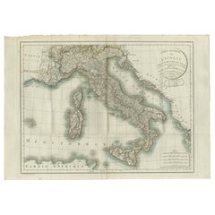
Map of Italy and Neighboring Regions by Delamarche – Antique Map, c.1800
Located in Langweer, NL
Antique Map of Italy and Surrounding Regions by Delamarche, circa 1800
This elegant and detailed antique map titled Carte Générale de l’Italie was drawn and engraved by the French g...
Category
Antique Early 1800s French Maps
Materials
Paper
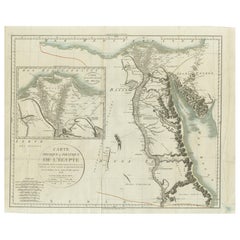
Antique Map of Egypt with Detailed Inset of the Nile Delta, ca. 1799
Located in Langweer, NL
Antique Map of Egypt with Detailed Inset of the Nile Delta, ca. 1799
This finely engraved antique map titled Carte Physique et Politique de l’Égypte presents a detailed and scientif...
Category
Antique Early 1800s French Maps
Materials
Paper
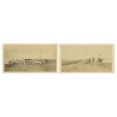
British Army Camp Scenes – Highland and Queen’s Regiments, 19th Century Pair
Located in Langweer, NL
British Army Camp Scenes – Highland and Queen’s Regiments, 19th Century Pair, circa 1870
This is a compelling pair of original 19th-century albumen photographs depicting British Arm...
Category
Antique Late 19th Century English Arms, Armor and Weapons
Materials
Paper
1658 Large Map of the Holy Land by Jansson – Twelve Tribes of Israel in 6 Sheets
Located in Langweer, NL
Holy Land Divided Among the Twelve Tribes – Six-Part Map by Jan Jansson and Georgius Hornius, circa 1658
This rare and impressive six-sheet engraved map of the Holy Land was publish...
Category
Antique Mid-17th Century Dutch Maps
Materials
Paper
Hand-Colored Dutch Map of Ancient Israel Divided by the Twelve Tribes – c.1730
Located in Langweer, NL
Hand-Colored Dutch Map of Ancient Israel Divided by the Twelve Tribes – After Ezekiel, c.1730
This beautifully hand-colored antique map is titled "Ontwerp en Erfdeeling van’t Land K...
Category
Antique Early 18th Century Dutch Maps
Materials
Paper
1723 Antique Map of Asia – Carte d’Asie by Guillaume Delisle, Paris
Located in Langweer, NL
Title: Carte d'Asie – Rare Hand-Colored Map of Asia by Guillaume Delisle, Paris 1723
Description:
This rare and highly decorative antique map titled 'Carte d'Asie', engraved and han...
Category
Antique Early 18th Century French Maps
Materials
Paper
Frederic de Wit Map of Palestine – Terra Sancta, Amsterdam c.1670
Located in Langweer, NL
Terra Sancta sive Promissionis, olim Palestina – hand-coloured copper-engraved map of the Holy Land by Frederic de Wit, Amsterdam, circa 1670
This impressive folio sheet, bearing th...
Category
Antique Late 17th Century Dutch Maps
Materials
Paper
Hand-Colored Map of Westphalia – Copper Engraving by Ottens, Amsterdam c.1720
Located in Langweer, NL
Hand-Colored Map of Westphalia – Copper Engraving by Ottens, Amsterdam c.1720
This striking early 18th-century map titled *Nova Ducatus Westphaliae Tabula accurate descripta et in S...
Category
Antique Early 17th Century European Maps
Materials
Paper
Original Map of the Rhine River in the Holy Roman Empire by Janssonius, c.1645
Located in Langweer, NL
This striking original antique map, titled "Rhenus Fluviorum Europae celeberrimus," showcases the historic Rhine River region, a vital artery of European trade, culture, and history....
Category
Antique Mid-17th Century Dutch Maps
Materials
Paper
Map of India and Southeast Asia from Ptolemaic Geography – 16th Century Woodcut
Located in Langweer, NL
Map of India and Southeast Asia from Ptolemaic Geography – 16th Century Woodcut
This remarkable hand-colored woodcut map, originally designed according to the geographical knowledge...
Category
Antique 16th Century European Maps
Materials
Paper
Map of Florida, Louisiana and the Bahamas – Set of Rare French Sea Charts, 1777
Located in Langweer, NL
1777 Le Rouge Map of Florida, Louisiana, and the Bahamas. Lot of 2 large maps: "Carte de la Floride Occidentale et Louisiane & La Peninsule et Golfe de la Floride"
This rare and im...
Category
Antique 1770s Maps
Materials
Paper
Rare Hand-colored Map of the British Isles by Gerard Valk, Published circa 1700
Located in Langweer, NL
Map of the British Isles by Gerard Valk circa 1700 – Hand-Colored Engraving
This elegant copperplate engraving titled *Les Isles Britanniques, qui contiennent les Royaumes d'Anglete...
Category
Antique Early 1700s Dutch Maps
Materials
Paper
Rare 1690 Map of England by Nicolaes Visscher II – Heptarchy Depicted
Located in Langweer, NL
Map of England 1690 by Nicolaes Visscher II – Heptarchy and Counties Shown
Antique 1690 map of England by Nicolaes Visscher II, showing the Anglo-Saxon Heptarchy and detailed county...
Category
Antique Late 17th Century Dutch Maps
Materials
Paper
Original Antique Map of the Duchy of Luxembourg by De Wit, Amsterdam circa 1680
Located in Langweer, NL
Map of the Duchy of Luxembourg by De Wit, Amsterdam circa 1680
Rare original antique map of the Duchy of Luxembourg by Frederick de Wit, published in Amsterdam circa 1680. A highly ...
Category
Antique Late 17th Century Dutch Maps
Materials
Paper
Original Antique Map of Trier and Luxembourg by Joan Blaeu, Amsterdam circa 1640
Located in Langweer, NL
Map of Trier and Luxembourg by Joan Blaeu, Amsterdam circa 1640
This beautifully engraved and hand-colored map titled Trevirensis Archiepiscopatus, et Lutzenburgi Ducatus depicts th...
Category
Antique Mid-17th Century Dutch Maps
Materials
Paper
Map of the Persian Empire circa 1750 by Tirion – Hand-Colored Dutch Map
Located in Langweer, NL
Map of the Persian Empire circa 1750 by Tirion – Hand-Colored Dutch Map
This finely detailed antique map titled "Nieuwe Kaart van 't Ryk van Persie" (New Map of the Empire of Persia...
Category
Antique 1750s Dutch Maps
Materials
Paper
Map of South America 1792 by Elwe – Hand-Colored Antique Dutch Engraving
By J.B. Elwe
Located in Langweer, NL
Map of South America 1792 by Elwe – Hand-Colored Antique Dutch Engraving
This striking antique map of South America, titled "L'Amerique Meridionale," was published in 1792 by the Du...
Category
Antique Late 18th Century European Maps
Materials
Paper
British Island Group Map 1695 – Morden’s Smaller Islands of the British Ocean
Located in Langweer, NL
British Island Group Map 1695 – Morden’s Smaller Islands of the British Ocean
This rare and decorative late 17th-century map titled "The Smaller Islands in the British Ocean" was en...
Category
Antique Late 17th Century English Maps
Materials
Paper
Java and Bali with Borneo Coast – 18th Century French Colonial Map
Located in Langweer, NL
Java and Bali with Borneo Coast – 18th Century French Colonial Map
This original copperplate engraved map titled "Deuxième Carte des Isles de la Sonde" offers a rare and valuable 18...
Category
Antique Mid-18th Century French Maps
Materials
Paper
Rare 17th Century Map of Batavia and Castle on Java by Isaac de l'Obel
Located in Langweer, NL
Rare 17th Century Map of Batavia and Castle on Java by Isaac de l'Obel
This finely detailed and vividly hand-colored copperplate engraving offers a rare and early view of Batavia (p...
Category
Antique Late 17th Century Dutch Maps
Materials
Paper
Hand-Colored 1750 Plan of Batavia, Colonial Jakarta, Indonesia by Jacques Bellin
Located in Langweer, NL
Hand-Colored 1750 Plan of Batavia, Colonial Jakarta by Jacques Bellin
This finely detailed mid-18th century plan presents the fortified city of Batavia, now Jakarta, the capital of ...
Category
Antique Mid-18th Century Maps
Materials
Paper
Map of Batavia’s Surroundings with Early Reference to Jakarta, Indonesia, c.1770
Located in Langweer, NL
Map of Batavia’s Surroundings with Early Reference to Jakarta, circa 1770
Description:
This finely engraved map titled "Carte des Environs de Batavia" offers a compelling and histor...
Category
Antique Late 18th Century Dutch Maps
Materials
Paper
England and London Government Map with Allegorical Vignettes, ca. 1720
Located in Langweer, NL
England and London Government Map with Allegorical Vignettes, ca. 1720
Description:
This highly decorative and information-rich copperplate engraving, titled "Nouvelle carte du Gouv...
Category
Antique Early 18th Century French Maps
Materials
Paper
Original Antique Map of Muscovy or Russia by Isaak Tirion, Amsterdam circa 1740
Located in Langweer, NL
Map of Muscovy or Russia by Isaak Tirion, Amsterdam circa 1740
Description:
This beautifully engraved and delicately hand-colored map titled "Nieuwe Kaart van Muskovië of Rusland" w...
Category
Antique Mid-18th Century Dutch Maps
Materials
Paper
Antique Map of Hungary and Transylvania by Isaak Tirion, Amsterdam c.1740
Located in Langweer, NL
Poland Map 1740s – Nieuwe Kaart van het Koninryk Poolen by Isaak Tirion
This finely engraved and attractively hand-colored map of the Kingdom of Poland was published by Isaak Tirion...
Category
Antique Mid-18th Century Dutch Maps
Materials
Paper
Historic Map of Poland and Lithuania – Tirion Edition c.1740
Located in Langweer, NL
Poland Map 1740s – Nieuwe Kaart van het Koninryk Poolen by Isaak Tirion
This finely engraved and attractively hand-colored map of the Kingdom of Poland was published by Isaak Tirion...
Category
Antique Mid-18th Century Maps
Materials
Paper
France Map 1757 – Southern Provinces by Isaak Tirion in Dutch Engraving
Located in Langweer, NL
France Map 1757 – Southern Provinces by Isaak Tirion in Dutch Engraving
This original copperplate engraving published in 1757 by Isaak Tirion in Amsterdam presents a highly detailed...
Category
Antique Mid-18th Century Dutch Maps
Materials
Paper
Crete Map 1749 – Homann Heirs Engraving of Candia with Aegean Islands
Located in Langweer, NL
Crete Map 1749 – Homann Heirs Engraving of Candia with Aegean Islands
This fine 1749 map titled 'Insula Creta hodie Candia' presents an 18th-century cartographic portrait of the isl...
Category
Antique 1740s German Maps
Materials
Paper
Switzerland Map 1778 – Striking Hand-Colored Copperplate of the Thirteen Cantons
Located in Langweer, NL
Switzerland Map 1778 – Faden’s Hand-Colored Copperplate of the Thirteen Cantons
This striking copperplate engraving, published by William Faden in London in 1778, offers a detailed ...
Category
Antique Late 18th Century European Maps
Materials
Paper
Greece and Ottoman Balkans Map – Homann Engraving ca. 1720
Located in Langweer, NL
Greece and the Danube Basin Map c.1720 – Antique Engraving of the Balkans
This remarkable early 18th-century map presents a sweeping view of southeastern Europe, centering on the co...
Category
Antique 18th Century German Maps
Materials
Paper
Hainaut Map Ortelius 1590 – Rare Hand-Colored French-Belgian Border Map
Located in Langweer, NL
Decorative 16th Century Map of Northern France by Ortelius, circa 1590
This richly colored antique map titled *Nobilis Hannoniae Comitatus Descriptio* depicts the County of Hainaut ...
Category
Antique 16th Century Belgian Maps
Materials
Paper
Rare 1699 Map of the Failed Scottish Colony of Caledonia in Panama
Located in Langweer, NL
Rare 1699 Map of the Failed Scottish Colony of Caledonia in Panama
This scarce and historically fascinating map, titled 'The Scots Settlement in America or New Caledonia A.D. 1699',...
Category
Antique Late 17th Century English Maps
Materials
Paper
Imperial map of Northern Russia with Archangel, Lapland and Permia, c.1730
Located in Langweer, NL
Imperial map of Northern Russia with Archangel, Lapland, and Permia, c.1730
Description:
This intricately engraved and hand-colored map presents the northern reaches of the Russian ...
Category
Antique Early 18th Century German Maps
Materials
Paper
Original Spanish Brabant map with Brussels, Louvain and Antwerp quarters, c.1684
Located in Langweer, NL
Spanish Brabant map with Brussels, Louvain, and Antwerp quarters, c.1690
Description:
This richly detailed antique map depicts the historical region of Spanish Brabant, focusing on ...
Category
Antique Late 17th Century French Maps
Materials
Paper
Antique Map of Roermond & Duchy of Guelders by Sanson – Hand-Colored, c.1667
Located in Langweer, NL
Antique map of Roermond and the Duchy of Guelders with rich detail, c.1667
This beautifully hand-colored 17th-century map presents the region of Roermond and the broader Duchy of Gu...
Category
Antique Late 17th Century French Maps
Materials
Paper
17th Century Map of Southern Portugal by Sanson – Hand-Colored, 1679
Located in Langweer, NL
17th Century Map of Southern Portugal by Sanson – Hand-Colored, 1679
This stunning 1679 map of Portugal offers a captivating glimpse into the past, showcasing the country's geograph...
Category
Antique Late 17th Century French Maps
Materials
Paper
Map of Switzerland by Justus Danckerts, Hand-Colored Engraving ca. 1690
Located in Langweer, NL
Map of Switzerland by Justus Danckerts, Hand-Colored Engraving ca. 1690
This detailed and attractively hand-colored antique map titled *Helvetiae Rhaetiae et Valesiae, nec non parti...
Category
Antique Late 17th Century Maps
Materials
Paper
Map of Languedoc by Willem Blaeu, Antique French Copper Engraving 1635
Located in Langweer, NL
Map of Languedoc by Willem Blaeu, Antique French Copper Engraving 1635
This fine antique map titled "Langvedoc" depicts the historical province of Languedoc in southern France and w...
Category
Antique 1630s Maps
Materials
Paper
Map of Brittany and Western France by Gerard Valk, circa 1690
Located in Langweer, NL
Map of Brittany and Western France by Gerard Valk, circa 1700
This finely detailed antique map, titled *Praefectura Ducatus Britanniae, Quae Superior et Inferior*, was created aroun...
Category
Antique Late 17th Century Dutch Maps
Materials
Paper
Antique Map of Piedmont, Savoy and Liguria by Justus Danckerts, Amsterdam c.1690
Located in Langweer, NL
Map of Piedmont, Savoy and Liguria by Justus Danckerts, Amsterdam c.1690
This richly detailed and decorative map, titled *Tabula Generalis Ducatus Sabaudiae Principatus Pedemontii C...
Category
Antique Late 17th Century Maps
Materials
Paper
Map of Cape Verde and the Mouth of the River Niger by Coronelli, 1691
Located in Langweer, NL
Map of Cape Verde and the Mouth of the River Niger by Coronelli, 1691
This finely engraved map, titled "Bocche del Fiume Negro et Isole di Capo Verde," was created in 1691 by Vincen...
Category
Antique Late 17th Century Maps
Materials
Paper
Map of Haute-Garonne France with Toulouse and Garonne River by Vuillemin, c.1850
Located in Langweer, NL
Map of Haute-Garonne France with Toulouse and Garonne River by Vuillemin, 19th c
Description:
This finely engraved 19th-century map of the department of Haute-Garonne, located in so...
Category
Antique Mid-19th Century French Maps
Materials
Paper
Map of Gard France with Pont du Gard and Wine Regions by Vuillemin, 19th c
Located in Langweer, NL
Title: Map of Gard France with Pont du Gard and Wine Regions by Vuillemin, 19th c
Description:
This finely engraved 19th-century map of the department of Gard in southern France was...
Category
Antique Mid-19th Century French Maps
Materials
Paper
Map of Finistère France with Brest, Quimper and Brittany Coastline, 19th Century
Located in Langweer, NL
Map of Finistère France with Brest, Quimper and Brittany Coastline, 19th Century
Description:
This richly engraved 19th-century map of Finistère, the westernmost department of mainl...
Category
Antique Mid-19th Century French Maps
Materials
Paper
Map of Eure-et-Loir France with Chartres Cathedral and Marceau Portrait, c.1850
Located in Langweer, NL
Map of Eure-et-Loir France with Chartres Cathedral and Marceau Portrait, 19th c
This detailed and elegantly illustrated 19th-century map of the Eure-et-Loir department in north-cent...
Category
Antique Mid-19th Century French Maps
Materials
Paper
Map of Eure France with Evreux, Poussin and Normandy Countryside, 19th Century
Located in Langweer, NL
Map of Eure France with Evreux, Poussin and Normandy Countryside, 19th Century
Description:
This 19th-century engraved map of the Eure department in the Normandy region of northern ...
Category
Antique Mid-19th Century French Maps
Materials
Paper
Map of Drôme France with Valence and Rhône Valley Wine Region, 19th Century
Located in Langweer, NL
Map of Drôme France with Valence and Rhône Valley Wine Region, 19th Century
Description:
This beautifully engraved 19th-century map of the Drôme department in southeastern France wa...
Category
Antique Mid-19th Century French Maps
Materials
Paper
Map of Doubs France with Besançon and Swiss Border Landscape, 19th Century
Located in Langweer, NL
Map of Doubs France with Besançon and Swiss Border Landscape, 19th Century
Description:
This decorative 19th-century map of the department of Doubs in eastern France was drawn by Al...
Category
Antique Mid-19th Century French Maps
Materials
Paper
Map of Côtes-du-Nord France with Saint-Brieuc and Brittany Coastline, c.1850
Located in Langweer, NL
Map of Côtes-du-Nord France with Saint-Brieuc and Brittany Coastline, 19th c
Description:
This elegant 19th-century map of Côtes-du-Nord, the historic name for what is now known as ...
Category
Antique Mid-19th Century French Maps
Materials
Paper
Map of Côte-d'Or France with Dijon and Burgundy Wine Region, 19th Century
Located in Langweer, NL
Map of Côte-d'Or France with Dijon and Burgundy Wine Region, 19th Century
Description:
This beautifully engraved 19th-century map of Côte-d'Or, located in the historic region of Bur...
Category
Antique Mid-19th Century French Maps
Materials
Paper
Map of Corsica France with Ajaccio and Napoleon Portraits, 19th Century
Located in Langweer, NL
Map of Corsica France with Ajaccio and Napoleon Portraits, 19th Century
Description:
This finely engraved 19th-century map of Corsica, the Mediterranean island region of France, was...
Category
Antique Mid-19th Century French Maps
Materials
Paper
Map of Corrèze France with Brive, Tulle and Dordogne River Landscape, c.1850
Located in Langweer, NL
Map of Corrèze France with Brive, Tulle and Dordogne River Landscape
Description:
This finely detailed 19th-century map of the Corrèze department in southwestern France was publish...
Category
Antique Mid-19th Century French Maps
Materials
Paper
Map of Cher France with Bourges, Sancerre Vineyards and Engraved Vignettes, 1850
Located in Langweer, NL
Map of Charente-Inférieure France with La Rochelle and Coastal Vineyards, 19th c
Description:
This decorative 19th-century map of the former department of Charente-Inférieure, now k...
Category
Antique Mid-19th Century French Maps
Materials
Paper
Map of Charente-Inférieure France with La Rochelle and Coastal Vineyards, c.1850
Located in Langweer, NL
Map of Charente-Inférieure France with La Rochelle and Coastal Vineyards, 19th c
Description:
This decorative 19th-century map of the former department of Charente-Inférieure, now k...
Category
Antique Mid-19th Century French Maps
Materials
Paper
Map of Charente France with Cognac Region and Château de La Rochefoucauld, 1850
Located in Langweer, NL
Map of Charente France with Cognac Region and Château de La Rochefoucauld, 19th c
Description:
This richly illustrated 19th-century map of the Charente department in southwestern Fr...
Category
Antique Mid-19th Century French Maps
Materials
Paper
Map of Cantal France with Aurillac, Volcanic Peaks and Rural Life, 19th Century
Located in Langweer, NL
Map of Cantal France with Aurillac, Volcanic Peaks and Rural Life, 19th Century
Description:
This finely engraved and hand-colored 19th-century map of Cantal, a mountainous departme...
Category
Antique Mid-19th Century French Maps
Materials
Paper
Map of Calvados France with Caen and Cider-Brandy Region, 19th Century
Located in Langweer, NL
Map of Calvados France with Caen and Cider-Brandy Region, 19th Century
Description:
This finely engraved 19th-century map of the Calvados department in Normandy, northwestern France...
Category
Antique Mid-19th Century French Maps
Materials
Paper
