Bartele Gallery Maps
to
4,198
5,088
5,087
1
2,799
1,981
307
1
179
6
68
3
3
3
2
5,083
9
7
2
1
363
128
77
77
46
5,088
5,088
5,088
104
59
20
14
13
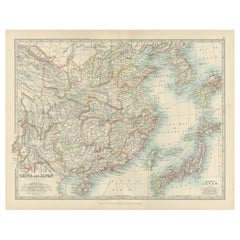
Antique Map of China, Taiwan, Korea, Hong-Kong and Japan, 1903
Located in Langweer, NL
Antique Map of China, Taiwan, Korea, Hong-Kong and Japan, 1903
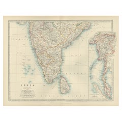
Description: This antique map, titled "India (Southern Sheet) and the South Eastern Provinces," was engraved and publi...
Category
Early 20th Century Maps
Materials
Paper
Antique Map of Southern India and South Eastern Provinces, 1903
Located in Langweer, NL
Title: Antique Map of Southern India and South Eastern Provinces, 1903, with Intricate Detail
Description:
This antique map, titled "India (Southern Sheet) and the South Eastern Pro...
Category
Early 20th Century Maps
Materials
Paper
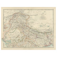
Antique Map of Northern India, Featuring Boundaries & Himalayan Detail, 1903
Located in Langweer, NL
Antique Map of Northern India, 1903, Featuring Provincial Boundaries and Himalayan Detail
This antique map, titled "India (Northern Sheet)," was engraved and published in 1903 by W....
Category
Early 20th Century Maps
Materials
Paper
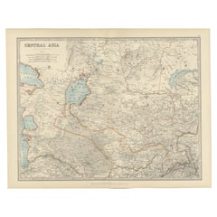
Antique Map of Central Asia - Featuring the Caspian Sea and Silk Road Regions
Located in Langweer, NL
Antique Map of Central Asia, 1903, Featuring the Caspian Sea and Silk Road Regions
This antique map, titled "Central Asia," was engraved and published in 1903 by W. & A.K. Johnston ...
Category
Early 20th Century Maps
Materials
Paper
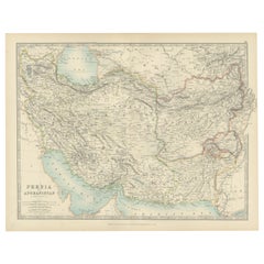
Antique Map of Persia and Afghanistan, 1903, with Delicate Pastel Borders
Located in Langweer, NL
Title: Antique Map of Persia and Afghanistan, 1903, with Delicate Pastel Borders and Detailed Topography
Description:
This antique map, titled "Persia and Afghanistan," was engraved...
Category
Early 20th Century Maps
Materials
Paper
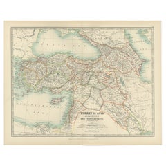
Antique Map of Turkey in Asia (Asia Minor and Transcaucasia), 1903
Located in Langweer, NL
Antique Map of Turkey in Asia (Asia Minor and Transcaucasia), 1903, with Intricate Provincial Borders
This antique map, titled "Turkey in Asia (Asia Minor) and Transcaucasia," was e...
Category
Early 20th Century Maps
Materials
Paper
Antique Map of Asia with Intricate Provincial Boundaries, Published in 1903
Located in Langweer, NL
Title: Antique Map of Asia, 1903, with Intricate Provincial Boundaries and Coastal Features
Description:
This antique map, titled "Asia," was engraved and published in 1903 by the r...
Category
Early 20th Century English Maps
Materials
Paper
Antique Map of European Russia, 1903, with Colorful Provincial Boundaries
Located in Langweer, NL
Title: Antique Map of European Russia, 1903, with Colorful Provincial Boundaries
Description:
This antique map, titled "European Russia," was engraved and published in 1903 by W. & ...
Category
Early 20th Century Maps
Materials
Paper
Antique Map of Sweden & Norway, 1903, with Intricate Topographical Detail
Located in Langweer, NL
Title: Antique Map of Sweden & Norway, 1903, with Intricate Topographical Detail
Description:
This antique map, titled "Sweden & Norway (Scandinavia)," was engraved and published in...
Category
Early 20th Century Maps
Materials
Paper
Antique Map of Greece and the Cyclades, 1903, with Many Details and Inset Maps
Located in Langweer, NL
Title: Antique Map of Greece and the Cyclades, 1903, with Intricate Detail and Inset Maps
Description: This antique map, titled "Greece with Its Islands, Including the Cyclades," wa...
Category
Early 20th Century Maps
Materials
Paper
Antique Map of Turkey in Europe, 1903, with Delicate Pastel Coloration
Located in Langweer, NL
Title: Antique Map of Turkey in Europe, 1903, with Delicate Pastel Coloration
Description:
This antique map, titled "Turkey in Europe," was engraved and published in 1903 by the dis...
Category
Early 20th Century Maps
Materials
Paper
Antique Map of the Austro-Hungarian Monarchy, 1903, with Colorful Borderlines
Located in Langweer, NL
Title: Antique Map of the Austro-Hungarian Monarchy, 1903, with Colorful Provincial Borders
Description:
This antique map, titled "Austro-Hungarian Monarchy," was engraved and publi...
Category
Early 20th Century Maps
Materials
Paper
Antique Map of the German Empire, 1903, Northern Portion with Coastal and Inland
Located in Langweer, NL
Title: Antique Map of the German Empire, 1903, Northern Portion with Coastal and Inland Detail
Description:
This antique map, titled "Empire of Germany (Northern Portion)," was engr...
Category
Early 20th Century Maps
Materials
Paper
Antique Map of the German Empire, 1903, with Intricate Provincial Boundaries
Located in Langweer, NL
Title: Antique Map of the German Empire, 1903, with Intricate Provincial Boundaries
Description:
This antique map, titled "Empire of Germany (Southern Portion)," was engraved and pu...
Category
Early 20th Century Maps
Materials
Paper
Antique Map of Denmark and German Empire Regions, 1903, Intricate and Colorful
Located in Langweer, NL
Title: Antique Map of Denmark and German Empire Regions, 1903, Intricate and Colorful
Description:
This antique map, titled "Denmark with North West Portions of the German Empire," ...
Category
Early 20th Century Maps
Materials
Paper
Antique Map of Belgium and The Netherlands with Delicate Pastel Coloration, 1903
Located in Langweer, NL
Antique Map of Belgium and The Netherlands, 1903, with Delicate Pastel Coloration
This antique map, titled "Belgium and The Netherlands," was engraved and published in 1903 by the d...
Category
Early 20th Century Maps
Materials
Paper
Antique Map of Switzerland and the Alps of Savoy & Piedmont, 1903 Edition
Located in Langweer, NL
Title: Antique Map of Switzerland and the Alps of Savoy & Piedmont, 1903, with Intricate Topographical Detail
Description:
This beautifully engraved antique map, titled "Switzerland...
Category
Early 20th Century Maps
Materials
Paper
Antique Map of the Mediterranean Basin, 1903, with Detailed Coastal and Inland
Located in Langweer, NL
Title: Antique Map of the Mediterranean Basin, 1903, with Detailed Coastal and Inland Geography
Description: This antique map, titled "Basin of the Mediterranean," was engraved and ...
Category
Early 20th Century Maps
Materials
Paper
Antique Map of Spain and Portugal, 1903, Regional Boundaries and Coastal Detail
Located in Langweer, NL
Antique Map of Spain and Portugal, 1903, Featuring Regional Boundaries and Coastal Detail
Description: This antique map, titled "Spain & Portugal," was engraved and published in 190...
Category
Early 20th Century Maps
Materials
Paper
Antique Map of France, 1903, with Inset of Paris and Corsica
Located in Langweer, NL
Title: Antique Map of France, 1903, with Inset of Paris and Corsica
Description:
This antique map, titled "France," was engraved and published in 1903 by the renowned W. & A.K. John...
Category
Early 20th Century Maps
Materials
Paper
Antique Map of Ireland, 1903, with Intricate County Boundaries & Coastal Details
Located in Langweer, NL
Title: Antique Map of Ireland, 1903, with Intricate County Boundaries and Coastal Detail
Description:
This antique map of Ireland, engraved and published in 1903 by the esteemed W. ...
Category
Early 20th Century Maps
Materials
Paper
Antique Map of Southern Scotland, 1903, with Coastal and Inland Details
Located in Langweer, NL
Title: Antique Map of Southern Scotland, 1903, with Coastal and Inland Details
Description:
This exquisite antique map, titled "Scotland (Southern Sheet I)," was engraved and publis...
Category
Early 20th Century Maps
Materials
Paper
Antique Map of Northern Scotland, 1903, with Intricate Coastal Features
Located in Langweer, NL
Title: Antique Map of Northern Scotland and Islands, 1903, with Intricate Coastal Features
Description:
This striking antique map, titled "Scotland (Northern Sheet I)," was engraved...
Category
Early 20th Century Maps
Materials
Paper
Antique Map of Southern England & Wales, 1903, with Coastal Details and Railways
Located in Langweer, NL
Title: Antique Map of Southern England and Wales, 1903, with Coastal Details and Railways
Description:
This detailed antique map, titled "England and Wales (Southern Sheet I)," was ...
Category
Early 20th Century Maps
Materials
Paper
Antique Map of England and Wales, 1903, with Detailed Counties and Railways
Located in Langweer, NL
Title: Antique Map of England and Wales, 1903, with Detailed Counties and Railways
Description:
This beautifully detailed antique map, titled "England and Wales," was engraved and p...
Category
Early 20th Century Maps
Materials
Paper
Antique Map of Europe, 1903, with Intricate Political Boundaries and Rich Detail
Located in Langweer, NL
Title: Antique Map of Europe, 1903, with Intricate Political Boundaries and Rich Detail
Description:
This antique map, titled "Europe," is a finely engraved and beautifully colored ...
Category
Early 20th Century Maps
Materials
Paper
Antique World Map on Mercator's Projection, Ocean Currents and Trade Routes 1903
Located in Langweer, NL
Title: Antique World Map on Mercator's Projection, 1903, Showing Ocean Currents and Trade Routes
Description:
This antique map, titled "Chart of the World on Mercator's Projection,"...
Category
Early 20th Century Maps
Materials
Paper
Antique World Map in Hemispheres with Delicate Pastel Coloring, 1903
Located in Langweer, NL
Title: Antique World Map in Hemispheres with Delicate Pastel Coloring, 1903
Description:
This stunning antique map, titled "The World in Hemispheres," dates back to 1903 and offers ...
Category
Early 20th Century Maps
Materials
Paper
Vintage North Polar Chart Featuring Arctic Exploration Routes, 1903
Located in Langweer, NL
Title: Vintage North Polar Chart Featuring Arctic Exploration Routes, 1903
This vintage map titled "North Polar Chart" offers a fascinating glimpse into early 20th-century Arctic ex...
Category
Early 20th Century Maps
Materials
Paper
Dutch City Plan of Sloten in Friesland by N. Van Geelkercken, hand-colored 1616
Located in Langweer, NL
Bird’s-Eye View of Sloten in Friesland by Nicolaes van Geelkercken, ca. 1616
This captivating hand-colored engraving presents an early 17th-century bird’s-eye view of the fortified ...
Category
Antique 1610s Dutch Maps
Materials
Paper
Dutch City Plan of Workum in Friesland by N. Van Geelkercken, hand-colored 1616
Located in Langweer, NL
Workum in Friesland by Nicolaes van Geelkercken, hand-colored map ca. 1616
This beautifully hand-colored engraving titled 'Worcum' presents an early 17th-century bird’s-eye view of ...
Category
Antique 1610s Dutch Maps
Materials
Paper
Map of the Persian Empire by Nicolas Sanson, Hand-colored, circa 1683
Located in Langweer, NL
Map of the Persian Empire by Nicolas Sanson, hand-colored, circa 1683
This finely detailed and delicately hand-colored map titled *L'Empire du Sophy des Perses* presents a late 17th...
Category
Antique 1680s Maps
Materials
Paper
Rare 1670 Map of Tartary by Richard Blome after Sanson, Hand-colored Engraving
Located in Langweer, NL
Rare 1670 Map of Tartary by Richard Blome after Sanson, hand-colored engraving
This striking and highly decorative map, titled *A Generall Mapp of the Kingdome of Tartaria*, was pub...
Category
Antique 1670s Maps
Materials
Paper
Germany and the Borders of Empire: Bodenehr’s Map of the Holy Roman World, 1710
Located in Langweer, NL
Title:
Germany and Surrounding Realms by Gabriel Bodenehr, circa 1710
This striking copperplate engraving, titled "S. Imperium Romano-Germanicum, Teutschland mit Seinen Angräntzende...
Category
Antique 1710s Maps
Materials
Paper
Map of the Kingdom of Württemberg, Oberamt Tettnang in Germany, circa 1885
Located in Langweer, NL
Administrative Map of the Kingdom of Württemberg, Oberamt Tettnang, circa 1885
This detailed antique map titled "Handkarte von dem Königl. Württ. Oberamt Tettnang" was created by G....
Category
Antique 1880s Maps
Materials
Paper
Antique Map of the West-Frisian Part of Independant Friesland by Halma, 1718
Located in Langweer, NL
Antique map Friesland titled 'Pars I Frisiae Liberae (..)'. Old map of Friesland, the Netherlands. This map depicts the West-Frisian part of independant Friesland. Originates from 'U...
Category
Antique 18th Century Maps
Materials
Paper
Antique Map of the West-Frisian part of independent Friesland by Halma, 1718
Located in Langweer, NL
Antique map Friesland titled 'ars I. Frisiae Liberae quae Westfresia post eluviones seculi XIII (..)'. Old map of the West-Frisian part of the independent Friesland, the Netherlands ...
Category
Antique 18th Century Maps
Materials
Paper
1876 Map of the United States: Detailing the Railroads and Unsettled Territories
Located in Langweer, NL
Stanford’s Smaller Railway Map of the United States, 1876
This original 1876 map, titled "Stanford's Smaller Railway Map of the United States Distinguishing the Unsettled Territorie...
Category
Antique 1870s Maps
Materials
Paper
Historic 1864 Civil War Era Map of Canada with Great Lakes Detail
Located in Langweer, NL
Title: Rare 1864 Civil War Era Map of Canada with Great Lakes Detail
Description: This finely detailed antique map, titled "Johnson's Canada," was published in 1864 by Johnson and W...
Category
Antique 1860s Maps
Materials
Paper
Historic 1864 Civil War Map of Pennsylvania and New Jersey with Coastal Focus
Located in Langweer, NL
Title: Historic 1864 Civil War Map of Pennsylvania and New Jersey with Coastal Focus
Description: This meticulously crafted antique map, titled "Johnson's Pennsylvania and New Jerse...
Category
Antique 1860s Maps
Materials
Paper
Historic 1864 Civil War Map of Georgia and Alabama with Coastal Focus
Located in Langweer, NL
Title: Historic 1864 Civil War Map of Georgia and Alabama with Coastal Focus
Description: This intricately detailed antique map, titled "Johnson's Georgia and Alabama," was publishe...
Category
Antique 1860s Maps
Materials
Paper
Decorative 1864 Civil War Era Map of Indiana with Lake Michigan Detail
Located in Langweer, NL
Title: Rare 1864 Civil War Era Map of Indiana with Lake Michigan Detail
Description: This finely detailed antique map, titled "Johnson's Indiana," was published in 1864 by Johnson a...
Category
Antique 1860s Maps
Materials
Paper
Rare 1864 Civil War Era Map of Illinois with Lake Michigan Detail
Located in Langweer, NL
Title: Rare 1864 Civil War Era Map of Illinois with Lake Michigan Detail
Description: This intricately detailed antique map, titled "Johnson's Illinois," was published in 1864 by Jo...
Category
Antique 1860s Maps
Materials
Paper
Rare 1864 Civil War Era Map of Michigan and Wisconsin with Great Lakes Detail
Located in Langweer, NL
Title: Rare 1864 Civil War Era Map of Michigan and Wisconsin with Great Lakes Detail
Description: This beautifully crafted antique map, titled "Johnson's Michigan and Wisconsin," wa...
Category
Antique 1860s Maps
Materials
Paper
Rare 1864 Civil War Era Map of Vermont, New Hampshire, and Southern New England
Located in Langweer, NL
Title: Rare 1864 Civil War Era Map of Vermont, New Hampshire, and Southern New England
Description: This finely detailed antique map, titled "Johnson's Vermont, New Hampshire, Massa...
Category
Antique 1860s Maps
Materials
Paper
Rare 1864 Civil War Era Map of Massachusetts, Connecticut, and Rhode Island
Located in Langweer, NL
Title: Rare 1864 Civil War Era Map of Massachusetts, Connecticut, and Rhode Island
Description: This exquisite antique map, titled "Johnson's Massachusetts, Connecticut, and Rhode I...
Category
Antique 1860s Maps
Materials
Paper
Rare 1864 Civil War Era Map of North America with Detailed Borders
Located in Langweer, NL
Title: Rare 1864 Civil War Era Map of North America with Detailed Borders
Description: This remarkable antique map, titled "Johnson's North America," was published in 1864 by Johnso...
Category
Antique 1860s Maps
Materials
Paper
Rare 1864 Civil War Era Map of Arkansas, Mississippi, and Louisiana
Located in Langweer, NL
Title: Rare 1864 Civil War Era Map of Arkansas, Mississippi, and Louisiana
Description: This captivating antique map, titled "Johnson's Arkansas, Mississippi, and Louisiana," was pu...
Category
Antique 1860s Maps
Materials
Paper
Civil War Era Map of Kentucky and Tennessee with Scenic Insets, Published 1864
Located in Langweer, NL
Rare 1864 Civil War Era Map of Kentucky and Tennessee with Scenic Insets
Description: This stunning antique map, titled "Johnson's Kentucky and Tennessee," was published in 1864 by ...
Category
Antique 1860s Maps
Materials
Paper
Rare 1864 Ohio Civil War Era Map with State Capitol Illustration
Located in Langweer, NL
Title: Johnson's Ohio Antique Map by Johnson and Ward, 1864
Description: This exquisite antique map, titled "Johnson's Ohio," was published in 1864 by Johnson and Ward, a prominent ...
Category
Antique 1860s Maps
Materials
Paper
Historic Map of Missouri and Kansas Showing Railroads and Frontier Trails, 1864
Located in Langweer, NL
Antique 1864 Map of Missouri and Kansas by Johnson and Ward
Description:
This finely detailed and vibrantly hand-colored map of Missouri and Kansas, publ...
Category
Antique 1860s Maps
Materials
Paper
Antique Map of the Western Hemisphere by Lapie, France, circa 1830
Located in Langweer, NL
Antique Map of the Western Hemisphere by Lapie, France, circa 1830
This beautifully engraved and delicately hand-colored map, titled Hémisphère du Nouveau Continent (Ouest), depict...
Category
Antique 1830s Maps
Materials
Paper
Antique Map of the Eastern Hemisphere by Lapie, France, circa 1830
Located in Langweer, NL
Antique Map of the Eastern Hemisphere by Lapie, France, circa 1830
This finely engraved and hand-colored antique map, titled Hémisphère de l'ancien continent (Eastern Hemisphere), w...
Category
Antique 1830s Maps
Materials
Paper
Beautiful 17th Century Map of Paris and Isle de France by Templeux, c.1650
Located in Langweer, NL
Map of Isle de France by D. de Templeux, ca. 1650, Hand-Colored and Decorative
This richly detailed antique map titled *Le Gouvernement de L'Isle de France* was engraved by Daniel d...
Category
Antique 1650s Maps
Materials
Paper
Map of Blaisois by Janssonius, 1633, Decorative Antique Map of Loire Valley
Located in Langweer, NL
Map of Blaisois by Janssonius, 1633, Decorative Antique Map of Loire Valley
This finely detailed and colorfully embellished map titled 'Description du Blaisois' was published in 163...
Category
Antique 1630s Maps
Materials
Paper
Original Normandy Map by Frederick de Wit, 1705, with Inset of Channel Islands
Located in Langweer, NL
Normandy Map by Frederick de Wit, 1705, with Inset of Channel Islands
Description:
This beautifully engraved and hand-colored map, titled Duché et Gouvernement General de Normandie,...
Category
Antique Early 1700s Maps
Materials
Paper
Map of Le Maine by H. Hondius, 1633, Hand-Colored, Decorative and Historic
Located in Langweer, NL
Map of Le Maine by H. Hondius, 1633, Hand-Colored, Decorative and Historic
This rare and beautifully executed antique map titled 'Le Maine' was published in 1633 by Henricus Hondius...
Category
Antique 1630s Maps
Materials
Paper
Antique Map of Cyprus (Cypern) from Meyer's Lexikon, Leipzig, circa 1890
Located in Langweer, NL
Antique Map of Cyprus (Cypern) from Meyer's Lexikon, Leipzig, circa 1890
This finely detailed antique map titled "Cypern" presents the island of Cyprus as it appeared in the late 19...
Category
Antique 1890s Maps
Materials
Paper
Friesland, Groningen and Overijssel – Rare Woodcut Map by Münster, c. 1550
Located in Langweer, NL
Frisia, Groningen and Overijssel – Rare Woodcut Map by Münster, c. 1550, Germany
This highly decorative 16th-century woodcut map titled “Von dem Teutschen Land: Seelentfrie” was pub...
Category
Antique 16th Century Maps
Materials
Paper
1756 Map of Brazil from Bahia to São Paulo by Bellin – French Colonial Engraving
Located in Langweer, NL
Antique Map of Brazil from Bahia to São Paulo – Bellin for L'Histoire des Voyages
This elegant 18th-century French map titled "Suite du Bresil, Depuis la Baie de Tous les Saints jus...
Category
Antique 1750s Maps
Materials
Paper
