Bartele Gallery Maps
to
4,198
5,088
5,087
1
2,799
1,981
307
1
179
6
68
3
3
3
2
5,083
9
7
2
1
363
128
77
77
46
5,088
5,088
5,088
104
59
20
14
13
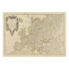
Europe Divided into Principal States by Jean Denis Janvier, Paris, 1782
Located in Langweer, NL
This is a historical map of Europe titled "L'Europe divisee en ses Principaux Etats," created by Jean Denis Janvier in 1782.
This beautiful map depicts the political boundaries and...
Category
Antique 1780s Maps
Materials
Paper
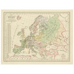
Antique Map of Europe in the 12th Century - Malte-Brun & Sarrazin, 1880
Located in Langweer, NL
Title: Antique Map of Europe in the 12th Century - Malte-Brun & Sarrazin, 1880
Description: This is an antique map titled "Europe en 1100," depicting Europe as it was around the 12...
Category
Antique 1880s Maps
Materials
Paper
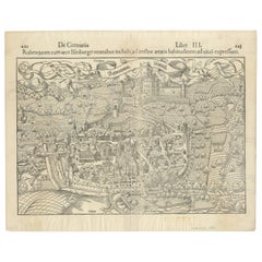
Early Woodcut Bird's Eye View of Rouffach, France, by Sebastian Münster, 1554
Located in Langweer, NL
Early Woodcut Bird's Eye View of Rouffach, France, by Sebastian Münster, 1554
Description: This rare 1554 woodcut is a bird's eye view of Rouffach, a town in the Haut-Rhin departmen...
Category
Antique 16th Century Maps
Materials
Paper
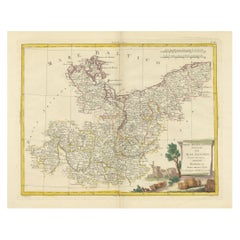
Vibrant 1782 Map of Northern Upper Saxony and Baltic Coast by Antonio Zatta
Located in Langweer, NL
This map is titled "Parte Settentrionale del Circolo dell'Alta Sassonia" and was created by Pietro Antonio Zatta in 1782. It is a beautifully colored copperplate engraving, depicting...
Category
Antique 1780s Maps
Materials
Paper
A Stunning 1744 Bowen Map: South East Germany & Queen of Hungary’s Dominions
Located in Langweer, NL
Title: A New and Correct Map of the South East part of Germany, 1744
This map by Emanuel Bowen, dating to around 1744, beautifully captures the southeastern part of Germany. The det...
Category
Antique 1740s Maps
Materials
Paper
Dresden Germany, Old Town Plan by Baldwin & Cradock 1833
Located in Langweer, NL
Dresden, depicted in this antique map by Baldwin & Cradock from 1833, was a historically significant city in Saxony, Germany. This map, published under the supervision of the Society...
Category
Antique 1830s Maps
Materials
Paper
Early Woodcut Map of Franconia and Surrounding Regions, 1628
Located in Langweer, NL
Title: Early Woodcut Map of Franconia and Surrounding Regions, 1628
Franconia (Franckenlande) is a region in Germany. Historically, Franconia was a significant part of the Holy Roma...
Category
Antique 1620s Maps
Materials
Paper
Rare Engraved City Plan of Nuremberg, Bavaria by Christoph Weigel, 1718
Located in Langweer, NL
Title: Rare Engraved City Plan of Nuremberg, Bavaria by Christoph Weigel, 1718
Description:
This detailed city plan of Nuremberg, Bavaria was crafted by Christoph Weigel in 1718 an...
Category
Antique 1710s Maps
Materials
Paper
Woodcut Map of the Rhine River Region Covering the Palatinate, Austria and Elsa
Located in Langweer, NL
Early Woodcut Map of the Rhine River Region Covering the Palatinate, Austria, and Elsass, ca. 1628
This early woodcut map, titled "Die ander Tafel des Rheinstromes/begriffen die Pfa...
Category
Antique 1620s Maps
Materials
Paper
Early Woodcut Map of Swabia and Bavaria in Germany, 1628
Located in Langweer, NL
Title: Early Woodcut Map of Swabia and Bavaria, 16th Century
This early woodcut map titled "Schwaben und Bayernlande / Darbey auch begreiffen der Oenwaldt / Nordgaw / etc." provides...
Category
Antique 1620s Maps
Materials
Paper
Ornate Hand-Colored Map of Germany by John Tallis with Vignettes, ca. 1850
Located in Langweer, NL
Title: Hand-Colored Map of Germany by J. Tallis, ca. 1850
This beautifully hand-colored map of Germany, published by John Tallis & Co. around 1850, provides a comprehensive depictio...
Category
Antique 1850s Maps
Materials
Paper
Early Woodcut Map of the Rhine River Region in Germany and Holland, circa 1628
Located in Langweer, NL
Early Woodcut Map of the Rhine River Region, "Die Dritte Tafel des Rheinstroms," ca. 16th Century
This early woodcut map, titled "Die Dritte Tafel des Rheinstroms Innhaltend das Nid...
Category
Antique 1620s Maps
Materials
Paper
Decorative Hand-Colored Map of Germany by Nicolas Sanson, 1648
Located in Langweer, NL
Title: Hand-Colored Map of Germany by Nicolas Sanson, 1648
This hand-colored map, titled "Allemagne," was created by Nicolas Sanson, a prominent 17th-century French cartographer and...
Category
Antique 1640s Maps
Materials
Paper
Hand-Colored City Plan of Cologne by Nicolas de Fer, 1705
Located in Langweer, NL
Title: Hand-Colored City Plan of Cologne by Nicolas de Fer, 1705
This hand-colored map, titled "Cologne Ville Considerable Situee sur le Bord Occidentale du Rhein Capit. de l'Electo...
Category
Antique Early 1700s Maps
Materials
Paper
Original Antique Map of Munich, Germany by J. Stockdale, 1800
Located in Langweer, NL
Title: Vintage Map of Munich, Germany by J. Stockdale, 1800
This vintage map, titled "A Plan of the City of Munich," was published by J. Stockdale in Piccadilly, London, in 1800. Th...
Category
Antique Early 1800s Maps
Materials
Paper
Decorative Map of Hanover, Lower Saxony by Lodge, ca. 1785
Located in Langweer, NL
Title: Decorative Map of Hanover, Lower Saxony by Lodge, ca. 1785
This decorative map, titled "A New & Correct Plan of Hanover, a City in the circle of Lower Saxony," was engraved b...
Category
Antique 1780s Maps
Materials
Paper
Original Antique Map of Dresden, Germany by J. Stockdale, 1800
Located in Langweer, NL
Vintage Map of Dresden, Germany by J. Stockdale, 1800
This vintage map titled "A Plan of the City of Dresden" was published by J. Stockdale in Piccadilly, London, in 1800. It provid...
Category
Antique Early 1800s Maps
Materials
Paper
Antique Map of Mecklenburg-Vorpommern in Germany by J.B. Homann, c.1720
Located in Langweer, NL
Antique Map of Mecklenburg-Vorpommern by J.B. Homann, c.1720
Old colored antique map of Mecklenburg-Vorpommern by Johann Baptist Homann. This stunning map, titled "Ducatus Meklenbur...
Category
Antique 1720s Maps
Materials
Paper
$513 Sale Price
20% Off
Bishopric of Hildesheim Map in Northern Germany by Willem & Joan Blaeu, 1645
Located in Langweer, NL
This beautifully hand-colored map, titled "Episcopatus Hildesiensis Descriptio Novissima," depicts the Bishopric of Hildesheim, a historical ecclesiastical territory in present-day L...
Category
Antique 1640s Maps
Materials
Paper
$494 Sale Price
20% Off
Historic Map of the Bishopric of Paderborn by Blaeu, a Masterpiece of 1645
Located in Langweer, NL
This hand-colored map, titled "Paderbornensis Episcopatus Descriptio Nova," depicts the Bishopric of Paderborn, a historical ecclesiastical territory within the Holy Roman Empire, lo...
Category
Antique 1640s Maps
Materials
Paper
$494 Sale Price
20% Off
Bird's-Eye View of Blâmont in Lorraine by Braun and Hogenberg, 1597
Located in Langweer, NL
Title: Bird's-Eye View of Blâmont in Lorraine by Braun and Hogenberg, 1597
This copperplate engraving, published in 1597 by Braun and Hogenberg, depicts a bird's-eye view of the t...
Category
Antique 16th Century Maps
Materials
Paper
$399 Sale Price
30% Off
Bird's-Eye Views of Dunkerque, Gravelines, and Bourbourg by Braun and Hogenberg
Located in Langweer, NL
Bird's-Eye Views of Dunkerque, Gravelines, and Bourbourg by Braun and Hogenberg, 1597
This antique print, published in 1597 by Braun and Hogenberg, showcases three detailed bird's...
Category
Antique 16th Century Maps
Materials
Paper
$456 Sale Price
20% Off
1876 Antique Map of New York State with Niagara and Hudson River Insets
Located in Langweer, NL
Title: Detailed Map of New York State - 1876 by Samuel Augustus Mitchell Jr.
Description: This is a hand-colored map of the state of New York from 1876, created by Samuel Augustus ...
Category
Antique 1870s Maps
Materials
Paper
$209 Sale Price
20% Off
1864 Johnson's Map of the West Indies and Bermuda
Located in Langweer, NL
Title: 1864 Johnson's Map of the West Indies and Bermuda
Description: This is an 1864 map titled "Johnson's West Indies," published by Johnson and Ward. The map provides a detailed ...
Category
Antique 1860s Maps
Materials
Paper
$304 Sale Price
20% Off
1862 Johnson's Map of the Vicinity of Richmond & Peninsular Campaign, Virginia
Located in Langweer, NL
Title: 1862 Johnson's Map of the Vicinity of Richmond & Peninsular Campaign, Virginia
Description: This 1862 map titled "Johnson's Map of the Vicinity of Richmond and Peninsular Cam...
Category
Antique 1860s Maps
Materials
Paper
$304 Sale Price
20% Off
1864 Johnson's Map of Virginia, Delaware, and Maryland with Fort Monroe Inset
Located in Langweer, NL
Title: 1864 Johnson's Map of Virginia, Delaware, and Maryland with Fort Monroe Inset
Description: This 1864 map titled "Johnson's Virginia, Delaware, and ...
Category
Antique 1860s Maps
Materials
Paper
$285 Sale Price
20% Off
1864 Johnson's Map of New York State with City Insets
Located in Langweer, NL
Title: 1864 Johnson's Map of New York State with City Insets
Description: This 1864 map, titled "Johnson's New York," was published by Johnson and Ward and features a detailed depic...
Category
Antique 1860s Maps
Materials
Paper
$266 Sale Price
20% Off
1862 Johnson's Map of New York State by Johnson & Browning
Located in Langweer, NL
Title: 1862 Johnson's Map of New York State by Johnson & Browning
Description:This is an 1862 map of New York State, titled "Johnson's New York," created by Johnson & Browning. The ...
Category
Antique 1860s Maps
Materials
Paper
$266 Sale Price
20% Off
1855 Colton's Map of Patagonia with South Atlantic Islands Insets
Located in Langweer, NL
Title: 1855 Colton's Map of Patagonia with South Atlantic Islands Insets
Description: This is an 1855 map titled "Colton's Patagonia," published by J.H. Colton & Co. in New York. Th...
Category
Antique 1850s Maps
Materials
Paper
$190 Sale Price
42% Off
1874 Map of the United States with Territorial Boundaries
Located in Langweer, NL
Title: 1874 Map of the United States with Territorial Boundaries
Description: This is an 1874 map titled "Map of the United States," showcasing the country during a period of rapid ...
Category
Antique 1870s Maps
Materials
Paper
$247 Sale Price
20% Off
Antique Map of the Spice Islands 'Moluccas', Indonesia by W. Blaeu, circa 1640
By Willem Blaeu
Located in Langweer, NL
Antique map titled 'Moluccae Insulae Celeberrimae'. Highly decorative antique map of the Spice Islands (Moluccas) published by W. Blaeu (circa 1640). This map features a large inset ...
Category
Antique Mid-17th Century Maps
Materials
Paper
The Antient City of Jerusalem and Places Adjacent, Hand-Colored Map, 1699
Located in Langweer, NL
Title: "1699 Hand-Colored Bird's-Eye Plan of Jerusalem with Ancient and Biblical Landmarks"
This beautifully hand-colored, imaginary bird's-eye plan of Jerusalem, published in 1699,...
Category
Antique 1690s Maps
Materials
Paper
$247 Sale Price
20% Off
1640 Map of North Africa Nova Barbariae Descriptio or The Barbarian Coast
Located in Langweer, NL
1640 Antique Map of North Africa 'Nova Barbariae Descriptio' by Johannes Janssonius
This antique map titled Nova Barbariae Descriptio*, published by Johannes Janssonius around 1640,...
Category
Antique 1640s Maps
Materials
Paper
$456 Sale Price
20% Off
1684 Mallet Map of Amazon River & Kingdom of Amazons – Hand Colored, Miniature
Located in Langweer, NL
This map, titled 'Royaume des Amazones', was created by Alain Manesson Mallet and published in 1684 in a German edition of *Beschreibung des Gantzen Welt-Kreisses*, a renowned work d...
Category
Antique 1680s Maps
Materials
Paper
$418 Sale Price
20% Off
Map of Groningen from The Genealogy of the Illustrious Counts of Nassau (1615)
Located in Langweer, NL
Title: Map of Groningen from "The Genealogy of the Illustrious Counts of Nassau" (1615)
Description: This antique map, titled "Gronenga," offers a detailed depiction of the forti...
Category
Antique 1610s Maps
Materials
Paper
$522 Sale Price
20% Off
Map of Friesland (La Frise), from "Atlas Nouveau Portatif" (1756)
Located in Langweer, NL
Title: Map of Friesland (La Frise), from "Atlas Nouveau Portatif" (1756)
This is an 18th-century map of Friesland (Frise), a northern province of the Netherlands, engraved by *Georg...
Category
Antique 1750s Maps
Materials
Paper
$275 Sale Price
20% Off
1930s AM Radio Map of US, Canada, Cuba, Mexico – Stations & Frequencies
Located in Langweer, NL
Title: 1930s Lewis Bros. Limited Detailed Radio Station Map of the United States and Canada – AM Stations, Call Signs, Frequencies, Vintage Advertising
Detailed Description: This v...
Category
Vintage 1930s Maps
Materials
Paper
$941 Sale Price
20% Off
1849 Hand-Colored Map of Fort Smith to Santa Fe Route, Detailing Trails & Camps
Located in Langweer, NL
Map Title: Map, No. 3, Showing Continuation of Details of Fort Smith and Santa Fe Route, from Mounds Near the 100½ Degree of W. Longitude to Tucumcari Creek
Cartographer: James H....
Category
Antique 1840s Maps
Materials
Paper
$399 Sale Price
20% Off
1667 Melchior Tavernier Map of the Patriarchate of Constantinople – Black Sea
Located in Langweer, NL
This 1667 map titled "Patriarchatus Constantinopolitani Geographica Descriptio" was crafted by renowned French cartographer Melchior Tavernier, who was a prominent map engraver during the 17th century. This rare and historically significant map focuses on the territories under the ecclesiastical jurisdiction of the Patriarchate of Constantinople, one of the most important centers of the Eastern Orthodox Church.
It covers regions around the Black Sea (Pontus Euxinus), parts of Greece, and adjacent areas in Asia Minor and the Balkans, which were historically vital during the Byzantine and Ottoman Empires. The map is filled with ancient place names, making it a valuable resource for both historical and cartographic enthusiasts.
Key Features:
- Antique ecclesiastical map illustrating the influence of the Orthodox Patriarchate of Constantinople in the 17th century.
- Features beautifully detailed ancient coastlines, rivers, and terrains, providing a comprehensive geographical view of the region.
- Rich with historic place names - like Byzantium, Nicomedia, Nicaea, Cyzicus, Bithynia, Pontus, Macedonia, and Thrace - that date back to the classical era, offering insights into the ancient geography of the eastern Mediterranean.
- A finely engraved strapwork cartouche in the lower right corner with Baroque-style decoration, featuring two putti (cherubic figures) – a hallmark of 17th-century map art.
- The map extends to include the Mediterranean Sea (Mare Mediterraneum) to the south and the Black Sea to the north, highlighting its ecclesiastical and geopolitical significance.
- Original hand coloring may still be present, enhancing the decorative appeal for collectors of antique maps.
This rare map offers a unique perspective on the religious influence and historical geography of the Eastern Mediterranean during the late 17th century. It would appeal to collectors interested in:
- **Byzantine history**
- **Ottoman Empire**
- **Eastern Orthodox Church**
- **Antique cartography...
Category
Antique 1660s French Maps
Materials
Paper
$648 Sale Price
30% Off
1645 Blaeu Map of Westmorland, Northern England – Hand Colored, Decorative
Located in Langweer, NL
This map, "Westmoria Comitatus; Anglice Westmorland", was created by the esteemed Dutch cartographer Willem Blaeu and was published around 1645 in 'Le Theatre du Monde ou Nouvel Atlas'. It provides a detailed look at Westmorland, a historic county in northern England, based on John Speed’s earlier map. The map features numerous place names, parks, and estates, including Brigster Park, Colnhead Park, Crosbye, and Midleton, along with a detailed depiction of Windermere (spelled Wynandermere) and the surrounding regions.
Additional Features:
- Hand-colored map, with vibrant and detailed colors that bring out the topographical and decorative features.
- Includes intricate cartouches, such as the royal coat of arms, a decorative title cartouche topped with putti (cherubic figures), and six coats of arms (two left blank).
- Depicts the region’s rich landscape, including the rolling hills and mountainous terrain of northern England.
- French text on the verso, indicative of the publication period from 1645-1648, part of Blaeu’s highly sought-after atlases.
- Map shows precise details of small towns, estates, and parks, such as Brigster Park, Colnhead Park, Crosbye, and Wynandermere (now Windermere Lake).
This map would be of particular interest to collectors of English county maps, antique maps of northern England, 17th-century cartography, and the decorative works of Willem Blaeu. Blaeu's maps are renowned for their accuracy, artistic beauty, and historical significance.
Keywords: Willem Blaeu, Westmorland map, northern England, 17th-century map, antique map, English county map, John Speed, Windermere, decorative cartography, hand-colored map, rare map, antique cartography...
Category
Antique 1640s Maps
Materials
Paper
$1,188 Sale Price
20% Off
1817 Large Northern Hindostan Map by J. Thomson – New General Atlas
Located in Langweer, NL
1817 Thomson Map of Northern Hindoostan – Detailed British Cartography of India
This map, titled "A New Map of Hindoostan from the Latest Authorities," was drawn and engraved for Jo...
Category
Antique 1810s Maps
Materials
Paper
$503 Sale Price
20% Off
1816 Large Southern Hindostan Map by J. Thomson – New General Atlas
Located in Langweer, NL
Title: 1816 Southern Hindostan Map by J. Thomson – New General Atlas
This map, titled "Southern Hindostan," was published in 1816 as part of J. Thomson’s *New General Atlas*. The ma...
Category
Antique 1810s Maps
Materials
Paper
$503 Sale Price
20% Off
1808 C. Smith Map of Hindoostan – British India with Intricate Details
Located in Langweer, NL
Title: 1808 C. Smith Map of Hindoostan – British India with Intricate Details
This map, titled "Hindoostan," was published by C. Smith, a prominent London map seller, on January 6, ...
Category
Antique Early 1800s Maps
Materials
Paper
$370 Sale Price
20% Off
1806 John Cary Map of Hindoostan – Detailed British Cartography of India
Located in Langweer, NL
Title: 1806 John Cary Map of Hindoostan – Detailed British Cartography of India
This highly detailed map, titled "A New Map of Hindoostan from the Latest Authorities," was engraved ...
Category
Antique Early 1800s Maps
Materials
Paper
$513 Sale Price
20% Off
Battle of Wimpfen, 1622: Engraving by Matthäus Merian (ca. 1645)
Located in Langweer, NL
Title: Battle of Wimpfen, 1622: Engraving by Matthäus Merian (ca. 1645)
Description: This antique copper engraving, created by the renowned Swiss-German engraver Matthäus Merian aro...
Category
Antique 1640s Maps
Materials
Paper
$323 Sale Price
20% Off
16th-Century Panoramic View of Worms: A Woodcut from Sebastian Münster's
Located in Langweer, NL
This is a woodcut city view of Worms, published in Sebastian Münster's *Cosmographia* around 1578. The image depicts a bird's-eye view of the city of Worms, located in Rheinland-Pfal...
Category
Antique 16th Century Maps
Materials
Paper
$209 Sale Price
20% Off
Antique Map of Cities of the Province of Che-Kyang in China, 1738
Located in Langweer, NL
Antique print China titled 'Cities of the Province of Che-Kyang'. Old map depicting four walled cities of the Chinese Qing dynasty province of Che-Kiang (modern day CHEKIANG): Hang C...
Category
Antique 18th Century Maps
Materials
Paper
$332 Sale Price
20% Off
Map of French Colonies in the Americas: St. Martin, French Guiana and St. Pierre
Located in Langweer, NL
This is an intricately detailed map from 1852 titled *Colonies Françaises en Amérique*, depicting several key French colonies in the Americas.
The map focuses on regions such as Fr...
Category
Antique 1850s Maps
Materials
Paper
$180 Sale Price
20% Off
French Colonies in the Caribbean: Maps of Martinique and Guadeloupe (1852)
Located in Langweer, NL
This pair of maps, published in 1852, provides a detailed representation of the French Caribbean colonies, specifically Martinique and Guadeloupe. They were part of the *Atlas Univer...
Category
Antique 1850s Maps
Materials
Paper
$313 Sale Price / set
20% Off
18th Century Original Dutch Map of Martinique in The West Indies by Isaak Tirion
Located in Langweer, NL
This is an 18th-century Dutch map of Martinique, titled *Het Westindisch Eiland Martinique*. The map was produced by Isaak Tirion, a renowned Dutch cartographer and publisher known for his precise and beautifully crafted maps. The cartouche in the lower left corner, adorned with decorative elements, adds to the aesthetic appeal of the map.
### Key Features:
- Martinique: The map offers detailed topographical information of the island, including mountains, rivers, and settlements.
- Geographical Details: Locations such as Fort Royal, Bay de St. Pierre, and Point de Cloche are marked, showcasing significant features of the island.
- Cartouche: The ornate cartouche, featuring tropical plants, reflects the importance of the island's agricultural production during the colonial period, particularly its sugar plantations.
This map captures Martinique during its time as a French colony and provides valuable insight into the island’s layout and strategic significance in the Caribbean. The attention to coastal detail highlights the importance of Martinique as a hub of maritime activity.
The map’s combination of aesthetic elegance and cartographic precision makes it a remarkable piece for collectors and those interested in Caribbean colonial...
Category
Antique 1760s Maps
Materials
Paper
$418 Sale Price
20% Off
1821 Thomson Map of Guadeloupe, Marie-Galante and Antigua in the West Indies
Located in Langweer, NL
This map, published in 1821 by John Thomson, showcases Guadeloupe, Marie-Galante, and Antigua from the *West India Islands* collection. Part of Thomson's *New General Atlas*, it prov...
Category
Antique 1820s Maps
Materials
Paper
$551 Sale Price
20% Off
1825 Buchon Map of Puerto Rico & Virgin Islands with Detailed Colonial History
Located in Langweer, NL
This map of Puerto Rico and the Virgin Islands, published by Jean Alexandre Buchon in 1825, offers a unique look at the Caribbean during a time of E...
Category
Antique 1820s Maps
Materials
Paper
$437 Sale Price
20% Off
Hand-Colored Map of West India Islands: St. Christopher's, St. Lucia and Nevis
Located in Langweer, NL
This map, titled "West India Islands," was published by John Thomson & Co. in 1821 as part of *Thomson's New General Atlas.* The map offers detailed depictions of three key islands i...
Category
Antique 1820s Maps
Materials
Paper
$551 Sale Price
20% Off
Very Large Double Page Detailed Map of Italy and Surrounding Regions, 1794
Located in Langweer, NL
This is a large (two seperate sheets) and detailed map of Italy, including the southern parts of Germany, Dalmatia, the adjacent countries, and the Illyric Islands. The map is titled...
Category
Antique 1790s Maps
Materials
Paper
$1,891 Sale Price / set
20% Off
Large 1695 Hand-Colored Engraved Map of Gascony (Gascogna), France
Located in Langweer, NL
This map, created by Giacomo Cantelli da Vignola in 1695, represents the "General Government of Guyenne and Gascony" in southwest France. Cantelli da Vignola was a renowned Italian c...
Category
Antique 1690s Maps
Materials
Paper
$2,138 Sale Price
20% Off
Spectacular 1770 Bird's-Eye View of Dunkirk Harbor by Basset, with 66 Landmarks
Located in Langweer, NL
This engraving, titled *Vue de Dunkerque du coté de la Mer*, is a spectacular bird's-eye view of Dunkirk from the sea, published by Basset around 1770.
It provides a detailed panor...
Category
Antique 1770s Maps
Materials
Paper
$465 Sale Price
20% Off
Antique Map of Africa by Bordiga Fratelli 'circa 1818'
Located in Langweer, NL
Antique map titled 'Carta dell Africa'. Large and quite scarce Italian map of Africa, reflecting the then-current knowledge of the continent's geography, with large areas left comple...
Category
Antique Early 19th Century Maps
Materials
Paper
$1,711 Sale Price
20% Off
Large Wall Map of Europe by George Philip & Son, circa 1920
Located in Langweer, NL
Antique map titled 'Philips' New Commercial Map of Europe'. Very large wall map of Europe including the North African coast and Turkey. Decorative bord...
Category
Early 20th Century Maps
Materials
Linen, Paper
$2,079 Sale Price
30% Off
Antique Map of New England and Part of Canada by Vaugondy 'circa 1755'
Located in Langweer, NL
Antique map titled 'Partie de l'Amérique septent qui comprend la nouvelle France ou le Canada'. Decorative and highly detailed map of New England an...
Category
Antique Mid-18th Century Maps
Materials
Paper
$1,560 Sale Price
24% Off
Finely Detailed Map Covering Northern Italy, Austria, Slovenia & Croatia, c.1690
Located in Langweer, NL
Antique map titled 'Exactissima Tabula, qua tam Danubii Fluvii Pars Superior'.
Very finely detailed map covering the region of northern Italy, Austria, Slovenia and Croatia. The co...
Category
Antique 1690s Maps
Materials
Paper
$1,758 Sale Price
20% Off
