Country French Interiors Maps
to
1
1
1
1
1
1
1
1
1
1
1
1
1
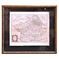
17th Century Framed Map of Ancient France Titled "Typus Galliae Veteris"
Located in Dallas, TX
Decorate an office or a library with this elegant historic map. Crafted in the Netherlands circa 1630, this beautifully framed antique map with pr...
Category
Antique 17th Century Dutch Baroque Maps
Materials
Glass, Giltwood, Paper
Related Items
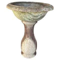
French 17th Century Baptismal Font
Located in Round Top, TX
A very beautiful 17th century Baptismal Font from the South of France beautifully carved from marble. Minimalist lines give this piece a calming feel. Wil...
Category
Antique 17th Century French Garden Ornaments
Materials
Marble
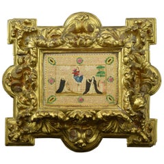
Frame with Vellum Painting, 17th Century
Located in Madrid, ES
Carved and gilded frame with painting on vellum, "Virgin of the Rosary with Santo Domingo de Guzmán and Santa Catalina of Siena", 17th century. Registration in the back zone (Mr. Jos...
Category
Antique 17th Century European Baroque Religious Items
Materials
Leather, Wood, Paint
French 17th Century Stone Blasson
Located in Round Top, TX
An exquisite 17th century Blasson of a Pelican nurturing its young - representing the Eucharist. Wonderfully carved from Burgundy Stone. A stunning piece.
Category
Antique Mid-17th Century French Garden Ornaments
Materials
Stone
Early 17th Century Sculpture
Located in Copenhagen, K
Amazing Baroque sculpture of a woman wearing a crown in original paint. Her hands are missing. Colors are untouched, recently cleaned off from a thick dark coating, I have images fro...
Category
Antique Early 17th Century French Baroque Figurative Sculptures
Materials
Oak
Original 17th-Century Antique Map of Nanjing Province, China – by Blaeu
Located in Langweer, NL
Title: 17th-Century Antique Map of Nanjing Province, China – "Nanking sive Kiangnan" by Blaeu, with Decorative Details
Description: This captivating 17th-century map of Nanjing Pr...
Category
Antique 1650s Maps
Materials
Paper
$1,596
H 18.9 in W 23.04 in D 0.01 in
Vintage Reproduction 17th Century Map of Europe, American, Cartography, Blaeuw
Located in Hele, Devon, GB
This is a vintage reproduction map of Europe. An American, paper stock cartography print in frame after the work by Blaeuw, dating to the late 20t...
Category
Late 20th Century Central American Mid-Century Modern Maps
Materials
Glass, Wood, Paper
$1,258
H 30.32 in W 38.39 in D 1.38 in
17th French Century Iron Figure of The Virgin
Located in Stamford, CT
Wonderful 17th century French Baroque cast iron figure of the Virgin praying. Likely originally part of an outdoor shrine as it has been exposed to the ...
Category
Antique Early 17th Century French Baroque Religious Items
Materials
Iron
French Bronze Mortar, Early 17th Century
Located in Spencertown, NY
The mortar with fleurs de lys decoration.
Category
Antique Early 17th Century French Baroque Scientific Instruments
Materials
Bronze
Beautiful 17th Century Map of Paris and Isle de France by Templeux, c.1650
Located in Langweer, NL
Map of Isle de France by D. de Templeux, ca. 1650, Hand-Colored and Decorative
This richly detailed antique map titled *Le Gouvernement de L'Isle de France* was engraved by Daniel d...
Category
Antique 1650s Maps
Materials
Paper
$762
H 18.9 in W 22.45 in D 0.01 in
Extremely Rare French 17th Century Brandy Bottle
Located in Middleburg, VA
Extremely Rare French 17th Century Brandy Bottle. Hand-blown with an extraordinary effervescent patina. Found on a shipwreck in the English Channel. Made in France circa 1650.
An ex...
Category
Antique 17th Century Baroque Nautical Objects
Materials
Glass, Blown Glass
17th-Century Antique Map of Jiangxi (Kiangsi) Province, China – by Blaeu
Located in Langweer, NL
Title: 17th-Century Antique Map of Jiangxi Province, China – "Kiangsi" by Blaeu, Detailed and Vibrantly Colored
Description: This detailed 17th-century map of Jiangxi Province, historically referred to as "Kiangsi," was created by Johannes Blaeu and published in 1655 as part of the *Novus Atlas Sinensis*. Jiangxi, located in southeastern China, is known for its cultural heritage, scenic landscapes, and significant contributions to Chinese history.
The map meticulously charts Jiangxi’s geography, including mountain ranges, rivers, and cities, with place names rendered in Latin. Poyang Lake, one of the largest freshwater lakes in China, is prominently depicted, emphasizing the region’s ecological and economic importance. The map also highlights key cities such as Nanchang, the provincial capital, which has long been a cultural and political center, and Jingdezhen, globally famous as the center of Chinese porcelain production.
The decorative cartouche in the lower-right corner features traditional Chinese figures, adding cultural depth to the map. Blaeu’s craftsmanship is evident in the precise copperplate engraving and the vibrant hand-coloring, which enhances the boundaries and natural features, making this map both a functional document and a work of art.
Condition: Nearly excellent. Sharp impression with vivid hand-coloring. Wide margins with minor age-toning appropriate for its age.
Framing Tips: Use a neutral double mat and an ornate gilt or dark wood frame to highlight the map’s historical and artistic value. UV-protective glass is recommended to preserve the hand-coloring and intricate details.
Jiangxi, historically referred to as "Kiangsi," is famous for its rich cultural history, stunning landscapes, and economic contributions. It has been a key region for porcelain production, with Jingdezhen renowned as the "Porcelain Capital" of the world. Poyang Lake, featured prominently on the map, is vital for fishing, transportation, and its ecological significance. The province’s location along the Gan River has historically made it an important transportation corridor. Nanchang, the provincial capital, is noted for its historical landmarks and political significance in modern Chinese history.
Keywords include: antique map of Jiangxi, Kiangsi map, Poyang Lake, Jingdezhen porcelain, 17th-century China map...
Category
Antique 1650s Maps
Materials
Paper
$1,596
H 18.9 in W 23.04 in D 0.01 in
17th Century Map of Denmark by French Cartographer Sanson, Dated 1658
By Nicolas Sanson
Located in Copenhagen, K
17th century map of Denmark by French cartographer Sanson.
Nicolas Sanson (20 December 1600-7 July 1667) was a French cartographer, termed by some the creator of French geography an...
Category
Antique 17th Century French Maps
Materials
Paper
$1,750
H 18.51 in W 23.23 in D 0.4 in


