Enrica Pasino Maps
to
4
4
2
2
4
4
3
1
4
4
4
1
1
1
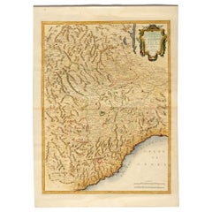
Geographical Antique Map of Principality of Monaco
By Bruno Santini
Located in Alessandria, Piemonte
ST/609 - Interesting antique color map of Monaco Principality in French language : "Carte qui contient le Principauté de Piémont, le Monferrat et la comté de...
Category
Antique Late 18th Century Italian Other Maps
Materials
Paper
Antique Map of Principality of Monaco
By Antonio Vallardi Editore
Located in Alessandria, Piemonte
ST/619 - "Old Geographical Atlas of Italy - Topographic map of ex-Principality of Monaco" -
ediz Vallardi - Milano -
A somewhat special edition ---
Category
Antique Late 19th Century Italian Other Prints
Materials
Paper
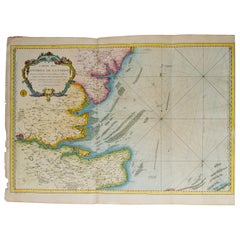
Map "Estuary- Mouth of the Thames"
Located in Alessandria, Piemonte
ST/426 - Antique French Map of the estuary of the Thames, map dated 1769 -
"Mape of the entrance of the Thames. Designed by filing of Navy cards fo...
Category
Antique Mid-18th Century French Other Prints
Materials
Paper
Old Horizontal Map of England
By Tasso
Located in Alessandria, Piemonte
ST/520 - Old rare Italian map of England, dated 1826-1827 - by Girolamo Tasso, editor in Venise, for the atlas of M.r Le-Sage.
Category
Antique Early 19th Century Italian Other Prints
Materials
Paper
Related Items
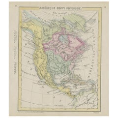
Small Map of the United States
Located in Langweer, NL
Antique map titled 'Amérique septe. Physique'. Small map of the United States. lithographed by C. Callewaert brothers in Brussels circa 1870.
Category
Antique Mid-19th Century Maps
Materials
Paper
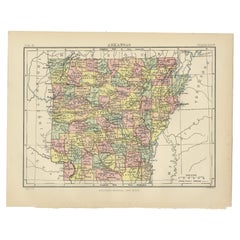
Antique Map of Arkansas
Located in Langweer, NL
Antique map titled 'Arkansas'. Original antique map of Arkansas, United States. This print originates from 'Encyclopaedia Britannica', Ninth Edition. P...
Category
Antique Late 19th Century Maps
Materials
Paper
Mythical Atlantis Restored - A 1694 Map of the Americas and Ancient Geography
Located in Langweer, NL
This rare and fascinating map, titled "Atlantis Insula a Nicolao Sanson Antiquitati Restituta" by Guillaume Sanson, presents an unusual interpretation of the Western Hemisphere, comb...
Category
Antique 1690s Maps
Materials
Paper
$2,279
H 15.52 in W 21.5 in D 0.01 in
Antique Map of Algeria, 1880
Located in Langweer, NL
Antique map titled 'Algérie. Old map of Algeria. This map originates from 'Géographie Universelle Atlas-Migeon' by J. Migeon.
Artists and Engravers: Published by J. Migeon. Review...
Category
Antique 19th Century Maps
Materials
Paper
Antique Map of the Region of Algiers, Algeria
Located in Langweer, NL
Antique map titled 'Alger'. This map shows the region of Algiers, Algeria. With a small inset map of the region of Algiers and a decorative vignette with a harbor view. Originates fr...
Category
Antique Mid-19th Century Maps
Materials
Paper
Original Antique Map of Spain and Portugal, circa 1790
Located in St Annes, Lancashire
Super map of Spain and Portugal
Copper plate engraving by A. Bell
Published, circa 1790.
Unframed.
Category
Antique 1790s English Other Maps
Materials
Paper
Map of India and Southeast Asia from Ptolemaic Geography – 16th Century Woodcut
Located in Langweer, NL
Map of India and Southeast Asia from Ptolemaic Geography – 16th Century Woodcut
This remarkable hand-colored woodcut map, originally designed according to the geographical knowledge...
Category
Antique 16th Century European Maps
Materials
Paper
$2,244
H 15.6 in W 19.89 in D 0.01 in
Antique Map of New Jersey
Located in Langweer, NL
Antique map titled 'Colton's New Jersey'. This rare hand colored map of New Jersey is a copper plate engraving dating to 1855. Produced by the import...
Category
Antique Mid-19th Century Maps
Materials
Paper
Antique Map of North Carolina, with inset map of the western part
Located in Langweer, NL
Antique map titled 'North Carolina'. Original antique map of North Carolina, United States. With inset map of the western part of North Carolina....
Category
Antique Late 19th Century Maps
Materials
Paper
$274 Sale Price
20% Off
H 8.27 in W 10.63 in D 0.02 in
Original Antique Map of Ancient Greece, Achaia, Corinth, 1786
Located in St Annes, Lancashire
Great map of Ancient Greece. Showing the region of Thessaly, including Mount Olympus
Drawn by J.D. Barbie Du Bocage
Copper plate engraving by P.F Tardieu
Original hand color...
Category
Antique 1780s French Other Maps
Materials
Paper
Antique Map of the United States with inset map of the region of Mexico City
Located in Langweer, NL
Antique map titled 'Verein-Staaten von Nord-America, Mexico, Yucatan u.a.'. Very detailed map of the United States of America showing the Caribbean. With an inset map of the surround...
Category
Antique Mid-19th Century Maps
Materials
Paper
$812 Sale Price
20% Off
H 14.69 in W 17.92 in D 0.02 in
Antique Map of the Eastern United States with Inset Map of Texas
Located in Langweer, NL
Antique map titled 'Verein-Staaten von Nord-America mit Ausnahme Florida's und der Westlichen Territorien'. This map extends as far west as Louisiana and only includes the northern p...
Category
Antique Mid-19th Century Maps
Materials
Paper
$510 Sale Price
20% Off
H 14.65 in W 17.84 in D 0.02 in


