Lannan Gallery Maps
to
17
17
6
11
6
1
2
4
2
1
1
1
11
2
12
1
1
17
17
17
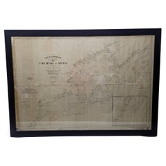
Antique Maritime Chart of East Coast Virginia to Nova Scotia
Located in Norwell, MA
1920 nautical chart of the East Coast of the United States from Virginia to Maine, New Brunswick, and Nova Scotia. The chart shows Cape Cod, Long Island, the Connecticut coast, Jersey Shore, Maine, New Hampshire, etc. Very detailed, showing ports, lighthouses, shoals, depths, etc. The chart is by famous cartographer George W. Eldridge, compiled from surveys of the United States government, British Admiralty, George Eldridge, and others. First authorized by George Eldridge, published in 1916 by Wilfred O. White with a merchant's stamp of Charles Hutchinson...
Category
Vintage 1920s North American Maps
Materials
Paper
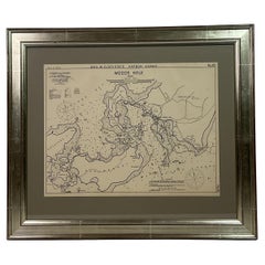
1901 Nautical Chart Showing Woods Hole, Mass
Located in Norwell, MA
Rare 1901 chart of Woods Hole, Mass., showing Buzzards Bay, Penzance Point, Nonamesset Island, Downtown Woods Hole, Parker Neck, Nobska Head, Vineyard Sound, Woods Hole Golf Club, Ra...
Category
Antique Early 1900s North American Maps
Materials
Paper
1907 Chart of Nantucket Harbor by George Eldridge
Located in Norwell, MA
Chart of Nantucket Harbor from 1907 by cartographer George W. Eldridge. The chart shows the channel passing by the jetty into the harbor, by Brant Point to Steamboat Wharf. Also show...
Category
Antique Early 1900s North American Maps
Materials
Paper
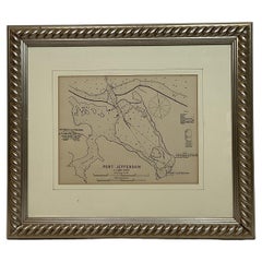
1901 Chart of Port Jefferson, New York
Located in Norwell, MA
Original chart by George Eldridge of Port Jefferson on Long Island, New York. The identified waters include Setauket Harbor, Mount Misery Point, and Match Rock. Two channels are mark...
Category
Antique Early 1900s North American Maps
Materials
Paper
Wychmere Harbor Allens Harbor Map Circa 1890
Located in Norwell, MA
Map of Harwich Mass showing Wychmere Harbor, Doane's Creek, Allens Harbor, Herring River, Pleasant Lake, Grassy Pond, Paddocks Pond, Hinkleys Pond, etc., This is an original period m...
Category
Antique 1890s North American Maps
Materials
Paper
1873 Martha's Vineyard and Nantucket Chart
Located in Norwell, MA
Original chart of Nantucket and Martha's Vineyard by George Eldridge, Cartographer, 125 State Street, Boston. Dated 1873. Mounted to canvas. Also showing the coast of Cape Cod includ...
Category
Antique 1870s North American Maps
Materials
Paper
Maitland Smith Globe on Stand
Located in Norwell, MA
World globe with brass horizon band. Intricately carved pedestal base with ball and claw feet. Quite detailed. By the famous Maitland Smith, globe itself is from Replogle. 62" H x 26...
Category
Vintage 1970s North American Maps
Materials
Wood
8 Foot Framed World Map by Philips
Located in Norwell, MA
1951 map of the world by George Philip and Son. Large beautiful map as it was in 1951. Nice patina mounted to a sturdy wood frame. Overall good condition. Very large in size. 90" W x...
Category
Vintage 1950s North American Maps
Materials
Paper
Mariners Chart of Quicks Hole and Tarpaulin Cove by George Eldridge 1901
Located in Norwell, MA
Nautical chart showing the harbor and local waters of Naushon Island Quick Holes. The chart display depths buoys, lightness, etc., The chart shows the cove in Naushon with ships stor...
Category
Antique Early 1900s North American Maps
Materials
Paper
1865 Chart of the Islands of Madeira
Located in Norwell, MA
Rare James Imray chart from 1865 titled "Chart of the Islands of Madeira, Porto Santo and Dezerea" drawn from the survey made by Captain Ate Vidal Royal Navy, London. Published by Ja...
Category
Antique 1860s European Maps
Materials
Paper
Chart of Boston's North Shore
Located in Norwell, MA
Rarely found restrike of an 1804 chart by Nathanael Bowditch of the Harbors of Salem, Marblehead, Beverly, and Manchester.
Showing the Islands of Great Misery, Satan, Cuney, Winter,...
Category
Vintage 1980s North American Maps
Materials
Paper
1891 Map of Plymouth County Mass
Located in Norwell, MA
Original 1891 map showing Sandwich, Bourne, Plymouth Carver, Middleborough, Plympton and Kingston. Showing Long Beach in Plymouth also as well as all shore points. Cape Cod Bay is ma...
Category
Antique 1890s North American Maps
Materials
Paper
Early 20th Century American Library Globe
Located in Norwell, MA
Fine library globe with makers logo from Atlas School Supply Co., Chicago. Hardwood base with rich finish and nice detail. Celestial globe with equ...
Category
Vintage 1920s North American Maps
Materials
Wood
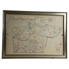
Map of Harwich, Massachusetts
Located in Norwell, MA
Turn of the century map of Harwich, Massachusetts. Plate from a Cape Cod County Map book showing the Barnstable county town of Harwich including Allens Harbor, Pleasant Lake, Harwich...
Category
20th Century Maps
Original 1910 George Eldridge Chart
Located in Norwell, MA
Original framed 1910 George Eldridge chart "E" showing Gloucester to the Kennebec river. Showing the coast of Maine in great detail. Towns includ...
Category
20th Century Unknown Maps
Original 1891 Walker Map
Located in Norwell, MA
Original 1891 map of Massachusetts by Walker. Towns include Cambridge, Boston, Dedham, Ashland, Brookline, Newton etc... burl wood frame. Measures...
Category
Antique 19th Century Maps
1891 Map of Norfolk County Massachusetts
Located in Norwell, MA
1891 map of Norfolk county Massachusetts including the towns of Wrentham, Franklin, Medfield, Sherborn, Norwood etc., measures: 23 x 31.
Category
Antique 19th Century Maps
Related Items
New York Interiors, Signature Edition
Located in New York, NY
Signed by Simon Upton
Edited by Karen Howes
Foreword by Rupert Thomas
A striking visual homage by leading interiors photographer Simon Upton
In his first book, renowned interiors photographer Simon Upton turns his camera on one of his most-loved destinations in this personal exploration of fashionable homes in New York City. Urbane and characterful, Simon Upton's New York Interiors unveils the photographer's favorite interior projects from the city, among them the homes of Aerin Lauder, Hamish Bowles, Stephen Sills...
Category
2010s Books
Materials
Paper
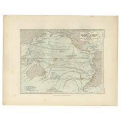
Antique Physical Chart of the Pacific Ocean by Johnston, '1850'
Located in Langweer, NL
Antique map titled 'Physical Chart of the Pacific Ocean showing the currents and temperature of the ocean'. Original antique chart of the Pacific Ocean. This map originates from 'The...
Category
Antique Mid-19th Century Maps
Materials
Paper
$190 Sale Price
20% Off
H 11.03 in W 14.18 in D 0.02 in
Antique maritime navy compass
Located in Banská Štiavnica, SK
Antique maritime navy compass in very nice original condition.
Category
Antique 19th Century European Scientific Instruments
Materials
Brass
19th Century half mode of steam ship New York
Located in Martlesham, GB
A fabulous quality 19th Century half model of the steam ship "New York", originally called "City of New York", British built for the Inman line launched on the 15th March 1888. Cir...
Category
Antique 19th Century British Victorian Models and Miniatures
Materials
Walnut
circa 1890s Micro-Beaded Drawstring Evening Bag
Located in Chapel Hill, NC
circa 1890s micro-beaded draw-string evening bag. Scenic design with Shaker Style houses appears in various bag designs & color variations. Silk lining i...
Category
Antique 1890s American Arts and Crafts Collectible Jewelry
Materials
Beads
Vintage Wood-N-Stuff Handcrafted Nautical Handmade Oak Rowboat Coffee Table 46"
Located in Dayton, OH
Vintage scaled down row boat or dinghy coffee / cocktail Table. Handmade from oak with beautifully stained and painted wood with brass screws, a custom glass top, oars and sturdy wo...
Category
Vintage 1970s American Bohemian Nautical Objects
Materials
Glass, Oak
$2,000 Sale Price
20% Off
H 24 in W 46.5 in D 21.5 in
Rare Original Map of New Amsterdam (New York) – “Restitutio”, ca. 1674 –
Located in Dronten, NL
An exceptionally rare and original 17th-century engraving of New Amsterdam, now New York City, published by the renowned Amsterdam cartographer Carel (Carolus) Allard around 1674. Kn...
Category
Antique 17th Century Dutch Maps
Materials
Paper
$24,950
H 20.16 in W 23.35 in D 0.4 in
1855 Astronomical Plate of Distance of the Planets by FJ Huntington New York
Located in Milan, IT
Plate of the distance of the planets “Entered according to Act of Congress in the year 1855 by F.J. Huntington in the Clerk's Office of the District Court of the United States for th...
Category
Antique 1850s American Scientific Instruments
Materials
Glass, Wood, Paper
$1,425
H 19.61 in W 32.21 in D 0.6 in
Antique Mercator Projection World Map by Petri, c.1873
Located in Langweer, NL
Antique world map titled 'Wereldkaart naar Mercator's Projectie'. Old map of the world. This map originates from 'School-Atlas van alle Deelen der Aarde'.
Artists and engravers: ...
Category
Antique 19th Century Maps
Materials
Paper
$119 Sale Price
20% Off
H 10.32 in W 12.84 in D 0 in
1907 Rubaiyat of Omar Khayyam
By Edward Fitzgerald
Located in Bath, GB
A sumptuously bound copy of this noted work, presented here in a highly decorative Bumpus binding, with exquisite gilt detail and watered silk pastedowns.
The 1907 edition of the wo...
Category
Antique Early 1900s British Books
Materials
Paper
Antique Swiss Music Box, circa 1890
Located in New Orleans, LA
Antique Swiss Music Box circa 1890.
Category
Antique Late 19th Century Swiss Musical Instruments
Materials
Mahogany
Antique Wood Nautical British Scale Model of Brig with Three Masts , Early 1900
Located in Milan, IT
Scale model of a brig with three masts, UK early 1900, oak wooden hull, black hull and grey topsides, oak wooden base with turned feet. Very good condition. Measures: Length cm 106, ...
Category
Early 20th Century British Nautical Objects
Materials
Wood
$2,970
H 31.11 in W 41.74 in D 11.03 in
