Map York
Price
Item Location
Sort By
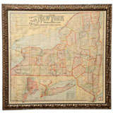
Antique Map of New York by Johnson '1872'
Located in Langweer, NL
Antique map titled 'Johnson's New York'. Original map showing New York, with an inset map of Long Island. This map originates from 'Johnson's New Illustrated Family Atlas of the Worl...
Category
Antique Late 19th Century Maps
Materials
Paper
Old Map of Southern Australia, with an Inset Map of Cape York Peninsula, 1882
Located in Langweer, NL
Antique map titled 'South Australia, New South Wales, Victoria & Queensland'.
Old map of Southern Australia, with an inset map of Cape York Peninsula. This map originates from 'T...
Category
Antique 1880s Maps
Materials
Paper
H 24.22 in. W 19.53 in. D 0 in.
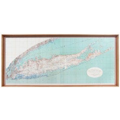
Vintage Map of New York Harbor, Framed, circa 1930
Located in West Palm Beach, FL
Framed US Coast Guard map of the New York Harbor, stamped April 12, 1930.
Stock ID: D9417
Category
Vintage 1930s American Maps
Materials
Glass, Wood, Paper
Road Map, John Ogilby, London, Barwick, York, Chester, Darlington, Durham
By John Ogilby
Located in Eversholt, Bedfordshire
The continuation of the road from London to Barwick beginning at York and extending to Chester in ye Street. Plate ye 4th continuing 76 ½ miles. No 8.
York to Burrowbridge, to Top...
Category
Antique 1670s English Baroque Maps
Materials
Paper
H 18.12 in. W 23.04 in. D 0.6 in.
Antique Map of New York City by Balbi '1847'
Located in Langweer, NL
Antique map titled 'New-York'. Original antique map of New York. This map originates from 'Abrégé de Géographie (..)' by Adrien Balbi. Published 1847.
Category
Antique Mid-19th Century Maps
Materials
Paper
19th Century Lithograph Map of Lower Manhattan, New York
Located in Haddonfield, NJ
1859 hand colored map of Lower Manhattan or New Amsterdam by George H. Moore.
Category
Antique 19th Century English Folk Art Maps
Materials
Paper
Antique Map of "New-York City & County" by Charles Magnus, 1855
By Charles Magnus
Located in Colorado Springs, CO
This is a beautiful hand-colored map titled “New York City & County Map with Vicinity entire Brooklyn, Williamsburgh, Jersey City &c.” The work was published in 1855 by Charles Magnu...
Category
Antique 1850s American Maps
Materials
Paper
Pictorial Vintage Map of New York City Showing Numerous Landmarks, 1939
Located in Langweer, NL
This pictorial souvenir map focuses on New York City and the site of the 1939 World's Fair. It was drawn by graphic artist George Annand and published by Sinclair Oil, likely with th...
Category
Vintage 1930s Maps
Materials
Paper
H 26 in. W 26.9 in. D 0.002 in.
18th Century Emanuel Bowen Map of County of York, c.1740
By Emanuel Bowen
Located in Royal Tunbridge Wells, Kent
Antique 18th century British rare and original Emanuel Bowen (1694-1767) map of the County of York divided into its Ridings and subdivided into wapontakes, mounted in solid wood fram...
Category
Antique Early 18th Century British Maps
Materials
Paper
Antique Map of the Passenger Transportation Systems of New York, 1901
Located in Langweer, NL
Antique map titled 'Map of New York City except Richmond Borough showing Passenger Transportation Systems'. Map of New York City showing passenger transportation systems. Supplement ...
Category
20th Century Maps
Materials
Paper
H 26.97 in. W 18.9 in. D 0.02 in.
Framed New York Central Railway Map Original from 1943 with Railway Label
By Baker, Jones, Hausauer, Inc. 1
Located in Ottawa, Ontario
Framed New York Central Railway Map Original from 1943 With Railway Label, The map is by Baker, Jones, Hausauer, Inc. Buffalo, N.Y. The map covers all lines in Central NY to Ontario,...
Category
Vintage 1940s American Mid-Century Modern Maps
Materials
Paper
H 26.5 in. W 41 in. D 0.75 in.
1856 The Constellations Map for Each Month in the Year by FJ Huntington New York
Located in Milan, IT
Map VI and VII depicting the constellations titled The Constellations for each Month in the Year. "Entered according to Act of Congress in the year 1856 by FJ Huntington in the Clerk...
Category
Antique 1850s American Maps
Materials
Glass, Wood, Paper
H 18.71 in. W 32.17 in. D 0.6 in.
Original Antique City Plan of Buffalo, New York, USA, circa 1900
By Rand McNally & Co.
Located in St Annes, Lancashire
Fabulous colorful map of Buffalo
Original color
By Rand, McNally & Co.
Published, circa 1900.
Unframed
Free shipping.
Category
Antique Early 1900s American Maps
Materials
Paper
Mychael Barratt, Map of New York Days, Illustration New York Map, Blue Art, NYC
By Mychael Barratt
Located in Deddington, GB
Mychael Barratt
New York Map of Days
Limited Edition Cityscape Etching
Edition of 100
Sheet Size: H 64cm x W 100cm x D 0.1cm
Signed and Titled
Sold Unframed
Please note that insitu i...
Category
21st Century and Contemporary Contemporary Landscape Prints
Materials
Paper, Etching
H 25.2 in. W 39.38 in. D 0.04 in.
Map of White Plains, New York
Located in New York, NY
Map of White Plains, New York Original antique map of White Plains New York. This authentic large vintage map of White Plains New York comes from F.W. Beers Atlas of New York and Vic...
Category
1860s Realist Landscape Prints
Materials
Lithograph
1870 Map Flatbush Brooklyn New York
By Beers Atlas Co.
Located in Sag Harbor, NY
An amazing Antique 1870 Map Flatbush Brooklyn New York, Hand Water colored, Includes Prospect Park in Brooklyn and Flatbush Village. Unframed and in great condition for its 150 years...
Category
Antique Late 19th Century American Antiquities
Materials
Paper
Map of White Plains, New York
Located in New York, NY
Map of White Plains, New York Original antique map of White Plains New York. This authentic large vintage map of White Plains New York comes from F.W. Beers Atlas of New York and Vic...
Category
1860s Realist Landscape Prints
Materials
Lithograph
Sacred City, New York - contemporary New York Manhattan map gold leaf ink print
Located in London, GB
UV treated ink on Dutch gold leaf gilded to 400 gsm paper
Ewan David Eason’s Mappa Mundi series – the title of which comes from the Medieval Latin Mappa, meaning sheet, and Mundi, o...
Category
2010s Contemporary More Prints
Materials
Gold Leaf
H 16.15 in. W 39.38 in. D 0.99 in.
1835 Map of Turtle Bay Farms, New York City
Located in New York, NY
Title: "Map of allotment N. 3 of the Turtle Bay Farms in the 12. Ward of the City of New York belonging to the Estate of D. W. Kissam Jnr Deed. New York, Oct. 1 1835 surveyed & laid ...
Category
1860s Realist More Prints
Materials
Ink
"Chance" Contemporary Surrealist Perspectival Map Drawing of Albany, New York
By Ken Ragsdale
Located in New York, NY
In "Chance" Albany based artist, Ken Ragsdale has created a visual conversation which references a historical lithograph of Albany, New York made by J. W. Hill in the 1850's. This w...
Category
2010s Contemporary Figurative Drawings and Watercolors
Materials
Ink, Color Pencil, Graphite
Map of City of New York and Island of Manhattan
By George Hayward
Located in New York, NY
"This Map of the City of New York and Island of Manhattan, as laid out by the Commissioners Appointed by the Legislature, April 3d. 1807 is Respectfully Dedicated to the Mayor, Alder...
Category
1850s Realist More Prints
Materials
Lithograph
Map of Hell Gate and East River, New York City
Located in New York, NY
Original, extremely rare first edition map (1887), full title "Hell Gate and East River from S. End of Blackwell's Island to Lawrence's Point including Little Hell Gate and Mouth of ...
Category
1880s Realist More Prints
Materials
Lithograph
rare piece of New york subway map by Death NYC
By Death NYC
Located in Paris, FR
NYC/YSL subway map
rare piece of New york subway map by Death NYC,
Collage and marker.
Signed and dated 2016 by the artist Support: part of a new york subway map
Size: 17 X 13...
Category
2010s Mixed Media
Materials
Glue, Screen
Arbuckle Coffee Company Maps of New York, Delaware, Tennessee, New Hampshire
Located in New York, NY
Sheet with lithograph maps of four states in full color. Beautifully presented in a antiqued gold wood frame, ivory conservation mat, and UV protecting conservation clear acrylic. ...
Category
1880s Realist Landscape Prints
Materials
Lithograph
H 10.75 in. W 15.5 in. D 1 in.
Valentine Lithograph after 1771 Map of Turtle Bay, New York City
Located in New York, NY
Original Valentine lithograph after a manuscript map and survey entitled "At the request of the Recorder Thomas Jones Esq, Chairman & the other Gentlemen of the Committee, I have sur...
Category
Mid-19th Century Realist Prints and Multiples
Materials
Lithograph
Sacred City, Midtown Manhattan - contemporary New York map gold giclee print
Located in London, GB
Hot gold foil on giclee print
unframed: 15 x 15cm, £300
framed : 20 x 20cm, £420
Ewan David Eason’s Mappa Mundi series – the title of which comes from the Medieval Latin Mappa, mea...
Category
2010s Contemporary More Prints
Materials
Gold Leaf
Geological Map of Long & Staten Islands with the Environs of New York
By William W. Mather
Located in New York, NY
Published in 1842 prior to the American Civil War and the subsequent Long Island land rush, this is one of the most detailed and attractive large format maps of Long Island to appear...
Category
1840s American Realist Landscape Prints
Materials
Lithograph
A Map of the Eastern Part of the Province of New York with part of New Jersey...
By Thomas Kitchin
Located in New York, NY
Rare hand-colored map full title "A Map of the Eastern Part of the Province of New York with part of New Jersey &C. Drawn from the best Authorities. By T. Kitchin Geog. Printed for ...
Category
1750s Realist Landscape Prints
Materials
Engraving
New York City & County Map ...
By Charles Magnus
Located in New York, NY
CHARLES MAGNUS
(1826 - 1900)
New York City & County Map
with Vicinity entire...
Lithograph on paper
Paper size: 20 1/2” x 33 1/2”
Framed size: 29 1/2” x 42” 3/4
Category
Antique 19th Century Maps
Materials
Lithograph, Paper
Rare Hudson New York Aerial Map, 1923
Located in North Beninngton, VT
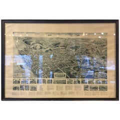
1923 Aerial Map of Hudson, NY. Original frame original glass, original print. Very rare great souvenir of Hudson.
Category
Vintage 1920s Prints
Antique City Maps, New York City, gold leaf, unframed
Located in Los Angeles, CA
Celebrating every city and state with a gold leaf background. Contact us if you are needing a different city or state. We can customize any map. Printed on a gold leaf paper and fram...
Category
2010s Contemporary More Prints
Materials
Gold Leaf
Antique City Maps, New York City, gold leaf, acrylic box frame
Located in Los Angeles, CA
Celebrating every city and state with a gold leaf background. Contact us if you are needing a different city or state. We can customize any map. Printed on a gold leaf paper and fram...
Category
2010s Contemporary More Prints
Materials
Gold Leaf
1852 Magnus Map New York City, Brooklyn & Williamsburg, Hand-Colored Engraving
By Charles Magnus
Located in Vineyard Haven, MA
Magnus, C. [New York, 1852] Complete Map of the Cities of New York, Brooklyn and Williamsburgh.
18 x 22 ¼ inches. Lithograph with original color; wear at folds with minor loss, ligh...
Category
Antique 1850s American American Colonial Maps
Materials
Paper
H 18 in. W 22.5 in. D .07 in.
Early Map of New York City
Located in Sag Harbor, NY
This map is from the 1830s. It was originally made in 1723 and is a detailed rendition of lower Manhattan, New York settled by the Dutch. It was then reprinted in the 1830s by John S...
Category
Antique Mid-19th Century American Maps
Materials
Linen, Paper
Antique Map "Routes Between New York & Washington" New York Baltimore Washington
Located in Colorado Springs, CO
This charming and colorful map depicts the east coast from New York City south to Washington D.C. highlighting the various direct routes a traveler may take. The folding pocket map o...
Category
Antique 1830s American Maps
Materials
Paper
H 30.5 in. W 9.75 in. L 30.5 in.
1939 Map of the Reaches of New York City
Located in Colorado Springs, CO
This colorful and informative map, "The Reaches of New York City", was published, circa 1939. The map was created in the studios of the National Geographic Magazine, under ...
Category
Vintage 1930s Maps
An 1860 Johnson & Ward Framed Map of New York City
Located in East Hampton, NY
Hand colored lithograph - Excellent aged map of Manhattan and NYC boroughs. Wonderful nostalgic value and framed beautifully in UV protected gallery glass and anti-reflection.
Category
Antique 19th Century American Maps
Materials
Paper
“Johnson’s New York and Brooklyn” 1866 Map in Antique Windowpane Frame
Located in Colorado Springs, CO
“Johnson’s New York and Brooklyn” Original map
published by A.J. Johnson & Co., New York, in 1866.
This map is an original hand colored engraving of New York City and Brooklyn fr...
Category
Antique 1860s American Maps
Materials
Paper
1939 Vintage Map "The City of New York" by Richard Edes Harrison
By Richard Harrison
Located in Colorado Springs, CO
This 1939 Richard Edes Harrison map of New York City, published for an issue of Fortune Magazine, represents a triumph of the visual display of quantitative information. Its aestheti...
Category
Vintage 1930s American Maps
Materials
Paper
New York City and Surrounding Burroughs Map by Joesph Colton, circa 1865
Located in Colorado Springs, CO
This is a Great Republic exclusive presentation of Joseph Colton's 1865 map of NYC and the surrounding Burroughs. The frame is made from re-purposed 19th century window framing taken...
Category
Antique 1860s Maps
1855 "New-York City & County Map with Vicinity..." by Charles Magnus
Located in Colorado Springs, CO
This is an extremely rare, full-color folding edition of Charles Magnus' s extraordinary 1855 broadside map of New York City, issued to commemorate the signing of the Declaration of ...
Category
Antique 1850s Maps
New York City Map with Surrounding Burroughs in Antique Windowpane, circa 1875
Located in Colorado Springs, CO
This is a Great Republic exclusive presentation of Goulding's 1875 directory map of NYC and its Burroughs. The frame is made from re-purposed 19th century window framing taken from a...
Category
Antique 1870s Maps
H 33 in. W 29 in. D 2 in.
Large 1840 Map of Long Island, New York
Located in Sag Harbor, NY
Amazing pre Civil War 1840 Map of Long Island, had water colored. Amazing condition, Framed in oak with glass over matted Map. Mounted beautifully, the details are fantastic. Suffolk...
Category
Antique Early 19th Century American Antiquities
Materials
Paper
Large Nautical Map of New York Entrance, 1870
Located in Haddonfield, NJ
Large rectangular nautical map of the New York Entrance, 1857.
Sandy Hook Bay, Coney Island, Jamaica Bay, Staten Island
Category
Antique 19th Century American Nautical Objects
New York City Graffiti Art on Manhattan Bus Map
Located in Los Angeles, CA
Great piece of street art from a graffiti artist in New York City. Unsigned. Great piece of pop art. Hand-painted on a Manhattan bus map.
Category
1990s American Contemporary Art
Materials
Paint, Paper
Copper World Map from Sabena Airlines, JFK Airport, New York, 1972
Located in Wilton, CT
Commissioned by Sabena Airlines Belgium. This unique copper repousse world map was the backdrop for Sabena's check in counter at JFK Airport, New York, in the 1970's. The commission ...
Category
Vintage 1970s Chilean Mid-Century Modern Wall-mounted Sculptures
Materials
Copper
1854 "Panorama of Manhattan Island, City of New York and Environs" Antique Map
Located in Colorado Springs, CO
This is a stunning panoramic view of New York City, published in New York, 1854. The map, a color lithograph, was drawn on stone by John Bornet and printed by A. Weingartner, N.Y. Fo...
Category
Antique 1850s American Prints
Materials
Paper
H 45 in. W 56 in. D 2 in.
Map of New York City, Antique Hand-Colored Map, 1876
Located in Colorado Springs, CO
This original map of the city of New York was first surveyed by J. Hills in 1782 and was later re-published by J. Disturnell in 1876, as is shown here. The plan includes detailed han...
Category
Antique 1870s American Maps
Materials
Paper
Cape Cod Map Showing New York City
Located in Colorado Springs, CO
This is a rare 1905 chromolithographed bird's-eye view of Cape Cod, New York, and Long Island. The map was issued by George H. Walker to promote the Joy Line. The Joy Line was a regu...
Category
Antique Early 1900s American Maps
Antique Map of New York 'circa 1855'
Located in Langweer, NL
Antique map titled 'Neu York'. Lithograph of New York, United States. With inset maps of Staten Island and Manhattan. On verso, a smaller map of New York (Manhattan). This map origin...
Category
Antique Mid-19th Century Maps
Materials
Paper
Original Antique Map of Upstate New York, circa 1890
Located in St Annes, Lancashire
Great map of Upstate New York
Original color.
Published circa 1890
Repairs to minor edge tears. Crease in top half.
Unframed.
Category
Antique 1890s English Other Maps
Materials
Paper
Original Antique Map of The American State of New York, 1889
Located in St Annes, Lancashire
Great map of New York
Drawn and Engraved by W. & A.K. Johnston
Published By A & C Black, Edinburgh.
Original colour
Unframed.
Category
Antique 1880s Scottish Victorian Maps
Materials
Paper
Antique Map of New York and Brooklyn by Johnson, 1872
Located in Langweer, NL
Antique map titled 'Johnson's New York and Brooklyn'. Original map showing New York and Brooklyn, with an inset map of New York north of Central Park. This map originates from 'Johns...
Category
Antique Late 19th Century Maps
Materials
Paper
Antique Map of American Cities, Vignette of New York City, circa 1920
Located in St Annes, Lancashire
Great maps of American Cities
Unframed
Original color
By John Bartholomew and Co. Edinburgh Geographical Institute
Published, circa 1920
Free shipping.
Category
Vintage 1920s British Maps
Materials
Paper
1 bid
H 18 in. W 23 in. D 0.07 in.
Original Antique Map of New York and Adjacent States by T. Ettling, 1861
Located in St Annes, Lancashire
Great map of North East United States
Steel engraving with original color outline
Drawn and engraved by T. Ettling
Published in the weekly Dispatch Atlas, 1861
Some minor...
Category
Antique 1860s English Other Maps
Materials
Paper
H 19 in. W 13 in. D 0.07 in.
Antique Map of the Railroad of New York and Pennsylvania, circa 1890
Located in Langweer, NL
Antique map titled 'Western New York and Pennsylvania R.R. and connections'. Lithographed railroad map of Western New York and Pennsylvania. Published circa 1890.
Category
Antique Late 19th Century Maps
Materials
Paper
H 8.47 in. W 14.18 in. D 0.02 in.
Antique Map of the Railway between New York and Oswego 'circa 1890'
Located in Langweer, NL
Antique map titled 'Sketch of the Del. Lack and West R.R. and Branches'. Lithographed map of the railway in the region of New York, Pottersville, Scranton, Ithaca, Oswego, Albany and...
Category
Antique Late 19th Century Maps
Materials
Paper
H 12.21 in. W 9.26 in. D 0.02 in.
Antique Map of American Cities, Vignette of New York City, circa 1920
Located in St Annes, Lancashire
Great maps of American Cities
Unframed
Original color
By John Bartholomew and Co. Edinburgh Geographical Institute
Published, circa 1920
Free shipping.
Category
Vintage 1920s British Maps
Materials
Paper
Antique Map of Manhattan, New York City by Thomas Cowperthwait & Co. 1850
Located in San Diego, CA
A very nice antique map of Lower Manhattan, New York City by Thomas Cowperthwait & Co., circa 1850. The map itself measures 13" x 16" and is professionally presented in a nice black ...
Category
Antique Mid-19th Century American Maps
Materials
Paper
Antique Map of American Cities, Vignette of New York City, circa 1920
Located in St Annes, Lancashire
Great maps of American Cities
Unframed
Original color
By John Bartholomew and Co. Edinburgh Geographical Institute
Published, circa 1920
Free shipping.
Category
Vintage 1920s British Maps
Materials
Paper
- 1
Map York For Sale on 1stDibs
With a vast inventory of beautiful furniture at 1stDibs, we’ve got just the map york you’re looking for. A map york — often made from paper, fabric and wood — can elevate any home. Whether you’re looking for an older or newer map york, there are earlier versions available from the 18th Century and newer variations made as recently as the 20th Century. A map york is a generally popular piece of furniture, but those created in Mid-Century Modern, Baroque and Victorian styles are sought with frequency. A well-made map york has long been a part of the offerings for many furniture designers and manufacturers, but those produced by Beers Atlas Co., Baker, Jones, Hausauer, Inc. and Charles Magnus are consistently popular.
How Much is a Map York?
Prices for a map york can differ depending upon size, time period and other attributes — at 1stDibs, they begin at $67 and can go as high as $26,500, while the average can fetch as much as $1,250.