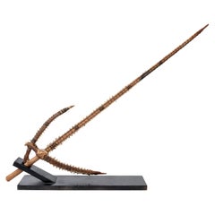
Shark Teeth Edged Sword from the Gilbert Islands Pre-Contact
View Similar Items


1 of 7
Shark Teeth Edged Sword from the Gilbert Islands Pre-Contact
$1,399List Price
About the Item
- Dimensions:Height: 38 in (96.52 cm)Width: 12 in (30.48 cm)Depth: 2 in (5.08 cm)
- Materials and Techniques:Bone,Palmwood
- Place of Origin:Kiribati
- Period:
- Date of Manufacture:1399
- Condition:Wear consistent with age and use.
- Seller Location:Stamford, CT
- Reference Number:Seller: FUNSTON ANTIQUES1stDibs: LU862327924032
Authenticity Guarantee
In the unlikely event there’s an issue with an item’s authenticity, contact us within 1 year for a full refund. DetailsMoney-Back Guarantee
If your item is not as described, is damaged in transit, or does not arrive, contact us within 7 days for a full refund. Details24-Hour Cancellation
You have a 24-hour grace period in which to reconsider your purchase, with no questions asked.Vetted Professional Sellers
Our world-class sellers must adhere to strict standards for service and quality, maintaining the integrity of our listings.Price-Match Guarantee
If you find that a seller listed the same item for a lower price elsewhere, we’ll match it.Trusted Global Delivery
Our best-in-class carrier network provides specialized shipping options worldwide, including custom delivery.You May Also Like
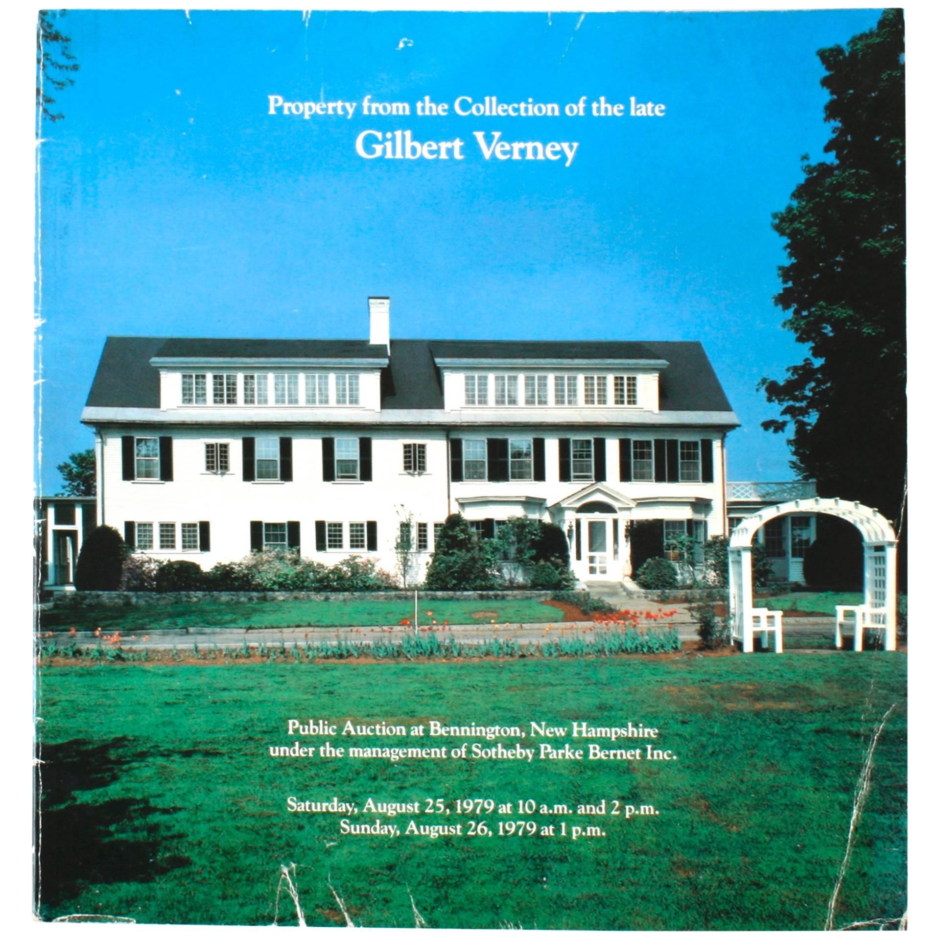
Sotheby's: Property from the Collection of the Late Gilbert Verney, 1979
Located in valatie, NY
Property from the Collection of the Late Gilbert Verney: At Bennington, New Hampshire, Including Property Removed from His Residence on Nantucket Island, Massachusetts. Softcover first edition. American, English and Continental Furniture, Decorations and Clocks, Prints, Watercolors and Paintings of Sporting and Marine Interest, Including a Rare Complete Set of Federal Migratory Bird Duck Stamp Prints...
Category
Vintage 1970s American Books
Materials
Paper

Long Island Chart from 1828
Located in Norwell, MA
Rare original chart of Long Island Sound by E + G Blunt of New York, 179 Water St. "Surveyed in the years 1828, 29 & 30" Exceedingly rare and early chart, titled Long Island Sound fr...
Category
Antique 1830s Nautical Objects
Materials
Paper

Antique Map of the Islands Within the Queen Charlotte's Islands
Located in Langweer, NL
Antique map titled 'Cote Septentrional de la plus grande des Isles de la Reine Charlotte (..)'. Map and coastal view of the islands within the Queen Charlotte's Islands (Santa Cruz I...
Category
Antique Late 18th Century Maps
Materials
Paper

$314 Sale Price
20% Off
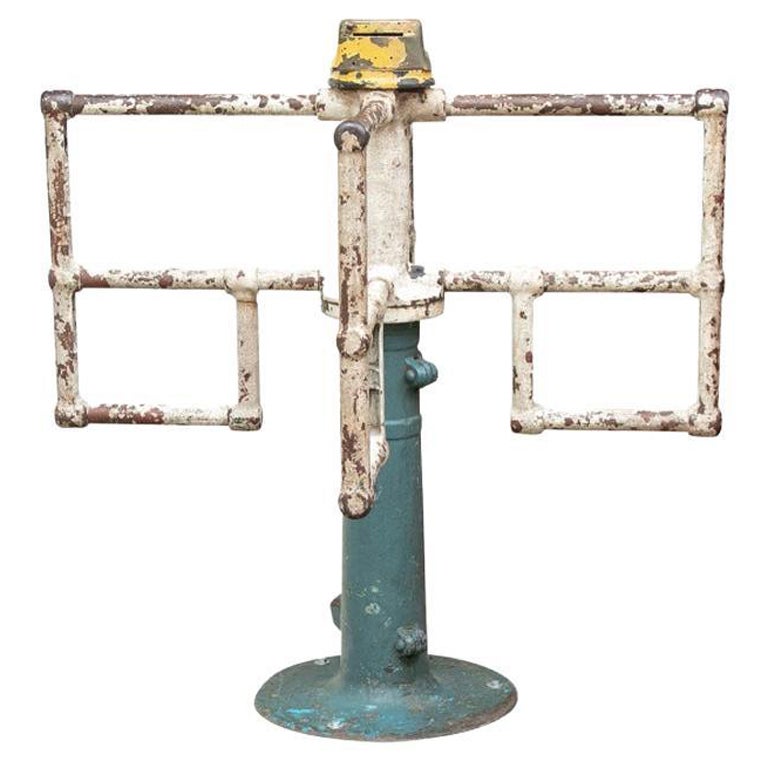
Mounted Turnstile “To The Fun House” from Coney Island, New York
Located in Bridgeport, CT
A rare and Historical Industrial Era Mounted Turnstile from the Fun House at Coney Island, New York, featuring original painted finishes mounted on wood plinth with label reading, “T...
Category
Early 20th Century American Industrial Carnival Art
Materials
Steel

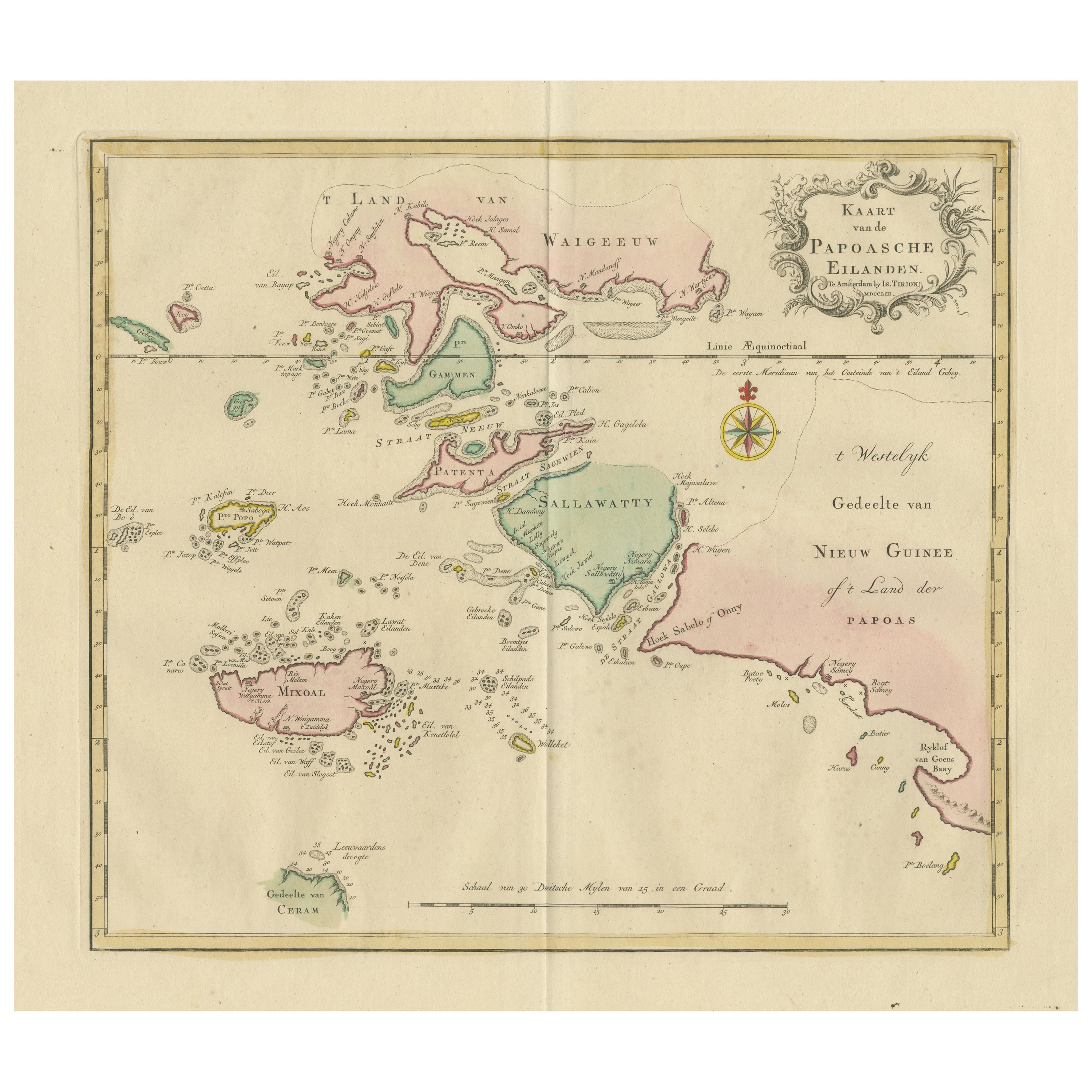
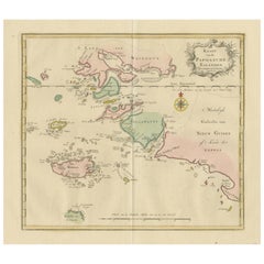
Antique Map extending from the Spice Islands to the west of Papua New Guinea
Located in Langweer, NL
Antique map titled 'Kaart van de Papoasche Eilanden'. Beautiful original old map extending from the Spice Islands (Sallawatty, Patenta, Gammen, Land van Waigeeuw, Popo, Misool, and part of Seram) to the western end of Papua New Guinea. Many smaller islands are detailed, and depth soundings are shown near Seram and to the east of Misool. This map originates from 'Nieuwe en Beknopte Hand-Atlas, bestaande in eene Verzameling van eenige der algemeenste en nodigste Landkaarten' by I. Tirion. Published circa 1770.
Tirion was born in Utrecht in 1705. He moved to Amsterdam in 1725 and set up shop on Damrak as a book publisher. Tirion quick rose in prominence by publishing pamphlets, historical works, and, most importantly...
Category
Antique Late 18th Century Maps
Materials
Paper
$467 Sale Price
20% Off
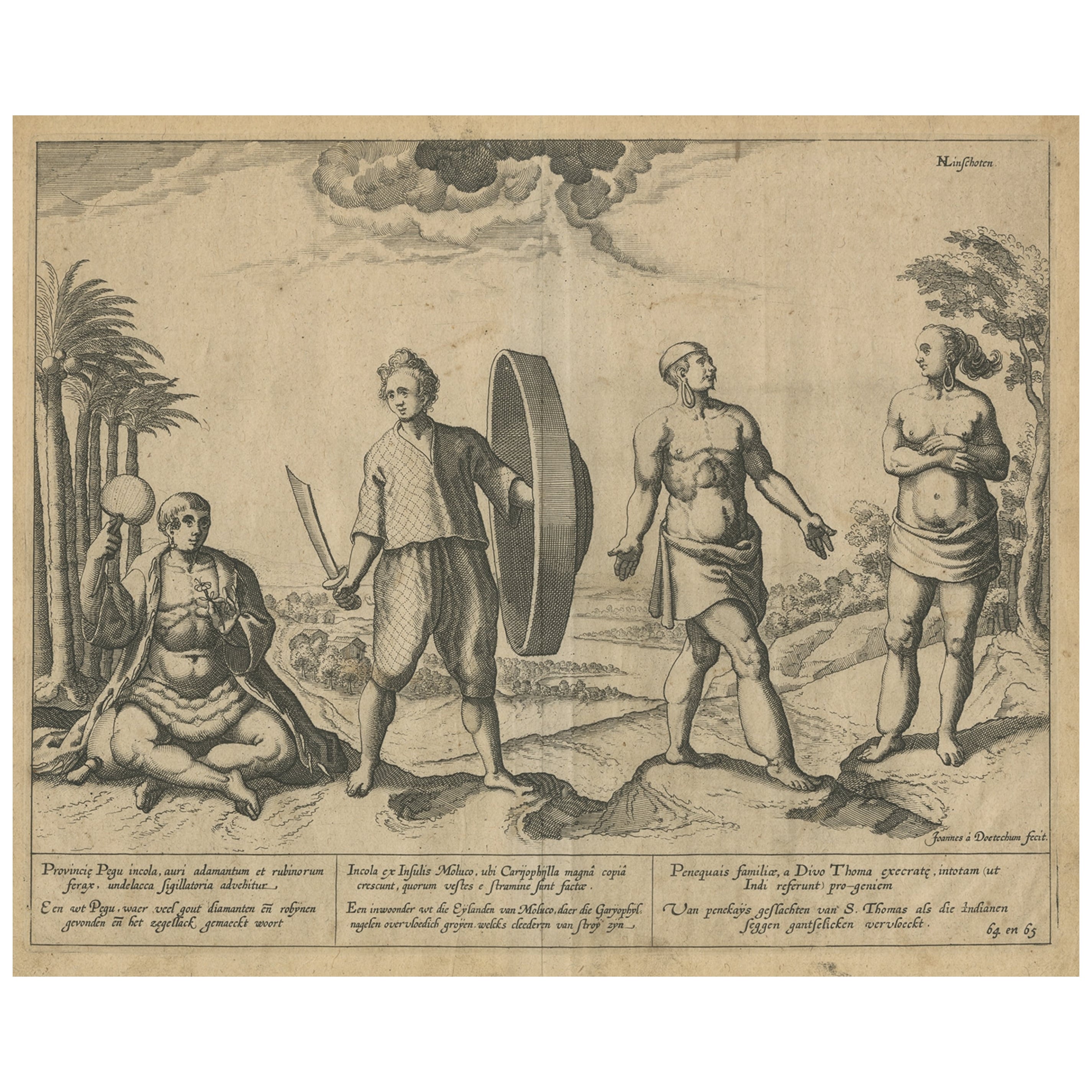
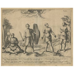
Natives from Pegu, the Moluccan Islands, Penequais Indians and St Thomas, c.1605
Located in Langweer, NL
Antique print titled 'Provincie Pegu incola (..) - Incola ex Insulis Moluco (..) - Penequais familiae (..)'.
Old print showing various figures including a man from Pegu, a man fr...
Category
Antique Early 1600s Prints
Materials
Paper
$343 Sale Price
20% Off