Items Similar to Natives from Pegu, the Moluccan Islands, Penequais Indians and St Thomas, c.1605

Want more images or videos?
Request additional images or videos from the seller
1 of 6
Natives from Pegu, the Moluccan Islands, Penequais Indians and St Thomas, c.1605
About the Item
Antique print titled 'Provincie Pegu incola (..) - Incola ex Insulis Moluco (..) - Penequais familiae (..)'.
Old print showing various figures including a man from Pegu, a man from the Moluccan islands, Penequais indians and inhabitants of S. Thomas. Illustration from an edition of Linschoten's Itinerario. This work informed Europeans of the 16th century Portuguese trade and navigation in southern Asia.
Artists and Engravers: Jan Huygen van Linschoten (1563 - 1611) was a Dutch Protestant merchant, traveller and historian. An alternative spelling of his second name is Huijgen. He is credited with publishing important information about Asian trade, such as the navigational routes that enabled the passage to the elusive East Indies to be opened to the English and the Dutch. This enabled the British East India Company and the Dutch East India Company to break the 16th century monopoly enjoyed by the Portuguese on trade with the East Indies.
- Dimensions:Height: 11.82 in (30 cm)Width: 13.98 in (35.5 cm)Depth: 0 in (0.02 mm)
- Materials and Techniques:
- Period:1600-1609
- Date of Manufacture:circa 1605
- Condition:Wear consistent with age and use. Condition: Fair, age-related toning. Minor wear and small defects. Blank verso. Please study image carefully.
- Seller Location:Langweer, NL
- Reference Number:
About the Seller
5.0
Platinum Seller
These expertly vetted sellers are 1stDibs' most experienced sellers and are rated highest by our customers.
Established in 2009
1stDibs seller since 2017
1,916 sales on 1stDibs
Typical response time: <1 hour
- ShippingRetrieving quote...Ships From: Langweer, Netherlands
- Return PolicyA return for this item may be initiated within 14 days of delivery.
More From This SellerView All
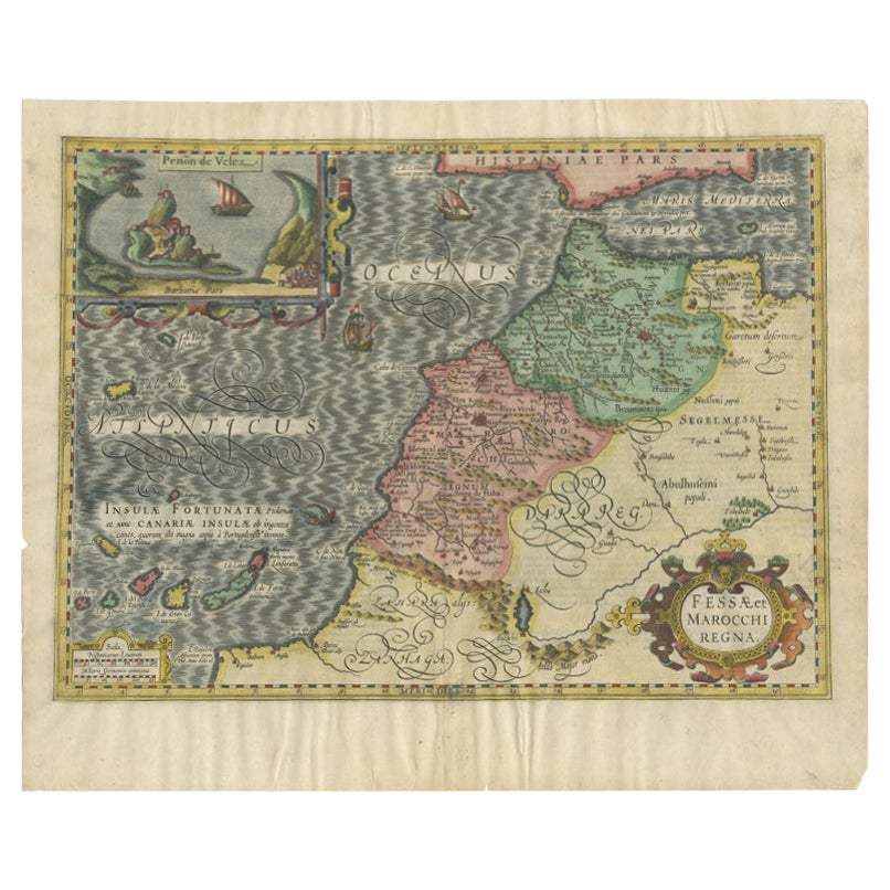
- Old Map of Morocco, The Canary Islands, Madeira, Inset of Penon de Velez, 1605Located in Langweer, NLAntique map titled 'Fessae et Marocchi Regna'. Original antique map of Morocco, extending south to Cape Bojador and , north to the Spanish Coast. Inset of Penon de Velez. Artists and...Category
Antique 17th Century Maps
MaterialsPaper
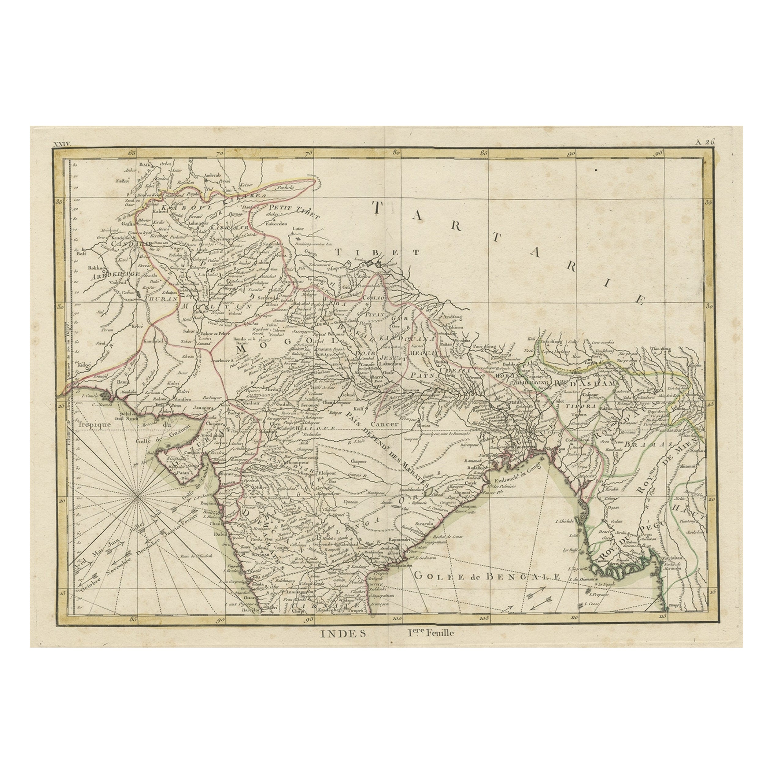
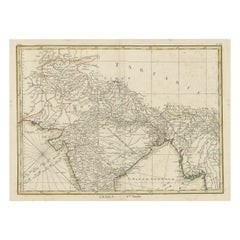
- Old Map of North India From Kandahar East to Burma 'Pegu' and South to Goa, 1776Located in Langweer, NLDescription: Antique map titled 'Indes Iere Feuille'. Old map of northern India. Covers the subcontinent from Kandahar east as far as Burma (Pegu) and south to just past Goa. Nam...Category
Antique 1770s Maps
MaterialsPaper
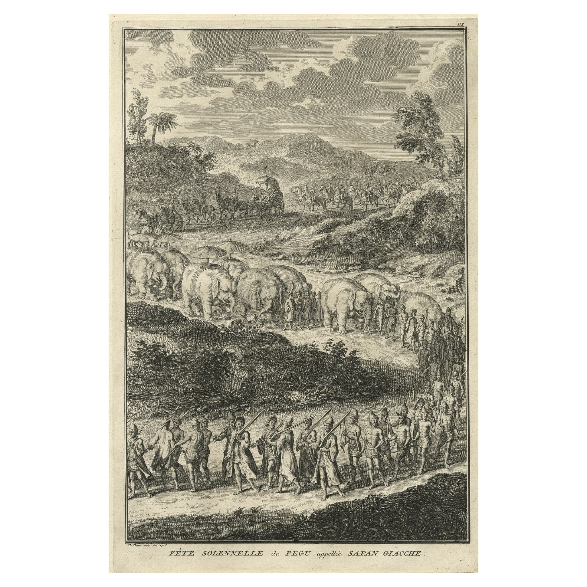
- Print of the Solemn Celebration Sapan Giacche in Pegu, Burma 'Myanmar', 1725Located in Langweer, NLAntique print, titled: 'Fete Solennelle de Pegu appelee Sapan Giacche' This plate shows the Solemn celebration called Sapan Giacche in Pegu or Bago, the capital of the Bago Regio...Category
Antique 1720s Prints
MaterialsPaper
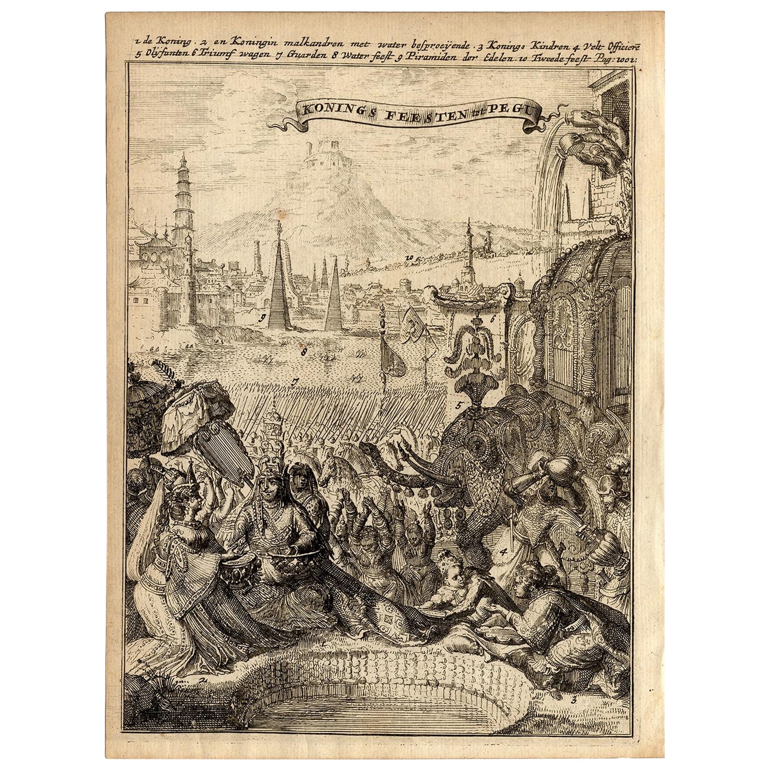
- Very Rare Antique Print of the Kings Celebrations in Pegu, Myanmar, 1682Located in Langweer, NLPlate: 'Konings feesten tot Pegu.' (Kings celebrations in Pegu.) On this plate: 1. The King. 2. And the Queen, sprinkling water on each other. 3. Their children. 4. Officers. 5. ...Category
Antique 1680s Prints
MaterialsPaper
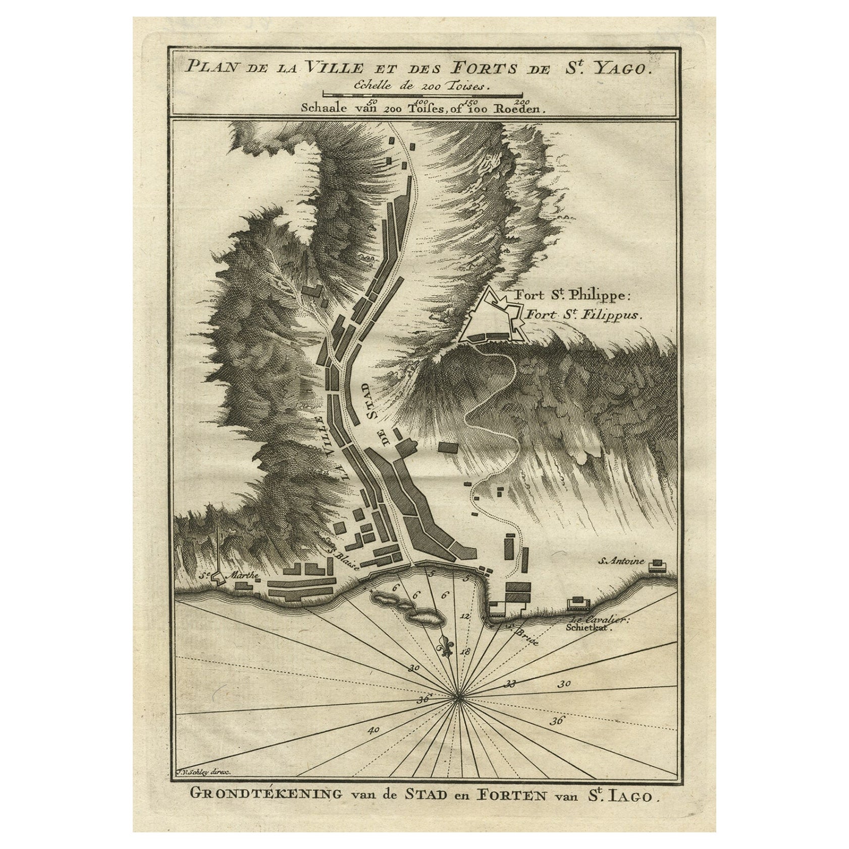
- Antique Plan of the Forts and Town of St. Yago in the Cape Verde Islands, 1747By Jakob van der SchleyLocated in Langweer, NLAntique map titled 'Plan de la Ville et des Forts de St. Yago - Grondtekening van de Stad en Forten van St. Iago'. Plan of the Forts and Town of St. Yago in the Cape Verde Islands. T...Category
Antique 18th Century Maps
MaterialsPaper
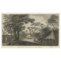
- Cemetery on Amsterdam Island, French Territory in the Indian Ocean, ca.1785Located in Langweer, NLAntique print titled 'Begraafplaats op het eiland Amsterdam'. Engraved view of a local cemetery on Amsterdam Island, a small French territory in the southern Indian Ocean. Origin...Category
Antique 1780s Prints
MaterialsPaper


You May Also Like
- St. Christophe 'St. Kitts' Island: An 18th Century Hand-colored Map by BellinBy Jacques-Nicolas BellinLocated in Alamo, CAJacques Bellin's copper-plate map of the Caribbean island of Saint Kitts entitled "Carte De De l'Isle St. Christophe Pour servir á l'Histoire Genle. des V...Category
Antique Mid-18th Century French Maps
MaterialsPaper
- Original Antique Map of The World by Thomas Clerk, 1817Located in St Annes, LancashireGreat map of The Eastern and Western Hemispheres On 2 sheets Copper-plate engraving Drawn and engraved by Thomas Clerk, Edinburgh. Published by Mackenzie And Dent, 1817 ...Category
Antique 1810s English Maps
MaterialsPaper
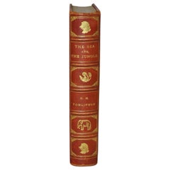
- H.M. Tomlinson "The Sea and The Jungle" 1st Edition Woodcuts by Clare LeightonBy TomlinsonLocated in San Francisco, CAH.M. Tomlinson "The Sea and The Jungle" First Edition with woodcuts by Clare Leighton, circa 1930 Rare First Edition. Very good condition. Fantastic woodcuts by noted artist Clare...Category
Early 20th Century American American Classical Books
MaterialsOther
- Hand-Colored 18th Century Homann Map of Denmark and Islands in the Baltic SeaBy Johann Baptist HomannLocated in Alamo, CAAn 18th century copper plate hand-colored map entitled "Insulae Danicae in Mari Balthico Sitae utpote Zeelandia, Fionia, Langelandia, Lalandia, Falstria, Fembria Mona" created by Joh...Category
Antique Early 18th Century German Maps
MaterialsPaper
- Alpine Ski Photograph, 'St. Moritz' Taken from Original 1930s PhotographLocated in Oxfordshire, GBAlpine Ski photograph. 'St. MORITZ', a new mounted black and white photographic image after an original 1930s skiing photograph. Prior to being a recreational activity skiing was purely a means of travelling from A to B through the snow, it only started to become the sport it is today in the mid-1800s. St. Moritz is a luxury alpine resort town in Switzerland's Engadin valley. It has hosted the Winter Olympics twice, has the Cresta Run...Category
Vintage 1930s English Sporting Art Sports Equipment and Memorabilia
MaterialsPaper
- Original Antique Map of Spain and Portugal by Thomas Clerk, 1817Located in St Annes, LancashireGreat map of Spain and Portugal Copper-plate engraving Drawn and engraved by Thomas Clerk, Edinburgh. Published by Mackenzie And Dent, 1817 Unframed.Category
Antique 1810s English Maps
MaterialsPaper


Recently Viewed
View AllMore Ways To Browse
Southern Furniture Company
Antique Spelling
Indian Portuguese
Native Indian Figures
British East Indies
Antique French Wall Tapestry
Antique Wool Tapestry
Large Coin
Midcentury Brutalist Wall
Antique Lacquer Cabinet
Display Cabinets Light
Regency Pair Of Cabinets
Lighted Display Cabinet
Antique Flower Pendant
Domed Band
Pair Of Wide Cabinets
Metal Cabinets With Glass Doors
Display Shelves With Drawers