Items Similar to Old Map of Morocco, The Canary Islands, Madeira, Inset of Penon de Velez, 1605


Want more images or videos?
Request additional images or videos from the seller
1 of 5
Old Map of Morocco, The Canary Islands, Madeira, Inset of Penon de Velez, 1605
About the Item
Antique map titled 'Fessae et Marocchi Regna'. Original antique map of Morocco, extending south to Cape Bojador and , north to the Spanish Coast. Inset of Penon de Velez. Artists and Engravers: Jodocus Hondius the Elder (1563-1612), or Joost de Hondt, was one of the most prominent geographers and engravers of his time. His work did much to establish Amsterdam as the center of cartographic publishing in the seventeenth century. Born in Wakken but raised in Ghent, the young Jodocus worked as an engraver, instrument maker, and globe maker.
Artist: Jodocus Hondius the Elder (1563-1612), or Joost de Hondt, was one of the most prominent geographers and engravers of his time. His work did much to establish Amsterdam as the center of cartographic publishing in the seventeenth century. Born in Wakken but raised in Ghent, the young Jodocus worked as an engraver, instrument maker, and globe maker.
Condition: Good, professionally restored. Bit wrinkled, French text on verso. Please study image carefully.
Date: 1605
Overall size: 52 x 44 cm.
Image size: 48 x 35.5 cm.
- Dimensions:Height: 20.48 in (52 cm)Width: 17.33 in (44 cm)Depth: 0 in (0.01 mm)
- Materials and Techniques:
- Period:
- Date of Manufacture:1605
- Condition:
- Seller Location:Langweer, NL
- Reference Number:
About the Seller
5.0
Platinum Seller
These expertly vetted sellers are 1stDibs' most experienced sellers and are rated highest by our customers.
Established in 2009
1stDibs seller since 2017
1,938 sales on 1stDibs
Typical response time: <1 hour
- ShippingRetrieving quote...Ships From: Langweer, Netherlands
- Return PolicyA return for this item may be initiated within 14 days of delivery.
More From This SellerView All
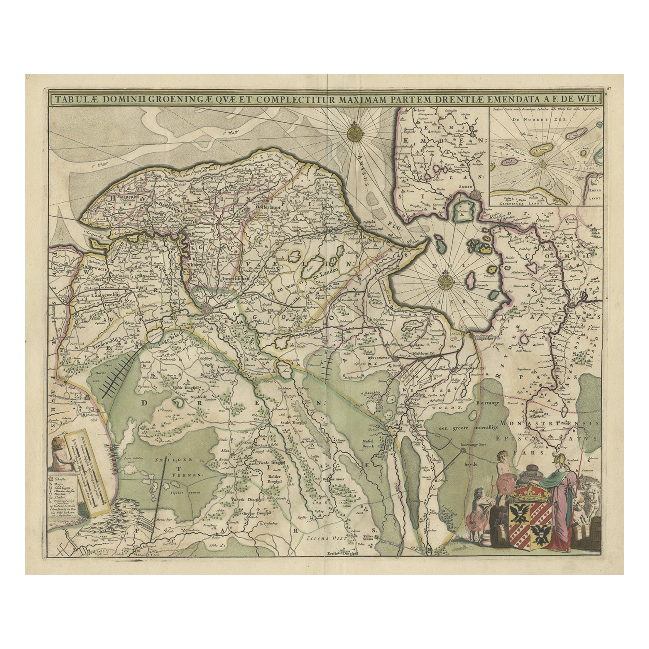
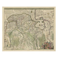
- Old Map of the Province of Groningen, the Netherlands & inset of Islands, C.1680Located in Langweer, NLAntique map titled 'Tabulae dominii Groeningae quae et complecitur maximam partem Drentiae Emendata'. Old map of the province of Groningen, the Netherlands. With an inset map of ...Category
Antique 1680s Maps
MaterialsPaper
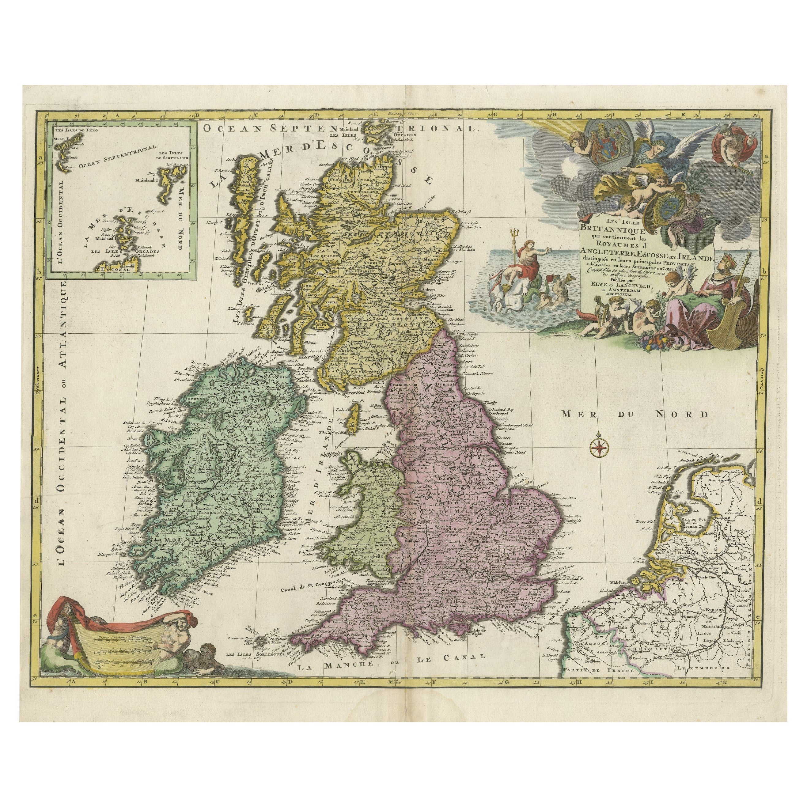
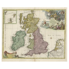
- Old Map of the UK & Ireland, Insets of Orkney, Shetland and Faroe Islands, 1786Located in Langweer, NLTitle: "Les Isles Britanniques qui contiennent les Royaumes d'Angleterre, Escosse, et Irlande". Hand-colored engraved map with 2 (large) decorative cartouches, inset map of the O...Category
Antique 1780s Maps
MaterialsPaper
- Antique Map of Scotland With an Inset Map of the Shetland Islands, 1854Located in Langweer, NLStunning Map of Scotland that will look beautiful in any setting framed on the wall. Description: Large Antique map titled 'Scotland with its Islands, drawn from the Topographical surveys...Category
Antique 1850s Maps
MaterialsPaper
- Antique Map of France with an Inset Map of the Island of Corsica, c.1820Located in Langweer, NLAntique map titled 'Frankrijk naar de nieuwste bepalingen meerendeels gevolgd naar Lapie'. Beautiful map of France with an inset map of the island of Corsica. Includes a table with r...Category
Antique 19th Century Maps
MaterialsPaper
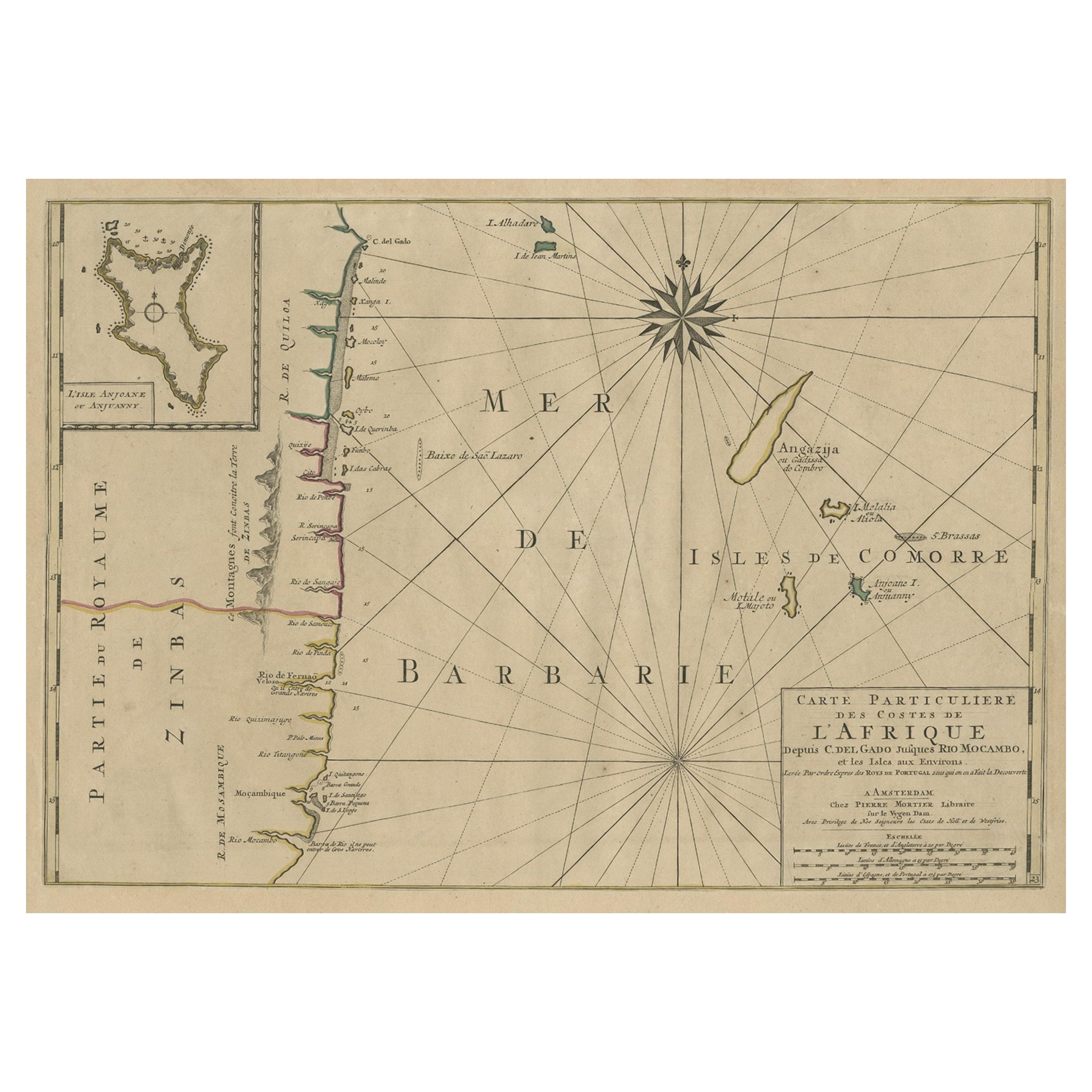
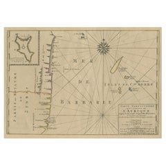
- Map of the Mozambique and Tanzania Coast & Inset Map of Anjouan Island, ca.1700Located in Langweer, NLAntique map titled 'Carte particuliere des Costes de l'Afrique'. Depicts the coasts of Mozambique and Tanzania. With an inset map of Anjouan Island. Artists and engravers: Pub...Category
Antique Early 1700s Maps
MaterialsPaper
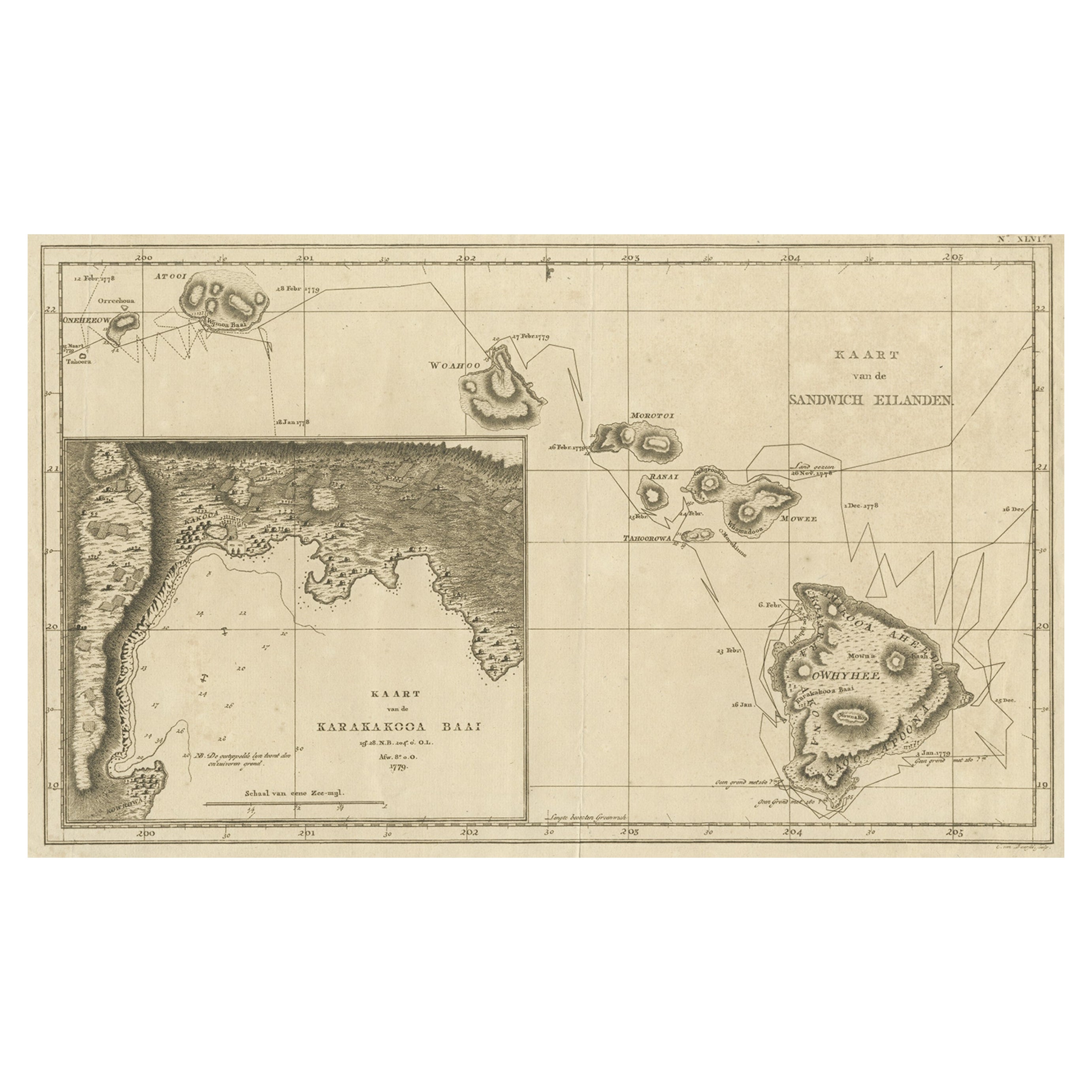
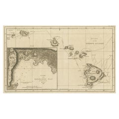
- Map of the Hawaiian Islands with a Large Inset of Karakakooa Bay, 1803Located in Langweer, NLAntique map titled 'Kaart van de Sandwich Eilanden'. Map of the Hawaiian Islands with a large inset of Karakakooa Bay, including soundings and anchorages. Originates from 'Reizen R...Category
Antique Early 1800s Maps
MaterialsPaper


You May Also Like
- Old Nautical Map of CorsicaLocated in Alessandria, PiemonteST/556/1 - Old map of Corsica isle, surveyed by Captain Hell, of the French Royal Navy in 1824, engraved and published on 1874, with additions and corre...Category
Antique Early 19th Century English Other Prints
MaterialsPaper
- Old Horizontal Map of EnglandBy TassoLocated in Alessandria, PiemonteST/520 - Old rare Italian map of England, dated 1826-1827 - by Girolamo Tasso, editor in Venise, for the atlas of M.r Le-Sage.Category
Antique Early 19th Century Italian Other Prints
MaterialsPaper
- Map of the Republic of GenoaLocated in New York, NYFramed antique hand-coloured map of the Republic of Genoa including the duchies of Mantua, Modena, and Parma. Europe, late 18th century. Dimension: 25...Category
Antique Late 18th Century European Maps
- Hand-Colored 18th Century Homann Map of Denmark and Islands in the Baltic SeaBy Johann Baptist HomannLocated in Alamo, CAAn 18th century copper plate hand-colored map entitled "Insulae Danicae in Mari Balthico Sitae utpote Zeelandia, Fionia, Langelandia, Lalandia, Falstria, Fembria Mona" created by Joh...Category
Antique Early 18th Century German Maps
MaterialsPaper
- Map of the Holy Land "Carte de la Syrie et de l'Egypte" by Pierre M. LapieBy Pierre M. LapieLocated in Alamo, CAAn early 19th century map of ancient Syria and Egypt entitled "Carte de la Syrie et de l'Egypte anciennes/dressée par M. Lapie, Colonel d'Etat Major, et...Category
Antique Early 19th Century French Maps
MaterialsPaper
- Map "Estuary- Mouth of the Thames"Located in Alessandria, PiemonteST/426 - Antique French Map of the estuary of the Thames, map dated 1769 - "Mape of the entrance of the Thames. Designed by filing of Navy cards fo...Category
Antique Mid-18th Century French Other Prints
MaterialsPaper


