Items Similar to Antique Plan of the Forts and Town of St. Yago in the Cape Verde Islands, 1747


Want more images or videos?
Request additional images or videos from the seller
1 of 6
Antique Plan of the Forts and Town of St. Yago in the Cape Verde Islands, 1747
About the Item
Antique map titled 'Plan de la Ville et des Forts de St. Yago - Grondtekening van de Stad en Forten van St. Iago'. Plan of the Forts and Town of St. Yago in the Cape Verde Islands. This map originates from 'Historische beschryving der reizen, of Nieuwe en volkoome verzameling van de aller-waardigste en zeldsaamste Zee- en Landtogten' by P. de Hondt.
Artists and Engravers: Engraved by Jakob van der Schley (Amsterdam 1715-1779), a Dutch draughtsman and engraver. He studied under Bernard Picart and became heavily influenced by his style.
Condition: Good, given age. General age-related toning and/or occasional minor defects from handling. Please study scan carefully.
Date: 1747
Overall size: 20.1 x 27 cm
Image size: 14.7 x 21.3 cm
We sell original antique maps to collectors, historians, educators and interior decorators all over the world. Our collection includes a wide range of authentic antique maps from the 16th to the 20th centuries. Buying and collecting antique maps is a tradition that goes back hundreds of years. Antique maps have proved a richly rewarding investment over the past decade, thanks to a growing appreciation of their unique historical appeal. Today the decorative qualities of antique maps are widely recognized by interior designers who appreciate their beauty and design flexibility. Depending on the individual map, presentation, and context, a rare or antique map can be modern, traditional, abstract, figurative, serious or whimsical. We offer a wide range of authentic antique maps for any budget.
- Creator:Jakob van der Schley (Artist)
- Dimensions:Height: 10.63 in (27 cm)Width: 7.92 in (20.1 cm)Depth: 0 in (0.01 mm)
- Materials and Techniques:
- Period:
- Date of Manufacture:1747
- Condition:Condition: Good, given age. General age-related toning and/or occasional minor defects from handling. Please study scan carefully.
- Seller Location:Langweer, NL
- Reference Number:
About the Seller
5.0
Platinum Seller
These expertly vetted sellers are 1stDibs' most experienced sellers and are rated highest by our customers.
Established in 2009
1stDibs seller since 2017
1,919 sales on 1stDibs
Typical response time: <1 hour
- ShippingRetrieving quote...Ships From: Langweer, Netherlands
- Return PolicyA return for this item may be initiated within 14 days of delivery.
More From This SellerView All
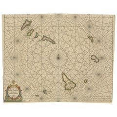
- Original Antique Map of the Cape Verde Islands, 1746Located in Langweer, NLAntique map titled 'Carte Des Isles Du Cap Verd.' Original antique map of the Cape Verde Islands. Decorative cartouche and compass rose. Extends from Isle d...Category
Antique 18th Century Maps
MaterialsPaper
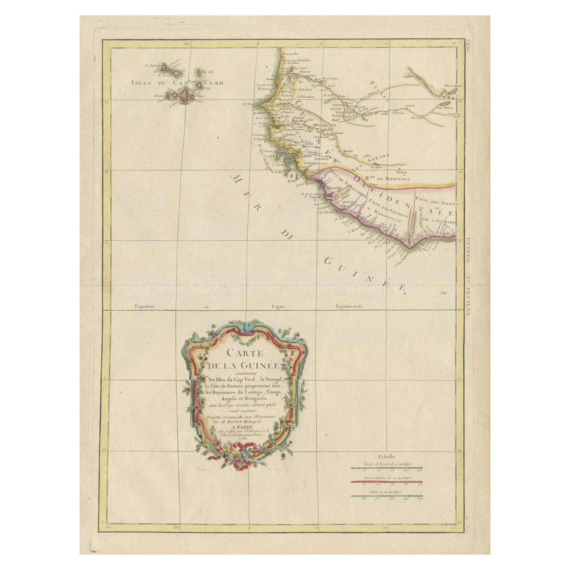
- Antique Map of the Coast of Guinea and the Cape Verde IslandsLocated in Langweer, NLAntique map titled 'Carte de la Guinée (..)'. This map was originally part of a 2 sheet larger map of Eastern Africa, showing the Cape Verde Islands and Senegal. This map originates ...Category
Antique Late 18th Century Maps
MaterialsPaper
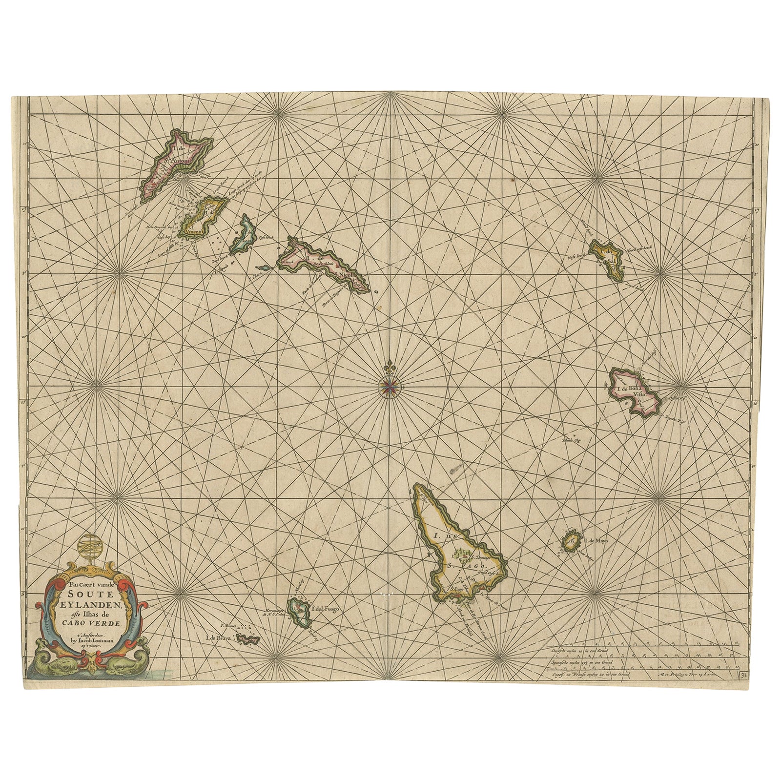
- Antique Map of the Cape Verde Islands, Africa, ca.1670Located in Langweer, NLAntique map titled 'Pascaert van de Soute Eylanden ofte Ilhas de Cabo Verde'. This map depicts the Cape Verde Islands (Africa). Islands titled 'Ile de B...Category
Antique 1670s Maps
MaterialsPaper
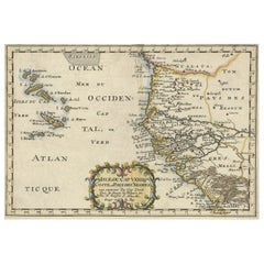
- Antique Map of the West African Coast and the Cape Verde Islands, c.1680Located in Langweer, NLAntique map Africa titled 'Isles du Cap Verd Coste et Pays des Negres'. Antique map of the coast of Africa and the Cape Verde islands. Artists a...Category
Antique 17th Century Maps
MaterialsPaper
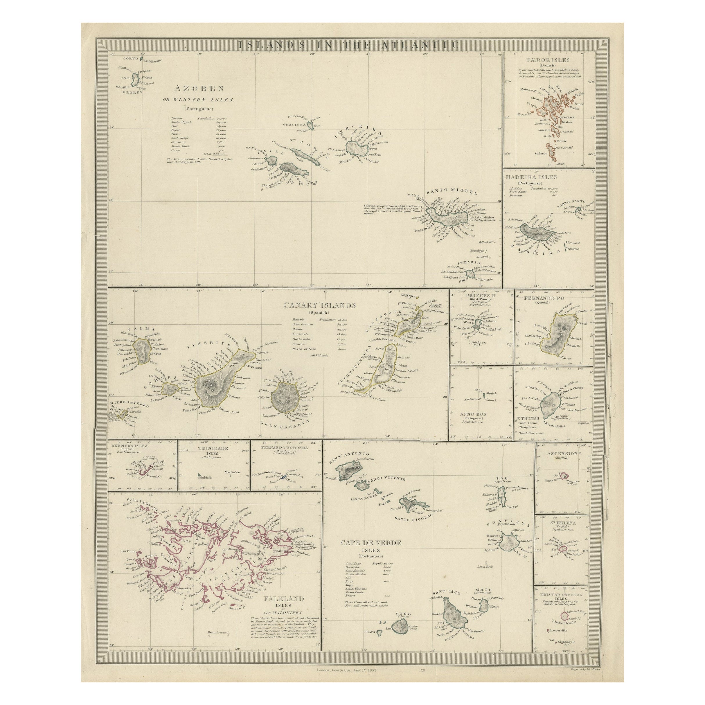
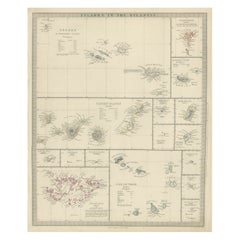
- Antique Map of the Islands in the Atlantic Ocean including Bermuda & Cape VerdeLocated in Langweer, NLAntique map titled 'Islands in the Atlantic'. Steel engraved map of the islands in the Atlantic Ocean. It shows 16 individual maps on one sheet. Covers the Azores or Western Isles, Faeroe Isles, Madeira Isles, Princes Island, Canary Islands, Fernando Po, Anno Bon, St. Thomas, Bermuda Isles, Trinidade Isles, Fernando Noronha, Cape Verde Isles, Ascension Island, St. Helena, Tristan d'Acunha Isles and the Falkland Isles. Engraved by J. & C. Walker. Published by George Cox...Category
Antique Mid-19th Century Maps
MaterialsPaper
- Antique Map of the Coast of Africa and the Cape Verde Islands, ca.1680Located in Langweer, NLAntique map Africa titled 'Isles du Cap Verd Coste et Pays des Negres'. Antique map of the coast of Africa and the Cape Verde islands. Artis...Category
Antique 1680s Maps
MaterialsPaper


You May Also Like
- Hand-Colored 18th Century Homann Map of Denmark and Islands in the Baltic SeaBy Johann Baptist HomannLocated in Alamo, CAAn 18th century copper plate hand-colored map entitled "Insulae Danicae in Mari Balthico Sitae utpote Zeelandia, Fionia, Langelandia, Lalandia, Falstria, Fembria Mona" created by Joh...Category
Antique Early 18th Century German Maps
MaterialsPaper
- Catalogue of Engraved Views, Plans, Etc., Of New York City, 1st EdLocated in valatie, NYA catalogue of engraved views, plans, etc., Of New York City, (The Collection of Percy R. Pyne II). Privately Printed by The De Vinne Press, New York, 1912. Limited to 100 copies. Gr...Category
Early 20th Century American Books
MaterialsPaper
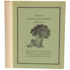
- More Massachusetts Towns, Illustrated with Wood Engravings of 53 Mass. TownsLocated in valatie, NYMore Massachusetts Towns, illustrated with wood engravings of fifty-three Massachusetts Towns, drawn in 1840 by J. W. Barber. Commentary by Ivan Sandrof, and a special foreword by Mr...Category
Vintage 1960s American Books
MaterialsPaper
- Original Antique Map / City Plan of Brussels by Tallis, circa 1850Located in St Annes, LancashireGreat map of Brussels. Steel engraving. Published by London Printing & Publishing Co. (Formerly Tallis), C.1850 Free shipping.Category
Antique 1850s English Maps
MaterialsPaper
- St. Christophe 'St. Kitts' Island: An 18th Century Hand-colored Map by BellinBy Jacques-Nicolas BellinLocated in Alamo, CAJacques Bellin's copper-plate map of the Caribbean island of Saint Kitts entitled "Carte De De l'Isle St. Christophe Pour servir á l'Histoire Genle. des V...Category
Antique Mid-18th Century French Maps
MaterialsPaper
- H.M. Tomlinson "The Sea and The Jungle" 1st Edition Woodcuts by Clare LeightonBy TomlinsonLocated in San Francisco, CAH.M. Tomlinson "The Sea and The Jungle" First Edition with woodcuts by Clare Leighton, circa 1930 Rare First Edition. Very good condition. Fantastic woodcuts by noted artist Clare...Category
Early 20th Century American American Classical Books
MaterialsOther


Recently Viewed
View AllMore Ways To Browse
Cape Beige
Antique Cape
Antique Capes
Cape Antique Furniture
St Bernard
Cape Dutch
World Maps Antique Style
World Map Antique Style
Antique Style Map Of The World
Scan Style
Cape Dutch Furniture
Van Der Zee
Cape Verde
Cape Dutch Antique Furniture
Antique Furniture Cape Town
Used Nautical Charts
Antique World Chart
Antique Char