Items Similar to California and Its Gold Regions by Fayette Robinson

Want more images or videos?
Request additional images or videos from the seller
1 of 8
California and Its Gold Regions by Fayette Robinson
$750
£573.41
€660.46
CA$1,050.98
A$1,173.32
CHF 614.80
MX$14,362.59
NOK 7,807.99
SEK 7,361.95
DKK 4,929.07
Shipping
Retrieving quote...The 1stDibs Promise:
Authenticity Guarantee,
Money-Back Guarantee,
24-Hour Cancellation
About the Item
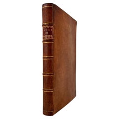
California and Its Gold Regions
by Fayette Robinson
137 pages, small octavo
Published New York: Stringer & Townsend 222 Broadway. 1849. First Edition
Beautifully rebound in gilt-tooled 3/4 red morocco with marbleized end papers.
Contains a replaced map of the United States. Bookplate of former owner.
Very good overall condition
Lovely little volume See table of contents in photos below for contents.
Originally published as a pamphlet
- Dimensions:Height: 8.5 in (21.59 cm)Width: 5 in (12.7 cm)Depth: 1.5 in (3.81 cm)
- Materials and Techniques:
- Place of Origin:
- Period:
- Date of Manufacture:1849
- Condition:Wear consistent with age and use. Minor losses.
- Seller Location:San Francisco, CA
- Reference Number:Seller: C1021-41A1stDibs: LU855245059652
About the Seller
5.0
Recognized Seller
These prestigious sellers are industry leaders and represent the highest echelon for item quality and design.
Platinum Seller
Premium sellers with a 4.7+ rating and 24-hour response times
Established in 1982
1stDibs seller since 2008
358 sales on 1stDibs
Typical response time: 1 hour
Associations
The Art and Antique Dealers League of AmericaAntiques Associations Members
- ShippingRetrieving quote...Shipping from: San Francisco, CA
- Return Policy
Authenticity Guarantee
In the unlikely event there’s an issue with an item’s authenticity, contact us within 1 year for a full refund. DetailsMoney-Back Guarantee
If your item is not as described, is damaged in transit, or does not arrive, contact us within 7 days for a full refund. Details24-Hour Cancellation
You have a 24-hour grace period in which to reconsider your purchase, with no questions asked.Vetted Professional Sellers
Our world-class sellers must adhere to strict standards for service and quality, maintaining the integrity of our listings.Price-Match Guarantee
If you find that a seller listed the same item for a lower price elsewhere, we’ll match it.Trusted Global Delivery
Our best-in-class carrier network provides specialized shipping options worldwide, including custom delivery.More From This Seller
View AllCalifornia Illustrated by J. M. Letts
Located in San Francisco, CA
California Illustrated
by J. M. Letts
Published New York: R. T. Young, 140 Fulton Street. Later edition, published 1853.
Rebound in 3/4 blue calf with marbleized boards and end paper...
Category
Antique Mid-19th Century American Books
Materials
Leather, Paper
Three Years in California by J. D. Borthwick
Located in San Francisco, CA
Three Years in California
by J. D. Borthwick
Published William Blackwood and Sons Edinburgh and London 1857, First Edition
Bound in 3/4 leather and marbleized boards, gilt tooled spi...
Category
Antique Mid-19th Century English Books
Materials
Leather, Paper
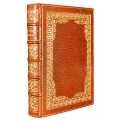
The Works of Shakespeare Complete in Seven Leatherbound Volumes
Located in San Francisco, CA
The Works of Shakespeare Complete in 7 duodecimo 3/4 leather bound volumes with marbleized boards and end papers, top edges gilt. A charming set in attractive original condition. Fro...
Category
Early 20th Century American Books
Materials
Leather, Paper
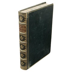
Europe During the Middle Ages by Henry Hallam 3 Volumes Leatherbound
Located in San Francisco, CA
Hallam's View of the State of Europe During the Middle Ages, complete in 3 leather bound octavo volumes with marbleized boards. The volumes contain the bookplate of former owner, Cha...
Category
Antique 1830s English Books
Materials
Leather, Paper

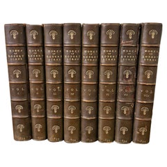
Works of Robert Burns 1834
Located in San Francisco, CA
The works of Robert Burns in 8 volumes bound in full blue calf and printed in Waterloo, 1834. One volume as is. Spines sun faded to green
Category
Antique 1830s English Books
Materials
Leather, Paper
$475 / set
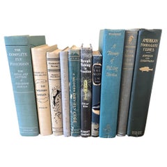
Small Library of Ten Volumes of Vintage Fishing Books Largely First Editions
Located in San Francisco, CA
This library of 10 books (mostly 1st Editions) contains 3 volumes with dust jackets:
Nymph Fishing in Practice by Oliver Kite, London Herbert Jenkins (reprinted 1969)
The Salmon by...
Category
20th Century American Books
Materials
Paper
You May Also Like
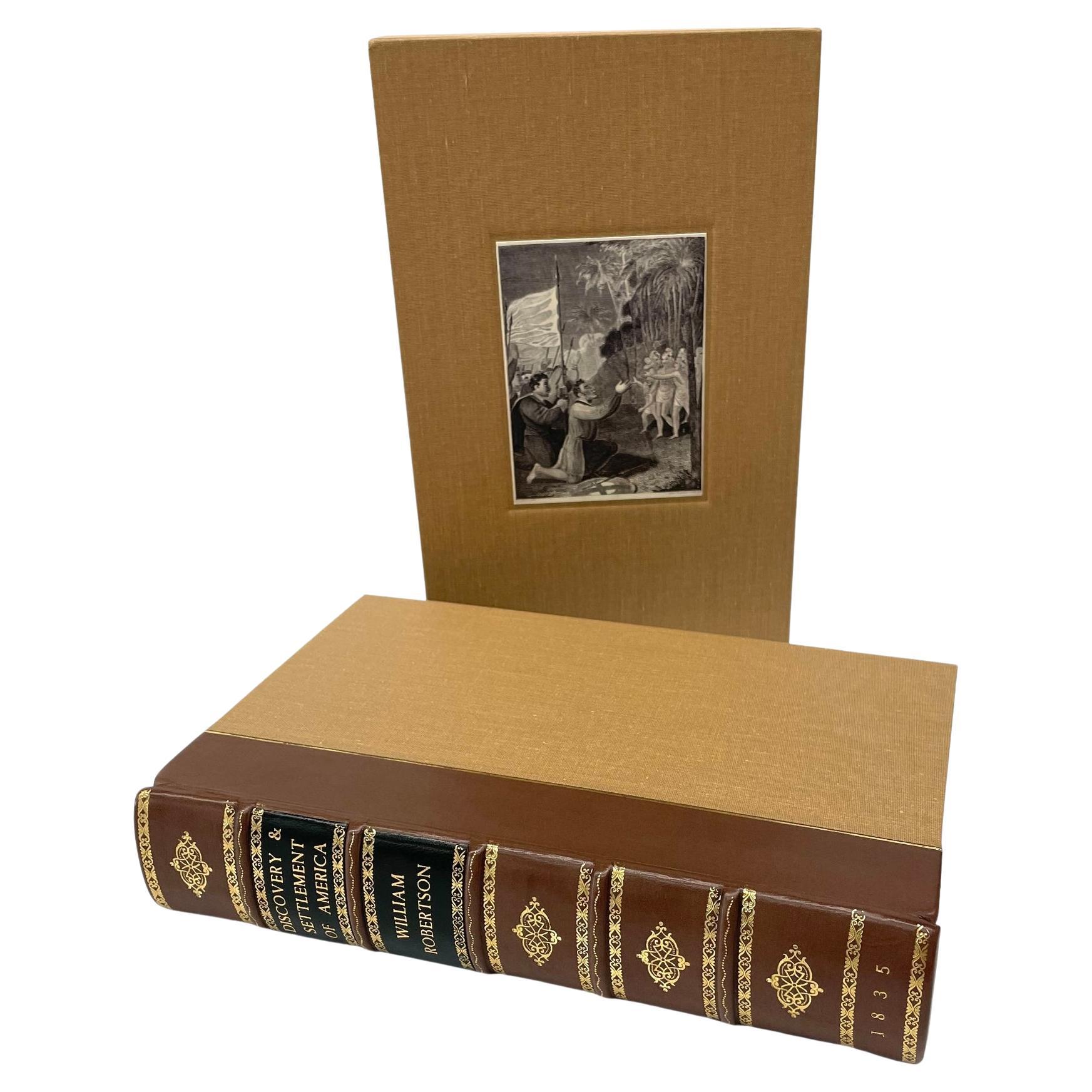
The History of the Discovery and Settlement of America by W. Robertson, 1835
By William Robertson
Located in Colorado Springs, CO
Robertson, William, Frost, John. The History of the Discovery and Settlement of America, With an Account of His Life and Writings, To which are added Questions for the Examination of...
Category
Antique 1830s American Early Victorian Books
Materials
Leather, Fabric, Paper

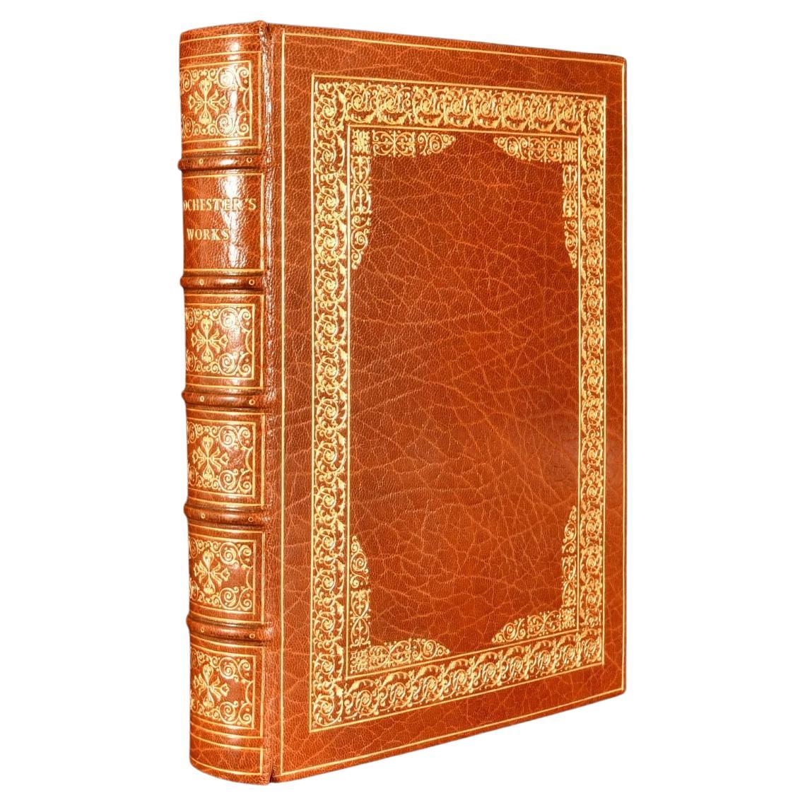
1926 Collected Works of John Wilmot, Earl of Rochester
By John Wilmot
Located in Bath, GB
A fine limited edition of the works of the Earl of Rochester, in a sumptuous full crushed morocco binding by Bayntun Riviere.
Number 285 of a 1050 copy limitation.
In a beautiful c...
Category
Vintage 1920s British Books
Materials
Paper
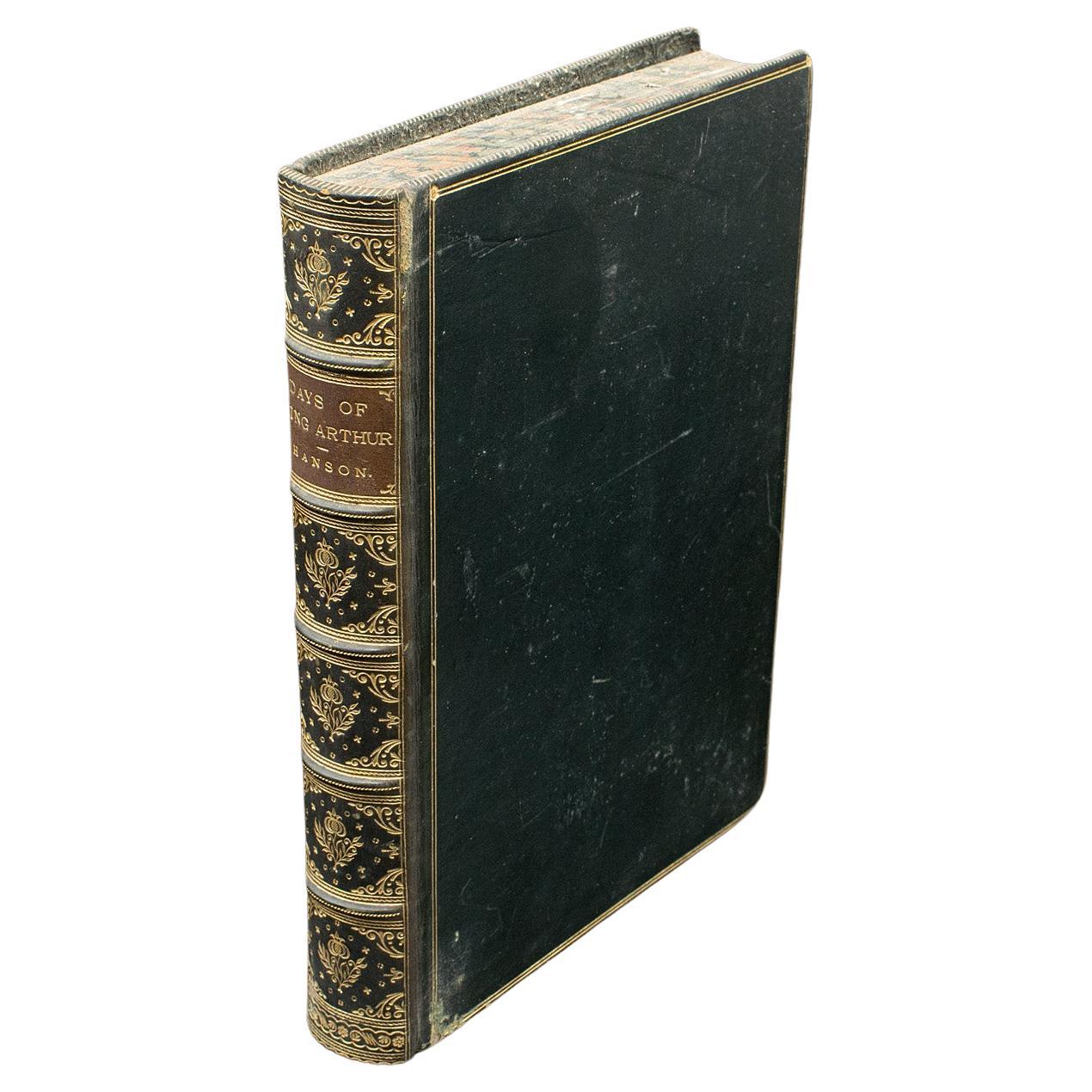
Antique Book, Days of King Arthur, Mythology, English, Fiction, Late Victorian
Located in Hele, Devon, GB
This is an antique mythology book, Days of King Arthur by Charles Henry Hanson. An English language, hard bound fictional work with illustrations by Gus...
Category
Antique Late 19th Century British Late Victorian Books
Materials
Paper
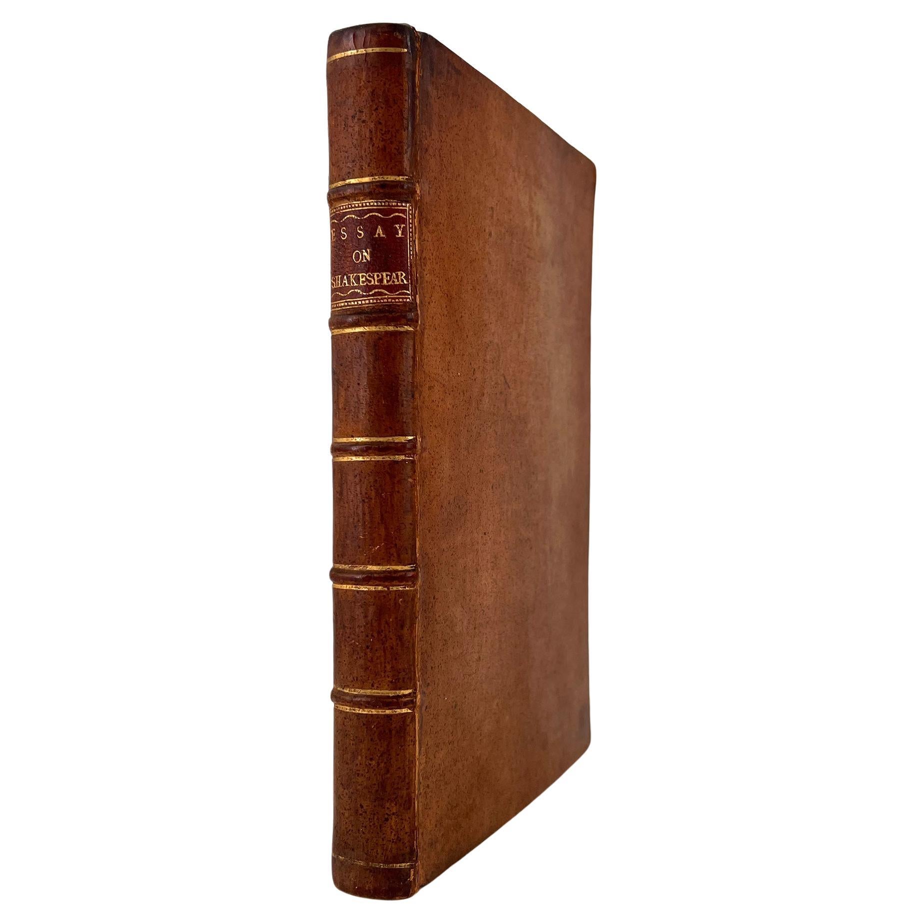
An Essay on the Writings and Genius of Shakespeare by Montagu, Mrs. (Elizabeth)
Located in Middletown, NY
Montagu, Mrs. (Elizabeth), 1718-1800
An Essay on the Writings and Genius of Shakespeare; An essay on the writings and genius of Shakespeare, compared with the Greek and French dramat...
Category
Antique Mid-18th Century English Books
Materials
Gold Leaf
1927 Dictionary of Modern English Usage H.W. Fowler Oxford Antique Leather Book
Located in Dayton, OH
A Dictionary of Modern English Usage - by H.W. Fowler - Published by G.P. Putnam's Sons, 1927 - Printed in England at the Oxford university Press by John Johnson - Soft cover, black ...
Category
Vintage 1920s Books
Materials
Leather, Paper
$372 Sale Price
20% Off
Samuel Taylor Coleridge's "Zapolya, a Christmas Tale" in Fine Leather Binding
Located in Middletown, NY
Samuel Taylor Coleridge. Zapolya: A Christmas Tale; in Two Parts: The Prelude entitled "The Usurper's Fortune;" and The Sequel, entitled "The Usurper's Fate."
London: Rest Fenner, ...
Category
Antique Early 19th Century English Books
Materials
Gold Leaf
More Ways To Browse
Antique Furniture California
Antique Map New York
19th Century Robinson
Antique Moroccan Table
Antique Maps California
Antique Pamphlets
Century Furniture Down Chair
Antique Carved Walnut Table
Brazilian Chair 1970
Vintage 2000S
Italian Hand Painted Table
Afghanistan Kilim
Green Carpet 1960
English Furniture Library
Medieval Antique
1904 Chair
Antique Furniture Castors
Carlo Bellini