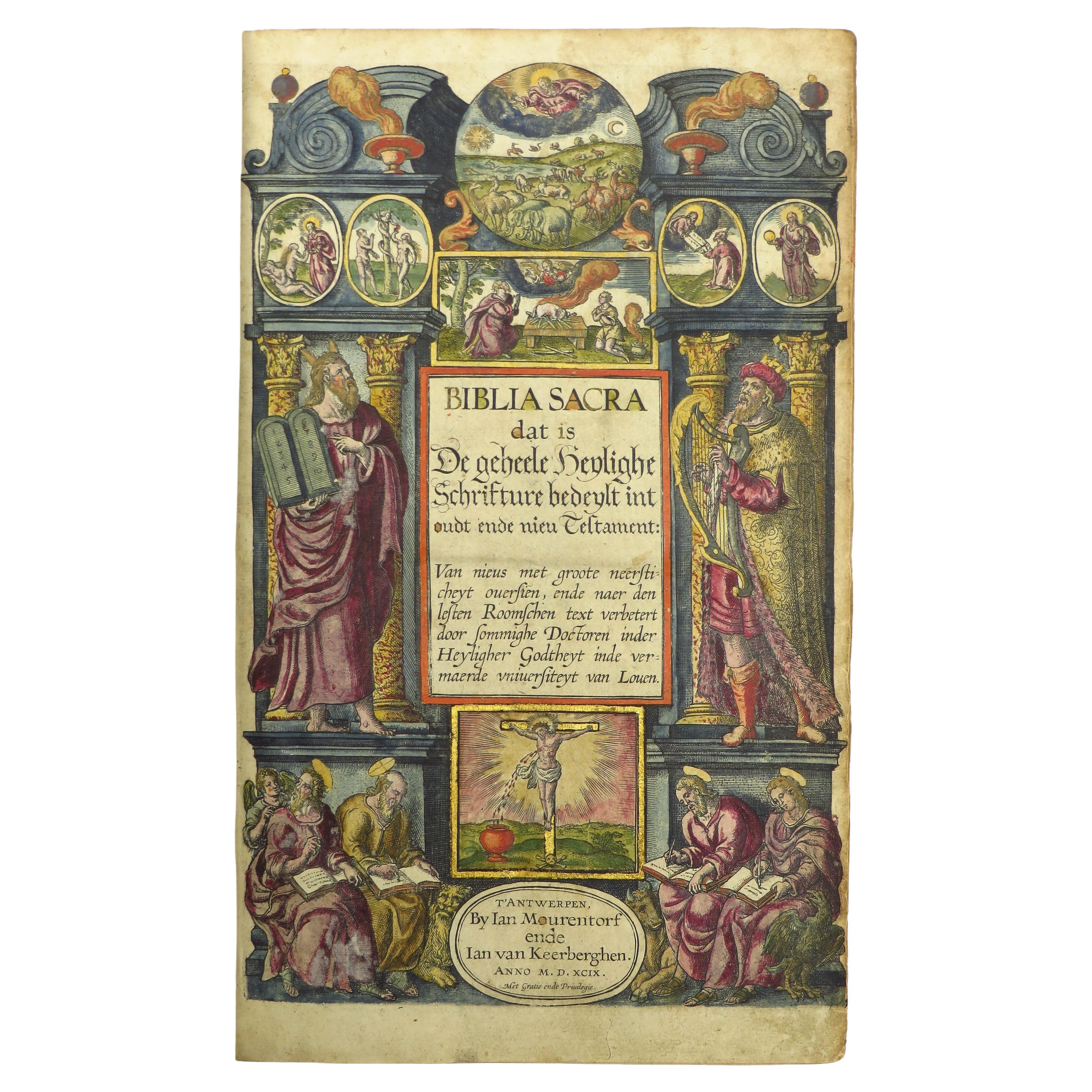
The famous Elzevier Dutch States Bible, finely coloured and highlighted
View Similar Items

Want more images or videos?
Request additional images or videos from the seller
1 of 21
The famous Elzevier Dutch States Bible, finely coloured and highlighted
$52,411.14List Price
About the Item
- Creator:Theodorus Danckerts (Designer)
- Dimensions:Height: 16.93 in (43 cm)Width: 11.03 in (28 cm)Depth: 5.12 in (13 cm)
- Style:Dutch Colonial (Of the Period)
- Materials and Techniques:
- Place of Origin:
- Period:1660-1669
- Date of Manufacture:1663
- Condition:
- Seller Location:ZWIJNDRECHT, NL
- Reference Number:1stDibs: LU9419237458722
About the Seller
No Reviews Yet
Vetted Professional Seller
Every seller passes strict standards for authenticity and reliability
Established in 2004
1stDibs seller since 2023
Authenticity Guarantee
In the unlikely event there’s an issue with an item’s authenticity, contact us within 1 year for a full refund. DetailsMoney-Back Guarantee
If your item is not as described, is damaged in transit, or does not arrive, contact us within 7 days for a full refund. Details24-Hour Cancellation
You have a 24-hour grace period in which to reconsider your purchase, with no questions asked.Vetted Professional Sellers
Our world-class sellers must adhere to strict standards for service and quality, maintaining the integrity of our listings.Price-Match Guarantee
If you find that a seller listed the same item for a lower price elsewhere, we’ll match it.Trusted Global Delivery
Our best-in-class carrier network provides specialized shipping options worldwide, including custom delivery.More From This Seller
View AllHand-colored 16th century copy of the famous Moerentorf Bible
By Henry Moret
Located in ZWIJNDRECHT, NL
Publisher: Daniel Vervliet and Hendrik Swingen for Jan I Moretus & Jan I van Keerberghen
Place / Date: Antwerp, 1599
Biblia sacra. Dat is de geheele heylighe schrifture bed...
Category
Antique 16th Century Belgian Baroque Books
Materials
Wood, Paper

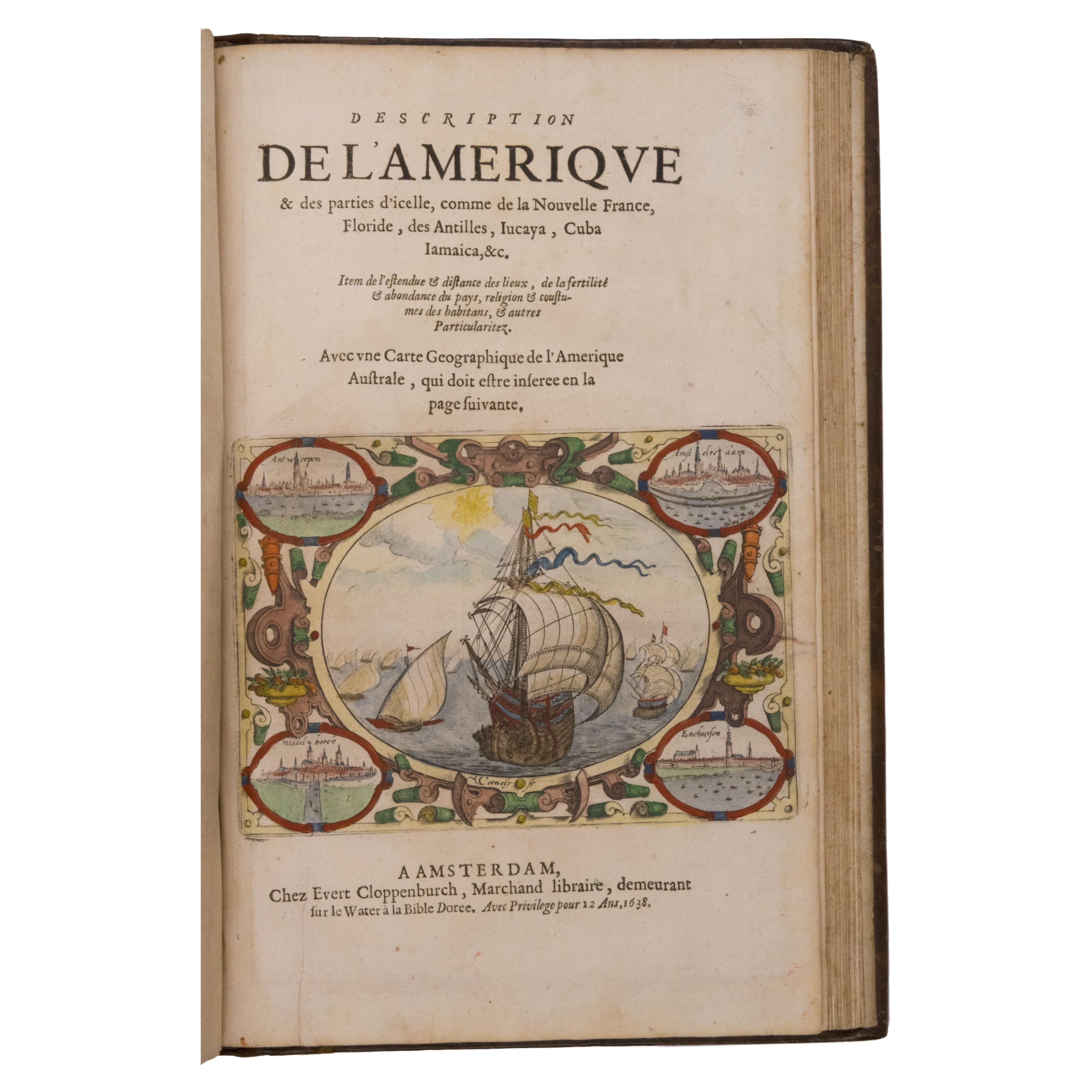
Seminal guide to the East and West Indies, with 42 coloured maps and plates
By Jan Huygen van Linschoten
Located in ZWIJNDRECHT, NL
Seminal guide to the East and West Indies, with 42 double-page and folding plates, including 6 maps, all engravings beautifully coloured by a contemporary hand
LINSCHOTEN, Jan Huygh...
Category
Antique Early 17th Century Dutch Dutch Colonial Books
Materials
Paper

$262,055 Sale Price
25% Off
Free Shipping
Hand-coloured set of Buffon’s Histoire naturelle in its most luxurious form
By Georges-Louis Leclerc, Comte de Buffon
Located in ZWIJNDRECHT, NL
Publisher: Buffon, Georges-Louis Leclerc de
Place / Date: Dordrecht, Abraham Blussé, 1766-1799
Size: 38 parts in 21 volumes.
Large 4to. With more than 1100 hand-coloured engraved ...
Category
Antique Late 18th Century Dutch Dutch Colonial Books
Materials
Paint, Paper
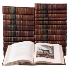
$125,786 Sale Price / set
20% Off
Free Shipping
Colored wall map of the WORLD
By Chambon
Located in ZWIJNDRECHT, NL
“Mappe Monde, contenant les Parties Connues du Globe Terrestre”
CHAMBON, Gobert-Denis (France, 17.. - 1781)
Paris, Longchamps et Janvier, 1754
Size H. 115 x W. 145 cm.
Gobert-Denis Chambon made copper engraving after the work of Guillaume De L’Isle, published in 1754 by Jean Janvier and S.G. Longschamps.
A huge wall map of the world in two hemispheres printed on two sheets, depicting the Eastern and Western hemispheres supported by two male figures, decorated at the bottom right and left with two celestial hemispheres (boreal and southern) and at the bottom in the middle with an armillary sphere, in addition.
This map is most notable for its depiction of the Sea of Japan labeled "Mer de Corée" and of "Mer de L'Ouest" or Sea of the West - a great sea, easily the size of the Mediterranean, to flow from the then-known Strait of Juan de Fuca...
Category
Antique Mid-18th Century French French Provincial Maps
Materials
Wood, Paper

A beautiful Celestial Table Globe produced by Gerard & Leonard Valk
By Gerard and Leonard Valk
Located in ZWIJNDRECHT, NL
A magnificent and very rare early 18th century celestial table globe produced by Gerard and Leonard Valk. Established at the end of the previous ...
Category
Antique Early 18th Century Dutch Dutch Colonial Globes
Materials
Other
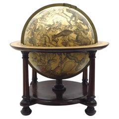
$186,430 Sale Price
20% Off
Free Shipping
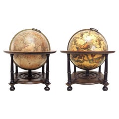
A pair of extremely rare Valk table globes
By Gerard and Leonard Valk
Located in ZWIJNDRECHT, NL
Title on the globes:
VALK, Gerard and Leonard. [Terrestrial globe:] Cosmotheore, caelesti nostro globo, par, et plane novus, hic terrestris ut existeret, certo scias, errore veterum ...
Category
Antique 18th Century Dutch Dutch Colonial Globes
Materials
Other
You May Also Like
Italy, Sicily, Sardinia, Corsica and Dalmatian Coast: A 17th Century Dutch Map
By Theodorus Danckerts
Located in Alamo, CA
This hand colored 17th century Dutch map entitled "Novissima et Accuratissima totius Italiae Corsicae et Sardiniae Descriptio" by Theodore Danckerts depicts the Italian Peninsula in ...
Category
Antique Late 17th Century Dutch Maps
Materials
Paper

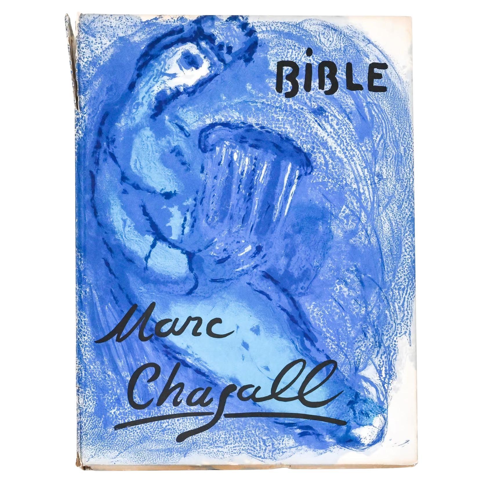
La Bible “Illustrations for the Bible” by Marc Chagall
By Marc Chagall
Located in Henley-on Thames, Oxfordshire
[Verve (Vol VIII, Nos. 33-34] 30 lithographs, including the cover (18 in color). Text in French by Jean Wahl and Meyer Schapiro. No dust jacket. some damage to the spine but lithogra...
Category
Mid-20th Century French Books
Materials
Paper

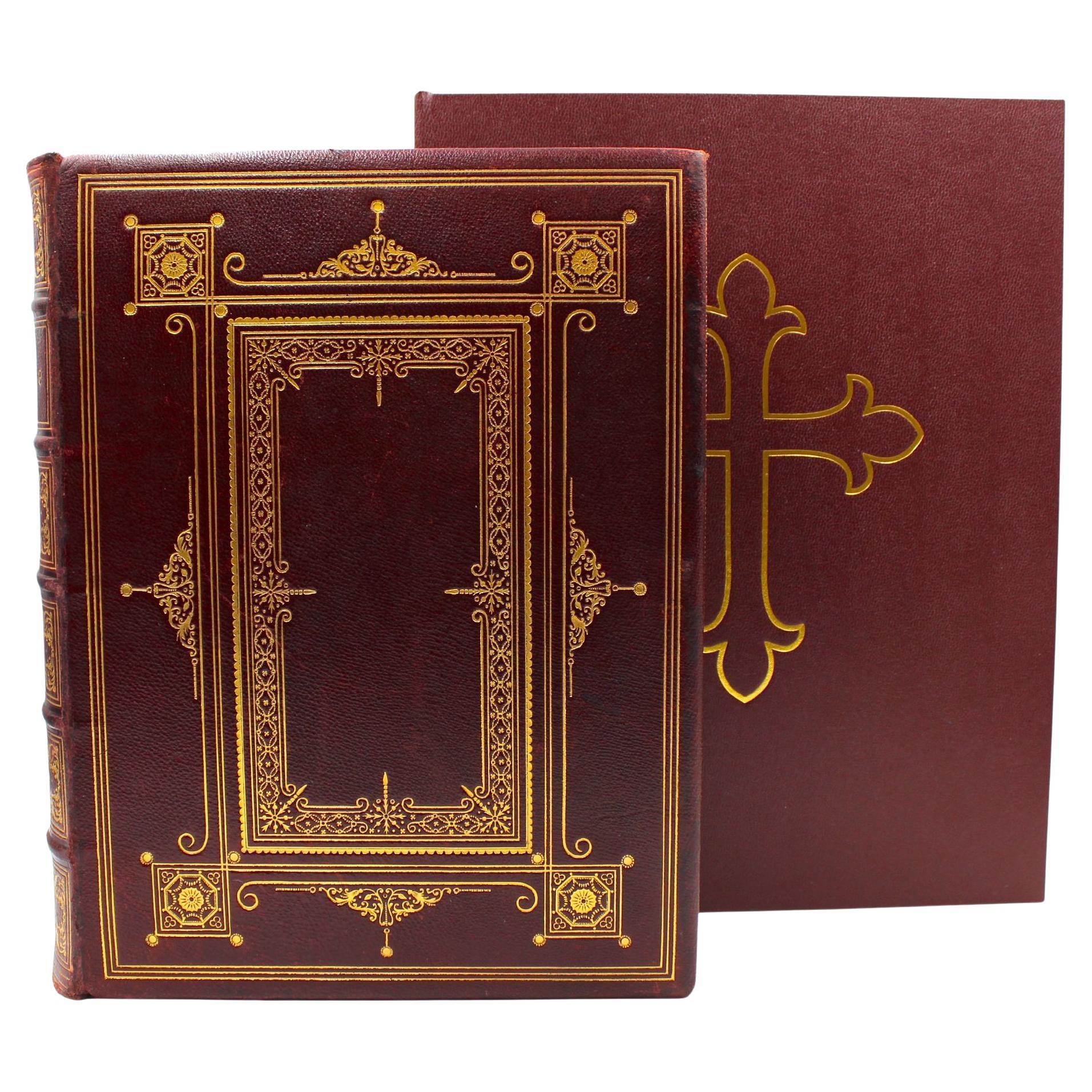
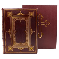
The Holy Bible, Containing the Old and New Testaments, 1887
Located in Colorado Springs, CO
The Holy Bible, Containing the Old and New Testaments, Translated out of the Original Tongues: And with the Former Translations Diligently Compared and Revised, by His Majesty’s Spec...
Category
Antique 1880s English Late Victorian Books
Materials
Leather, Paper
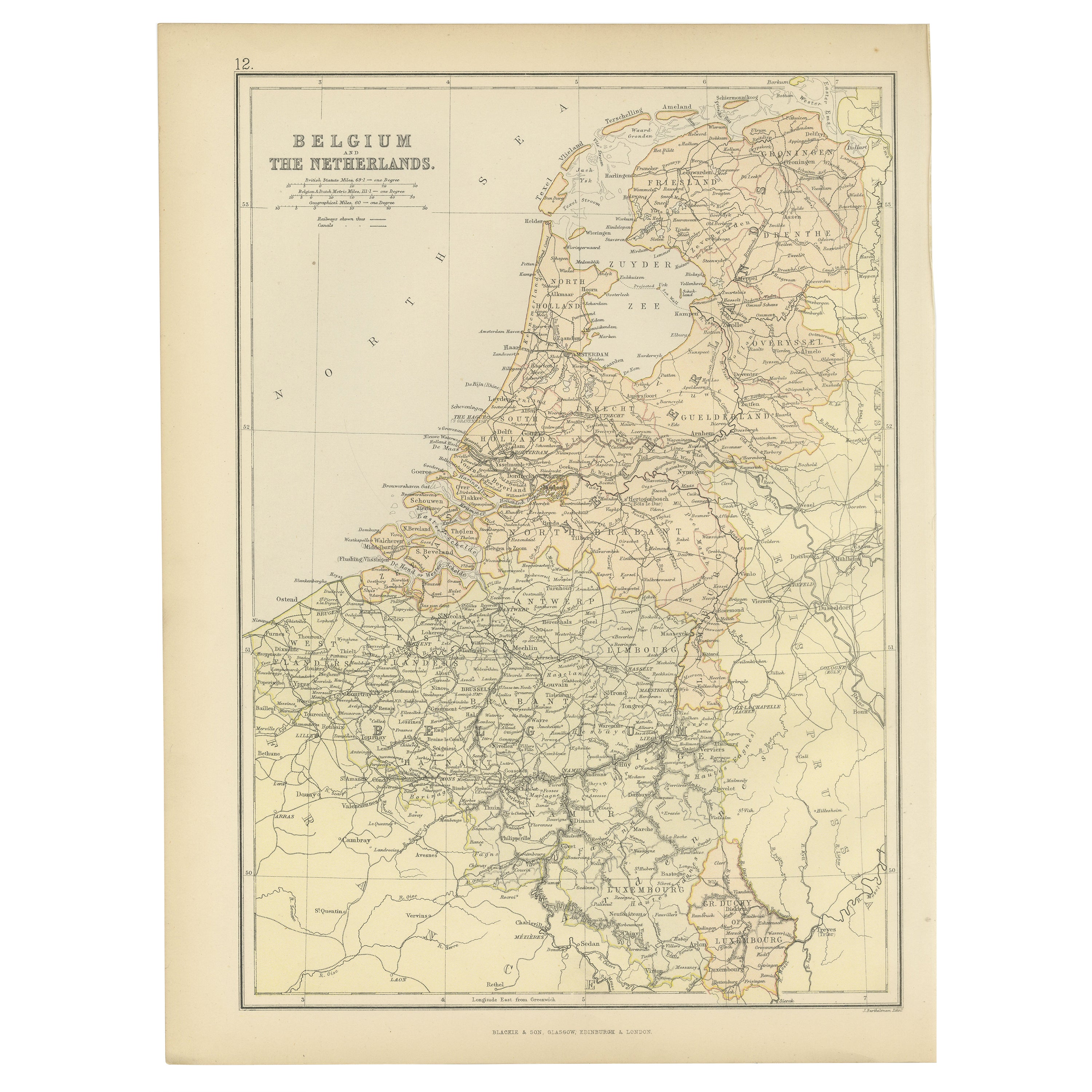
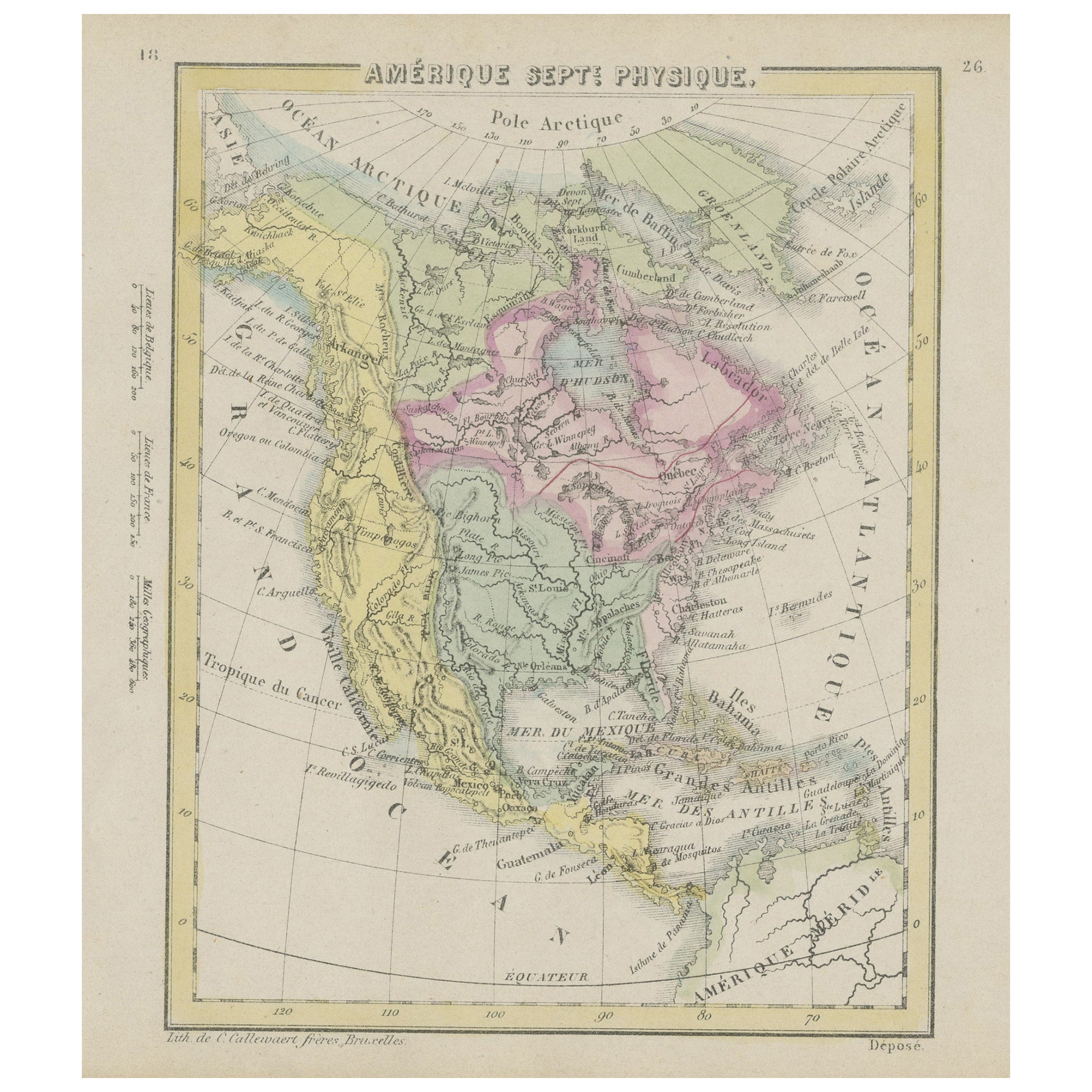
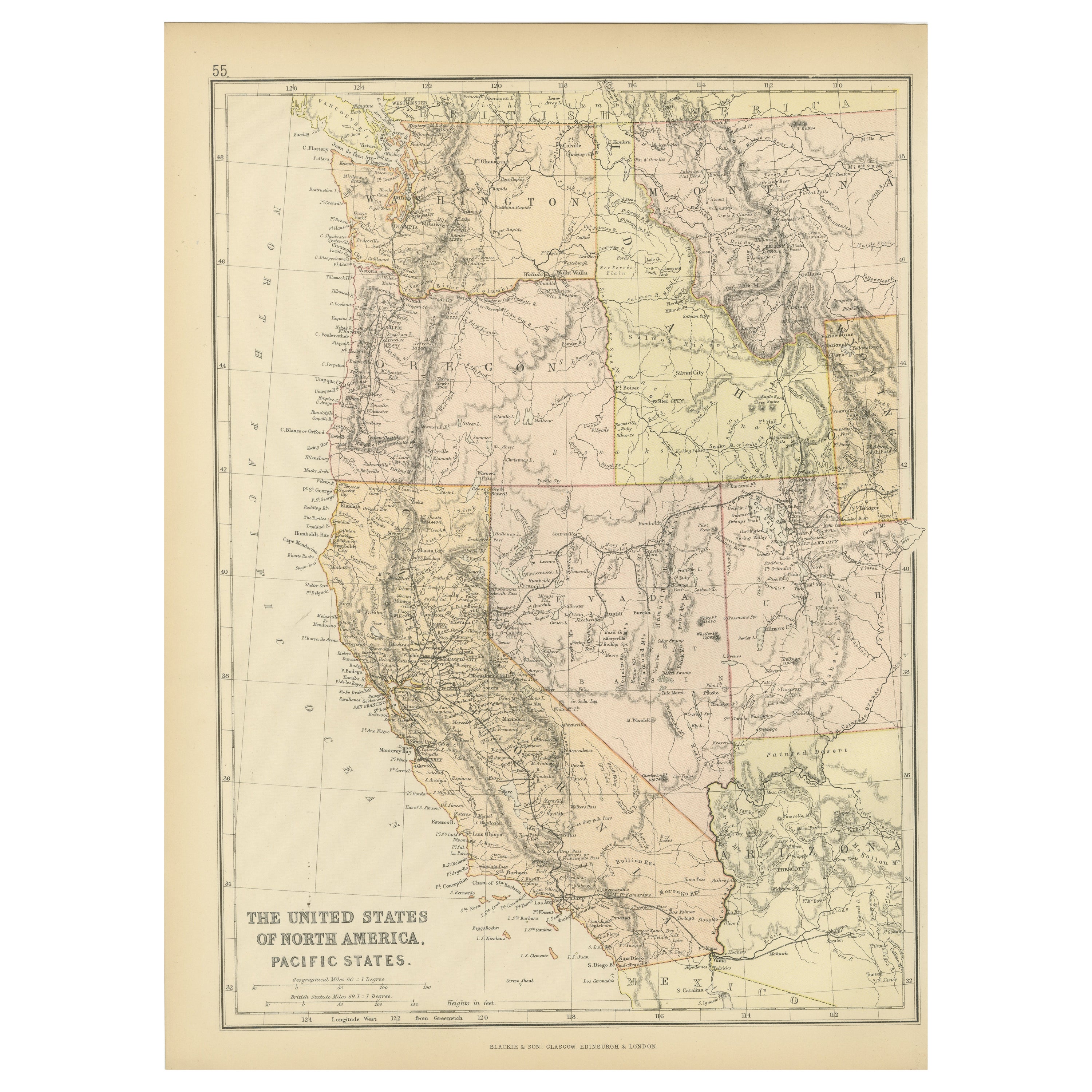
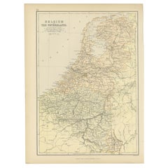
1882 Map of Belgium and The Netherlands Highlighting Geographical Details
Located in Langweer, NL
This 1882 map of Belgium and The Netherlands, published by Blackie and Son as part of the 'Comprehensive Atlas and Geography of the World,' offers a detailed representation of the tw...
Category
Antique 1880s Maps
Materials
Paper
$177 Sale Price
20% Off
Free Shipping
VISIONAIRE 28: The Bible (2936/6000)
By Visionaire
Located in Kleinburg, ON
From the Visionaire website:
28 BIBLE, our millennium issue: “the greatest story ever told" retold in images by modern-day artists and photographers. The intent was to make an issue...
Category
1990s American Books
Materials
Paper
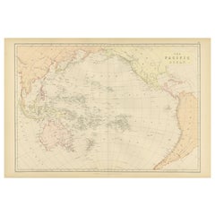
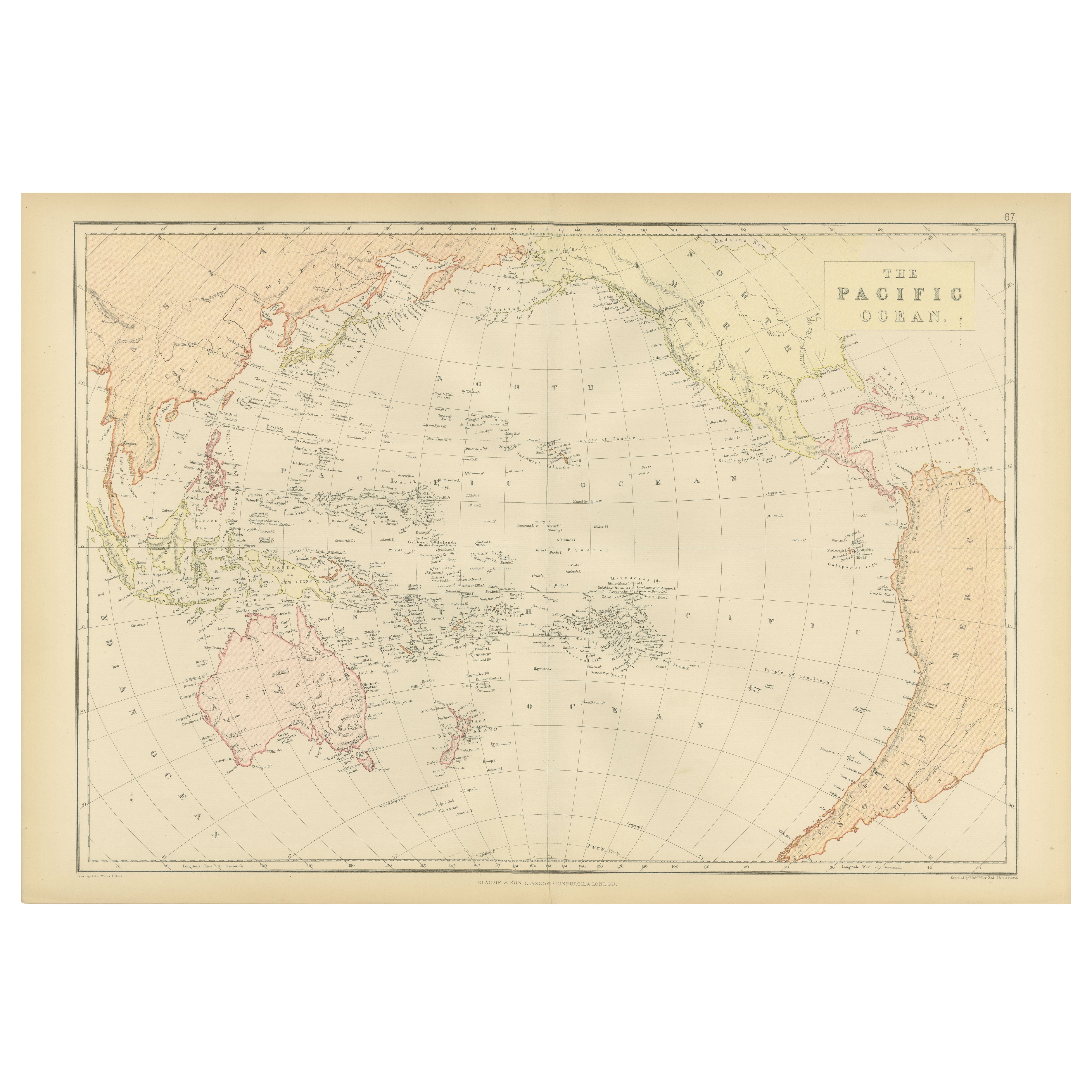
1882 Map of the Pacific Ocean Highlighting Islands and Surrounding Regions
Located in Langweer, NL
This 1882 map of the Pacific Ocean, published by Blackie and Son as part of the 'Comprehensive Atlas and Geography of the World,' presents a detailed and fascinating overview of the ...
Category
Antique 1880s Maps
Materials
Paper