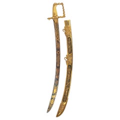
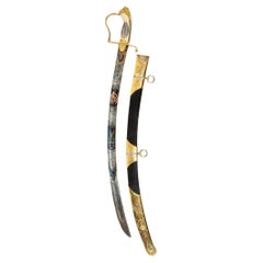
The Lloyd’s Patriotic Fund £100 Trafalgar Sword awarded to JOHN PILFORD ESQ CAPT
View Similar Items
Want more images or videos?
Request additional images or videos from the seller
1 of 21
The Lloyd’s Patriotic Fund £100 Trafalgar Sword awarded to JOHN PILFORD ESQ CAPT
$380,192.64List Price
About the Item
- Dimensions:Height: 0.1 in (2.54 mm)Width: 16 in (40.64 cm)Length: 0.1 in (2.54 mm)
- Materials and Techniques:
- Place of Origin:
- Period:
- Date of Manufacture:1805
- Condition:Wear consistent with age and use. Good.
- Seller Location:Lymington, GB
- Reference Number:Seller: pppcdmifqmpy1stDibs: LU973022116012
About the Seller
5.0
Recognized Seller
These prestigious sellers are industry leaders and represent the highest echelon for item quality and design.
Established in 1982
1stDibs seller since 2013
133 sales on 1stDibs
Typical response time: 2 hours
Associations
LAPADA - The Association of Arts & Antiques Dealers
Authenticity Guarantee
In the unlikely event there’s an issue with an item’s authenticity, contact us within 1 year for a full refund. DetailsMoney-Back Guarantee
If your item is not as described, is damaged in transit, or does not arrive, contact us within 7 days for a full refund. Details24-Hour Cancellation
You have a 24-hour grace period in which to reconsider your purchase, with no questions asked.Vetted Professional Sellers
Our world-class sellers must adhere to strict standards for service and quality, maintaining the integrity of our listings.Price-Match Guarantee
If you find that a seller listed the same item for a lower price elsewhere, we’ll match it.Trusted Global Delivery
Our best-in-class carrier network provides specialized shipping options worldwide, including custom delivery.More From This Seller
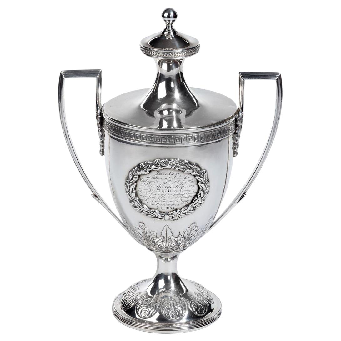
View AllGeorge III Lloyds Patriotic Fund Silver and Silver Gilt Vase and Cover by Samuel
Located in Lymington, Hampshire
George III Lloyds patriotic fund silver and silver gilt vase and cover by Samuel Hennell, of Adam design, the lift-off cover with knop finial above an...
Category
Antique Early 1800s English Nautical Objects
Materials
Silver

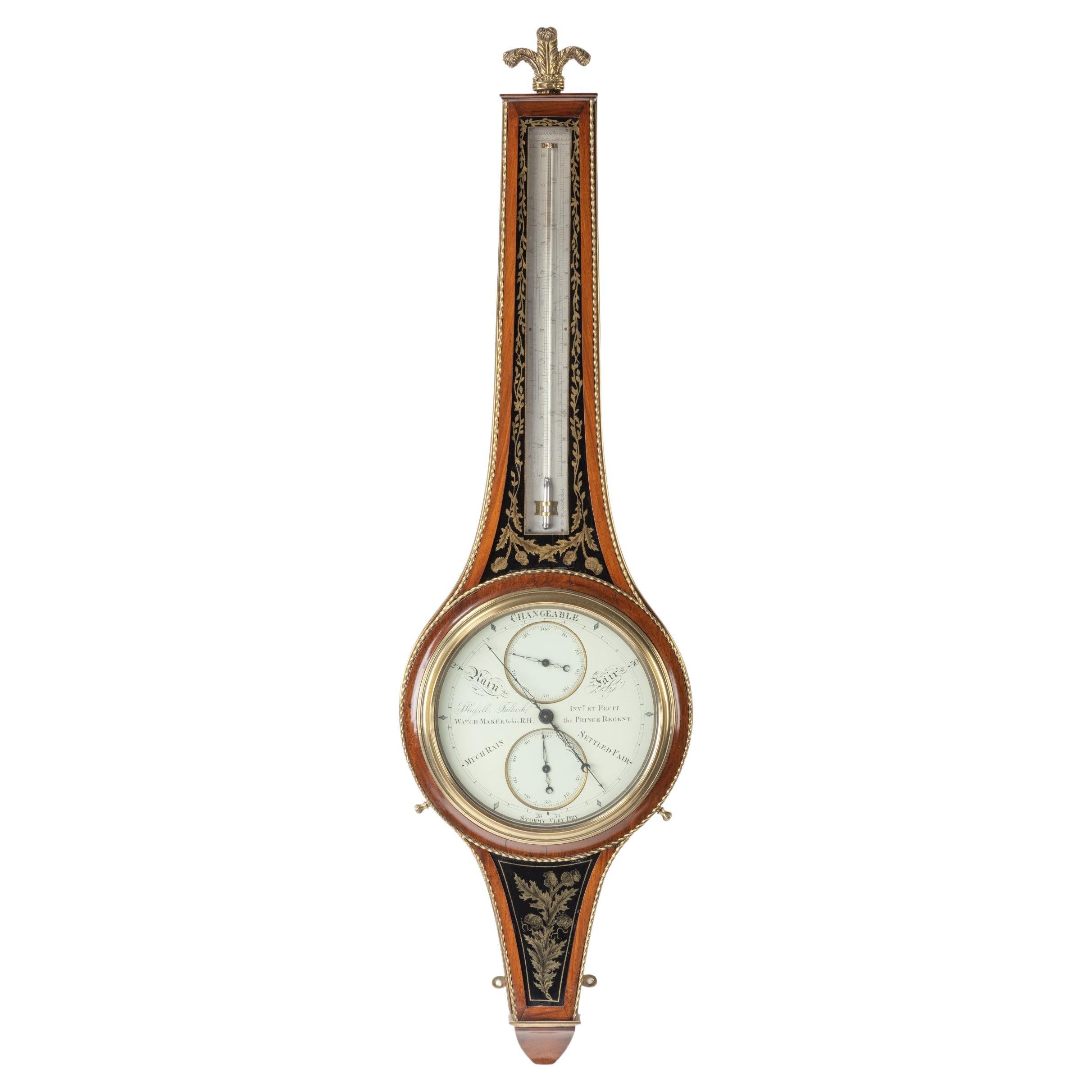
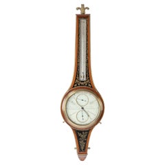
‘Royal’ Barometer by John Russell, Watchmaker to the Prince Regent
By John Russell
Located in Lymington, Hampshire
This superbly crafted wheel barometer and thermometer has a mahogany case surrounded by twisted brass stringing and central panels of foliate tendrils above Russell’s signature thistle motif in black and gilt verre églomisé. It is surmounted by a brass Prince of Wales feather finial. The long, rectangular thermometer plate is inscribed ‘Thermometers: Beaumar, Fahrenheit, Royal Society of London’, the latter being an early attempt to standardise temperature measurement. The circular dial is inscribed ‘Changeable, Fair, Settled Fair, Much Rain’ and ‘Rain’ and signed across the centre ‘J Russell, Falkirk, Invt et Fecit, Watch Maker to his R.H the Prince Regent’. The reverse has a paper label ‘Russell, Iden Collection Inventory 1896’. Scottish, circa 1815.
Provenance: Mr Walter Iden.
Published: Percy G. Dawson, The Iden Clock Collection, Woodbridge, 1987. No.125, p.280.
These ‘royal barometers’ were so named because John Russell of Falkirk...
Category
Antique 1810s Scottish Scientific Instruments
Materials
Metal
Fine Presentation Sword Given to Lieutenant Charles Peake
Located in Lymington, Hampshire
A fine presentation sword given to Lieutenant Charles Peake as a token of gratitude by the Men of His Ship when recommissioned for Foreign Service i...
Category
Antique 1820s English Arms, Armor and Weapons
Materials
Metal
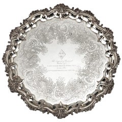
Silver salver of a Hero of Trafalgar: Captain Pryce Cumby London, circa 1836
Located in Lymington, Hampshire
A William IV silver salver with shellwork and scroll border, on four feet, profusely chased and engraved with foliate decoration and inscribed in the centre beneath a widow’s coat of...
Category
Antique 1830s English Sterling Silver
Materials
Silver
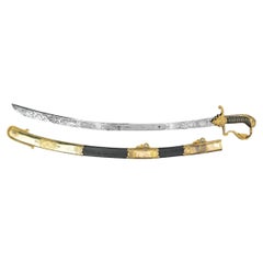
Midshipman Proctor’s Sword for Valour at the Battle of Copenhagen
Located in Lymington, Hampshire
This curved sword has a blued steel German blade with an ivory cross-hatched grip bearing silver and gilt mounts in the form of a lion’s head and mane. ...
Category
Antique Early 1800s English Arms, Armor and Weapons
Materials
Silver, Steel
A Fascinating Ship’s Log And Journal Relating To The Whitway/Whiteway
Located in Lymington, Hampshire
A Fascinating Ship’s Log And Journal Relating To The Whitway/Whiteway Family of Bristol Mariners, Along With A Dispatch Letter From The Bureau in St Petersburg Relating to One Of The...
Category
Antique Early 19th Century Nautical Objects
Materials
Paper
You May Also Like
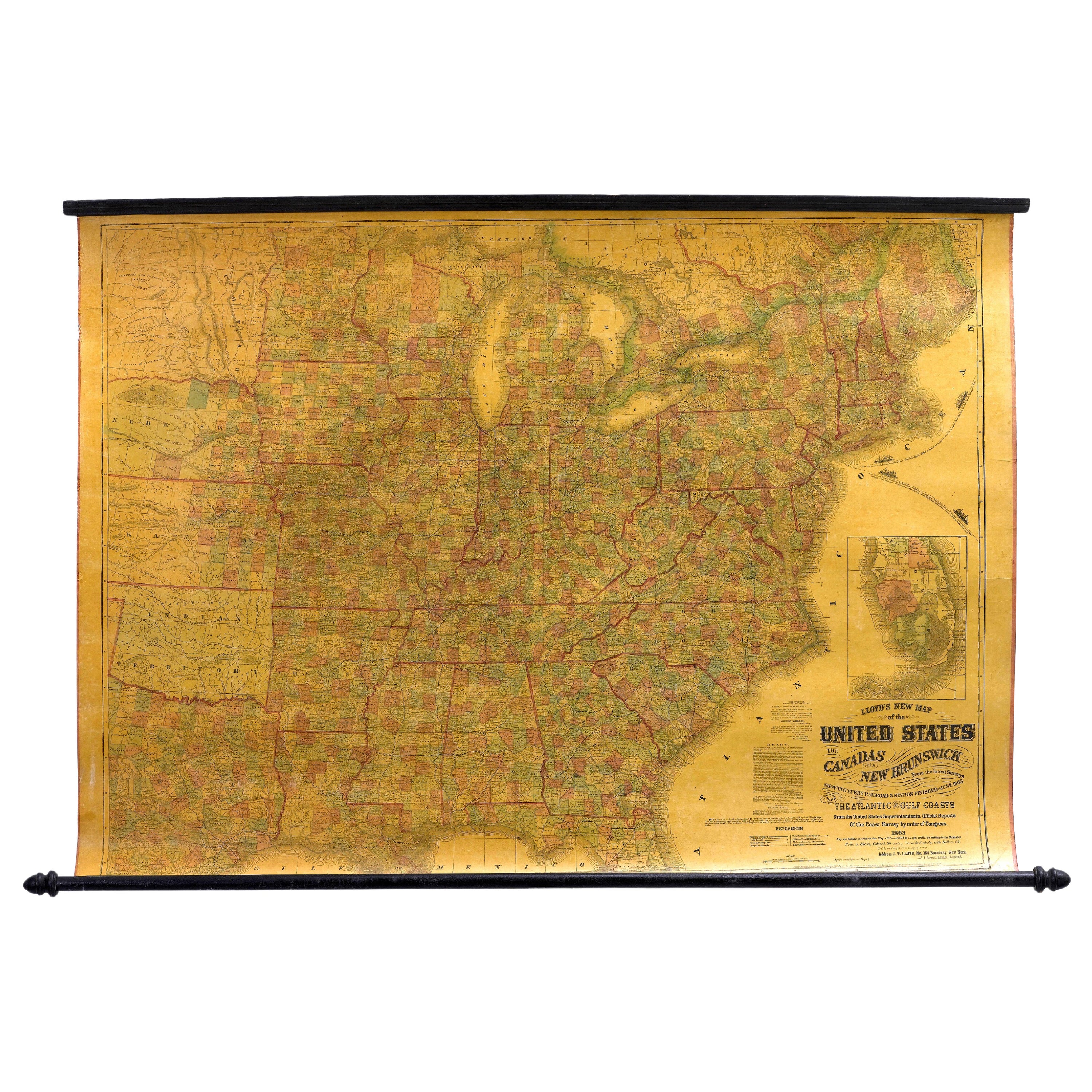
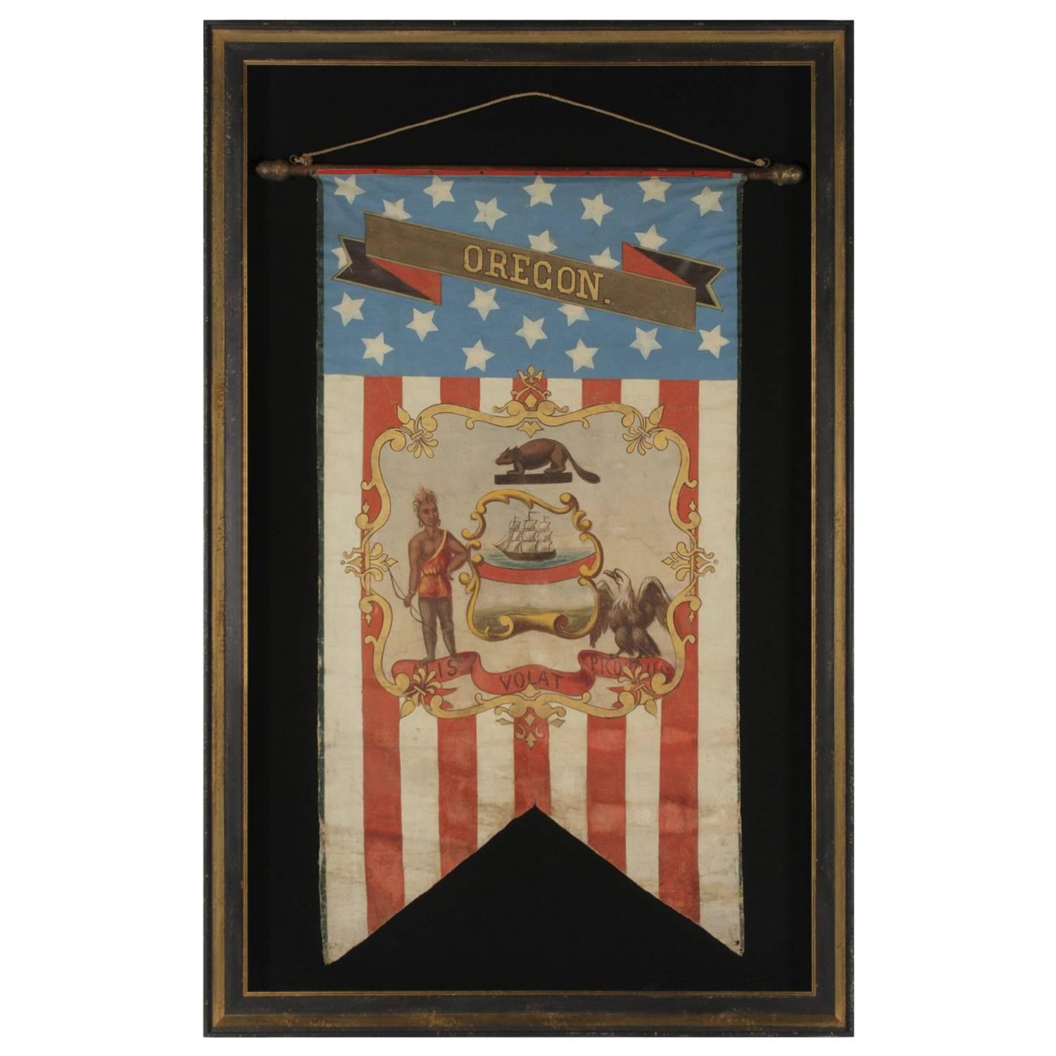
1863 "Lloyd's New Map of the United States, the Canadas, and New Brunswick"
Located in Colorado Springs, CO
Presented is “Lloyd's New Map of the United States, the Canadas and New Brunswick, From the latest Surveys, Showing Every Railroad & Station Finished to June 1863, and the Atlantic and Gulf Coasts.” A large, Civil War-era hanging map of the United States and adjacent territories, this map covers the area from the Atlantic Ocean and extends as far west as the 103 meridian, to “Dacotah,” Nebraska, Kansas, "Indian Territory," and Texas. The southern continuation of Florida is shown in an inset map along the right margin. This map was published by J. T. Lloyd, in New York, in 1863. According to the publisher’s marking at lower right, this map was originally issued in two states: "in Sheets, Colored" for 50 cents, and "Varnished nicely, with Rollers" for $1.
Throughout the map, the counties are colored and the towns and cities well labeled. A reference key in the bottom margin provides symbols for railroads, turnpikes and wagon roads, state capitals, cities and towns, and village post offices. As emphasized in the map’s title, this map is especially notable for the countless railway lines and stations depicted, with distances noted between points, listing “every railroad and finished station to June 1863.” Additionally, two shipping agents and their routes are drawn out of New York City. The map includes details of the steamship routes into New York and Philadelphia from Liverpool and on to California and Oregon via an overland Nicaraguan trek, presumably to assist gold rush emigrants.
This expansive and impressive map depicts the eastern half of the United States in the third year of the Civil War. In order not to recognize the legitimacy of the Confederate States of America, each state is shown in the same manner as the Union states. The only indication that the American Civil War was in progress when this map was published is a printed notice that Gideon Wells, Secretary of the Navy, wishes to acquire a quote on 100 copies of Lloyd’s Mississippi River map...
Category
Antique 1860s American Maps
Materials
Linen, Wood, Paper

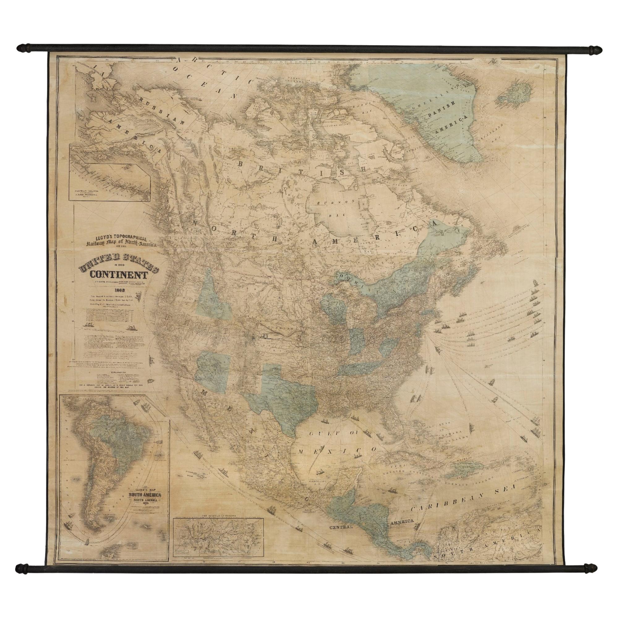
1868 "Lloyd's Topographical Railway Map of North America..." Hanging Wall Map
Located in Colorado Springs, CO
Presented is “Lloyd's Topographical Railway Map of North-America, or the United States Continent in 1900.” This map was published by J. T. Lloyd, in New York, in 1868. A large, hangi...
Category
Antique 1860s American Late Victorian Maps
Materials
Linen, Paper

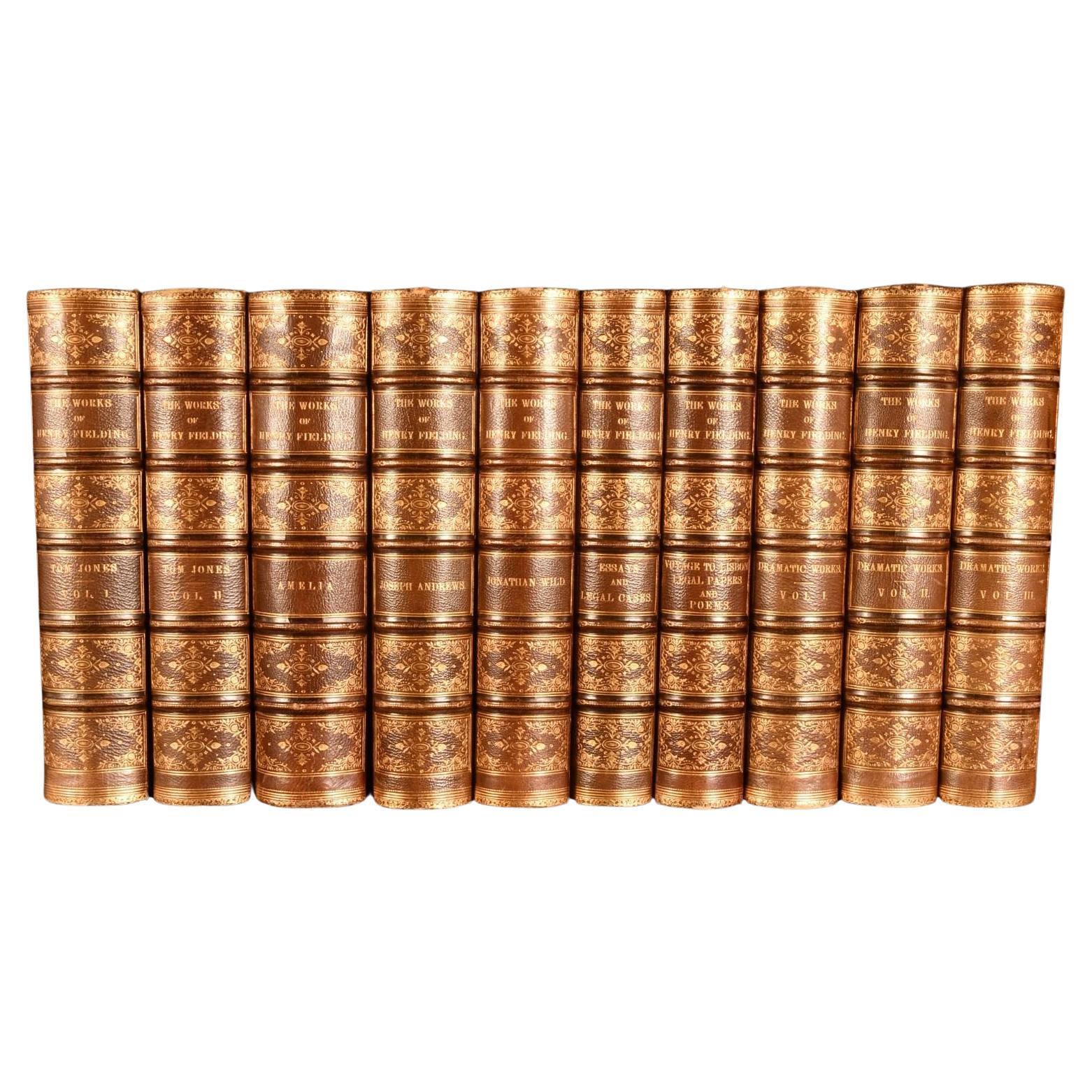
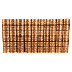
1882 The Works of Henry Fielding, Esq.
By Henry Fielding
Located in Bath, GB
A limited edition ten-volume set of the works of Henry Fielding, edited with a biography by Leslie Stephen.
A ten-volume set in half morocco bindings. All edges gilt.
No. 92 of a t...
Category
Antique 1880s British Books
Materials
Paper
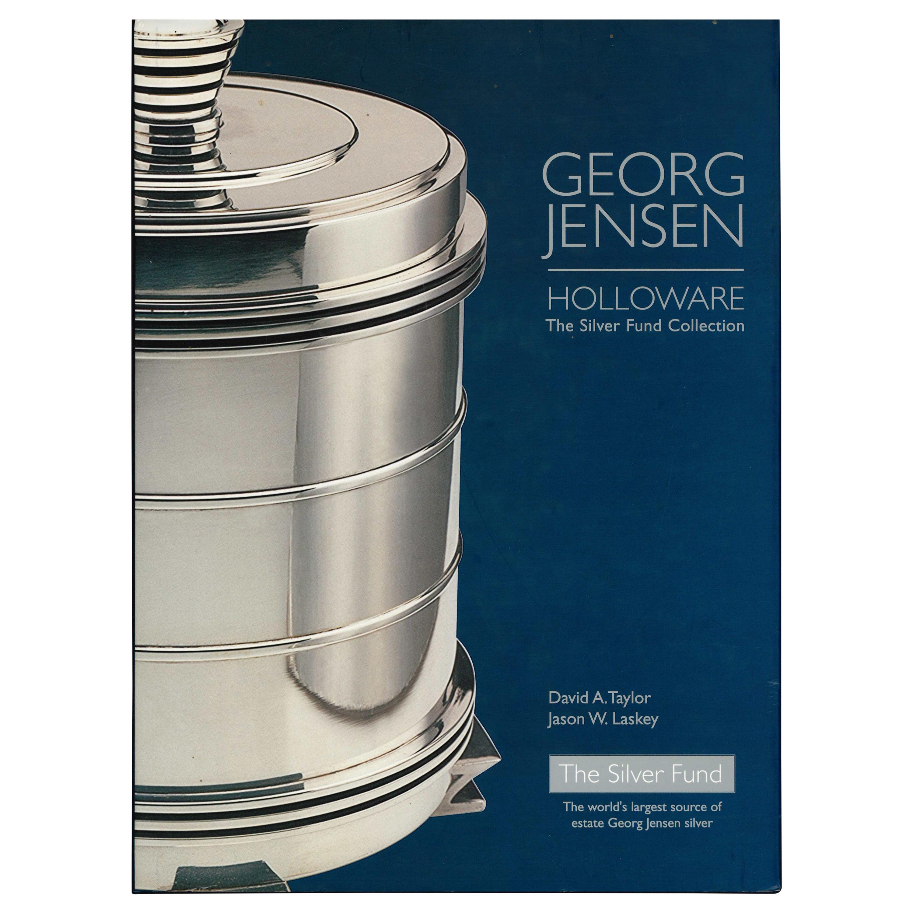
Georg Jensen: Holloware The Silver Fund Collection Book)
Located in North Yorkshire, GB
by David A. Taylor & Jason W. Laskey
This book presents hundreds of pieces of Jensen holloware which are taken from The Silver Fund's collection. The...
Category
20th Century Books
Materials
Paper

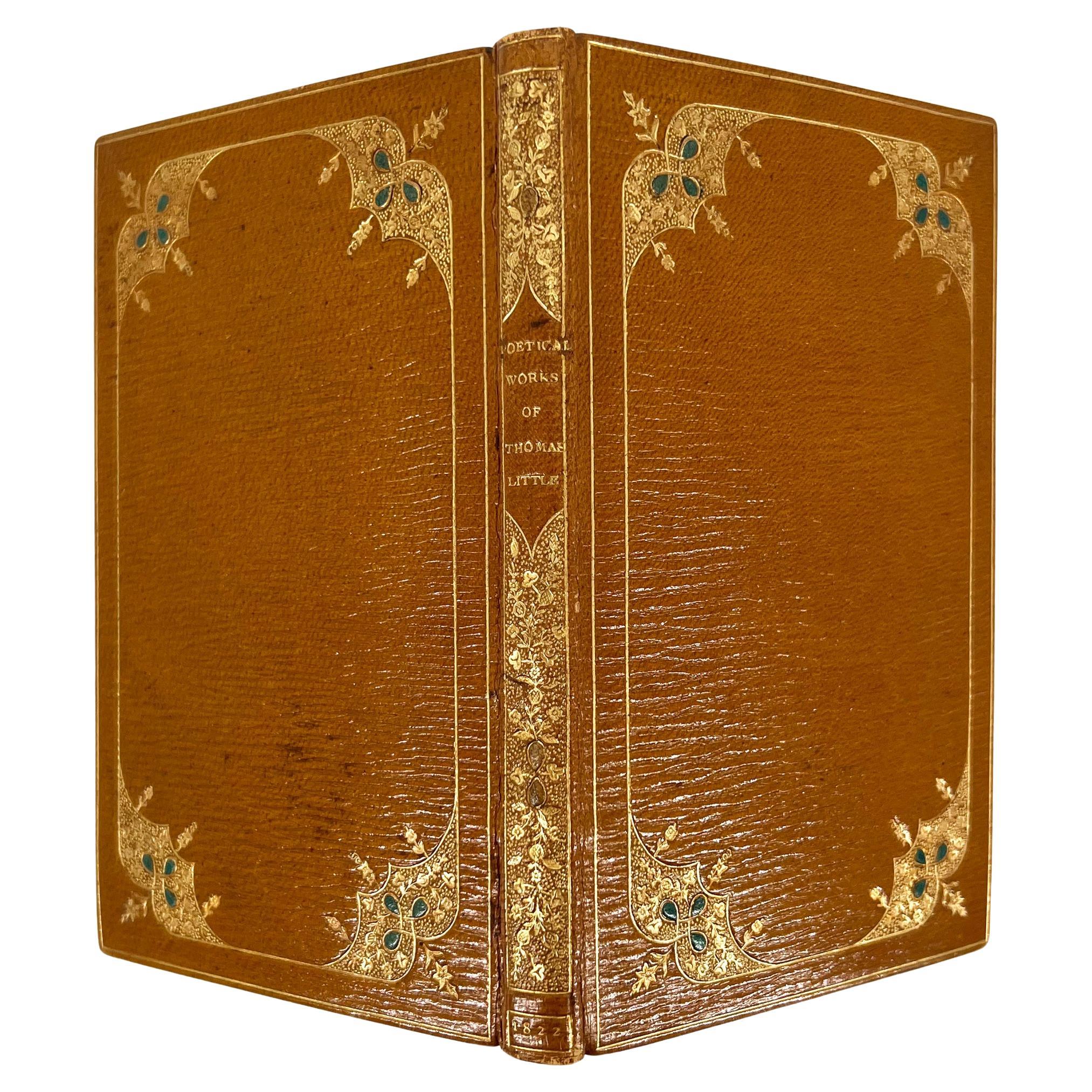
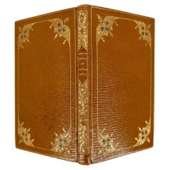
The Poetical Works of the late Thomas Little, Esq. by Thomas MOORE
Located in Middletown, NY
A handsomely-bound collection of juvenile poetry by Thomas Moore (1779 – 1852), published under the pseudonym of Thomas Little due to the eroticism of their content, as Moore's celebration of kisses and embraces was regarded as improper. A relatively successful publication, which was put to an end with the Victorian tight sense of propriety. Thomas Moore was an Irish poet...
Category
Antique Early 19th Century English Books
Materials
Gold Leaf
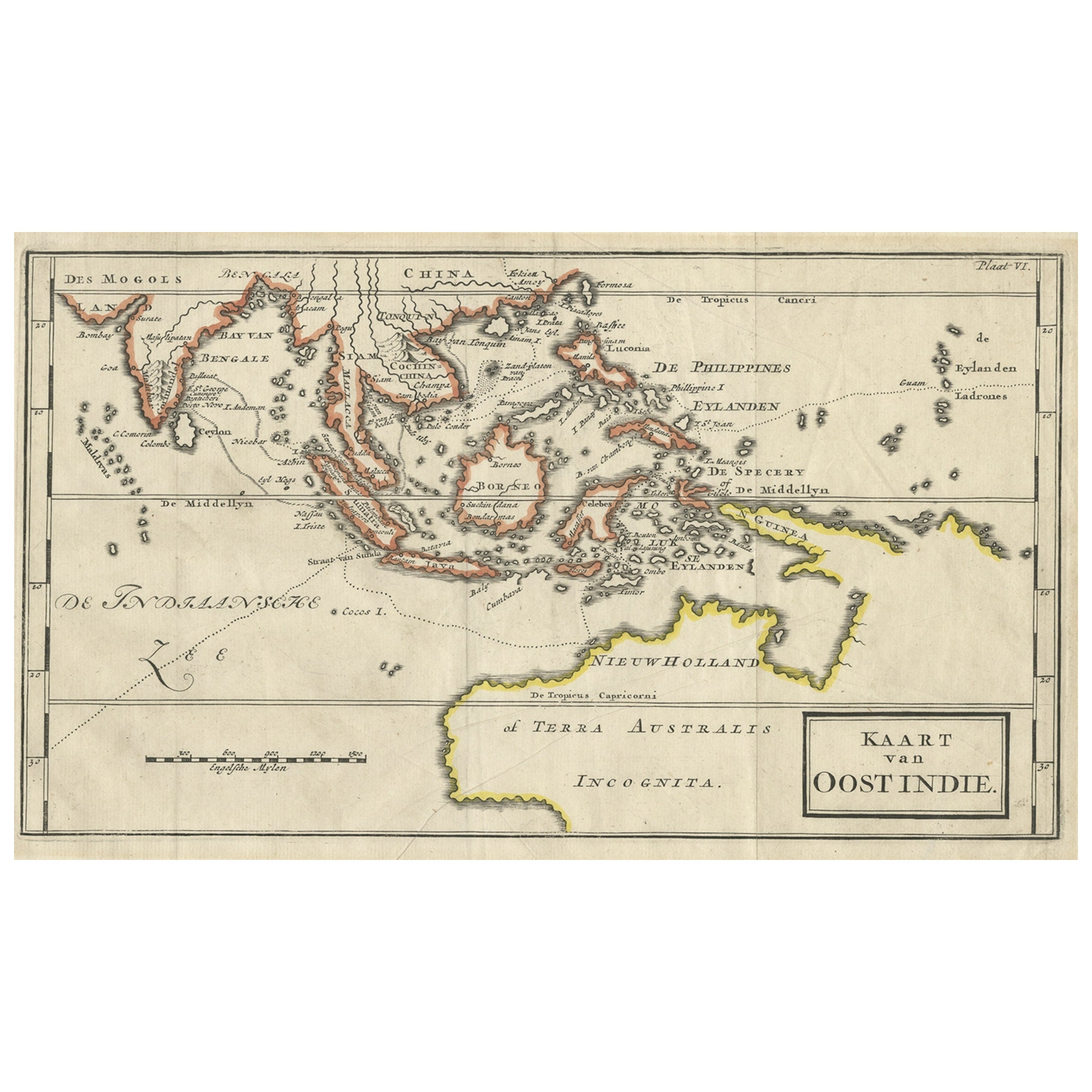
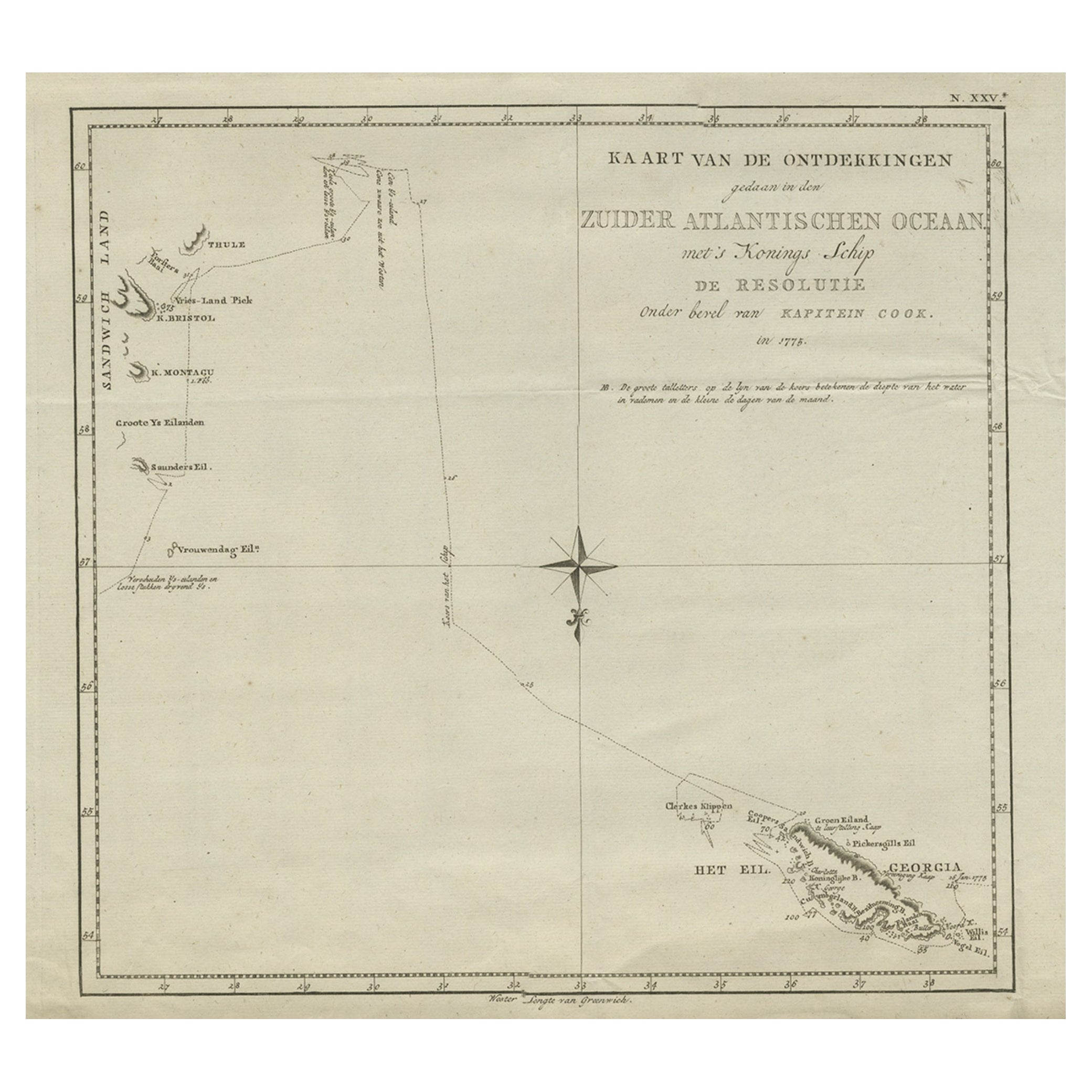
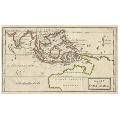
Map of The East Indies with the Route of Capt. William Dampier's Voyage, 1698
Located in Langweer, NL
Antique map titled 'Kaart van Oost Indie'.
Old map of the East Indies. It shows the routes of Captain William Dampier's voyage throughout the regio...
Category
Antique 1690s Maps
Materials
Paper
$692 Sale Price
20% Off
Recently Viewed
View AllMore Ways To Browse
Beaded Gun Scabbard
Antique Spanish Stirrups
Spanish Stirrups
Mahogany Gun Case
Popcorn Machine
Silver Shekel
Vintage Bird Christmas Tree Ornaments
Vintage Bird Clip Ornaments
Antique Civil War Belt Buckles
Antique Glass Miniature Oil Lamp Lamps
Antique Knife Cleaner
Antique Quill Knife
Art Deco Mezuzah
Baby Bootlegger
Catherineholm Lotus
Chuck Yeager
Deco Mailbox
English Cordite Bucket