Items Similar to 1711 Star Chart of Southern Sky with Mythical Constellations and Exotic Animals
Want more images or videos?
Request additional images or videos from the seller
1 of 7
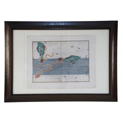
1711 Star Chart of Southern Sky with Mythical Constellations and Exotic Animals
$1,623.73
$2,029.6720% Off
£1,195.88
£1,494.8520% Off
€1,352
€1,69020% Off
CA$2,208.96
CA$2,761.2020% Off
A$2,454.64
A$3,068.3120% Off
CHF 1,286.26
CHF 1,607.8220% Off
MX$30,101.84
MX$37,627.3020% Off
NOK 16,405.50
NOK 20,506.8720% Off
SEK 15,433.69
SEK 19,292.1120% Off
DKK 10,292.57
DKK 12,865.7120% Off
Shipping
Retrieving quote...The 1stDibs Promise:
Authenticity Guarantee,
Money-Back Guarantee,
24-Hour Cancellation
About the Item
1711 Star Chart of the Southern Sky - "Mappa Stellarum Australium quae in Altitudine Poli Borei Graduum"
This beautiful star chart, engraved by Arnold van Westerhout in 1711, shows the stars visible in the southern sky, centered on the south equatorial pole. The chart includes numerous constellations, such as Argo Navis, Centaur, Lupus, Apus (bird of paradise), Apis (bee), Indus (Native Indian), and Pavo (peacock). The map is hand-colored, bringing life to these celestial figures and adding artistic charm.
The chart also provides details about the 'magnitude of the stars', represented in a table on the left side of the map, allowing viewers to understand the relative brightness of various stars. The artwork is finely detailed, with each constellation illustrated in a unique and imaginative style, typical of the celestial maps from this period.
The chart serves both as a scientific and decorative piece, illustrating the fascination of 18th-century astronomers with the stars of the Southern Hemisphere, which were less known to European audiences at the time.
"Mappa Stellarum Australium quae in altitudine poli Borei graduum 30 nunquam supra Horizontem ascendunt, ex recentibus observationibus confecta. Harum Stellarum Ascensiones Rectae ac Declinationes constructae sunt ad Annum Christi completum 1687."
Translation:
"Map of the Southern Stars which, at an altitude of 30 degrees north of the pole, never rise above the horizon, based on recent observations. The right ascensions and declinations of these stars have been constructed for the year of Christ 1687."
"Tab. V. to A. 1711, M. Sept. pag. 386."
"In this map's projection, the eye is positioned at the center of the world, turned towards the Antarctic pole; thus the stars of the southern regions appear as they do when seen from those areas."
Condition Report:
- Paper Quality: The paper has minor light soiling typical of its age. The original watermarks are still visible.
- Edges and Margins: The margins have been trimmed or chipped and professionally extended to accommodate framing. Some minor image loss at the edges and the neatline at the bottom has been replaced in facsimile.
- Print Quality: A dark and clear impression remains, with vibrant hand-coloring enhancing the constellations.
Summary Condition: Overall in very good condition with minor professional restoration, vibrant hand-coloring, and intact paper quality. The extended margins and restored neatline have been done to a high standard, making the piece suitable for framing and display.
- Dimensions:Height: 14.89 in (37.8 cm)Width: 13.59 in (34.5 cm)Depth: 0.01 in (0.2 mm)
- Materials and Techniques:Paper,Engraved
- Period:1710-1719
- Date of Manufacture:1711
- Condition:Overall in very good condition with minor professional restoration, vibrant hand-coloring, and intact paper quality. The extended margins and restored neatline have been done to a high standard, making the piece suitable for framing.
- Seller Location:Langweer, NL
- Reference Number:Seller: BHZ119021stDibs: LU3054342599672
About the Seller
5.0
Recognized Seller
These prestigious sellers are industry leaders and represent the highest echelon for item quality and design.
Platinum Seller
Premium sellers with a 4.7+ rating and 24-hour response times
Established in 2009
1stDibs seller since 2017
2,494 sales on 1stDibs
Typical response time: 1 hour
- ShippingRetrieving quote...Shipping from: Langweer, Netherlands
- Return Policy
Authenticity Guarantee
In the unlikely event there’s an issue with an item’s authenticity, contact us within 1 year for a full refund. DetailsMoney-Back Guarantee
If your item is not as described, is damaged in transit, or does not arrive, contact us within 7 days for a full refund. Details24-Hour Cancellation
You have a 24-hour grace period in which to reconsider your purchase, with no questions asked.Vetted Professional Sellers
Our world-class sellers must adhere to strict standards for service and quality, maintaining the integrity of our listings.Price-Match Guarantee
If you find that a seller listed the same item for a lower price elsewhere, we’ll match it.Trusted Global Delivery
Our best-in-class carrier network provides specialized shipping options worldwide, including custom delivery.More From This Seller
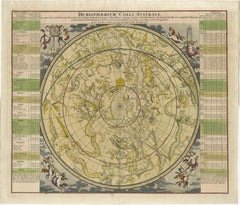
View All1730 Southern Hemisphere Celestial Chart with Zodiac Signs and Decorative Putti
Located in Langweer, NL
Title: 1730 Southern Hemisphere Celestial Chart with Zodiac Signs and Decorative Putti
Description: This stunning 1730 celestial map, "Hemisphaerium Coeli Australe," showcases the S...
Category
Antique 1730s Prints
Materials
Paper
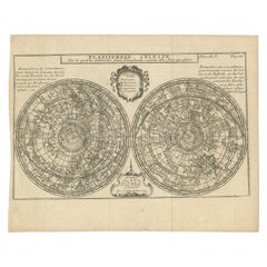
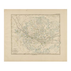
Antique Planisphere with Constellations by Bion, 1751
Located in Langweer, NL
Antique map titled 'Planisphere Celeste'. Planisphere with various constellations. This map originates from 'L'Usage des globes célestes et terrestres et des sphères (..)' by N. Bion...
Category
Antique Mid-19th Century Maps
Materials
Paper
$192 Sale Price
20% Off
Antique Chart of the Passage of Comets in the Southern Sky, circa 1740
Located in Langweer, NL
Antique map titled 'Motus Comtarum in Hemispaerio Australi (..)'. This uncommon chart depicts the passage of comets in the southern sky between the years 1530-1704. Centered on the ecliptic poles and shows the constellation figures based on classical mythology, without showing the stars. The paths of dozens of comets are illustrated, eincluding those sighted by Tycho Brahe...
Category
Antique Mid-18th Century Maps
Materials
Paper
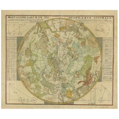
$2,251 Sale Price
25% Off
Northern Hemisphere Star Map – Constellations & Astronomical Chart, c.1858
Located in Langweer, NL
Northern Hemisphere Star Map – Constellations & Astronomical Chart c.1858
This attractive antique print shows the northern starry sky titled “Der nördliche gestirnte Himmel”, meanin...
Category
Antique Mid-19th Century German Maps
Materials
Paper
Antique Map of the Eastern Hemisphere by Valk & Chenk '1708'
Located in Langweer, NL
Antique map titled 'Hemispherium Orbis Antiqui, Cumzonis Circulis, Et Sity populorum Diverso'. Decorative example of Andreas Cellarius's map of the Eastern Hemisphere, illustrating with climatic zones ranging from Frigida Borealis to Torrida, with planetary details superimposed. The elaborate border includes fine scrollwork, numerous putti, and additional diagrams showing armillary spheres and climatic zones. Andreas Cellarius was born in 1596 in Neuhausen and educated in Heidelberg. He emigrated to Holland in the early 17th century and 1637 moved to Hoorn, where he became the rector of the Latin School. Cellarius' best known work is his Harmonia Macrocosmica, first issued in 1660 by Jan Jansson, as a supplement to Jansson's Atlas Novus. The work consists of a series of Celestial Charts...
Category
Antique Early 18th Century Dutch Maps
Materials
Paper
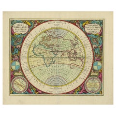
$4,053 Sale Price
25% Off
Antique Map Illustrating Solar Eclipses by Scherer, C.1703
Located in Langweer, NL
Antique map of an hemisphere and several figures illustrating the position of the earth, moon and sun. Printed for Scherer's 'Atlas Novus' (1702-1710).
Artists and Engravers: Heinrich Scherer (1628-1704) was a Professor of Hebrew, Mathematics and Ethics at the University of Dillingen until about 1680. Thereafter he obtained important positions as Official Tutor to the Royal Princes...
Category
Antique 18th Century Maps
Materials
Paper
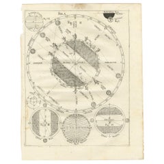
$211 Sale Price
20% Off
You May Also Like
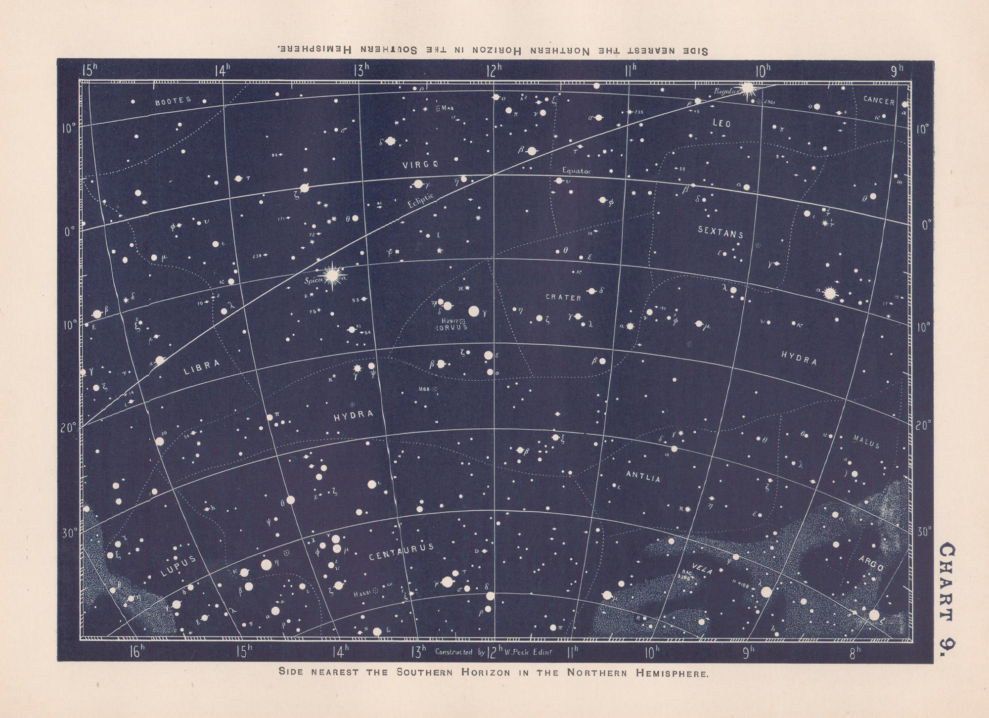
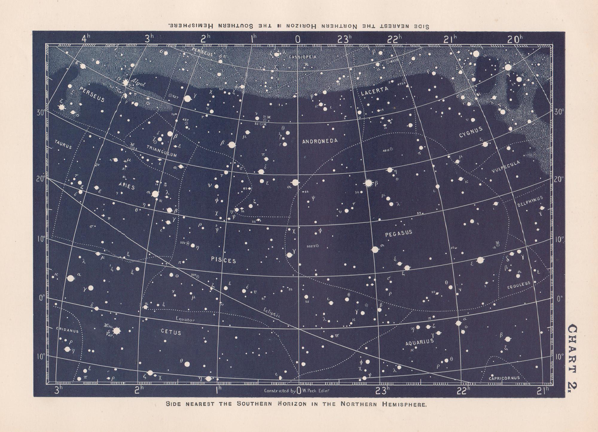
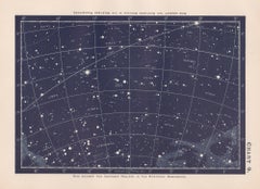
Star Chart. Antique Astronomy celestial print
Located in Melbourne, Victoria
Colour lithograph, 1890. 210mm by 285mm (sheet). From W Peck's 'A Handbook and Atlas of Astronomy', 1890. Sir William Peck FRSE FRAS (1862 – 1925) was a Scottish astronomer and scien...
Category
Late 19th Century Victorian More Prints
Materials
Lithograph
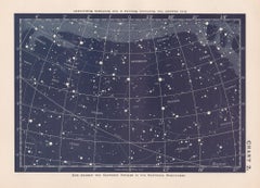
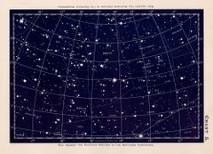

Alexander Mair Renaissance Hand-Colored Engravings of Astronomy Star Charts
Located in Queens, NY
Sst of 20 Renaissance (17th century) engraved, hand-colored etchings for Johann Bayer's book 'Uranometria', a star atlas, in wooden frames with white mat....
Category
Antique 17th Century Renaissance Paintings
Materials
Wood, Paper
Star Chart. Antique Astronomy celestial print
Located in Melbourne, Victoria
Colour lithograph, 1890. 210mm by 285mm (sheet). From W Peck's 'A Handbook and Atlas of Astronomy', 1890. Sir William Peck FRSE FRAS (1862 – 1925) was a Scottish astronomer and scien...
Category
Late 19th Century Victorian More Prints
Materials
Lithograph
More Ways To Browse
Eye Chart
World Map Table
Antique Bee Print
Celestial Map
Antique Sky Map
Antique Chart Table
Ascension Of Christ
Antique Eye Chart
Red Retro Dining Set
Antique Silver Glasses Case
Carlo Scarpa 1934 Chairs
Christofle Marly
1900 Antique Chairs
Glass Table Italian Round
Mid Century Colonial
Alvar Aalto Poster
Geometric Metal Table
Post Modern High Chairs