Items Similar to Antique Chart of the Passage of Comets in the Southern Sky, circa 1740
Want more images or videos?
Request additional images or videos from the seller
1 of 5
Antique Chart of the Passage of Comets in the Southern Sky, circa 1740
About the Item
Antique map titled 'Motus Comtarum in Hemispaerio Australi (..)'. This uncommon chart depicts the passage of comets in the southern sky between the years 1530-1704. Centered on the ecliptic poles and shows the constellation figures based on classical mythology, without showing the stars. The paths of dozens of comets are illustrated, eincluding those sighted by Tycho Brahe, John Flamsteed, Johannes Hevelius, and many others. The chart also identifies "newly discovered" stars between 1572-1686. Surrounding the hemisphere are various diagrams related to comets and a chart listing details regarding the comets and stars depicted on the charts. Published by the Homann Heirs, circa 1740.
- Dimensions:Height: 20.87 in (53 cm)Width: 24.69 in (62.7 cm)Depth: 0.02 in (0.5 mm)
- Materials and Techniques:
- Period:
- Date of Manufacture:circa 1740
- Condition:Good, given age. Edges with an occasional tiny tears, not affecting image. Some staining and light soiling in the margins. Some crinkles and creases. A few minor spots. Original middle fold as issued. General age-related toning. Please study images.
- Seller Location:Langweer, NL
- Reference Number:
About the Seller
5.0
Platinum Seller
These expertly vetted sellers are 1stDibs' most experienced sellers and are rated highest by our customers.
Established in 2009
1stDibs seller since 2017
1,933 sales on 1stDibs
Typical response time: <1 hour
- ShippingRetrieving quote...Ships From: Langweer, Netherlands
- Return PolicyA return for this item may be initiated within 14 days of delivery.
More From This SellerView All
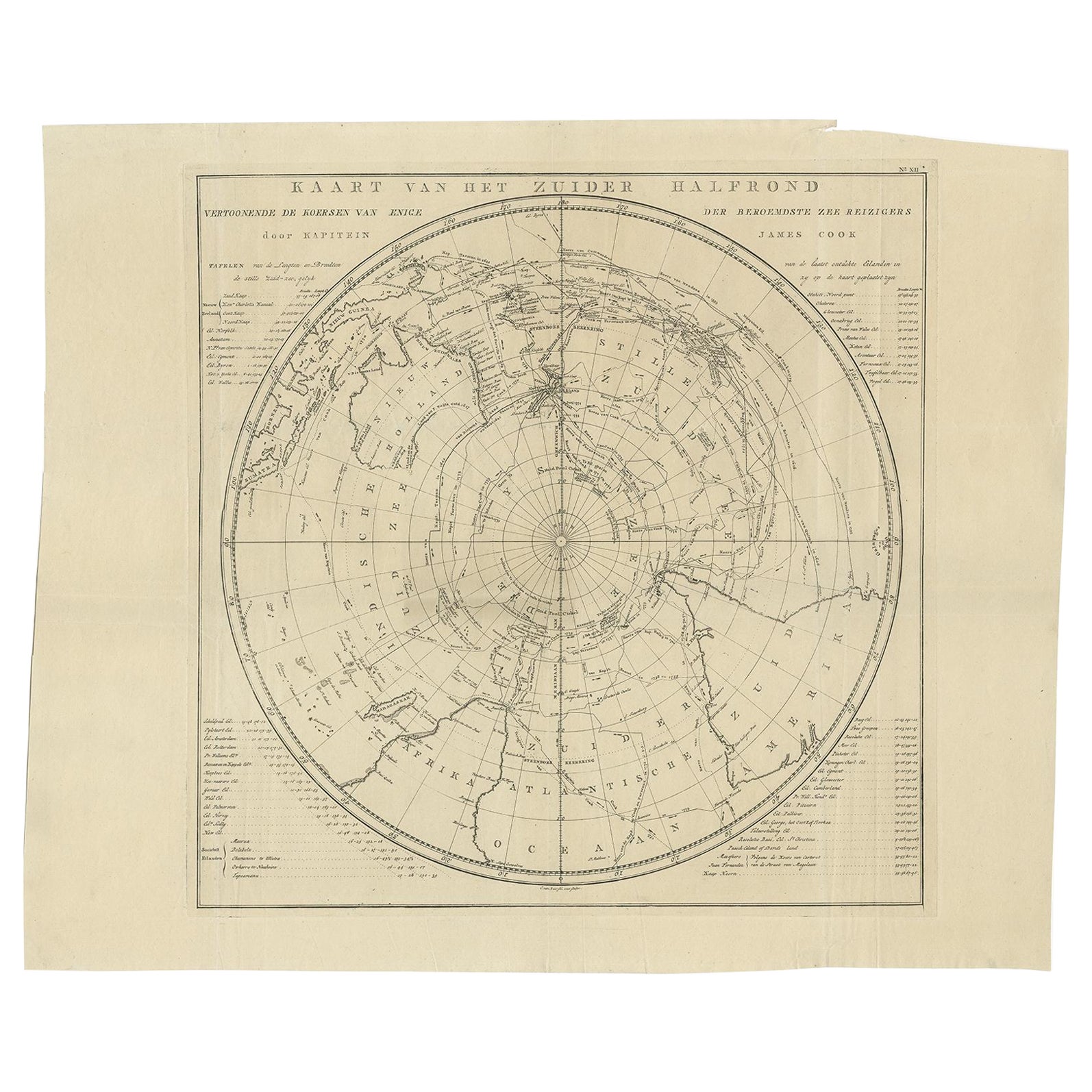
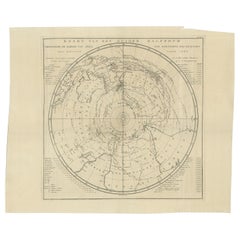
- Antique Chart of the Southern Pole, Showing Three Routes of Captain Cook, 1803Located in Langweer, NLAntique map titled 'Kaart van het Zuider Halfrond'. Circular chart within a square frame centred on the southern pole. It shows southern parts of South America, South Africa and Mada...Category
Antique 19th Century Prints
MaterialsPaper
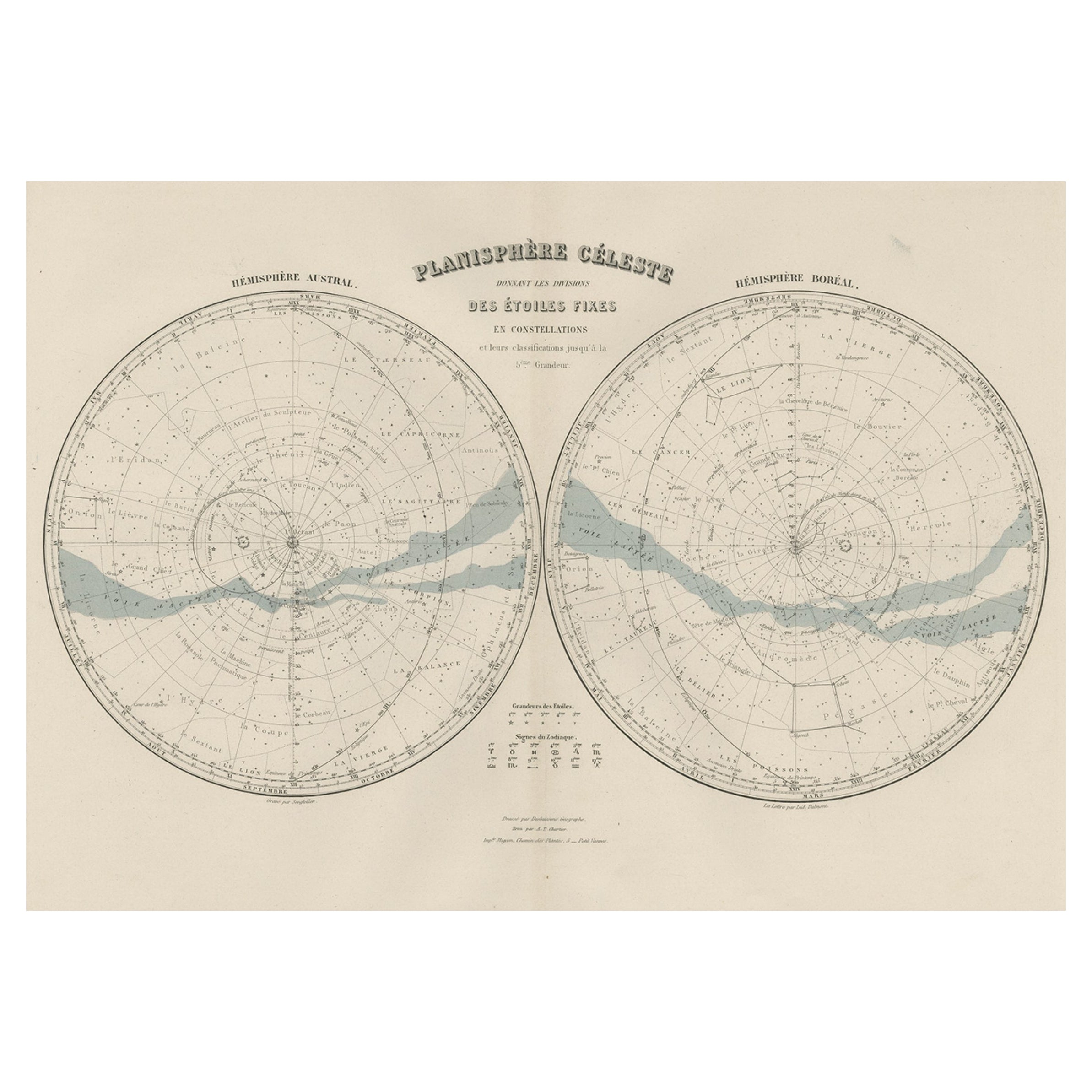
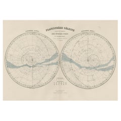
- Antique Map of the Night Skies of the Northern and Southern Hemispheres, 1880Located in Langweer, NLAntique world map titled 'Planisphère en Céleste'. This map depicts the night skies of both the northern and southern hemispheres. This map originates from 'Géographie Universell...Category
Antique 1880s Maps
MaterialsPaper
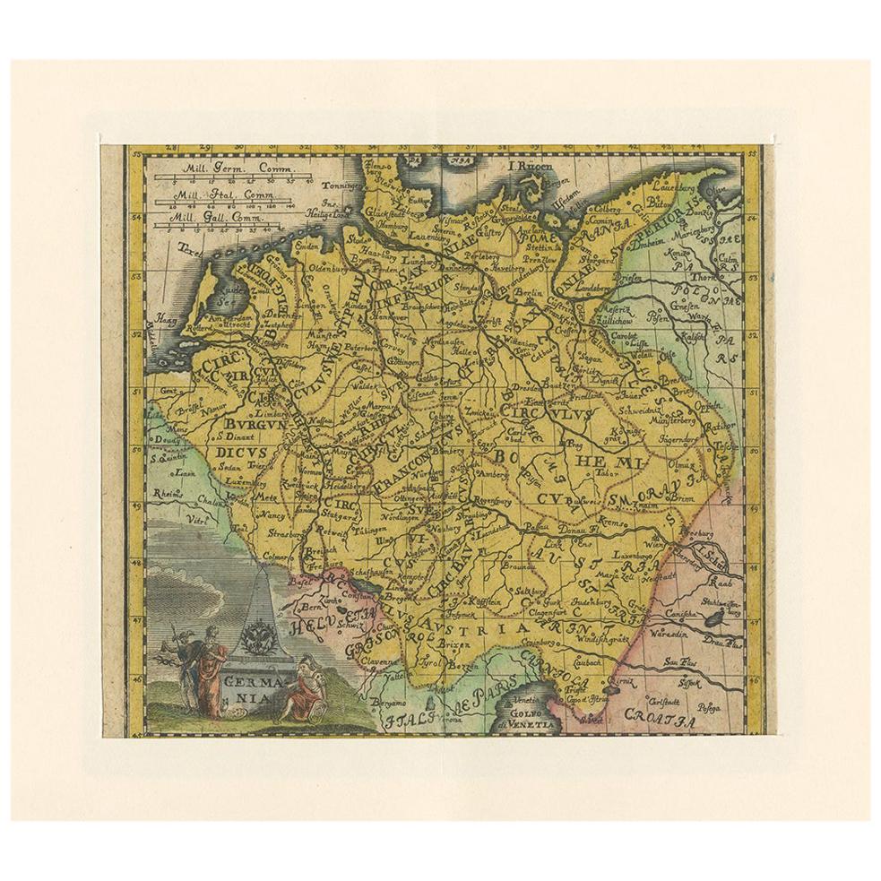
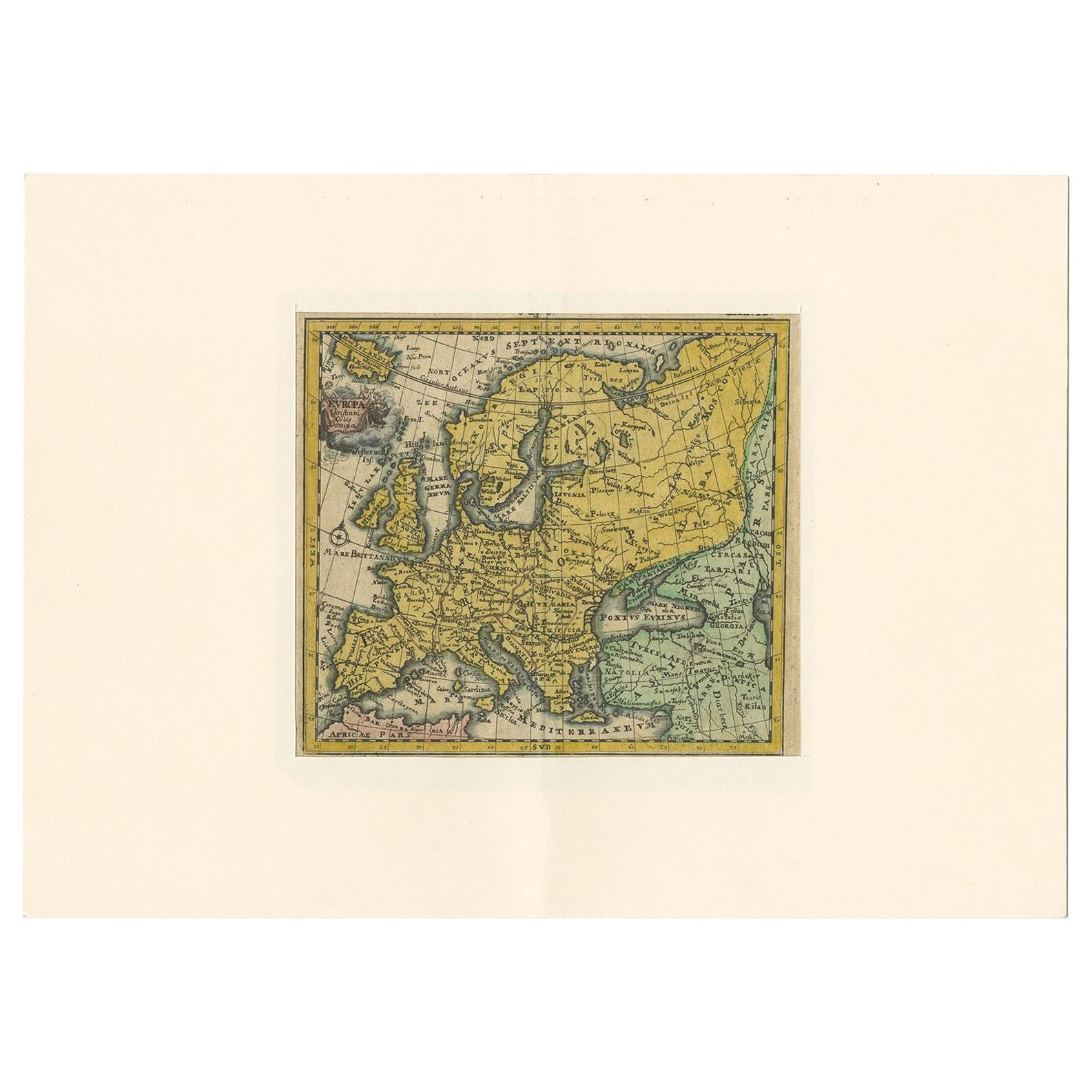
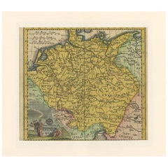
- Antique Map of Germany by Hederichs 'circa 1740'Located in Langweer, NLAntique map titled 'Germania'. Rare miniature map of Germany and surroundings. This map covers the entirety of those lands traditionally occupied by Germanic peoples, from the Blatic...Category
Antique Mid-18th Century Maps
MaterialsPaper
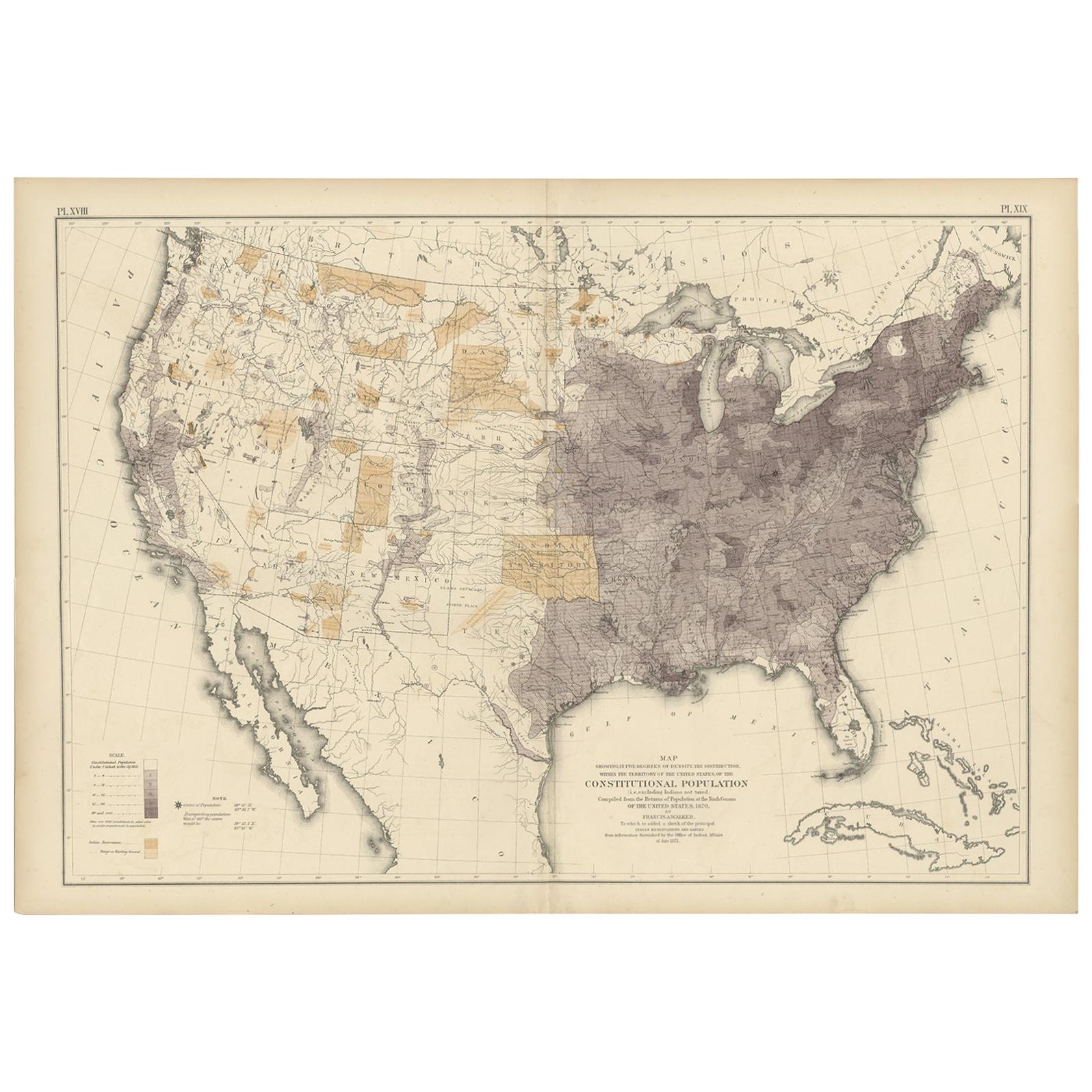
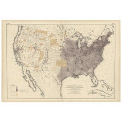
- Antique Chart of the US Population in 1870, published in 1874Located in Langweer, NLAntique chart titled 'Map showing, in five degrees of density, the distribution, within the territory of the United States, of the constitutional population, i.e., excluding Indians ...Category
Antique Late 19th Century Maps
MaterialsPaper
- Antique Chart of the Pacific Coast '1874'Located in Langweer, NLAntique chart titled 'Maps of the Pacific Coast exhibiting various subjects. Compiled from the statistics of the eight and ninth census of the United Sta...Category
Antique Late 19th Century Maps
MaterialsPaper
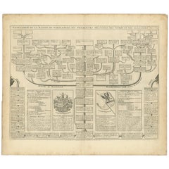
- Antique Genealogy Chart of the House of Wurttemberg in Germany, 1732Located in Langweer, NLAntique print titled 'Genealogie de la Maison de Wirtemberg (..)'. Genealogy of the House Wurttemberg. This print orginates from 'Atlas Historique'. The House of Württemberg is a...Category
Antique 18th Century Prints
MaterialsPaper

You May Also Like
- Antique Anatomical Wall Chart Depicting the Human SkeletonLocated in Berghuelen, DEA rare 19th century anatomical wall chart depicting the human skeleton. On the sides On the sides are detailed description in German language. The wall...Category
Early 20th Century German Victorian Prints
MaterialsPaper
- Antique Foldable Anatomical Wall Chart Depicting Human MusculatureLocated in Berghuelen, DEAntique Foldable Anatomical Wall Chart Depicting Human Musculature The rare 19th century anatomical wall chart depicts the human musculature and inter...Category
Early 20th Century German Victorian Prints
MaterialsWood, Paper
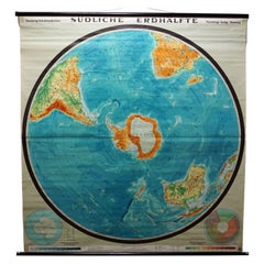
- Southern Hemisphere of the Earth Rollable Map Vintage Wall ChartLocated in Berghuelen, DEA great pull-down map or vintage wall chart illustrating the southern hemisphere of the earth, published by Prof. Dr. C. Troll, Flemmings Verlag Hamburg. Colorful print on paper rein...Category
Mid-20th Century German Country Prints
MaterialsCanvas, Wood, Paper
- The Kingdom of Naples and Southern Italy: A Hand-Colored 18th Century Homann MapBy Johann Baptist HomannLocated in Alamo, CA"Novissima & exactissimus Totius Regni Neapolis Tabula Presentis Belli Satui Accommo Data" is a hand colored map of southern Italy and the ancient Kingdom of Naples created by Johann...Category
Antique Early 18th Century German Maps
MaterialsPaper
- Anatomical Wall Chart Depicting the Human Lymphatic and Blood VesselsLocated in Berghuelen, DEA rare 19-carat anatomical wall chart depicting the human lymphatic and blood vessels. On the sides with detailed description in German language. Print...Category
Early 20th Century German Victorian Prints
MaterialsPaper
- Civil War Panorama of the Seat of War by John Bachmann, Antique Print circa 1864Located in Colorado Springs, COPanorama of the seat of war. Bird's-eye View of Virginia, Maryland, Delaware and the District of Columbia. This third state of this fascinating bird's eye view of the northernmost p...Category
Antique 1860s American Maps
MaterialsPaper


Recently Viewed
View AllMore Ways To Browse
Southern Antiques
Antique Skies
Map Chart
Chart Antique
The Comet
18th Century Southern Antiques
Map Of Stars
Antique Constellation
Diagram Map
Hemispheres Map
Hemisphere Antiques
Antique Diagrams
Antique Hemisphere Maps
Map Of Constellations
Map Of The Constellations
Antique Sky Map
Antique Constellation Map
Constellation Map