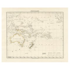
Diagram Map
2
to
19
202
59
133
77
57
45
41
27
20
17
16
15
15
12
11
9
6
5
5
5
4
4
4
3
3
3
3
2
1
1
1
1
1
1
1
1
1
1
1
51
19
16
8
4
Sort By
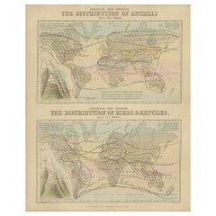
Antique Zoological Map, 1843
Located in Langweer, NL
Two antique world maps on one sheet. The upper map shows the distribution of animals over the world
Category
Antique 19th Century Maps
Materials
Paper
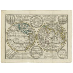
Interesting Antique Engraving of the World in Hemispheres with 6 Diagrams, 1788
Located in Langweer, NL
Antique map titled 'De Nieuwe en Ouden oppervlakke en doorzigtkundige Aardrykes Bollen (..)'. Twin
Category
Antique Late 18th Century Maps
Materials
Paper
H 8.08 in W 11.03 in D 0.02 in
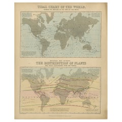
Antique Tidal Chart and Botanical Map, 1843
Located in Langweer, NL
Two antique world maps on one sheet. The upper map is a tidal chart of the world and shows the
Category
Antique 19th Century Maps
Materials
Paper
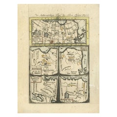
Antique Map of Northern Asia by Mallet, 1719
Located in Langweer, NL
Antique map titled 'Das Mitternächtige Theil des Alten Asien'. This sheet of five miniature maps
Category
Antique 18th Century Maps
Materials
Paper
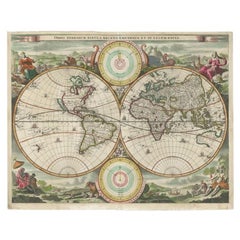
Antique Map of the World by Stoopendaal, c.1714
Located in Langweer, NL
Antique world map titled 'Orbis Terrarum Tabula Recens Emendata et in Lucem Edita'. Decorative
Category
Antique 18th Century Maps
Materials
Paper
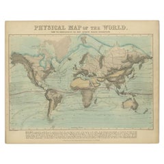
Antique Physical Map of the World by Reynolds, 1849
Located in Langweer, NL
Antique physical map of the world, showing the discoveries of the most eminent modern geographers
Category
Antique 19th Century Maps
Materials
Paper
Antique Bible World Map by R. & J. Wetstein, 1743
Located in Langweer, NL
polar hemisphere maps and astronomical diagrams. The information about Australia, Tasmania and New
Category
Antique Mid-18th Century Maps
Materials
Paper
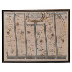
Road Map, John Ogilby, No 54, London, Yarmouth, Britannia
By John Ogilby
Located in BUNGAY, SUFFOLK
-sixth year, as a publisher of maps and geographical accounts.
Ogilby was born outside Dundee, in
Category
Antique 1670s English Baroque Maps
Materials
Paper
Title: Mid-19th Century Map of Australasia by Carl Flemming - 1855
Located in Langweer, NL
Title: "Mid-19th Century Map of Australasia by Carl Flemming - 1855"
Description: This original
Category
Antique 1850s Maps
Materials
Paper
No Reserve
H 14.06 in W 17.52 in D 0 in
Antique Map of the Eastern Hemisphere by Valk & Chenk '1708'
Located in Langweer, NL
Antique map titled 'Hemispherium Orbis Antiqui, Cumzonis Circulis, Et Sity populorum Diverso
Category
Antique Early 18th Century Maps
Materials
Paper
Antique Map Showing the Religions Around the World by Johnston '1854'
Located in Langweer, NL
Antique map titled 'Moral & Statistical Chart showing the Geographical Distribution of Man
Category
Antique Mid-19th Century Maps
Materials
Paper
No Reserve
H 21.66 in W 26.38 in D 0.02 in
Antique Map of the Empire of the Assyriens by Mallet, 1683
By Alain Manesson Mallet
Located in Langweer, NL
Antique map titled 'Empire des Assyriens' and 'Assyrie Chaldee et Mesopotamie selon les Anciens
Category
Antique 17th Century Maps
Materials
Paper
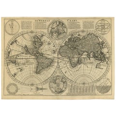
Antique Double Hemisphere World Map with California as an Island, 1710
Located in Langweer, NL
Description: Antique map titled 'De Werelt Caart'. First state (out of three) antique double
Category
Antique 1710s Maps
Materials
Paper
Antique Map of the Distribution of Air and Rain by Reynolds, 1843
Located in Langweer, NL
Two antique world maps on one sheet. The upper map shows the distribution of the currents of air
Category
Antique 19th Century Maps
Materials
Paper
Antique Map of the Phenomena of Volcanoes and Earthquakes by Reynolds, 1852
Located in Langweer, NL
Antique world map showing the phenomena of Volcanoes and Earthquakes, showing the influence exerted
Category
Antique 19th Century Maps
Materials
Paper
H 8.94 in W 11.23 in D 0 in
Antique Map of Northern India and the Bengal Gulf by Mallet, 1686
Located in Langweer, NL
Antique map titled "Partie Orientale de la Terre Ferme de l'Inde Moderne". Original antique map of
Category
Antique 17th Century Maps
Materials
Paper
Map Road Strip Britannia Sheet 2 John Ogilby London Aberistwith Islip Bramyard
By John Ogilby
Located in BUNGAY, SUFFOLK
of England and Wales.
Strip map Islip to Bramyard, on a scale of approximately one inch to the mile
Category
Antique 17th Century English Baroque Maps
Materials
Paper
H 14.38 in W 19.3 in D 0.79 in
Map Road John Ogilby Britannia No 74 Ipswich to Norwich Cromer Framed
By John Ogilby
Located in BUNGAY, SUFFOLK
his sixty-sixth year, as a publisher of maps and geographical accounts.
Ogilby was born outside
Category
Antique 1670s English Baroque Maps
Materials
Paper
Road Map John Ogilby No 75 Kings Lyn Harwich, Britannia Framed Wallhanging
By John Ogilby
Located in BUNGAY, SUFFOLK
, as a publisher of maps and geographical accounts.
Ogilby was born outside Dundee, in 1600, the
Category
Antique 1670s European Baroque Maps
Materials
Paper
H 15.75 in W 19.69 in D 0.6 in
Antique Map of India and the Gulf of Bengal by Mallet, c.1686
Located in Langweer, NL
Antique map titled ?Partie Orientale de la Terre Ferme de l'Inde Moderne. Small map of India and
Category
Antique 17th Century Maps
Materials
Paper
Road Map No43 London to Kings Lynn, Royston to Downham, John Ogilby, Britannia
By John Ogilby
Located in BUNGAY, SUFFOLK
John Ogilby (British 1600-1676) Cosmographer and Geographick Printer to Charles II.
A road map
Category
Antique Late 17th Century British Charles II Maps
Materials
Paper
H 20.48 in W 24.41 in D 0.4 in
Road Map John Ogilby London St David's Britannia No 15 Abingdon Monmouth Framed
By John Ogilby
Located in BUNGAY, SUFFOLK
John Ogilby (British 1600-1676) Cosmographer and Geographick Printer to Charles II. A road map from
Category
Antique 1670s English Baroque Maps
Materials
Paper
H 20.48 in W 24.41 in D 0.6 in
Old Map of the Empire of the Assyriens & the Tigres and Euphrates Rivers, 1683
Located in Langweer, NL
Antique map titled 'Empire des Assyriens' and 'Assyrie Chaldee et Mesopotamie selon les Anciens
Category
Antique 1680s Maps
Materials
Paper
H 8.27 in W 5.12 in D 0 in
Road Map Britannia No 32 the Road from London to Barnstable John Ogilby Framed
By John Ogilby
Located in BUNGAY, SUFFOLK
A road map from Britannia, by John Ogilby Esq., Cosmographer and Geographick Printer to Charles II
Category
Antique Late 17th Century English Charles II Maps
Materials
Paper
H 20.48 in W 24.41 in D 0.6 in
Road Map Britannia No 15 London to St Davids John Ogilby Brown Gilt Frame
By John Ogilby
Located in BUNGAY, SUFFOLK
Lechlade, to Fairford, to Barnsley to Gloucester showing Monmouth as the destination. A road map from
Category
Antique Late 17th Century British Charles II Maps
Materials
Paper
H 22.05 in W 26.19 in D 0.6 in
Road Map Britannia No 25 London to the Lands End, John Ogilby Brown Gilded Frame
By John Ogilby
Located in BUNGAY, SUFFOLK
Senan in Cornwall. By John Ogilby His Majesties Cosmographer. A road map from Britannia, 1675/6. No 25
Category
Antique Late 17th Century British Charles II Maps
Materials
Paper
H 22.05 in W 26.19 in D 0.6 in
1842 Wall Map of the United States by J. H. Young, Published by S. A. Mitchell
Located in Colorado Springs, CO
Presented is an 1842 hanging “Map of the United States,” engraved by J. H. Young and published by
Category
Antique 1840s American Maps
Materials
Paper
H 45 in W 38 in D 1 in
Road Map Britannia 1675/6 No 5 Road London to Barwick, London Stilton Grey Frame
By John Ogilby
Located in BUNGAY, SUFFOLK
John Ogilby (British 1600-1676) cosmographer and geographick printer to Charles II.
A road map from
Category
Antique Late 17th Century British Charles II Maps
Materials
Paper
H 22.84 in W 25.99 in D 0.4 in
Antique Chart of the Passage of Comets in the Southern Sky, circa 1740
Located in Langweer, NL
Antique map titled 'Motus Comtarum in Hemispaerio Australi (..)'. This uncommon chart depicts the
Category
Antique Mid-18th Century Maps
Materials
Paper
H 20.87 in W 24.69 in D 0.02 in
Map from Home to Kaz's Gallery
By Kory Twaddle
Located in Kansas City, MO
Artist : Kory Twaddle
Title : Map from Home to Kaz's Gallery
Materials : Oil, acrylic, charcoal
Category
2010s Abstract Expressionist Mixed Media
Materials
Color Pencil, Graphite, Paint, Paper, Conté, Charcoal, India Ink, Acryli...
Draught of a Galley /// Old Masters Ship Boat Seascape Construction Diagram Art
By William Henry Toms
Located in Saint Augustine, FL
Set of Maps of all the Counties in England and Wales". The maps were republished on 29 September 1742
Category
1730s Baroque More Prints
Materials
Watercolor, Laid Paper, Engraving, Intaglio
Original Vintage Poster General Dynamics Aerodynamics UN Atomic Energy World Map
By Erik Nitsche
Located in London, GB
map diagram of the earth above a photo of a crane, set against a bold red background with stylized
Category
Vintage 1950s Swiss Posters
Materials
Paper
H 50.4 in W 35.44 in D 0.04 in
Walking in Circles - Geometric Abstract Neutral Colored Landscape Map Painting
By Heny Steinberg
Located in Los Angeles, CA
Mexican artist Heny Steinberg’s abstracted landscapes invite us to travel from the map to the
Category
21st Century and Contemporary Abstract Abstract Paintings
Materials
Canvas, Mixed Media, Acrylic
Theories of Planetary Orbits: A Framed 18th C. Celestial Map by Doppelmayr
By Johann Gabriel Doppelmayr 1
Located in Alamo, CA
This 18th century hand-colored copperplate celestial map by Johann Doppelmayr entitled "Astronomia
Category
Early 18th Century Landscape Prints
Materials
Engraving
H 31.5 in W 34.94 in D 1 in
Natural Order - Abstract Landscape Light Green and Grey Map Line Painting
By Heny Steinberg
Located in Los Angeles, CA
Mexican artist Heny Steinberg’s abstract artworks invite us to travel from the map to the localized
Category
21st Century and Contemporary Abstract Abstract Paintings
Materials
Acrylic, Canvas, Mixed Media
Theories of Planetary Motion: An 18th C. Framed Celestial Map by Doppelmayr
By Johann Gabriel Doppelmayr 1
Located in Alamo, CA
This 18th century hand-colored copperplate celestial map by Johann Doppelmayr entitled "Theoria
Category
Early 18th Century Landscape Prints
Materials
Engraving
H 31.25 in W 34.88 in D 1 in
The Orbits of Venus and Mercury: An 18th C. Framed Celestial Map by Doppelmayr
By Johann Gabriel Doppelmayr 1
Located in Alamo, CA
This 18th century hand-colored copperplate celestial map by Johann Doppelmayr entitled "Phænomena
Category
Early 18th Century Landscape Prints
Materials
Engraving
H 31.13 in W 34.88 in D 1 in
Red Bird Reef, Strong Portrait of a Woman, NYC Subway Map, Bright Red Coral Reef
By Francine Fox
Located in Kent, CT
print. An intricate depiction on the woman's skin delicately details a NYC subway car and subway map
Category
2010s Contemporary Portrait Drawings and Watercolors
Materials
Watercolor, Archival Paper, Graphite, Digital Pigment
Rain, by Rosalyn Richards
By Rosalyn Richards
Located in Palm Springs, CA
particle physics, satellite photography, biotechnology, radiology, and geological survey maps, have all
Category
21st Century and Contemporary Abstract Abstract Prints
Materials
Etching, Aquatint
Abstraction in pink
Located in Ciudad de México, MX
where the artist meets his inner being, without a map, and begins to have a conversation with himself
Category
20th Century Contemporary Abstract Paintings
Materials
Linen, Oil, Pigment
Art of Ancient Egypt by Kazimierz Michalowski
Located in Bradenton, FL
color; many with gold, plus 135 plans, elevations, sites, and diagrams, and 15 maps and charts, 600
Category
Late 20th Century French Egyptian Books
Materials
Paper
Abstraction in blue
Located in Ciudad de México, MX
where the artist meets his inner being, without a map, and begins to have a conversation with himself
Category
20th Century Abstract Abstract Paintings
Materials
Linen, Oil, Pigment
Antique Print of the World's Time Zones by Johnson, 1872
Located in Langweer, NL
Antique print titled 'A Diagram exhibiting the difference of time between the places shown
Category
Antique Late 19th Century Prints
Materials
Paper
Original Painting. New Yorker Cover Proposal Baseball c. 1939 Modern Cubist Deco
By Antonio Petruccelli
Located in New York, NY
anything, from charts and diagrams to maps, illustrations, covers, and caricatures,’ said Francis Brennan
Category
1930s American Modern Figurative Paintings
Materials
Gouache, Board
Original Painting Fortune Cover Published 1937 American Modern - Met Museum
By Antonio Petruccelli
Located in New York, NY
for Fortune. He could do anything, from charts and diagrams to maps, illustrations, covers, and
Category
1930s American Modern Landscape Paintings
Materials
Board, Gouache
The Art of the Maya from the Olmecs to the Toltec-Maya by Henr Stierlin, 1st Ed
Located in valatie, NY
, illustrations, maps, and diagrams in color and black and white. Describes the world of the Maya and their legacy
Category
Vintage 1980s English Books
Materials
Paper
H 12.5 in W 9.75 in D 1 in
Mountain Lions of LA, Nature Inspired Painting, Animal, Trees, Gray, Green, Gold
By Francine Fox
Located in Kent, CT
beneath an intricately detailed map of Los Angeles in bright shimmering gold and branches of a verdant
Category
2010s Contemporary Animal Paintings
Materials
Canvas, Oil, Mica
Original California Wine Country vintage wine and travel poster
Located in Spokane, WA
diagram of the grape-growing regions of California. The artist provides some comparisons of the grape
Category
1970s Abstract Expressionist Landscape Prints
Materials
Offset
H 36 in W 24 in D 0.05 in
Japan Issue Fortune Magazine Cover Proposal Japanese Mid-Century Illustration
By Antonio Petruccelli
Located in New York, NY
anything, from charts and diagrams to maps, illustrations, covers, and caricatures,’ said Francis Brennan
Category
1930s American Modern Still-life Paintings
Materials
Gouache, Board
Original Painting Steel Workers Fabric Design Industrial Deco American Modernism
By Antonio Petruccelli
Located in New York, NY
and diagrams to maps, illustrations, covers, and caricatures,’ said Francis Brennan, the former art
Category
1930s American Modern Figurative Paintings
Materials
Gouache, Board
Leopards of Mumbai, Leopard, Animal, Trees, Gray, Gold Nature Inspired Painting
By Francine Fox
Located in Kent, CT
beneath an intricately detailed map of Mumbai, India in bright shimmering gold. In this oil painting with
Category
2010s Contemporary Animal Paintings
Materials
Canvas, Oil, Mica
American Scene Industrial Modern Lamp Magazine Illustration Mid-Century c. 1930s
By Antonio Petruccelli
Located in New York, NY
and diagrams to maps, illustrations, covers, and caricatures,’ said Francis Brennan, the former art
Category
1930s American Modern Landscape Paintings
Materials
Gouache, Board
Original Painting. Colliers Magazine Cover Published 1933 Wedding Illustration
By Antonio Petruccelli
Located in New York, NY
anything, from charts and diagrams to maps, illustrations, covers, and caricatures,’ said Francis Brennan
Category
1930s American Realist Figurative Paintings
Materials
Gouache, Board
Original Painting. Vanity Fair Illustration Proposal. Art Deco Modern 1930s
By Antonio Petruccelli
Located in New York, NY
and diagrams to maps, illustrations, covers, and caricatures,’ said Francis Brennan, the former art
Category
1930s American Modern Figurative Paintings
Materials
Gouache, Board
Fireman Textile Fabric Design 1920s American Scene Modern Working Men Art Deco
By Antonio Petruccelli
Located in New York, NY
– 60s. ‘Tony was Mr. Versatility for Fortune. He could do anything, from charts and diagrams to maps
Category
1920s American Modern Figurative Paintings
Materials
Gouache, Board
Bricklayers House Beautiful Cover Proposal American Scene Modern 1930s Workers
By Antonio Petruccelli
Located in New York, NY
anything, from charts and diagrams to maps, illustrations, covers, and caricatures,’ said Francis Brennan
Category
1930s American Modern Figurative Paintings
Materials
Gouache, Board
Original Painting. Colliers Cover Published. American Scene Christmas Modern
By Antonio Petruccelli
Located in New York, NY
– 60s.
‘Tony was Mr. Versatility for Fortune. He could do anything, from charts and diagrams to maps
Category
1930s American Modern Figurative Paintings
Materials
Gouache, Board
Original Painting Published Fortune Mag Cover 1935 Jewels Jewelry Illustration
By Antonio Petruccelli
Located in New York, NY
and diagrams to maps, illustrations, covers, and caricatures,’ said Francis Brennan, the former art
Category
1930s American Modern Still-life Paintings
Materials
Gouache, Board
Original Painting Cathedral Interior New Yorker Cover Proposal 1939 Jesus Church
By Antonio Petruccelli
Located in New York, NY
anything, from charts and diagrams to maps, illustrations, covers, and caricatures,’ said Francis Brennan
Category
1930s American Realist Interior Paintings
Materials
Gouache, Board
Original Painting Life Mag Published 1955 Birds Animals Illustration Mid Century
By Antonio Petruccelli
Located in New York, NY
for Fortune. He could do anything, from charts and diagrams to maps, illustrations, covers, and
Category
1950s American Realist Animal Paintings
Materials
Gouache, Board
- 1
Get Updated with New Arrivals
Save "Diagram Map", and we’ll notify you when there are new listings in this category.
Diagram Map For Sale on 1stDibs
Surely you’ll find the exact diagram map you’re seeking on 1stDibs — we’ve got a vast assortment for sale. There are many abstract, contemporary and Pop Art versions of these works for sale. You’re likely to find the perfect diagram map among the distinctive items we have available, which includes versions made as long ago as the 18th Century as well as those made as recently as the 21st Century. When looking for the right diagram map for your space, you can search on 1stDibs by color — popular works were created in bold and neutral palettes with elements of gray, beige, brown and orange. Finding an appealing diagram map — no matter the origin — is easy, but Heny Steinberg, Rosalyn Richards, Donise English, Jeffrey Beebe and Andreas Cellarius each produced popular versions that are worth a look. Artworks like these of any era or style can make for thoughtful decor in any space, but a selection from our variety of those made in paint, fabric and canvas can add an especially memorable touch.
How Much is a Diagram Map?
The price for an artwork of this kind can differ depending upon size, time period and other attributes — a diagram map in our inventory may begin at $106 and can go as high as $125,000, while the average can fetch as much as $1,800.
More Ways To Browse
Irish Postage Stamps
Map Of Quebec
Hermes Atlas
Hermes Horse Face
Eclipse Horse
Antique Map Of Michigan
Irish Canterbury Furniture
Irish Canterbury
Vintage Bartholomews Maps
Wooden Copper Coat Of Arms
Nyc Subway Map
Vintage Bartholomew Maps
Rush Seats With Final
Antique Furniture Worcester Ma
Vintage Aberdeenshire
King Richard Service For 12
Hermes Heir
Constellation Hermes
