Items Similar to Antique Map of the Distribution of Air and Rain by Reynolds, 1843


Want more images or videos?
Request additional images or videos from the seller
1 of 5
Antique Map of the Distribution of Air and Rain by Reynolds, 1843
About the Item
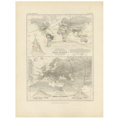
Two antique world maps on one sheet. The upper map shows the distribution of the currents of air and variable winds over the world. The lower meteorological map shows the distribution of the rain over the world. Originates from 'Geographical Diagrams '.
Artists and Engravers: Published by J. Reynolds, London.
Condition: Good, general age-related toning. Please study image carefully.
Date: 1843
Overall size: 22.7 x 28.5 cm.
Image size: 19.5 x 26.5 cm.
We sell original antique maps to collectors, historians, educators and interior decorators all over the world. Our collection includes a wide range of authentic antique maps from the 16th to the 20th centuries. Buying and collecting antique maps is a tradition that goes back hundreds of years. Antique maps have proved a richly rewarding investment over the past decade, thanks to a growing appreciation of their unique historical appeal. Today the decorative qualities of antique maps are widely recognized by interior designers who appreciate their beauty and design flexibility. Depending on the individual map, presentation, and context, a rare or antique map can be modern, traditional, abstract, figurative, serious or whimsical. We offer a wide range of authentic antique maps for any budget
- Dimensions:Height: 11.23 in (28.5 cm)Width: 8.94 in (22.7 cm)Depth: 0 in (0.01 mm)
- Materials and Techniques:
- Period:
- Date of Manufacture:1843
- Condition:
- Seller Location:Langweer, NL
- Reference Number:
About the Seller
5.0
Platinum Seller
These expertly vetted sellers are 1stDibs' most experienced sellers and are rated highest by our customers.
Established in 2009
1stDibs seller since 2017
1,929 sales on 1stDibs
Typical response time: <1 hour
- ShippingRetrieving quote...Ships From: Langweer, Netherlands
- Return PolicyA return for this item may be initiated within 14 days of delivery.
More From This SellerView All
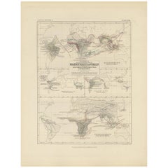
- Antique Map Showing the Distribution of the Currents of Air by Johnston '1850'Located in Langweer, NLAntique map titled 'Geographical Distribution of the Currents of Air'. Original antique map showing the distribution of the currents of air. This map originates from 'The Physical At...Category
Antique Mid-19th Century Maps
MaterialsPaper
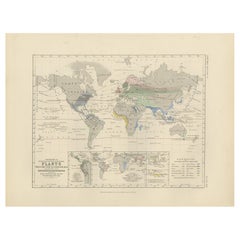
- Antique Map Showing the Distribution of Plants by Johnston, '1850'Located in Langweer, NLAntique map titled 'Geographical Distribution of Plants'. Original antique map showing the distribution of plants. This map originates from 'The Physical Atlas of Natural Phenomena' ...Category
Antique Mid-19th Century Maps
MaterialsPaper
- Antique Map Showing the Distribution of Plants by Johnston '1850'Located in Langweer, NLAntique map titled 'Geographical plants which are used as food for man'. Original antique map showing the distribution of plants. This map originates from 'The Physical Atlas of Natu...Category
Antique Mid-19th Century Maps
MaterialsPaper
- Antique Map Showing the Division and Distribution of Mammals by Johnston '1850'Located in Langweer, NLAntique map titled 'Geographical division and distribution of mammiferous animals of the orders rodentia and ruminantia over the globe'. Original antique map showing geographical div...Category
Antique Mid-19th Century Maps
MaterialsPaper
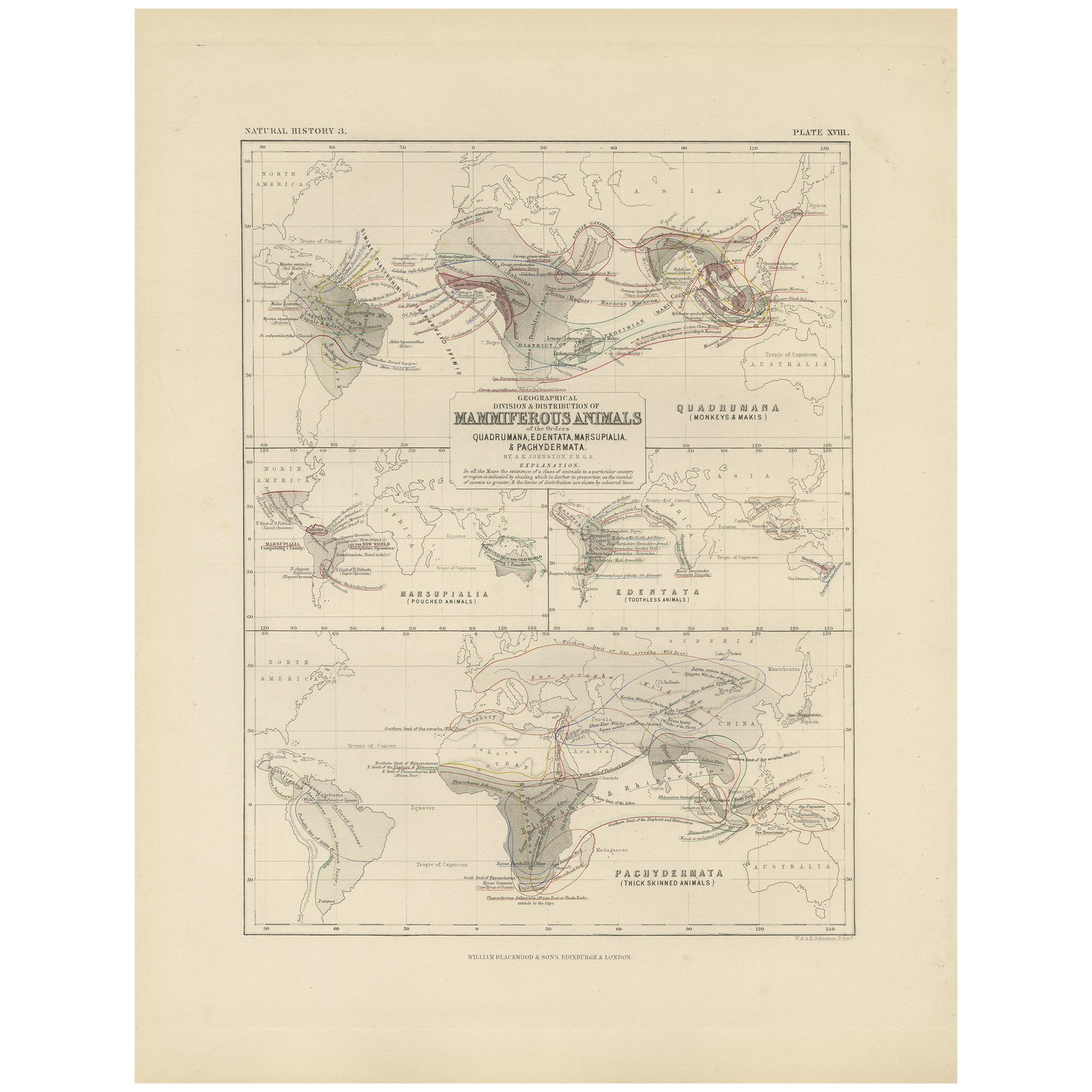
- Antique Map Showing the Division and Distribution of Mammals by Johnston '1850'Located in Langweer, NLAntique map titled 'Geographical division and distribution of mammiferous animals of the orders quadrumana, edentata, marsupialia & pachydermata'. Original antique map showing the ge...Category
Antique Mid-19th Century Maps
MaterialsPaper
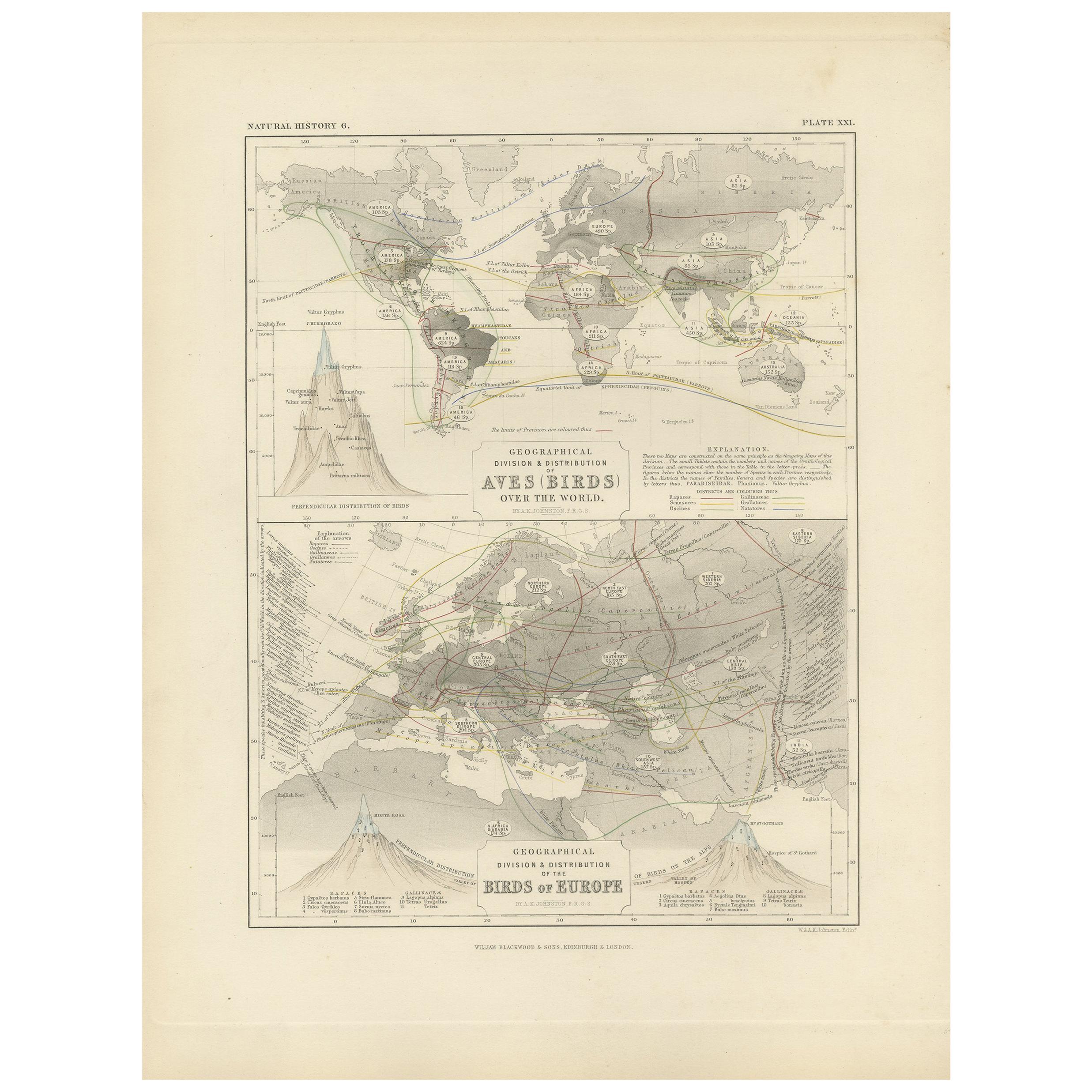
- Antique Map Showing the Division and Distribution of Birds by Johnston '1850'Located in Langweer, NLAntique map titled 'Geographical division and distribution of birds over the world and birds of Europe'. Original antique map showing the geographical division and distribution of bi...Category
Antique Mid-19th Century Maps
MaterialsPaper


You May Also Like
- Antique Map of Italy by Andriveau-Goujon, 1843By Andriveau-GoujonLocated in New York, NYAntique Map of Italy by Andriveau-Goujon, 1843. Map of Italy in two parts by Andriveau-Goujon for the Library of Prince Carini at Palazzo Carini i...Category
Antique 1840s French Maps
MaterialsLinen, Paper
- Original Antique Map of United States, Grattan and Gilbert, 1843Located in St Annes, LancashireGreat map of United States Drawn and engraved by Archer Published by Grattan and Gilbert. 1843 Original colour Unframed.Category
Antique 1840s English Maps
MaterialsPaper
- Original Antique Map of Sweden and Norway, Grattan and Gilbert, 1843Located in St Annes, LancashireGreat map of Sweden and Norway Drawn and engraved by Archer Published by Grattan and Gilbert Original color Unframed.Category
Antique 1840s English Other Maps
MaterialsPaper
- 1861 Topographical Map of the District of Columbia, by Boschke, Antique MapLocated in Colorado Springs, COPresented is an original map of Albert Boschke's extremely sought-after "Topographical Map of the District of Columbia Surveyed in the Years 1856 ...Category
Antique 1860s American Historical Memorabilia
MaterialsPaper
- Vintage "View of the Center of Paris Taken from the Air" Lithograph MapLocated in San Diego, CAA very stylish "View of the Center of Paris Taken from the Air" lithograph map published by the Paris Ministry of Tourism, circa early 1950s. The piece measures 27" x 43" and shows...Category
20th Century French Mid-Century Modern Prints
MaterialsPaper
- Original Antique Map of The World by Thomas Clerk, 1817Located in St Annes, LancashireGreat map of The Eastern and Western Hemispheres On 2 sheets Copper-plate engraving Drawn and engraved by Thomas Clerk, Edinburgh. Published by Mackenzie And Dent, 1817 ...Category
Antique 1810s English Maps
MaterialsPaper


Recently Viewed
View AllMore Ways To Browse
Diagram Map
Antique Diagrams
Compass 18th Century
18th Century Compass
Premier Antiques
Antique Furniture Building Plans
Large City Maps
Spain Antique Map
Antique Spain Map
Antique Japanese Maps
Military Maps
Antique Map Of Spain
Antique Maps Of Spain
Antique Japanese Map
Military Map
Antique Map South America
Antique Maps South America
South America Antique Map