Items Similar to Antique Map Showing the Distribution of Plants by Johnston '1850'


Want more images or videos?
Request additional images or videos from the seller
1 of 5
Antique Map Showing the Distribution of Plants by Johnston '1850'
About the Item
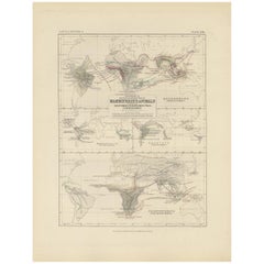
Antique map titled 'Geographical plants which are used as food for man'. Original antique map showing the distribution of plants. This map originates from 'The Physical Atlas of Natural Phenomena' by A.K. Johnston, published 1850.
- Dimensions:Height: 11.03 in (28 cm)Width: 14.18 in (36 cm)Depth: 0.02 in (0.5 mm)
- Materials and Techniques:
- Period:
- Date of Manufacture:1850
- Condition:General age-related toning. Minor wear, blank verso. Please study image carefully.
- Seller Location:Langweer, NL
- Reference Number:
About the Seller
5.0
Platinum Seller
These expertly vetted sellers are 1stDibs' most experienced sellers and are rated highest by our customers.
Established in 2009
1stDibs seller since 2017
1,919 sales on 1stDibs
Typical response time: <1 hour
- ShippingRetrieving quote...Ships From: Langweer, Netherlands
- Return PolicyA return for this item may be initiated within 14 days of delivery.
More From This SellerView All
- Antique Map Showing the Distribution of Plants by Johnston, '1850'Located in Langweer, NLAntique map titled 'Geographical Distribution of Plants'. Original antique map showing the distribution of plants. This map originates from 'The Physical Atlas of Natural Phenomena' ...Category
Antique Mid-19th Century Maps
MaterialsPaper
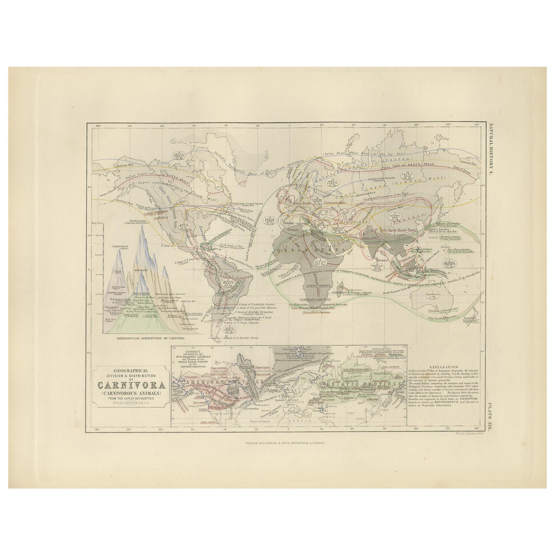
- Antique Map Showing the Division & Distribution of Carnivora by Johnston '1850'Located in Langweer, NLAntique map titled 'Geographical division and distribution of carnivorous animals'. Original antique map showing the geographical division and distribution of carnivora. This map ori...Category
Antique Mid-19th Century Maps
MaterialsPaper
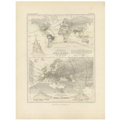
- Antique Map Showing the Distribution of the Currents of Air by Johnston '1850'Located in Langweer, NLAntique map titled 'Geographical Distribution of the Currents of Air'. Original antique map showing the distribution of the currents of air. This map originates from 'The Physical At...Category
Antique Mid-19th Century Maps
MaterialsPaper
- Antique Map Showing the Division and Distribution of Mammals by Johnston '1850'Located in Langweer, NLAntique map titled 'Geographical division and distribution of mammiferous animals of the orders rodentia and ruminantia over the globe'. Original antique map showing geographical div...Category
Antique Mid-19th Century Maps
MaterialsPaper
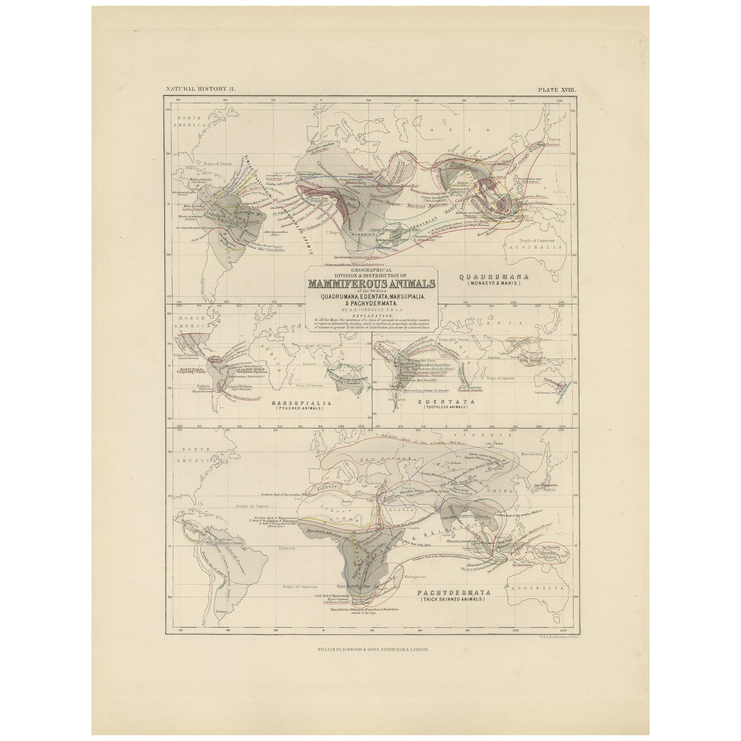
- Antique Map Showing the Division and Distribution of Mammals by Johnston '1850'Located in Langweer, NLAntique map titled 'Geographical division and distribution of mammiferous animals of the orders quadrumana, edentata, marsupialia & pachydermata'. Original antique map showing the ge...Category
Antique Mid-19th Century Maps
MaterialsPaper
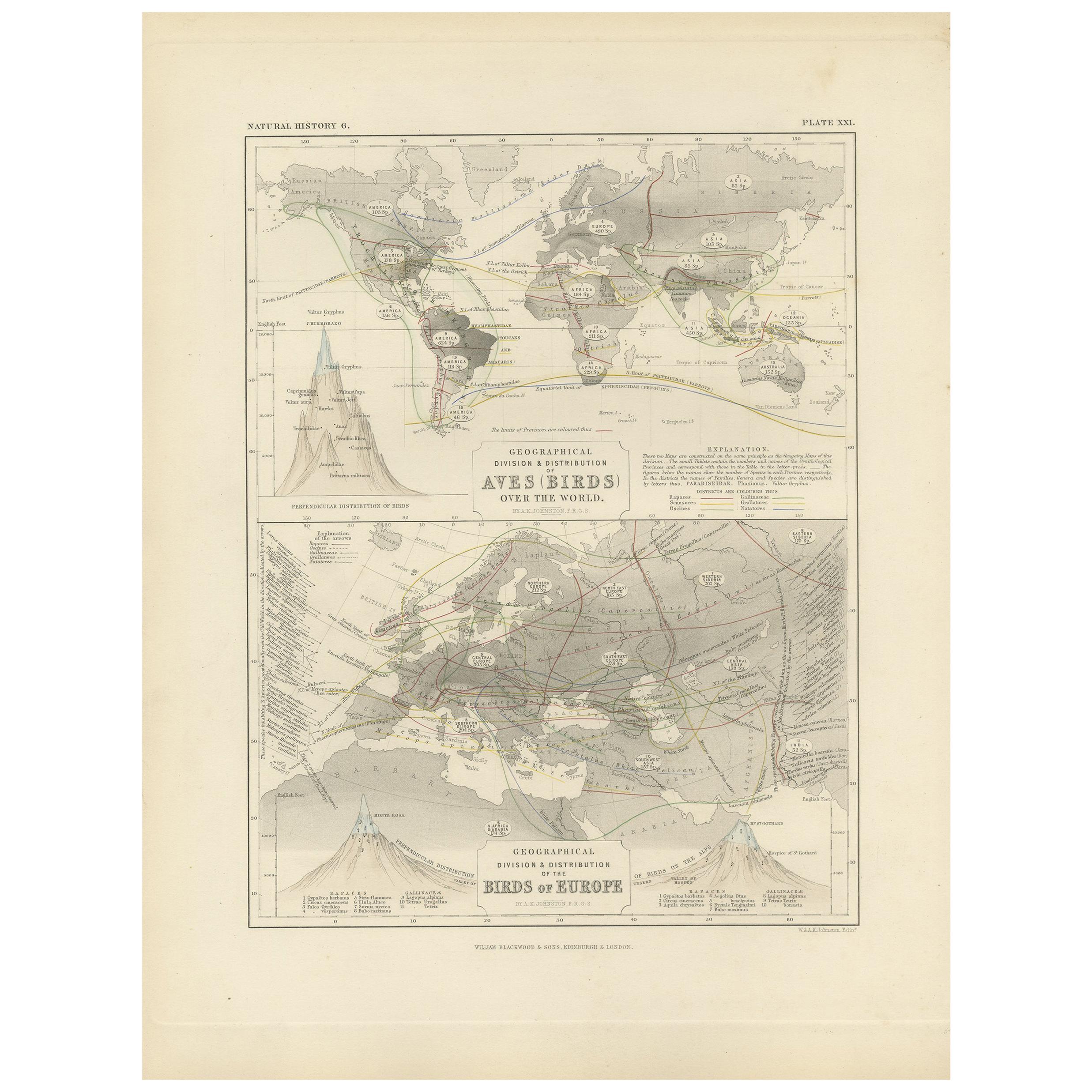
- Antique Map Showing the Division and Distribution of Birds by Johnston '1850'Located in Langweer, NLAntique map titled 'Geographical division and distribution of birds over the world and birds of Europe'. Original antique map showing the geographical division and distribution of bi...Category
Antique Mid-19th Century Maps
MaterialsPaper


You May Also Like
- Original Antique Map of Belgium by Tallis, Circa 1850Located in St Annes, LancashireGreat map of Belgium Steel engraving Many lovely vignettes Published by London Printing & Publishing Co. ( Formerly Tallis ), C.1850 Origin...Category
Antique 1850s English Maps
MaterialsPaper
- Original Antique Map / City Plan of Brussels by Tallis, circa 1850Located in St Annes, LancashireGreat map of Brussels. Steel engraving. Published by London Printing & Publishing Co. (Formerly Tallis), C.1850 Free shipping.Category
Antique 1850s English Maps
MaterialsPaper
- Original Antique Map of The World by Thomas Clerk, 1817Located in St Annes, LancashireGreat map of The Eastern and Western Hemispheres On 2 sheets Copper-plate engraving Drawn and engraved by Thomas Clerk, Edinburgh. Published by Mackenzie And Dent, 1817 ...Category
Antique 1810s English Maps
MaterialsPaper
- Original Antique Map of The Netherlands, Engraved by Barlow, Dated 1807Located in St Annes, LancashireGreat map of Netherlands Copper-plate engraving by Barlow Published by Brightly & Kinnersly, Bungay, Suffolk. Dated 1807 Unframed.Category
Antique Early 1800s English Maps
MaterialsPaper
- Map of the Republic of GenoaLocated in New York, NYFramed antique hand-coloured map of the Republic of Genoa including the duchies of Mantua, Modena, and Parma. Europe, late 18th century. Dimension: 25...Category
Antique Late 18th Century European Maps
- Antique Map of Italy by Andriveau-Goujon, 1843By Andriveau-GoujonLocated in New York, NYAntique Map of Italy by Andriveau-Goujon, 1843. Map of Italy in two parts by Andriveau-Goujon for the Library of Prince Carini at Palazzo Carini i...Category
Antique 1840s French Maps
MaterialsLinen, Paper


Recently Viewed
View AllMore Ways To Browse
Antique Map Engraving
Antique City Map
Antique City Maps
Antique Maps Of Cities
England Map
Antique World Maps And Atlases World Maps
Antique Furniture Portugal
Map Of England
Original City Map
Antique Furniture Edinburgh
Maps Colored
Antique Map Of Holland
Antique Furniture Mexico
16th Century German
Rare Antique Level
Antique Edinburgh Scotland
Dutch 16th
Railroad Furniture