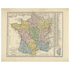
Antique Map Engraving
157
to
178
1,675
486
1,310
888
771
416
273
184
174
149
129
109
101
77
68
61
57
50
48
45
43
38
35
35
32
31
29
26
23
23
22
22
21
21
21
19
16
15
15
13
10
9
9
8
7
7
7
6
3
2
2
1
127
44
33
30
25
Sort By
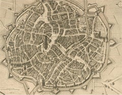
18th Century Map Engraving - Mechlin, or Malines
Located in Corsham, GB
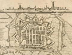
A map of Mechelen, known as Malines in French and Mechlin in English, a city and municipality in
Category
18th Century Antique Map Engraving
Materials
Engraving
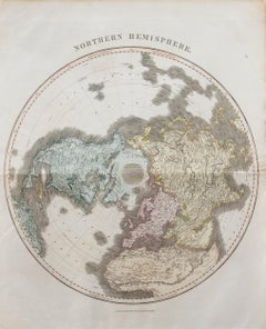
John Thomson (1777-1840) - 1830 Map Engraving, Northern Hemisphere
By John Thomson
Located in Corsham, GB
A fine engraved map of the Northern Hemisphere, from the second edition of John Thomson's 'New
Category
Early 19th Century Antique Map Engraving
Materials
Engraving
H 22.05 in W 20.48 in
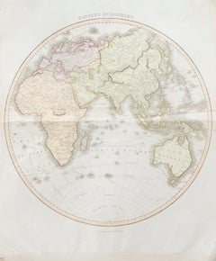
John Thomson (1777-1840) - 1830 Map Engraving, Eastern Hemisphere
By John Thomson
Located in Corsham, GB
A fine engraved map of the Eastern Hemisphere of Earth, from the second edition of John Thomson's
Category
Early 19th Century Antique Map Engraving
Materials
Engraving
H 22.05 in W 20.48 in
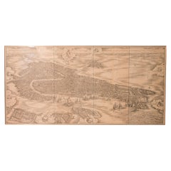
Huge Mid 19th century Six Panels Venice Map Engraving
Located in IT
and the frames are new. To be considered a masterpiece of woodcut engraving printed on six panels
Category
Mid-19th Century Italian Antique Map Engraving
Materials
Paper
John Thomson (1777-1840) - 1830 Map Engraving, Chart of the World
By John Thomson
Located in Corsham, GB
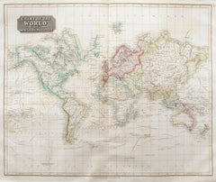
A fine engraved map of the world on Mercator's projection, from the second edition of John
Category
Early 19th Century Antique Map Engraving
Materials
Engraving
H 20.48 in W 24.41 in
18th Century Map Engraving - Newport, a Strong Sea-Port Town in Flanders
Located in Corsham, GB
A map of Nieuwpoort, anglicised to 'Newport', in northern Belgium. There is a panorama in the upper
Category
18th Century Antique Map Engraving
Materials
Engraving
John Thomson (1777-1840) - 1830 Map Engraving, The Rivers of the World
By John Thomson
Located in Corsham, GB
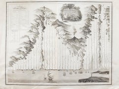
A fine engraved chart table showing the lengths of the principal rivers across the world, from the second edition of John Thomson's 'New General Atlas' published in 1830. On paper.
Category
Early 19th Century Antique Map Engraving
Materials
Engraving
18th Century Map Engraving - Plan of the Works of the City of Messina, Sicily
Located in Corsham, GB
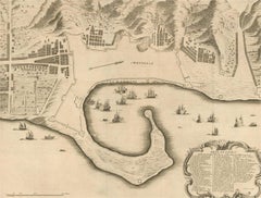
A map of Messina, a harbour city in northeast Sicily. Inscribed with the title in plate to the
Category
18th Century Antique Map Engraving
Materials
Engraving
Antique Map of France by Van Baarsel (c.1820)
Located in Langweer, NL
. Engraving was a common technique for producing detailed and high-quality maps during earlier periods
Category
Early 19th Century Antique Map Engraving
Materials
Paper
Antique Lithography Map, Bedfordshire, English, Framed Engraving, Cartography
Located in Hele, Devon, GB
This is an antique lithography map of Bedfordshire. An English, framed atlas engraving of
Category
Mid-19th Century British Victorian Antique Map Engraving
Materials
Wood
H 15.75 in W 13.19 in D 0.6 in
Antique Lithography Map, Hertfordshire, English, Framed Engraving, Cartography
Located in Hele, Devon, GB
This is an antique lithography map of Hertfordshire. An English, framed atlas engraving of
Category
Mid-19th Century British Victorian Antique Map Engraving
Materials
Wood
H 13.59 in W 15.75 in D 16.34 in
Antique Lithography Map, Lincolnshire, English, Framed, Engraving, Cartography
Located in Hele, Devon, GB
This is an antique lithography map of Lincolnshire. An English, framed atlas engraving of
Category
Mid-19th Century British Victorian Antique Map Engraving
Materials
Wood
H 15.95 in W 13.39 in D 0.6 in
Antique Lithography Map, Gloucestershire, English, Framed Engraving, Cartography
Located in Hele, Devon, GB
This is an antique lithography map of Gloucestershire. An English, framed atlas engraving of
Category
Mid-19th Century British Victorian Antique Map Engraving
Materials
Wood
H 15.75 in W 13 in D 0.6 in
Antique Lithography Map, Northumberland, English, Framed, Engraving, Cartography
Located in Hele, Devon, GB
This is an antique lithography map of Northumberland. An English, framed atlas engraving of
Category
Mid-19th Century British Victorian Antique Map Engraving
Materials
Wood
H 16.74 in W 13.98 in D 0.6 in
Antique Lithography Map, Worcestershire, English, Framed Engraving, Cartography
Located in Hele, Devon, GB
This is an antique lithography map of Worcestershire. An English, framed atlas engraving of
Category
Early 19th Century British Regency Antique Map Engraving
Materials
Wood
H 15.95 in W 13.19 in D 0.6 in
Engraving Depicting 16th Century Map of Terra Sancta
Located in Buchanan, MI
Abraham Ortelius (Flemish, 1527-1598) Terra Sancta.
Engraving depicting 16th century map of Terra
Category
18th Century and Earlier Antique Map Engraving
Materials
Paper
1726 Valentyn's Map of Bali and Lombok, Original Engraving
Located in Langweer, NL
This antique map is a detailed 18th-century chart of the island of Bali, one of the many islands of
Category
Early 18th Century Antique Map Engraving
Materials
Paper
Antique Lithography Map, Cornwall, English Framed Engraving, Cartography, C.1850
Located in Hele, Devon, GB
This is an antique lithography map of the Duchy of Cornwall. An English, framed atlas engraving of
Category
Mid-19th Century British Victorian Antique Map Engraving
Materials
Wood
H 13.98 in W 16.34 in D 0.6 in
Antique Lithography Map, Isle of Wight, English, Framed, Engraving, Cartography
Located in Hele, Devon, GB
This is an antique lithography map of the Isle of Wight. An English, framed atlas engraving of
Category
Early 19th Century British Regency Antique Map Engraving
Materials
Wood
H 13.59 in W 15.56 in D 0.6 in
Roseaux, St. Lucia Island Map by BELLIN, Handcolored Engraving, 1763
Located in Langweer, NL
part of Bellin's renowned "Petit atlas maritime," this map showcases an exquisite depiction of the
Category
1760s Antique Map Engraving
Materials
Paper
Matthaus Seutter, Framed 1730 Color Engraving Map of "Belgium Fonderatum"
Located in Bridgeport, CT
Label on verso. From Grosser Atlas. The name Belgium comes from the ancient designation "Gallis Belgica". Figural decoration upper left. M. Seutter was a famed German mapmaker in the...
Category
18th Century European Renaissance Antique Map Engraving
Materials
Brass
H 27.5 in W 31 in D 0.75 in
Framed 1731 Color Engraving, Map of Rotterdam by Matthaus Seutter, "Roterodami"
Located in Bridgeport, CT
"Roterodami". Seutter (1678-1757) was an important German 18th century map maker. Bird's eye view
Category
18th Century European Renaissance Antique Map Engraving
Materials
Glass, Wood, Paper
H 29.75 in W 32.75 in D 1 in
Original Copper Engraving of a Map of Syria and Lebanon, 1698
Located in Langweer, NL
Antique map titled 'Syriae, sive Soriae, Nova et Accurata Descriptio.'
Map of Syria and Lebanon
Category
1690s Antique Map Engraving
Materials
Paper
Free Shipping
H 12.41 in W 14.45 in D 0 in
Old Engraving of Batavia 'Jakarta, Indonesia' with Map and Harbour View, 1750
Located in Langweer, NL
Antique map titled 'Carte des environs de Batavia '. French map of the Batavia area (Jakarta) in
Category
1750s Antique Map Engraving
Materials
Paper
H 11.82 in W 15.75 in D 0 in
Rare Map of Kildin Island in Russia Plus Engraving of Seal Hunting, 1614
Located in Langweer, NL
Insula Kilduyn. Orig. copper-engraving after details from J. H. van Linschoten's map taken from his
Category
Early 17th Century Antique Map Engraving
Materials
Paper
Small Map of Bantam with Dutch Ships and an Engraving of Portugese, 1614
Located in Langweer, NL
18 cm)
measurement map: 5.3 x 3.3 inch ( 13,5 x 8.5 cm ) - the engraving of the Portugese is almost
Category
Early 17th Century Antique Map Engraving
Materials
Paper
Engraving of a Map of Florida, the Gulf Coast, Caribbean & Central America, 1728
Located in Langweer, NL
This exceptional antique map, titled "Nouvelle Carte Marine de Toute les Cotes de l´Amerique" and
Category
Mid-18th Century European Antique Map Engraving
Materials
Paper
Free Shipping
H 24.61 in W 40.56 in D 0.02 in
Antique Engraving of a Map or Plan of Jerusalem and Surrounding Mountains, 1773
Located in Langweer, NL
Antique map titled 'Platte grond van Jerusalem, en de omliggende Bergen'. Plan of the city of
Category
18th Century Antique Map Engraving
Materials
Paper
H 14.18 in W 10.24 in D 0 in
Old Color Engraving of Blaeu's first Map of Brazil, North Oriented to the Right
By Willem Blaeu
Located in Langweer, NL
Antique map titled 'Novus Brasiliae Typus'. Fine old color example of Blaeu's first map of Brazil
Category
Mid-17th Century Antique Map Engraving
Materials
Paper
H 19.3 in W 22.84 in D 0.02 in
Rare Antique Copper Engraving of a Map of Pegu and Arakan, Burma (Myanmar), 1714
Located in Langweer, NL
Antique map Myanmar (Birma) titled 'Les Royaumes de Pegu et d'Aracan'.
Rare map of Pegu and
Category
1710s Antique Map Engraving
Materials
Paper
H 7.29 in W 9.06 in D 0 in
Engraving by Tallis and Rapkin of Map of the West Indies in The Caribbean, 1851
Located in Langweer, NL
John Tallis' 1851 map of the West Indies stands as a striking example of his renowned cartographic
Category
Mid-19th Century Antique Map Engraving
Materials
Paper
H 10.44 in W 14.57 in D 0 in
Antique Map Made After a Roman Papyrus Travel Map, Known as Peutinger Map, 1773
Located in Langweer, NL
Old Dutch engraving with title: 'Romeinsche Reis Kaart van K. Peutinger'.
Rare antique map based
Category
18th Century Antique Map Engraving
Materials
Paper
H 15.56 in W 18.51 in D 0 in
Map of Cambridge 18th century engraving by Sutton Nichols
Located in London, GB
."
Sutton Nichols (1668 - 1729)
Map of Cambridgeshire
Engraving
43 x 36 cm
Signed in plate lower left.
A
Category
18th Century Antique Map Engraving
Materials
Engraving
Antique Map of Eastern Canada with an inset Map of Newfoundland, 1882
Located in Langweer, NL
Antique map titled 'Dominion of Canada'. Old map of Eastern Canada with an inset map of
Category
19th Century Antique Map Engraving
Materials
Paper
Antique Map of New Jersey
Located in Langweer, NL
plate engraving dating to 1855. Produced by the important mid 19th century American map publisher J. H
Category
Mid-19th Century Antique Map Engraving
Materials
Paper
Antique Map of Saxony, Germany
Located in Langweer, NL
Original antique map titled 'Circulus Saxoniae Superioris'. Original antique map of Saxony, Germany
Category
Early 18th Century Antique Map Engraving
Materials
Paper
Antique Map of Swabia, 1685
Located in Langweer, NL
Antique map titled 'Sueviae quae cis Codanum fuit finum Antiqua defcriptio.' Miniature map of
Category
17th Century Antique Map Engraving
Materials
Paper
1844 Map "Russia in Eurpoe, Part II to Part VIII", 7 Maps Ric.r023
Located in Norton, MA
. & C. Walker worked closely with Beaufort in engraving the maps. Finely engraved, carefully researched
Category
19th Century Unknown Antique Map Engraving
Materials
Paper
Old Map of Southern Australia, with an Inset Map of Cape York Peninsula, 1882
Located in Langweer, NL
Antique map titled 'South Australia, New South Wales, Victoria & Queensland'.
Old map of
Category
1880s Antique Map Engraving
Materials
Paper
H 24.22 in W 19.53 in D 0 in
Original Antique Map of Switzerland, 1882
Located in Langweer, NL
Embark on a historical journey with an original Antique Map of Switzerland from the renowned
Category
1880s Antique Map Engraving
Materials
Paper
Antique Map of Denmark with Inset Maps of Iceland, Copenhagen and the Elbe, 1882
Located in Langweer, NL
Antique map titled 'Denmark with North-West portion of the German Empire comprising Schleswic
Category
19th Century Antique Map Engraving
Materials
Paper
H 24.22 in W 19.53 in D 0 in
1812 United States Map, by Pierre Tardieu, Antique French Map Depicting the U.S.
By Pierre François Tardieu
Located in Colorado Springs, CO
showcases high quality engravings. This detailed map of the recently independent United States includes one
Category
1810s French Antique Map Engraving
Materials
Paper
H 43.5 in W 48 in D 2.25 in
Antique World Map by Johnston, 1882
Located in Langweer, NL
Antique map titled 'The World in Hemispheres'. Old double-hemisphere world map. This map originates
Category
19th Century Antique Map Engraving
Materials
Paper
Scarce Antique Map of South America
Located in Langweer, NL
Antique map titled 'Carte de l'Amérique Méridionale'. Scarce map of South America, published in
Category
Early 19th Century Antique Map Engraving
Materials
Paper
Colored wall map of the WORLD
By Chambon
Located in ZWIJNDRECHT, NL
engraving after the work of Guillaume De L’Isle, published in 1754 by Jean Janvier and S.G. Longschamps.
A
Category
Mid-18th Century French French Provincial Antique Map Engraving
Materials
Wood, Paper
A Decorative Detailed Map of the Crimea, with an Inset Map of Sebastopol, c 1851
Located in Langweer, NL
: 350 x 270mms
Condition: good
Technique: original steel engraving
Description: A decorative
Category
1850s Antique Map Engraving
Materials
Paper
H 10.83 in W 14.18 in D 0 in
Original Antique Map of Asia. C.1780
Located in St Annes, Lancashire
Great map of Asia
Copper-plate engraving
Published C.1780
Two small worm holes to right side of
Category
Early 1800s English Georgian Antique Map Engraving
Materials
Paper
Original Antique Map of India. C.1780
Located in St Annes, Lancashire
Great map of India
Copper-plate engraving
Published C.1780
Three small worm holes to right
Category
Early 1800s English Georgian Antique Map Engraving
Materials
Paper
Original Antique Map of Italy. C.1780
Located in St Annes, Lancashire
Great map of Italy
Copper-plate engraving
Published C.1780
Unframed.
Category
Early 1800s English Georgian Antique Map Engraving
Materials
Paper
Large Antique County Map of Lincolnshire, England
Located in Langweer, NL
engraving and distinct style which influenced the entire map industry.
Category
Early 19th Century Antique Map Engraving
Materials
Paper
Large Antique County Map of Essex, England
Located in Langweer, NL
Antique map titled 'A Map of Essex from the best Authorities'. Original old county map of Essex
Category
Early 19th Century Antique Map Engraving
Materials
Paper
Large Antique County Map of Hertfordshire, England
Located in Langweer, NL
engraving and distinct style which influenced the entire map industry.
Category
Early 19th Century Antique Map Engraving
Materials
Paper
Large Antique County Map of Somersetshire, England
Located in Langweer, NL
engraving and distinct style which influenced the entire map industry.
Category
Early 19th Century Antique Map Engraving
Materials
Paper
Large Antique County Map of Northamptonshire, England
Located in Langweer, NL
his clean engraving and distinct style which influenced the entire map industry.
Category
Early 19th Century Antique Map Engraving
Materials
Paper
Large Antique County Map of Ruthlandshire, England
Located in Langweer, NL
engraving and distinct style which influenced the entire map industry.
Category
Early 19th Century Antique Map Engraving
Materials
Paper
Large Antique County Map of Norfolk, England
Located in Langweer, NL
Antique map titled 'A Map of Norfolk from the best Authorities'. Original old county map of Norfolk
Category
Early 19th Century Antique Map Engraving
Materials
Paper
Large Antique County Map of Middlesex, England
Located in Langweer, NL
engraving and distinct style which influenced the entire map industry.
Category
Early 19th Century Antique Map Engraving
Materials
Paper
Large Antique County Map of Cambridgeshire, England
Located in Langweer, NL
engraving and distinct style which influenced the entire map industry.
Category
Early 19th Century Antique Map Engraving
Materials
Paper
Large Antique County Map of Huntingdonshire, England
Located in Langweer, NL
engraving and distinct style which influenced the entire map industry.
Category
Early 19th Century Antique Map Engraving
Materials
Paper
Large Antique Map of England and Wales
Located in Langweer, NL
Antique map titled 'An Accurate Map of England and Wales'. Original old map of England and Wales
Category
Early 19th Century Antique Map Engraving
Materials
Paper
- 1
- ...
Get Updated with New Arrivals
Save "Antique Map Engraving", and we’ll notify you when there are new listings in this category.
Antique Map Engraving For Sale on 1stDibs
Find the exact antique map engraving you’re shopping for in the variety available on 1stDibs. Find Surrealist versions now, or shop for Surrealist creations for a more modern example of these cherished works. You’re likely to find the perfect antique map engraving among the distinctive items we have available, which includes versions made as long ago as the 18th Century as well as those made as recently as the 19th Century. When looking for the right antique map engraving for your space, you can search on 1stDibs by color — popular works were created in bold and neutral palettes with elements of beige, brown and gray. An antique map engraving from Victor Levasseur, Isaac Slater, Frans Hogenberg, Jacques-Nicolas Bellin and Henricus Hondius — each of whom created distinctive versions of this kind of work — is worth considering. Artworks like these of any era or style can make for thoughtful decor in any space, but a selection from our variety of those made in engraving, paper and laid paper can add an especially memorable touch.
How Much is a Antique Map Engraving?
The price for an artwork of this kind can differ depending upon size, time period and other attributes — an antique map engraving in our inventory may begin at $165 and can go as high as $3,138, while the average can fetch as much as $309.
More Ways To Browse
Antique Maps Philippines
Louisiana Antique Map
Malaysian Map
Map Of Hungary
Antique Newfoundland Canada
Peru Map
Antique Map Poland
Malaysia Map
Antique Ecuador
Map Of Jerusalem
Antique Basque
Map Of Louisiana
Maastricht Plate
Venezuelan Antiques
Antique Map Peru
Antique Maps Palestine
World Map Relief
Antique Map Of Jersey
