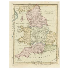
England Map

226
to
121
870
499
534
346
312
261
218
194
172
156
129
115
104
95
75
69
64
59
54
42
41
33
33
32
30
28
28
27
26
22
18
17
17
15
15
12
11
11
10
10
10
8
8
8
6
6
5
5
5
5
5
4
4
4
4
3
2
2
2
2
1
1
75
16
15
13
10
Sort By
England Map of the County of Southampton from an Actual Survey
Located in Paonia, CO
, who undertook an ambitious project to produce a series of large-scale maps of the counties of England
Category

19th Century Other Art Style Landscape Prints

Materials

Engraving

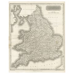
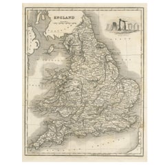
Small Steel Engraved Map of England
Located in Langweer, NL
Antique map titled 'England'. Original steel engraved map of England. Drawn by A. Arrowsmith
Category

Antique Mid-19th Century Maps

Materials

Paper

Small Steel Engraved Map of England
H 10.63 in W 8.43 in D 0.02 in
Original Antique Map of Leicestershire, England
Located in Langweer, NL
, England. This map originates from 'Britannia: or, a Geographical Description of the Kingdoms of England
Category

Antique Late 17th Century Maps

Materials

Paper

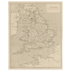
Steel Engraved Antique Map of England
Located in Langweer, NL
Antique map titled 'Angleterre'. Original antique map of England. Engraved by Th. Duvotenay
Category

Antique Late 19th Century Maps

Materials

Paper

Steel Engraved Antique Map of England
H 10.75 in W 7.76 in D 0.02 in
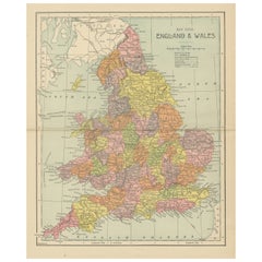
Lithographed Antique Map of England and Wales
Located in Langweer, NL
Original antique map titled 'Map XXIII England & Wales'. Lithographed map of England and Wales
Category

Antique Late 19th Century Maps

Materials

Paper

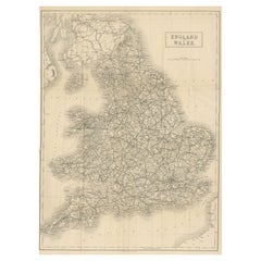
Antique Folding Map of England and Wales
Located in Langweer, NL
Antique map titled 'England and Wales'. Original folding map of England and Wales. Publishes by A
Category

Antique Late 19th Century Maps

Materials

Paper

Antique Folding Map of England and Wales
H 20.99 in W 15.52 in D 0.02 in
Miniature Antique Map of England and Wales
Located in Langweer, NL
Miniature map titled 'England & Wales'. Original antique map of England & Wales. This map
Category

Antique Early 19th Century Maps

Materials

Paper

Miniature Antique Map of England and Wales
H 6.03 in W 3.63 in D 0.02 in
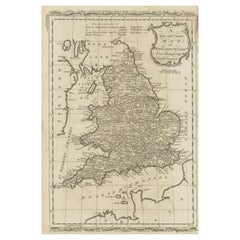
Original Antique Map of England and Wales
Located in Langweer, NL
Antique map titled 'A New and Correct Map of England and Wales from the Latest and Best
Category

Antique Late 18th Century Maps

Materials

Paper

Original Antique Map of England and Wales
H 13.94 in W 9.38 in D 0.02 in
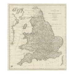
Large Antique Map of England and Wales
Located in Langweer, NL
Antique map titled 'An Accurate Map of England and Wales'. Original old map of England and Wales
Category

Antique Early 19th Century Maps

Materials

Paper

Large Antique Map of England and Wales
H 20.71 in W 17.49 in D 0.02 in
Original Antique County Map of Derbyshire, England
Located in Langweer, NL
Antique map titled 'Darbyshire'. Original antique map of the country of Derbyshire, England
Category

Antique Late 17th Century Maps

Materials

Paper

Large Antique County Map of Lincolnshire, England
Located in Langweer, NL
Antique map titled 'A Map of Lincolnshire from the best Authorities'. Original old county map of
Category

Antique Early 19th Century Maps

Materials

Paper

Large Antique County Map of Essex, England
Located in Langweer, NL
Antique map titled 'A Map of Essex from the best Authorities'. Original old county map of Essex
Category

Antique Early 19th Century Maps

Materials

Paper

Large Antique County Map of Essex, England
H 17.37 in W 21.42 in D 0.02 in
Large Antique County Map of Northamptonshire, England
Located in Langweer, NL
Antique map titled 'A Map of Northamptonshire from the best Authorities'. Original old county map
Category

Antique Early 19th Century Maps

Materials

Paper

Large Antique County Map of Somersetshire, England
Located in Langweer, NL
Antique map titled 'A Map of Somersetshire from the best Authorities'. Original old county map of
Category

Antique Early 19th Century Maps

Materials

Paper

Large Antique County Map of Hertfordshire, England
Located in Langweer, NL
Antique map titled 'A Map of Hartfordshire from the best Authorities'. Original old county map of
Category

Antique Early 19th Century Maps

Materials

Paper

Large Antique County Map of Ruthlandshire, England
Located in Langweer, NL
Antique map titled 'A Map of Ruthlandshire from the best Authorities'. Original old county map of
Category

Antique Early 19th Century Maps

Materials

Paper

Large Antique County Map of Norfolk, England
Located in Langweer, NL
Antique map titled 'A Map of Norfolk from the best Authorities'. Original old county map of Norfolk
Category

Antique Early 19th Century Maps

Materials

Paper

Large Antique County Map of Norfolk, England
H 17.45 in W 21.26 in D 0.02 in
Large Antique County Map of Middlesex, England
Located in Langweer, NL
Antique map titled 'A Map of Middlesex from the best Authorities'. Original old county map of
Category

Antique Early 19th Century Maps

Materials

Paper

Large Antique County Map of Huntingdonshire, England
Located in Langweer, NL
Antique map titled 'A Map of Huntingdonshire from the best Authorities'. Original old county map of
Category

Antique Early 19th Century Maps

Materials

Paper

Large Antique County Map of Cambridgeshire, England
Located in Langweer, NL
Antique map titled 'A Map of Cambridgeshire from the best Authorities'. Original old county map of
Category

Antique Early 19th Century Maps

Materials

Paper

Large Antique County Map of Nottinghamshire, England
Located in Langweer, NL
Antique map titled 'A Map of Nottinghamshire from the best Authorities'. Original old county map of
Category

Antique Early 19th Century Maps

Materials

Paper

Large Antique County Map of Suffolk, England
Located in Langweer, NL
Antique map titled 'A Map of Suffolk from the best Authorities'. Original old county map of Suffolk
Category

Antique Early 19th Century Maps

Materials

Paper

Large Antique County Map of Suffolk, England
H 16.58 in W 21.15 in D 0.02 in
Large Antique County Map of Surrey, England
Located in Langweer, NL
Antique map titled 'A Map of Surry from the best Authorities'. Original old county map of Surrey
Category

Antique Early 19th Century Maps

Materials

Paper

Large Antique County Map of Surrey, England
H 16.7 in W 21.15 in D 0.02 in
Large Antique County Map of Westmorland, England
Located in Langweer, NL
Antique map titled 'A Map of Westmoreland from the best Authorities'. Original old county map of
Category

Antique Early 19th Century Maps

Materials

Paper

Large Antique County Map of Buckinghamshire, England
Located in Langweer, NL
Antique map titled 'A Map of Buckinghamshire from the best Authorities'. Original old county map of
Category

Antique Early 19th Century Maps

Materials

Paper

Large Antique County Map of Buckinghamshire, England
No Reserve
H 21.54 in W 15.6 in D 0.02 in
Large Antique County Map of Worcestershire, England
Located in Langweer, NL
Antique map titled 'A Map of Worcestershire from the best Authorities'. Original old county map of
Category

Antique Early 19th Century Maps

Materials

Paper

Large Antique County Map of Northumberland, England
Located in Langweer, NL
Antique map titled 'A Map of Northumberland from the best Authorities'. Original old county map of
Category

Antique Early 19th Century Maps

Materials

Paper

Large Antique County Map of Derbyshire, England
Located in Langweer, NL
Antique map titled 'A Map of Derbyshire from the best Authorities'. Original old county map of
Category

Antique Early 19th Century Maps

Materials

Paper

Large Antique County Map of Warwickshire, England
Located in Langweer, NL
Antique map titled 'A Map of Warwickshire from the best Authorities'. Original old county map of
Category

Antique Early 19th Century Maps

Materials

Paper

Large Antique County Map of Cumberland, England
Located in Langweer, NL
Antique map titled 'A Map of Cumberland from the best Authorities'. Original old county map of
Category

Antique Early 19th Century Maps

Materials

Paper

Large Antique County Map of Durham, England
Located in Langweer, NL
Antique map titled 'A Map of Durham from the best Authorities'. Original old county map of Durham
Category

Antique Early 19th Century Maps

Materials

Paper

Large Antique County Map of Durham, England
H 16.54 in W 21.46 in D 0.02 in
Antique Map of England, Also Showing Calais
Located in Langweer, NL
of England, also showing Calais. This map originates from 'Voyage dans les trois royaumes
Category

Antique Late 18th Century Maps

Materials

Paper

Antique Map of England, Also Showing Calais
H 9.53 in W 9.45 in D 0.02 in
Antique Map of Cheshire, North West England
By Joan (Johannes) Blaeu
Located in Langweer, NL
Antique map titled 'Cestria comitatus Palatinus'. Original old map of Cheshire, Northwest England
Category

Antique Mid-17th Century Maps

Materials

Paper

Antique Map of Cheshire, North West England
H 21.97 in W 25.52 in D 0.02 in
Antique Map of Berkshire, South East England
By Joan (Johannes) Blaeu
Located in Langweer, NL
Antique map titled 'Bercheria vernacule Barkshire'. Original old map of Berkshire, a historic
Category

Antique Mid-17th Century Maps

Materials

Paper

Antique Map of Berkshire, South East England
H 21.97 in W 25.44 in D 0.02 in
Antique Map of Buckinghamshire in England, 1743
Located in Langweer, NL
Antique map titled 'Buckingham both shyre and shire towne describ'. Map of Buckinghamshire, England
Category

Antique 18th Century Maps

Materials

Paper

Antique Map of Buckinghamshire in England, 1743
No Reserve
H 15.75 in W 20.48 in D 0 in
Antique County Map of Derbyshire, England, 1804
Located in Langweer, NL
Antique county map of Derbyshire first published, circa 1800. Villages, towns, and cities
Category

Antique Early 1800s Maps

Materials

Paper

Antique County Map of Leicestershire, England, 1804
Located in Langweer, NL
Antique county map of Leicestershire first published c.1800. Villages, towns, and cities
Category

Antique Early 1800s Maps

Materials

Paper

Antique Map of England with Vignette of Stonehenge
Located in Langweer, NL
Antique map titled 'England'. Original antique map of England, with decorative vignette of
Category

Antique Mid-19th Century Maps

Materials

Paper

Antique Map of England with Contemporary Hand Coloring
Located in Langweer, NL
Antique map titled 'l'Angleterre'. Original antique map of England, with original/contemporary hand
Category

Antique Late 18th Century Maps

Materials

Paper

Original Antique Map of England with Outline Coloring
Located in Langweer, NL
Antique map titled 'Angleterre'. Original old map of England with outline coloring. Source unknown
Category

Antique Mid-19th Century Maps

Materials

Paper

Original Antique Map of England with Hand Coloring
Located in Langweer, NL
Antique map titled 'Engand'. Original old map of England. Engraved by W. Milton. Published by John
Category

Antique Mid-19th Century Maps

Materials

Paper

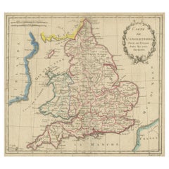
Original Antique Map of England with Decorative Cartouche
Located in Langweer, NL
Antique map titled 'l'Angleterre (..)'. Original antique map of England, with beautiful hand
Category

Antique Late 18th Century Maps

Materials

Paper

Large Antique County Map of North Wales, England
Located in Langweer, NL
Antique map titled 'A Map of North Wales from the best Authorities'. Original old county map of
Category

Antique Early 19th Century Maps

Materials

Paper

Large Antique County Map of Wiltshire, England, 1805
Located in Langweer, NL
Antique map titled 'A Map of Wiltshire from the best Authorities'. Original old county map of
Category

Antique Early 19th Century Maps

Materials

Paper

Large Antique County Map of Wiltshire, England, 1805
Free Shipping
H 21.66 in W 16.82 in D 0.02 in
Large Antique County Map of South Wales, England
Located in Langweer, NL
Antique map titled 'A Map of South Wales from the best Authorities'. Original old county map of
Category

Antique Early 19th Century Maps

Materials

Paper

Antique Map of England & Wales by Wyld '1845'
Located in Langweer, NL
Antique map titled 'England & Wales'. Original antique map of England & Wales. This map originates
Category

Antique Mid-19th Century Maps

Materials

Paper

Antique Map of England & Wales by Wyld '1845'
H 14.18 in W 10.24 in D 0.02 in
Large Antique County Map of Leicestershire, England, 1805
Located in Langweer, NL
, England, with this original old county map engraved by the renowned cartographer John Cary. Titled 'A Map
Category

Antique Early 19th Century Maps

Materials

Paper

Antique Map of England with French Title, 1806
Located in Langweer, NL
Antique map titled 'L'Angleterre.' Map of England by Robert de Vaugondy, revised and published by
Category

Antique 19th Century Maps

Materials

Paper

Antique County Map of Monmouthshire, England, circa 1804
Located in Langweer, NL
Antique county map of Monmouthshire first published circa 1800. Villages, towns, and cities
Category

Antique Early 1800s Maps

Materials

Paper

Antique Decorative County Map of Lincolnshire, England, 1804
Located in Langweer, NL
Antique county map of Lincolnshire first published circa 1800 Cities illustrated include Grantham
Category

Antique Early 1800s Maps

Materials

Paper

Antique Decorative County Map of Huntingdonshire, England, 1804
Located in Langweer, NL
Antique county map of Huntingdonshire first published c.1800. Cities illustrated include Kimbolton
Category

Antique Early 1800s Maps

Materials

Paper

Large Original Antique Folding Map of Manchester, England, Dated 1793
Located in St Annes, Lancashire
Superb map of Manchester and Salford Folding map. Printed on paper laid on to the original
Category

Antique 1790s English Georgian Maps

Materials

Canvas, Paper

Large Scale Antique Scroll Map of Lincolnshire, England, Dated 1778
Located in St Annes, Lancashire
Wonderful scroll map of Lincolnshire By Captain Armstrong, 1778 Copper plate engraving on
Category

Antique 1770s English Georgian Maps

Materials

Wood, Paper

Antique Map of England with Inset Maps of the Region of Liverpool and London
Located in Langweer, NL
Antique map titled 'England'. Original antique map of England, with two inset maps of the region of
Category

Antique Mid-19th Century Maps

Materials

Paper

Colorful Detailed Antique Map of England and Wales, 1882
Located in Langweer, NL
Explore the Historic Splendor of 'England and Wales' with this Antique Map! Part of a distinguished
Category

Antique 1880s Maps

Materials

Paper

Miniature Map of England and Wales with Hand Coloring
Located in Langweer, NL
Antique map titled 'England and Wales'. An attractive miniature map of England and Wales enhanced
Category

Antique Late 18th Century Maps

Materials

Paper

Large Antique Map of England Hand Colored by Counties
Located in Langweer, NL
Antique map titled 'A New Map of England from the latest Authorities'. Large map of England, hand
Category

Antique Early 19th Century Maps

Materials

Paper

Antique Map of England and Wales with Roman Numerals
Located in Langweer, NL
Untitled original antique map of England and Wales. Drawn & Engraved for Cobbetts 'Geographical
Category

Antique Mid-19th Century Maps

Materials

Paper

Large Antique Map of New England with decorative Vignettes
Located in Langweer, NL
Antique map titled 'Johnson's New England'. Large map of New England, comprising the states
Category

Antique Mid-19th Century Maps

Materials

Paper

Antique Map of England and Wales by Johnson '1872'
Located in Langweer, NL
Antique map titled 'Johnson's England and Wales'. Original map of England and Wales. This map
Category

Antique Late 19th Century Maps

Materials

Paper

  • 1
  • ...
Get Updated with New Arrivals
Save "England Map", and we’ll notify you when there are new listings in this category.

England Map For Sale on 1stDibs

Find many varieties of an authentic England map available at 1stDibs. A England map — often made from paper, wood and metal — can elevate any home. If you’re shopping for a England map, we have 225 options in-stock, while there are 1 modern editions to choose from as well. There are many kinds of the England map you’re looking for, from those produced as long ago as the 18th Century to those made as recently as the 21st Century. A England map, designed in the Victorian, Georgian or Regency style, is generally a popular piece of furniture. A well-made England map has long been a part of the offerings for many furniture designers and manufacturers, but those produced by Captain Greenvile Collins, George Philip & Son and Aaron Arrowsmith are consistently popular.

How Much is a England Map?

A England map can differ in price owing to various characteristics — the average selling price 1stDibs is $429, while the lowest priced sells for $46 and the highest can go for as much as $88,500.