Items Similar to Antique Map of England with Vignette of Stonehenge


Want more images or videos?
Request additional images or videos from the seller
1 of 6
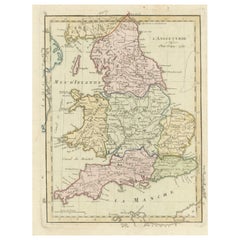
Antique Map of England with Vignette of Stonehenge
About the Item
Antique map titled 'England'. Original antique map of England, with decorative vignette of stonehenge. Engraved by R. Scott. Published by Fullarton, circa 1835.
- Dimensions:Height: 11.23 in (28.5 cm)Width: 8.78 in (22.3 cm)Depth: 0.02 in (0.5 mm)
- Materials and Techniques:
- Period:
- Date of Manufacture:circa 1835
- Condition:General age-related toning. Minor wear and foxing, original folding lines. Blank verso. Please study image carefully.
- Seller Location:Langweer, NL
- Reference Number:
About the Seller
5.0
Platinum Seller
These expertly vetted sellers are 1stDibs' most experienced sellers and are rated highest by our customers.
Established in 2009
1stDibs seller since 2017
1,916 sales on 1stDibs
Typical response time: <1 hour
- ShippingRetrieving quote...Ships From: Langweer, Netherlands
- Return PolicyA return for this item may be initiated within 14 days of delivery.
More From This SellerView All
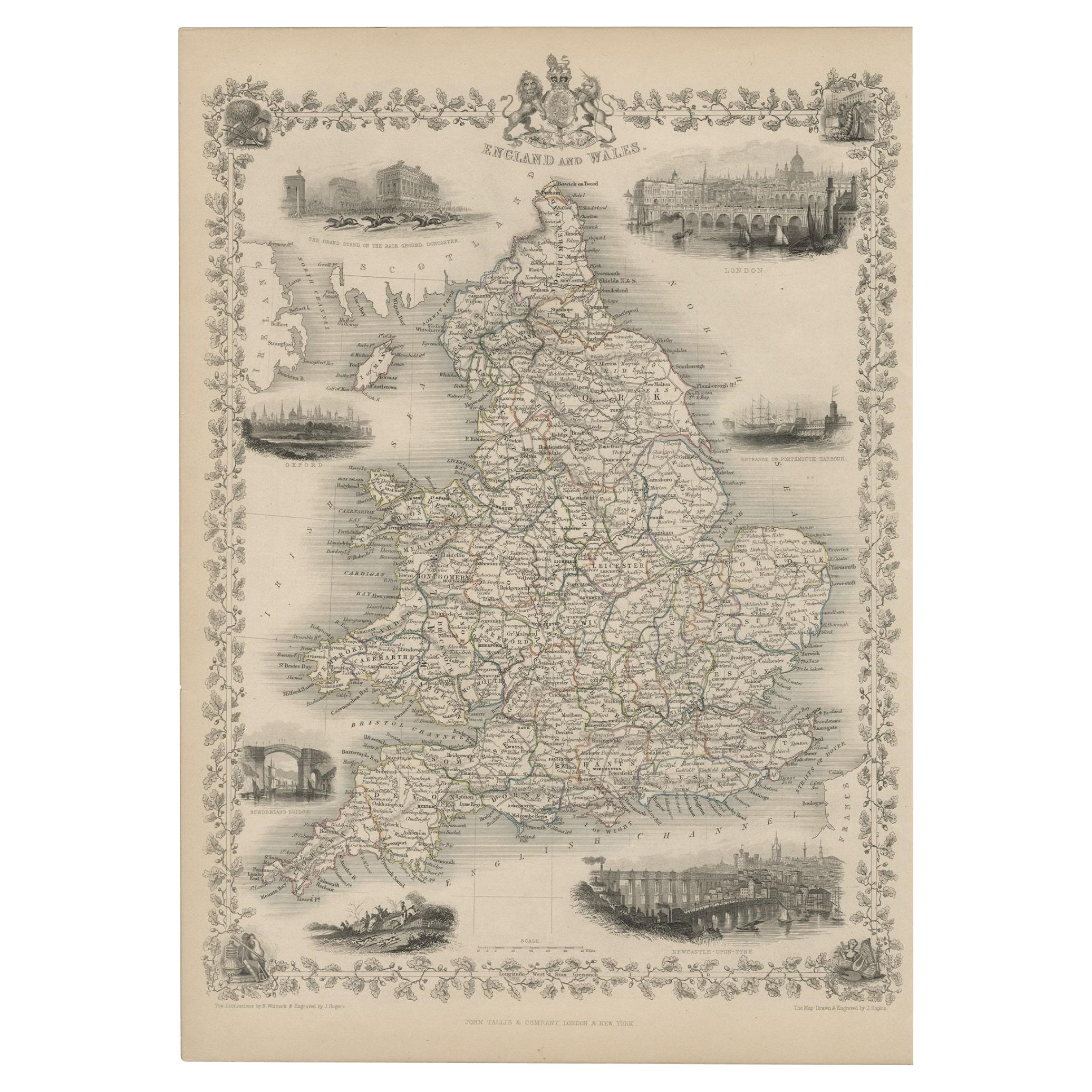
- Antique Map of England and Wales with Decorative Vignettes, 1851Located in Langweer, NLAntique map titled ‘England and Wales’. Includes decorative vignettes titled The grand stand on the race ground Doncaster, London, Oxford, Entrance to Portsmouth Harbour, Sunderland ...Category
Antique 19th Century Maps
MaterialsPaper
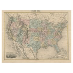
- Antique Map of the United States with Vignette of WashingtonLocated in Langweer, NLAntique map titled 'États-Unis'. A very attractive and detailed late 19th century map of the United States, with a fine decorative vignette of Washington. The extensive railway netwo...Category
Antique Late 19th Century Maps
MaterialsPaper
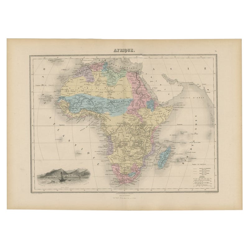
- Antique Map of Africa with Decorative Vignette of Saint Helena, 1880Located in Langweer, NLAntique map titled 'Afrique'. Old map of Africa, covering the African continent. With decorative vignette of Saint Helena. This map originates from 'Géogr...Category
Antique 19th Century Maps
MaterialsPaper
- Original Antique Map of England with Hand ColoringLocated in Langweer, NLAntique map titled 'Engand'. Original old map of England. Engraved by W. Milton. Published by John Mc. Gowan, circa 1829.Category
Antique Mid-19th Century Maps
MaterialsPaper
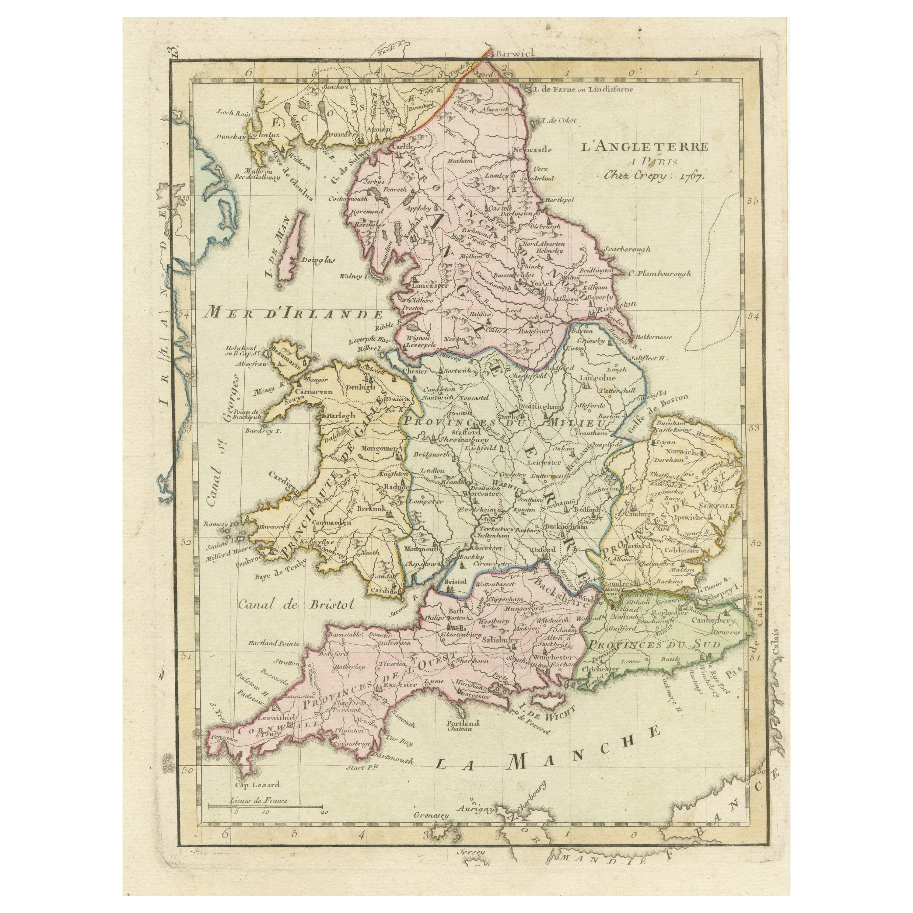
- Antique Map of England with Contemporary Hand ColoringLocated in Langweer, NLAntique map titled 'l'Angleterre'. Original antique map of England, with original/contemporary hand coloring. Published by Crepy, circa 1767.Category
Antique Late 18th Century Maps
MaterialsPaper
- Original Antique Map of England with Outline ColoringLocated in Langweer, NLAntique map titled 'Angleterre'. Original old map of England with outline coloring. Source unknown, to be determined. Published circa 1830.Category
Antique Mid-19th Century Maps
MaterialsPaper


You May Also Like
- Old Horizontal Map of EnglandBy TassoLocated in Alessandria, PiemonteST/520 - Old rare Italian map of England, dated 1826-1827 - by Girolamo Tasso, editor in Venise, for the atlas of M.r Le-Sage.Category
Antique Early 19th Century Italian Other Prints
MaterialsPaper
- Antique Map of Principality of MonacoBy Antonio Vallardi EditoreLocated in Alessandria, PiemonteST/619 - "Old Geographical Atlas of Italy - Topographic map of ex-Principality of Monaco" - ediz Vallardi - Milano - A somewhat special edition ---Category
Antique Late 19th Century Italian Other Prints
MaterialsPaper
- Original Antique Map of Italy. C.1780Located in St Annes, LancashireGreat map of Italy Copper-plate engraving Published C.1780 Unframed.Category
Antique Early 1800s English Georgian Maps
MaterialsPaper

- Original Antique Map of Asia. C.1780Located in St Annes, LancashireGreat map of Asia Copper-plate engraving Published C.1780 Two small worm holes to right side of map Unframed.Category
Antique Early 1800s English Georgian Maps
MaterialsPaper

- Original Antique Map of India. C.1780Located in St Annes, LancashireGreat map of India Copper-plate engraving Published C.1780 Three small worm holes to right side of map and one bottom left corner Unframed.Category
Antique Early 1800s English Georgian Maps
MaterialsPaper

- England, Scotland & Ireland: A Hand Colored Map of Great Britain by TirionBy Isaak TirionLocated in Alamo, CAThis is a hand-colored double page copperplate map of Great Britain entitled "Nieuwe Kaart van de Eilanden van Groot Brittannien Behelzende de Kon...Category
Antique Mid-18th Century Dutch Maps
MaterialsPaper


Recently Viewed
View AllMore Ways To Browse
1681 Moses Pitt
Antique Cabbage Cutter
Antique Chesapeake Bay Map
Antique Handcrafted Model Sailboat
Antique Map Of Chesapeake Bay
Cartier 1730
Devonia Antique
Eso Antique Map
Eso Antique Maps
Formosa Vintage Map
M S Merian
Union Pacific Map
Ian Maguire
Map Scandinavia
Pakistan Antique Map
Antique Map Iceland
Antique Map Of Iceland
Antique Map Scandinavia