Maps Colored
20
to
136
779
530
542
335
248
243
229
194
152
129
129
111
79
67
65
65
46
42
41
41
38
36
34
32
29
25
23
23
21
20
17
17
17
16
13
13
11
11
11
10
10
10
10
9
9
9
8
8
8
8
8
7
7
7
6
6
6
4
4
4
4
3
3
3
43
42
42
35
29
Sort By
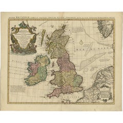
Antique Map 'Colored Cartouches' of the British Isles by Covens & Mortier ‘1761’
By Covens & Mortier
Located in Langweer, NL
Covens and Mortier's attractive double-page engraved map of the British Isles, based on the 1702 De
Category
Antique Late 18th Century Maps
Materials
Paper
H 21.07 in W 25.6 in D 0.2 in
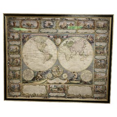
Colored wall map of the WORLD
By Chambon
Located in ZWIJNDRECHT, NL
huge wall map of the world in two hemispheres printed on two sheets, depicting the Eastern and Western
Category
Antique Mid-18th Century French French Provincial Maps
Materials
Wood, Paper
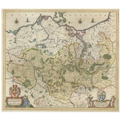
Antique Hand-colored Map of Brandenburg, Germany
Located in Langweer, NL
Antique map titled 'Marchionatus Brandenburgicus'. Original antique map of Brandenburg, with
Category
Antique Mid-17th Century Maps
Materials
Paper
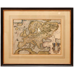
Antique Hand Colored Framed Map of Europe
Located in West Palm Beach, FL
Antique reproduction copied from an edition dated 1595 by Ortelius.
Category
Antique Late 19th Century Maps
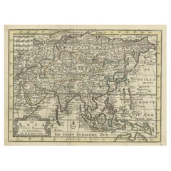
Rare Hand-Colored Antique Map of Asia, 1788
Located in Langweer, NL
Antique map titled 'Kaartje van Asia'.
Original antique map of Asia. This map originates from
Category
Antique 1780s Maps
Materials
Paper
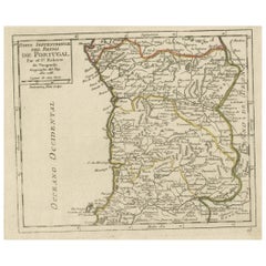
Antique Hand-Colored Map of Northern Portugal, 1756
Located in Langweer, NL
Antique map Portugal titled 'Parte Sepentrional del Reyno de Portugal'.
Antique map of Northern
Category
Antique 1750s Maps
Materials
Paper
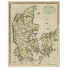
Antique Hand-Colored Engraved Map of Denmark, 1790
Located in Langweer, NL
Authorities, 1790, hand-coloured engraved map on handmade paper with watermark. 410 x 320 mm
Very nice
Category
Antique 1790s Maps
Materials
Paper
1864 Map of North America, Antique Hand-Colored Map, by Adolphe Hippolyte Dufour
Located in Colorado Springs, CO
Offered is a map of North America entitled Amerique du Nord from 1864. This rare, separately
Category
Antique 1860s French Maps
Materials
Paper
H 44.5 in W 33 in D 1.5 in
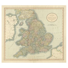
Large Antique Map of England Hand Colored by Counties
Located in Langweer, NL
Antique map titled 'A New Map of England from the latest Authorities'. Large map of England, hand
Category
Antique Early 19th Century Maps
Materials
Paper
Framed 1820s Hand Colored Map of the United States
Located in Stamford, CT
Framed 1820s hand colored map photos of North America and South America. As found framed in
Category
Antique 1820s American Spanish Colonial Maps
Materials
Giltwood, Paper, Glass
Framed 1839 Hand Colored Map of the United States
Located in Stamford, CT
Framed hand colored map of the United States of America from 1839. Newly framed in a giltwood frame.
Category
Antique 1830s American American Classical Maps
Materials
Giltwood, Paper, Glass
Hand Colored 17th Century Visscher Map "Hollandiae" Southern Holland
By Nicolaes Visscher II
Located in Alamo, CA
A hand colored 17th century map of the southern portions of Holland by Nicolaus (Nicolas) Visscher
Category
Antique Early 18th Century Dutch Maps
Materials
Paper
Antique Map of Italy with Hand-Colored Borders, 1852
Located in Langweer, NL
Antique map titled 'Italië'. Map of Italy. This map originates from 'School-Atlas van alle deelen
Category
Antique 19th Century Maps
Materials
Paper
Antique Nicely Colored Map of Holland and Belgium, 1846
Located in Langweer, NL
Antique map titled 'Holland and Belgium'. Old map of the Netherlands and Belgium. This map
Category
Antique 19th Century Maps
Materials
Paper
Antique Hand-Colored County Map of Rutland, England, 1804
Located in Langweer, NL
Antique county map of Rutland first published c.1800. Villages, towns, and cities illustrated
Category
Antique Early 1800s Maps
Materials
Paper
Original Hand-Colored Antique Regional Map of Switzerland, 1753
Located in Langweer, NL
Antique map Switzerland titled 'Territorium Reipublicae liberae Helveticae Scaphusiensis
Category
Antique 1750s Maps
Materials
Paper
Staffordshire 1645 Hand Colored Antique Print Staffordiensis Comitatvs Map
Located in GB
We are delighted to offer for sale this lovely antique Atlas page map of Staffordshire printed in
Category
Antique Early 1800s English Georgian Maps
Materials
Paper
H 22.45 in W 25.32 in D 0.99 in
1571-1638 Willem Blaeu map entitled, "Ilcadorino, " Hand Colored Ric0009
Located in Norton, MA
Willem Blaeu map entitled,
"Ilcadorino,".
Hand colored.
Description: large, unusual, and
Category
Antique 16th Century Dutch Maps
Materials
Paper
H 20.28 in W 23.63 in D 0.4 in
Northern Scotland: A 16th Century Hand-colored Map by Mercator
By Gerard Mercator
Located in Alamo, CA
A framed hand-colored 16th century map of Northern Scotland by Gerard Mercator entitled "Scotiae
Category
Antique 16th Century Dutch Maps
Materials
Paper
Northern Scotland: A 17th Century Hand-colored Map by Mercator
By Gerard Mercator
Located in Alamo, CA
This is a framed hand-colored 17th century map of Northern Scotland by Gerard Mercator entitled
Category
Antique 1630s Dutch Maps
Materials
Paper
Hand Colored Antique Map of the Department of Oise, France
By Victor Levasseur
Located in Langweer, NL
Antique map titled 'Dept. de l'Oise'. Old map of the French department of Oise, France. The map
Category
Antique Mid-19th Century Maps
Materials
Paper
Original Hand-Colored Antique Map of Ancient Germany, circa 1630
Located in Langweer, NL
Antique map titled 'Germaniae Veteris typus'. Very attractive map of ancient Germany. Published by
Category
Antique Mid-17th Century Maps
Materials
Paper
No Reserve
H 18.9 in W 21.5 in D 0.02 in
Hand Colored Antique Map of the Department of Calais, France
By Victor Levasseur
Located in Langweer, NL
Antique map titled 'Dépt. du Pas de Calais'. Map of the French department of Calais, France. This
Category
Antique Mid-19th Century Maps
Materials
Paper
Hand Colored Antique Map of the Department of Marne, France
By Victor Levasseur
Located in Langweer, NL
Antique map titled 'Dépt. de la Marne'. Map of the French department of Marne, France. This
Category
Antique Mid-19th Century Maps
Materials
Paper
Hand Colored Antique Map of the department of Somme, France
By Victor Levasseur
Located in Langweer, NL
Antique map titled 'Dépt de la Somme'. Map of the French department of Somme, France. This area is
Category
Antique Mid-19th Century Maps
Materials
Paper
Hand Colored Antique Map of the Department of Doubs, France
By Victor Levasseur
Located in Langweer, NL
Antique map titled 'Dépt. du Doubs'. Map of the French department of Doubs, France. The whole is
Category
Antique Mid-19th Century Maps
Materials
Paper
Hand Colored Antique Map of the department of Ardennes, France
By Victor Levasseur
Located in Langweer, NL
Antique map titled 'Dépt. des Ardennes'. Map of the French department of Ardennes, France. Part of
Category
Antique Mid-19th Century Maps
Materials
Paper
Hand Colored Antique Map of the Department of Nord, France
By Victor Levasseur
Located in Langweer, NL
Antique map titled 'Dept. du Nord'. Map of the French department of Nord, France. This area is
Category
Antique Mid-19th Century Maps
Materials
Paper
Hand Colored Antique Map of the Department of Orne, France
By Victor Levasseur
Located in Langweer, NL
Antique map titled 'Dépt. de l'Orne'. Map of the French department of Orne, France. This area, part
Category
Antique Mid-19th Century Maps
Materials
Paper
Hand Colored Antique Map of the department of Drôme, France
By Victor Levasseur
Located in Langweer, NL
Antique map titled 'Dépt. de la Drôme'. Map of the French department of Drôme, France. This area is
Category
Antique Mid-19th Century Maps
Materials
Paper
Hand Colored Antique Map of the department of Lozere, France
By Victor Levasseur
Located in Langweer, NL
Antique map titled 'Dept. de la Lozère'. Map of the French department of Lozere, France. This
Category
Antique Mid-19th Century Maps
Materials
Paper
Hand Colored Antique Map of the Department of Nièvre, France
By Victor Levasseur
Located in Langweer, NL
Antique map titled 'Dept. de la Nièvre'. Map of the French department of Nievre, France. Part of
Category
Antique Mid-19th Century Maps
Materials
Paper
Hand Colored Antique Map of the department of Loiret, France
By Victor Levasseur
Located in Langweer, NL
Antique map titled 'Dépt. du Loiret'. Map of the French department of Loiret, France. Surrounding
Category
Antique Mid-19th Century Maps
Materials
Paper
Hand Colored Antique Map of the department of Finistère, France
By Victor Levasseur
Located in Langweer, NL
Antique map titled 'Dépt. du Finistère'. Map of the French department of Finistere, Brittany
Category
Antique Mid-19th Century Maps
Materials
Paper
Hand Colored Antique Map of the Department of Creuse, France
By Victor Levasseur
Located in Langweer, NL
Antique map titled 'Dépt. de la Creuse'. Map of the French department of Creuse, France. This
Category
Antique Mid-19th Century Maps
Materials
Paper
Hand Colored Antique Map of the Department of Ariège, France
By Victor Levasseur
Located in Langweer, NL
Antique map titled 'Dépt. de l'Ariège'. Map of the French department of Ariege, France. This area
Category
Antique Mid-19th Century Maps
Materials
Paper
Hand Colored Antique Map of the Department of Correze, France
By Victor Levasseur
Located in Langweer, NL
Antique map titled 'Dépt. de la Corrèze'. Map of the French department of Correze, France. This
Category
Antique Mid-19th Century Maps
Materials
Paper
Hand Colored Antique Map of the Department of Cher, France
By Victor Levasseur
Located in Langweer, NL
Antique map titled 'Dépt. du Cher'. Map of the French department of Cher, France. This area of
Category
Antique Mid-19th Century Maps
Materials
Paper
Hand Colored Antique Map of the department of Cantal, France
By Victor Levasseur
Located in Langweer, NL
Antique map titled 'Dépt. du Cantal'. Map of the French department of Cantal, France. This area of
Category
Antique Mid-19th Century Maps
Materials
Paper
Hand Colored Antique Map of the Department of Eure, France
By Victor Levasseur
Located in Langweer, NL
Antique map titled 'Dépt. de l'Eure'. Map of the French department of Eure, France. This region of
Category
Antique Mid-19th Century Maps
Materials
Paper
Free Shipping
H 14.57 in W 21.66 in D 0.02 in
Hand Colored Antique Map of the Department of Gard, France
By Victor Levasseur
Located in Langweer, NL
Antique map titled 'Départ. Du Gard'. Map of the French department of Gard, France. This area of
Category
Antique Mid-19th Century Maps
Materials
Paper
Hand Colored Antique Map of the Department of Ardèche, France
By Victor Levasseur
Located in Langweer, NL
Antique map titled 'Dépt. de l'Ardèche'. Map of the Department of Ardèche, France. This region is
Category
Antique Mid-19th Century Maps
Materials
Paper
Hand Colored Antique Map of the department of Aube, France
By Victor Levasseur
Located in Langweer, NL
Antique map titled 'Dépt. de l'Aube'. Map of the French department of Aube, France. This area of
Category
Antique Mid-19th Century Maps
Materials
Paper
Hand Colored Antique Map of the Department of Vaucluse, France
By Victor Levasseur
Located in Langweer, NL
Antique map titled 'Dépt de Vaucluse'. Map of the French department of Vaucluse, France. Vaucluse
Category
Antique Mid-19th Century Maps
Materials
Paper
Four 18th Century Engraved and Hand-Colored Maps by Weigel
By Christoph Weigel
Located in Copenhagen, K
Small collection of four engraved maps of Italy, Balkan and of Central Asia.
Two are of Italy
Category
Antique 18th Century German Maps
Materials
Paper
Hand Colored Antique Map of the Department of Indre, France
By Victor Levasseur
Located in Langweer, NL
Antique map titled 'Dept. de l'Indre'. Map of the French department of Indre, France. Part of the
Category
Antique Mid-19th Century Maps
Materials
Paper
Hand Colored Antique Map of the Department of Aude, France
By Victor Levasseur
Located in Langweer, NL
Antique map titled 'Dépt. de l'Aude'. Map of the French department of Aude, France. This area of
Category
Antique Mid-19th Century Maps
Materials
Paper
Hand Colored Antique Map of the department of Aveyron, France
By Victor Levasseur
Located in Langweer, NL
Antique map titled 'Dépt. de l'Aveyron'. Map of the French department of Aveyron, France. This area
Category
Antique Mid-19th Century Maps
Materials
Paper
"Africa Vetus": a 17th Century Hand-Colored Map by Sanson
By Nicolas Sanson
Located in Alamo, CA
This original hand-colored copperplate engraved map of Africa entitled "Africa Vetus, Nicolai
Category
Antique Late 17th Century French Maps
Materials
Paper
Antique 1630 Colored Belgium Map Flandria Gallica Flanders Henricus Hondius
Located in Dayton, OH
"Antique hand colored map of Flanders, Belgium, circa 1630, engraved by Henricus Hondius. “Henricus
Category
Antique Early 17th Century Renaissance Maps
Materials
Paper
H 20 in W 0.625 in D 23.375 in
Nice Decorative Hand-Colored Antique Map of Italy, ca.1745
Located in Langweer, NL
Antique map Italy titled 'A New Map of Italy from the lastest observations'.
Antique map of Italy
Category
Antique 1740s Maps
Materials
Paper
Original Colored Antique Map of Utrecht & Surroundings, The Netherlands, c1690
Located in Langweer, NL
Antique map titled 'Tabula nova Provinciae Ultrajectinae quam jussu Nob: hujus Dominij Ordinum
Category
Antique 1690s Maps
Materials
Paper
H 20.87 in W 24.22 in D 0 in
Original Antique Hand-Colored Map of Southern Scotland, ca.1600
Located in Langweer, NL
Antique map of Southern Scotland. This map was published by G. Mercator, he also published a map of
Category
Antique Early 1600s Maps
Materials
Paper
Decorative Hand-Colored French Map of the English Channel, 1827
Located in Langweer, NL
Antique map titled 'Carte et Coupe du Canal de la Manche'. Original antique map of the English
Category
Antique Mid-19th Century Maps
Materials
Paper
Original Hand-Colored Antique County Map of Durham, England, 1804
Located in Langweer, NL
Antique county map of Durham first published c.1800. Villages, towns, and cities illustrated
Category
Antique Early 1800s Maps
Materials
Paper
No Reserve
H 21.26 in W 25.2 in D 0 in
Beautiful Decorative Hand-Colored Antique Map of West Canada, 1851
Located in Langweer, NL
Description: Antique map of Canada titled 'West Canada'.
With decorative vignettes titled
Category
Antique 1850s Maps
Materials
Paper
No Reserve
H 10.63 in W 14.38 in D 0 in
Original Hand-Colored Antique Map of Africa by Elwe '1792'
Located in Langweer, NL
Antique map titled 'l'Afrique Divisée en ses Empires, Royaumes, et Etats'. Decorative large map of
Category
Antique Late 18th Century Maps
Materials
Paper
1585 Mercator Map of Ireland, Entitled "Irlandiae Regnvm, " Hand Colored Ric0006
Located in Norton, MA
1585 Mercator map of Ireland, entitled
"Irlandiae Regnvm."
Hand Colored
Description
Category
Antique 16th Century Dutch Maps
Materials
Paper
H 18.51 in W 22.84 in D 0.4 in
17th Century Hand-Colored Map of West Africa by Mercator/Hondius
Located in Alamo, CA
A 17th century hand-colored map entitled "Guineae Nova Descriptio" by Gerard Mercator and Jodocus
Category
Antique Mid-17th Century Dutch Maps
Materials
Paper
South America: Hand-colored 18th Century Framed Map by Thomas Jefferys
By Thomas Jefferys
Located in Alamo, CA
This detailed hand-colored map of South America by Thomas Jefferys was published in London in 1750
Category
Antique Mid-18th Century English Maps
Materials
Paper
- 1
- ...
Get Updated with New Arrivals
Save "Maps Colored", and we’ll notify you when there are new listings in this category.
Maps Colored For Sale on 1stDibs
With a vast inventory of beautiful furniture at 1stDibs, we’ve got just the maps colored you’re looking for. Each maps colored for sale was constructed with extraordinary care, often using paper, glass and metal. Whether you’re looking for an older or newer maps colored, there are earlier versions available from the 18th Century and newer variations made as recently as the 20th Century. Each maps colored bearing Georgian, Baroque or Folk Art hallmarks is very popular. Many designers have produced at least one well-made maps colored over the years, but those crafted by Johann Baptist Homann, Nicolas Sanson and Frederick de Wit are often thought to be among the most beautiful.
How Much is a Maps Colored?
The average selling price for a maps colored at 1stDibs is $1,275, while they’re typically $250 on the low end and $250,000 for the highest priced.
More Ways To Browse
Map Of Peru
South Pacific Map
Antique Canadian Maps
Korea Antique Map
Hungary Antique Map
Antique Maps Dublin
Antique Map Of Canada
Nicolas Baier
Mediterranean Sea Map
Used Office Furniture Salt Lake City
Huge Antique Map
Antique Map San Francisco
Antique Maps San Francisco
Antique Furniture Tasmania
Antique Louisiana Map
Antique Maps Of Louisiana
Ostrich Cape
Map Of Palestine
