Huge Antique Map
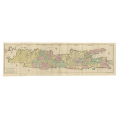
Huge Old Map of Java, Indonesia, Published by the Dutch in Colonial Times, 1728
Located in Langweer, NL
Antique map titled 'Nieuwe en zeer naaukeurige Kaart van t Eyland Java Major of Groot Java'. This
Category
18th Century Huge Antique Map
Materials
Paper
H 68.12 in W 21.07 in D 0 in
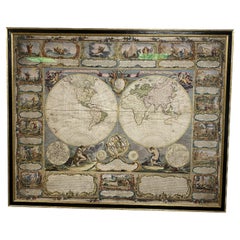
Colored wall map of the WORLD
By Chambon
Located in ZWIJNDRECHT, NL
huge wall map of the world in two hemispheres printed on two sheets, depicting the Eastern and Western
Category
Mid-18th Century French French Provincial Huge Antique Map
Materials
Wood, Paper
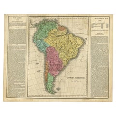
Interesting Original Antique Map of South America, 1822
Located in Langweer, NL
Antique map titled 'South America'.
Map of South America with attractive topography, surrounded
Category
19th Century Huge Antique Map
Materials
Paper
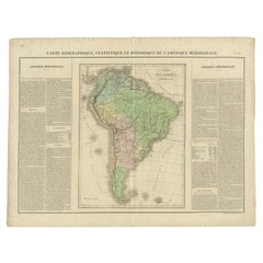
Antique Map of South America by Buchon, 1825
Located in Langweer, NL
Antique map titled 'Carte de l'Amérique méridionale'. Map of South America with attractive
Category
19th Century Huge Antique Map
Materials
Paper
Antique Map of England by Mercator/Hondius, circa 1600
Located in Langweer, NL
Antique map titled 'Westmorlandia, Lancastria, Caernvan, Denbigh, Flint, Merionidh, Dalopia cum
Category
16th Century Huge Antique Map
Materials
Paper
Antique Map of Northeastern India, Nepal, Bhutan, Assam and Bangladesh
Located in Langweer, NL
Antique map titled 'De Land-Reyse door Benedictus Goes, van Lahor gedaan, door Tartaryen na China
Category
Early 18th Century Huge Antique Map
Materials
Paper
H 12.72 in W 17.21 in D 0.02 in
Antique Map of the Banda Islands by Commelin, 1646
Located in Langweer, NL
to Indonesia (1598-99). The purpose of the expedition was to bring back spices, and was a huge
Category
17th Century Huge Antique Map
Materials
Paper
Large Antique Map of the west coast of Celebes, Sulawesi, Indonesia
Located in Langweer, NL
Original antique map titled 'Kaart der Westkust van Celebes van Makasser tot Laijkan'. This large
Category
Mid-19th Century Huge Antique Map
Materials
Paper
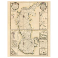
Fabulous Original Antique two-sheet Map of the Caspian Sea, ca.1723
Located in Langweer, NL
Tartarie", Delisle, Guillaume (2 maps)
Subject: Caspian Sea
Period: 1723 (circa)
Publication:
Color: Hand
Category
1720s Huge Antique Map
Materials
Paper
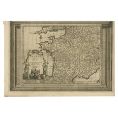
Antique Map of France with Beautiful Title Cartouche and Border, c.1740
Located in Langweer, NL
Antique map titled 'La France suivant les nouvelles Observations de Messrs de l'Academie Royale des
Category
18th Century Huge Antique Map
Materials
Paper
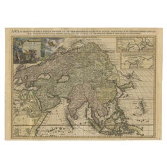
Important and Scarce Antique Map of Asia from Jesuit Sources, C.1713
Located in Langweer, NL
Antique map titled 'L'Asie selon les nouvelles observations de Messrs de l'Academie des Sciences
Category
18th Century Huge Antique Map
Materials
Paper
"Nova Barbariae Descriptio", a 17th Century Hand-Colored Map of North Africa
By Johannes Janssonius
Located in Alamo, CA
This original attractive 17th century hand-colored map of North Africa entitled "Nova Barbariae
Category
Mid-17th Century Dutch Huge Antique Map
Materials
Paper
H 22.38 in W 29 in D 0.13 in
Decorative Early Hand-Colored Map of the Northeast of England, ca.1620
Located in Langweer, NL
Antique map titled 'Eboracum, Lincolnia, Derbia, Staffordia, Notinghamia, Lecestria, Rutlandia et
Category
1620s Huge Antique Map
Materials
Paper
17th Century Hand-Colored Map of a Region in West Germany by Janssonius
By Johannes Janssonius
Located in Alamo, CA
This attractive highly detailed 17th century original hand-colored map is entitled
Category
Mid-17th Century Dutch Huge Antique Map
Materials
Paper
Prussia, Poland, N. Germany, Etc: A Hand-colored 17th Century Map by Janssonius
By Johannes Janssonius
Located in Alamo, CA
This is an attractive hand-colored copperplate engraved 17th century map of Prussia entitled
Category
Mid-17th Century Dutch Huge Antique Map
Materials
Paper
H 21.25 in W 24.63 in D 0.07 in
Huge Mid 19th century Six Panels Venice Map Engraving
Located in IT
Perspective view of Venice in the 1500s by Jacopo de Barbari. Re-edition of the original . this is from mid-19th century on yellowed laid paper. The blown glasses are from the period...
Category
Mid-19th Century Italian Huge Antique Map
Materials
Paper
Map - Etching by Nicola Fiorillo - 18th Century
Located in Roma, IT
Map from "Antiquities of Herculaneum" is an etching on paper realized by Nicola Fiorillo in the
Category
18th Century Old Masters Huge Antique Map
Materials
Etching
H 19.89 in W 14.38 in D 0.04 in
Map of Scotland - Etching by Johannes Blaeu - 1650s
Located in Roma, IT
publishing some of the most important maps and atlases of the 17th century, including the Atlas Maior, a huge
Category
1650s Modern Huge Antique Map
Materials
Etching
H 18.51 in W 23.82 in D 0.08 in
A huge pair of 21 inches Cruchley Library Globes
By G.F. Cruchley
Located in ZWIJNDRECHT, NL
, published by G.F. Cruchley, map-seller & globe maker, 81 Fleet street.
Signed: CRUCHLEY in London England
Category
1850s British Victorian Huge Antique Map
Materials
Other
Architectural Roman Map - Etching by Vincenzo Scarpati - 18th Century
Located in Roma, IT
Architectural Roman Map from "Antiquities of Herculaneum" is an etching on paper realized by
Category
18th Century Old Masters Huge Antique Map
Materials
Etching
Vincenzo ScarpatiArchitectural Roman Map - Etching by Vincenzo Scarpati - 18th Century, 18th Century
H 19.69 in W 14.18 in D 0.04 in
Important Confederate Field Map of Richmond VA 1864 with Provenance
Located in Dallas, TX
consisting of:
(1) ORIGINAL and FULLY AUTHENTIC Confederate Field Map of Richmond, VA 1864 belonging to Capt
Category
Mid-19th Century American American Classical Huge Antique Map
Materials
Canvas, Paper
West Germany: Original Hand Colored 17th Century Map by Johannes Janssonius
By Johannes Janssonius
Located in Alamo, CA
An original hand colored copperplate engraved map entitled in Latin "Archiepiscopatus
Category
Mid-17th Century Old Masters Huge Antique Map
Materials
Engraving
A Hand Colored 17th Century Janssonius Map of Prussia: Poland, N. Germany, etc.
By Johannes Janssonius
Located in Alamo, CA
An attractive hand-colored copperplate engraved 17th century map of Prussia entitled "Prussia
Category
Mid-17th Century Old Masters Huge Antique Map
Materials
Engraving
Antique Print of a Chinese Funeral, 1749
By Jakob van der Schley
Located in Langweer, NL
the drawing by Du Halde. A huge funeral of ondoubtly a very high ranking official, With hundreds of
Category
18th Century Huge Antique Map
Materials
Paper
Decorative Engraving of VOC Battle Ships Attacking Palembang in Sumatra, ca.1700
Located in Langweer, NL
fifty years in his business, he published a huge amount of highly decorative maps and atlases. His
Category
Early 1700s Huge Antique Map
Materials
Paper
H 12.33 in W 14.06 in D 0 in
La Port De Cannes, 1930. Vieux Port, French Riviera. Côte d'Azur. Paul Delvaux.
By Paul Delvaux
Located in Sutton Poyntz, Dorset
he collaborated with Ysette Gabriels and Charles Van Deun to paint Le Paradis Terrestre, a huge mural
Category
Early 20th Century Romantic Huge Antique Map
Materials
Paper, Watercolor
H 23.82 in W 33.27 in D 0.79 in
Original Engraving of Rotterdam Island, Nowadays Nomuka, Kingdom of Tonga, c1800
Located in Langweer, NL
water, and the description of the huge lake they brought back afterwards leaves little doubt about the
Category
Early 1800s Huge Antique Map
Materials
Paper
H 11.62 in W 14.77 in D 0 in
Captain James Cook: 18th C. Portrait by William Hodges After Cook's 2nd Voyage
By William Hodges
Located in Alamo, CA
to explore the eastern coast of Australia, and he was the first to map the New Zealand coastline. He
Category
1770s Huge Antique Map
Materials
Engraving
People Also Browsed
Decorative Pair of Gilded Antique Flemish Mirrors, Europe 19th Century
Located in Copenhagen, DK
A beautiful pair of gilded antique mirrors with old facetted glass.
The mirrors originate from Holland, 19th century and are in ornamented baroque cut shape.
The are made in bras...
Category
19th Century Dutch Baroque Revival Huge Antique Map
Materials
Brass, Tin
H 23.23 in W 12.6 in D 1.97 in
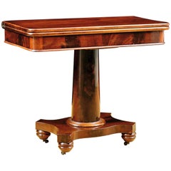
Antique American Empire Card/ Games Table in West Indies Mahogany with Pedestal
Located in Miami, FL
An American Empire games or card table with cylinder column resting on quatre-form base terminating with turned feet on casters. Swivel-top opens to a square with storage compartment...
Category
1830s American American Empire Huge Antique Map
Materials
Mahogany
H 30 in W 36 in D 17 in
Dutch VOC Silver Shipwreck Treasure Coins From The Akerendam Shipwreck 1724
Located in AMSTERDAM, NH
Origin: Holland
Value: 2 pennies / 2 stuiver
Date: 1724
A VOC Akerendam shipwreck treasure of nine 2 stuivers minted by the Province of Holland in 1724.
The Akerendam sunk off th...
Category
1720s Dutch Huge Antique Map
Materials
Silver
Free Shipping
H 0.04 in Dm 0.77 in
A Pair of Antique Transitional Long Nose Golf Clubs, Woods.
Located in Oxfordshire, GB
Antique Scared Head Charles Ramage Woods.
An elegant pair of transitional scared head beech wood hickory golf clubs by Charles Ramage, Brighton & Hove Golf Club (1888 - 1902). This g...
Category
Late 19th Century British Huge Antique Map
Materials
Wood, Beech, Hickory
Large and Extremely Rare Terrestrial Globe by Newton
By Newton Globes - Planer & Newton
Located in Lymington, Hampshire
A large and extremely rare 24-inch terrestrial globe by Newton
Our most magnificent and rare globes were a pair of 24-inch Newton globes.
These too were updated in 1852 (terre...
Category
Mid-19th Century English Huge Antique Map
Materials
Mahogany
Classical American Empire Grecian-Form Work Table in Mahogany, circa 1830 Boston
Located in Miami, FL
A very beautiful American Empire work table in the Grecian style in a very fine grade of solid West Indies mahogany with expert book-matching of the top planks and the crotch veneer....
Category
1820s American American Empire Huge Antique Map
Materials
Mahogany
H 29.5 in W 20.5 in D 20 in
Bed King Tester 4 Poster Oak RenaissanceStyle Carved Adam Eve Armorials Tapestry
Located in BUNGAY, SUFFOLK
A vintage king size oak tester or four poster bed in the Renaissance style. Hand carved with Adam & Eve carvings in the headboard, figurative sculptures in the bedposts, three carve...
Category
1950s English Renaissance Huge Antique Map
Materials
Oak
H 88.98 in W 70.87 in D 94.89 in
Antique Federal Mahogany Work Table/ Nightstand Attributed to Isaac Vose, Boston
By Isaac Vose
Located in Miami, FL
A very handsome Federal work table in fine West Indies mahogany with fold-down leaves. There are two drawers with two rounded columns flanking each side. Drawers have the original tu...
Category
1820s American Federal Huge Antique Map
Materials
Mahogany
H 29 in W 18 in D 19 in
Rare 15th Century Solid Oak Medieval Dutch Gothic Chest or Trunk
Located in Casteren, NL
A very rare chest that was completely made of solid oak from the Netherlands middle ages.
It is a joined chest with hand carved geometric gothic front panels. The ornaments used ar...
Category
15th Century and Earlier Dutch Gothic Huge Antique Map
Materials
Wrought Iron
Pair 18th Century Delft Blue & White Vases
Located in Dallas, TX
Pair 18th century delft blue & white vases are of a type that is getting more rare with each passing year. Alas, the fragile nature of such hand-crafted ceramics means a certain perc...
Category
Late 18th Century Dutch Dutch Colonial Huge Antique Map
Materials
Ceramic
Six VOC Chinese Export Style Blue and White Porcelain Chargers, 20th Century
Located in Austin, TX
Six Japanese export style blue and white porcelain chargers, 20th century, China or Japan.
The blue and white porcelain chargers decorated in the kraak style, and emblazoned with th...
Category
20th Century Unknown Chinese Export Huge Antique Map
Materials
Porcelain
19th Century Scandinavian Birch Empire Bureau Secretary with Bookcase, c. 1820
Located in Miami, FL
A very fine Scandinavian Empire/Biedermeier secretary in beautiful birch wood with mahogany interior, Denmark, circa 1820. The highly sculptural form makes this piece an outstanding ...
Category
Early 19th Century Swedish Empire Huge Antique Map
Materials
Birch
H 84 in W 48 in D 24 in
A beautiful Celestial Table Globe produced by Gerard & Leonard Valk
By Gerard and Leonard Valk
Located in ZWIJNDRECHT, NL
A magnificent and very rare early 18th century celestial table globe produced by Gerard and Leonard Valk. Established at the end of the previous century by Gerard Valk, and assisted ...
Category
Early 18th Century Dutch Dutch Colonial Huge Antique Map
Materials
Other
Hand-colored 16th century copy of the famous Moerentorf Bible
By Henry Moret
Located in ZWIJNDRECHT, NL
Publisher: Daniel Vervliet and Hendrik Swingen for Jan I Moretus & Jan I van Keerberghen
Place / Date: Antwerp, 1599
Biblia sacra. Dat is de geheele heylighe schrifture bed...
Category
16th Century Belgian Baroque Huge Antique Map
Materials
Wood, Paper
Free Shipping
H 13 in W 10.63 in D 4.34 in
SSC103-1 Console Table by Stone Stackers
Located in Geneve, CH
SSC103-1 console table by Stone Stackers
Limited edition of 5 products.
Dimensions: W 92 x D 39 x H 81 cm.
Materials: Patagonia and Marquina marbles.
Marble Structure: Patagonia
...
Category
2010s Italian Post-Modern Huge Antique Map
Materials
Marble
Vintage Rembrandt Self Portrait Age 34 Cavalier Oil Painting on Canvas 34"
Located in Dayton, OH
Vintage reproduction oil painting on canvas of Rembrandt at age 34. Originally painted in the 17th century, these self portraits were created by the artist looking at himself in a m...
Category
Late 20th Century Huge Antique Map
Materials
Canvas, Paint
Recent Sales
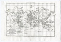
World map on Mercator's projection by Bonne - Engraving - 18th Century
Located in Zeeland, Noord-Brabant
Terre (…).' - World map on Mercator's projection. Greenland and the Arctic are attached to North America
Category
1780s Contemporary Huge Antique Map
Materials
Engraving
H 11.03 in W 16.26 in
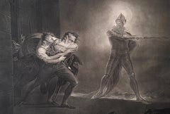
Hamlet, Act I, Scene IV: Hamlet, Horatio, Marcellus, and the Ghost
By Henry Fuseli
Located in New York, NY
undertaking put England back on the printmaking map and was a huge financial success for Boydell. He helped
Category
1790s Romantic Huge Antique Map
Materials
Engraving
Hamlet, Act I, Scene IV: Hamlet, Horatio, Marcellus, and the Ghost
By Henry Fuseli
Located in New York, NY
undertaking put England back on the printmaking map and was a huge financial success for Boydell. He helped
Category
1790s Romantic Huge Antique Map
Materials
Engraving
Pair of Topographical Portraits of the Pavillion and Village of Vaux-Sur-Seine
Located in London, Middlesex
Faisanderie, which was completed in 1789 at the huge cost of 160,000 livres . All of this came under the
Category
Early 18th Century French Louis XIV Huge Antique Map
Materials
Canvas
H 60.24 in W 60.24 in D 3.94 in
1911 Rand-McNally Pocket Map and Shippers' Guide of Montana
Located in Colorado Springs, CO
1911 Rand-McNally Indexed County and Township Pocket Map and Shippers' Guide of Montana
This is a
Category
1910s Huge Antique Map
Materials
Paper
20th Century German World Atlas, 1912
Located in LEGNY, FR
1912 World Atlas Huge Andrees Handatlas. Jubilaums- Ausgabe, Funfte Auflage.
This is a stunning
Category
1910s German Huge Antique Map
Materials
Paper
China Camp Coastal Landscape Painting, California Artist Davis Francis Schwartz
Located in San Francisco, CA
1915. In 1924 he moved to San Francisco for the installation of a huge map at the Ferry Building for
Category
Early 20th Century American Huge Antique Map
Materials
Paint
H 13 in W 16.5 in D 1.5 in
Typus Orbis Terrarum, Antique Map 1667
By Matthäus Merian the Younger
Located in Soquel, CA
, a huge southern continent and no trace yet of Australia. The most striking features of the map are
Category
17th Century Huge Antique Map
Materials
Printer's Ink, Watercolor, Rag Paper
Huge Oil on Canvas Pirate Mural Painting
Located in Palm Beach, FL
cliches you could ask for. Signed Percy Hartley Jr. 32.Treasure Map not included.
* The WPA or Works
Category
Early 20th Century American Huge Antique Map
1915 Barnum & Bailey Antique Circus Poster
Located in Colorado Springs, CO
, circus bandwagon ever built. The bandwagon was decorated with two hemispheric map depictions of the world
Category
1910s American Huge Antique Map
Materials
Paper
"Battle of Gettysburg, Repulse of Longstreet's Assault" John B. Bachelder, 1876
Located in Colorado Springs, CO
. This advance, ultimately repulsed with huge losses, marked the “high-water mark of the Confederacy” and
Category
1870s American Huge Antique Map
H 20 in W 40 in D 2.5 in
Oil Painting Portrait of Lord Edward Grenfell, 1st Baron St Just (1870-1941)
By Oswald Birley
Located in London, GB
Battle of the Somme). Birley focussed on making maps and models of positions to be assaulted by First
Category
Early 20th Century Victorian Huge Antique Map
Materials
Oil
1906 Map of Colorado by Rand McNally & Co., Antique County and Township Map
By Rand McNally & Co.
Located in Colorado Springs, CO
This is a 1906 Indexed County and Township Pocket Map and Shipper’s Guide of Colorado published by
Category
Early 1900s American Huge Antique Map
Materials
Paper
Antique World Map on Mercator's Projection, 1782
Located in Langweer, NL
Antique map titled 'Carte Reduite des Terres et des Mers du Globe Terrestre.'
World map on
Category
1780s Huge Antique Map
Materials
Paper
Antique Map of Northeastern Canada by Lotter 'circa 1760'
Located in Langweer, NL
Antique map titled 'Partie Orientale de la Nouvelle France ou du Canada avec l'Isle de Terre-Neuve
Category
Mid-18th Century Huge Antique Map
Materials
Paper
Scarce Impressive Antique Map of Asia from Jesuit Sources, C.1715
Located in Langweer, NL
Antique map titled 'L'Asie selon les nouvelles observations de Messrs de l'Academie des Sciences
Category
18th Century Huge Antique Map
Materials
Paper
17th Century Hand-Colored Map of the Hesse-Kassel Region of Germany by Hondius
By Jodocus Hondius
Located in Alamo, CA
This highly detailed 17th century original hand-colored map is entitled "Hassia Landgraviatus". It
Category
Mid-17th Century Dutch Huge Antique Map
Materials
Paper
H 27.5 in W 30 in D 0.13 in
Large, circa 1916 Drafting Cabinet
By Fritz Manufacturing Co
Located in Sag Harbor, NY
Antique map/drafting cabinet, solid oak with cedar lined interiors. Made by the Fritz manufacturing
Category
1910s American Huge Antique Map
Materials
Cedar, Oak
Court Of Chinese Emperor- Original Hand Watercolored Etching by A. Leide
By Pieter Van Der Aa
Located in Roma, IT
comprehensive geographical work ever produced. The volume contained plates that generally consist of views, maps
Category
Early 18th Century Huge Antique Map
Materials
Etching
H 9.06 in W 13.19 in D 0.08 in
Komárno
By Franz Hogenberg
Located in Saint Augustine, FL
Antique map with two views of Komárno by Braun and Hogenberg: One from the northeast of the castle
Category
15th Century and Earlier Old Masters Huge Antique Map
Materials
Copper
1903 "Barnum & Bailey Circus, " Antique Advertisement Poster
Located in Colorado Springs, CO
two hemispheric map depictions of the world, and was so large it required a team of 40 horses to pull
Category
Early 1900s American Huge Antique Map
Materials
Paper
1902 Portland City Map
Located in Portland, OR
A huge, amazing map of Portland circa 1902. 1″ : 600′ scale. Showing individual lots of
Category
Early 20th Century American Huge Antique Map
Materials
Wood
Large Gustavian Map Chest, c. 1820
Located in Los Angeles, CA
a huge chest from sweden with 5 shelves that seamlessly pull in & out. original key included.
Category
19th Century Swedish Huge Antique Map
Materials
Wood
Antique Leatherbound Reference Library for Asprey of London
Located in Los Angeles, CA
summary. 2. French and English Dictionary, unpaginated, with appendices of maps, weights and measures etc
Category
Early 20th Century Huge Antique Map
Adriano Balbi Gran Carta D'Italia Map of Italy, circa 1845
Located in Houston, TX
map of huge size it was not unfurled every day but was instead most likely used in a university
Category
1840s Italian Huge Antique Map
The Infant Shakspeare
By George Romney
Located in New York, NY
drawings of Claude Lorrain. This ambitious undertaking put England back on the printmaking map and was a
Category
18th Century and Earlier Other Art Style Huge Antique Map
Materials
Engraving
Get Updated with New Arrivals
Save "Huge Antique Map", and we’ll notify you when there are new listings in this category.
Huge Antique Map For Sale on 1stDibs
Choose from an assortment of styles, material and more with respect to the huge antique map you’re looking for at 1stDibs. Each huge antique map for sale was constructed with extraordinary care, often using paper, animal skin and leather. Whether you’re looking for an older or newer huge antique map, there are earlier versions available from the 18th Century and newer variations made as recently as the 19th Century. Many designers have produced at least one well-made huge antique map over the years, but those crafted by Johannes Janssonius are often thought to be among the most beautiful.
How Much is a Huge Antique Map?
Prices for a huge antique map start at $149 and top out at $29,784 with the average selling for $1,175.
