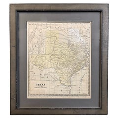
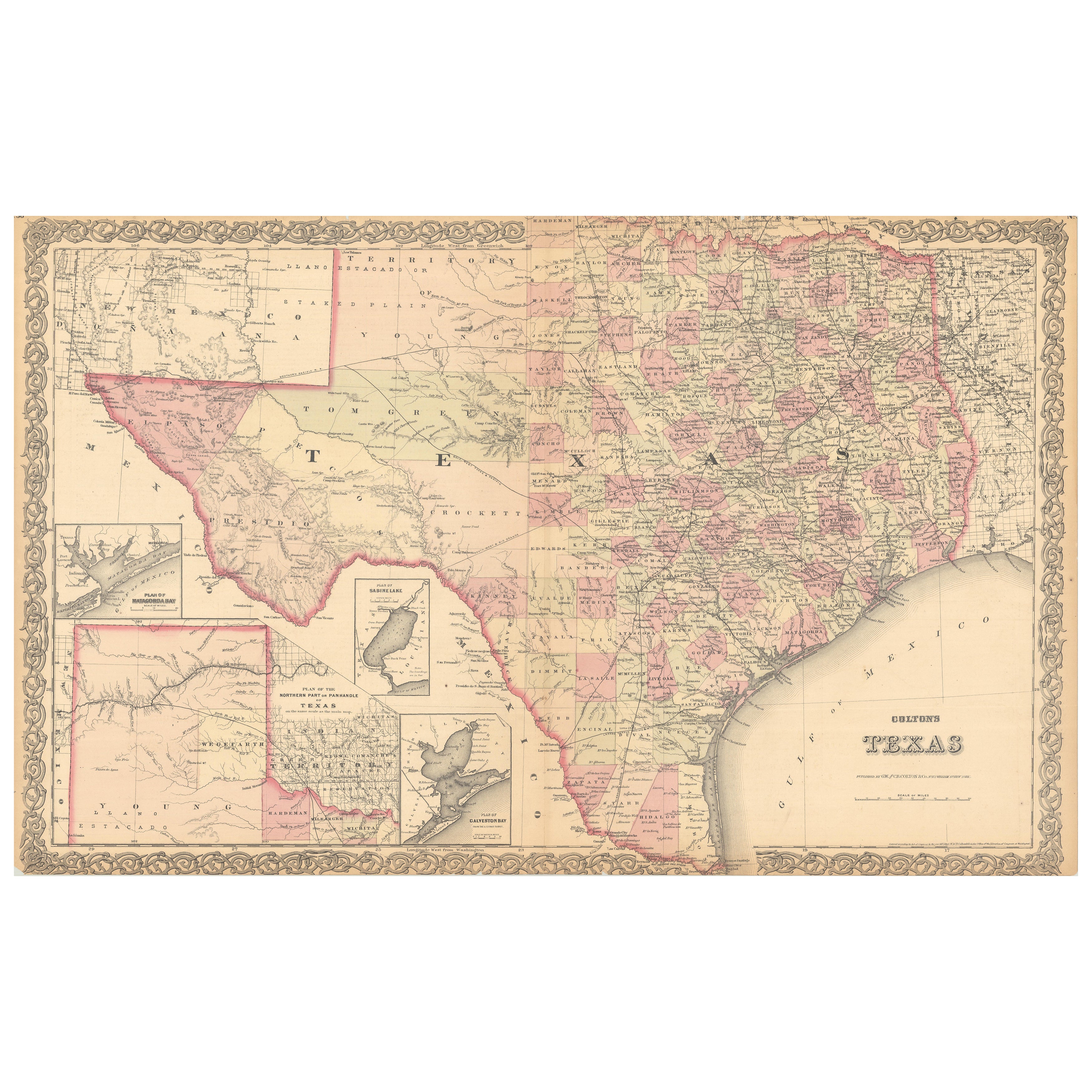
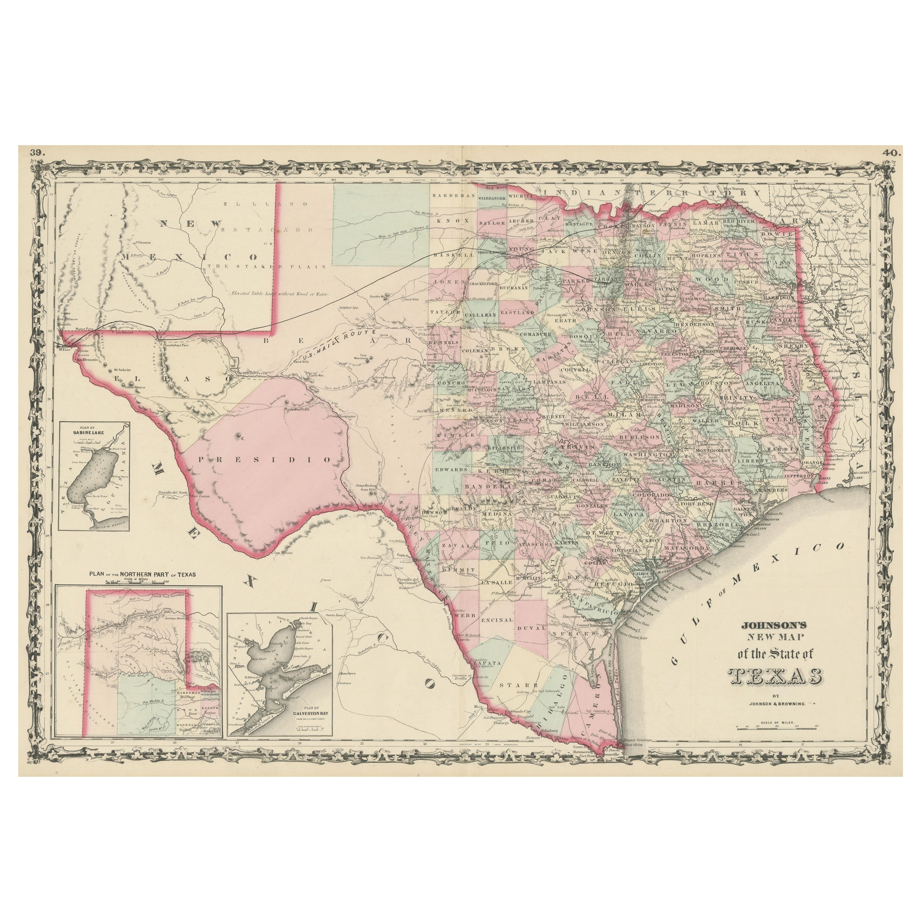
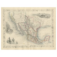
1853 "Texas" Map by Daniel Burgess
View Similar Items


Want more images or videos?
Request additional images or videos from the seller
1 of 6
1853 "Texas" Map by Daniel Burgess
$850List Price
About the Item
- Dimensions:Height: 15.63 in (39.71 cm)Width: 13.63 in (34.63 cm)Depth: 1 in (2.54 cm)
- Style:Victorian (Of the Period)
- Materials and Techniques:
- Place of Origin:
- Period:
- Date of Manufacture:1853
- Condition:Additions or alterations made to the original: Framed by Rio Grande Custom Framing in Colorado Springs, CO, in December of 2024. Wear consistent with age and use. Minor fading.
- Seller Location:Colorado Springs, CO
- Reference Number:Seller: M3821stDibs: LU909742864932
About the Seller
4.9
Platinum Seller
Premium sellers with a 4.7+ rating and 24-hour response times
Established in 2010
1stDibs seller since 2011
463 sales on 1stDibs
Authenticity Guarantee
In the unlikely event there’s an issue with an item’s authenticity, contact us within 1 year for a full refund. DetailsMoney-Back Guarantee
If your item is not as described, is damaged in transit, or does not arrive, contact us within 7 days for a full refund. Details24-Hour Cancellation
You have a 24-hour grace period in which to reconsider your purchase, with no questions asked.Vetted Professional Sellers
Our world-class sellers must adhere to strict standards for service and quality, maintaining the integrity of our listings.Price-Match Guarantee
If you find that a seller listed the same item for a lower price elsewhere, we’ll match it.Trusted Global Delivery
Our best-in-class carrier network provides specialized shipping options worldwide, including custom delivery.More From This Seller
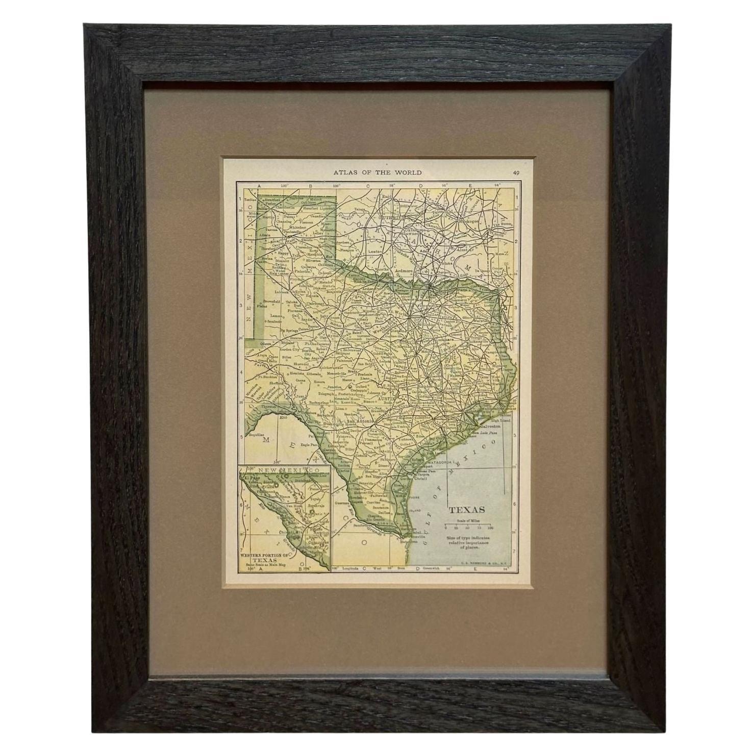
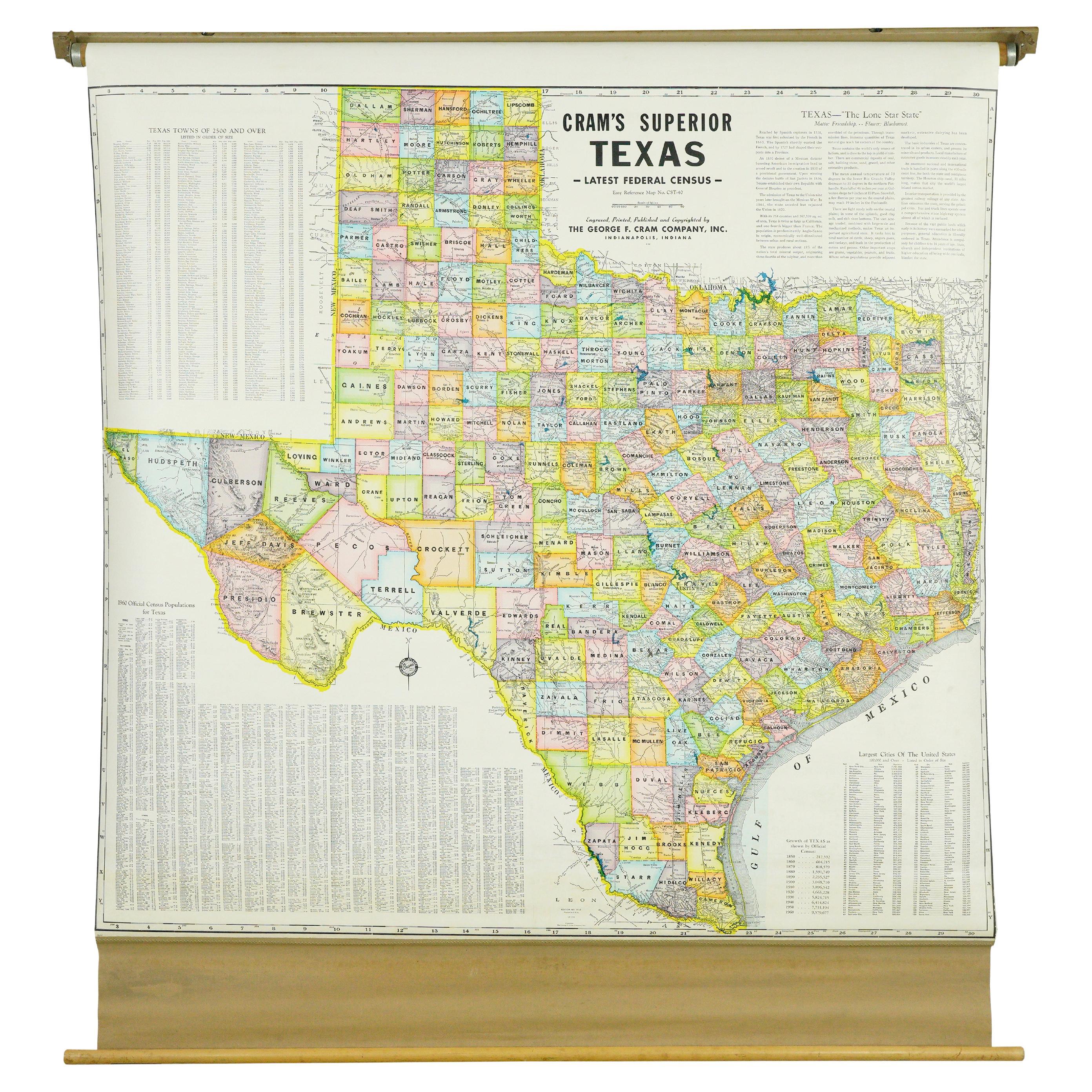
View All1927 "Texas" Map by C.S. Hammond
Located in Colorado Springs, CO
Presented is a very detailed map of Texas, printed in 1927. The map was featured in The Literary Digest Atlas of the World and Gazetteer, published by Funk & Wagnalls. The map is sma...
Category
Vintage 1920s American Maps
Materials
Paper
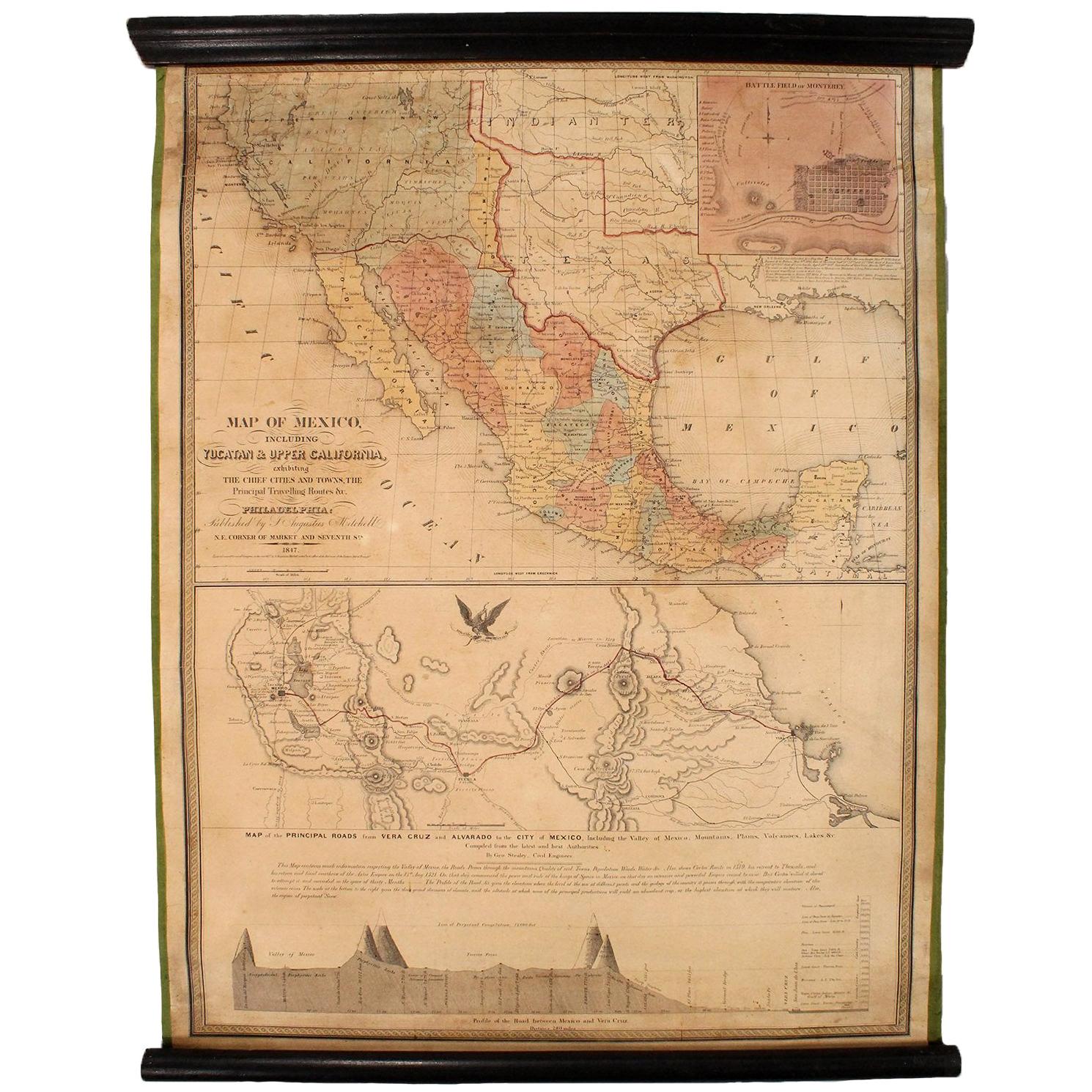
1847 Antique Map of Mexico, Texas and California by Samuel Augustus Mitchell
By Samuel Augustus Mitchell 1
Located in Colorado Springs, CO
Presented is the second edition of Samuel Augustus Mitchell's Map of Mexico, Including Yucatan & Upper California, an important map showing the progress of the Mexican-American War. ...
Category
Antique 1840s American Maps
Materials
Paper

1846 "North America" Map, Engraved by I. Dower
Located in Colorado Springs, CO
Presented is an original 1846 map of “North America.” The map was drawn and engraved by I. Dower and published in London by Orr & Company. The map depicts North America, to include G...
Category
Antique 1840s English Victorian Maps
Materials
Paper

1868 "Lloyd's Topographical Railway Map of North America..." Hanging Wall Map
Located in Colorado Springs, CO
Presented is “Lloyd's Topographical Railway Map of North-America, or the United States Continent in 1900.” This map was published by J. T. Lloyd, in New York, in 1868. A large, hangi...
Category
Antique 1860s American Late Victorian Maps
Materials
Linen, Paper

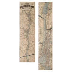
1917 "New Hudson River Map" by Wallace Bruce, Later Edition, Folding Map
Located in Colorado Springs, CO
Presented is a 1917 printing of “New Hudson Map” by Wallace Bruce. The map was published by Bryant Union Publishing Co., in New York City. The map is a later edition, issued in a distinct strip-chart format that is over 100 inches long. The map includes amazing detail, compiled mostly from U.S. Coast Survey data. It is drawn on a scale of 1.5 miles per inch, allowing ample space for it to show historical landmarks, landings, islands, list prominent residents, and more. The verso is filled with related text and illustrations about the Hudson River valley. The map folds into cream paper wrappers, titled "Hudson River Map...
Category
Vintage 1910s American Beaux Arts Maps
Materials
Paper
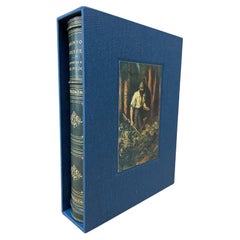
The Robinson Crusoe by Daniel Defoe, Illustrated, 1931
Located in Colorado Springs, CO
Defoe, Daniel. The Life and Strange Surprising Adventures Robinson Crusoe of York, Mariner, as related by Himself. London: Humphrey Milford, 1931. Embe...
Category
Vintage 1930s English Books
Materials
Paper
$950 Sale Price
45% Off
You May Also Like
Antique Map of the World by D'Urville '1853'
Located in Langweer, NL
Antique map titled 'Voyage Autour du Monde'. Original map of the world. This map originates from volume 1 of 'Voyage Autour du Monde' by Comte-Amiral Dumont D'Urville.
Category
Antique Mid-19th Century Maps
Materials
Paper

$285 Sale Price
20% Off
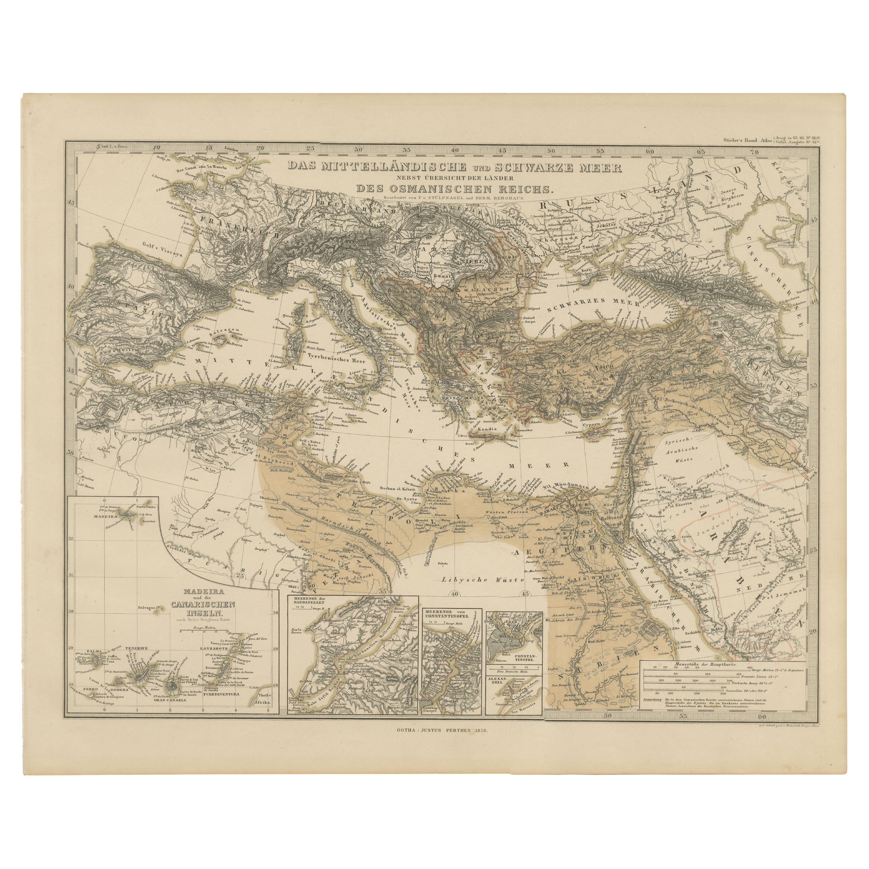
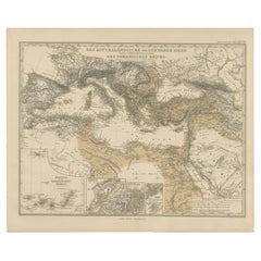
Mediterranean, Black Sea & Ottoman Empire Map 1853
Located in Langweer, NL
Mediterranean, Black Sea & Ottoman Empire Map 1853
This impressive antique print shows the Mediterranean and Black Sea regions with a focus on the Ottoman Empire, titled “Das Mittel...
Category
Antique Mid-19th Century German Maps
Materials
Paper
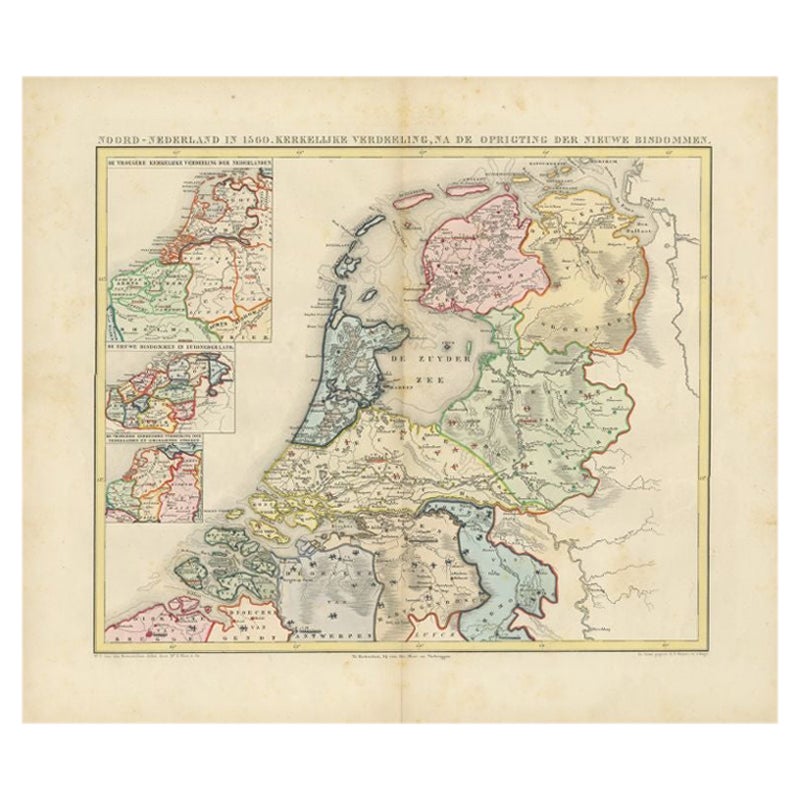
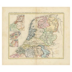
Antique Map of the Netherlands in 1560 by Mees, 1853
Located in Langweer, NL
Antique map titled 'Noord-Nederland in 1560. Kerkelijke verdeeling, na de oprigting der nieuwe bisdommen'. Map of the Netherlands in 1560. This map originates from 'Historische Atlas...
Category
Antique 19th Century Maps
Materials
Paper
$121 Sale Price
20% Off
Texas California Mexico Map – Antique Tallis Map with Gold Region, c.1850
Located in Langweer, NL
Texas California Mexico Map – Antique Tallis Map with Gold Region, c.1850
This highly decorative and historically rich map titled 'Mexico, California and Texas' was published around...
Category
Antique Mid-19th Century Maps
Materials
Paper
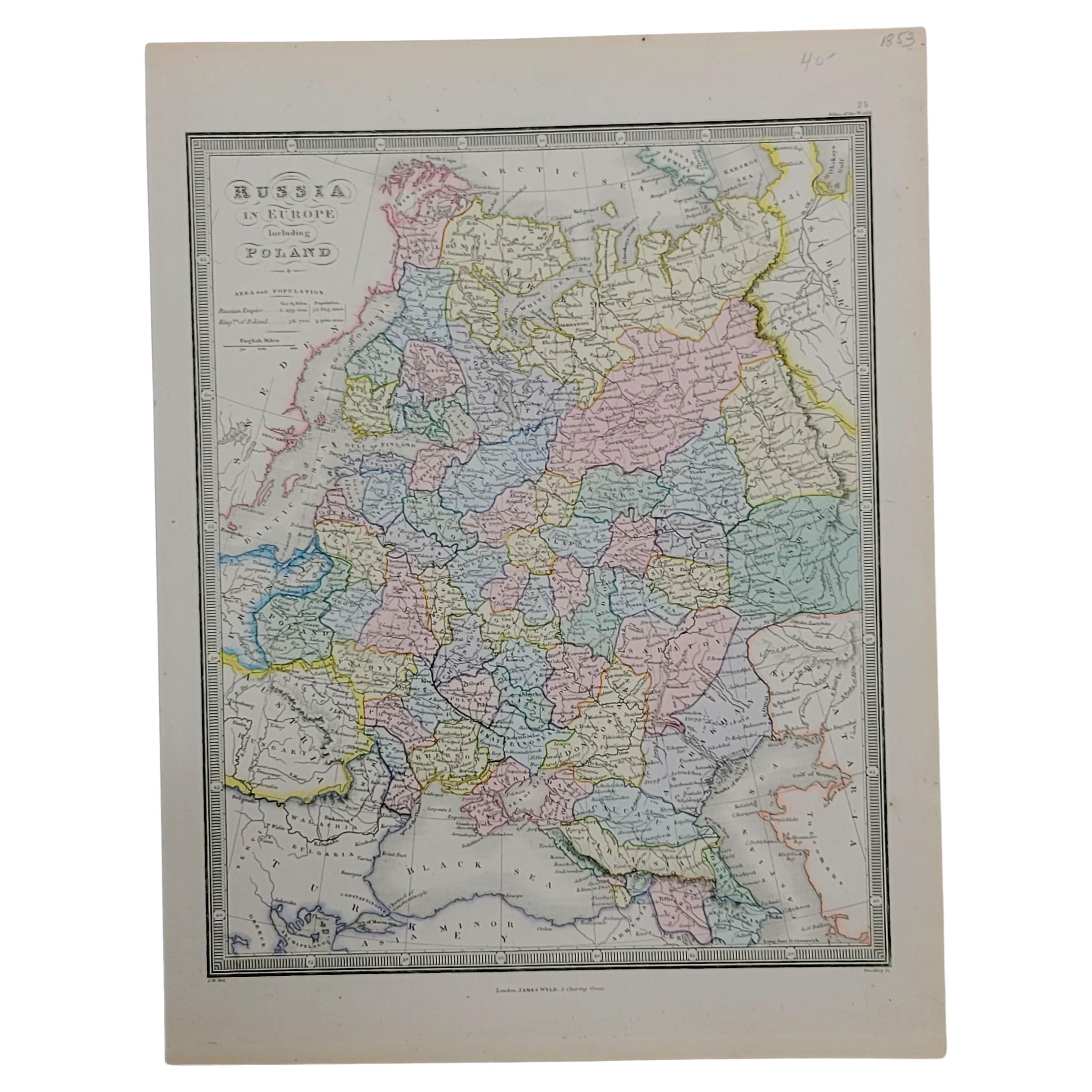
1853 Map of "Russia in Europe Including Poland" Ric.r016
Located in Norton, MA
Description
Russia in Europe incl. Poland by J Wyld c.1853
Hand coloured steel engraving
Dimension: Paper: 25 cm W x 33 cm H ; Sight: 22 cm W x 28 cm H
Condition: Good ...
Category
Antique 19th Century Unknown Maps
Materials
Paper

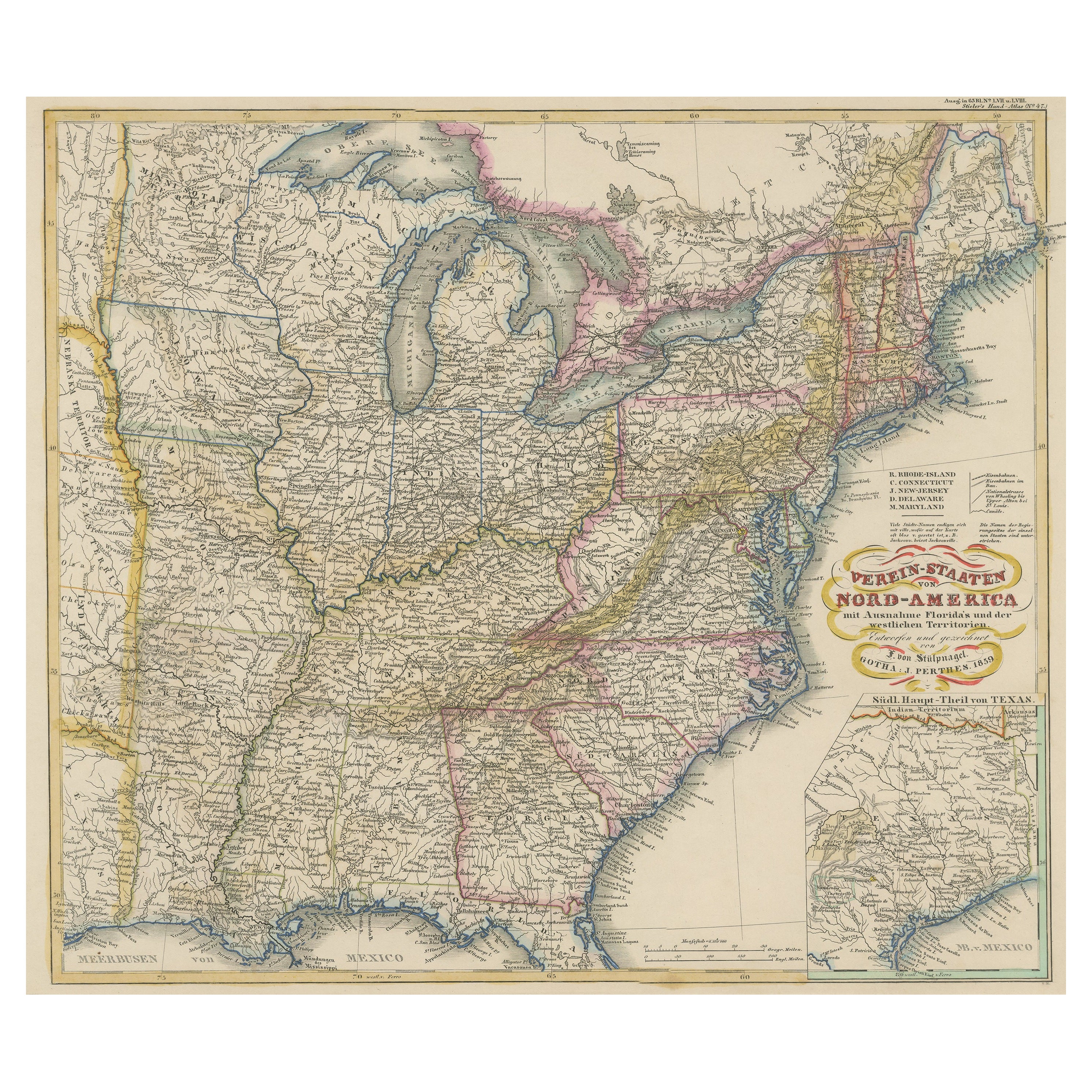
Antique Map of the Eastern United States with Inset Map of Texas
Located in Langweer, NL
Antique map titled 'Verein-Staaten von Nord-America mit Ausnahme Florida's und der Westlichen Territorien'. This map extends as far west as Louisiana and only includes the northern p...
Category
Antique Mid-19th Century Maps
Materials
Paper

$513 Sale Price
20% Off
Recently Viewed
View AllMore Ways To Browse
Red Retro Dining Set
Antique Silver Glasses Case
Carlo Scarpa 1934 Chairs
Christofle Marly
1900 Antique Chairs
Glass Table Italian Round
Mid Century Colonial
Alvar Aalto Poster
Geometric Metal Table
Post Modern High Chairs
United Nations
Vintage Vine Rug
Cancel An Order
Antique Framing Square
Silver Metal Chair
Swedish Kilim
Vintage Scandanavian Chairs
Vintage Tropical Furniture