Items Similar to 1858 Map of Southwestern Germany & Switzerland – Bavaria, Württemberg, Baden


Video Loading
Want more images or videos?
Request additional images or videos from the seller
1 of 11
1858 Map of Southwestern Germany & Switzerland – Bavaria, Württemberg, Baden
$518.59
£390.60
€440
CA$715.16
A$803.45
CHF 419.81
MX$9,806.53
NOK 5,330.31
SEK 5,017.36
DKK 3,349.11
About the Item
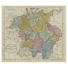
Antique Map of Southwestern Germany & Switzerland – Bavaria, Württemberg, Baden, 1858
Detailed antique map titled "Südwestliches Deutschland mit Bayern, Würtemberg, Baden, Hohenzollern und Schweiz", published by Justus Perthes in Gotha in 1858. This copperplate engraving presents a richly detailed view of Southwestern Germany and Switzerland during the mid-19th century, a time of growing national consciousness and evolving regional alliances prior to German unification.
The map encompasses the southern German states of Bavaria (Bayern), Württemberg, Baden, and Hohenzollern, extending southward into Switzerland and westward to the Rhine. A wealth of cities, roads, and rivers are labeled, including Munich (München), Stuttgart, Freiburg, Augsburg, and Zurich. Switzerland’s mountainous topography is carefully engraved, as is the Black Forest region of Baden.
Administrative boundaries are outlined in vivid hand-coloring, and a key at lower right lists abbreviations for Bavarian districts. The Alpine terrain is represented with shaded relief, conveying the geographical transition from southern Germany into the Swiss Alps and northern Tyrol.
This map is valuable not only for its political geography but also for its finely rendered depiction of terrain and infrastructure during a pivotal period in Central European history. Its detail and clarity make it a compelling item for collectors of maps focusing on German regional history or the early modern Swiss Confederation.
Condition report:
Very good condition. Minor toning in the outer margins. Hand-coloring remains vibrant and clear. No tears, foxing, or repairs noted. Please examine the image closely for additional detail.
Framing tips:
Pair this map with a natural wood or black frame and a soft ivory mat. A thin red or green accent line in the mat can reflect the political boundaries and enhance contrast. Suitable for historical or academic interiors, especially alongside other 19th-century Germanic or Alpine maps.
Technique: Copperplate engraving with original hand-coloring
Maker: Justus Perthes, Gotha, 1858
- Dimensions:Height: 14.77 in (37.5 cm)Width: 17.88 in (45.4 cm)Depth: 0.01 in (0.2 mm)
- Materials and Techniques:Paper,Engraved
- Place of Origin:
- Period:
- Date of Manufacture:1858
- Condition:Very good condition. Minor toning in the outer margins. Hand-coloring remains vibrant and clear. No tears, foxing, or repairs noted. Please examine the image closely for additional detail.
- Seller Location:Langweer, NL
- Reference Number:Seller: BG-05552-321stDibs: LU3054346118482
About the Seller
5.0
Recognized Seller
These prestigious sellers are industry leaders and represent the highest echelon for item quality and design.
Platinum Seller
Premium sellers with a 4.7+ rating and 24-hour response times
Established in 2009
1stDibs seller since 2017
2,533 sales on 1stDibs
Typical response time: <1 hour
- ShippingRetrieving quote...Shipping from: Langweer, Netherlands
- Return Policy
Authenticity Guarantee
In the unlikely event there’s an issue with an item’s authenticity, contact us within 1 year for a full refund. DetailsMoney-Back Guarantee
If your item is not as described, is damaged in transit, or does not arrive, contact us within 7 days for a full refund. Details24-Hour Cancellation
You have a 24-hour grace period in which to reconsider your purchase, with no questions asked.Vetted Professional Sellers
Our world-class sellers must adhere to strict standards for service and quality, maintaining the integrity of our listings.Price-Match Guarantee
If you find that a seller listed the same item for a lower price elsewhere, we’ll match it.Trusted Global Delivery
Our best-in-class carrier network provides specialized shipping options worldwide, including custom delivery.More From This Seller
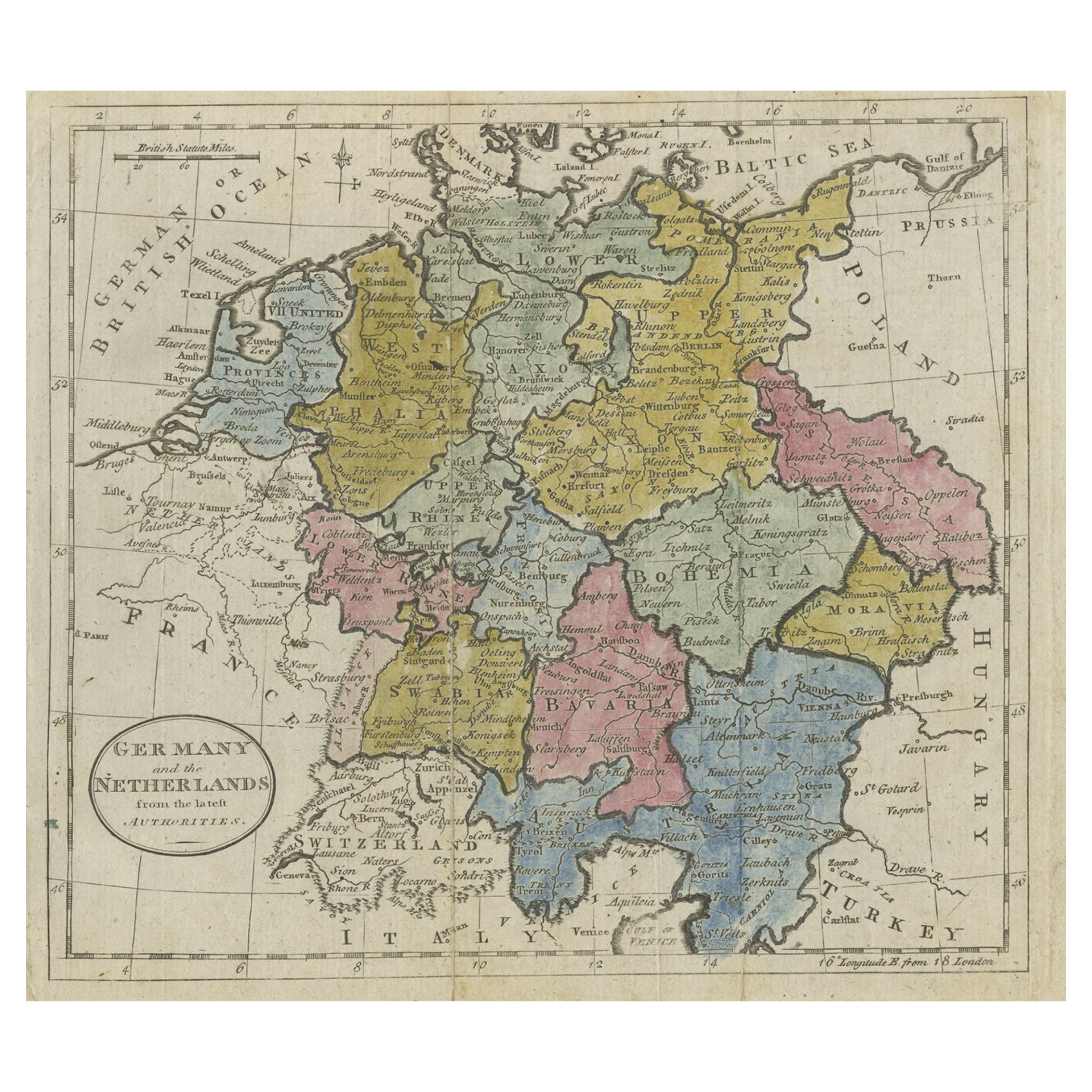
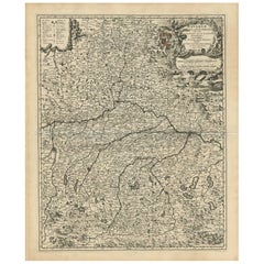
View AllAntique Map of Germany, the Netherlands, Bohemia, Bavaria and Switzerland, 1785
Located in Langweer, NL
Antique map titled 'Germany and the Netherlands from the latest authorities'. Depicts Germany, the Netherlands and the surrounding region including Bohemia, Bavaria, and Switzerland....
Category
Antique 18th Century Maps
Materials
Paper
$132 Sale Price
20% Off
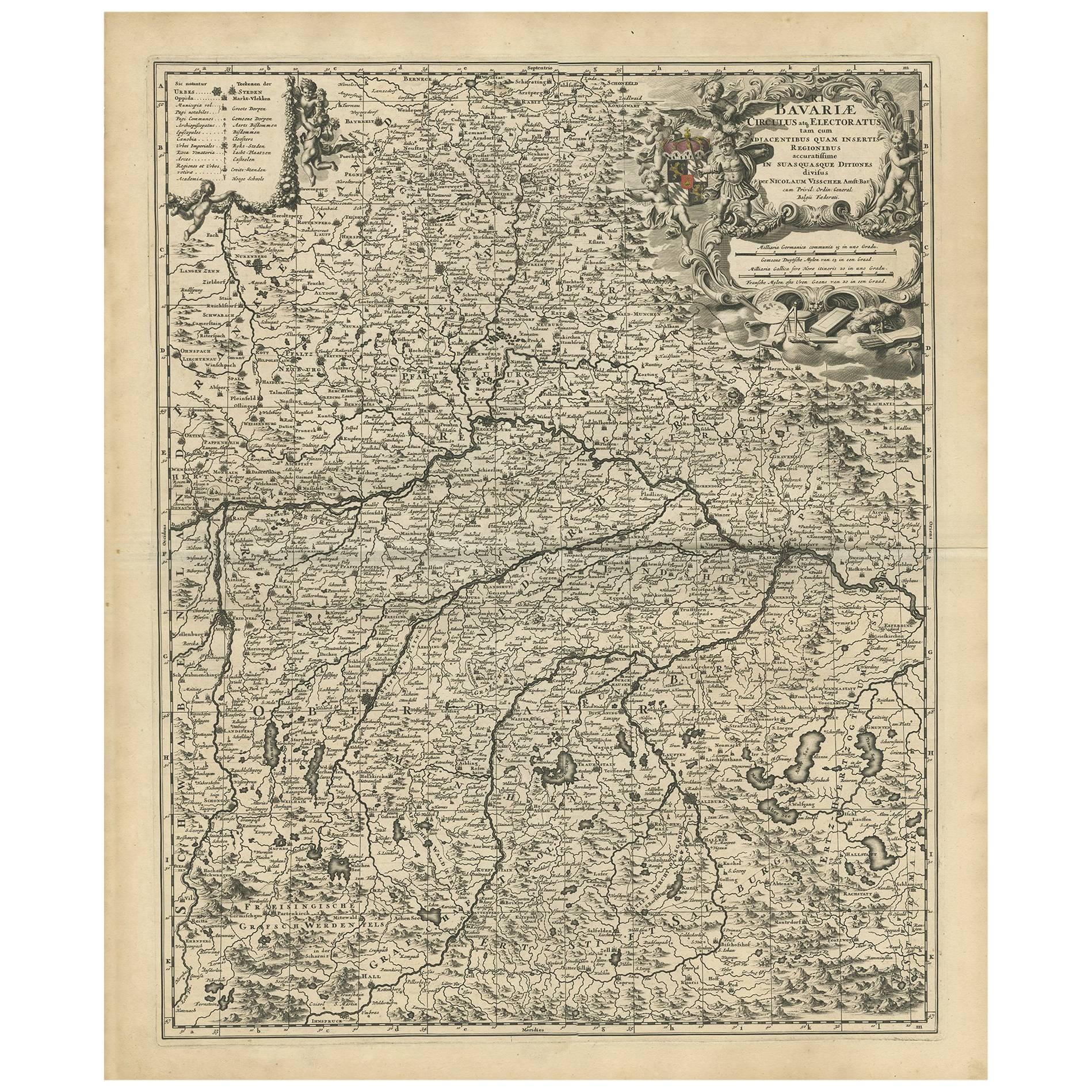
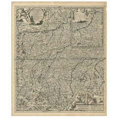
Antique Map of Bavaria with many details, Germany
Located in Langweer, NL
Antique map titled 'Bavariae Circulus atq Electoratus tam cum Adiacentibus quam insertis Regionibus (..)'. Dutch map of Bavaria, showing the many cities, towns, and other features of...
Category
Antique Late 17th Century Maps
Materials
Paper
$622 Sale Price
20% Off
Antique Map of Upper Bavaria, Germany, circa 1690
Located in Langweer, NL
Antique map titled 'Bavariae pars superior cum insertis et adjacentibus regionibus non solum in ejusdem ditiones generales (..). Original antique map of upper Bavaria from Regensburg...
Category
Antique Late 17th Century Dutch Maps
Materials
Paper
$655 Sale Price
20% Off
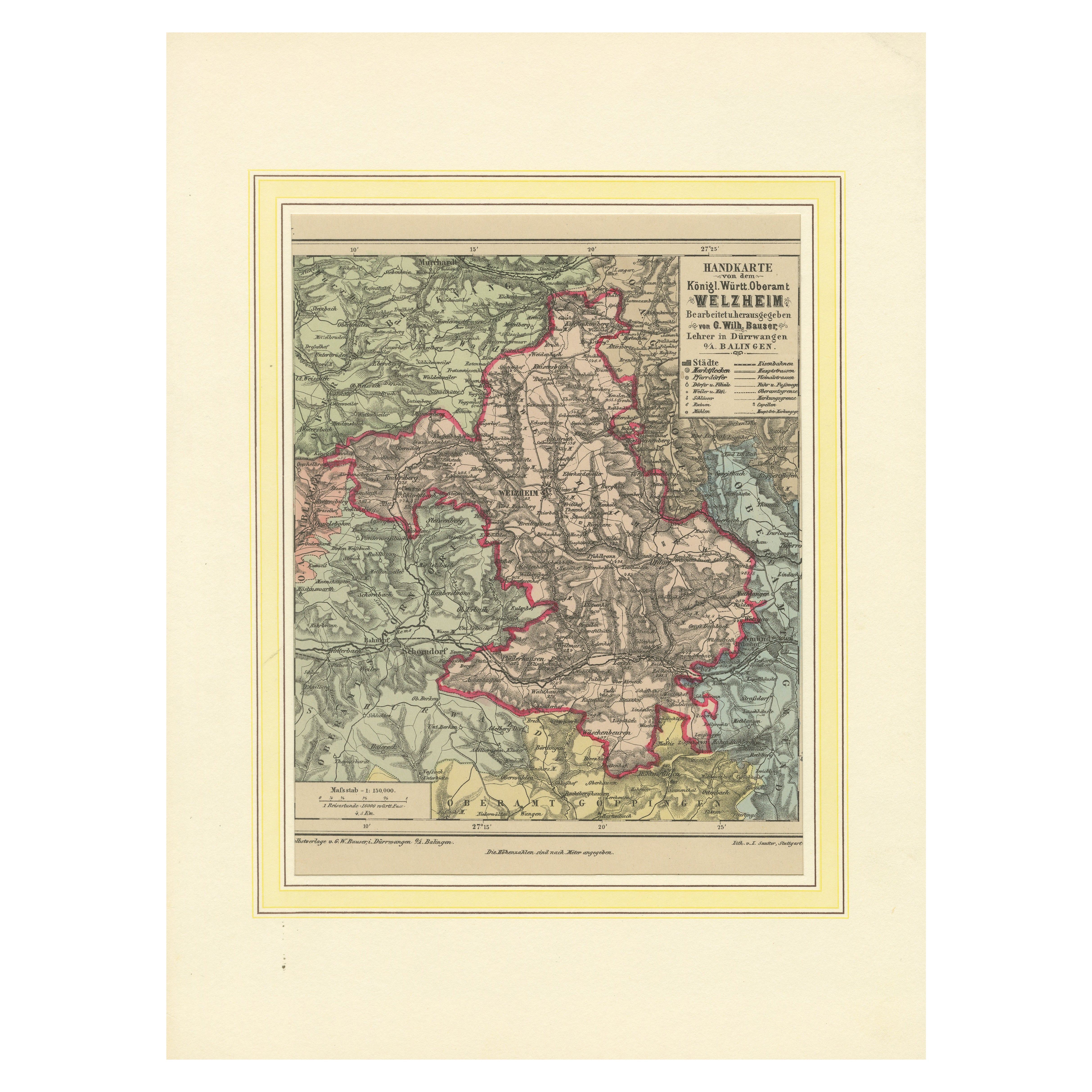
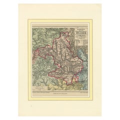
Decorative Map of the Royal Württemberg District of Welzheim, Germany, ca.1880
Located in Langweer, NL
The Royal Württemberg District of Welzheim is located in Germany. Welzheim is a town in the state of Baden-Württemberg, which was historically part of the Kingdom of Württemberg. The...
Category
Antique 1880s Maps
Materials
Paper
Map of the Kingdom of Württemberg, Oberamt Tettnang in Germany, circa 1885
Located in Langweer, NL
Administrative Map of the Kingdom of Württemberg, Oberamt Tettnang, circa 1885
This detailed antique map titled "Handkarte von dem Königl. Württ. Oberamt Tettnang" was created by G....
Category
Antique 1880s Maps
Materials
Paper
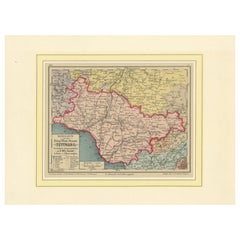
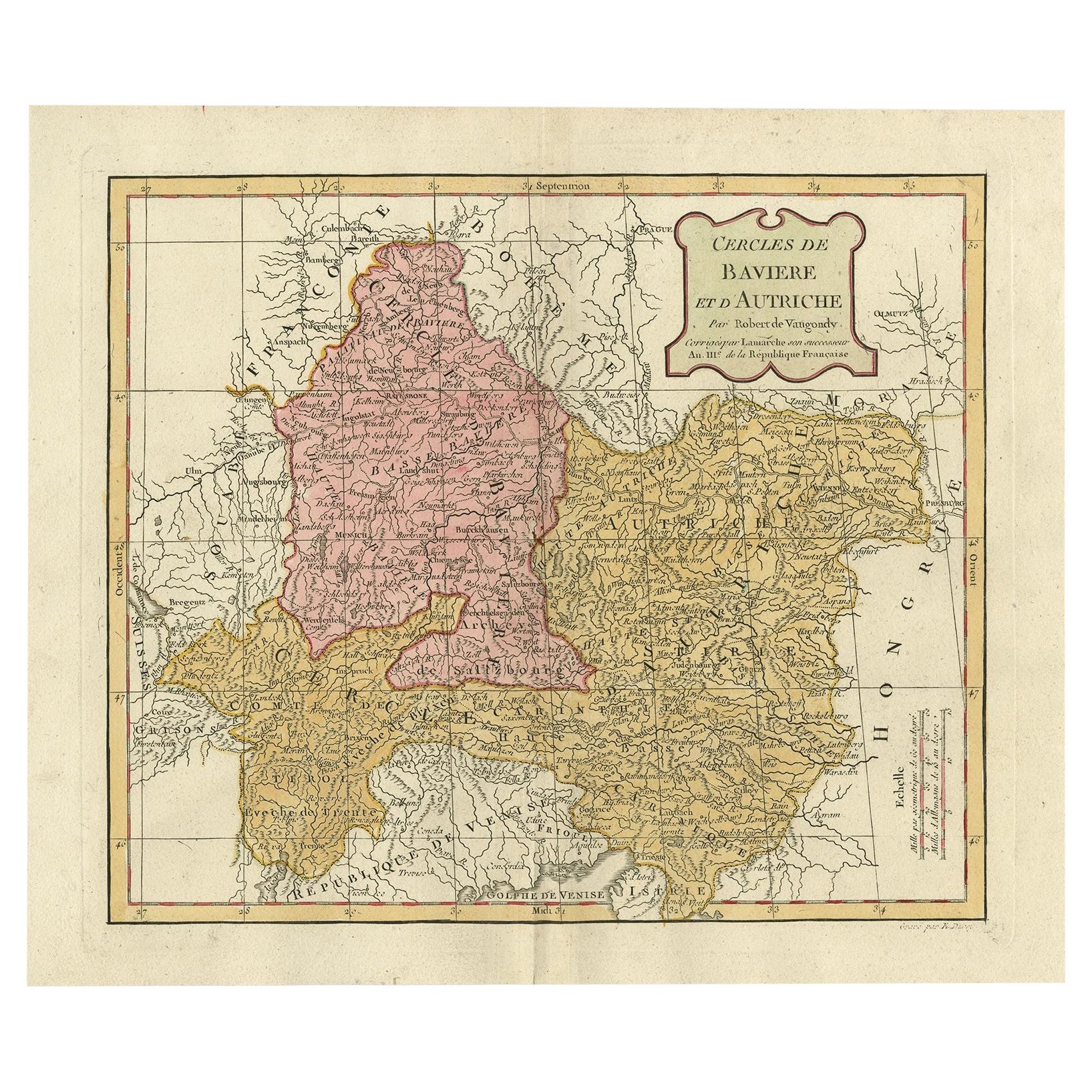
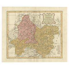
Antique Map of Bavaria in Southern Germany and Austria, 1806
Located in Langweer, NL
Antique map titled 'Cercles de Baviere et d'Autriche.' This map shows Bavaria in southern Germany and Austria. By Robert de Vaugondy, revised and published by Delamarche. Source unkn...
Category
Antique 19th Century Maps
Materials
Paper
$330 Sale Price
20% Off
You May Also Like
1858 Colton's Map of New York, Ric.B011
Located in Norton, MA
An 1858 Colton's map of New York
Ric.b011
Colton’s New York, 1858 - A large original color engraved and very detailed map of the state of New York,...
Category
Antique 19th Century Unknown Maps
Materials
Paper

Large Original Vintage Map of Switzerland, circa 1920
Located in St Annes, Lancashire
Great map of Switzerland
Original color.
Good condition
Published by Alexander Gross
Unframed.
Category
Vintage 1920s English Maps
Materials
Paper
Original Antique Map of Switzerland, Engraved By Barlow, Dated 1807
Located in St Annes, Lancashire
Great map of Switzerland
Copper-plate engraving by Barlow
Published by Brightly & Kinnersly, Bungay, Suffolk.
Dated 1807
Unframed.
Category
Antique Early 1800s English Maps
Materials
Paper

Original Antique Map or City Plan of Geneva, Switzerland. Circa 1835
Located in St Annes, Lancashire
Nice map of Geneva
Drawn and engraved by J.Dower
Published by Orr & Smith. C.1835
Unframed.
Free shipping
Category
Antique 1830s English Maps
Materials
Paper

Very Large Vintage Map of Canada, German, Education, Institution, Cartography
Located in Hele, Devon, GB
This is a very large vintage map of Canada. A German, quality printed educational or institution map, dating to the mid 20th century, circa 1965....
Category
Mid-20th Century German Maps
Materials
Paper

1858 The Story of Jack and the Giants
By Richard Doyle
Located in Bath, GB
An exciting retelling of Jack the Giant Killer, beautifully illustrated throughout by Richard Doyle, a smart copy.
A vivid retelling of 'The Story of Ja...
Category
Antique 1850s British Books
Materials
Paper