Items Similar to Antique Asia Map – Large 19th-Century Engraving with Political Boundaries, 1865


Want more images or videos?
Request additional images or videos from the seller
1 of 10
Antique Asia Map – Large 19th-Century Engraving with Political Boundaries, 1865
$463.31
£344.42
€390
CA$637.31
A$709.95
CHF 374.49
MX$8,608.34
NOK 4,764.01
SEK 4,437.98
DKK 2,970.53
About the Item
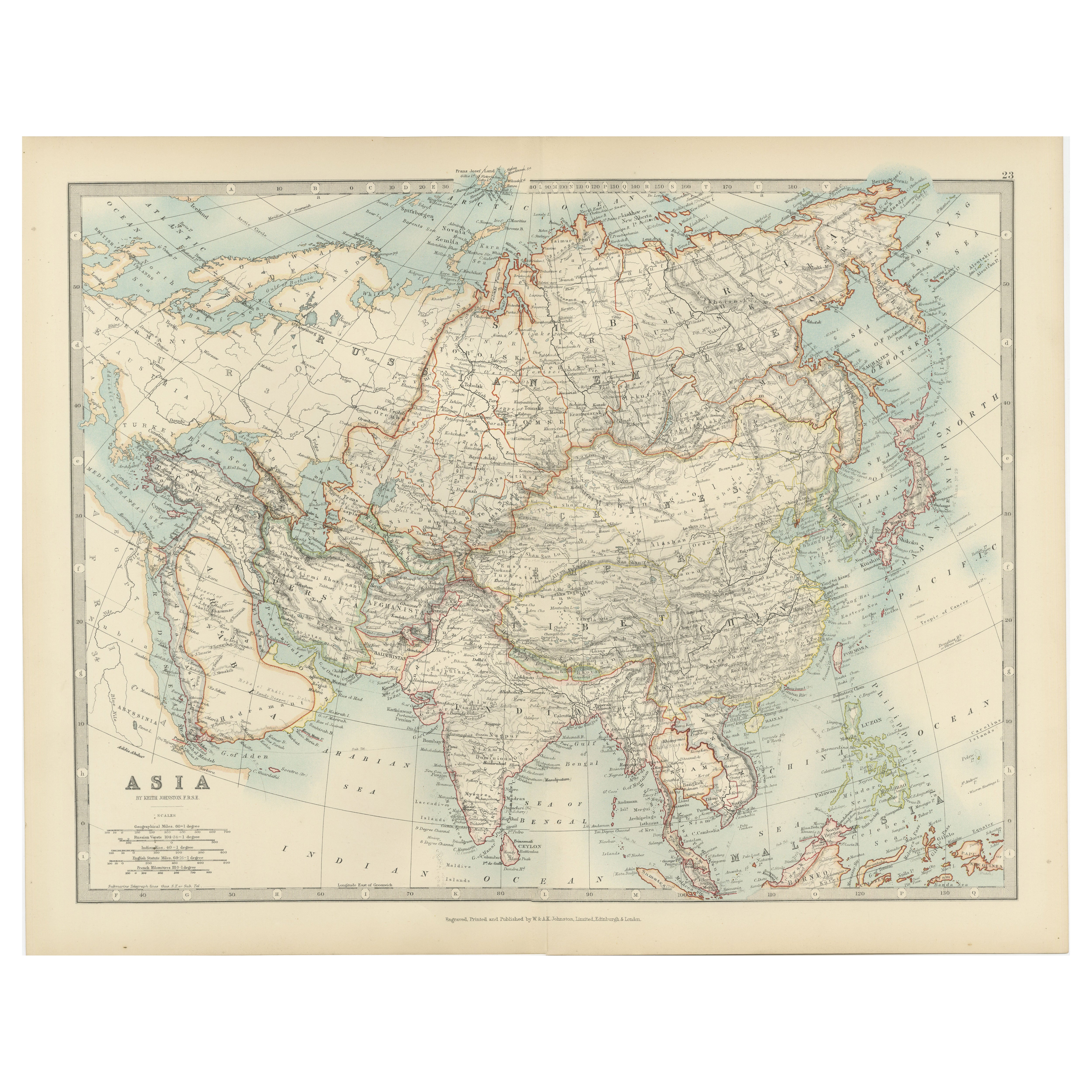
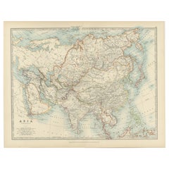
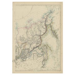
Antique Map of Asia – Andriveau-Goujon, Paris 1865
This large and finely engraved antique map titled “Asie” was published in Paris in 1865 by the prominent French cartographer E. Andriveau-Goujon. Issued as plate number 33 from the *Atlas Universel*, it presents the continent of Asia in its entirety, extending from the Mediterranean and Middle East to the Pacific Ocean, and from the Arctic Ocean down to the islands of Southeast Asia and the Indian Ocean.
The map shows the vast expanse of Asia divided into major regions and empires of the time. The Russian Empire dominates the north, shaded in light green, stretching across Siberia and into Central Asia. China is clearly outlined and labeled as “Empire de la Chine,” while India, shown in pink, is marked as “Empire de l’Inde,” reflecting its status under British colonial control. Other territories such as Persia (Iran), the Ottoman provinces in Asia, Afghanistan, Siam (Thailand), Korea, and Japan are distinctly marked and shaded.
Major cities including Peking (Beijing), Calcutta, Bombay, Delhi, Kabul, Mecca, Tehran, Tokyo (referred to as Yedo), and others are labeled. Mountain ranges, deserts, river systems, and key trade routes are finely engraved, adding geographical depth to the political boundaries.
A legend in the lower left corner explains the color-coding of empires and political entities, as well as the symbols for capitals, fortresses, ports, and trade centers. This map reflects the geopolitical landscape of Asia during a period of colonial expansion, imperial rivalry, and increased European interest in Asia’s strategic and commercial importance.
Condition: Very good condition. Original centerfold as issued. Light age toning and minimal foxing to the margins. Strong impression with well-preserved original hand coloring. Plate number 33 in upper right.
Framing tips: Best presented in a dark wood or black frame with a wide ivory mat. A secondary mat in soft green or gold can enhance the pastel tones and period character.
Technique: Engraving with original hand coloring
Maker: E. Andriveau-Goujon, Paris, 1865
- Dimensions:Height: 20.91 in (53.1 cm)Width: 27.64 in (70.2 cm)Depth: 0.01 in (0.2 mm)
- Materials and Techniques:Paper,Engraved
- Place of Origin:
- Period:
- Date of Manufacture:1865
- Condition:Condition: Very good condition. Original centerfold as issued. Light age toning and minimal foxing to the margins. Strong impression with well-preserved original hand coloring. Plate number 33 in upper right.
- Seller Location:Langweer, NL
- Reference Number:Seller: BG-14099-131stDibs: LU3054346186042
About the Seller
5.0
Recognized Seller
These prestigious sellers are industry leaders and represent the highest echelon for item quality and design.
Platinum Seller
Premium sellers with a 4.7+ rating and 24-hour response times
Established in 2009
1stDibs seller since 2017
2,567 sales on 1stDibs
Typical response time: <1 hour
- ShippingRetrieving quote...Shipping from: Langweer, Netherlands
- Return Policy
Authenticity Guarantee
In the unlikely event there’s an issue with an item’s authenticity, contact us within 1 year for a full refund. DetailsMoney-Back Guarantee
If your item is not as described, is damaged in transit, or does not arrive, contact us within 7 days for a full refund. Details24-Hour Cancellation
You have a 24-hour grace period in which to reconsider your purchase, with no questions asked.Vetted Professional Sellers
Our world-class sellers must adhere to strict standards for service and quality, maintaining the integrity of our listings.Price-Match Guarantee
If you find that a seller listed the same item for a lower price elsewhere, we’ll match it.Trusted Global Delivery
Our best-in-class carrier network provides specialized shipping options worldwide, including custom delivery.More From This Seller
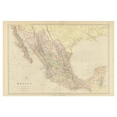
View All1882 Antique Map of Mexico Highlighting Geographical and Political Boundaries
Located in Langweer, NL
This 1882 map of Mexico, published by Blackie and Son as part of the 'Comprehensive Atlas and Geography of the World,' provides a highly detailed representation of the country's geog...
Category
Antique 1880s Maps
Materials
Paper
Antique Map of Europe, 1903, with Intricate Political Boundaries and Rich Detail
Located in Langweer, NL
Title: Antique Map of Europe, 1903, with Intricate Political Boundaries and Rich Detail
Description:
This antique map, titled "Europe," is a finely engraved and beautifully colored ...
Category
Early 20th Century Maps
Materials
Paper

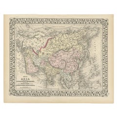
Antique Map of Asia with Intricate Provincial Boundaries, Published in 1903
Located in Langweer, NL
Title: Antique Map of Asia, 1903, with Intricate Provincial Boundaries and Coastal Features
Description:
This antique map, titled "Asia," was engraved and published in 1903 by the r...
Category
Early 20th Century English Maps
Materials
Paper
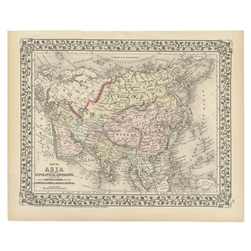
Antique Map of Asia Showing Its Political Divisions, 1874
Located in Langweer, NL
Antique map titled 'Map of Asia showing its Gt. Political Divisions and also the various routes of Travel between London & India, China & Japan & c'. This map covers from the Arabian...
Category
Antique 19th Century Maps
Materials
Paper
$85 Sale Price
20% Off
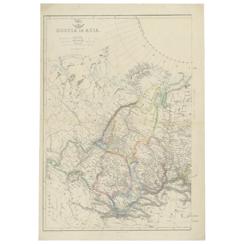
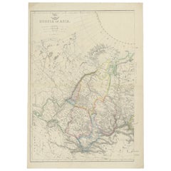
Antique Map of Russia in Asia by Weller, c.1865
Located in Langweer, NL
Antique map titled 'Russia in Asia'. Old map of Russia originating from the 'Weekly Dispatch Atlas'. Artists and Engravers: Engraved by E. Weller.
Artist: Engraved by E. Weller.
...
Category
Antique 19th Century Maps
Materials
Paper
Antique Map of Russia in Asia by Lowry, c.1865
Located in Langweer, NL
Antique map titled 'Russia in Asia, E Sheet'. Old map of Russia originating from the 'Weekly Dispatch Atlas'. Artists and Engravers: Engraved by J.W. Lowry.
Artist: Engraved by J....
Category
Antique 19th Century Maps
Materials
Paper
$84 Sale Price
20% Off
You May Also Like
Large 19th Century Map of France
Located in Pease pottage, West Sussex
Large 19th Century Map of France.
Remarkable condition, with a pleasing age worn patina.
Recently framed.
France Circa 1874.
Category
Antique Late 19th Century French Maps
Materials
Linen, Paper

Antique Asian Bronze Large Camel Toy on Wheels 19th C
Located in North Hollywood, CA
A scene from Ramakian or Ramayan, the Indian epic Rama and Sita.
Large and heavy Antique Indian Temple toy metal camel, bronze camel on wheels.
Camel with r...
Category
Antique Late 19th Century Indian Moorish Animal Sculptures
Materials
Bronze

Antique Botanical Book Printing / Engraving Plate, Walnut Frame, 19th Century
Located in Chatham, ON
Antique book printing / engraving plate - featuring stems of Geranium and Currant plants with titles - unsigned - walnut frame - country of origin unknown - 19th century.
Excellent antique condition - no loss - no damage - no restoration - oxidation of the metal plate in areas - signs of age and use.
Printing plate...
Category
Antique 19th Century Unknown Victorian Decorative Art
Materials
Lead
Antique Painting with Barometer 19th Century
Located in Madrid, ES
Antique table with barometer
Interesting 19th century painting painted in oil with meteorological reasons on wood and which has a barometer in the center and a thermometer in the up...
Category
Antique 1890s Scientific Instruments
Materials
Fruitwood
Large 19th Century Processional Sunburst with Crown
Located in Hastings, GB
An incredible processional sunburst/cross, wooden rays emanate from the central image of the Virgin Mary set behind glass, topped with a metal crown and cross. The sunburst is set wi...
Category
Antique 19th Century French Religious Items
Materials
Metal
Large Original Antique Map of Asia by Sidney Hall, 1847
Located in St Annes, Lancashire
Great map of Asia
Drawn and engraved by Sidney Hall
Steel engraving
Original colour outline
Published by A & C Black. 1847
Unframed
Free shipping
Category
Antique 1840s Scottish Maps
Materials
Paper
