Items Similar to Antique Map of Austria by F. de Wit, 1690


Want more images or videos?
Request additional images or videos from the seller
1 of 8
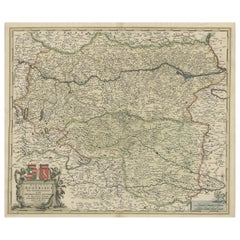
Antique Map of Austria by F. de Wit, 1690
$881.28
£651.46
€736
CA$1,198.61
A$1,343.03
CHF 699.10
MX$16,429.94
NOK 8,873.78
SEK 8,381.18
DKK 5,604.28
Shipping
Retrieving quote...The 1stDibs Promise:
Authenticity Guarantee,
Money-Back Guarantee,
24-Hour Cancellation
About the Item
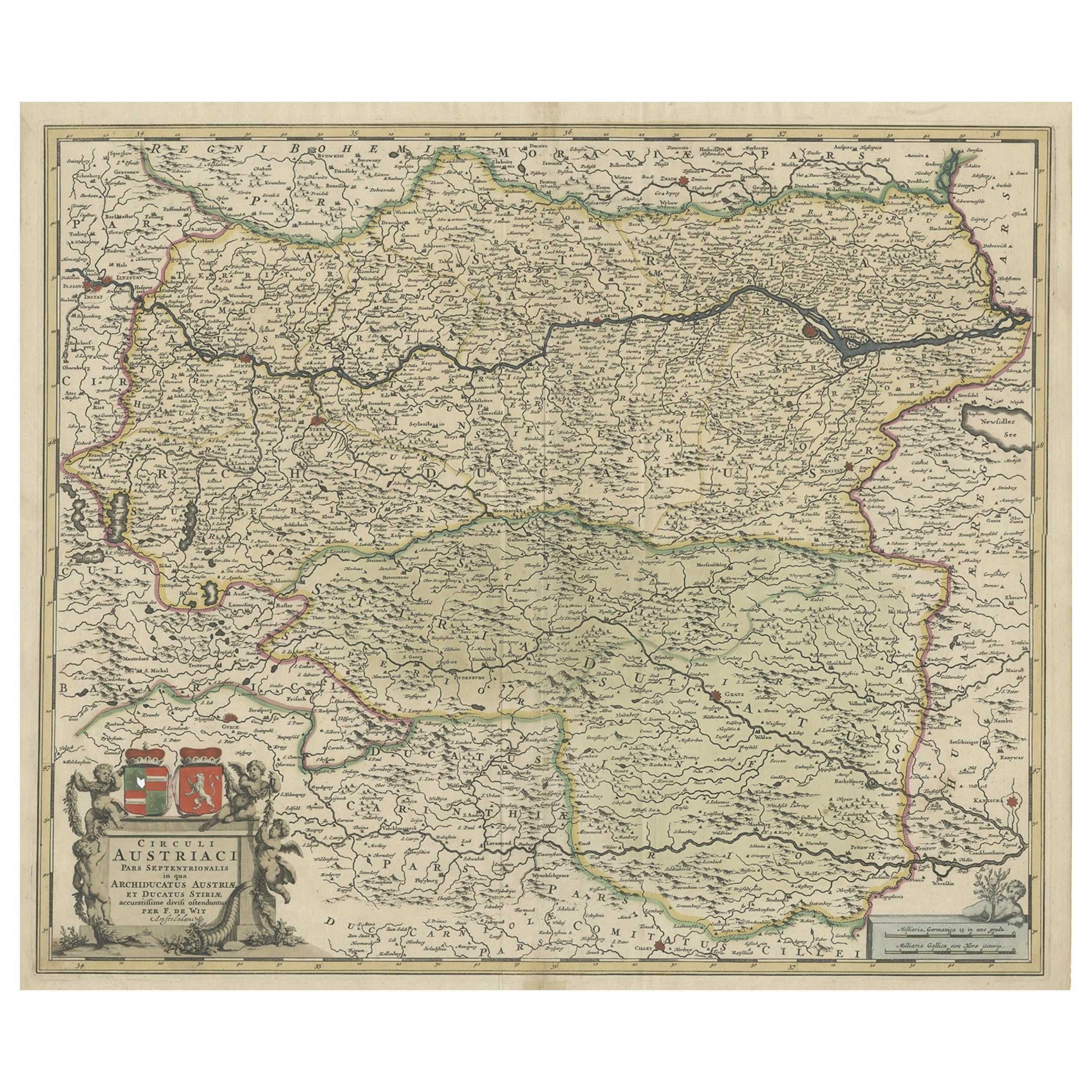
Antique map titled 'Circuli Austriaci pars Septentrionalis in qua Archiducatus'. Decorative and detailed map of Austria by F. de Wit.
- Dimensions:Height: 20.79 in (52.8 cm)Width: 25.04 in (63.6 cm)Depth: 0.02 in (0.5 mm)
- Materials and Techniques:
- Period:Late 17th Century
- Date of Manufacture:1690
- Condition:Please study image carefully.
- Seller Location:Langweer, NL
- Reference Number:Seller: BG-091671stDibs: LU305439941541
About the Seller
5.0
Recognized Seller
These prestigious sellers are industry leaders and represent the highest echelon for item quality and design.
Platinum Seller
Premium sellers with a 4.7+ rating and 24-hour response times
Established in 2009
1stDibs seller since 2017
2,494 sales on 1stDibs
Typical response time: 1 hour
- ShippingRetrieving quote...Shipping from: Langweer, Netherlands
- Return Policy
Authenticity Guarantee
In the unlikely event there’s an issue with an item’s authenticity, contact us within 1 year for a full refund. DetailsMoney-Back Guarantee
If your item is not as described, is damaged in transit, or does not arrive, contact us within 7 days for a full refund. Details24-Hour Cancellation
You have a 24-hour grace period in which to reconsider your purchase, with no questions asked.Vetted Professional Sellers
Our world-class sellers must adhere to strict standards for service and quality, maintaining the integrity of our listings.Price-Match Guarantee
If you find that a seller listed the same item for a lower price elsewhere, we’ll match it.Trusted Global Delivery
Our best-in-class carrier network provides specialized shipping options worldwide, including custom delivery.More From This Seller
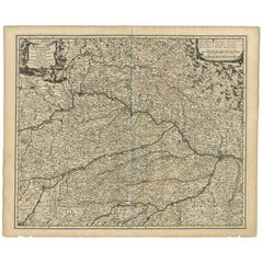
View AllAntique Map of Southern Germany by F. de Wit, circa 1680
Located in Langweer, NL
This antique map depicts a portion of southern Germany that included the historic regions of Bavaria, the Palatinate, Prussia-Brandenburg, the Rhineland and Saxony. Regensberg, Freis...
Category
Antique Late 17th Century Maps
Materials
Paper

$667 Sale Price
20% Off
Antique Map of Austria by N. Visscher, circa 1690
Located in Langweer, NL
Antique map titled 'Austriae Archiducatus pars superior in omnes ejusdem'. Spectacular large map of Upper and Lower Austria between Passau and Wien with figurative cartouche and armo...
Category
Antique Late 17th Century Maps
Materials
Paper

$893 Sale Price
20% Off
Antique Map of the Saxony Region 'Germany' by F. de Wit, circa 1680
Located in Langweer, NL
A detailed map of a region in eastern Germany. Cartouches depict coat of arms surrounded by cherubs. The map is fully engraved with towns, political boundaries, rivers and forests. P...
Category
Antique Late 17th Century Dutch Maps
Materials
Paper

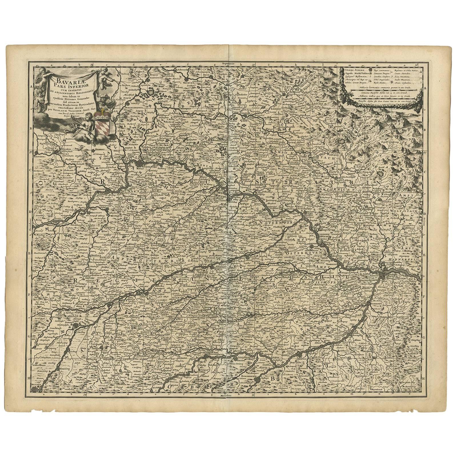
Antique Map of Bavaria ‘Bayern, Germany’ by N. Visscher, circa 1700
Located in Langweer, NL
Antique map titled 'Bavariae pars inferior cum insertis et adjacentibus regionibus (..)'. Published circa 1700 in N. Visscher's World Atlas.
The map "Bavariae pars inferior cum inse...
Category
Antique Early 18th Century Dutch Maps
Materials
Paper
$586 Sale Price
20% Off
Antique Map of Austria, Centered Around the Danube from Passau to Vienna, C.1690
Located in Langweer, NL
Antique map of Austria titled 'Circuli Austriaci pars septentrionalis in quia archiducatus Austriae et Ducatus Stiriae accuratissime divisi ostenduntur per F. de Wit'.
Detailed m...
Category
Antique 1690s Maps
Materials
Paper
$1,297 Sale Price
20% Off
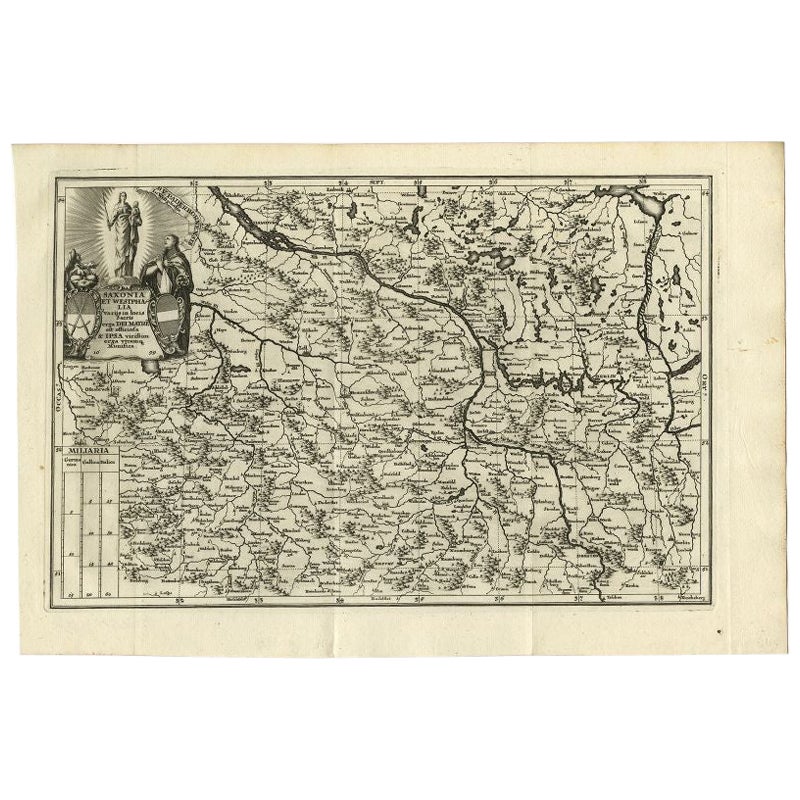
Antique Map of Saxony and Westphalia by Scherer, 1699
Located in Langweer, NL
Antique map titled 'Saxonia et Westphalia varijs in locis sacris erga dei matre est officiosa & ipsa vicissim erga utramq. Munifica.' Detailed uncommon map of Saxony and Westphalia i...
Category
Antique 17th Century Maps
Materials
Paper
$216 Sale Price
20% Off
You May Also Like
17th Century Hand-Colored Map of a Region in West Germany by Janssonius
By Johannes Janssonius
Located in Alamo, CA
This attractive highly detailed 17th century original hand-colored map is entitled "Archiepiscopatus Maghdeburgensis et Anhaltinus Ducatus cum terris adjacentibus". It was published ...
Category
Antique Mid-17th Century Dutch Maps
Materials
Paper

Original Antique Map of Switzerland, Engraved By Barlow, Dated 1807
Located in St Annes, Lancashire
Great map of Switzerland
Copper-plate engraving by Barlow
Published by Brightly & Kinnersly, Bungay, Suffolk.
Dated 1807
Unframed.
Category
Antique Early 1800s English Maps
Materials
Paper

17th Century Nicolas Visscher Map of Southeastern Europe
Located in Hamilton, Ontario
A beautiful, highly detailed map of southeastern Europe by Nicolas Visscher. Includes regions of Northern Italy (showing the cities Bologna, Padua, and Venice), Bohemia, Austria (sho...
Category
Antique 17th Century Dutch Maps
Materials
Paper

$1,350 Sale Price
38% Off
Hand Colored 18th Century Homann Map of Austria Including Vienna and the Danube
By Johann Baptist Homann
Located in Alamo, CA
"Archiducatus Austriae inferioris" is a hand colored map of Austria created by Johann Baptist Homann (1663-1724) and published in Nuremberg, Germany in 1728 shortly after his death. ...
Category
Antique Early 18th Century German Maps
Materials
Paper

17th Century Hand Colored Map of the Liege Region in Belgium by Visscher
By Nicolaes Visscher II
Located in Alamo, CA
An original 17th century map entitled "Leodiensis Episcopatus in omnes Subjacentes Provincias distincté divisusVisscher, Leodiensis Episcopatus" by Nicolaes Visscher II, published in Amsterdam in 1688. The map is centered on Liege, Belgium, includes the area between Antwerp, Turnhout, Roermond, Cologne, Trier and Dinant.
This attractive map is presented in a cream-colored mat measuring 30" wide x 27.5" high. There is a central fold, as issued. There is minimal spotting in the upper margin and a tiny spot in the right lower margin, which are under the mat. The map is otherwise in excellent condition.
The Visscher family were one of the great cartographic families of the 17th century. Begun by Claes Jansz Visscher...
Category
Antique Late 17th Century Dutch Maps
Materials
Paper

Prussia, Poland, N. Germany, Etc: A Hand-colored 17th Century Map by Janssonius
By Johannes Janssonius
Located in Alamo, CA
This is an attractive hand-colored copperplate engraved 17th century map of Prussia entitled "Prussia Accurate Descripta a Gasparo Henneberg Erlichensi", published in Amsterdam by Joannes Janssonius in 1664. This very detailed map from the golden age of Dutch cartography includes present-day Poland, Latvia, Lithuania, Estonia and portions of Germany. This highly detailed map is embellished by three ornate pink, red, mint green and gold...
Category
Antique Mid-17th Century Dutch Maps
Materials
Paper

More Ways To Browse
Carved Cabriole Table
Dark Antique Table
Antique Wall Table
1960 Chair Wood Danish
Unusual Dining Table
Antique Dutch Plates
Mdf Table
Showcase Coffee Table
Space Age Orange
Vallauris France
Silver Ladle
Scalloped Table
Brazil Wood Chairs
Vintage Art Deco Side Tables
Window Display
1960s Cushion Chair
Green Brown Oriental Rug
Authentic Models