Items Similar to Antique Map of Baja California and parts of Alta California, Arizona and Sonora


Want more images or videos?
Request additional images or videos from the seller
1 of 6
Antique Map of Baja California and parts of Alta California, Arizona and Sonora
On Hold
$935.49
$1,169.3620% Off
On Hold
£702.88
£878.6020% Off
On Hold
€792
€99020% Off
On Hold
CA$1,288.18
CA$1,610.2220% Off
On Hold
A$1,441.71
A$1,802.1420% Off
On Hold
CHF 754.68
CHF 943.3520% Off
On Hold
MX$17,514.16
MX$21,892.7020% Off
On Hold
NOK 9,582.56
NOK 11,978.2020% Off
On Hold
SEK 9,042.78
SEK 11,303.4820% Off
On Hold
DKK 6,027.91
DKK 7,534.8820% Off
About the Item
Antique map titled 'Kaart van het Westelyk Gedeelte van Nieuw Mexico en van California'. Beautiful map of Baja California and parts of Alta California, Arizona and Sonora. Isaac Tirion's map of Baja California is one of the best mid-18th century maps of Southern California, Baja California and parts of Arizona and Sonora. Issued 4 years prior to the establishment of the first Spanish Mission in Alta California (San Diego) and based in large part on the work of Ferdinando Consag, the map provides one of the earliest large format attempts to map this still mysterious and unsettled region north of Baja California, along with the then Jesuit regions of Baja California and Sonora. The map is one of the last to focus on the region before the expulsion of the Jesuits in 1768.
Published by I. Tirion, 1765.
- Dimensions:Height: 14.1 in (35.8 cm)Width: 14.97 in (38 cm)Depth: 0.02 in (0.5 mm)
- Materials and Techniques:
- Period:
- Date of Manufacture:1765
- Condition:Replacements made: Right margin partly extended. General age-related toning. Original folding lines. Right margin partly extended. Minor wear and soiling, blank verso. Please study image carefully.
- Seller Location:Langweer, NL
- Reference Number:Seller: BG-135571stDibs: LU3054336259822
About the Seller
5.0
Recognized Seller
These prestigious sellers are industry leaders and represent the highest echelon for item quality and design.
Platinum Seller
Premium sellers with a 4.7+ rating and 24-hour response times
Established in 2009
1stDibs seller since 2017
2,534 sales on 1stDibs
Typical response time: <1 hour
- ShippingRetrieving quote...Shipping from: Langweer, Netherlands
- Return Policy
Authenticity Guarantee
In the unlikely event there’s an issue with an item’s authenticity, contact us within 1 year for a full refund. DetailsMoney-Back Guarantee
If your item is not as described, is damaged in transit, or does not arrive, contact us within 7 days for a full refund. Details24-Hour Cancellation
You have a 24-hour grace period in which to reconsider your purchase, with no questions asked.Vetted Professional Sellers
Our world-class sellers must adhere to strict standards for service and quality, maintaining the integrity of our listings.Price-Match Guarantee
If you find that a seller listed the same item for a lower price elsewhere, we’ll match it.Trusted Global Delivery
Our best-in-class carrier network provides specialized shipping options worldwide, including custom delivery.More From This Seller
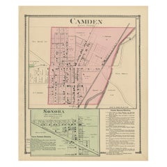
View AllAntique Map of Camden and Sonora, 1871
Located in Langweer, NL
Antique map titled 'Camden, Sonora'. Original antique map of villages and communities of Ohio. This map originates from 'Atlas of Preble County Ohio' by C.O. Titus. Published 1871.
Category
Antique Late 19th Century Maps
Materials
Paper
$236 Sale Price
20% Off
Antique Map of California, Utah, Nevada, Colorado, New Mexico & Arizona '1872'
Located in Langweer, NL
Antique map titled 'Johnson's California (..)'. Original map of California, Utah, Nevada, Colorado, New Mexico and Arizona. This map originates from ...
Category
Antique Late 19th Century Maps
Materials
Paper

$236 Sale Price
20% Off
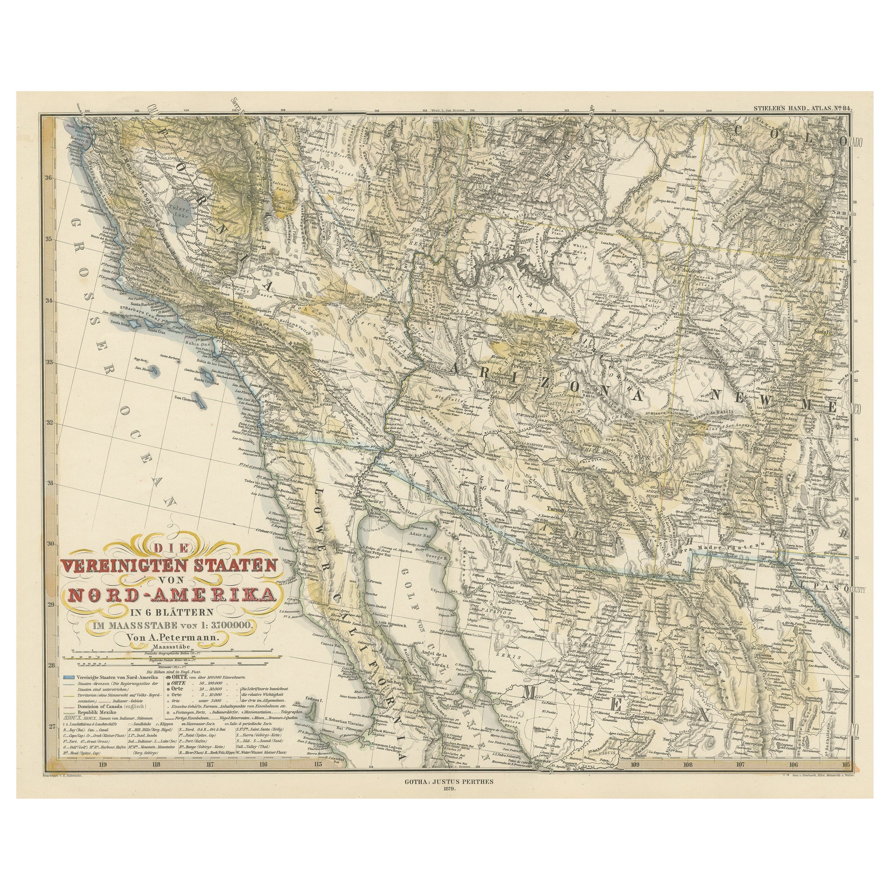
Antique Map of Part of the United States Including Lower California & Arizona
Located in Langweer, NL
Antique map of part of the United States of America including Lower California, Arizona and part of Mexico. This map was part of a set of six individual sheets with maps of the Unite...
Category
Antique Late 19th Century Maps
Materials
Paper

$415 Sale Price
20% Off
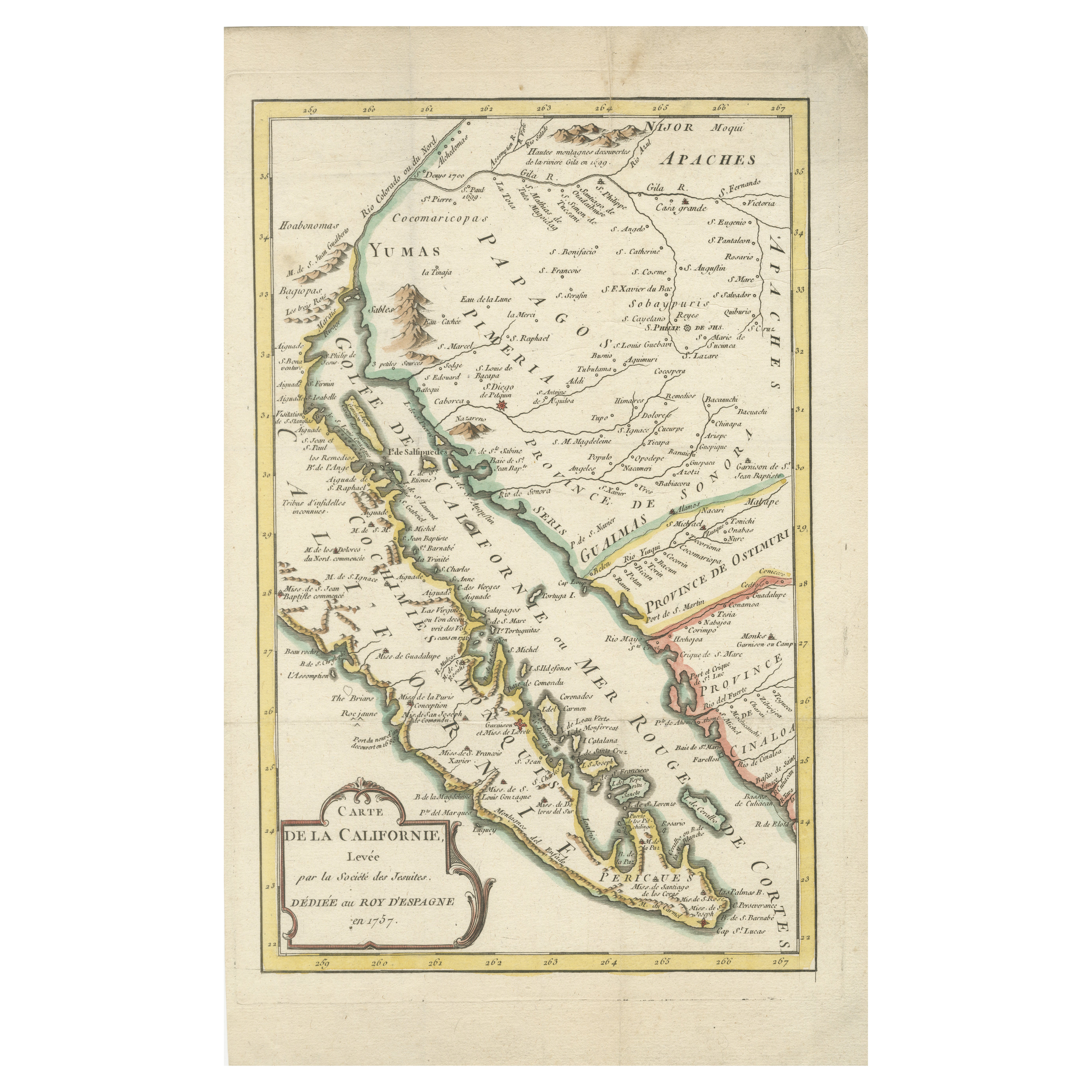
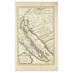
Rare 1757 Jesuit Map of California and Baja, Dedicated to the King of Spain
Located in Langweer, NL
Title: Rare 1757 Jesuit Map of California and Baja, Dedicated to the King of Spain
This rare and detailed map, titled *Carte de la Californie Levee par la Société des Jésuites*, wa...
Category
Antique 1750s Maps
Materials
Paper
Antique Map of Greece, Albania, Macedonia and Parts of Turkey and Cyprus, c.1745
Located in Langweer, NL
Antique map titled 'Accurata Totius Archipelagi Et Graeciae Universae Tabula'.
Detailed map of Greece. Includes Albania, Macedonia and parts of Turkey and Cyprus. With compass rose...
Category
Antique 18th Century Maps
Materials
Paper

$803 Sale Price
20% Off
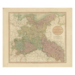
Antique Map of the Eastern Part of Germany, with Parts of Poland and Slovakia
Located in Langweer, NL
Antique map titled 'A New Map of the Circle of Upper Saxony: with the Duchy of Silesi and Lusatia, from the latest authorities'. Clear and accurate map of what is now the eastern par...
Category
Antique Early 19th Century Maps
Materials
Paper
$415 Sale Price
20% Off
You May Also Like
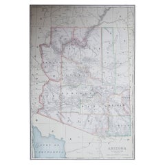
Large Original Antique Map of Arizona, Usa, C.1900
Located in St Annes, Lancashire
Fabulous map of Arizona
Original color.
Engraved and printed by the George F. Cram Company, Indianapolis.
Published, C.1900.
Unframed.
Free shipping.
Category
Antique 1890s American Maps
Materials
Paper
Antique Map of California as an Island "The 5 Californias" by Robert de Vaugondy
Located in San Diego, CA
A very nice and rare antique map entitled "Carte de la Californie Suivant" (The 5 Californias), by Didier Robert de Vaugondy of Paris, circa 1772. The map itself measures 15.5" x 13...
Category
Antique Mid-19th Century American Maps
Materials
Paper

Large Original Antique Map of California, USA, circa 1900
Located in St Annes, Lancashire
Fabulous map of California
Original color
Engraved and printed by the George F. Cram Company, Indianapolis.
Published, circa 1900
Unframed
Free shipping.
Category
Antique 1890s American Maps
Materials
Paper

Original Antique Map of the American State of Arizona & New Mexico, 1903
Located in St Annes, Lancashire
Antique map of Arizona and New Mexico
Published By A & C Black. 1903
Original colour
Good condition
Unframed.
Free shipping
Category
Antique Early 1900s English Maps
Materials
Paper

1847 Antique Map of Mexico, Texas and California by Samuel Augustus Mitchell
By Samuel Augustus Mitchell 1
Located in Colorado Springs, CO
Presented is the second edition of Samuel Augustus Mitchell's Map of Mexico, Including Yucatan & Upper California, an important map showing the progress of the Mexican-American War. ...
Category
Antique 1840s American Maps
Materials
Paper

Original Antique Map of the American State of California ( Southern Part ), 1903
Located in St Annes, Lancashire
Antique map of California ( Southern part )
Published By A & C Black. 1903
Original colour
Good condition
Unframed.
Free shipping
Category
Antique Early 1900s English Maps
Materials
Paper

More Ways To Browse
Antique Rug Wool Navy Blue Red
Antique Silver Platter
Boat Blueprint
Cream Plates
Vintage Art Deco Rugs
Vintage Serving Forks
Brewery Signs
Herati Rug
Gold Leaf Furniture Black
Italian Wood Console Tables
Maison Jansen Argentina
Antique Oushak
Mid Century Danish Directors Chairs
Moller 70
Wood Relief Art
Argentina Travel Poster
Century Furniture Faux Bamboo
Early American Chairs