Items Similar to Antique Map of Canada, The Province of Ontario and Part of Quebec, 1882


Want more images or videos?
Request additional images or videos from the seller
1 of 6
Antique Map of Canada, The Province of Ontario and Part of Quebec, 1882
$239.48
$299.3520% Off
£177.03
£221.2820% Off
€200
€25020% Off
CA$325.71
CA$407.1420% Off
A$364.95
A$456.1920% Off
CHF 189.97
CHF 237.4720% Off
MX$4,464.66
MX$5,580.8220% Off
NOK 2,411.35
NOK 3,014.1920% Off
SEK 2,277.49
SEK 2,846.8720% Off
DKK 1,522.90
DKK 1,903.6320% Off
Shipping
Retrieving quote...The 1stDibs Promise:
Authenticity Guarantee,
Money-Back Guarantee,
24-Hour Cancellation
About the Item
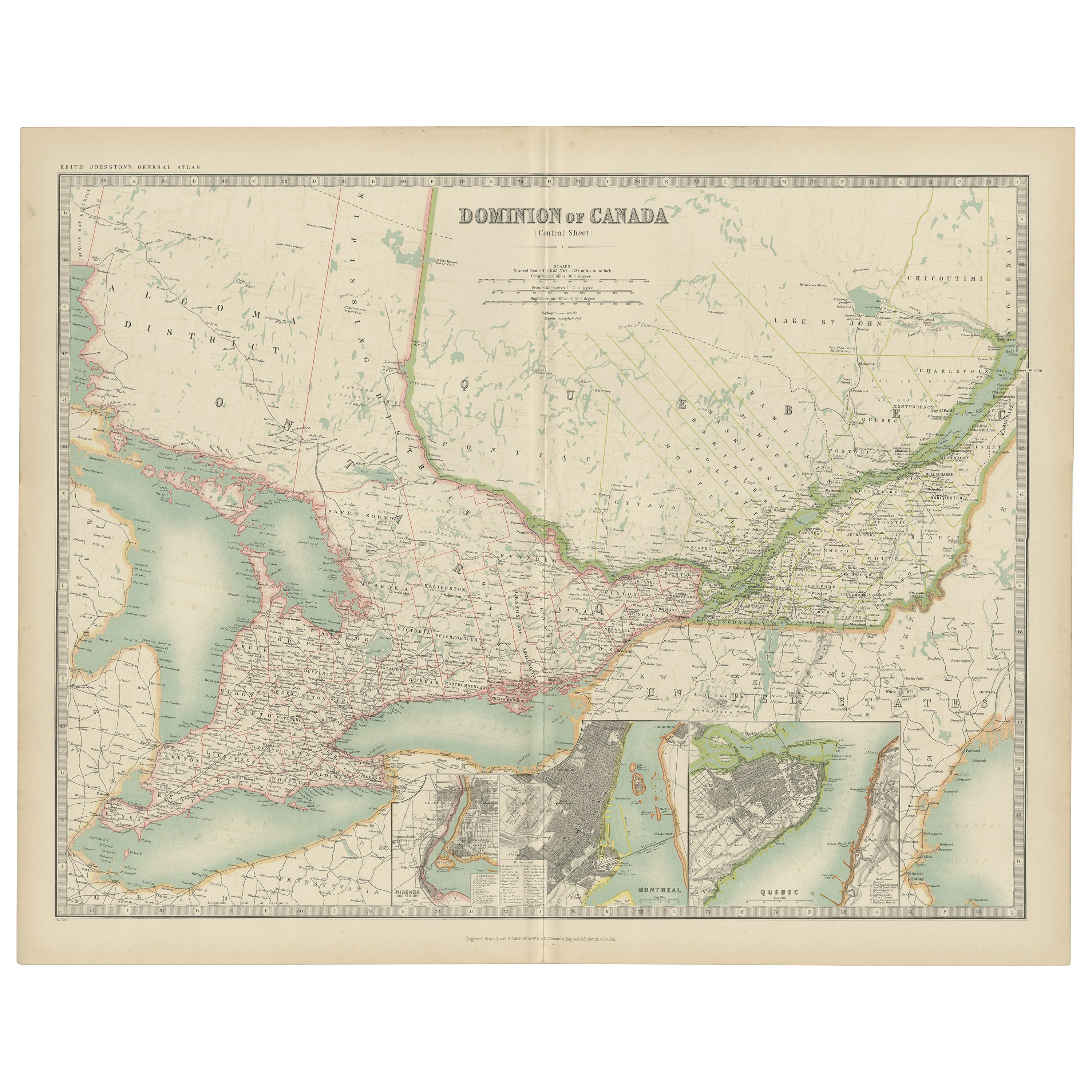
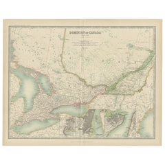
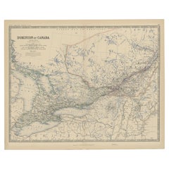
This is a historical map from the 1882 Blackie Atlas, this time detailing "The Province of Ontario, and Part of Quebec" in Canada. The map presents a detailed illustration of Ontario, highlighting its dense network of rivers, lakes, and settlements, as well as the intricate railway systems that were vital for communication and transportation during that period.
The map features Lake Ontario prominently and includes the bordering areas of Quebec. This suggests an emphasis on the interconnectedness of these regions, both geographically and economically, during the time. The inclusion of the St. Lawrence River, a key navigational route, reflects its importance for trade and movement between the Great Lakes and the Atlantic Ocean.
An inset in the top left corner provides a more detailed street map of the city of Montreal, indicating the city's importance as a hub during the late 19th century. The detail in this inset suggests that Montreal was a significant urban center worth separate consideration from the larger provincial map.
The map's legend, likely located on the left side, probably lists the towns and various geographical features, such as counties, in Ontario. The hachures indicate the relief and show the varied terrain of Ontario and part of Quebec. As with other maps from the era, the scale and longitude and latitude markers are indicative of the map's utility for navigation and education. The precision of the mapmaking suggests a high level of cartographic skill and a commitment to detail.
- Dimensions:Height: 14.97 in (38 cm)Width: 22.45 in (57 cm)Depth: 0 in (0.02 mm)
- Materials and Techniques:
- Period:
- Date of Manufacture:1882
- Condition:Good condition, folding line in the middle. The outer borders are slightly discolored due to age, but not the image. Study the image carefully.
- Seller Location:Langweer, NL
- Reference Number:Seller: BG-13601-2-601stDibs: LU3054338776202
About the Seller
5.0
Recognized Seller
These prestigious sellers are industry leaders and represent the highest echelon for item quality and design.
Platinum Seller
Premium sellers with a 4.7+ rating and 24-hour response times
Established in 2009
1stDibs seller since 2017
2,494 sales on 1stDibs
Typical response time: 1 hour
- ShippingRetrieving quote...Shipping from: Langweer, Netherlands
- Return Policy
Authenticity Guarantee
In the unlikely event there’s an issue with an item’s authenticity, contact us within 1 year for a full refund. DetailsMoney-Back Guarantee
If your item is not as described, is damaged in transit, or does not arrive, contact us within 7 days for a full refund. Details24-Hour Cancellation
You have a 24-hour grace period in which to reconsider your purchase, with no questions asked.Vetted Professional Sellers
Our world-class sellers must adhere to strict standards for service and quality, maintaining the integrity of our listings.Price-Match Guarantee
If you find that a seller listed the same item for a lower price elsewhere, we’ll match it.Trusted Global Delivery
Our best-in-class carrier network provides specialized shipping options worldwide, including custom delivery.More From This Seller
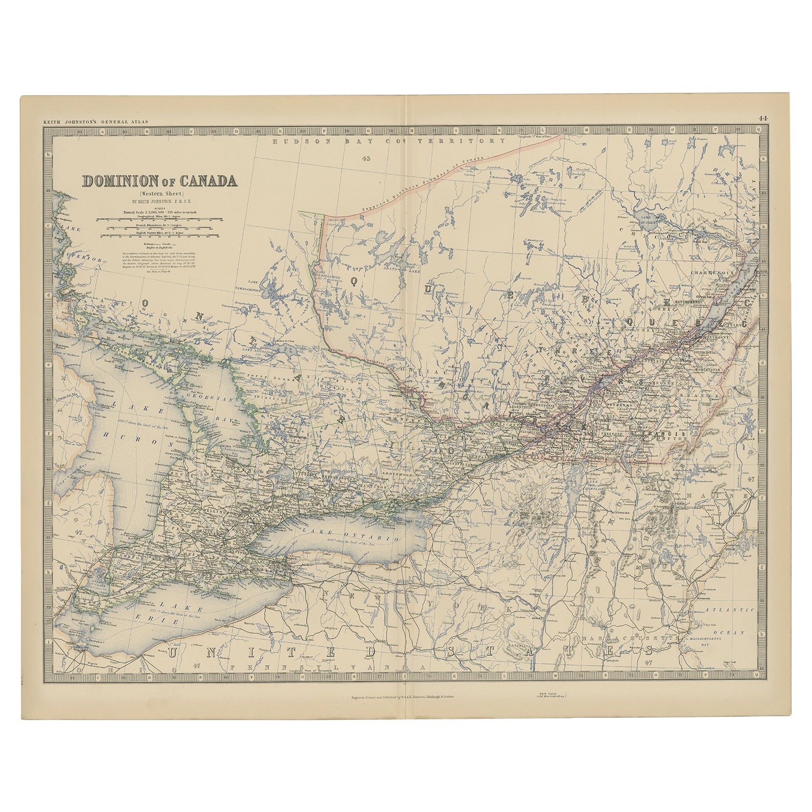
View AllAntique Map of Canada by Johnston '1909'
Located in Langweer, NL
Antique map titled 'Dominion of Canada'. Original antique map of Canada. With inset maps of Niagara, Montreal, Quebec. This map originates from t...
Category
Early 20th Century Maps
Materials
Paper
$239 Sale Price
20% Off
Decorative Antique Map of Eastern Canada, Published in 1882
Located in Langweer, NL
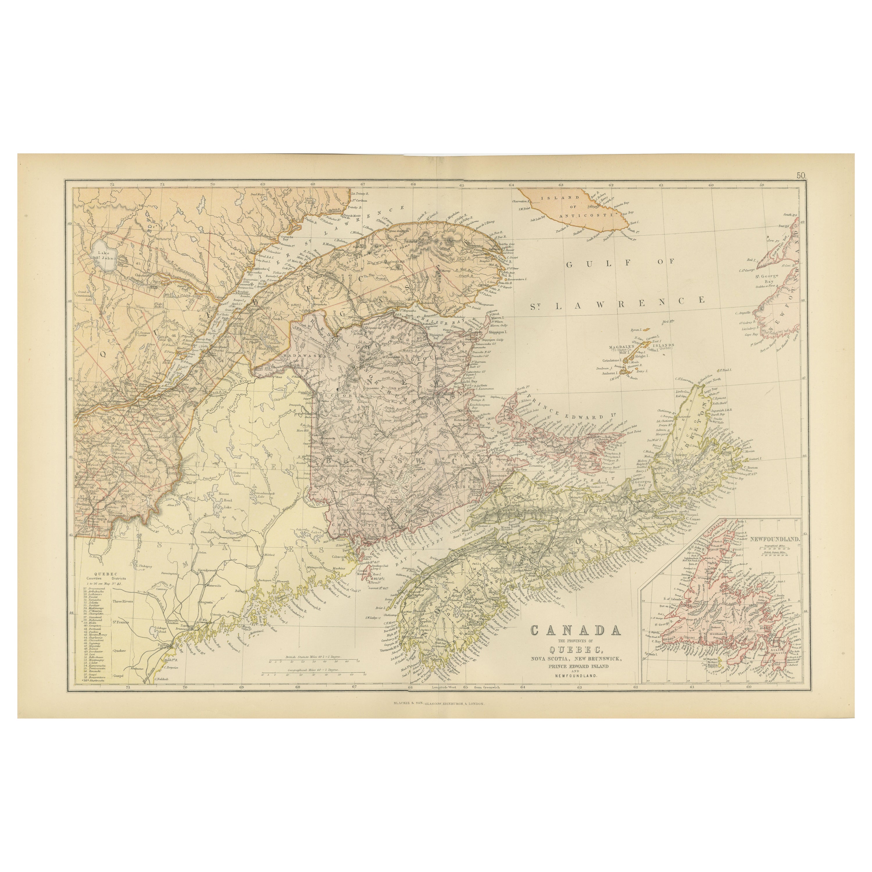
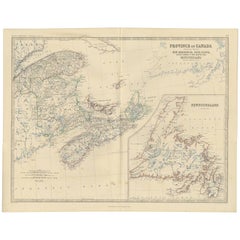
This is a historical map from the 1882 Blackie Atlas, focused on eastern Canada and the maritime provinces. The map is titled "Canada. No. 2. Provinces of Nova Scotia, New Brunswick,...
Category
Antique 1880s Maps
Materials
Paper

Old Original Antique Map of Western Canada, 1882
Located in Langweer, NL
Antique map titled 'Dominion of Canada'.
Old map of Western Canada. This map originates from 'The Royal Atlas of Modern Geography, Exhibiting, in a ...
Category
Antique 1880s Maps
Materials
Paper
$268 Sale Price
20% Off
Antique Map of West Canada by Tallis 'c.1850'
Located in Langweer, NL
Antique map titled 'West Canada'. Original antique map of West Canada, with decorative vignettes titled Kingston and Falls of Niagara. This map originates from 'The History and Topog...
Category
Antique Mid-19th Century Maps
Materials
Paper

$287 Sale Price
20% Off
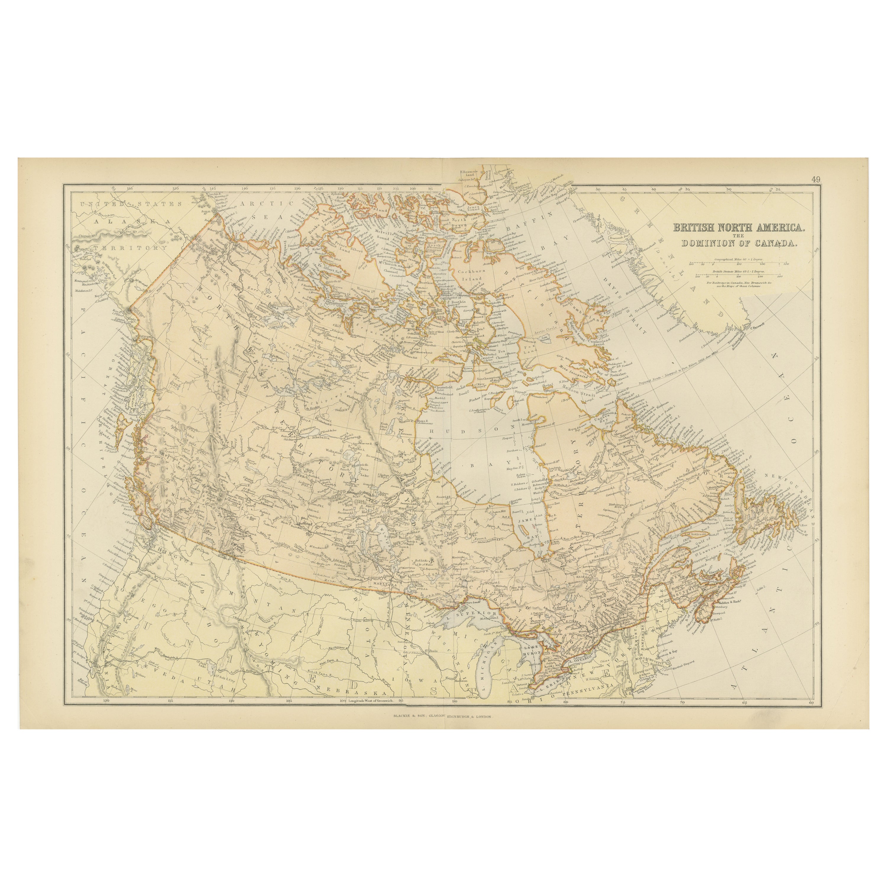
Antique Map of British North America, The Dominion of of Canada, 1882
Located in Langweer, NL
This map is titled "British North America, Dominion of Canada," from the 1882 Blackie Atlas. It features the geographical area that comprises modern-day Canada, with notable features...
Category
Antique 1880s Maps
Materials
Paper

$239 Sale Price
20% Off
Free Shipping
Antique Map of the Province of Canada 'East' by A.K. Johnston, 1865
Located in Langweer, NL
Antique map titled 'Province of Canada (Eastern Sheet)'. Depicting New Brunswick, Newfoundland, Cape Breton Island, Prince Edward Island, Nova Scotia and m...
Category
Antique Mid-19th Century Maps
Materials
Paper
$249 Sale Price
20% Off
You May Also Like
Quebec. Canada. Century Atlas antique vintage map
Located in Melbourne, Victoria
'The Century Atlas. Quebec'
Original antique map, 1903.
Inset maps 'Sketch Map of Quebec', Quebec and Vicinity; and 'Montreal and Vicinity'.
Central fo...
Category
Early 20th Century Victorian More Prints
Materials
Lithograph

Original Antique Map of New Brunswick and Nova Scotia, 1889
Located in St Annes, Lancashire
Great map of New Brunswick and Nova Scotia
Drawn and Engraved by W. & A.K. Johnston
Published By A & C Black, Edinburgh.
Original colour
Unfr...
Category
Antique 1880s Scottish Victorian Maps
Materials
Paper

Original Antique Map of the American State of New York ( Western Part ) 1903
Located in St Annes, Lancashire
Antique map of New York ( Western Part )
Published By A & C Black. 1903
Original colour
Good condition
Unframed.
Free shipping
Category
Antique Early 1900s English Maps
Materials
Paper

Large Original Antique Map of New York State ( Northern ), USA, C.1900
Located in St Annes, Lancashire
Fabulous map of Northern New York
Original color.
Engraved and printed by the George F. Cram Company, Indianapolis.
Published, C.1900.
Unframed.
Repairs to minor edge tears
Fr...
Category
Antique 1890s American Maps
Materials
Paper
Original Antique Map of the American State of Michigan ( Northern Part ), 1903
Located in St Annes, Lancashire
Antique map of Michigan ( Northern part )
Published By A & C Black. 1903
Original colour
Good condition
Unframed.
Free shipping
Category
Antique Early 1900s English Maps
Materials
Paper

Canada and Newfoundland. Century Atlas antique vintage map
Located in Melbourne, Victoria
'The Century Atlas. Dominion of Canada and Newfoundland.'
Original antique map, 1903.
Central fold as issued. Map name and number printed on the reverse corners.
Sheet 29.5cm by 40...
Category
Early 20th Century Victorian More Prints
Materials
Lithograph

More Ways To Browse
Canadian Antique Furniture
Quebec Furniture
Used Furniture Ontario
Railway Map
Huber Canada
20th Century Spanish Table
Antonio Bellini
Antique Oushak Carpets
Blue Coffee Tables
German Bauhaus Posters
1945 Chair Juhl
Antique Three Leg Table
Folke Arstrom
Silver Over Copper
Vintage Barware Glasses
Antique Etched Glass
Antique French Shell
Coffee Table Black Italian Modern