Items Similar to Antique Map of China, Japan & Korea – Eastern Asia by Andriveau-Goujon, 1860


Want more images or videos?
Request additional images or videos from the seller
1 of 10
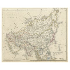
Antique Map of China, Japan & Korea – Eastern Asia by Andriveau-Goujon, 1860
$463.83
£345.14
€390
CA$637.28
A$711.26
CHF 374.20
MX$8,639.81
NOK 4,743.89
SEK 4,439.69
DKK 2,968.92
About the Item
Antique Map of China, Japan & Korea – Eastern Asia by Andriveau-Goujon, 1860
This beautifully hand-colored antique map, titled “Carte de la Chine, de la Corée et du Japon,” was published in Paris in 1860 by E. Andriveau-Goujon as plate number 36 in his Atlas Universel. It offers a highly detailed view of Eastern Asia at a time of dramatic change, with sharp delineations of the Qing Empire, the expanding Russian Empire, and newly opening trade routes to Japan and Korea.
China is prominently featured at the center, divided into its various imperial provinces. Major cities such as Beijing (Pekin), Nanking, Canton (Guangzhou), and Shanghai are clearly marked, alongside key geographical features like the Yellow River, Yangtze River, and the Great Wall. The western parts of the empire, including Xinjiang and Tibet, are also well represented.
To the east, the Korean Peninsula is shown as a vassal kingdom under Chinese suzerainty. Japan, still under the Tokugawa Shogunate at the time, is depicted in its entirety, with the main islands of Honshu, Kyushu, Shikoku, and Hokkaido carefully labeled and outlined. This was just years after Commodore Perry’s expedition opened Japan to foreign trade in 1854, marking this map as a historical document of geopolitical transition.
The Russian Empire stretches across the northern part of the map, with its southern borders pressing into Manchuria and the Far East. The map also shows parts of Indochina, including present-day Vietnam, Laos, Cambodia, and Thailand.
This map is a fascinating record of mid-19th century Asian political geography and European perceptions of the East. It is particularly significant for collectors interested in imperial Chinese cartography, early Japanese maps, or the colonial view of Asia during the 1800s.
Condition: Excellent impression with original centerfold. Slight age toning to outer margins, small handling marks, no tears. Strong plate imprint and original hand coloring preserved.
Framing tips: Frame in a minimalist black or deep cherry wood frame with a neutral cream or pale green mat. This enhances the color palette and highlights the fine engraved detail.
Technique: Engraving with original hand coloring
Maker: E. Andriveau-Goujon, Paris, 1860
- Dimensions:Height: 20.91 in (53.1 cm)Width: 27.64 in (70.2 cm)Depth: 0.01 in (0.2 mm)
- Materials and Techniques:Paper,Engraved
- Place of Origin:
- Period:
- Date of Manufacture:1860
- Condition:Condition: Excellent impression with original centerfold. Slight age toning to outer margins, small handling marks, no tears. Strong plate imprint and original hand coloring preserved.
- Seller Location:Langweer, NL
- Reference Number:Seller: BG-14099-151stDibs: LU3054346186172
About the Seller
5.0
Recognized Seller
These prestigious sellers are industry leaders and represent the highest echelon for item quality and design.
Platinum Seller
Premium sellers with a 4.7+ rating and 24-hour response times
Established in 2009
1stDibs seller since 2017
2,567 sales on 1stDibs
Typical response time: <1 hour
- ShippingRetrieving quote...Shipping from: Langweer, Netherlands
- Return Policy
Authenticity Guarantee
In the unlikely event there’s an issue with an item’s authenticity, contact us within 1 year for a full refund. DetailsMoney-Back Guarantee
If your item is not as described, is damaged in transit, or does not arrive, contact us within 7 days for a full refund. Details24-Hour Cancellation
You have a 24-hour grace period in which to reconsider your purchase, with no questions asked.Vetted Professional Sellers
Our world-class sellers must adhere to strict standards for service and quality, maintaining the integrity of our listings.Price-Match Guarantee
If you find that a seller listed the same item for a lower price elsewhere, we’ll match it.Trusted Global Delivery
Our best-in-class carrier network provides specialized shipping options worldwide, including custom delivery.More From This Seller
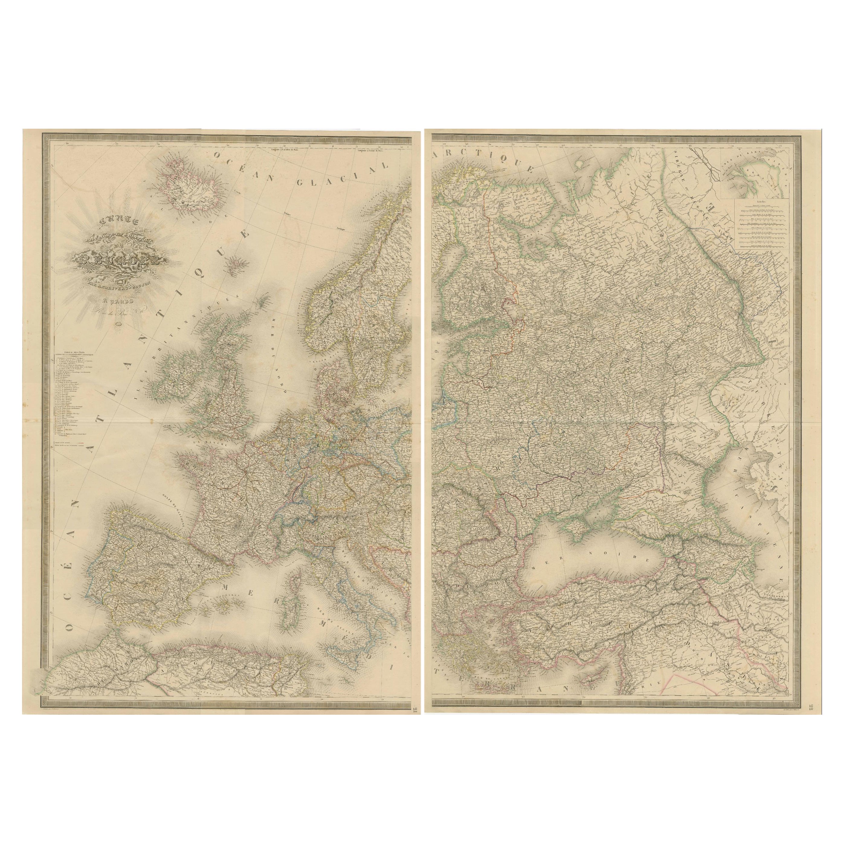
View AllMajestic Map of Europe by Andriveau-Goujon - Complete Continental View - ca.1849
Located in Langweer, NL
Majestic 19th Century Map of Europe by Andriveau-Goujon - Complete Continental View - Circa 1849
This magnificent and intricately detailed map of Europe, titled "Carte Physique et...
Category
Antique 1840s Maps
Materials
Paper
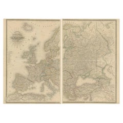
$732 Sale Price / set
20% Off
Antique Map of Asia by Young, c.1860
Located in Langweer, NL
Antique map titled 'Asia'. Steel engraved map of Asia by Francis Young.
Artists and Engravers: Engraved by Lewis Becker. Published by S.O. Beeton.
We sell original antique maps to...
Category
Antique 19th Century Maps
Materials
Paper

$128 Sale Price
20% Off
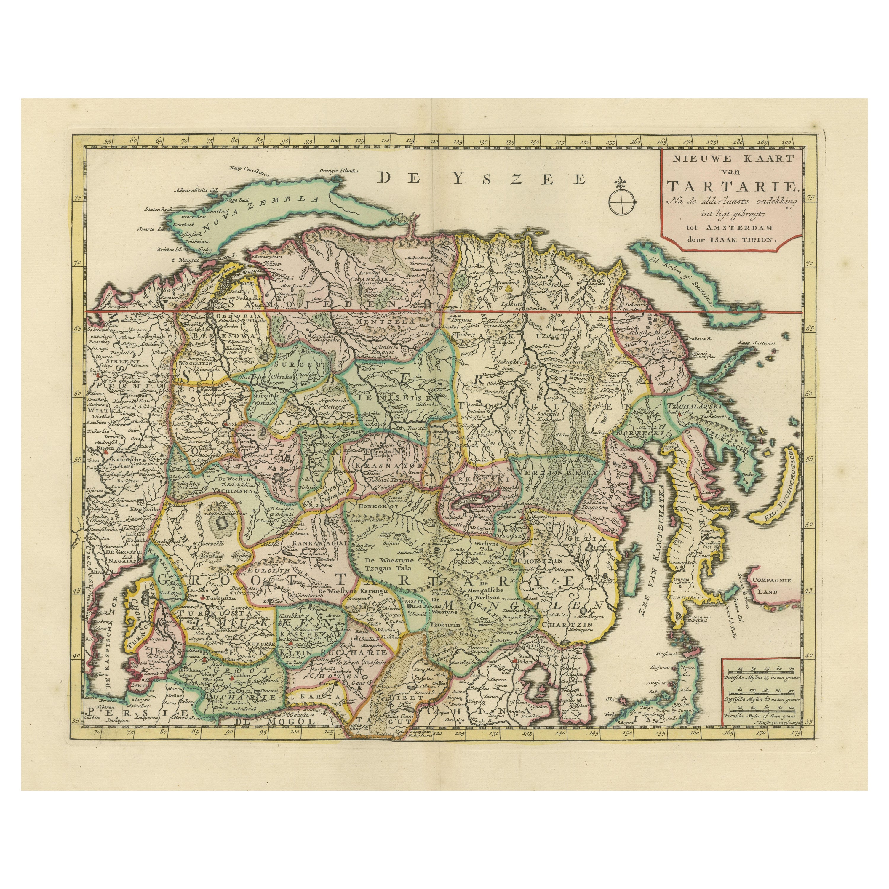
Antique Map of Northern Asia, with Russia, Korea and Northern Japan
Located in Langweer, NL
Antique map titled 'Nieuwe Kaart van Tartarie'. Map op Siberia and Chinese tartary. In the north Novaya Zemlya curls back to attach itself to the mainland by a narrow isthmus. In the...
Category
Antique Mid-18th Century Maps
Materials
Paper
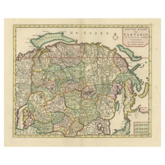
$765 Sale Price
34% Off
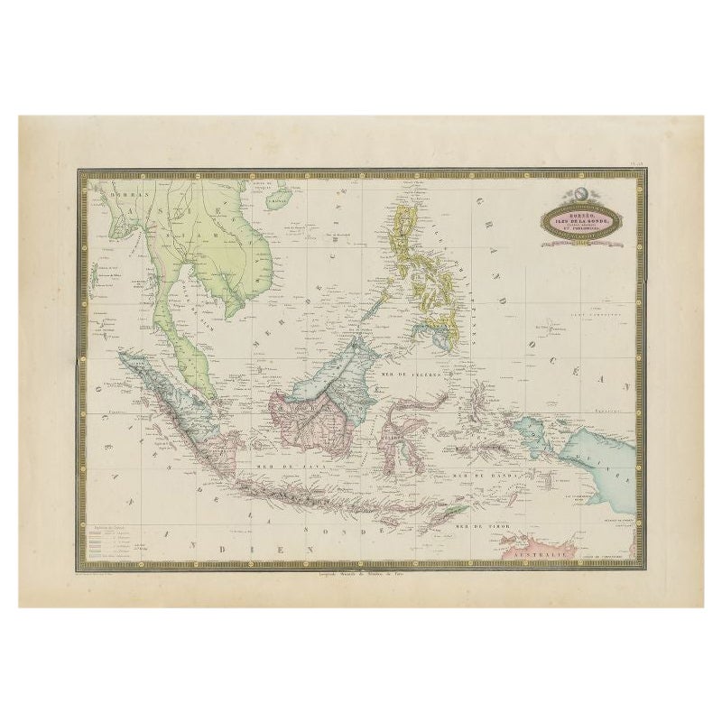
Antique Map of Southeast Asia by Garnier, 1860
Located in Langweer, NL
"Antique map titled 'Borneo, Iles de la Sonde, Celebes, Moluques et Phillippines'. Antique map of Southeast Asia, from Birma and Sumatra to the Philippines and Nouveau Guinea. Artist...
Category
Antique 19th Century Maps
Materials
Paper
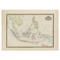
$275 Sale Price
20% Off
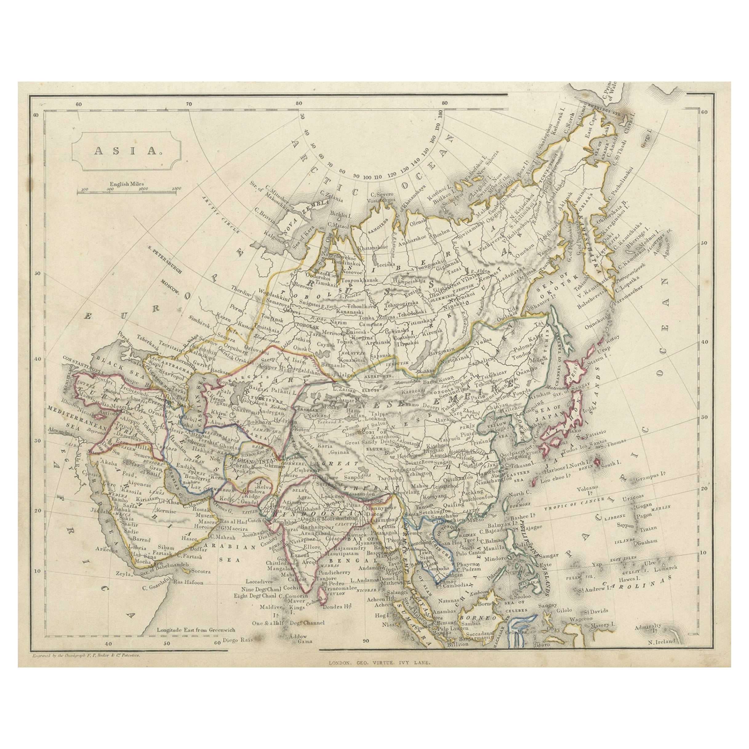
Antique Steel Engraved Map of Asia, c.1860
Located in Langweer, NL
Antique map titled 'Asia'. Steel engraved map of Asia by F. P. Becker & Co.
Artists and Engravers: Engraved by F.P. Becker & Co. Published in London.
Condition: Very good, gen...
Category
Antique 19th Century Maps
Materials
Paper
$75 Sale Price
20% Off
Antique Map of Eastern Russia in Asia by Kuyper, 1880
Located in Langweer, NL
Antique map titled 'Aziatisch Rusland. Oost'. Original antique map of Eastern Russia in Asia. This lithographed map originates from: 'Wereld-atlas voor ...
Category
Antique 19th Century Maps
Materials
Paper
$61 Sale Price
20% Off
You May Also Like
Antique Map of Italy by Andriveau-Goujon, 1843
By Andriveau-Goujon
Located in New York, NY
Antique Map of Italy by Andriveau-Goujon, 1843. Map of Italy in two parts by Andriveau-Goujon for the Library of Prince Carini at Palazzo Carini i...
Category
Antique 1840s French Maps
Materials
Linen, Paper

$3,350 / set
Antique French Map of Asia Including China Indoneseia India, 1783
Located in Amsterdam, Noord Holland
Very nice map of Asia. 1783 Dedie au Roy.
Additional information:
Country of Manufacturing: Europe
Period: 18th century Qing (1661 - 1912)
Condition: Overall Condition B (Good Used)...
Category
Antique 18th Century European Maps
Materials
Paper

$648 Sale Price
20% Off
Antique 1803 Italian Map of Asia Including China Indoneseia India
Located in Amsterdam, Noord Holland
Antique 1803 Italian Map of Asia Including China Indoneseia India
Very nice map of Asia. 1803.
Additional information:
Type: Map
Country of Manufacturing: Europe
Period: 19th centu...
Category
Antique 19th Century European Maps
Materials
Paper

$584 Sale Price
20% Off
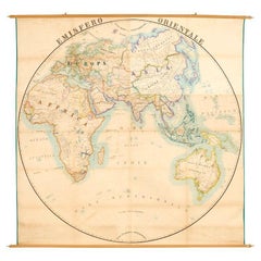
Original Antique Map of The Eastern Hemisphere by Dower, circa 1835
Located in St Annes, Lancashire
Nice map of the Eastern Hemisphere
Drawn and engraved by J.Dower
Published by Orr & Smith. C.1835
Unframed.
Free shipping
Category
Antique 1830s English Maps
Materials
Paper

Large Original Antique Map of Asia by Sidney Hall, 1847
Located in St Annes, Lancashire
Great map of Asia
Drawn and engraved by Sidney Hall
Steel engraving
Original colour outline
Published by A & C Black. 1847
Unframed
Free shipping
Category
Antique 1840s Scottish Maps
Materials
Paper

Antique Map of Eastern Hemisphere from the collection of Thierry Despont
Located in New York, NY
Designed by Enrico Bonetti (E. Bonatti) and published by Francesco Vallardi Editore. Based on an earlier map by Evangelista Azzi (Ev. Azzi). Labeled as such at bottom edge of map.
T...
Category
Antique Late 19th Century Italian Maps
Materials
Canvas, Wood