Items Similar to Antique Map of Eastern Hemisphere from the collection of Thierry Despont


Want more images or videos?
Request additional images or videos from the seller
1 of 6
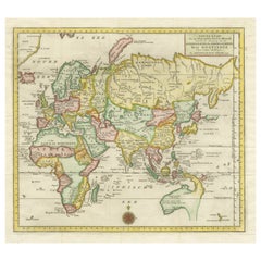
Antique Map of Eastern Hemisphere from the collection of Thierry Despont
$3,500
£2,704.36
€3,126.49
CA$4,945.75
A$5,546.99
CHF 2,904.87
MX$67,401.35
NOK 36,887.03
SEK 34,971.50
DKK 23,337.63
About the Item
Designed by Enrico Bonetti (E. Bonatti) and published by Francesco Vallardi Editore. Based on an earlier map by Evangelista Azzi (Ev. Azzi). Labeled as such at bottom edge of map.
This piece came from the personal collection of Thierry Despont (1948 - 2023), perhaps best known for his architectural practice—which played integral roles in the restoration of the Statue of Liberty, re-imagining the Ritz in Paris, and designing the interiors of the Getty Center—as well as for his notable private clients like Bill Gates and Calvin Klein. He was an avid, omnivorous, and (above all) imaginative collector. Throughout his life, he acquired furniture and objects from very different periods and in a broad array of styles, relishing the unexpected dialogues juxtaposing works and complementary pieces made among themselves.
- Dimensions:Height: 92 in (233.68 cm)Width: 95 in (241.3 cm)Depth: 1 in (2.54 cm)
- Materials and Techniques:
- Place of Origin:
- Period:
- Date of Manufacture:1873
- Condition:
- Seller Location:New York, NY
- Reference Number:Seller: VALLF 011stDibs: LU781345130252
About the Seller
5.0
Recognized Seller
These prestigious sellers are industry leaders and represent the highest echelon for item quality and design.
Established in 1974
1stDibs seller since 2003
208 sales on 1stDibs
Typical response time: 4 hours
Associations
The Art and Antique Dealers League of America20th Century SpecialistsAntiques Associations Members
- ShippingRetrieving quote...Shipping from: Long Island City, NY
- Return Policy
Authenticity Guarantee
In the unlikely event there’s an issue with an item’s authenticity, contact us within 1 year for a full refund. DetailsMoney-Back Guarantee
If your item is not as described, is damaged in transit, or does not arrive, contact us within 7 days for a full refund. Details24-Hour Cancellation
You have a 24-hour grace period in which to reconsider your purchase, with no questions asked.Vetted Professional Sellers
Our world-class sellers must adhere to strict standards for service and quality, maintaining the integrity of our listings.Price-Match Guarantee
If you find that a seller listed the same item for a lower price elsewhere, we’ll match it.Trusted Global Delivery
Our best-in-class carrier network provides specialized shipping options worldwide, including custom delivery.More From This Seller
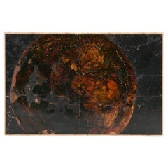
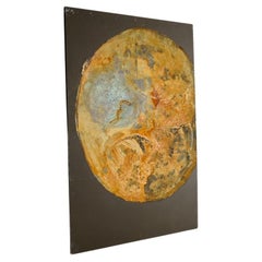
View AllNB 12, Large-scale Painting of a Planet by Thierry Despont
By Thierry Despont
Located in New York, NY
Thierry Despont, best-known as a very successful architect, was also an accomplished artist. In his painting practice, when not analyzing the smallest, most detailed creatures of the...
Category
21st Century and Contemporary American Paintings
Materials
Enamel
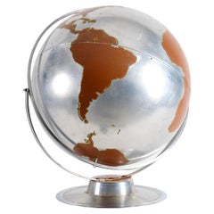
Aluminum Globe from the collection of Thierry Despont
By Thierry Despont
Located in New York, NY
While Thierry Despont (1948 - 2023) was best-known for his architectural practice—for his integral role in the restoration of the Statue of Liberty, his re-imagining of the Ritz in P...
Category
21st Century and Contemporary American Globes
Materials
Aluminum
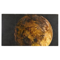
NB 32, Large-scale Painting of a Planet by Thierry Despont
By Thierry Despont
Located in New York, NY
Thierry Despont, best-known as a very successful architect, was also an accomplished artist. In his painting practice, when not analyzing the smallest, most detailed creatures of the...
Category
21st Century and Contemporary American Paintings
Materials
Enamel
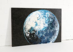
NB 06, Large-scale Painting of a Planet by Thierry Despont
By Thierry Despont
Located in New York, NY
Thierry Despont, best-known as a very successful architect, was also an accomplished artist. In his painting practice, when not analyzing the smallest, most detailed creatures of the...
Category
21st Century and Contemporary American Paintings
Materials
Enamel
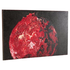
NB 37, Large-scale Painting of a Planet by Thierry Despont
By Thierry Despont
Located in New York, NY
Thierry Despont, best-known as a very successful architect, was also an accomplished artist. In his painting practice, when not analyzing the smallest, most detailed creatures of the...
Category
21st Century and Contemporary American Paintings
Materials
Enamel
NB 10, Large-scale Painting of a Planet by Thierry Despont
By Thierry Despont
Located in New York, NY
Thierry Despont, best-known as a very successful architect, was also an accomplished artist. In his painting practice, when not analyzing the smallest, most detailed creatures of the...
Category
21st Century and Contemporary American Paintings
Materials
Enamel
You May Also Like
Antique Map of the Eastern Hemisphere by Wyld, 1842
Located in Langweer, NL
Antique map titled 'Eastern Hemisphere'. Large map depicting the continents Europe, Asia, Afrika and Australia.
Artists and Engravers: James Wyld (1812–1887) was a British geograph...
Category
Antique 19th Century Maps
Materials
Paper

$1,025 Sale Price
20% Off
Antique Map of the Eastern Hemisphere by Valk & Chenk '1708'
Located in Langweer, NL
Antique map titled 'Hemispherium Orbis Antiqui, Cumzonis Circulis, Et Sity populorum Diverso'. Decorative example of Andreas Cellarius's map of the Eastern Hemisphere, illustrating with climatic zones ranging from Frigida Borealis to Torrida, with planetary details superimposed. The elaborate border includes fine scrollwork, numerous putti, and additional diagrams showing armillary spheres and climatic zones. Andreas Cellarius was born in 1596 in Neuhausen and educated in Heidelberg. He emigrated to Holland in the early 17th century and 1637 moved to Hoorn, where he became the rector of the Latin School. Cellarius' best known work is his Harmonia Macrocosmica, first issued in 1660 by Jan Jansson, as a supplement to Jansson's Atlas Novus. The work consists of a series of Celestial Charts...
Category
Antique Early 18th Century Dutch Maps
Materials
Paper

$3,930 Sale Price
25% Off
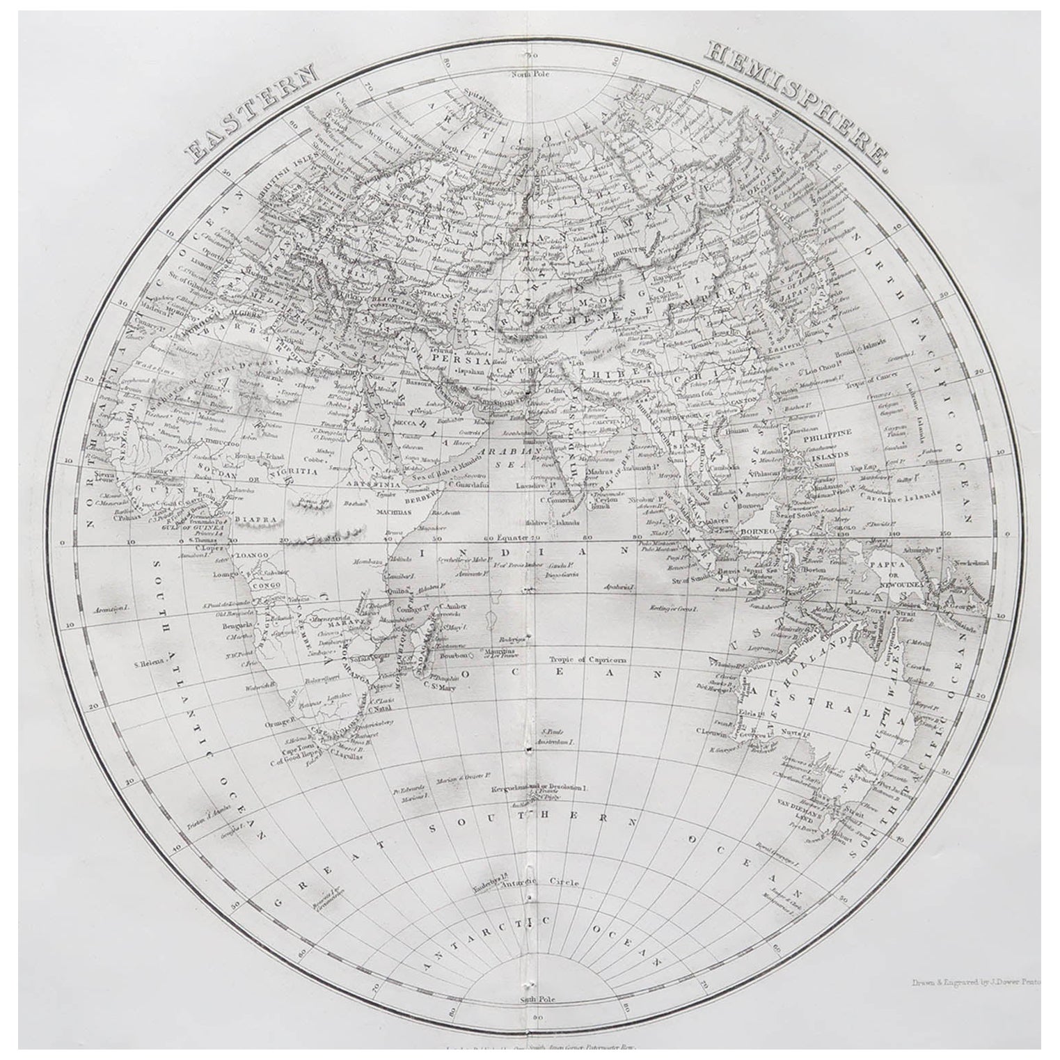
Original Antique Map of The Eastern Hemisphere by Dower, circa 1835
Located in St Annes, Lancashire
Nice map of the Eastern Hemisphere
Drawn and engraved by J.Dower
Published by Orr & Smith. C.1835
Unframed.
Free shipping
Category
Antique 1830s English Maps
Materials
Paper

Antique Map of the Eastern Hemisphere by Wyld '1845'
Located in Langweer, NL
Antique map titled 'Eastern Hemisphere'. Original antique map of the eastern hemisphere. This map originates from 'An Atlas of the World, Comprehending Separate Maps of its...
Category
Antique Mid-19th Century Maps
Materials
Paper

$326 Sale Price
20% Off
Antique World Map by P. Schenk '1706'
By Peter Schenk
Located in Langweer, NL
Antique map titled 'Diversa Orbis Terrae. Visu Incedente per Coluros Tropicorum, Ambos Ejus Polos, et Parciularis Sphaerae Zenith, in Planum Orthographica Projectio (..) Plat Ontwerp van verscheyde Aert-klooten (..)'. One of the earliest Dutch World Maps to focus on a more modern cartographic style, based on Carel Allard's map of 1696. This map represented a noteworthy shift from the traditional decorative Dutch 17th century maps where the margins would be full of classical mythological...
Category
Antique Early 18th Century Maps
Materials
Paper

$5,031 Sale Price
20% Off
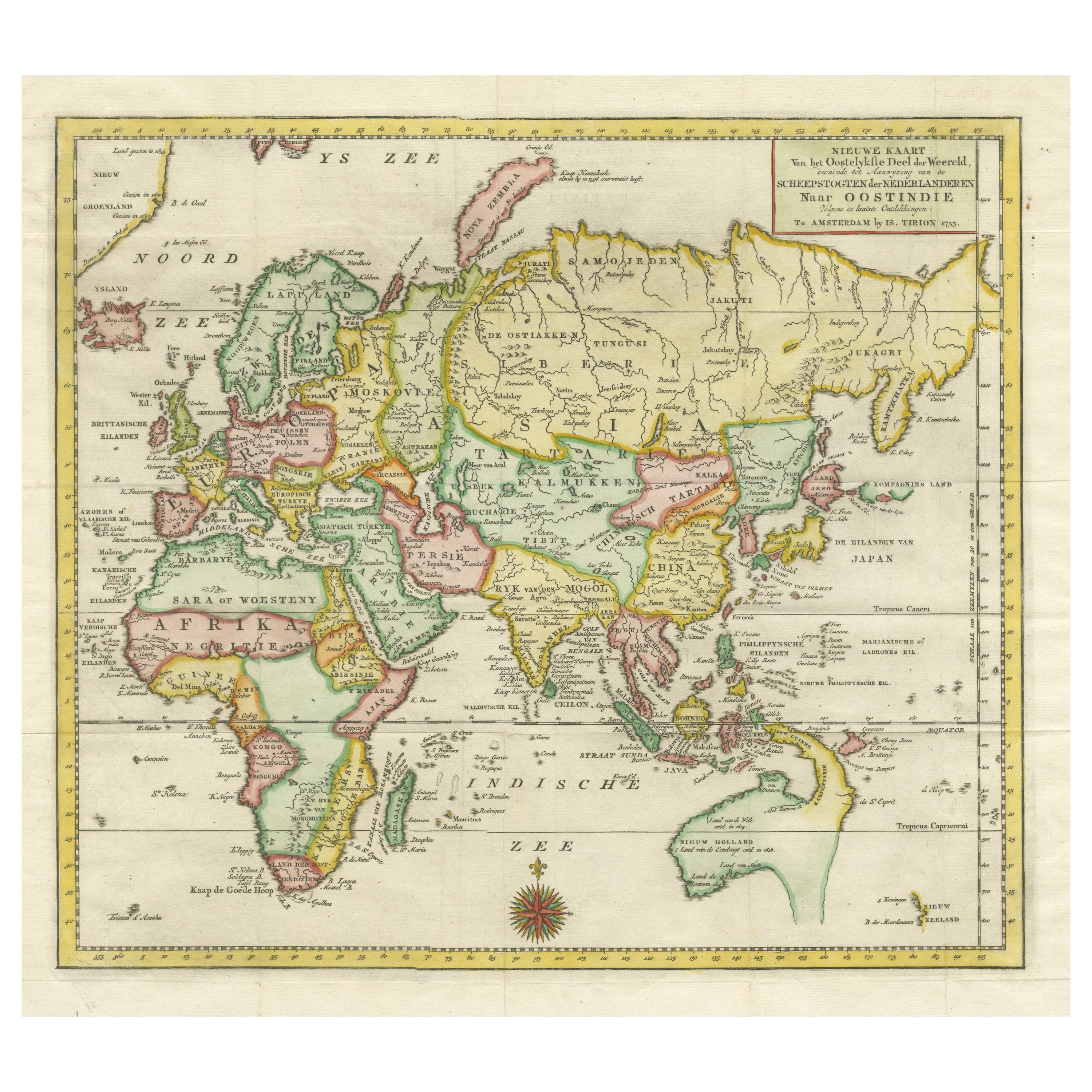
Antique Map of the Eastern Part of the World
Located in Langweer, NL
Antique map titled 'Nieuwe Kaart van het Oostelykste Deel der Weereld, diendende tot aanwyzing van de Scheepstogten der Nederlanderen Naar Oostindie'. This finely engraved map of the...
Category
Antique Mid-18th Century Maps
Materials
Paper
More Ways To Browse
Solid Mahogany Table
Dessert Glasses
Geometric Glass Table
Mid Century Pin
6x10 Rug
Studded Furniture
Styles Of Antique Desks
Black And White Coffee Table
Metal Relief
Curved Velvet Couch
Velvet Curved Sofa
Wood Round Coffee Tables
Antique Paper Flowers
Oak Brutalist
Used College Furniture
Wood Minimalist Chair
2002 Lamp
Antique Imperial Furniture