Items Similar to Antique Map of Japan, the Kurile Islands and Liu Kiu Islands, 1886

Want more images or videos?
Request additional images or videos from the seller
1 of 5
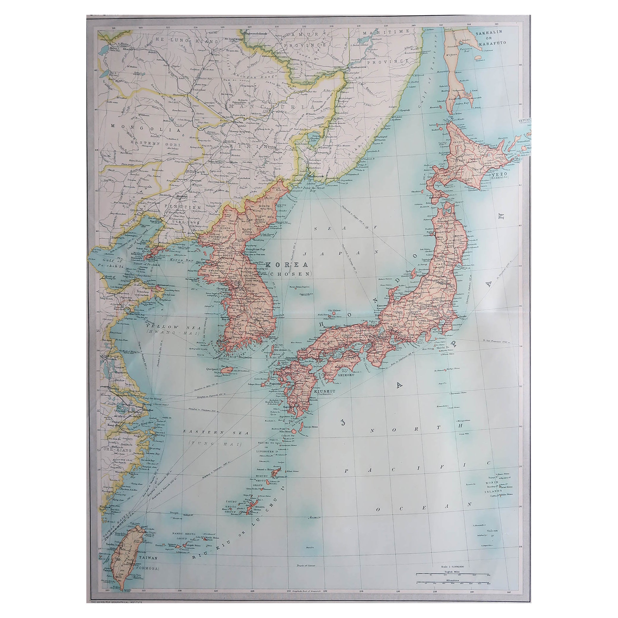
Antique Map of Japan, the Kurile Islands and Liu Kiu Islands, 1886
$115.02
$143.7820% Off
£85.63
£107.0320% Off
€96
€12020% Off
CA$157.55
CA$196.9420% Off
A$175.23
A$219.0420% Off
CHF 91.50
CHF 114.3820% Off
MX$2,132.38
MX$2,665.4720% Off
NOK 1,168.60
NOK 1,460.7520% Off
SEK 1,095.94
SEK 1,369.9220% Off
DKK 730.81
DKK 913.5220% Off
Shipping
Retrieving quote...The 1stDibs Promise:
Authenticity Guarantee,
Money-Back Guarantee,
24-Hour Cancellation
About the Item
The map is an exquisite piece, showcasing Japan's vibrant geography. Engraved by J. Bartholomew and published by George Philip & Son in London & Liverpool, it presents a detailed and visually striking depiction of Japan. The inclusion of insets for the Kurile Islands and the Liu Kiu Islands offers a comprehensive view of Japan's broader territorial landscape.
This map is a testament to the artistry and precision of Bartholomew's engraving skills, capturing the intricate details of Japan's topography, cities, and waterways. The use of vibrant colors emphasizes geographical features, political boundaries, or cultural divisions within the country.
Given its publisher's reputation, the map adheres to high cartographic standards, providing not just geographical information but also historical and cultural insights into Japan's diverse regions. It's a fascinating collector's item, appealing not just to cartography enthusiasts but also to historians, travelers, and those fascinated by Japan's rich cultural heritage.
- Dimensions:Height: 18.43 in (46.8 cm)Width: 13.39 in (34 cm)Depth: 0.02 in (0.5 mm)
- Materials and Techniques:
- Period:
- Date of Manufacture:1886
- Condition:Please study image carefully.
- Seller Location:Langweer, NL
- Reference Number:Seller: BG-067451stDibs: LU305439809291
About the Seller
5.0
Recognized Seller
These prestigious sellers are industry leaders and represent the highest echelon for item quality and design.
Platinum Seller
Premium sellers with a 4.7+ rating and 24-hour response times
Established in 2009
1stDibs seller since 2017
2,510 sales on 1stDibs
Typical response time: <1 hour
- ShippingRetrieving quote...Shipping from: Langweer, Netherlands
- Return Policy
Authenticity Guarantee
In the unlikely event there’s an issue with an item’s authenticity, contact us within 1 year for a full refund. DetailsMoney-Back Guarantee
If your item is not as described, is damaged in transit, or does not arrive, contact us within 7 days for a full refund. Details24-Hour Cancellation
You have a 24-hour grace period in which to reconsider your purchase, with no questions asked.Vetted Professional Sellers
Our world-class sellers must adhere to strict standards for service and quality, maintaining the integrity of our listings.Price-Match Guarantee
If you find that a seller listed the same item for a lower price elsewhere, we’ll match it.Trusted Global Delivery
Our best-in-class carrier network provides specialized shipping options worldwide, including custom delivery.More From This Seller
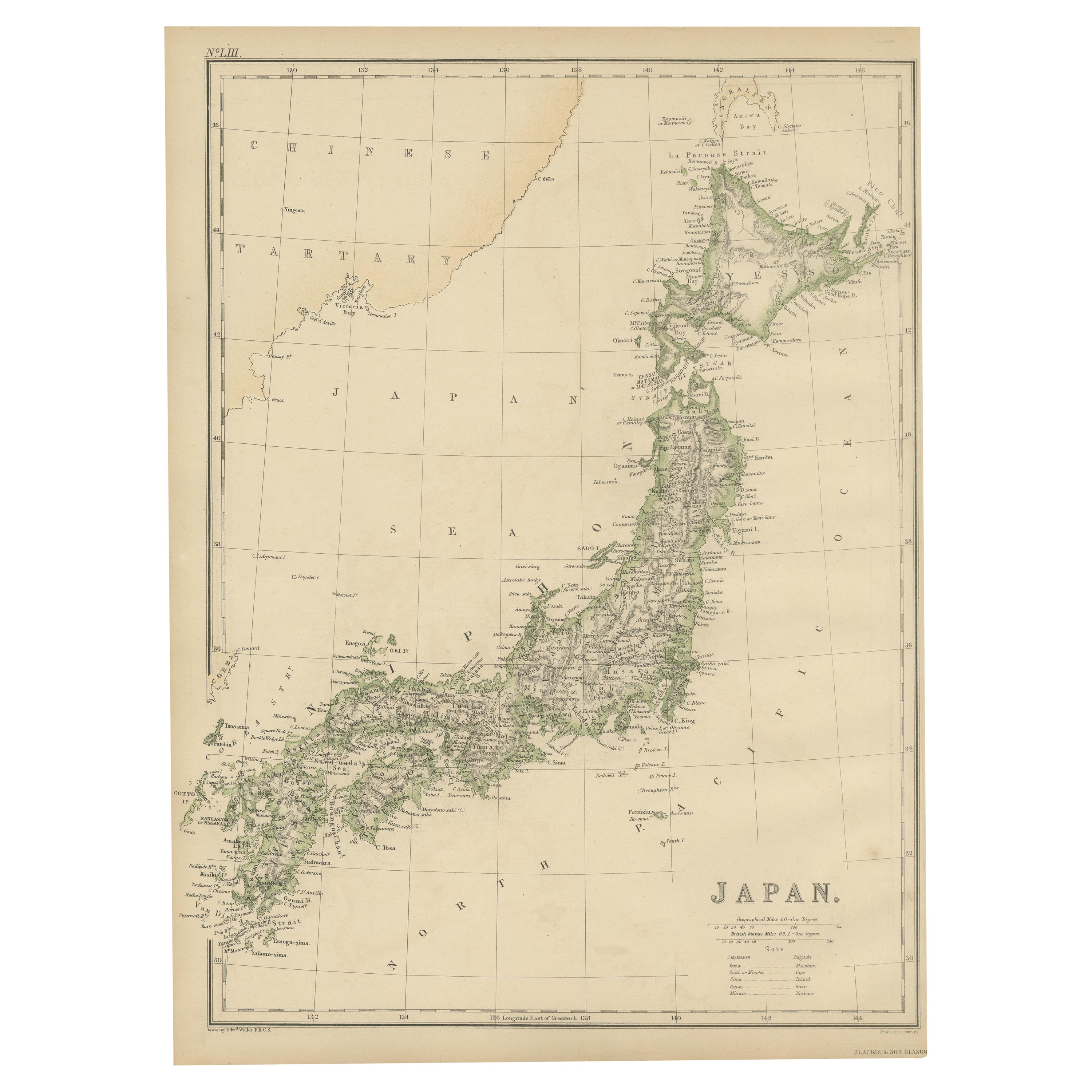
View AllAntique Map of Japan by W. G. Blackie, 1859
Located in Langweer, NL
Antique map titled 'Japan'. Original antique map of Japan. This map originates from ‘The Imperial Atlas of Modern Geography’. Published by W. G. B...
Category
Antique Mid-19th Century Maps
Materials
Paper

$179 Sale Price
25% Off
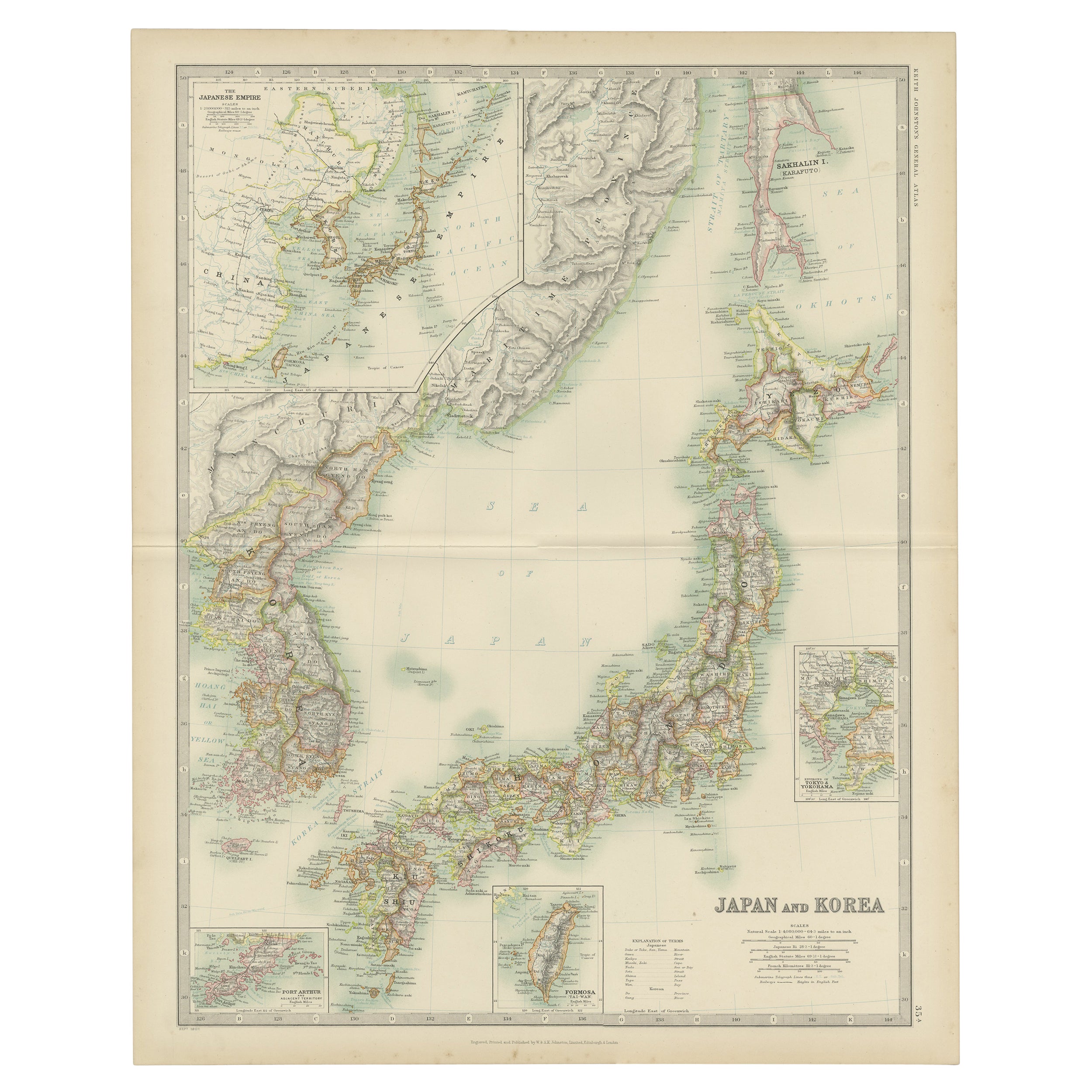
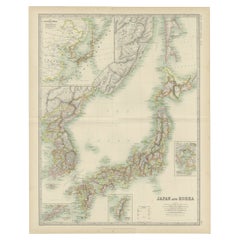
Antique Map of Japan and Korea by Johnston '1909'
Located in Langweer, NL
Antique map titled 'Japan and Korea'. Original antique map of Japan and Korea. With inset maps of the Japanese Empire, Port Arthur, Formosa ,Tokyo and Yoko...
Category
Early 20th Century Maps
Materials
Paper
$335 Sale Price
20% Off
Antique Map of the Region of Tokyo and Nagasaki in Japan, 1922
Located in Langweer, NL
Antique map of Japan titled 'Japan - Environs of Tokio & Nagasaki'. Old map of Japan, includes inset maps of Tokyo, Nagasaki and surroundings. This map or...
Category
20th Century Maps
Materials
Paper

$172 Sale Price
20% Off
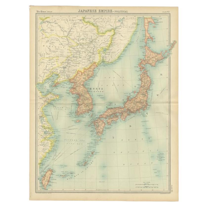
Antique Political Map of the Japanese Empire, 1922
Located in Langweer, NL
Antique map of Japan titled 'Japanese Empire - Political Map'. Old map of Japan depicting Japan, Korea and surroundings. This map originates from 'The Ti...
Category
20th Century Maps
Materials
Paper
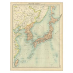
Antique Map of China and Japan by A.K. Johnston, 1865
Located in Langweer, NL
Antique map titled 'China and Japan'. Depicting Eastern China, the Islands of Japan and more. This map originates from the ‘Royal Atlas of Modern Geography’ by Alexander Keith Johnst...
Category
Antique Mid-19th Century Maps
Materials
Paper

$287 Sale Price
20% Off
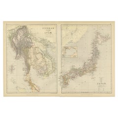
Antique Map Depicting Burma, Siam, Annam (Vietnam) and Japan, 1882
Located in Langweer, NL
The image shows two maps side by side from the 1882 atlas by Blackie & Son. On the left, the map is titled "BURMAH SIAM AND ANAM," while the one on the right is labeled "JAPAN."
**B...
Category
Antique 1880s Maps
Materials
Paper
$239 Sale Price
20% Off
Free Shipping
You May Also Like
Large Original Vintage Map of Japan, circa 1920
Located in St Annes, Lancashire
Great map of Japan
Unframed
Original color
By John Bartholomew and Co. Edinburgh Geographical Institute
Published, circa 1920
Free shipping.
Category
Vintage 1920s British Maps
Materials
Paper

Large Original Vintage Map of Japan, circa 1920
Located in St Annes, Lancashire
Great map of Japan
Original color. Good condition
Published by Alexander Gross
Unframed.
Category
Vintage 1920s English Maps
Materials
Paper

China and Japan, English antique map by Alexander Keith Johnston, 1901
Located in Melbourne, Victoria
'China and Japan', antique lithographic map by Keith Johnston.
Central vertical fold as issued.
495mm by 625mm (sheet)
Alexander Keith Johnston FRS...
Category
Early 20th Century Victorian More Prints
Materials
Lithograph

Original Antique Map of US Possessions In The Pacific Ocean, C.1900
Located in St Annes, Lancashire
Fabulous map of US possessions in the Pacific Ocean
Original color.
Engraved and printed by the George F. Cram Company, Indianapolis.
Published, C.1900.
Unframed.
Free shipping.
Category
Antique 1890s American Maps
Materials
Paper

Vintage Rollable Map Asia Japan Korea Wall Chart Poster Countrycore Decoration
Located in Berghuelen, DE
A decorative country core pull-down map depicting Japan and Korea. Published by Haack-Paincke Justus Perthes. Colorful print on paper reinforced with canvas.
Measurements:
Width 199....
Category
Late 20th Century German Country Prints
Materials
Canvas, Wood, Paper
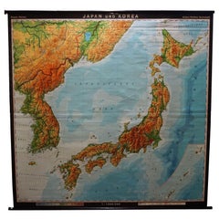
Chart of Japan by James Imray and Son
Located in Norwell, MA
Chart of southern Japan compiled by James F. Imray and published in 1870. The chart captures the coast and islands. Includes Nagasaki, Kii Channel, Gulf of Yed...
Category
Antique 1870s English Nautical Objects
Materials
Paper
More Ways To Browse
Japan Antiques Collectables
Carved Cabriole Table
Dark Antique Table
Antique Wall Table
1960 Chair Wood Danish
Unusual Dining Table
Antique Dutch Plates
Mdf Table
Showcase Coffee Table
Space Age Orange
Vallauris France
Silver Ladle
Scalloped Table
Brazil Wood Chairs
Vintage Art Deco Side Tables
Window Display
1960s Cushion Chair
Green Brown Oriental Rug