Items Similar to Antique Map of the Jesuit Missions in Madurai and Surrounding Kingdoms, c.1760
Want more images or videos?
Request additional images or videos from the seller
1 of 10
Antique Map of the Jesuit Missions in Madurai and Surrounding Kingdoms, c.1760
$524.36
£388.33
€440
CA$722.42
A$803.21
CHF 422.94
MX$9,745.33
NOK 5,354.60
SEK 5,005.25
DKK 3,349.21
About the Item
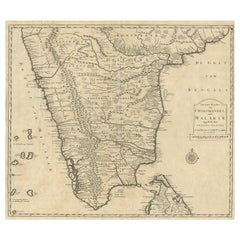
Antique Map of the Jesuit Missions in Madurai and Surrounding Kingdoms, c.1760
This 18th-century copperplate map, titled Carte des Missions du P.P. de la Compagnie de Jésus dans le Maduré et les Royaumes circonvoisins, depicts southern India and parts of Sri Lanka, showing the extent of Jesuit missionary activity in the region. The map covers the Malabar Coast along the Arabian Sea (Mer des Indes) and extends eastward to the Coromandel Coast, including key inland territories such as the Royaume de Carnate, Royaume de Gingi, and Royaume de Tanjaour.
The map highlights important locations in Jesuit history, including Maduré (Madurai), the center of the Madurai Mission established in the early 17th century by Roberto de Nobili, whose approach sought to integrate aspects of Indian culture into Christian teaching. Mountain ranges are depicted pictorially, while rivers, coastal towns, and key ports such as Nagapattinam, Cuddalore, and Pondicherry are marked. The Isle de Ceilon (Sri Lanka) is partially shown, with notable ports and towns labeled.
The map’s focus on missionary geography rather than purely political boundaries reflects the Jesuit interest in documenting their areas of influence and activity. This was part of a broader trend in 18th-century missionary cartography, where geographic knowledge was intertwined with evangelization efforts and reports sent back to Europe.
Engraved in the French style, the plate features a decorative title cartouche in the lower left and a double scale bar showing distances in both “lieues de vingt au degré” and “lieues d’une heure de chemin.” The presence of “Tome 7” in the upper right indicates its place within a larger travel or missionary history series.
Condition: Very good for age, with central folds as issued. Slight toning and minor handling marks in margins. Strong plate impression with crisp linework and clear lettering.
Framing tips: A dark or walnut-stained frame with a cream mount will enhance the engraved detail and period character. For thematic display, this map pairs well with other Jesuit-related or missionary maps of Asia.
Technique: Copperplate engraving
Maker: French school, c.1760
- Dimensions:Height: 10.04 in (25.5 cm)Width: 10.44 in (26.5 cm)Depth: 0.01 in (0.2 mm)
- Materials and Techniques:Paper,Engraved
- Place of Origin:
- Period:
- Date of Manufacture:circa 1760
- Condition:Condition: Very good for age, with central folds as issued. Slight toning and minor handling marks in margins. Strong plate impression with crisp linework and clear lettering.
- Seller Location:Langweer, NL
- Reference Number:Seller: BG-14078-301stDibs: LU3054346218032
About the Seller
5.0
Recognized Seller
These prestigious sellers are industry leaders and represent the highest echelon for item quality and design.
Platinum Seller
Premium sellers with a 4.7+ rating and 24-hour response times
Established in 2009
1stDibs seller since 2017
2,569 sales on 1stDibs
Typical response time: <1 hour
- ShippingRetrieving quote...Shipping from: Langweer, Netherlands
- Return Policy
Authenticity Guarantee
In the unlikely event there’s an issue with an item’s authenticity, contact us within 1 year for a full refund. DetailsMoney-Back Guarantee
If your item is not as described, is damaged in transit, or does not arrive, contact us within 7 days for a full refund. Details24-Hour Cancellation
You have a 24-hour grace period in which to reconsider your purchase, with no questions asked.Vetted Professional Sellers
Our world-class sellers must adhere to strict standards for service and quality, maintaining the integrity of our listings.Price-Match Guarantee
If you find that a seller listed the same item for a lower price elsewhere, we’ll match it.Trusted Global Delivery
Our best-in-class carrier network provides specialized shipping options worldwide, including custom delivery.More From This Seller
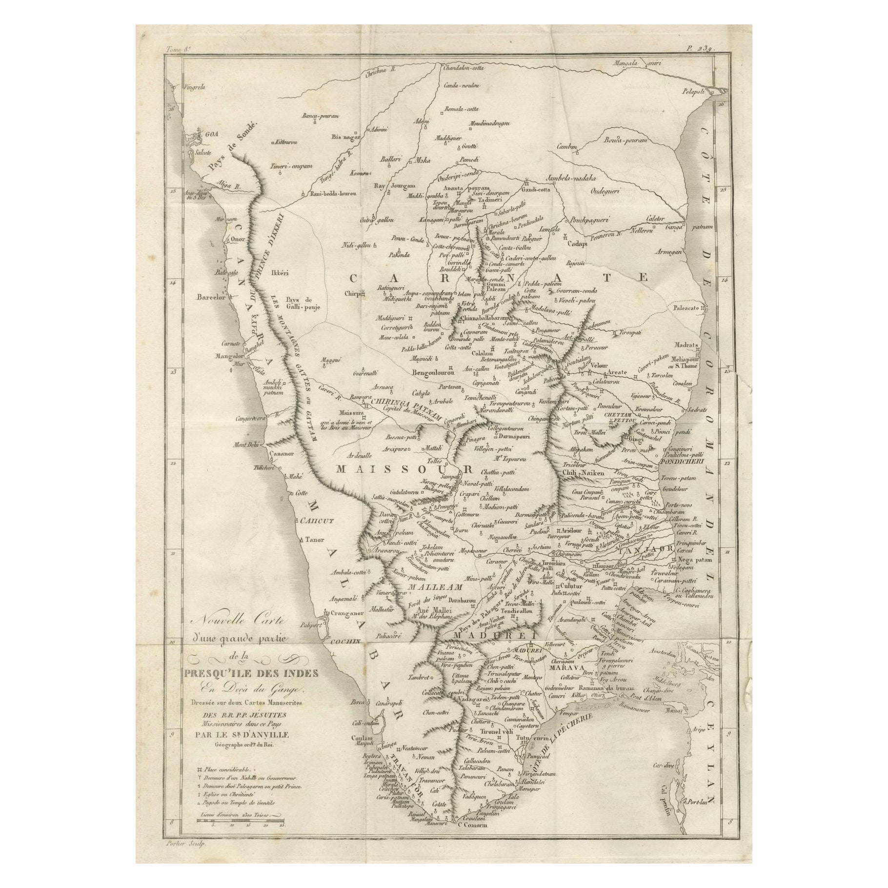
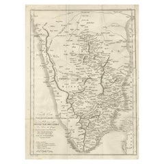
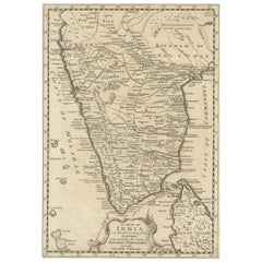
View AllAntique Map of Southern India – French Engraving by D’Anville, 18th Century
Located in Langweer, NL
This finely detailed antique map presents the southern portion of India, engraved in the 18th century by the renowned French cartographer Jean-Baptiste Bourguignon d’Anville.
It de...
Category
Antique Late 18th Century French Maps
Materials
Paper
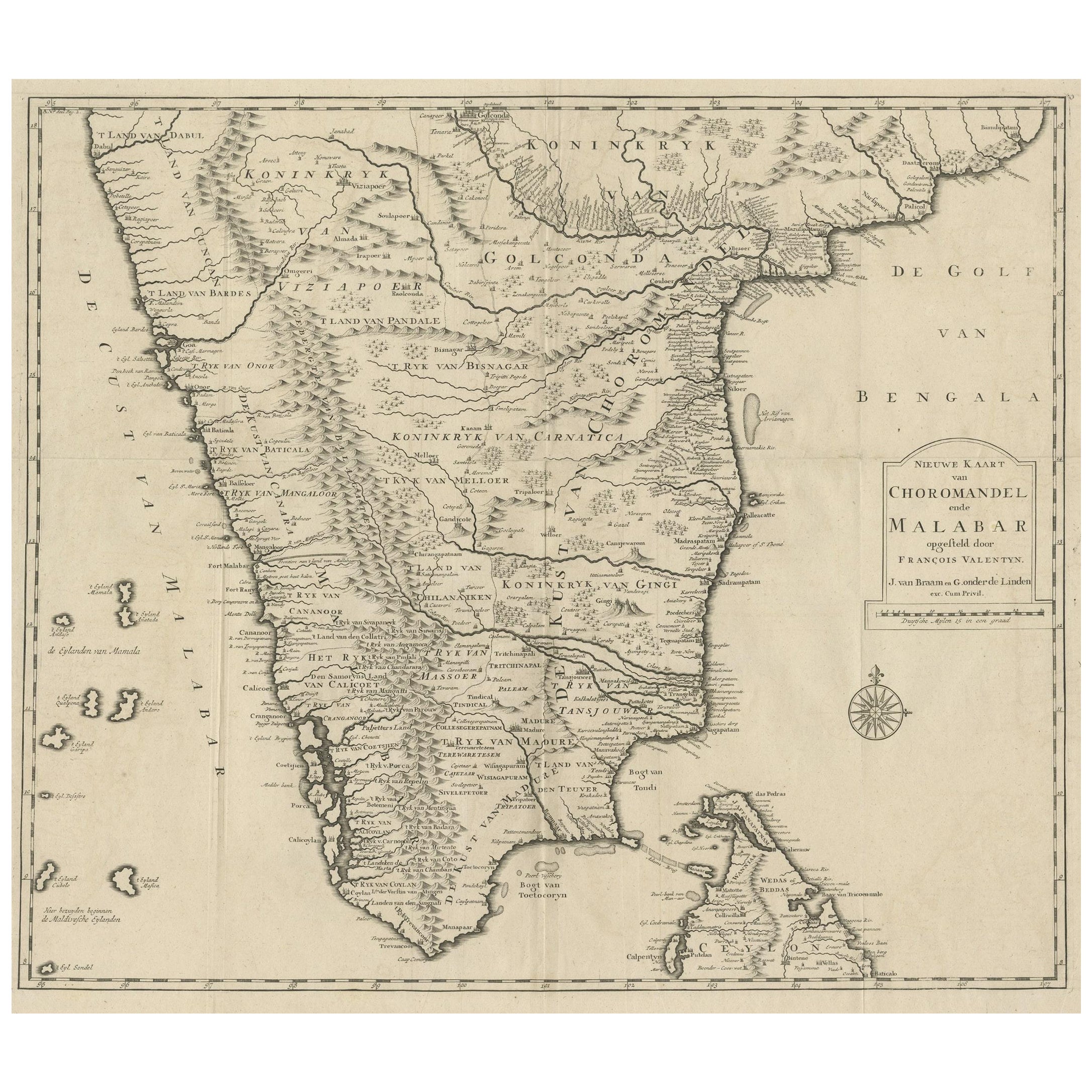
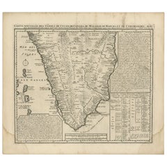
Map of Choromandel & Malabar, Incl Kerala, Tamil Nadu & Part of Sri Lanka, 1726
Located in Langweer, NL
Antique map titled 'Nieuwe kaart van Choromandel ende Malabar.'
Original antique map of Southern India documenting the VOC's areas of influence. Included is Kerala, Tamil Nadu...
Category
Antique 1720s Dutch Maps
Materials
Paper
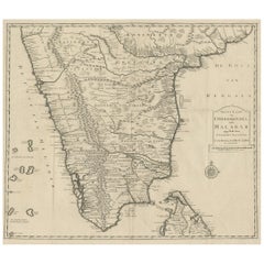
$583 Sale Price
50% Off
Free Shipping
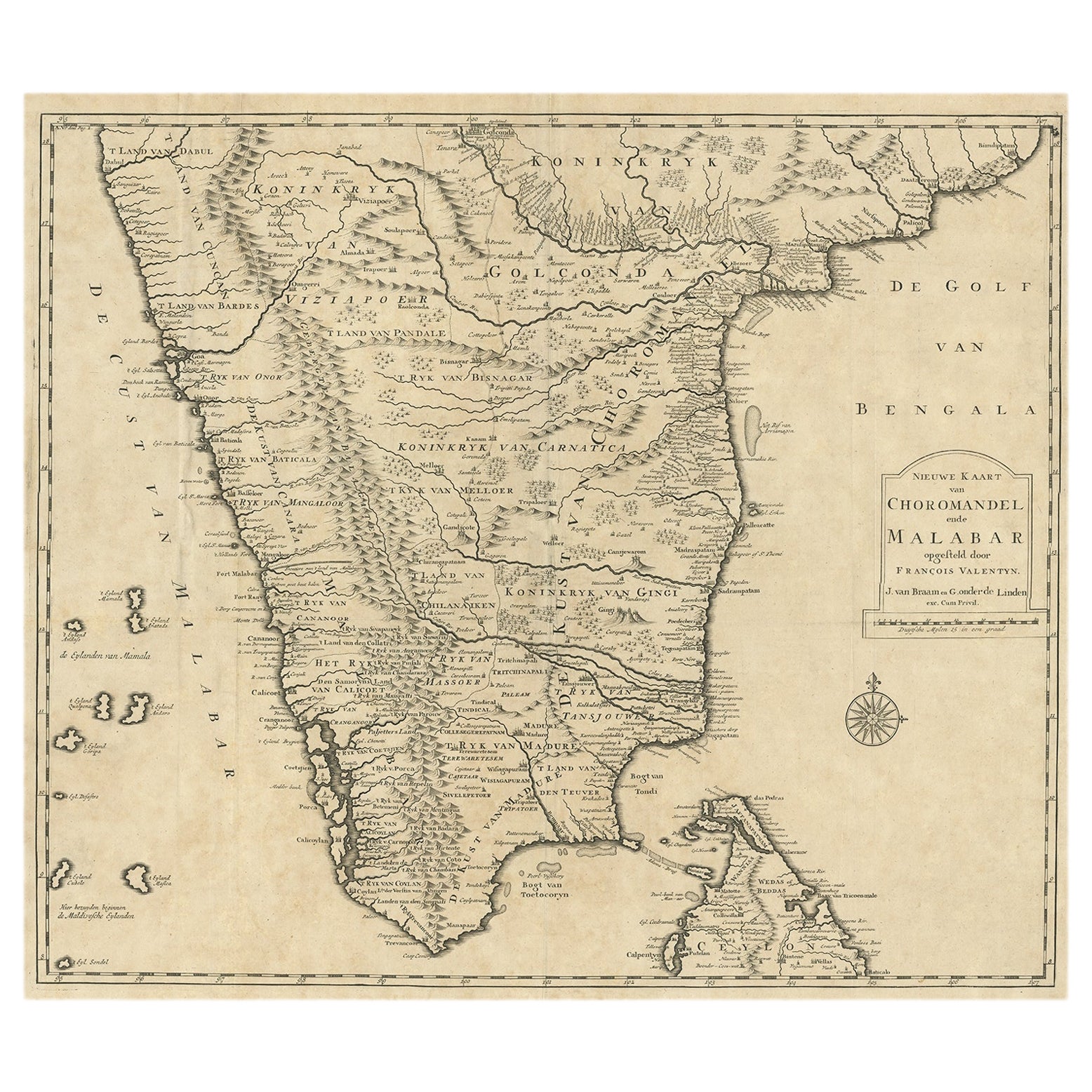
Old Original Map of Chormandel & Malabar, India & Ceylon, Now Sri Lanka, 1726
Located in Langweer, NL
Antique map titled 'Nieuwe Kaart van Choromandel ende Malabar'.
Antique map depicting the southern part of India and the northern tip of Ceylon, Sri Lanka. This map originates from...
Category
Antique 1720s Maps
Materials
Paper
$525 Sale Price
20% Off
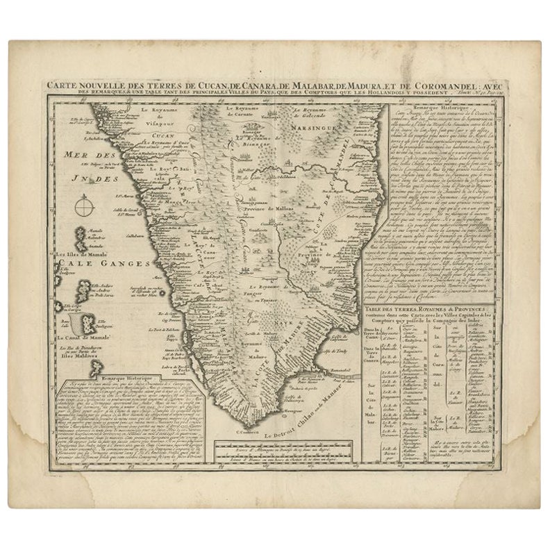
Antique Map of Southern India by Chatelain, c.1720
Located in Langweer, NL
"Antique map titled 'Carte Nouvelle des Terres de Cucan, de Canara, de Malabar, de Madura, et de Coromandel'. Map of the southern portion of India, originating from Chatelain's 'Atla...
Category
Antique 18th Century Maps
Materials
Paper
$296 Sale Price
20% Off
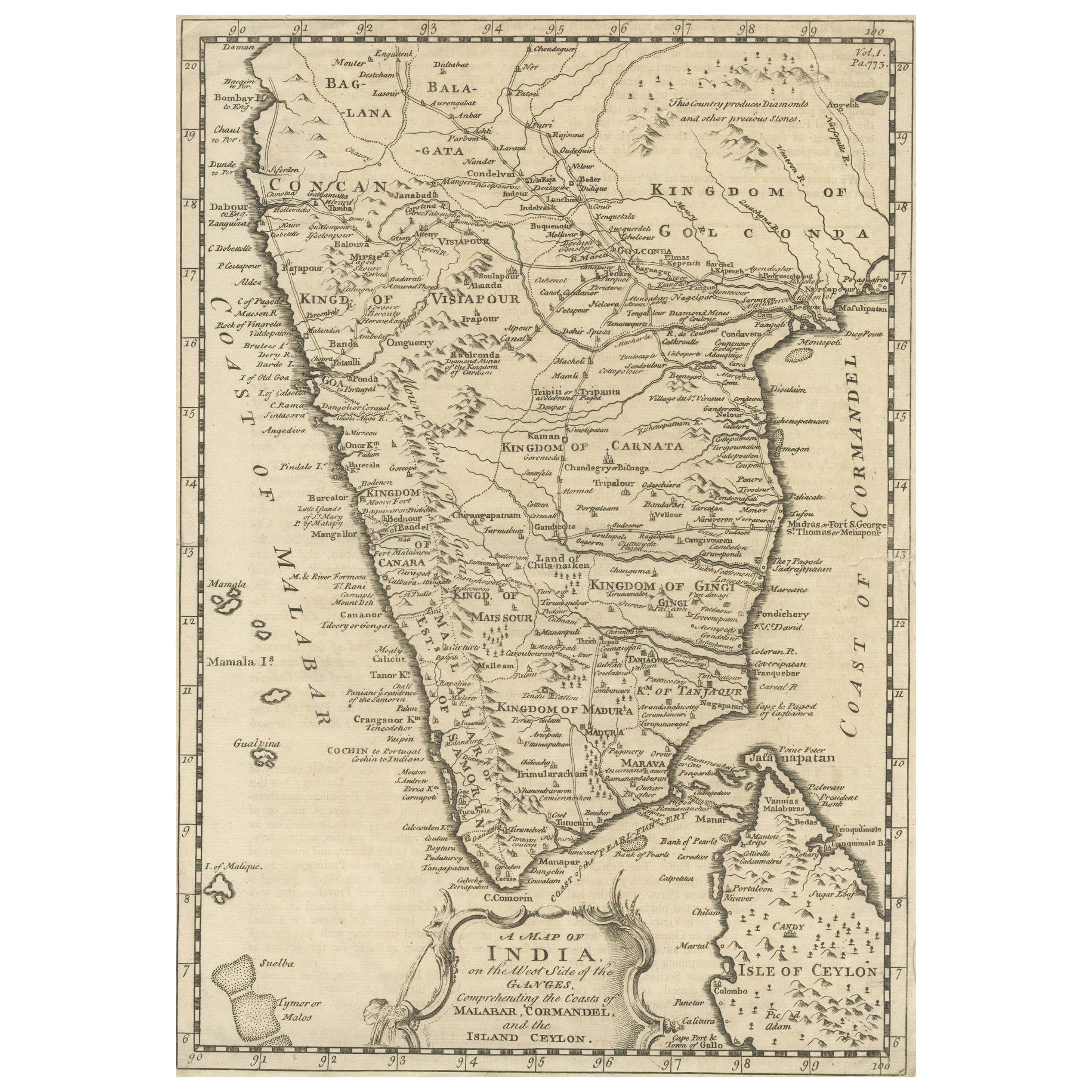
Original Detailed Antique Map of Southern India and Most of Ceylon, 1744
Located in Langweer, NL
Antique map titled 'A Map of India on the west Side of the Ganges, comprehending the coasts of Malabar, Coromandel and the Island Ceylon'.
Map of Southern India and most of Ceylo...
Category
Antique 1740s Maps
Materials
Paper
$419 Sale Price
20% Off
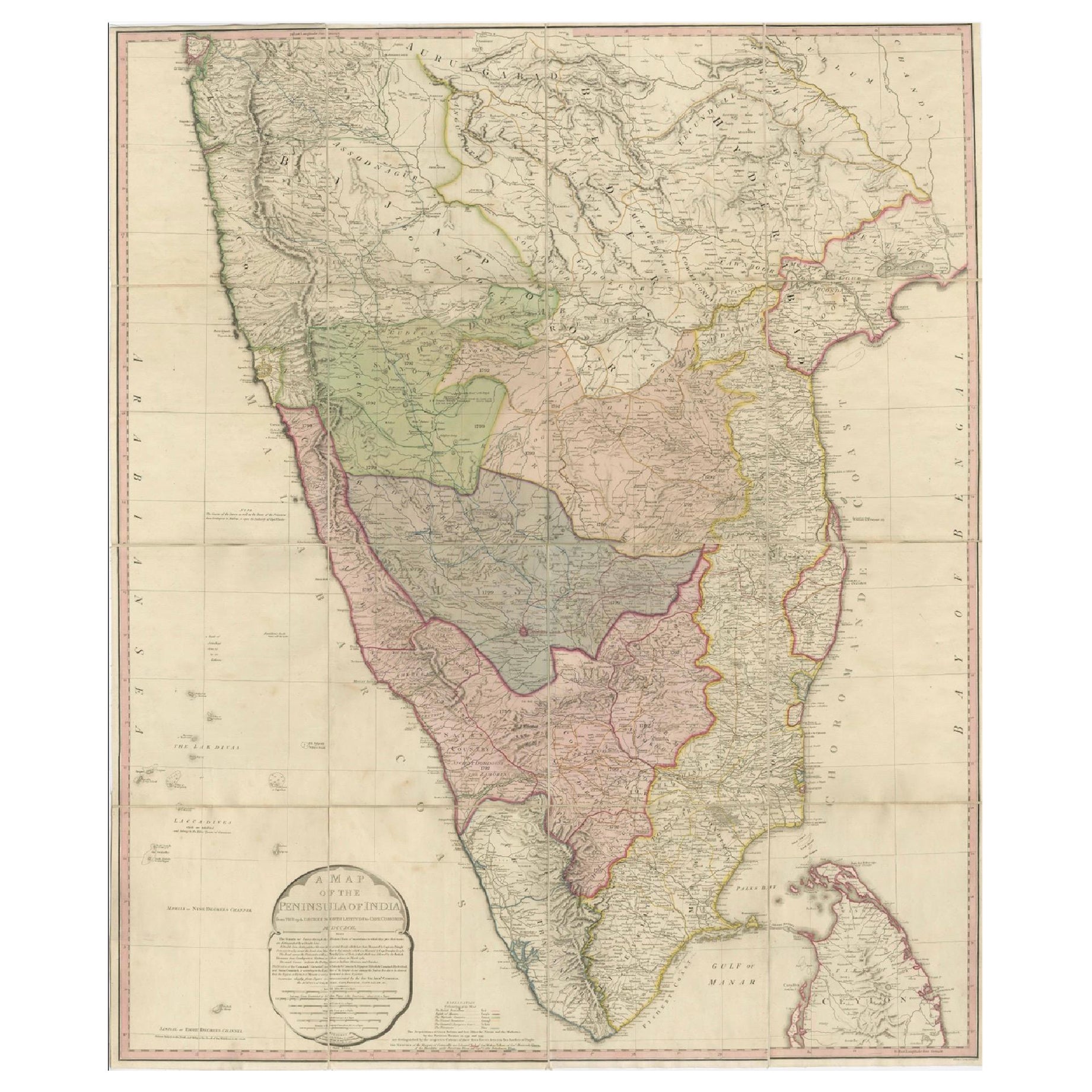
Large Decorative Colonial-Era Map of South India – Peninsula of India, 1800
Located in Langweer, NL
Antique Map of South India – “A Map of the Peninsula of India,” London 1800
This large and detailed antique map titled *A Map of the Peninsula of India* was published in London in 1...
Category
Antique Early 19th Century English Maps
Materials
Linen, Paper

You May Also Like
Map Of India - Original Lithograph - 19th Century
Located in Roma, IT
Map of India is an original lithograph artwork realized by an Anonymous engraver of the 19th Century.
Printed in the series of "France Pittoresque".
Titled "France Pittoresque".
...
Category
19th Century Modern Figurative Prints
Materials
Lithograph

Original Antique Map of India by Dower, circa 1835
Located in St Annes, Lancashire
Nice map of India
Drawn and engraved by J.Dower
Published by Orr & Smith. C.1835
Unframed.
Free shipping
Category
Antique 1830s English Maps
Materials
Paper

Antique French Map of Asia Including China Indoneseia India, 1783
Located in Amsterdam, Noord Holland
Very nice map of Asia. 1783 Dedie au Roy.
Additional information:
Country of Manufacturing: Europe
Period: 18th century Qing (1661 - 1912)
Condition: Overall Condition B (Good Used)...
Category
Antique 18th Century European Maps
Materials
Paper

$648 Sale Price
20% Off
Antique 1765 Wine Country Folding Map of France, Bordeau etc.
Located in Paonia, CO
Route du Carosse de Bordeaux, part de Paris tous les Mardis a 11 matin. a et pafse 1765 is a comprehensive map with two routes through the wine country of France starting in Paris going south...
Category
1760s Other Art Style Landscape Prints
Materials
Etching

India (Southern Sheet), English antique map by Alexander Keith Johnston, 1901
Located in Melbourne, Victoria
'India (Southern Sheet)', antique lithographic map by Keith Johnston.
Inset maps of 'Bombay Island & Town', 'Madras & Environs', and 'South-Eastern Provinces of India'.
Central vertical fold as issued.
495mm by 625mm (sheet)
Alexander Keith...
Category
Early 20th Century Victorian More Prints
Materials
Lithograph

Antique Map - Mare Pacificum - Etching by Johannes Janssonius - 1650s
By Johannes Janssonius
Located in Roma, IT
Mare Pacificum is an antique map realized in 1650 by Johannes Janssonius (1588-1664).
The Map is Hand-colored etching, with coeval watercolorang.
Good conditions with slight foxing...
Category
1650s Modern Figurative Prints
Materials
Etching
