Items Similar to Antique Map of Nagasaki – Nangasacki Called Tchangki by the Chinese, circa 1790


Want more images or videos?
Request additional images or videos from the seller
1 of 10
Antique Map of Nagasaki – Nangasacki Called Tchangki by the Chinese, circa 1790
$548.20
£405.98
€460
CA$755.26
A$839.72
CHF 442.16
MX$10,188.30
NOK 5,597.99
SEK 5,232.76
DKK 3,501.44
About the Item
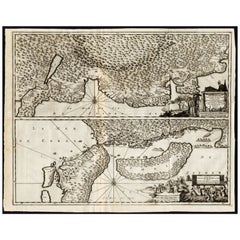
Map of Nagasaki – “Nangasacki appellé par les Chinois Tchangki”, c.1760
This finely engraved 18th-century map depicts the Japanese port city of Nagasaki (Nangasacki), here noted as being called 'Tchangki' by the Chinese. Oriented with the coastline at the top, the map presents a fortified city nestled between mountainous terrain, with the “Rivière de Nangasacki” flowing through its center. Small islands, including 'Mioxiema' and 'Paolata', appear offshore.
A numbered key at the upper right identifies important landmarks, including:
A. City of Nangasacki within its walls
B. Fortress of the military governor
C. Palace and smaller fortress of the governor
D. Dutch lodge (*loge Hollandoise*)
E. Large warehouse under the Chinese quartermaster’s control
F. Chinese lodge (*loge Chinoise*)
G. Light boats for reconnaissance
H. Places with cannon batteries
J. Place for Dutch ships
K. Place for Chinese ships
A notable annotation on the map describes the “Grande montagne qui commande à la ville et sur laquelle on martyrisoit les Chrétiens” – the large mountain overlooking the city where Christians were martyred, reflecting Japan’s complex and often repressive relationship with Christianity during the Edo period.
This engraving was executed by A. Porlier and is marked “Tome 9, No 1,” indicating its position in a multi-volume Enlightenment-era work. Such maps were produced at a time when Japan was largely closed to foreign trade under the policy of 'sakoku', with Nagasaki as one of the very few ports open to limited international contact, primarily with the Dutch and Chinese.
Collectors of Japanese history, cartography, and East Asian trade history will find this a valuable and visually engaging piece, capturing Nagasaki’s unique position in the 18th-century global network.
Condition: Very good for age, with central folds as issued. Minor toning and a few faint handling marks. Strong plate impression with fine detail in both topography and architectural depictions.
Framing tips: A dark frame, such as ebony or black walnut, with a cream or light grey mount will draw out the delicate linework. For thematic displays, this map pairs beautifully with other 18th-century port city plans.
Technique: Copperplate engraving
Maker: A. Porlier sculp., French school, c.1760
- Dimensions:Height: 6.38 in (16.2 cm)Width: 10.48 in (26.6 cm)Depth: 0.01 in (0.2 mm)
- Materials and Techniques:Paper,Engraved
- Place of Origin:
- Period:
- Date of Manufacture:circa 1790
- Condition:Condition: Very good for age, with central folds as issued. Minor toning and a few faint handling marks. Strong plate impression with fine detail in both topography and architectural depictions.
- Seller Location:Langweer, NL
- Reference Number:Seller: BG-14078-261stDibs: LU3054346216862
About the Seller
5.0
Recognized Seller
These prestigious sellers are industry leaders and represent the highest echelon for item quality and design.
Platinum Seller
Premium sellers with a 4.7+ rating and 24-hour response times
Established in 2009
1stDibs seller since 2017
2,569 sales on 1stDibs
Typical response time: <1 hour
- ShippingRetrieving quote...Shipping from: Langweer, Netherlands
- Return Policy
Authenticity Guarantee
In the unlikely event there’s an issue with an item’s authenticity, contact us within 1 year for a full refund. DetailsMoney-Back Guarantee
If your item is not as described, is damaged in transit, or does not arrive, contact us within 7 days for a full refund. Details24-Hour Cancellation
You have a 24-hour grace period in which to reconsider your purchase, with no questions asked.Vetted Professional Sellers
Our world-class sellers must adhere to strict standards for service and quality, maintaining the integrity of our listings.Price-Match Guarantee
If you find that a seller listed the same item for a lower price elsewhere, we’ll match it.Trusted Global Delivery
Our best-in-class carrier network provides specialized shipping options worldwide, including custom delivery.More From This Seller
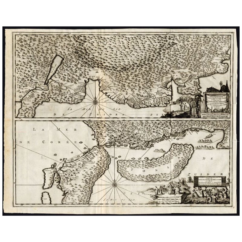
View AllAntique Map of the Region of Osaka and Hirado Island in Japan, 1725
By Pieter Van Der Aa
Located in Langweer, NL
Antique map titled 'Description exacte et fidele des villes, bourgs et villages qui les Ambassadeurs de Hollande ont rencontrez dans leur voyage par terre de la ville Osacca jusqu'a ...
Category
Antique 18th Century Maps
Materials
Paper
$1,263 Sale Price
20% Off
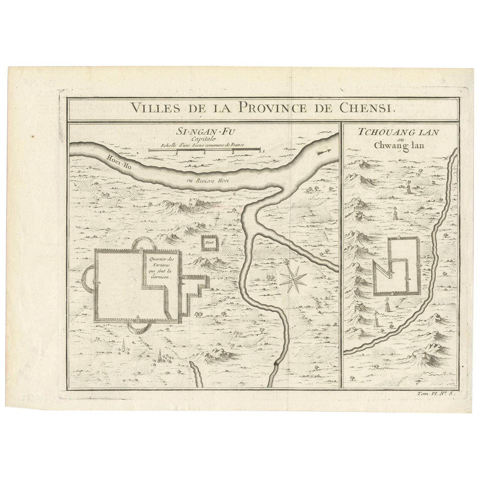
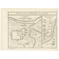
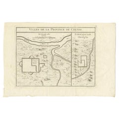
Antique Map of Si-Ngan-fu and Tchang Lan 'China' by Bellin '1748'
By Jacques-Nicolas Bellin
Located in Langweer, NL
Antique map China titled ‘Villes de la Province de Chensi’. Interesting set of two local town plans of "Si-Ngan-Fu: Capitale, Hoofdstad." and "Tchang...
Category
Antique Mid-18th Century Maps
Materials
Paper
$143 Sale Price
20% Off
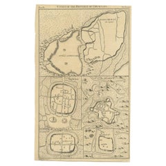
Antique Map of Cities of the Province of Che-Kyang in China, 1738
Located in Langweer, NL
Antique print China titled 'Cities of the Province of Che-Kyang'. Old map depicting four walled cities of the Chinese Qing dynasty province of Che-Kiang (modern day CHEKIANG): Hang C...
Category
Antique 18th Century Maps
Materials
Paper
$333 Sale Price
20% Off
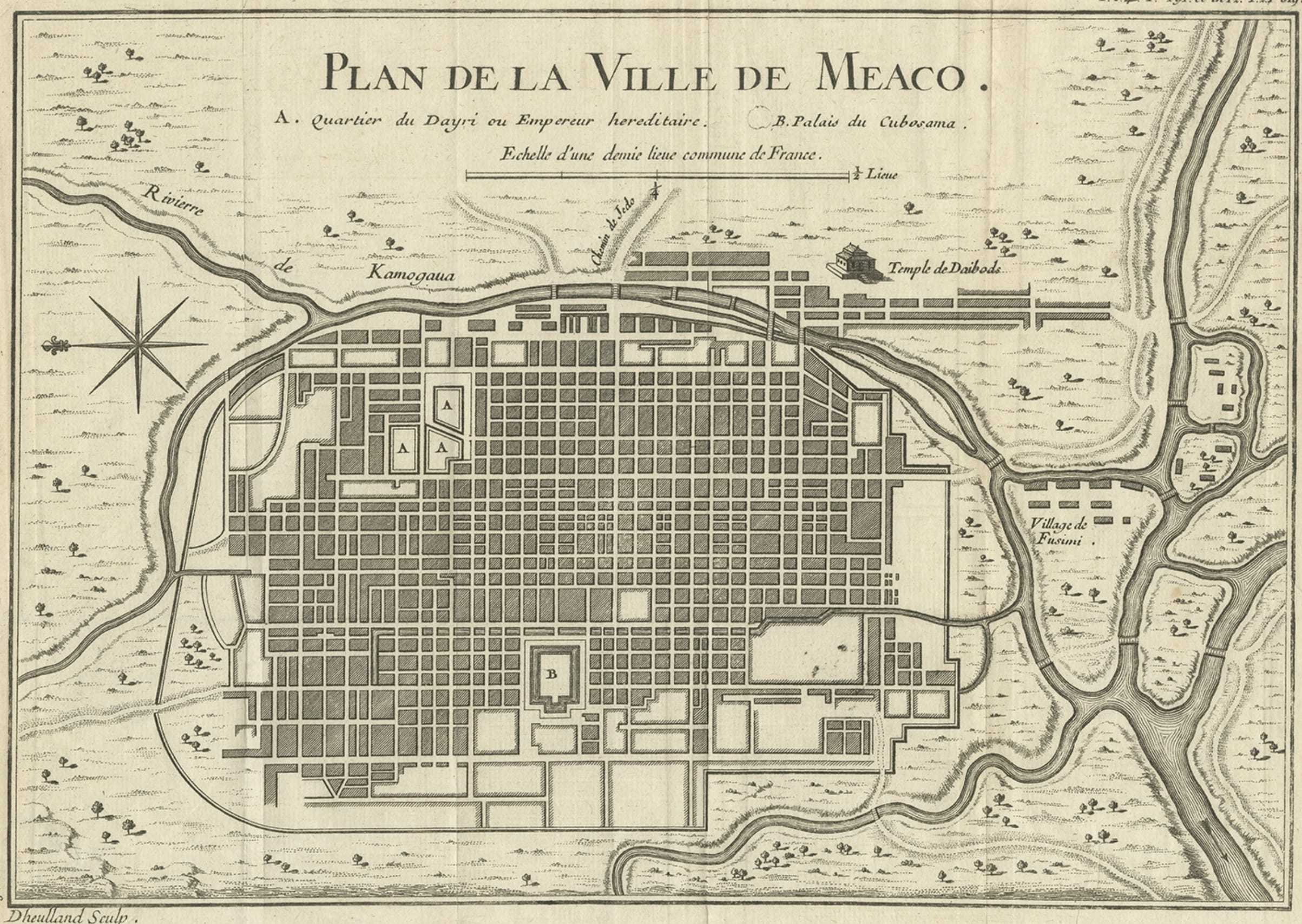
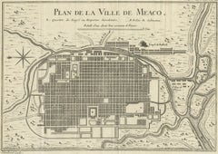
Antique Map of Kyoto located in The Kansai Region on the Island of Honshu, c1740
Located in Langweer, NL
Antique map titled 'Plan de la Ville de Meaco'.
Detailed plan of Kyoto, located in the Kansai region on the island of Honshu, Japan. This map most likely originates from an edition of 'Histoire et description generale du Japon' by P.F.X. de Charlevoix.
Artists and Engravers: Jacques-Nicolas Bellin (1703-1772) was among the most important mapmakers of the eighteenth century. In 1721, at age 18, he was appointed hydrographer (chief cartographer) to the French Navy. In August 1741, he became the first Ingénieur de la Marine of the Depot des cartes...
Category
Antique 18th Century Maps
Materials
Paper
$429 Sale Price
20% Off
Antique Map of Cities of the Province of Shanxi in China, 1749
By Jacques-Nicolas Bellin
Located in Langweer, NL
Antique print titled: 'Lan-Tcheou ou Lan-Chew dan la province Chensi; Can Tcheou ou Kan-Chew dan la province de Chensi; Tchin-Ywe-Fou ou Chin-Ywen-Fu dans la province de Koei-Tcheou ...
Category
Antique 18th Century Maps
Materials
Paper

$238 Sale Price
20% Off
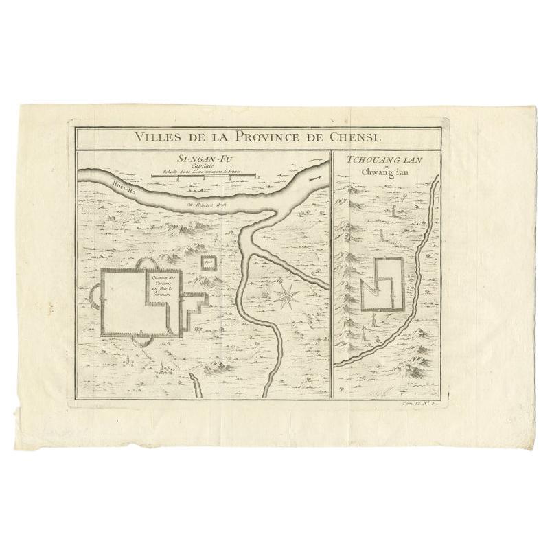
Antique Map of Two Cities in the Province of Shanxi or Chensi, China, 1748
By Jacques-Nicolas Bellin
Located in Langweer, NL
Antique map China titled ‘Villes de la Province de Chensi’. Interesting set of two local town plans of ""Si-Ngan-Fu: Capitale."" and ""Tchang Lan, Ou...
Category
Antique 18th Century Maps
Materials
Paper
$295 Sale Price
20% Off
You May Also Like
Antique French Map of Asia Including China Indoneseia India, 1783
Located in Amsterdam, Noord Holland
Very nice map of Asia. 1783 Dedie au Roy.
Additional information:
Country of Manufacturing: Europe
Period: 18th century Qing (1661 - 1912)
Condition: Overall Condition B (Good Used)...
Category
Antique 18th Century European Maps
Materials
Paper

$648 Sale Price
20% Off
18th Century Map Engraving - Plan of the Works of the City of Messina, Sicily
Located in Corsham, GB
A map of Messina, a harbour city in northeast Sicily. Inscribed with the title in plate to the lower edge, 'Plan of the Works of the City of Messina, one of the strongest and most co...
Category
18th Century More Prints
Materials
Engraving

$285 Sale Price
20% Off
Original Antique Map of China, Arrowsmith, 1820
Located in St Annes, Lancashire
Great map of China
Drawn under the direction of Arrowsmith
Copper-plate engraving
Published by Longman, Hurst, Rees, Orme and Brown, 1820
Unfr...
Category
Antique 1820s English Maps
Materials
Paper

Super Rare Antique French Map of Chine and the Chinese Empire, 1780
Located in Amsterdam, Noord Holland
Super Rare Antique French Map of Chine and the Chinese Empire, 1780
Very nice map of Asia. 1780 Made by Bonne.
Additional information:
Type: Map
...
Category
Antique 18th Century European Maps
Materials
Paper

$584 Sale Price
32% Off
Antique 1803 Italian Map of Asia Including China Indoneseia India
Located in Amsterdam, Noord Holland
Antique 1803 Italian Map of Asia Including China Indoneseia India
Very nice map of Asia. 1803.
Additional information:
Type: Map
Country of Manufacturing: Europe
Period: 19th centu...
Category
Antique 19th Century European Maps
Materials
Paper

$584 Sale Price
20% Off
Asia Declineatio: A 17th Century Hand-colored Map of Asia by Justus Danckerts
Located in Alamo, CA
This is a scarce 17th century beautifully hand-colored copperplate engraved map of Asia entitled “Exactissima Asiae Delineatio in Praecipuas Regiones Caerterasque Partes divisa et de...
Category
Late 17th Century Old Masters Landscape Prints
Materials
Engraving
