Items Similar to Antique Map of Kyoto located in The Kansai Region on the Island of Honshu, c1740

Want more images or videos?
Request additional images or videos from the seller
1 of 5
Antique Map of Kyoto located in The Kansai Region on the Island of Honshu, c1740
About the Item
Antique map titled 'Plan de la Ville de Meaco'.
Detailed plan of Kyoto, located in the Kansai region on the island of Honshu, Japan. This map most likely originates from an edition of 'Histoire et description generale du Japon' by P.F.X. de Charlevoix.
Artists and Engravers: Jacques-Nicolas Bellin (1703-1772) was among the most important mapmakers of the eighteenth century. In 1721, at age 18, he was appointed hydrographer (chief cartographer) to the French Navy. In August 1741, he became the first Ingénieur de la Marine of the Depot des cartes et plans de la Marine (the French Hydrographic Office) and was named Official Hydrographer of the French King.
Condition: Fair/good, general age-related toning. Original folding lines, few defects (slightly affecting image). Blank verso, please study image carefully.
Date: c.1740
- Dimensions:Height: 12.21 in (31 cm)Width: 9.06 in (23 cm)Depth: 0 in (0.01 mm)
- Materials and Techniques:
- Period:
- Date of Manufacture:circa 1740
- Condition:
- Seller Location:Langweer, NL
- Reference Number:
About the Seller
5.0
Platinum Seller
These expertly vetted sellers are 1stDibs' most experienced sellers and are rated highest by our customers.
Established in 2009
1stDibs seller since 2017
1,932 sales on 1stDibs
Typical response time: <1 hour
- ShippingRetrieving quote...Ships From: Langweer, Netherlands
- Return PolicyA return for this item may be initiated within 14 days of delivery.
More From This SellerView All
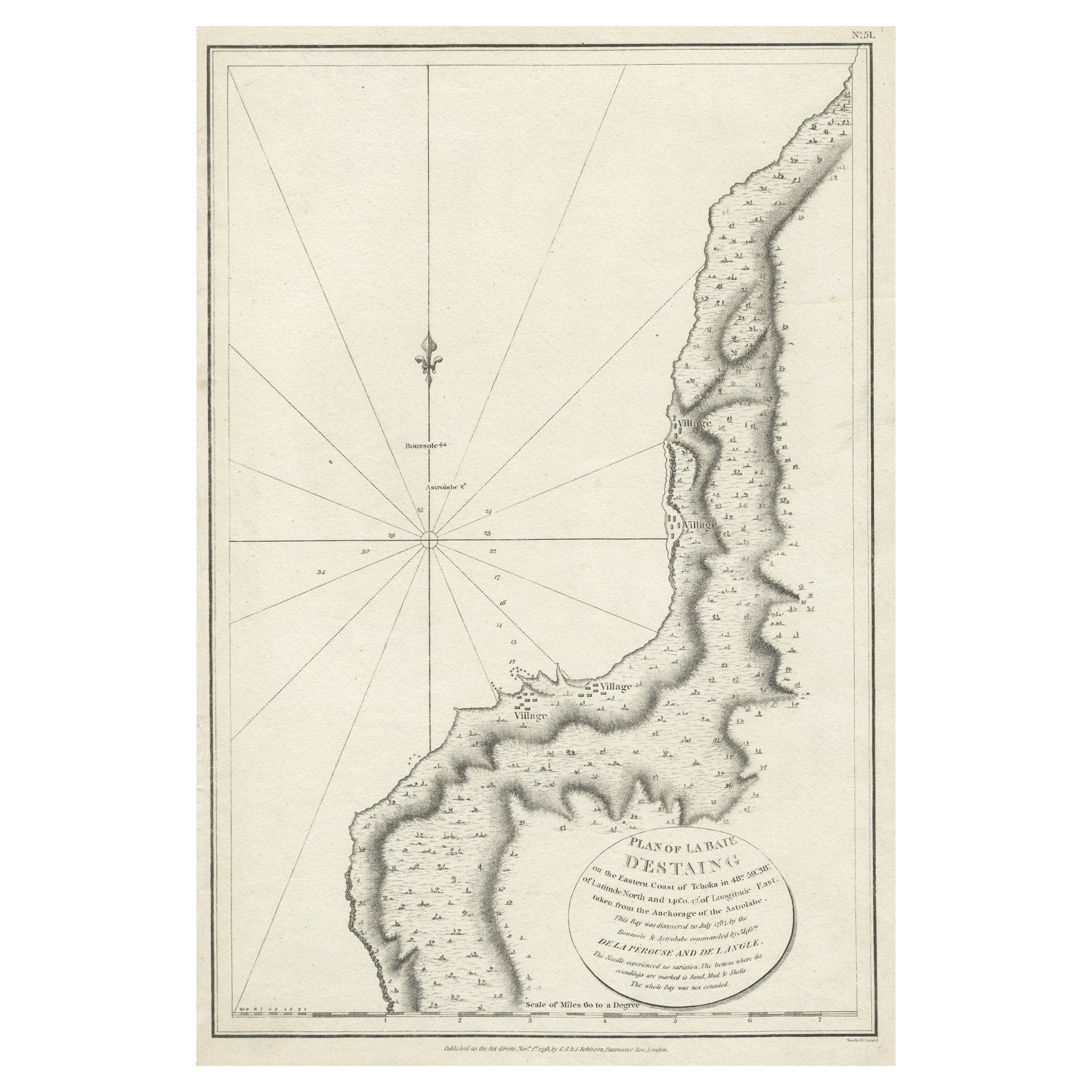
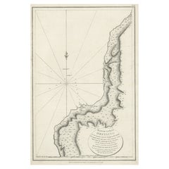
- Antique Map of The Bay of D'Estaing located on the Russian island Sakhalin, 1798Located in Langweer, NLAntique map titled 'Plan of La Baie d'Estaing'. This map shows the bay of D'Estaing located on the Russian island of Sakhalin. La Perouse was selected b...Category
Antique 1790s Maps
MaterialsPaper
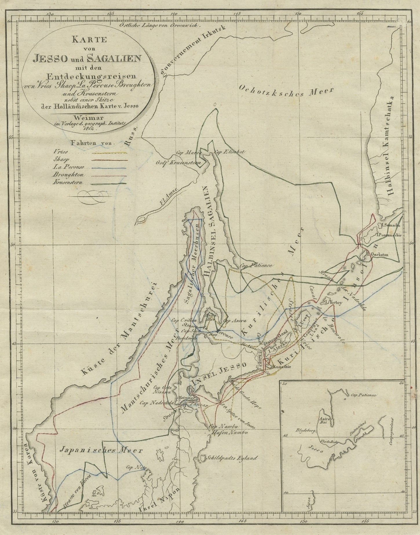
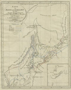
- Antique Map of the Region of Hokkaido, Island of Japan, 1812Located in Langweer, NLAntique map titled 'Karte von Jesso und Sagalien'. Old map of the region of the island of Yesso (Mororan, Hokkaido, Japan). This map originates from Volume 38 of 'Allgemeine geograph...Category
Antique 19th Century Maps
MaterialsPaper
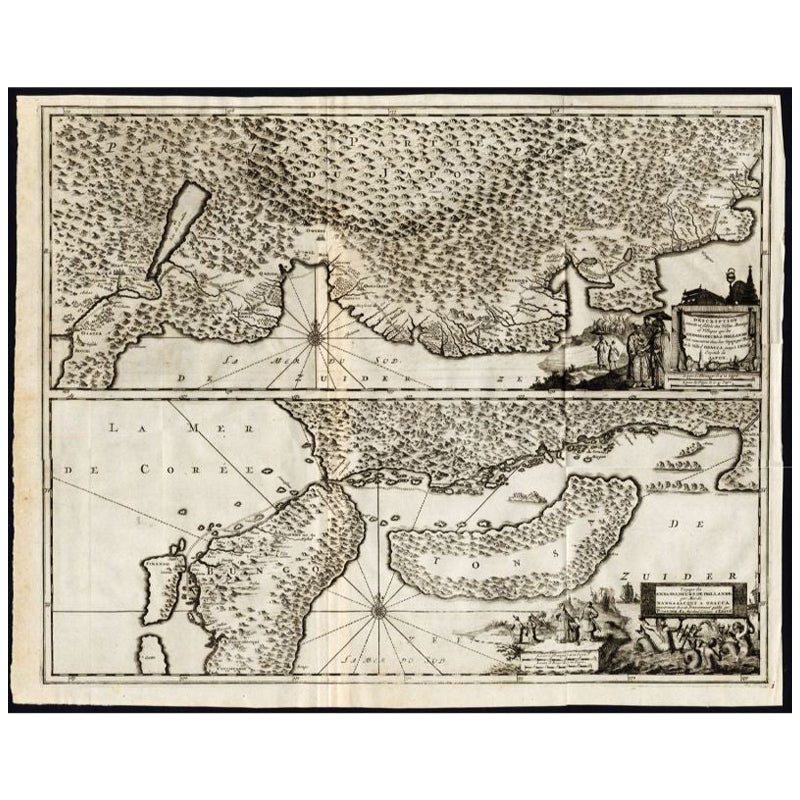
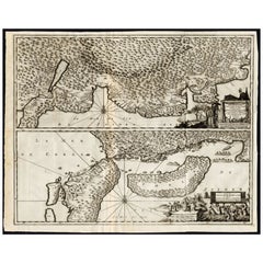
- Antique Map of the Region of Osaka and Hirado Island in Japan, 1725By Pieter Van Der AaLocated in Langweer, NLAntique map titled 'Description exacte et fidele des villes, bourgs et villages qui les Ambassadeurs de Hollande ont rencontrez dans leur voyage par terre de la ville Osacca jusqu'a ...Category
Antique 18th Century Maps
MaterialsPaper
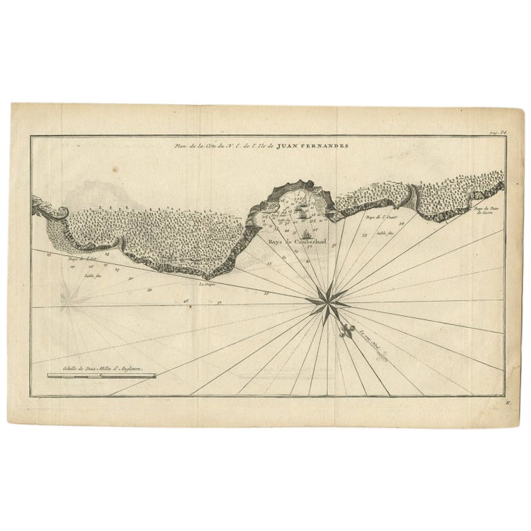
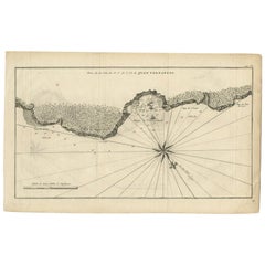
- Antique Map of Juan Fernandez Island by Anson, c.1740Located in Langweer, NLAntique map titled 'Plan de la Côte du N.E. de l 'Ile de Juan Fernandes'. Map of the northeast coast of the island of Juan Fernandez with Cumberland Bay, South America. In 1740 Ans...Category
Antique 18th Century Maps
MaterialsPaper
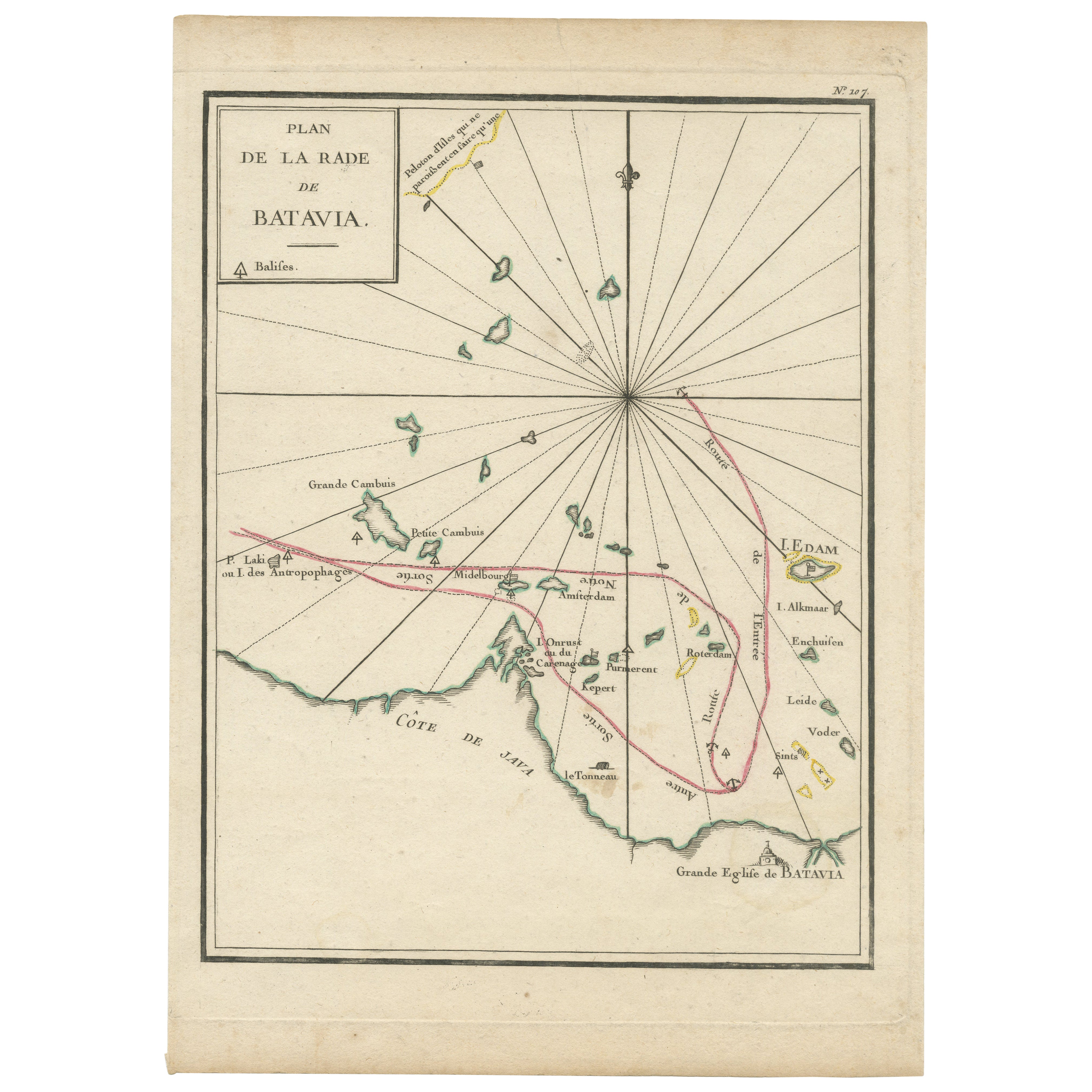
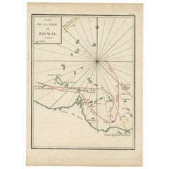
- Interesting Map of the Thousand Islands in the Bay of Batavia 'Jakarta', ca.1740Located in Langweer, NLA single unfolded page border colored engraved map, printed no. 107 in top corner. This same map is found as plate 107 in Atlas Universelle aus dem Jahre 1787 by Philippe de Pretot b...Category
Antique 1740s Maps
MaterialsPaper
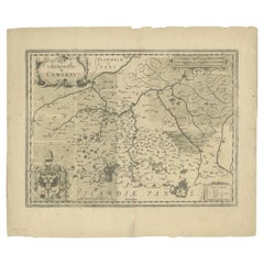
- Antique Map of the Region of Cambrai in France, c.1630Located in Langweer, NLAntique map titled 'l'Archevesche de Cambray'. Decorative map of the region of Cambrai, France. Includes the cities of Cambrai, Valencienes, Douai, and Bouchain. Artists and Engrav...Category
Antique 17th Century Maps
MaterialsPaper
You May Also Like
- 17th Century Hand Colored Map of the Liege Region in Belgium by VisscherBy Nicolaes Visscher IILocated in Alamo, CAAn original 17th century map entitled "Leodiensis Episcopatus in omnes Subjacentes Provincias distincté divisusVisscher, Leodiensis Episcopatus" by Nicolaes Visscher II, published in Amsterdam in 1688. The map is centered on Liege, Belgium, includes the area between Antwerp, Turnhout, Roermond, Cologne, Trier and Dinant. This attractive map is presented in a cream-colored mat measuring 30" wide x 27.5" high. There is a central fold, as issued. There is minimal spotting in the upper margin and a tiny spot in the right lower margin, which are under the mat. The map is otherwise in excellent condition. The Visscher family were one of the great cartographic families of the 17th century. Begun by Claes Jansz Visscher...Category
Antique Late 17th Century Dutch Maps
MaterialsPaper
- Hand-Colored 18th Century Homann Map of Denmark and Islands in the Baltic SeaBy Johann Baptist HomannLocated in Alamo, CAAn 18th century copper plate hand-colored map entitled "Insulae Danicae in Mari Balthico Sitae utpote Zeelandia, Fionia, Langelandia, Lalandia, Falstria, Fembria Mona" created by Joh...Category
Antique Early 18th Century German Maps
MaterialsPaper
- The Normandy Region of France: A 17th C. Hand-colored Map by Sanson and JaillotBy Nicolas SansonLocated in Alamo, CAThis large hand-colored map entitled "Le Duché et Gouvernement de Normandie divisée en Haute et Basse Normandie en divers Pays; et par evêchez, avec le Gouvernement General du Havre ...Category
Antique 1690s French Maps
MaterialsPaper
- 17th Century Hand-Colored Map of a Region in West Germany by JanssoniusBy Johannes JanssoniusLocated in Alamo, CAThis attractive highly detailed 17th century original hand-colored map is entitled "Archiepiscopatus Maghdeburgensis et Anhaltinus Ducatus cum terris adjacentibus". It was published ...Category
Antique Mid-17th Century Dutch Maps
MaterialsPaper
- Map of the Republic of GenoaLocated in New York, NYFramed antique hand-coloured map of the Republic of Genoa including the duchies of Mantua, Modena, and Parma. Europe, late 18th century. Dimension: 25...Category
Antique Late 18th Century European Maps
- Antique Map of Principality of MonacoBy Antonio Vallardi EditoreLocated in Alessandria, PiemonteST/619 - "Old Geographical Atlas of Italy - Topographic map of ex-Principality of Monaco" - ediz Vallardi - Milano - A somewhat special edition ---Category
Antique Late 19th Century Italian Other Prints
MaterialsPaper


