Items Similar to Antique Map of Northern India, Bengal, and Surrounding Regions by Tardieu, 1802


Want more images or videos?
Request additional images or videos from the seller
1 of 8
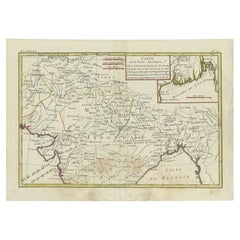
Antique Map of Northern India, Bengal, and Surrounding Regions by Tardieu, 1802
$422.11
$527.6420% Off
£314.01
£392.5120% Off
€352
€44020% Off
CA$578.01
CA$722.5220% Off
A$642.67
A$803.3420% Off
CHF 335.57
CHF 419.4620% Off
MX$7,822.90
MX$9,778.6220% Off
NOK 4,281.71
NOK 5,352.1420% Off
SEK 4,011.76
SEK 5,014.6920% Off
DKK 2,679.58
DKK 3,349.4820% Off
Shipping
Retrieving quote...The 1stDibs Promise:
Authenticity Guarantee,
Money-Back Guarantee,
24-Hour Cancellation
About the Item
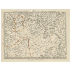
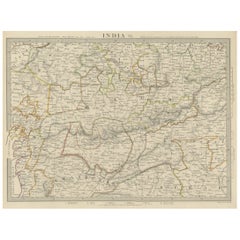
This is an original antique map titled "Inde, Indostan Bengale &c. et Partie Septentrionale de la Presqu'isle en deça du Gange," depicting the northern part of the Indian subcontinent including parts of modern-day India, Bangladesh, and surrounding areas. This map was created by Pierre Antoine Tardieu, a prominent French engraver and cartographer.
Map Details:
- Title: Inde, Indostan Bengale &c. et Partie Septentrionale de la Presqu'isle en deça du Gange
- Creator: Pierre Antoine Tardieu (1784-1869)
- Publication Date: Early 19th century
- Dimensions: Approximately 34.5 x 43.5 cm (13.5 x 17.25 inches)
- Features: The map provides detailed geographical and political features, showing various regions, cities, rivers, and mountain ranges. The title cartouche is located in the upper right corner, and the outlines are hand-colored to distinguish different territories.
Condition Overview:
1. **Paper Quality**: The paper shows some signs of aging, such as slight yellowing, but remains in good condition without major tears or damage.
2. **Edges and Corners**: The edges are slightly worn, with minor fraying and small tears, particularly near the center fold. These imperfections do not significantly impact the overall readability or aesthetic value.
3. **Center Fold**: A center fold is present, which is common for maps of this period that were often folded for storage or publication. The fold appears intact without significant separation or damage.
4. **Color and Print Quality**: The hand-colored outlines remain vibrant and clear, highlighting the borders of different regions. The print quality is excellent, with sharp, legible text and detailed illustrations.
5. **Staining and Spots**: There are a few spots and stains, particularly near the edges and along the fold. These do not obscure any critical details of the map.
Historical Context
Around the year 1800, the Indian subcontinent was undergoing significant changes under British colonial influence. Here’s an overview of the region during that period:
Political Landscape
1. British East India Company:
- The British East India Company was expanding its control over the Indian subcontinent, establishing dominance in Bengal, Bihar, and parts of the southern and western regions.
- Major battles, such as the Battle of Plassey (1757) and the Battle of Buxar (1764), had already established British supremacy in key areas.
2. Local Kingdoms and Empires:
- The Mughal Empire, once the dominant power, was in decline, with its authority largely reduced to the area around Delhi.
- Various regional powers such as the Maratha Confederacy, the Sikh Empire, the Kingdom of Mysore, and the Nizam of Hyderabad were influential and often in conflict with the British or each other.
Socio-Economic Conditions
1. Agriculture:
- The economy was primarily agrarian, with agriculture being the main occupation. Key crops included rice, wheat, cotton, and indigo.
- The British East India Company’s policies had significant impacts on agriculture, often leading to exploitation and economic changes.
2. Trade and Commerce:
- The Indian subcontinent was a major hub for trade in spices, textiles, and other goods. Key cities like Calcutta (Kolkata), Bombay (Mumbai), and Madras (Chennai) were significant ports.
- Inland trade routes were also important, connecting various regions through rivers and roads.
Cultural and Social Aspects
1. Diversity:
- The region was characterized by immense cultural, linguistic, and religious diversity, including Hindus, Muslims, Sikhs, Christians, and others.
- This diversity was reflected in the social structure, festivals, languages, and traditions.
2. British Influence:
- British colonial rule brought significant changes, including the introduction of Western education, legal systems, and administrative practices.
- There was also cultural exchange, with British and Indian influences intermingling in various aspects of life.
Conflicts and Changes
1. Anglo-Mysore Wars:
- The British fought a series of wars with the Kingdom of Mysore under rulers like Hyder Ali and Tipu Sultan, leading to British dominance in southern India by the end of the 18th century.
2. Anglo-Maratha Wars:
- Conflicts with the Maratha Confederacy also marked this period, with the British eventually defeating the Marathas and consolidating control over large parts of India.
Summary
The northern part of the Indian subcontinent around 1800 was a region of great political, economic, and cultural significance, undergoing profound changes under British colonial influence. The map by Pierre Antoine Tardieu offers a detailed and historically valuable representation of this dynamic region.
- Dimensions:Height: 16.34 in (41.5 cm)Width: 22.25 in (56.5 cm)Depth: 0.01 in (0.2 mm)
- Materials and Techniques:Paper,Engraved
- Period:
- Date of Manufacture:1802
- Condition:Good condition with minor age-related wear. Hand-colored boundaries are well-preserved, enhancing the clarity of regions and features. Fold lines as issued . Edge wear due to handling and age visible. Study the images carefully.
- Seller Location:Langweer, NL
- Reference Number:Seller: BG-13769-311stDibs: LU3054340565692
About the Seller
5.0
Recognized Seller
These prestigious sellers are industry leaders and represent the highest echelon for item quality and design.
Platinum Seller
Premium sellers with a 4.7+ rating and 24-hour response times
Established in 2009
1stDibs seller since 2017
2,510 sales on 1stDibs
Typical response time: <1 hour
- ShippingRetrieving quote...Shipping from: Langweer, Netherlands
- Return Policy
Authenticity Guarantee
In the unlikely event there’s an issue with an item’s authenticity, contact us within 1 year for a full refund. DetailsMoney-Back Guarantee
If your item is not as described, is damaged in transit, or does not arrive, contact us within 7 days for a full refund. Details24-Hour Cancellation
You have a 24-hour grace period in which to reconsider your purchase, with no questions asked.Vetted Professional Sellers
Our world-class sellers must adhere to strict standards for service and quality, maintaining the integrity of our listings.Price-Match Guarantee
If you find that a seller listed the same item for a lower price elsewhere, we’ll match it.Trusted Global Delivery
Our best-in-class carrier network provides specialized shipping options worldwide, including custom delivery.More From This Seller
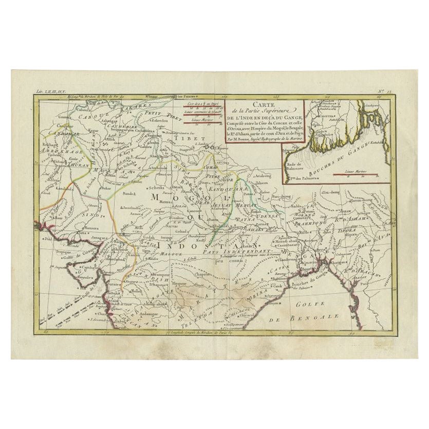
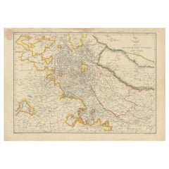
View AllAntique Map of Northern India by Bonne, 1780
Located in Langweer, NL
Antique map titled 'Carte de la partie Supérieure de l'Inde (..)'. A fine example of Rigobert Bonne and Guilleme Raynal?s 1780 map of northern India. Covers the northern part of Indi...
Category
Antique 18th Century Maps
Materials
Paper
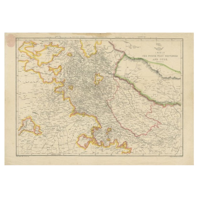
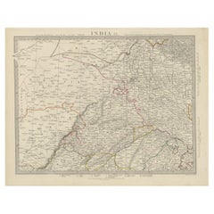
Antique Map of Northwestern India by Weller, 1857
Located in Langweer, NL
Antique map titled 'India, The North West Provinces and Oude'.Detailed map of the northwestern part of India, extending to the Himalaya Mountains. Shows part of Nepal including Dharm...
Category
Antique 19th Century Maps
Materials
Paper
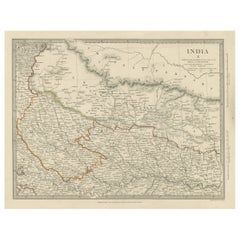
Antique Map of the Region of Delhi in India, 1833
Located in Langweer, NL
Antique map titled 'India IX'. Old steel engraved map of the region of Delhi, with great detail.
Artists and Engravers: Engraved by J. & C. Walker. Published under the superinten...
Category
Antique 19th Century Maps
Materials
Paper
$383 Sale Price
20% Off
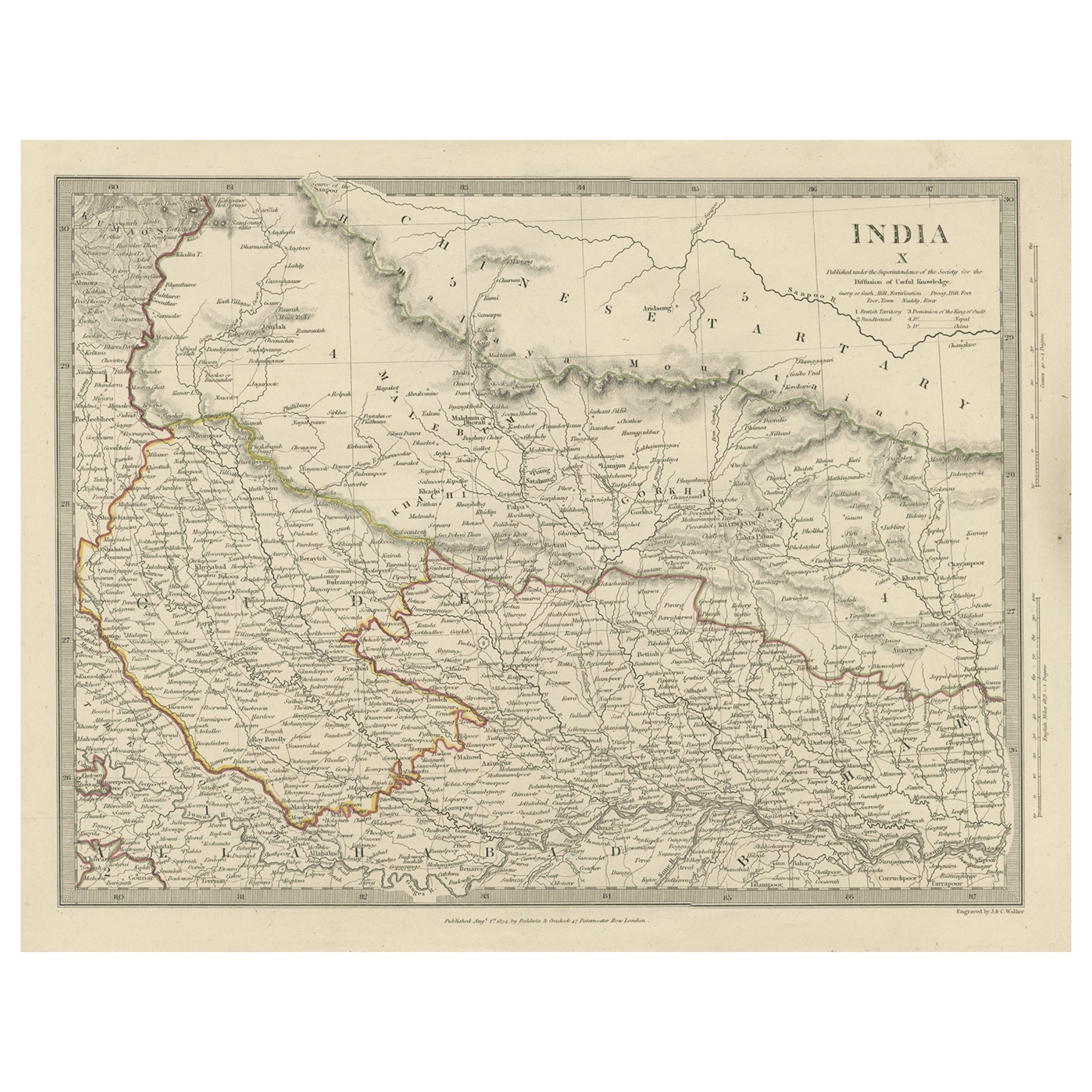
Original Antique Map of Part of the Bahar Region (India), 1834
Located in Langweer, NL
Antique map titled 'India X'. Old steel engraved map of part of the Bahar region, it also shows part of Nepal.
Artists and Engravers: Engraved by J. & C. Walker. Published under th...
Category
Antique 19th Century Maps
Materials
Paper
$278 Sale Price
20% Off
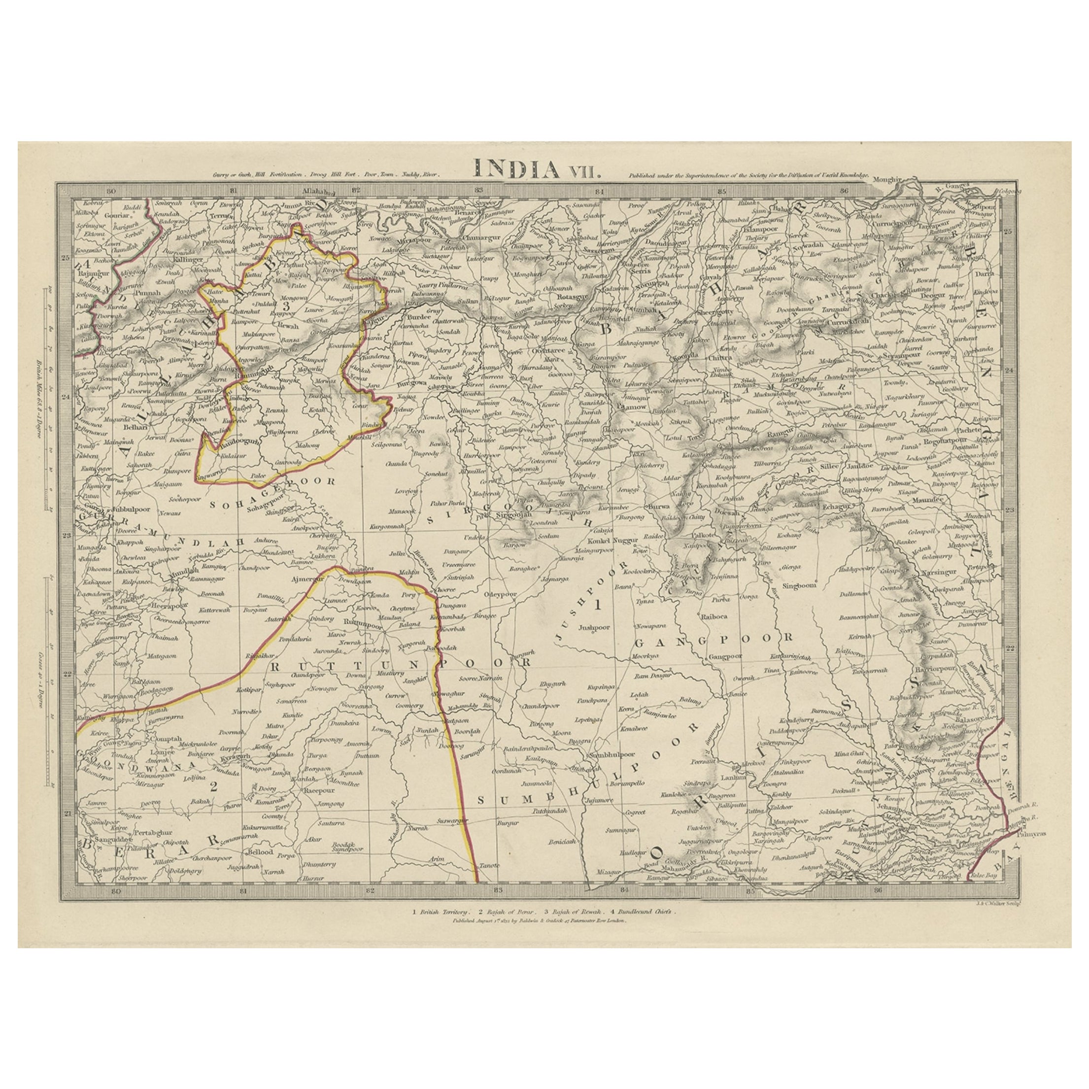
Antique Map of the Region of Berar and Rewah in India, 1832
Located in Langweer, NL
Antique map titled 'India VII'. Old steel engraved map of part of India including the Rajah of Berar, the Rajah of Rewah and British Territory.
Artists and Engravers: Engraved by...
Category
Antique 19th Century Maps
Materials
Paper
$278 Sale Price
20% Off
Detailed Antique Map of the Region of Malwa in India, 1833
Located in Langweer, NL
Antique map titled 'India VI'. Old steel engraved map of the region of Malwa showing great detail.
Artists and Engravers: Engraved by J. & C. Walker. Published under the superint...
Category
Antique 19th Century Maps
Materials
Paper
$278 Sale Price
20% Off
You May Also Like
Original Antique Map of India by Dower, circa 1835
Located in St Annes, Lancashire
Nice map of India
Drawn and engraved by J.Dower
Published by Orr & Smith. C.1835
Unframed.
Free shipping
Category
Antique 1830s English Maps
Materials
Paper

1839 Map of Karte Des "Russischen Reiches in Europa Und Asien" Ric.R0013
Located in Norton, MA
1839 map of Karte Des
"Russischen Reiches in Europa and Asien"
Ric.r013
Map of the European and Asian parts of Russian Empire. Karte der Russischen Reiches in Europa und Asien...
Category
Antique 19th Century Unknown Maps
Materials
Paper

Antique French Map of Asia Including China Indoneseia India, 1783
Located in Amsterdam, Noord Holland
Very nice map of Asia. 1783 Dedie au Roy.
Additional information:
Country of Manufacturing: Europe
Period: 18th century Qing (1661 - 1912)
Condition: Overall Condition B (Good Used)...
Category
Antique 18th Century European Maps
Materials
Paper

$648 Sale Price
20% Off
1849 Map of "Europaische Russland", 'Meyer Map of European Russia', Ric. R017
Located in Norton, MA
1849 Map of
"Europaische Russland"
( Meyer Map of European Russia)
Ric.r017
A lovely map of European Russia dating to 1849 by Joseph Meyer. It covers the European portions of...
Category
Antique 19th Century Unknown Maps
Materials
Paper

1851 Map of "Independent Tartary", Ric. R018
Located in Norton, MA
1851 Map of
Independent Tartary
"Russia"
Ric.r018
A highly decorative 1851 map of Independent Tartary by John Tallis and John Rapkin. Covers the regions between the Caspian Sea and Lake Bakquash and between Russia and Afghanistan. These include the ancient Silk Route kingdoms of Khiva, Tartaria, Kokand, and Bokhara. Today this region roughly includes Kazakhstan, Uzbekistan, Turkmenistan, Kyrgyzstan, and Tajikistan. This wonderful map offers a wealth of detail for anyone with an interest in the Central Asian portion of the ancient Silk Road. Identifies various caravan routes, deserts, wells, and stopping points, including the cities of Bokhara and Samarkand. Three vignettes by W. Bragg decorate the map, these including an image of Tartars on a Journey, a horseback Bride Chase, and a tartar camp site. Surrounded by a vine motif border. Engraved by J. Rapkin for John Tallis's 1851 Illustrated Atlas .
Tartary Antique Map...
Category
Antique 19th Century Unknown Maps
Materials
Paper

Map Of India - Original Lithograph - 19th Century
Located in Roma, IT
Map of India is an original lithograph artwork realized by an Anonymous engraver of the 19th Century.
Printed in the series of "France Pittoresque".
Titled "France Pittoresque".
...
Category
19th Century Modern Figurative Prints
Materials
Lithograph

More Ways To Browse
Southern Colonial
Colonial British India Furniture
East India Trading Company
Map Storage
Mughal Textiles
British East India Company
Madras India
Folding Ruler
Rice Storage
Bombay Company Furniture
Bombay Company
Mughal Print
Antique Map Storage
Antique Furniture Delhi
Silver Over Copper
Vintage Barware Glasses
Coffee Table Black Italian Modern
Christofle America